St John's Wood (Westminster)
Da Wikipedia, l'enciclopedia libera.
| St John's Wood | |
|---|---|
| Saint John's Wood | |
 | |
| Stato | |
| Regione | |
| Città | Londra |
| Distretto | Città di Westminster |
| Altri quartieri | Aldwych, Bayswater, Belgravia, Covent Garden, Chinatown, Fitzrovia, Hyde Park, Kilburn, Knightsbridge, Lisson Grove, Little Venice, Maida Vale, Marylebone, Mayfair, Millbank, Paddington, Paddington Green, Pimlico, Queen's Park, St James's, Soho |
| Codice postale | NW8 |
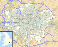 St John's Wood St John's Wood (Londra) | |
Saint John's Wood è un quartiere nella zona nord di Londra, Inghilterra, parte della Città di Westminster per il 98% del suo territorio, e per la restante parte di Camden.
Si estende dalla zona nord ovest di Regent's Park a Marylebone, fino a Edgware Road a Paddington e fino alla zona Swiss Cottage di Hampstead.[1][2]
La zona è servita dall'omonima stazione della metropolitana di Londra. Nel quartiere sono presenti i celebri Abbey Road Studios, meta di turisti e appassionati dei Beatles, anche per la presenza nelle vicinanze delle strisce pedonali immortalate sulla celebre copertina dell'omonimo album Abbey Road.
Storia
Principali luoghi di culto

- Abbey Road Baptist Church (Chiesa battista)
- St John's Wood Church (Chiesa anglicana)
- St Mark's Church, Hamilton Terrace (Chiesa anglicana)
- The Church of Our Lady (Chiesa cattolica)
- St John’s Wood United Synagogue (Sinagoga)
- The Liberal Jewish Synagogue (Sinagoga)
- The New London Synagogue (Sinagoga)
- Saatchi Shul (Sinagoga)
Educazione
- 3 House Club
- Robinsfield Infant School
- Saint Christina's Primary School
- Barrow Hill Junior School
- George Elliot Primary School
- Quintin Kynaston Community Academy
- The American School in London
- Arnold House School
Infrastrutture e trasporti
Text is available under the CC BY-SA 4.0 license; additional terms may apply.
Images, videos and audio are available under their respective licenses.
Cover photo is available under {{::mainImage.info.license.name || 'Unknown'}} license.
Cover photo is available under {{::mainImage.info.license.name || 'Unknown'}} license.
Credit:
(see original file).
