
List of crossings of the Ohio River
This is a complete list of current bridges and other crossings of the Ohio River from the mouth at the Mississippi River at Cairo, Illinois to the confluence of the Allegheny and Monongahela Rivers at Pittsburgh, Pennsylvania.
Illinois–Kentucky[edit]


.jpg)


Indiana–Kentucky[edit]
.jpg)


_P5250374.jpg)


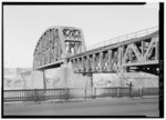
Ohio–Kentucky[edit]


.jpg)


.jpg)


.JPG)
Ohio–West Virginia[edit]


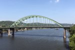


Pennsylvania[edit]


.jpg)


The source of the Ohio River is at the confluence of the Allegheny River and the Monongahela River (40°26′31″N 80°00′50″W / 40.44194°N 80.01389°W) at Pittsburgh, Pennsylvania.
See also[edit]
- List of crossings of the Allegheny River
- List of crossings of the Cumberland River
- List of crossings of the Green River
- List of crossings of the Monongahela River
- List of crossings of the Tennessee River
- List of crossings of the Lower Mississippi River
- List of crossings of the Upper Mississippi River
References[edit]
- ^ West Virginia Department of Transportation: General Highway Map, Marshall County West Virginia, January 2004.