Fagradalsfjall volcano
Updated: Mar 12, 2024 20:37 GMT -
Fissure swarm 385 m / 1263 ft
Reykjanes Peninsula, Iceland, 63.89°N / -22.27°W
Current status: normal or dormant (1 out of 5)
Reykjanes Peninsula, Iceland, 63.89°N / -22.27°W
Current status: normal or dormant (1 out of 5)
Last update: 3 Nov 2023 (Smithsonian / USGS Weekly Volcanic Activity Report)
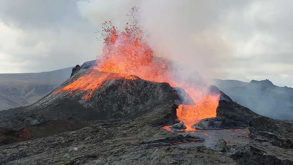
Lava fountaining from the main vent of Fagradalfjall's eruption in May 2021 (image: Ronny Quireyns)
Fagradalsfjall mountain is a tuya that erupted during the last glaciation under the ice shield. The broader Fagradalsfjall volcanic system comprises an area of eruptive fissures (fissure swarm), cones and lava fields in the southern part of the Reykjanes peninsula.
A strong seismic crisis began in the area near Fagradalsfjall since late Feb 2021, interpreted as intrusion of magma at shallow depth. This led to the first historic eruption of the volcano on 19 March 2021, followed by a similar, but smaller eruption in August 2022.
[smaller] [larger]
Fagradalsfjall volcano eruptions: 2023 (10 July - ongoing), 2022 (Aug), 2021
Less than few million years ago (Pleistocene)
Latest nearby earthquakes
| Time | Mag. / Depth | Distance / Location | |||
| Mar 8, 08:29 pm (universal) Mar 8, 20:29 GMT | 2.8 5.2 km | 8.6 km (5.4 mi) to the SW | I FELT IT | Info | |
| Thursday, March 7, 2024 GMT (1 quake) | |||||
| Mar 7, 04:41 am (universal) Mar 7, 04:41 GMT | 2.6 4.7 km | 9.8 km (6.1 mi) to the NE | I FELT IT | Info | |
| Wednesday, March 6, 2024 GMT (1 quake) | |||||
| Mar 6, 10:17 am (universal) Mar 6, 10:17 GMT | 3.0 5 km | 21 km (13 mi) to the SW | I FELT IT | Info | |
| Saturday, March 2, 2024 GMT (3 quakes) | |||||
| Mar 2, 04:01 pm (universal) Mar 2, 16:01 GMT | 2.6 4.9 km | 5.7 km (3.6 mi) to the W | Info | ||
| Mar 2, 03:54 pm (Reykjavik) Mar 2, 15:54 GMT | 2.4 4 km | 5.9 km (3.6 mi) to the W | Info | ||
| Mar 2, 02:56 pm (universal) Mar 2, 14:56 GMT | 2.4 5.1 km | 15 km (9.1 mi) to the E | Info | ||
Background
According to Catalogue of Icelandic Volcanoes used by the Global Volcanism Project's database, the Fagradalsfjall fissure swarm is considered the southwestern branch or a secondary part of the larger Krýsuvík–Trölladyngja volcanic system. However, we follow different publications that regard Fagradalsfjall as own volcanic system (or volcano in a wider sense).Fadradalsfjall mountain is a Pleistocene table mountain in the Reykjanes Peninsula NE of Grindavik, and the remnant of a subglacial eruption during the latest glaciation.
---
Source: Smithsonian / GVP volcano information
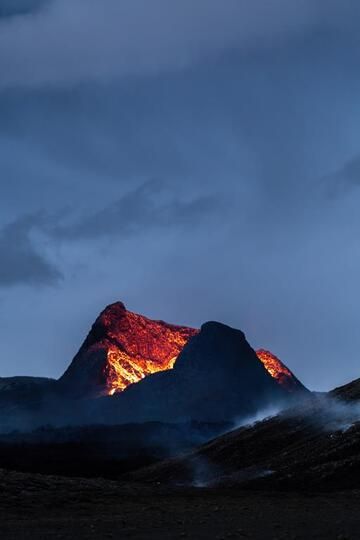
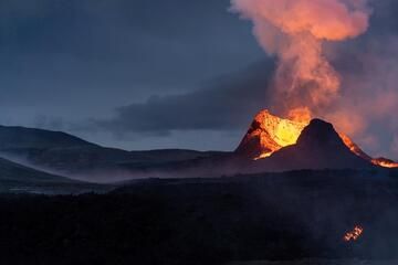
Fagradalsfjall Volcano Photos
The main vent of the 2021 Fagradalsfjall eruption on Iceland (Photo: World-Geographic)
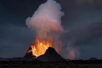
The active cone of the Fagradalsfjall volcano eruption in Iceland in June 2021 (Photo: World-Geographic)
Begin of a lava fountain phase at the main cone on the Fagradalsfjall eruption in Iceland, May 2021 (Photo: World-Geographic)
See also: Sentinel hub | Landsat 8 | NASA FIRMS