


Storm Track 8 blog: Storms hit Indiana with heavy winds

(WISH) — By 8:20 p.m., all storm watches for Indiana has been canceled, the National Weather Service says.
The storm watch first issued about 3 p.m. Wednesday was expanded about two hours later. Here was the list of Indiana counties in the watch at 5 p.m.: Allen, Benton, Carroll, Cass, Clinton, DeKalb, Elkhart, Fountain, Fulton, Howard, Huntington, Jasper, Kosciusko, Lake, La Porte, LaGrange, Marshall, Miami, Montgomery, Newton, Noble, Parke, Porter, Pulaski, St. Joseph, Starke, Steuben, Tippecanoe, Vermillion, Vigo, Wabash, Warren, White and Whitley. Primary threats are hail up to a quarter-sized diameter, scattered gusts up to 70 mph, and frequent lightning.
- Storm Track 8 interactive radar | Get the WISH-TV weather app for iOS devices | Get the WISH-TV weather app for Android devices
11 p.m.
NIPSCO reported 9,529 customers remained without power, primarily in Lake and Porter counties. More than 20,000 customers had initially been without power following afternoon storms.
9:28 p.m.
From the National Weather Service: A special weather statement has been issued for Lewisville and Mays, Indiana, until 10 p.m. EDT.

9:25 p.m.
NIPSCO reported 12,852 customers remained without power, primarily in Lake and Porter counties. More than 20,000 customers had initially been without power following afternoon storms.
7:46 p.m.
The Boone County sheriff says Lebanon Street in Jamestown is closed between Brush and Mill streets due to downed power lines and a downed tree.
7:30 p.m.
NIPSCO reports severe thunderstorms in the afternoon caused elevated electric power outages across northern Indiana, and Lake and Porter counties are most impacted. High winds and heavy rain downed trees, poles and power lines. NIPSCO crews were working to assess damage, make necessary repairs and restore power as safely and quickly as possible. Approximately more than 20,800 customers are affected. An estimate on when power will be restored is not able to be determined at this time.
7:29 p.m.
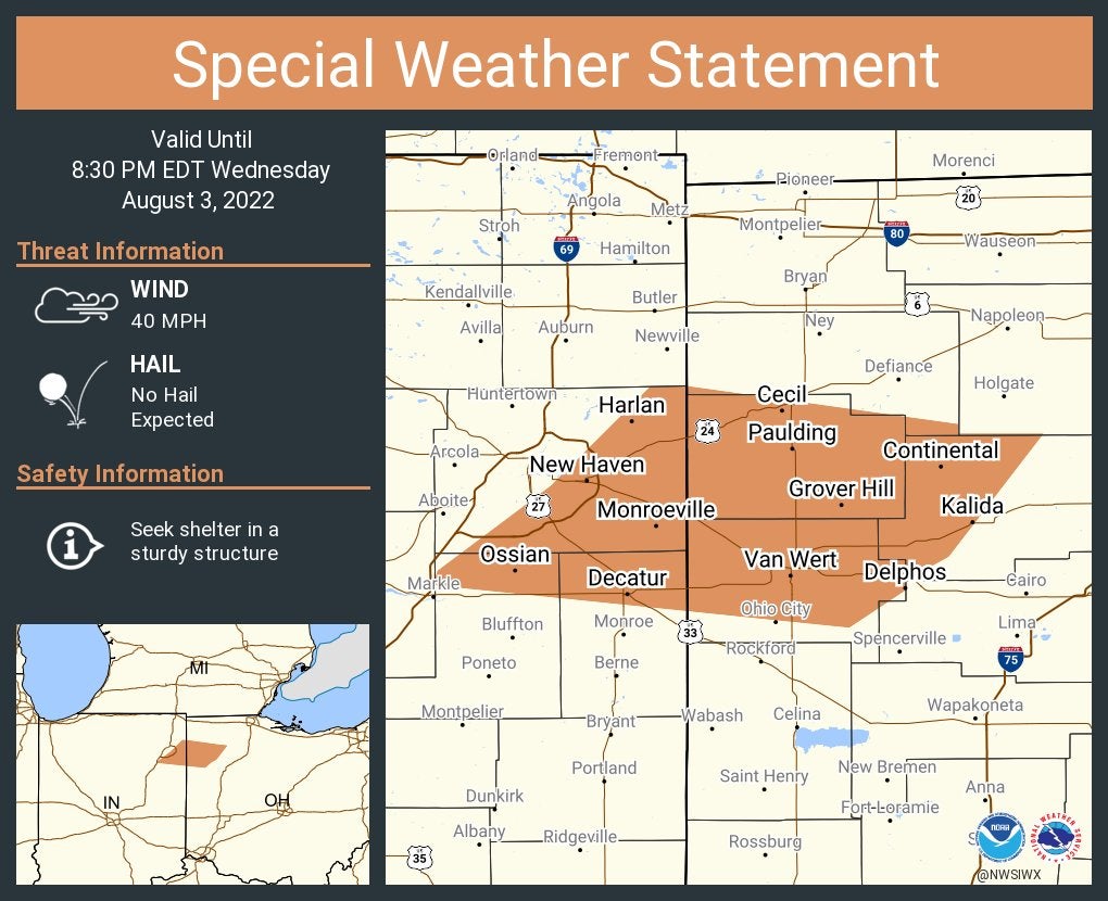
From the National Weather Service: A special weather statement has been issued for New Haven and Decatur, Indiana, and Van Wert, Ohio, until 8:30 p.m. EDT.
6:50 p.m.
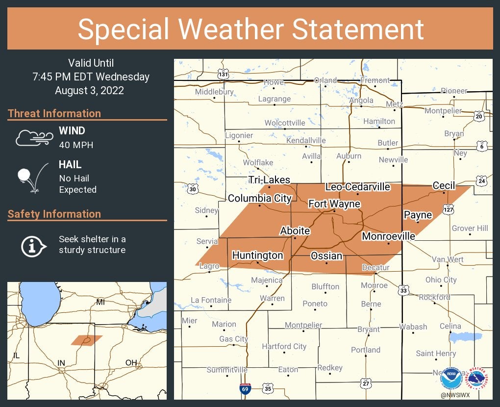
From the National Weather Service: A special weather statement has been issued for Fort Wayne, Huntington and New Haven, Indiana, until 7:45 p.m. EDT.
6:47 p.m.
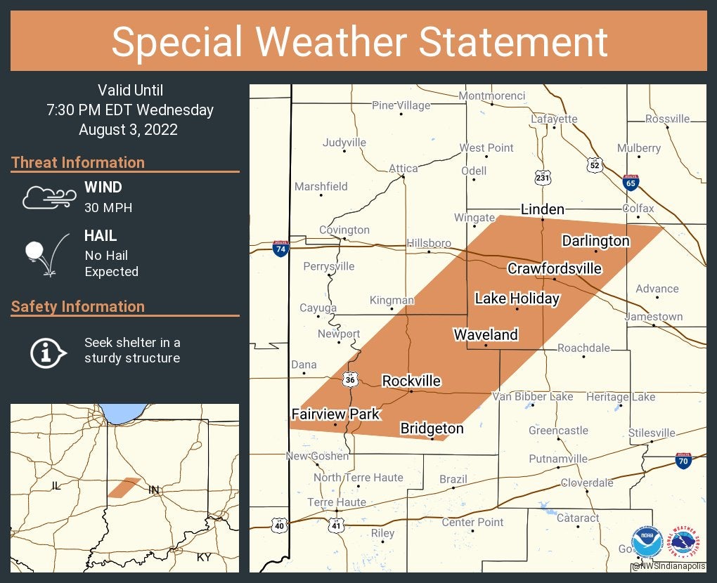
From the National Weather Service: A special weather statement has been issued for Crawfordsville, Rockville and Fairview Park, Indiana, until 7:30 p.m. EDT.
6:46 p.m.
From the National Weather Service: A special weather statement has been issued for Clarksburg and New Salem, Indiana, until 7 p.m. EDT.

6:30 p.m.
From the National Weather Service: A special weather statement has been issued for Marion, Peru and Wabash, Indiana, until 7:15 p.m. EDT.

6:24 p.m.
From the National Weather Service: A special weather statement has been issued for Auburn, Kendallville and Angola, Indiana, until 7:15 p.m. EDT.

6:21 p.m.
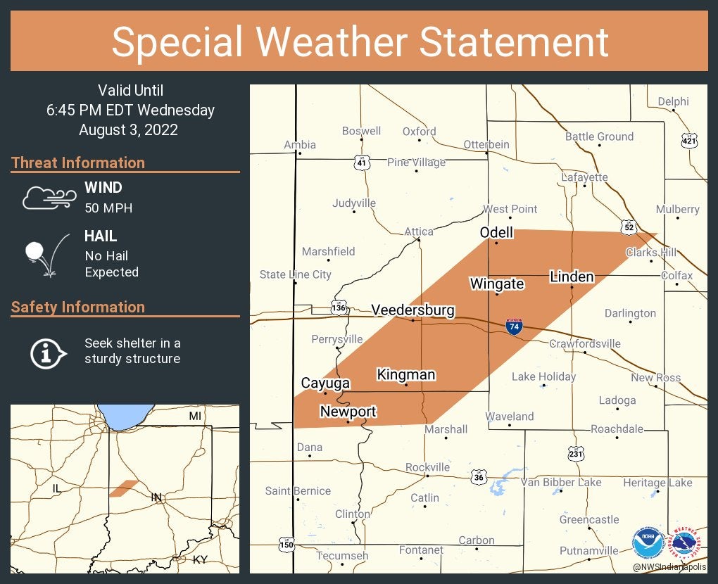
From the National Weather Service: A special weather statement has been issued for Veedersburg, Cayuga and Waynetown, Indiana, until 6:45 p.m. EDT.
6:14 p.m.
From the National Weather Service: A special weather statement has been issued for Columbia City, North Manchester and Churubusco, Indiana, until 7 p.m. EDT.

6:10 p.m.
From the National Weather Service: A special weather statement has been issued for Flora, Rossville and Dayton, Indiana, until 7 p.m. EDT.

6:05 p.m.
From the National Weather Service: A special weather statement has been issued for Logansport, Peru and Brookston, Indiana, until 6:30 p.m. EDT.

6 p.m.
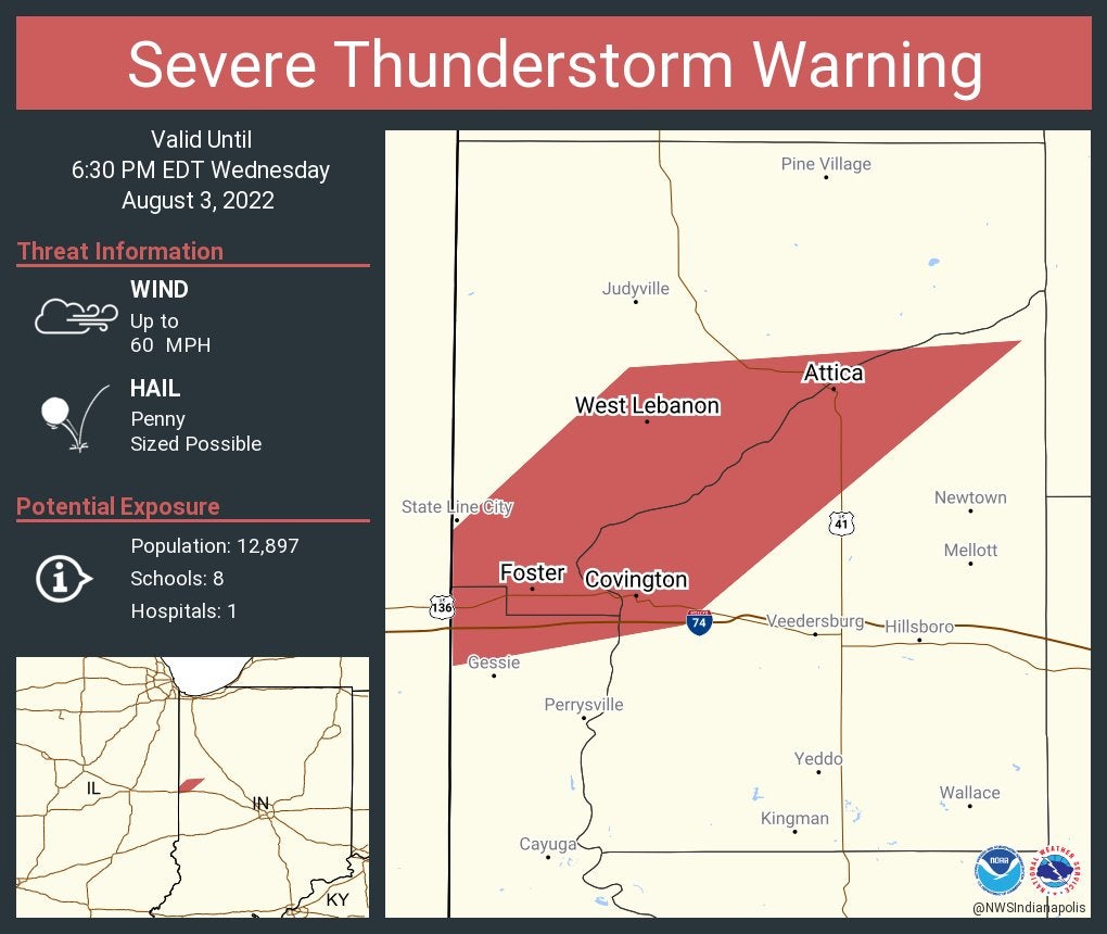
From Storm Track 8: Severe Thunderstorm Warning now in effect for parts of Fountain, Warren and Vermillion counties until 6:30 p.m. EDT. Main concern is 60 mph gusts.

5:58 p.m.
From the National Weather Service: A special weather statement has been issued for Kendallville, Angola and Ligonier, Indiana, until 6:45 p.m. EDT.

5:57 p.m.
From the National Weather Service: Severe Thunderstorm Warning including Attica, Covington and Williamsport, Indiana, until 6:30 p.m. EDT.
5:47 p.m.
From National Weather Service: A special weather statement has been issued for Lafayette, West Lafayette and Attica, Indiana, until 6:30 p.m. EDT.

5:41 p.m.
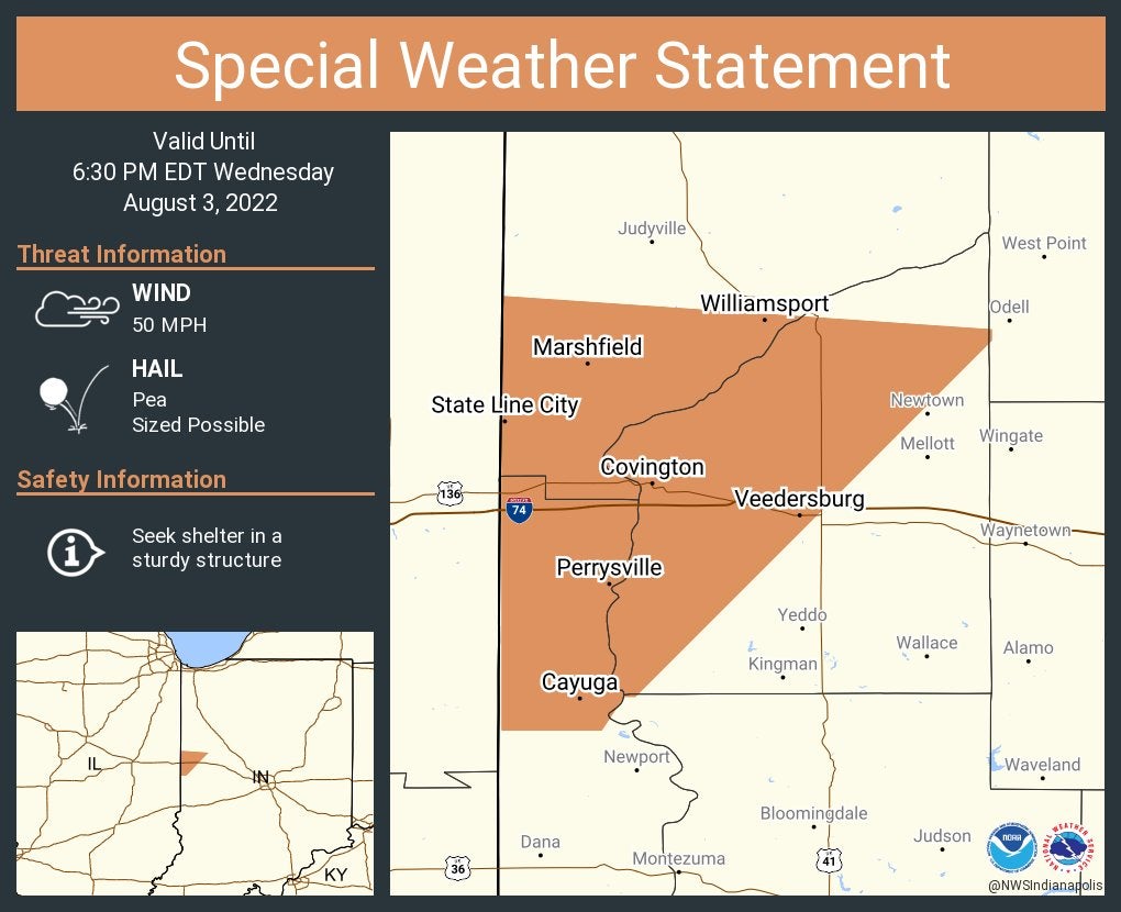
From National Weather Service: A special weather statement has been issued for Covington, Veedersburg and Williamsport, Indiana, until 6:30 p.m. EDT.
5:33 p.m.
From Storm Track 8: Severe Thunderstorm Warning now in effect until 6 p.m. EDT for portions of Tippecanoe and Warren counties. Main hazard is 60 mph gusts.

5:30 p.m.
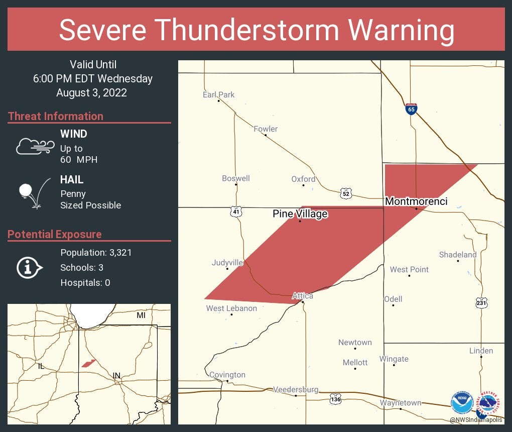
From National Weather Service: Severe Thunderstorm Warning including Montmorenci and Pine Village, Indiana, until 6 p.m. EDT.
From National Weather Service: A special weather statement has been issued for Warsaw, Rochester and Winona Lake, Indiana, until 6:15 p.m. EDT.

5:23 p.m.
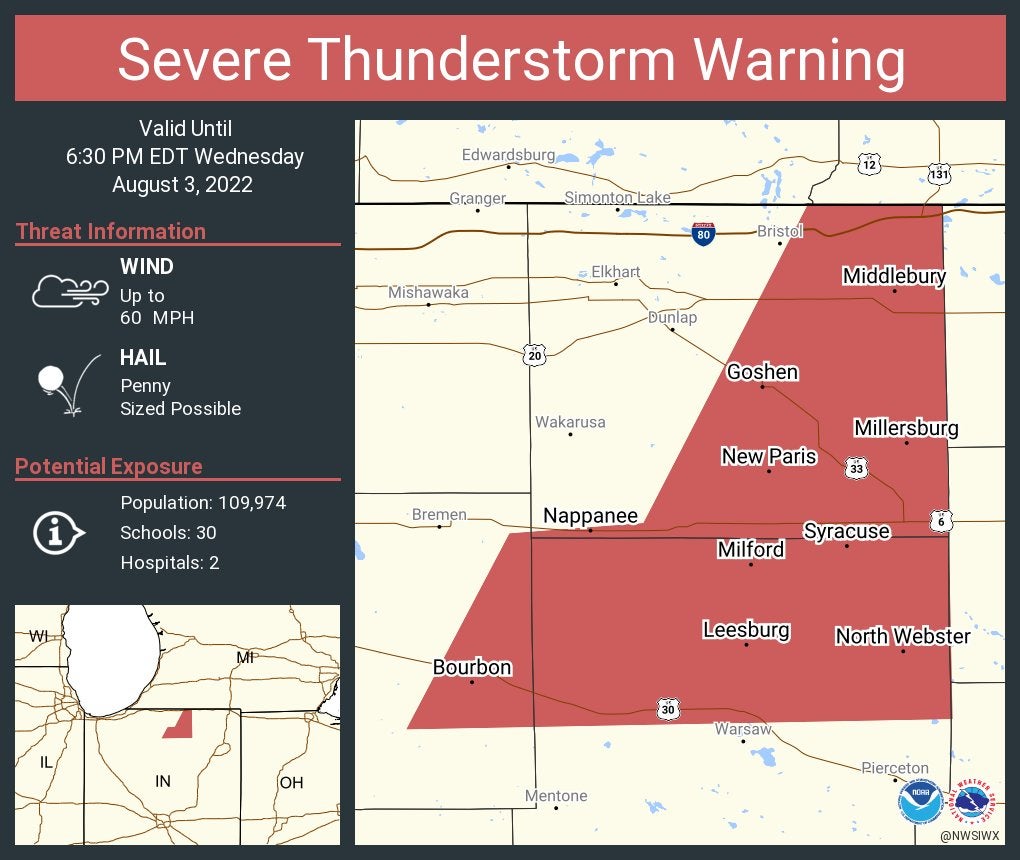
From National Weather Service: Severe Thunderstorm Warning including Goshen, Nappanee and Middlebury, Indiana, until 6:30 p.m. EDT.
5:16 p.m.
From Storm Track 8: Severe Thunderstorm Warning now in effect for Cass and White counties until 6 p.m. EDT. Main threat is 60 mph gusts.
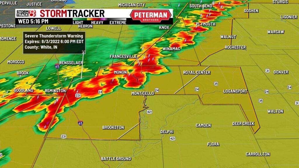
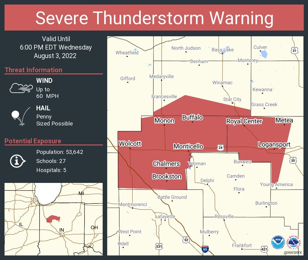
5:14 p.m.
From National Weather Service: Severe Thunderstorm Warning including Logansport, Monticello and Monon, Indiana, until 6 p.m. EDT.
5:09 p.m.
From Storm Track 8: Severe Thunderstorm Warning now in effect for the southeastern half of Benton County until 6 p.m. EDT. Main hazard is 60 mph gusts.

5:08 p.m.
The fire departments in Mishawaka and Granger, Indiana, reported downed trees are blocking roads.
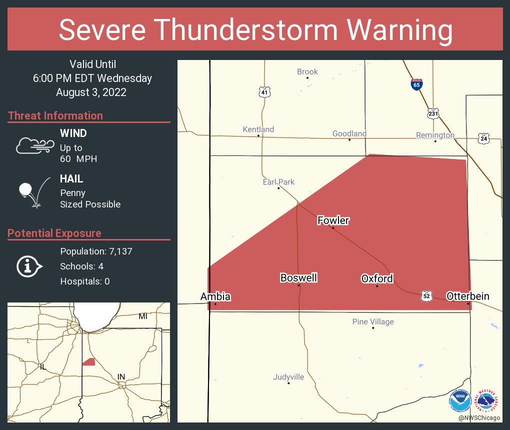
5:04 p.m.
From National Weather Service: Severe Thunderstorm Warning including Fowler, Otterbein and Oxford, Indiana, until 6 p.m. EDT.
5:01 p.m.
From Storm Track 8: The Severe Thunderstorm Watch has been extended down to include cities such as Terre Haute, Lafayette, Kokomo, and Huntington until 9 PM EDT.

Severe Thunderstorm Warning continues for Knox, North Judson and Francesville, Indiana, until 5:15 p.m. EDT

4:43 p.m.
From the National Weather Service: Severe Thunderstorm Warning including Plymouth, Winamac and Argos, Indiana, until 5:30 p.m. EDT.

4:32 p.m.
From Storm Track 8: A Severe Thunderstorm Warning has been issued until 5:30 p.m. EDT for portions of Benton County. Movement is east at 20 mph. Main threat is 60 mph gusts.

3:56 p.m.
Severe Thunderstorm Warning including Rensselaer IN, DeMotte IN and Hebron IN until 4:15 PM CDT

3:14 p.m.
From the weather service in Chicago: A broken line of severe thunderstorms continues to develop and move east. For now, eastern Illinois and northwest Indiana are under the gun for severe storms over the next hour. If ahead of this line, expect strong winds to 70 mph, small hail, and torrential rainfall.

3:02 p.m.
The latest from Storm Track 8’s team of meteorologists: We’re in the middle of a stifling Wednesday with heat advisories in place until 8 p.m. EDT Wednesday due to the heat. There is also a severe thunderstorm watch in place in northern Indiana until 9 p.m. EDT Wednesday as there is a threat for strong to severe storms north of Indianapolis.


