Up Holland
Up Holland is a village close to Skelmersdale and civil parish in the West Lancashire district, in the county of Lancashire, England, 4 miles west of Wigan. The population at the 2011 census was 7,376.Photo: Small-town hero, Public domain.
Notable Places in the Area
Church of St Thomas the Martyr, Up Holland
Church
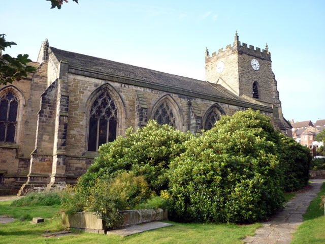
Photo: Karl and Ali, CC BY-SA 2.0.
The Church of St Thomas the Martyr is in School Lane, Up Holland, Lancashire, England.
Orrell railway station
Railway station

Photo: Raymond Knapman, CC BY-SA 2.0.
Orrell railway station serves the Orrell area of the Metropolitan Borough of Wigan, Greater Manchester, England.
St Luke's Church
Church

Photo: Gary Rogers, CC BY-SA 2.0.
St Luke's Church is in Lodge Road, Orrell, Wigan, Greater Manchester, England.
Localities in the Area
Shevington
Village

Photo: Shevington123, CC BY-SA 4.0.
Shevington is a village and civil parish within the Metropolitan Borough of Wigan, Greater Manchester, England. Shevington is situated 2 miles northeast of Up Holland.
Skelmersdale
Town

Photo: Small-town hero, Public domain.
Skelmersdale is a town in the West Lancashire district, in Lancashire, England, on the River Tawd, 6 miles west of Wigan, 13 miles northeast of Liverpool and 15 miles southwest of Preston. Skelmersdale is situated 2½ miles west of Up Holland.
Worsley Mesnes
Suburb
Worsley Mesnes is a suburb of Wigan in the Metropolitan Borough of Wigan in Greater Manchester, England. Worsley Mesnes is situated 3 miles east of Up Holland.
Up Holland
- Type: Village
- Description: village and civil parish in West Lancashire, Lancashire, England
- Categories: civil parish and locality
- Location: Up Holland, West Lancashire District, Lancashire, North West England, England, United Kingdom, Britain and Ireland, Europe
- View on OpenStreetMap
Latitude
53.54436° or 53° 32' 40" northLongitude
-2.72331° or 2° 43' 24" westElevation
292 feet (89 metres)United Nations Location Code
GB UPHOpen Location Code
9C5VG7VG+PMOpenStreetMap ID
node 29393733OpenStreetMap Feature
place=villageGeoNames ID
2635156Wikidata ID
Q2341564Up Holland Satellite Map
© OpenStreetMap, Mapbox and Maxar
Also Known As
- Bengali: আপ হল্যান্ড
- Bulgarian: Ъпхоланд
- Catalan: Up Holland
- Cebuano: Up Holland
- Chinese: 厄普荷兰
- Chinese: 厄普荷蘭
- Czech: Up Holland
- Dutch: Up Holland
- Dutch: Upholland
- English: Up Holland, Lancashire
- English: Upholland
- French: Up Holland
- French: Upholland
- German: Up Holland
- German: Upholland
- Greek: Απόλαντ
- Gujarati: અપહોલેંડ
- Hebrew: אפהולנד
- Irish: Up Holland
- Italian: Up Holland
- Japanese: アップ・ホーランド
- Kannada: ಅಪ್ಹಲೋಂಡ್
- Korean: 업 홀랜드
- Ladin: Up Holland
- Lithuanian: Ap Holandas
- Persian: آپهالند
- Polish: Up Holland
- Portuguese: Up Holland
- Russian: Апхолланд
- South Azerbaijani: آپهالند
- Spanish: Up Holland
- Swedish: Up Holland
- Tamil: அப்ஹால்லன்ட்
- Telugu: అప్ హాలండ్
- Turkish: Up Holland
- Ukrainian: Апхолланд
- Urdu: وپہولینڈ
- Welsh: Up Holland
Other Places Named Up Holland
Localities in the Area
- TontineHamlet
- Far MoorVillage
- Orrell PostSuburb
- Holland MoorQuarter
- Roby MillHamlet
Landmarks in the Area
- Artz CentreCommunity center
- Upholland Methodist ChurchChurch
- St Teresa's Catholic Primary SchoolSchool
- St Teresa'sChurch
Escape to a Random Place
Discover other destinations in the world.
About Mapcarta. Thanks to Mapbox for providing amazing maps. Data © OpenStreetMap contributors and available under the Open Database License. Text is available under the CC BY-SA 4.0 license, excluding photos, directions and the map. Description text is based on the Wikipdia page Up Holland. Photo: Small-town hero, Public domain.