Google Maps is a powerful tool for navigating the world around you. It provides detailed layouts to guide you through known and unknown territory, reducing the chances of getting lost. Also, Maps takes away the discomfort of asking strangers for directions and allows you to share your real-time whereabouts with loved ones. One of Maps' most interesting features is Street View, which allows you to explore streets in a given location as if you were physically there.
The feature is effortless to use on the latest smartphones and can be an immersive companion for scouting locations before you visit them. You can also satisfy your curiosity about famous spots on your favorite tablets and computers. This tutorial shows you how to access Street View in Google Maps.
What is Google Street View, and how does it work?
Google Street View is a feature that gives you a panoramic sight of different locations around the world. Google's professional team uses bicycles, boats, cars, and other available means, paired with multidirectional cameras, to make this experience possible. They shoot videos of places, then edit and overlap them into the continuous images you see on Google Maps.
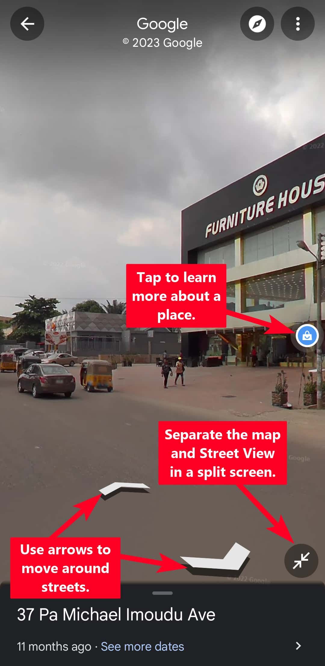
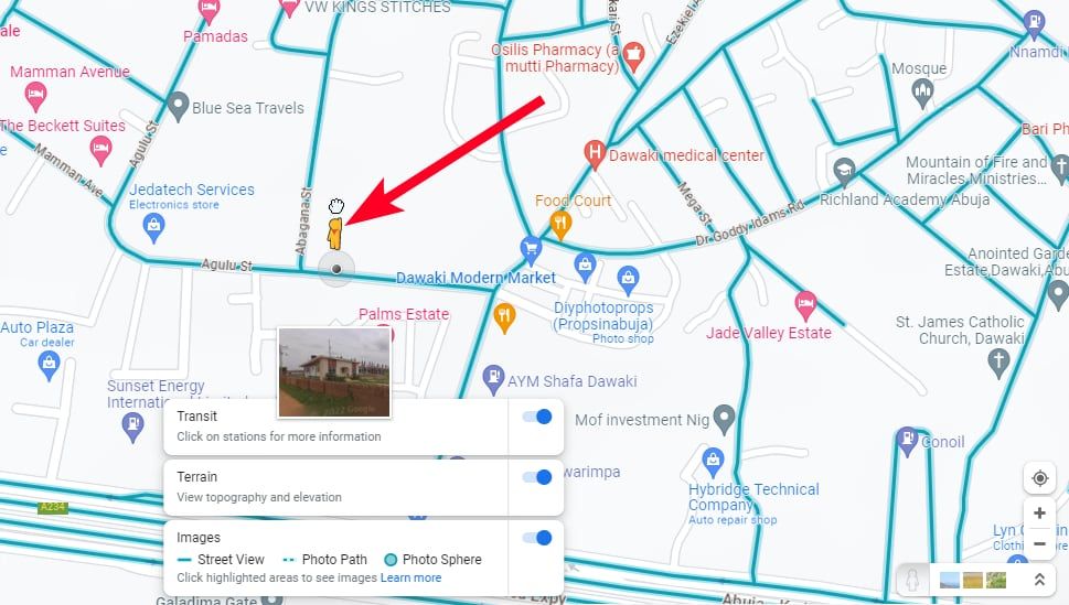
When you search for a place, Maps shows you whether it has Street View if you select the option in the Map details. You'll know if the view is available when you see blue lines or a thumbnail with the 360-degree symbol on it. Entering Street View allows you to pan your screen and use arrows to move around an image for a realistic experience. If the image contains shops, restaurants, or parks, you can tap them to get more information.
It's also worth noting that Street View isn't the same as Live View. Live View works similarly, but the difference is that you aim your phone camera at landmarks or street signs, and Maps creates a simulated experience. The app uses turn directions and a big arrow to show you how to get to your destination. As you walk, your camera moves along with you.
Since Street View doesn't provide live satellite images of locations, it's not completely accurate and needs updating. For example, if a new building is constructed or a road is blocked, you won't instantly see the changes in Maps. The good news is that you can be part of the process and contribute your images to the Street View Studio. Once Google reviews and approves it, it replaces outdated shots.
How to access Street View on different devices
Google Maps Street View is available on Android and iOS. If you haven't already, download the mobile app from your device's app store. You can also use the feature on PCs via web browsers if you want a wider view. Follow the steps below to use it on the different devices.
Use Street View on the Google Maps app
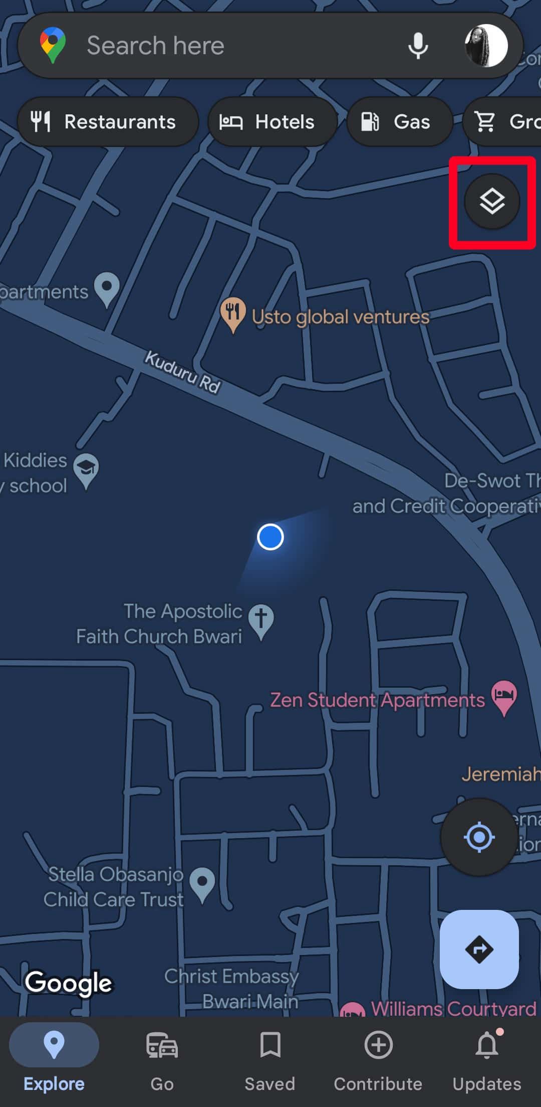
- Open Google Maps.
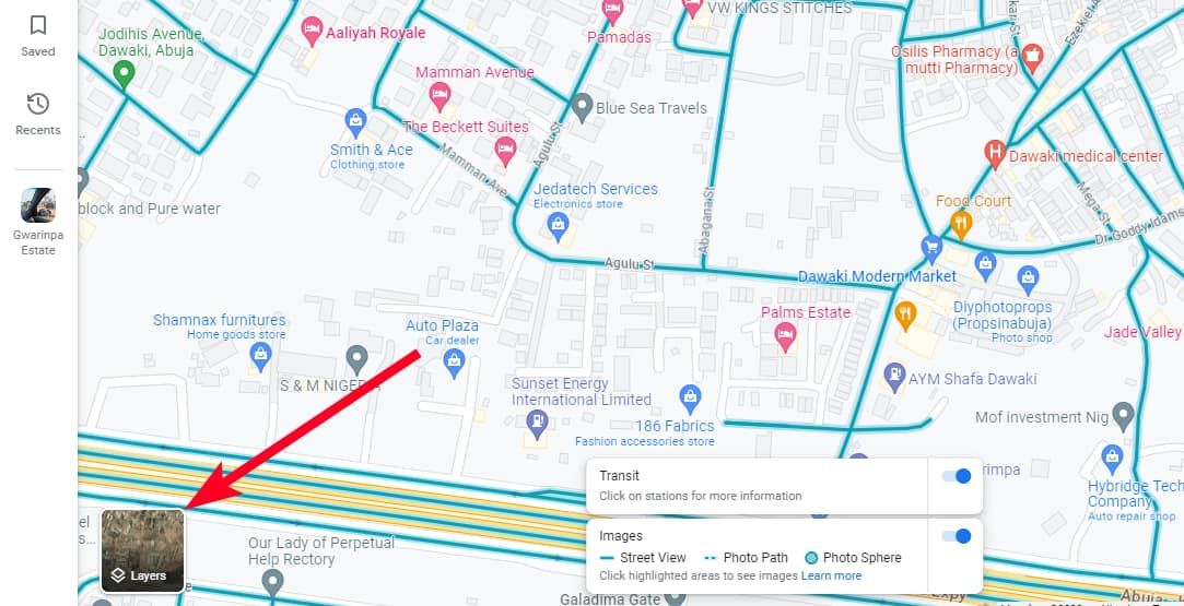
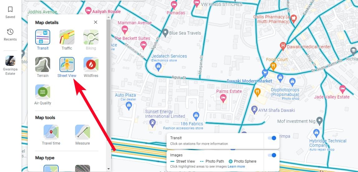
- Tap the Layers icon in the upper-right corner of the screen to view the Map types and details.
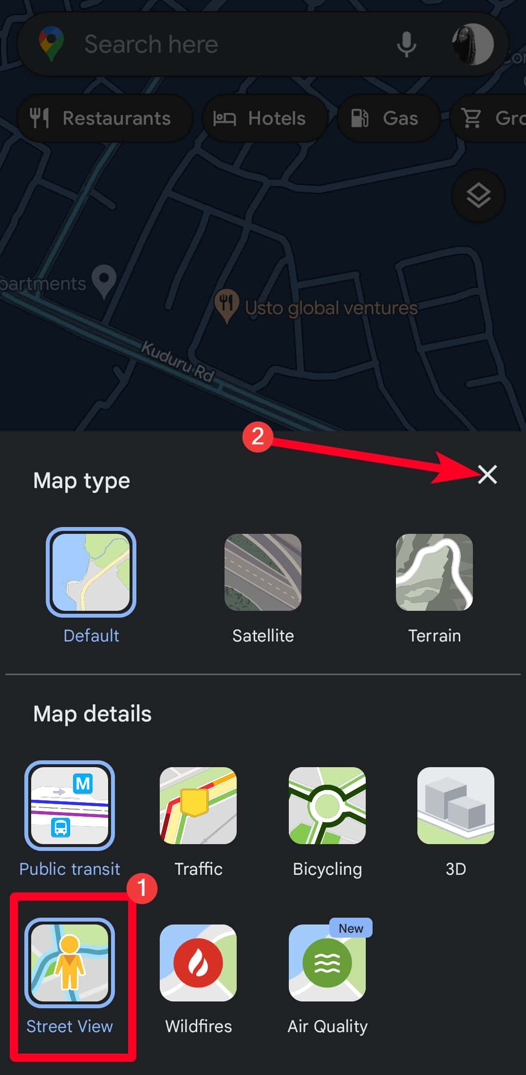
-
Under Map details, select Street View. Then close the menu.
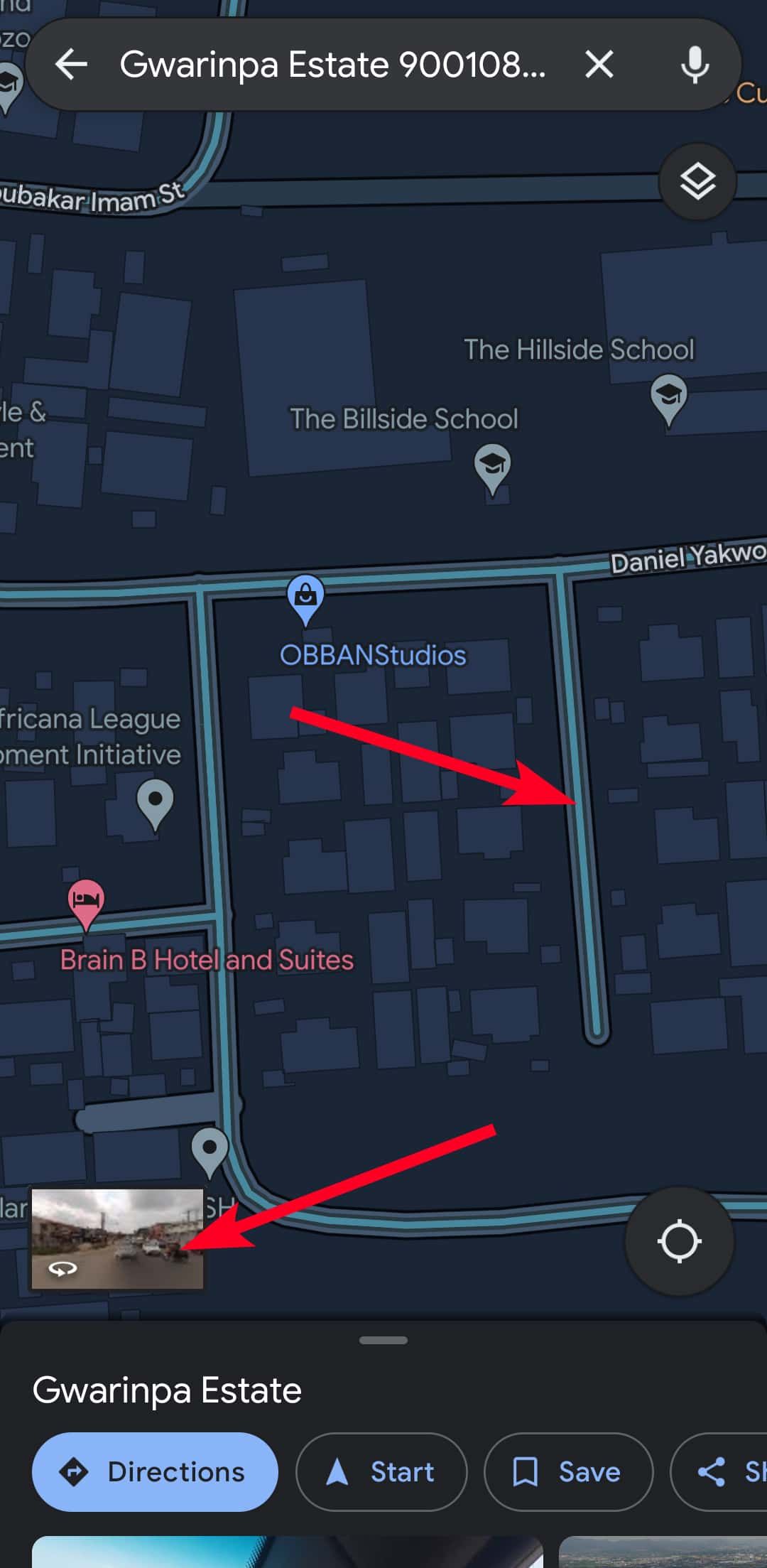
- Search for a location.
-
Tap a blue line or the Street View thumbnail to explore a location.
- To move around, tap the directional arrows or double-tap in the direction you want to go.
- To zoom out, pinch in your screen. To zoom in, pinch out your screen.
-
Tap the expand icon to separate the map and Street View in a split screen.


Use Street View on the web
- Open your browser and go to google.com/maps.
- Search for a location.
-
Drag the pegman in the lower-right corner of the screen to a location to enter Street View.
-
Alternatively, hover your mouse icon on Layers.
-
Go to More > Street View. This action makes blue lines appear on roads and paths. Clicking the pegman gives you the same result.
- Click the blue lines to enter Street View mode.
- Click a spot to go in that direction.
- To zoom in, swipe down on your mousepad with two fingers. To zoom out, swipe up with two fingers.
-
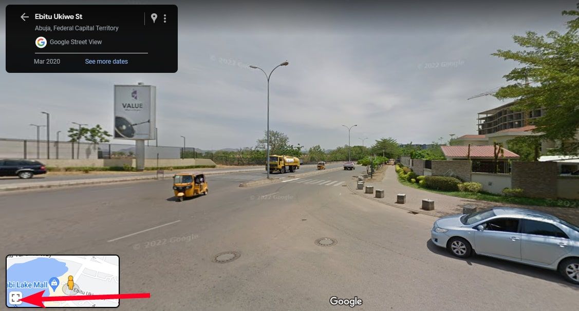
To merge Street View and the map into a split screen, hover over the map preview in the lower-left corner. Then click the expand icon.


Take a virtual stroll through the streets
Google Maps is a must-have tool if you want to plan your commute easily, but it's more than a navigation tool. With Street View, you can virtually visit any location and explore the world from the comfort of your home. The feature is a great resource if you plan to travel and want to familiarize yourself with the new environment. Although it's indispensable for commuters and vacationists worldwide, Street View doesn't consist of live satellite images or videos. You may be even more disappointed to learn that there's no app to give you real-time video broadcasts of the earth in high definition yet.