Category:Maps of South America
Jump to navigation
Jump to search
Temperate regions: Africa · Asia · Europe · North America · Oceania · South America – Polar regions: Antarctica ·
Wikimedia category | |||||
| Upload media | |||||
| Instance of | |||||
|---|---|---|---|---|---|
| Category combines topics | |||||
 | |||||
Maps of South America.

Subcategories
This category has the following 37 subcategories, out of 37 total.
Media in category "Maps of South America"
The following 166 files are in this category, out of 166 total.
-
 0 3459 Südküste Chiles.jpg 2,499 × 1,660; 2.78 MB
-
 28 América del Sur.jpg 837 × 653; 146 KB
-
 4 countries AR-BO-BR-PY.svg 100 × 100; 127 KB
-
 Alkoholersterwerbsalter in Südamerika.png 2,000 × 2,678; 214 KB
-
 Amazon map.jpg 1,440 × 900; 198 KB
-
 Amazon Reef.png 2,800 × 1,496; 136 KB
-
 America distribution.jpg 1,610 × 1,600; 75 KB
-
 America-del-sur-e1295595656169.jpg 318 × 448; 10 KB
-
 Amicountrieslist.png 473 × 512; 56 KB
-
 Anaconda Range.jpg 639 × 389; 17 KB
-
 Anales del Museo Nacional de Historia Natural de Buenos Aires (1911-1923.) (17545715544).jpg 2,278 × 3,288; 1.72 MB
-
 Andean culture history (1960) (20191193524).jpg 2,232 × 3,132; 645 KB
-
 Andean culture history (1960) (20625715120).jpg 2,412 × 3,360; 706 KB
-
 Andean culture history (1960) (20625769258).jpg 2,272 × 3,152; 582 KB
-
 Andean culture history (1960) (20626949209).jpg 2,256 × 2,812; 1.26 MB
-
 Andean culture history (1960) (20787472466).jpg 2,264 × 3,184; 626 KB
-
 Andean culture history (1960) (20813729045).jpg 2,268 × 3,172; 617 KB
-
 Andean culture history (1960) (20820741001).jpg 2,300 × 3,208; 952 KB
-
 Andean culture history (1960) (20820821841).jpg 2,272 × 3,192; 590 KB
-
 Andean culture history (1964) (17572871264).jpg 2,056 × 2,856; 690 KB
-
 Andean culture history (1964) (17572873514).jpg 2,068 × 2,860; 783 KB
-
 Andean culture history (1964) (17574885323).jpg 2,040 × 2,864; 755 KB
-
 Andean culture history (1964) (18007764080).jpg 2,012 × 2,852; 703 KB
-
 Andean culture history (1964) (18009168069).jpg 2,128 × 2,928; 776 KB
-
 Andean culture history (1964) (18168987366).jpg 2,052 × 2,860; 694 KB
-
 Andean culture history (1964) (18195492615).jpg 2,056 × 2,848; 783 KB
-
 Andean culture history (1964) (18196683871).jpg 2,072 × 2,876; 811 KB
-
 Angekommen an der karibik (12407895774).jpg 1,434 × 1,920; 2.93 MB
-
 Arhl.PNG 568 × 937; 31 KB
-
 Ash Continues From Calbuco, 04-25-2015.jpg 1,000 × 700; 281 KB
-
 Belem routes - april 2014.gif 540 × 540; 40 KB
-
 Belem, Lisboa (33266135834).jpg 3,024 × 4,032; 2.65 MB
-
 Bolivia Chile Locator.png 240 × 320; 25 KB
-
 BRA-orthographic.PNG 2,000 × 2,000; 653 KB
-
 BRAorthographic.PNG 2,000 × 1,700; 561 KB
-
 Brazil, argentina, paraguay.jpg 468 × 633; 45 KB
-
 Bulletin (1950) (20432441381).jpg 2,720 × 3,766; 1.16 MB
-
 Bulletin (1950) (20432472981).jpg 2,656 × 3,728; 1.29 MB
-

-
 Calbuco Volcano Erupts April 23 2015 with gravity waves.jpg 720 × 480; 163 KB
-
 Calcubo Ash 04-26-2015.jpg 1,000 × 700; 653 KB
-
 Cap horn.png 906 × 615; 58 KB
-
 Cap horn2.png 906 × 546; 71 KB
-
 Cape horn.png 519 × 428; 18 KB
-
 CapeHornOverviewMap.png 906 × 615; 65 KB
-
 Capture am24.png 799 × 565; 982 KB
-
 Che Guevara Trip map.jpg 1,232 × 2,048; 579 KB
-
 Chile1764.PNG 193 × 235; 3 KB
-
 Chile1810.PNG 193 × 235; 3 KB
-
 Chincha1.jpg 259 × 314; 8 KB
-
 Chinchawar.jpg 259 × 314; 8 KB
-
 Composición étnica en la zona sur de Chile.png 306 × 306; 11 KB
-
 Comprehensive Cartographia - South America.png 1,579 × 2,160; 206 KB
-
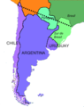
 Cono sur map.jpg 392 × 493; 41 KB
-
 Cono Sur.png 376 × 600; 49 KB
-
 Conosurazul.png 250 × 317; 14 KB
-
 CONSANAT.jpg 240 × 320; 18 KB
-
 Contributions from the United States National Herbarium (2008) (14780973364).jpg 2,820 × 2,304; 735 KB
-
 Convenio Andrés Bello países.jpg 381 × 355; 25 KB
-
 Copa América Chile 2015.png 637 × 801; 14 KB
-
 Crioulos luso-americanos.gif 540 × 719; 130 KB
-
 Crusoe's Island; a bird-hunter's story (1898) (14770671333).jpg 1,412 × 2,152; 335 KB
-
 A history of South America, 1854-1904 (IA cu31924021182823).pdf 900 × 1,354, 801 pages; 22.48 MB
-
 Current range of big-leaf mahogany in South America.jpg 517 × 414; 50 KB
-
 Cuxiu mapa.jpg 107 × 130; 10 KB
-
 Dakar Rally 2012 map-es.svg 2,585 × 2,448; 503 KB
-
 Dakar-Rally-2009-stages.jpg 510 × 653; 66 KB
-
 Distribution du quinoa en Amérique du Sud.jpg 943 × 1,242; 85 KB
-
 Drake-Passage-Area-Map.tif 1,906 × 2,420; 565 KB
-
 Eastern South America.png 500 × 700; 35 KB
-
 Esportacion de electricidad.png 634 × 563; 54 KB
-
 Estaciones Sirgas-CON.svg 705 × 808; 547 KB
-
 ETH-BIB-Südamerika auf Europa geklappt-Dia 247-Z-00263.tif 2,955 × 3,410; 28.96 MB
-
 ETH-BIB-Südamerika, Karte mit Expedition-Dia 247-Z-00063.tif 3,978 × 2,854; 32.6 MB
-
 ETH-BIB-Südamerika, Karte-Dia 247-06028.tif 3,042 × 3,521; 30.74 MB
-
 Ethnic map of South America.png 2,200 × 2,773; 452 KB
-
 Falklands eilanden lokatie.png 460 × 533; 11 KB
-
 Frontera .jpg 927 × 777; 206 KB
-
 Fronteras con el desierto.png 599 × 462; 355 KB
-
 Geogr.podocnemis.expansa.jpg 1,223 × 1,280; 71 KB
-
 Goethalsia plant range.png 747 × 483; 59 KB
-
 Gran Premio de la America del Sur del TC.jpg 643 × 947; 66 KB
-
 Human Development in Latin America in 2013.pdf 1,272 × 1,647; 22.19 MB
-
 Ilex paraguariensis native range.svg 454 × 608; 168 KB
-
 Ist Kolumbien sicher? (13393315615).jpg 1,434 × 1,920; 2.96 MB
-
 Itaú Cultural 2018 015.jpg 3,456 × 5,184; 18.7 MB
-
 Itaú Cultural 2018 016.jpg 5,184 × 3,456; 13.47 MB
-
 Jarawara and Jamamadí.png 807 × 990; 21 KB
-
 Jose Miguel Perez-Gomez ríos convergiendo.jpg 1,285 × 997; 338 KB
-
 Juan Fernández to continental Chile2.png 1,074 × 677; 493 KB
-
 Juegos Parasuramericanos 2014.png 363 × 456; 18 KB
-

-
 Kuschel.png 903 × 1,346; 455 KB
-
 La Salle Argentina - Paraguay.jpg 800 × 1,439; 215 KB
-
 LA2-South-America-UTM-zones.png 891 × 1,120; 199 KB
-
 LABMAN.JPG 577 × 520; 20 KB
-
 Latin America homosexuality laws.jpg 640 × 755; 71 KB
-
 Linhas austral Brasil.jpg 725 × 902; 128 KB
-
 LocationWHMiddleAmerica.png 800 × 800; 50 KB
-
 Lõuna-Ameerika.jpg 583 × 839; 481 KB
-
 Macushi area.png 256 × 256; 34 KB
-
 Map for the Pampas region.svg 1,181 × 1,732; 2.01 MB
-
 Map of oldest companies in South America; February 2020.png 1,200 × 1,331; 229 KB
-
 Map of SACN.png 332 × 409; 10 KB
-
 Map of South America by Mercosur membership.jpg 503 × 600; 82 KB
-
 Map of South America-AR.png 1,131 × 1,380; 242 KB
-
 Map of the Lonely island.png 964 × 966; 36 KB
-
 Mapa de Parva Domus.png 356 × 589; 28 KB
-
 Mapa esclavos.jpg 470 × 526; 43 KB
-
 Mapuche map.jpg 270 × 400; 57 KB
-
 MERCOSUR+Candidate countries (orthographic projection).svg 550 × 550; 600 KB
-
 Meteo Ambient.png 2,000 × 1,125; 3.84 MB
-
 Mural - mapa central - Latinoamérica.jpg 1,440 × 2,560; 1.52 MB
-
 Musica America Latina.svg 332 × 376; 19 KB
-
 Northwest South America.png 442 × 551; 43 KB
-
 P South America.png 667 × 600; 102 KB
-
 Pampas Range.png 550 × 737; 362 KB
-
 PAMPAS.png 305 × 336; 22 KB
-
 Pan American Games host countries.png 2,000 × 1,938; 293 KB
-
 Paraguay-bolivia-1924-1935.jpg 1,023 × 311; 415 KB
-
 Patagonia2.jpg 800 × 1,067; 174 KB
-
 Pionites Range.png 212 × 319; 9 KB
-
 President Trump at U.S. Southern Command (50108206596).jpg 3,000 × 2,000; 1.48 MB
-
 Prostitution in South America.png 448 × 600; 33 KB
-
 Qichwa Saywitu.svg 907 × 646; 204 KB
-
 Range Psammobati normani.png 452 × 464; 278 KB
-
 Regionalização da América do Sul.png 1,004 × 1,190; 156 KB
-
 Repartition Bothrops bilineatus.jpg 240 × 320; 44 KB
-
 RG varig 1989 brazil domestic routes.jpg 1,103 × 1,500; 415 KB
-
 River uruguay map-2.PNG 399 × 600; 36 KB
-
 SCCSSouthAmerica.png 226 × 330; 6 KB
-
 Scotiazee en scotiarug.png 1,280 × 747; 624 KB
-
 Sinusoid-south-america.jpg 1,775 × 2,048; 854 KB
-
 South America (PSF).png 1,629 × 2,108; 975 KB
-
 South America - Macedonian.png 448 × 600; 42 KB
-
 South America Color-coded Regions.png 1,131 × 1,376; 336 KB
-
 South America First level political divisions.PNG 406 × 464; 24 KB
-
 South America population map Neutral.png 1,753 × 1,649; 188 KB
-
 South America satellite orthographic.jpg 1,215 × 1,712; 249 KB
-
 South America satellite orthographic2.png 1,215 × 1,712; 3.39 MB
-
 South America satellite plane.jpg 5,940 × 8,520; 6 MB
-
 South America satellite.jpg 714 × 870; 335 KB
-
 South america SCCS cultures.jpg 869 × 591; 35 KB
-
 South America seismic hazard map with estimated El Tigre Fault location inset.png 1,174 × 1,127; 2.18 MB
-
 South America.png 195 × 306; 3 KB
-
 Southamerica culture map 1.jpg 459 × 684; 111 KB
-
 SouthAmericaContours.svg 612 × 1,022; 41 KB
-
 Southcom aor.jpg 1,717 × 2,322; 820 KB
-
 Southern Cone(Strict definition).png 541 × 541; 93 KB
-
 Southern South America.png 560 × 680; 40 KB
-
 Sud america ndrangheta map 2017.jpg 402 × 593; 42 KB
-
 Sud por.png 380 × 600; 58 KB
-
 Surconemap.png 376 × 378; 22 KB
-
 Suriname Highlighted on Map of South America.png 3,905 × 4,697; 906 KB
-
 The American Indian Fig 74.jpg 1,600 × 2,474; 360 KB
-
 The Geography Class by Sydney Hayes.jpg 1,036 × 636; 260 KB
-
 Tmercator-70wl.png 201 × 524; 25 KB
-
 Triangulo del lito.png 1,396 × 1,930; 172 KB
-
 Trigona spinipes range.jpg 240 × 320; 13 KB
-
 World cup south american countries best results and hosts.PNG 350 × 269; 12 KB
-
 WorldMap ja-SouthAmerica-001.PNG 1,373 × 1,623; 71 KB
-
 Heinrich Berghaus Physikalischer Atlas 1849 (129512709).jpg 11,294 × 9,130; 42.76 MB
-
 Áreas da América do Sul.png 2,000 × 3,150; 773 KB
-
 ÑanduesSudAmerica.png 741 × 810; 1,015 KB
-
 Ûžnaâ Amerika. Fizičeskaâ karta - btv1b53195338z.jpg 16,455 × 21,925; 49.94 MB
-
 Гвіяна.svg 327 × 289; 10 KB


_(17545715544).jpg)
_(20191193524).jpg)
_(20625715120).jpg)
_(20625769258).jpg)
_(20626949209).jpg)
_(20787472466).jpg)
_(20813729045).jpg)
_(20820741001).jpg)
_(20820821841).jpg)
_(17572871264).jpg)
_(17572873514).jpg)
_(17574885323).jpg)
_(18007764080).jpg)
_(18009168069).jpg)
_(18168987366).jpg)
_(18195492615).jpg)
_(18196683871).jpg)
.jpg)


.jpg)


_(20432441381).jpg)
_(20432472981).jpg)
_(20494682585).jpg)


_(14780973364).jpg)


_(14770671333).jpg)


.jpg)


,_NG-1064-10_(cropped).jpg)


.svg)


.jpg)


.png)


.png)


.jpg)


