Below is a snapshot of the Web page as it appeared on 4/22/2024 (the last time our crawler visited it). This is the version of the page that was used for ranking your search results. The page may have changed since we last cached it. To see what might have changed (without the highlights), go to the current page.
Bing is not responsible for the content of this page.
Philippines Google Maps - Driving Directions Google MapsSkip to content
Philippines (GPS: 13 00 N, 122 00 E) located in Southeastern Asia, archipelago between the Philippine Sea and the South China Sea, east of Vietnam. The country’s area measurements are total: 300,000 sq km; land: 298,170 sq km, water: 1,830 sq km. This sovereign state is slightly less than twice the size of Georgia, slightly larger than Arizona. The total irrigated land is 16,270 sq km (2012).
One of the Philippines’ essential features: For decades, the Philippine archipelago was reported as having 7,107 islands. In 2016, the national mapping authority said that hundreds of new islands had been discovered and increased the number of islands to 7,641 – though not all of the new islands verified. The country favorably located to many Southeast Asia’s central water bodies: the South China Sea, Philippine Sea, Sulu Sea, Celebes Sea, and Luzon Strait.
The Philippines is one of the countries along the Ring of Fire, a belt of active volcanoes and earthquake epicenters bordering the Pacific Ocean. Up to 90% of the world’s earthquakes and some 75% of the world’s volcanoes occur within the Ring of Fire. The Philippines sits astride the Pacific typhoon belt, and an average of 9 typhoons make landfall on the islands each year – with about 5 of these being destructive. The country is the most exposed in the world to tropical storms.
It’s significant, and at the same time, the principal city, Manila’s GPS coordinates are 14 36 N 120 58 E. Manila’s local time is 13 hours ahead of Washington DC during Standard Time. The capital’s time difference: UTC+8.
Google Maps Philippines and Manila, Southeast Asia
About the Philippines in detail
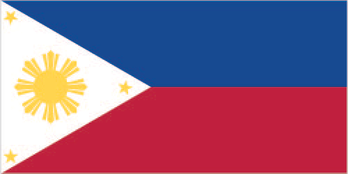
Flag of Philippines
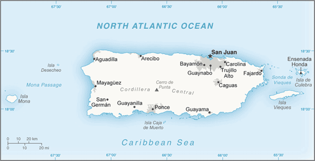
Map of the Philippines
The Philippine Islands became a Spanish colony during the 16th century; They were ceded to the US in 1898 following the Spanish-American War. In 1935 the Philippines became a self-governing commonwealth. Manuel QUEZON was elected president and was tasked with preparing the country for independence after a 10-year transition. In 1942 the islands fell under Japanese occupation during World War II, and US forces and Filipinos fought together during 1944-45 to regain control. On 4 July 1946, the Republic of the Philippines attained its independence. A 21-year rule by Ferdinand MARCOS ended in 1986 when a “people power” movement in Manila (“EDSA 1”) forced him into exile and installed Corazon AQUINO as president. Her presidency was hampered by several coup attempts that prevented a return to full political stability and economic development.
Fidel RAMOS was elected president in 1992. His administration was marked by increased stability and by progress on economic reforms. In 1992, the US closed its last military bases on the islands. Joseph ESTRADA was elected president in 1998. He was succeeded by his vice-president, Gloria MACAPAGAL-ARROYO, in January 2001 after ESTRADA’s stormy impeachment trial on corruption charges broke down, and another “people power” movement (“EDSA 2”) demanded his resignation. MACAPAGAL-ARROYO was elected to a six-year term as president in May 2004. Several corruption allegations marred her presidency. Still, the Philippine economy was one of the few to avoid contraction following the 2008 global financial crisis, expanding her administration year. Benigno AQUINO III was elected to a six-year term as president in May 2010 and was succeeded by Rodrigo DUTERTE in May 2016. The Philippine Government faces threats from several groups, some of which are on the US Government’s Foreign Terrorist Organization list.
Manila has waged a decades-long struggle against ethnic Moro insurgencies in the southern Philippines, which led to a peace accord with the Moro National Liberation Front and a separate agreement with a breakaway faction, the Moro Islamic Liberation Front. The decades-long Maoist-inspired New People’s Army insurgency also operates through much of the country. In 2017, Philippine armed forces battled an ISIS-Philippines siege in Marawi City, driving DUTERTE to declare martial law in the region. The Philippines faces increased tension with China over disputed territorial and maritime claims in the South China Sea.
Philippines’s names conventional long form: Republic of the Philippines, traditional short form: Philippines, local long form: Republika ng Pilipinas, local short form: Pilipinas, etymology: named in honor of King Phillip II of Spain by Spanish explorer Ruy LOPEZ de VILLALOBOS, who visited some of the islands in 1543. It was named in honor of King PHILLIP II of Spain by Spanish explorer Ruy LOPEZ de VILLALOBOS, who visited some of the islands in 1543.
Philippines’s terrain is typically mostly mountains with narrow to extensive coastal lowlands. The country’s mean elevation: 442 m, elevation extremes; lowest point: the Philippine Sea 0 m, highest point: Mount Apo 2,954 m.
The general climate in the country; tropical marine: northeast monsoon (November to April): southwest monsoon (May to October).
The total number of border countries is 0; none are the neighboring nations with the indicated border lengths. Philippines’s coastline is 36,289 km, while its marital claims are: territorial sea: irregular polygon extending up to 100 nautical miles from the coastline as defined by 1898 treaty; since the late 1970s has also claimed the polygonal-shaped area in the South China Sea as wide as 285 nautical miles, exclusive economic zone: 200 nautical miles, continental shelf: to the depth of exploitation. Waterways: 3,219 km (limited to vessels with a draft less than 1.5 m) (2011). Land use: agricultural land: 41%; arable land 18.2%; permanent crops 17.8%; permanent pasture 5%; forest: 25.9%; other: 33.1% (2011 estimate).
The population in Philippines 105,893,381 (July 2018 estimate), urban population: 44.4% of total population (2015), major urban area’s population: MANILA (capital) 12.946 million; Davao 1.63 million; Cebu City 951,000; Zamboanga 936,000 (2015), while Philippines has N/A. Their spoken languages are Filipino (official language; based on Tagalog) and English (official language); eight major dialects – Tagalog, Cebuano, Ilocano, Hiligaynon or Ilonggo, Bicol, Waray, Pampango, and Pangasinan. Main religions in Philippines are Catholic 82.9% (Roman Catholic 80.9%, Aglipayan 2%), Muslim 5%, Evangelical 2.8%, Iglesia ni Kristo 2.3%, other Christian 4.5%, other 1.8%, unspecified 0.6%, none 0.1% (2000 census). The nation uses mixed legal system of civil, common, Islamic, and customary law. It is a(n) presidential republic, National holiday(s) Independence Day, 12 June (1898).
Economic overview for the country: The economy has been relatively resilient to global economic shocks due to less exposure to troubled international securities, lower dependence on exports, relatively resilient domestic consumption, large remittances from about 10 million overseas Filipino workers, and migrants, and a rapidly expanding services industry. During 2017, the current account balance fell into the negative range, the first time since the 2008 global financial crisis, in part due to an ambitious new infrastructure spending program announced this year. However, international reserves remain at comfortable levels, and the banking system is stable. Efforts to improve tax administration and expenditures management have helped ease the Philippines’ debt burden and tight fiscal situation. The Philippines received investment-grade credit ratings on its sovereign debt under the former AQUINO administration and has had little difficulty financing its budget deficits. However, weak absorptive capacity and implementation bottlenecks have prevented the government from maximizing its expenditure plans. Although it has improved, the low tax-to-GDP ratio remains a constraint supporting increasingly higher spending levels and sustaining high and inclusive growth over the longer term. Economic growth has accelerated, averaging over 6% per year from 2011 to 2017, compared with 4.5% under the MACAPAGAL-ARROYO government; And competitiveness rankings have improved.
Although 2017 saw a new record year for net foreign direct investment inflows, FDI to the Philippines has continued to lag regional peers, in part because the Philippine constitution and other laws limit foreign investment and restrict foreign ownership in important activities/sectors – such as land ownership and public utilities. Although the economy proliferated under the AQUINO government, challenges to achieving more inclusive growth remain. Wealth is concentrated in the hands of the rich. The unemployment rate declined from 7.3% to 5.7% between 2010 and 2017; while there has been some improvement, underemployment remains high at around 17% to 18% of the employed population—at least 40% of the employed work in the informal sector. Poverty afflicts more than a fifth of the total population but is as high as 75% in some southern Philippines. More than 60% of the poor reside in rural areas, where the incidence of poverty (about 30%) is more severe – a challenge to raising rural farm and non-farm incomes.
Continued efforts are needed to improve governance, the judicial system, the regulatory environment, the infrastructure, and the overall ease of doing business. 2016 saw President Rodrigo DUTERTE, who has pledged to make inclusive growth and poverty reduction his top priority. DUTERTE believes that illegal drug use, crime, and corruption are key barriers to economic development. The administration wants to reduce the poverty rate to 17% and graduate the economy to upper-middle-income status by the end of President DUTERTE’s term in 2022. Key themes under the government’s Ten-Point Socioeconomic Agenda include continuity of macroeconomic policy, tax reform, higher investments in infrastructure and human capital development, and improving competitiveness and ease of doing business. The administration sees infrastructure shortcomings as a critical barrier to sustained economic growth and has pledged to spend $165 billion on infrastructure by 2022.
Although the outcome has yet to be seen, the current administration is shepherding legislation for a comprehensive tax reform program to raise revenues for its ambitious infrastructure spending plan and promote a more equitable and efficient tax system. However, the need to finance rehabilitation and reconstruction efforts in Mindanao’s southern region following the 2017 Marawi City siege may compete with another infrastructure spending.
Main export partners for the Philippines, Southeast Asia are Japan 21.1%, US 15%, China 10.9%, Hong Kong 10.6%, Singapore 6.2%, Germany 4.5%, South Korea 4.3% (2015) for semiconductors and electronic products, transport equipment, garments, copper products, petroleum products, coconut oil, fruits, while the main import partners for the country are: China 16.2%, US 10.8%, Japan 9.6%, Singapore 7%, South Korea 6.5%, Thailand 6.4%, Malaysia 4.8%, Indonesia 4.4% (2015) for electronic products, mineral fuels, machinery, and transport equipment, iron and steel, textile fabrics, grains, chemicals, plastic.
When you visit this country in Southeast Asia, consider the natural hazards in Philippines: Astride typhoon belt, usually affected by 15 and struck by five to six cyclonic storms each year, landslides, active volcanoes, destructive earthquakes, tsunamisvolcanism: significant volcanic activity, Taal (elevation 311 m), which has shown recent unrest and may erupt in the near future, has been deemed a Decade Volcano by the International Association of Volcanology and Chemistry of the Earth’s Interior, worthy of study due to its explosive history and close proximity to human populations, Mayon (elevation 2,462 m), the country’s most active volcano, erupted in 2009 forcing over 33,000 to be evacuated, other historically active volcanoes include Biliran, Babuyan Claro, Bulusan, Camiguin, Camiguin de Babuyanes, Didicas, Iraya, Jolo, Kanlaon, Makaturing, Musuan, Parker, Pinatubo and Ragang, while infectious diseases are degree of risk: high food or waterborne diseases: bacterial diarrhea, hepatitis A, and typhoid fever vectorborne diseases: dengue fever and malariawater contact disease: leptospirosis (2016). Also, note that the Philippines faces the following environmental issues: Uncontrolled deforestation, especially in watershed areas, Illegal mining and logging, Soil erosion, Air and water pollution in major urban centers, Coral reef degradation, Increasing pollution of coastal mangrove swamps that are substantial fish breeding grounds, Coastal decline, Dynamite fishing, wildlife extinction.
You may also be interested in the Philippines’ neighbouring countries around its 0 km border – No border countries.