CALIFORNIA, USA — 5:15 p.m. update:
Cal Fire officials have reduced or lifted evacuation orders in Alameda County.
Effective immediately, evacuation orders have been reduced to evacuation warnings in the following areas:
Zone 15B
- South of Welch Creek Road to the fire perimeter and the Alameda/Santa Clara County Line East of Calaveras Road at Welch Creek Road to the fire perimeter
Zone 19
- Inside of the Ohlone Fire Perimeter
Also effective immediately, evacuation warnings have been lifted in the following areas:
Zone 15C
- Mill Creek Road from the 196 block to the 9000 block
- East of Mission Blvd. from the intersection of Mission Blvd. and Mission Road, south to the intersection of Mission Blvd. and Curtner Road.
- East of Curtner Road south along I-680 to the Scott Creek Road/Santa Clara County Line
Zone 15D
- Tesla Road, north to Highway I-580 in between Greenville Road and the San Joaquin County Line
Zone 15E
- Calavera Road, west to Mill Creek Road, south of I-680 to the Ohlone fire perimeter.
3:15 p.m. update:
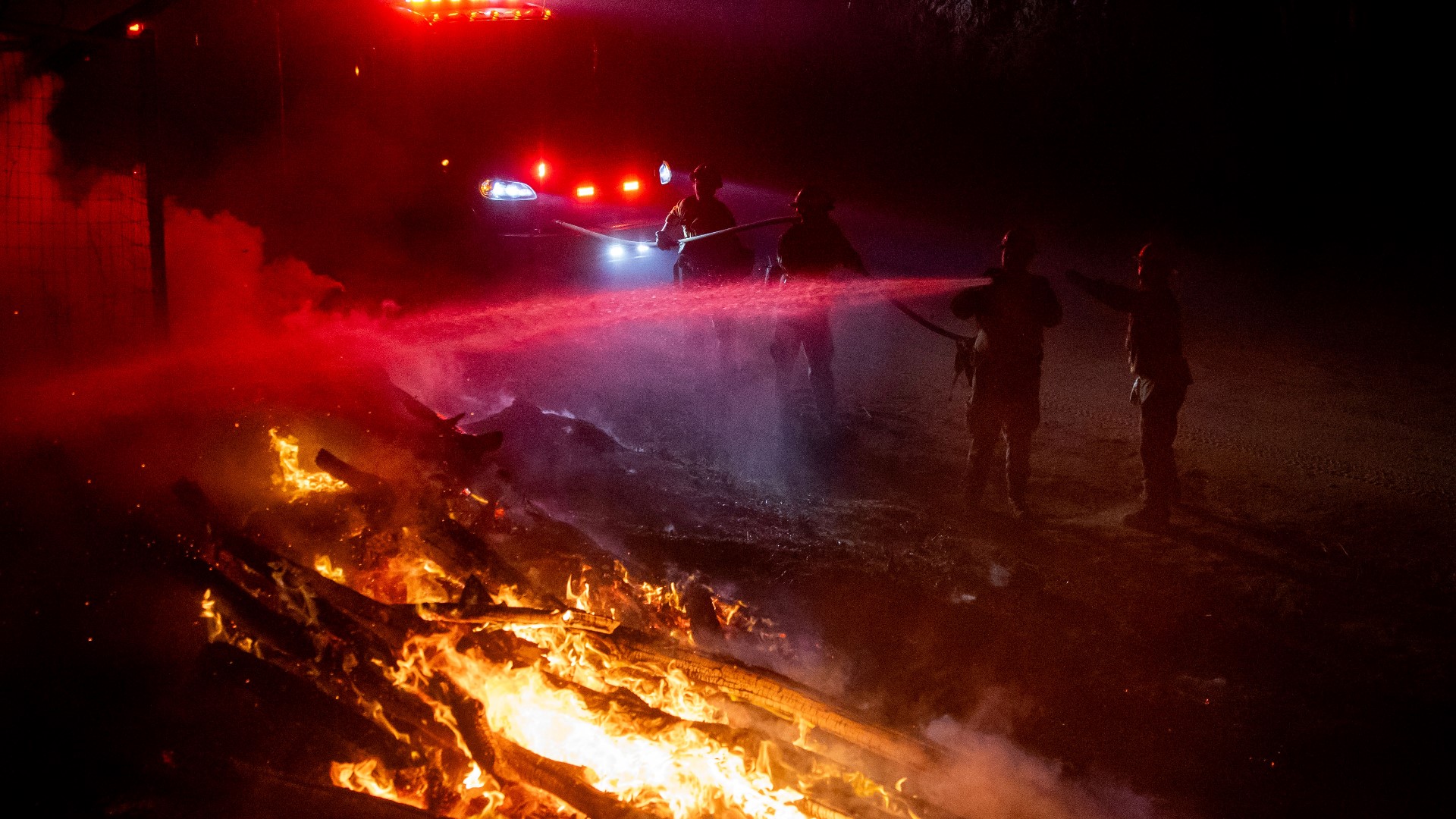
Cal Fire officials provided updates on the fight against the SCU Complex Fire on Twitter Tuesday afternoon.
Officials say the fire has destroyed five structures and threatens another 20,000. Civilians and firefighters have both been injured in the fire, but officials did not go into further detail during the afternoon press conference.
To watch the full update, click play on the Twitter video below. If you cannot see the tweet, click here.
1:30 p.m. update:
Cal Fire has lifted an evacuation warning in Santa Clara County.
The area in Zone 16 that are no longer under an evacuation warning includes:
- South of Eagle View Drive, East of Peet Road, North of Half Road, West of Cochrane Road and West of Coyote Creek
Original Story:
Cal Fire SCU reports that the SCU Lightning Complex Fire has reached 363,772 acres and is now the third-largest fire in California's history. The fire is 15% contained as of Tuesday morning.
Fire officials say the SCU Lightning Complex Fire is composed of 20 separate fires in San Joaquin, Stanislaus, Santa Clara, Alameda, and Contra Costa counties.
The complex incident was sparked on Sunday, Aug. 16, with multiple fires merging into one major fire.
Three first responders and two non-first responders have been injured as a result of working on the SCU Lightning Complex Fire, but Cal Fire reports no deaths.
Evacuation orders have been issued and released by zones.
Evacuation orders in Santa Clara County include:
Zone 2
- North of 130 to Santa Clara County Line
- West of San Antonio Valley Rd.
- West of Mines Rd. to Santa Clara County Line
- East of Three Springs Rd. and Mt. Hamilton Rd.
- South of Santa Clara County Line
- East of Ed Levin County Park, Felter Rd., Sierra Rd., Toyon Ave. and Mt. Hamilton Rd. to Three Springs Rd.
- North of Mt. Hamilton Rd. to Three Springs Rd.
- South of Santa Clara County Line
- West of the Fire Perimeter
- West of North of Mount Hamilton Rd.
Zone 3
- East of San Jose city limits
- South of Mt. Hamilton Rd. North of Metcalf Rd. & San Felipe Rd., east to the county line
- East of San Antonio Valley Rd. to Del Puerto Canyon Rd. to the county line
Zone 9
- South of the Alameda/Santa Clara County Line in between Mines Rd. and the Stanislaus/San Joaquin County line to Del Puerto Canyon Rd.
- East of Mines Rd to Santa Clara/Stanislaus County Line
- North of Del Puerto Canyon Rd. to Alameda/Santa Clara County Line in between Mines Rd. and the Stanislaus/San Joaquin County
- West of Santa Clara/Stanislaus County Line to Mines Rd. in between the Alameda/Santa Clara County Line and Del Puerto Canyon Rd.
Zone 5
- East of Shingle Valley Rd. and everything East of Anderson Lake, East of Coyote Creek,
- East of Coyote Reservoir, East of Roop Rd. East of Leavesley Rd., East of Crews Rd.,
- East of Ferguson Rd. East and North of Hwy 152
- West of the Merced County Line, North of Hwy 152
- South of Metcalf Rd. at Shingle Valley Rd., East to the Stanislaus County Line
Evacuation warnings in Santa Clara County include:
Zone 4A:
- North of Magnolia Ct. and Magnolia Way,
- East of Lower Thomas Grade along the East Dunne Corridor
- East of Hwy 101 to Meltcalf Rd., East of Coyote Creek, East of Cochrane Rd.,
- East of Hill Rd., South of Main Ave. North of Dunne Ave., West of Shingle Valley Rd. and Anderson Lake, to include the Jackson Oaks and Holiday Lake Estates.
- South of Metcalf Rd.
Zone 4B:
- South of Dunne Ave. and West of Lower Thomas Grade, East of Hill Rd.,
- North of Maple Ave., Foothill Ave., North San Martin Ave., East of New Ave. North of Roop Rd.,
- West of Coyote Creek and Coyote Lake
Zone 6:
- East of Lovers Lane and the Santa County Line
- South of Hwy 152 to the San Benito County Line West to the Merced County Line
- North of the San Benito County Line to Hwy 152
Zone 16:
- South of Eagle View Dr., East of Peet Rd., North of Half Rd., West of Cochrane Rd., West of Coyote Creek.
Evacuation orders in Stanislaus County include:
Zone 7A:
- Everything within the fire perimeter
- South of Orestimba Rd. and Orestimba Creek to the Stanislaus/Merced County Line
- West of the fire perimeter to the I-5
- North of the Stanislaus/Merced County Line to Orestimba Rd. and Orestimba Creek
- East of the I-5 in between Orestimba Rd. and the Stanislaus/Merced County Line to the fire perimeter
Evacuation warnings in Stanislaus County include:
Zone 7B:
- Everything within the fire perimeter South of Orestimba Rd. and Orestimba Creek to the Stanislaus/Merced County Line
- West of the fire perimeter to the I-5
- North of the Stanislaus/Merced County Line to Orestimba Rd. and Orestimba Creek
- East of the I-5 in between Orestimba Rd. and the Stanislaus/Merced County Line to the fire perimeter
Evacuation orders in Alameda County include:
Zone 12:
- All of Mines Road, south of Mile Marker 10 to the county line
Zone 15B:
- South of Welch Creek Rd. to the fire perimeter and the Alameda/Santa Clara County Line
- East of Calaveras Rd. at Welch Creek Rd. to the fire perimeter.
Evacuation warnings in Alameda County include:
Zone 14A:
- East of the Mission Blvd. and Mission Rd. Intersection south to the Intersection of Mission Blvd and Curtner Rd.
- East of Curtner Rd. south along I-680 to the Santa Clara County Line
- South of I-580 in between Greenville Rd. and San Joaquin County Line to the Alameda/Santa Clara County Line, South of the Livermore City limits (excluding the cities of Livermore and Pleasanton), South of Hwy 84 in between Vineyard Ave. and I-680, South of I-680 to the fire perimeter and the Alameda/Santa Clara County Line
- West of the Alameda/San Joaquin County Line to the Livermore city limits, to Hwy 84 to I-680
- North of fire perimeter and the Alameda/Santa Clara County Line to Hwy 84, to the Livermore city limits, to I-580
Evacuation orders in San Joaquin County include:
Zone 10:
- South of West Corral Hollow Road to Stanislaus county line
- West of I-580 to Alameda county line
- East of Alameda county line to I-580 and the Stanislaus county line
Evacuation warnings in San Joaquin County include:
Zone 11:
- All of PAR Estates which are the following streets: W. Vernalis Road, Bernard Drive,
- Stearman Road, Brichetto Court, Stearman Court, S. Chrisman Road south of I-580, and the Tracy Golf & Country Club
Zone 13:
- North of West Corral Hollow Road to I-580
- East of the Alameda county line to I-580
Evacuation warnings in Merced County include:
Zone 17:
- North of Hwy 152 to I-5 to the Santa Clara County Line and Stanislaus County Line
- West of the I-5 EXCLUDING THE COMMUNITY OF SANTA NELLA East of Santa Clara County Line and Stanislaus County Line to the Delta-Mendota
- South of the Stanislaus County Line to Hwy 152
Road closures are in place due to the SCU Complex. Those closures include:
- Holiday Dr. at East Dunne Ave., Coyote Reservoir Rd. at Roop Rd., Canada Rd. at Hwy 152, Hwy 152 at Belle Station
- Del Puerto Canyon Road (SR-130) between Mines Road and Diablo Grande PKWY
- Hwy 130 at Three Springs Rd.
- Hwy 130 at Quimby Rd.
Evacuees with animals or livestock may contact the following services for help:
County of Santa Clara Animal Services: (408) 686-3900
- For the unincorporated areas of Santa Clara County, Morgan Hill, and Gilroy
Hold Your Horses Livestock: (925)584-1976
- Large Animals in Canyon Zone
Alameda County Animal Services: (925)803-7041
- Large and Small animal shelter and assistance
WATCH MORE: California Wildfires: Ash falling from the sky, air quality, and tropical systems in Gulf of Mexico
WILDFIRE PREPS
According to Cal Fire, in 2019, California wildfires burned just under 260,000 acres from 7,860 incidents. Over 700 structures were damaged or destroyed and three people were killed. This follower two years of some of the “deadliest and most destructive wildfires” in California history.
If you live in a wildfire-prone zone, Cal Fire suggests creating a defensible space around your home. A defensible space is an area around a building in which vegetation and other debris is completely cleared. At least 100 feet is recommended.
The Department of Homeland Security suggests assembling an emergency kit that has important documents, N95 respirator masks, supplies to grab with you if you’re forced to leave at a moment’s notice. The agency also suggests signing up for local warning system notifications and know your community’s evacuation plans to best prepare yourself and your family in cases of wildfires.