Discovering the Cartography of the Past
Maps of Prince George
Maps of Prince George

Rand McNally Official 1925 Auto Trails Map British Colombia.
1 : 1077120 Rand McNally and Company
Map Of The Grand Trunk Pacific Railway In British Columbia.
1 : 1250000 Grand Trunk Pacific Railway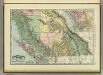
British Columbia.
1 : 2400000 Rand McNally and Company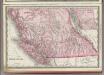
British Columbia.
1 : 2400000 Rand McNally and Company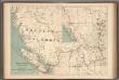
No.13, Telegraphs : British Columbia, Yukon and Alberta
1 : 2217600 Canada. Department of Interior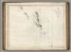
Chart of the North West Coast of America.
1 : 2660000 La Perouse, Jean-Francois de Galaup, comte de, 1741-1788
British Columbia. Historical Maps.
1 : 3787000 Hammond, C.S.
Washington, Mt. Rainier National Park : topography / R.B. Marshall, chief geographer ; T.G. Gerdine, geographer in charge ; topography by F.E. Matthes ... [et al.] ; engraved by U.S.G.S.
1 : 62500 Annotatie geografische gegevens: Opname: 1910-1911, 1913 Marshall, R. B.; Gerdine, T. G.; Matthes, François E.; United States Geological Survey [Washington, D.C. : U.S. Geological Survey]
Facsimile: Official British Columbia Map.
1 : 4500000 Selwyn, Alfred R.C.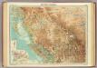
British Columbia.
1 : 2500000 John Bartholomew and Son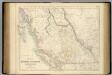
British North America. Sheet III. Pacific Coast.
1 : 2407680 Fullarton, A. & Co.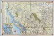
Shell British Columbia - Alberta.
1 : 2471040 Shell Oil Company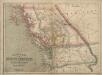
Philip’s Map of British Columbia and Vancouver Island
Philip's Map of British Columbia and Vancouver Island.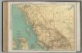
British Columbia.
1 : 2851000 Rand McNally and Company
British Columbia.
1 : 2408000 Rand McNally and Company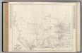
Alberta. British Columbia.
Rand McNally and Company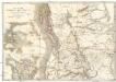
Map of the Oregon districts and the adjacent country
Kanada Wyld, James James Wyld
Facsimile: Map of the Province of British Columbia.
1 : 4539000 Mohun, Edward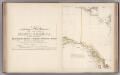
Facsimile: Arrowsmith's North America (portion).
1 : 4300000 Arrowsmith, Aaron
Sectional map indicating main automobile roads between Canada and United States
1 : 2534400 Kanada západní National Development Bureau
Facsimile: Part of Map of British North America. Arrowsmith.
1 : 9750000 Arrowsmith, John
British Columbia
1 : 2450000
Oregon-Gebiet.
1 : 5650000 Flemming, Carl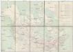
Limits of forest trees
1 : 12500000 Kanada
Oregon Territory.
1 : 6969600 Burr, David H., 1803-1875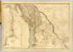
Map of the Oregon Territory.
1 : 3041280 Wilkes, Charles, 1798-1877
Cote N.O. de l'Amerique.
1 : 6600000 La Perouse, Jean-Francois de Galaup, comte de, 1741-1788
Oregon Territory.
1 : 7200000 Greenleaf, Jeremiah
Oregon Territory.
1 : 7603200 Greenleaf, Jeremiah
A map of Mackenzie's track from Fort Chipewyan to the Pacific Ocean in 1793
1 : 1850000Download OldMapsOnline Mobile

