Countries Ruled by a Presidential System
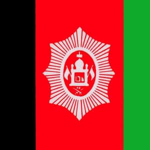
- KabulAfghanistan, officially the Islamic Republic of Afghanistan, is a landlocked country located within South Asia and Central Asia. It has a population of approximately 31 million people, making it the 42nd most populous country in the world. It is bordered by Pakistan in the south and east; Iran in the west; Turkmenistan, Uzbekistan, and Tajikistan in the north; and China in the far northeast. Its territory covers 652,000 km², making it the 41st largest country in the world. Human habitation in Afghanistan dates back to the Middle Paleolithic Era, and the country's strategic location along the Silk Road connected it to the cultures of the Middle East and other parts of Asia. Through the ages the land has been home to various peoples and witnessed numerous military campaigns, notably by Alexander the Great, Muslim Arabs, Mongols, British, Soviet Russians, and in the modern-era by Western powers. The land also served as the source from which the Kushans, Hephthalites, Samanids, Saffarids, Ghaznavids, Ghorids, Khiljis, Mughals, Hotaks, Durranis, and others have risen to form major empires.More Afghanistan

- Dig Deeper...The Best Books About Afghanistan
- And Deeper...The Most Corrupt Countries in the World
- #157 of 223 onThe Prettiest Flags in the World
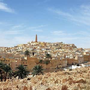
- AlgiersAlgeria, officially People's Democratic Republic of Algeria, is a country in North Africa on the Mediterranean coast. Its capital and most populous city is Algiers. With a total area of 2,381,741 square kilometres, 90% of which is desert, Algeria is the tenth-largest country in the world, and the largest in Arab world and Africa and on the Mediterranean. The country is bordered in the northeast by Tunisia, in the east by Libya, in the west by Morocco, in the southwest by Western Sahara, Mauritania, and Mali, in the southeast by Niger, and in the north by the Mediterranean Sea. The territory of today's Algeria was the home of many prehistoric cultures, including Aterian and Capsian and the Proto-Berber cultures. Its area has known many empires and dynasties, including ancient Numidians, Phoenicians, Carthaginians, Romans, Vandals, Byzantines, Umayyads, Abbasids, Fatimids, Hammadids, Almoravids, Almohads, Ottomans and the French colonial empire. In recent decades, Algeria has experienced increased identity recognition demands, in response to which, Tamazight, the language of their 13,000 year old people, has been constitutionalized as a national language.More Algeria
- Dig Deeper...The Most Corrupt Countries in the World
- And Deeper...Life Expectancy by Country | Life Expectancy Trends
- #115 of 223 onThe Prettiest Flags in the World
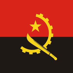
- LuandaAngola, officially the Republic of Angola, is a country in Southern Africa. It is the seventh largest country in Africa, and is bordered by Namibia on the south, the Democratic Republic of the Congo on the north, and Zambia on the east; its west coast is on the Atlantic Ocean and Luanda is its capital city. The exclave province of Cabinda has borders with the Republic of the Congo and the Democratic Republic of the Congo. The Portuguese were present in some – mostly coastal – points of the territory of what is now Angola from the 16th century, interacting in diverse ways with the peoples who lived there. In the 19th century, settlers slowly and hesitantly began to establish themselves in the interior. Angola as a Portuguese colony encompassing the present territory was not established until the early 20th century, after the Mbunda resistance and abduction of their King, Mwene Mbandu I Lyondthzi Kapova. Independence was achieved in 1975, after a protracted liberation war. After independence, Angola descended into an intense civil war from 1975 to 2002.More Angola
- Dig Deeper...The Most Corrupt Countries in the World
- And Deeper...World Poverty: The Poorest Countries In The World
- #129 of 223 onThe Prettiest Flags in the World
- Buenos AiresArgentina, officially the Argentine Republic is a federal republic located in southeastern South America. Sharing the Southern Cone with its smaller neighbour Chile, it is bordered by Bolivia and Paraguay to the north; Brazil to the northeast; Uruguay and the South Atlantic Ocean to the east; Chile to the west and the Drake Passage to the south. With a mainland area of 2,780,400 km², Argentina is the eighth-largest country in the world, the second-largest in Latin America, and the largest Spanish-speaking one. Argentina claims sovereignty over part of Antarctica, the Falkland Islands, South Georgia and the South Sandwich Islands.More Argentina
- Dig Deeper...The Top Beers from Argentina
- And Deeper...The Most Corrupt Countries in the World
- #14 of 223 onThe Prettiest Flags in the World
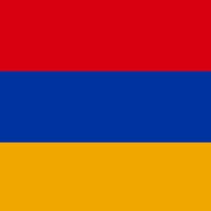
- YerevanArmenia, officially the Republic of Armenia, is a mountainous country in the South Caucasus region of Eurasia. Located in the north of Western Asia, it is bordered by Turkey to the west, Georgia to the north, the de facto independent Nagorno-Karabakh Republic and Azerbaijan to the east, and Iran and the Azerbaijani exclave of Nakhchivan to the south. Armenia is a unitary, multi-party, democratic nation-state with an ancient cultural heritage. The Satrapy of Armenia was established in the 6th century BC, after the fall of Urartu. In the first century BC the Kingdom of Armenia reached its height under Tigranes the Great. Armenia became the first state in the world to adopt Christianity as its official religion, in between late 3rd to early years of the 4th century, becoming the first Christian nation." An Armenian principality and later a kingdom, known as Cilician Armenia, existed on the coast of the Mediterranean Sea between the 11th and 14th centuries. Between the 16th and early 19th century, the traditional Armenian homeland composed of Eastern Armenia and Western Armenia came under rule of the rivaling Ottoman and Persian Empires, passing between the two over the centuries.More Armenia
- Dig Deeper...The Most Corrupt Countries in the World
- And Deeper...Nations That Are 'Against' Death Penalty
- #110 of 232 onThe Prettiest Flags in the World
- BakuAzerbaijan, officially the Republic of Azerbaijan, is a contiguous transcontinental presidential republic in the Caucasus region, situated at the crossroads of Eastern Europe and Western Asia. It is bounded by the Caspian Sea to the east, Russia to the north, Georgia to the northwest, Armenia to the west and Iran to the south. The exclave of Nakhchivan is bounded by Armenia to the north and east, Iran to the south and west, while having a short border with Turkey in the northwest. The Azerbaijan Democratic Republic proclaimed its independence in 1918 and became the first Muslim-majority democratic and secular republic. It was also the first Muslim-majority country to have operas, theaters and modern universities. The country was incorporated into the Soviet Union in 1920 as the Azerbaijan Soviet Socialist Republic. Azerbaijan proclaimed its independence in October 1991, before the official dissolution of the USSR. Earlier, in September 1991, the disputed Armenian-majority Nagorno-Karabakh region re-affirmed its willingness to create a separate state as the Nagorno-Karabakh Republic.More Azerbaijan
- Dig Deeper...The Most Corrupt Countries in the World
- And Deeper...Life Expectancy by Country | Life Expectancy Trends
- #79 of 223 onThe Prettiest Flags in the World
- MinskBelarus, officially the Republic of Belarus, is a landlocked country in Eastern Europe bordered by Russia to the northeast, Ukraine to the south, Poland to the west, and Lithuania and Latvia to the northwest. Its capital is Minsk; other major cities include Brest, Hrodna, Homiel, Mahilyow and Vitsebsk. Over 40% of its 207,600 square kilometres is forested. Its strongest economic sectors are service industries and manufacturing. Until the 20th century, the lands of modern-day Belarus belonged to several countries, including the Principality of Polotsk, the Grand Duchy of Lithuania, the Polish–Lithuanian Commonwealth, and the Russian Empire. In the aftermath of the Russian Revolution, Belarus declared independence as the Belarusian People's Republic, succeeded by the Socialist Soviet Republic of Byelorussia, which became a founding constituent republic of the Soviet Union and was renamed as the Byelorussian Soviet Socialist Republic. Belarus lost almost half of its territory to Poland after the Polish-Soviet war.More Belarus
- Dig Deeper...The Most Corrupt Countries in the World
- And Deeper...Countries with Best Sanitation Facilities
- #122 of 223 onThe Prettiest Flags in the World
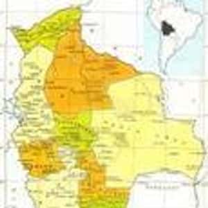
- SucreBolivia, officially known as the Plurinational State of Bolivia, is a landlocked country located in western-central South America. It is bordered by Brazil to the north and east, Paraguay and Argentina to the south, Chile to the southwest, and Peru to the west. Prior to Spanish colonization, the Andean region of Bolivia was a part of the Inca Empire, while the northern and eastern lowlands were inhabited by independent tribes. Spanish conquistadors arriving from Cuzco and Asunción took control of the region in the 16th century.More Bolivia
- Dig Deeper...This “Gate of the Sun” Monolithic Stone Monument Has Baffled Experts For Centuries
- And Deeper...The Most Corrupt Countries in the World
- #205 of 223 onThe Prettiest Flags in the World
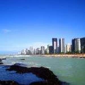
- BrasíliaBrazil, officially the Federative Republic of Brazil, is the largest country in both South America and the Latin American region. It is the world's fifth largest country, both by geographical area and by population. It is the largest Portuguese-speaking country in the world, and the only one in the Americas. Bounded by the Atlantic Ocean on the east, Brazil has a coastline of 7,491 km. It borders all other South American countries except Ecuador and Chile and occupies 47.3 percent of the continent of South America. Its Amazon River basin includes a vast tropical forest, home to diverse wildlife, a variety of ecological systems, and extensive natural resources spanning numerous protected habitats. This unique environmental heritage makes Brazil one of 17 megadiverse countries, and is the subject of significant global interest and debate regarding deforestation and environmental protection. Brazil was inhabited by numerous tribal nations prior to the landing of traveler Pedro Álvares Cabral in 1500, who claimed the area for Portugal.More Brazil
- Dig Deeper...The Best Soccer Players From Brazil
- And Deeper...The Most Corrupt Countries in the World
- #7 of 223 onThe Prettiest Flags in the World
- SantiagoChile, officially the Republic of Chile, is a American country in the south-west point of South America occupying a long, narrow strip of land between the Andes mountains to the east and the Pacific Ocean to the west. It borders Peru to the north, Bolivia to the northeast, Argentina to the east, and the Drake Passage in the far south. Chilean territory includes the Pacific islands of Juan Fernández, Salas y Gómez, Desventuradas, and Easter Island in Oceania. Chile also claims about 1,250,000 square kilometres of Antarctica, although all claims are suspended under the Antarctic Treaty. Chile's northern desert contains great mineral wealth, principally copper. The relatively small central area dominates in terms of population and agricultural resources, and is the cultural and political center from which Chile expanded in the late 19th century when it incorporated its northern and southern regions. Southern Chile is rich in forests and grazing lands, and features a string of volcanoes and lakes. The southern coast is a labyrinth of fjords, inlets, canals, twisting peninsulas, and islands.More Chile
- Dig Deeper...The Most Corrupt Countries in the World
- And Deeper...Life Expectancy by Country | Life Expectancy Trends
- #102 of 223 onThe Prettiest Flags in the World
- BogotáColombia, officially the Republic of Colombia, is a country situated in the northwest of South America, bordered to the northwest by Panama; to the east by Venezuela and Brazil; to the south by Ecuador and Peru; and it shares maritime limits with Costa Rica, Nicaragua, Honduras, Jamaica, Dominican Republic and Haiti. It is a unitary, constitutional republic comprising thirty-two departments. The territory of what is now Colombia was originally inhabited by indigenous peoples including the Muisca, Quimbaya, and Tairona. The Spanish arrived in 1499 and initiated a period of conquest and colonization ultimately creating the Viceroyalty of New Granada, with its capital at Bogotá. Independence from Spain was won in 1819, but by 1830 "Gran Colombia" had collapsed with the secession of Venezuela and Ecuador. What is now Colombia and Panama emerged as the Republic of New Granada. The new nation experimented with federalism as the Granadine Confederation, and then the United States of Colombia, before the Republic of Colombia was finally declared in 1886. Panama seceded in 1903.
- San JoséCosta Rica, officially the Republic of Costa Rica, is a country in Central America, bordered by Nicaragua to the north, Panama to the southeast, the Pacific Ocean to the west, the Caribbean Sea to the east, and Ecuador to the south of Cocos Island. It has a population of around 4.5 million, of whom nearly a quarter live in the metropolitan area of the capital and largest city, San José. Costa Rica was sparsely inhabited by indigenous people before coming under Spanish rule in the 16th century.More Costa Rica
- Dig Deeper...The Best Soccer Players From Costa Rica
- And Deeper...The Most Corrupt Countries in the World
- #142 of 223 onThe Prettiest Flags in the World
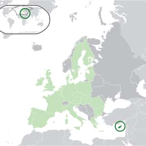
- NicosiaCyprus, officially the Republic of Cyprus, is an island country in the Eastern Mediterranean Sea. Cyprus is the third largest and third most populous island in the Mediterranean, and a member state of the European Union. It is located south of Turkey, west of Syria and Lebanon, northwest of Israel, north of Egypt and east of Greece. The earliest known human activity on the island dates to around the 10th millennium BC. Archaeological remains from this period include the well-preserved Neolithic village of Khirokitia, and Cyprus is home to some of the oldest water wells in the world. Cyprus was settled by Mycenaean Greeks in two waves in the 2nd millennium BC. At a strategic location in the Middle East, it was subsequently occupied by several major powers, including the empires of the Assyrians, Egyptians and Persians, from whom the island was seized in 333 BC by Alexander the Great. Subsequent rule by Ptolemaic Egypt, the Classical and Eastern Roman Empire, Arab caliphates for a short period, the French Lusignan dynasty and the Venetians, was followed by over three centuries of Ottoman rule between 1571 and 1878.More Cyprus
- Dig Deeper...The Most Corrupt Countries in the World
- And Deeper...Nations That Are 'Against' Death Penalty
- #52 of 223 onThe Prettiest Flags in the World
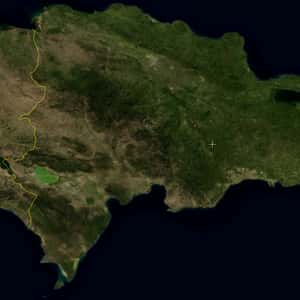
- Santo DomingoThe Dominican Republic is a nation on the island of Hispaniola, part of the Greater Antilles archipelago in the Caribbean region. The western three-eighths of the island is occupied by the nation of Haiti, making Hispaniola one of two Caribbean islands, along with Saint Martin, that are shared by two countries. Both by area and population, the Dominican Republic is the second-largest Caribbean nation, with 48,445 square kilometres and nearly 10 million people, one million of which live in the capital city, Santo Domingo. Christopher Columbus landed on the island in 1492, which the Taíno people had inhabited since the 7th century. It became the site of the first permanent European settlement in the Americas; namely Santo Domingo, the oldest continuously inhabited city and the first seat of the Spanish colonial rule in the New World. After three centuries of Spanish rule, with French and Haitian interludes, the country became independent in 1821. The ruler, José Núñez de Cáceres, intended that the Dominican Republic be part of the nation of Gran Colombia, but he was quickly removed by the Haitian government and Dominican slave revolts.More Dominican Republic
- Dig Deeper...The Best Dominican Baseball Players Of 2024
- And Deeper...The Most Corrupt Countries in the World
- #65 of 223 onThe Prettiest Flags in the World
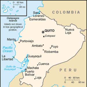
- QuitoEcuador, officially the Republic of Ecuador, is a representative democratic republic in northwestern South America, bordered by Colombia on the north, Peru on the east and south, and the Pacific Ocean to the west. Ecuador also includes the Galápagos Islands in the Pacific, about 1,000 kilometres west of the mainland. What is now Ecuador was home to a variety of indigenous groups that were gradually incorporated into the Inca Empire during the fifteenth century. The territory was colonized by Spain during the sixteenth century, achieving independence in 1820 as part of Gran Colombia, from which it emerged as its own sovereign state in 1830. The legacy of both empires is reflected in Ecuador's ethnically diverse population, with most of its 15.2 million people being mestizos, followed by large minorities of European, Amerindian, and African descendants. Spanish is the official language and is spoken by a majority of the population, though thirteen indigenous languages are also recognized, including Quichua and Shuar. The capital city is Quito, while the largest city is Guayaquil.More Ecuador
- Dig Deeper...The Best Soccer Players From Ecuador
- And Deeper...The Most Corrupt Countries in the World
- #127 of 223 onThe Prettiest Flags in the World
- San SalvadorEl Salvador, officially the Republic of El Salvador, is the smallest and the most densely populated country in Central America. The country's capital city and largest city is San Salvador, with other important cities including Santa Ana and San Miguel. El Salvador borders the Pacific Ocean on the south, and the countries of Guatemala to the west and Honduras to the north and east. Its easternmost region lies on the coast of the Gulf of Fonseca, opposite Nicaragua. As of 2013, El Salvador had a population of approximately 6.29 million making it the most densely populated country in the region composed predominantly by Mestizos of European and Indigenous American descent. Present-day El Salvador was inhabited by numerous sophisticated Mesoamerican nations, predominantly the Cuzcatlecs but also the Lenca and Maya prior to the European exploration and subsequent colonization of the Americas. By 1525 the Spanish Empire had conquered the territory, incorporating it into the colony of New Spain up until 1821, when it achieved independence as part of the Federal Republic of Central America.More El Salvador
- Dig Deeper...The Most Corrupt Countries in the World
- And Deeper...Life Expectancy by Country | Life Expectancy Trends
- #199 of 223 onThe Prettiest Flags in the World
- MalaboEquatorial Guinea, officially the Republic of Equatorial Guinea, is a country located in Central Africa, with an area of 28,000 square kilometres. Formerly the colony of Spanish Guinea, its post-independence name evokes its location near both the equator and the Gulf of Guinea. Equatorial Guinea is the only African state in which Spanish is an official language. As of 2012, the country has a population of 1.6 million. Equatorial Guinea consists of two parts, an insular and a mainland region. The insular region consists of the islands of Bioko in the Gulf of Guinea and Annobón, a small volcanic island south of the equator. Bioko Island is the northernmost part of Equatorial Guinea and is the site of the country's capital, Malabo. The island nation of São Tomé and Príncipe is located between Bioko and Annobón. The mainland region, Río Muni, is bordered by Cameroon on the north and Gabon on the south and east. It is the location of Bata, Equatorial Guinea's largest city, and Oyala, the country's planned future capital. Rio Muni also includes several small offshore islands, such as Corisco, Elobey Grande, and Elobey Chico.More Equatorial Guinea
- Dig Deeper...The Most Corrupt Countries in the World
- And Deeper...World Poverty: The Poorest Countries In The World
- #16 of 20 onThe Best Spanish Speaking Countries to Visit
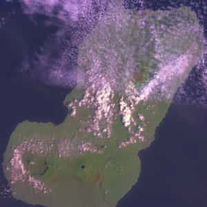
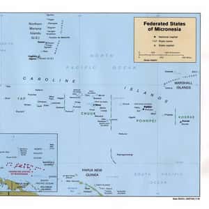
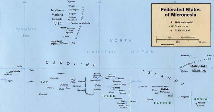
- The Federated States of Micronesia is an independent sovereign island nation and a United States associated state consisting of four states – from west to east, Yap, Chuuk, Pohnpei and Kosrae – that are spread across the Western Pacific Ocean. Together, the states comprise around 607 islands that cover a longitudinal distance of almost 2,700 km just north of the equator. They lie northeast of New Guinea, south of Guam and the Marianas, west of Nauru and the Marshall Islands, east of Palau and the Philippines, about 2,900 km north of eastern Australia and some 4,000 km southwest of the main islands of Hawaii. While the FSM's total land area is quite small, it occupies more than 2,600,000 km² of the Pacific Ocean. The capital is Palikir, located on Pohnpei Island, while the largest city is Weno, located in the Chuuk Atoll. Each of its four states is centered on one or more main high islands, and all but Kosrae include numerous outlying atolls. The Federated States of Micronesia is spread across part of the Caroline Islands in the wider region of Micronesia, which consists of thousands of small islands divided among several countries.
- Dig Deeper...Life Expectancy by Country | Life Expectancy Trends
- And Deeper...The Fattest Countries In The World
- #174 of 223 onThe Prettiest Flags in the World
- AccraGhana, officially called the Republic of Ghana, is a sovereign multinational state and unitary presidential constitutional democracy, located along the Gulf of Guinea and Atlantic Ocean, in the subregion of West Africa. Spanning a land mass of 238,535 km, Ghana is bordered by the Ivory Coast in the west, Burkina Faso in the north, Togo in the east and the Gulf of Guinea and Atlantic Ocean in the south. The word Ghana means "Warrior King" in Mande. Ghana has a population of approximately 27 million, from a variety of ethnic and religious groups. Its varied geography includes savannas, forests, springs, cave systems, mountains, estuaries, and nature reserves. Ghana's 560 kilometres coast is dotted by culturally significant castles, forts, and harbours. Prior to colonisation by the British empire in the early-20th century, Ghana was the site of numerous kingdoms and empires, the most powerful being the Kingdom of Ashanti. In 1957, it became the first African nation to declare independence from European colonisation. This made the country a symbol of black achievement and an inspiration for African independence movements.
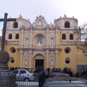
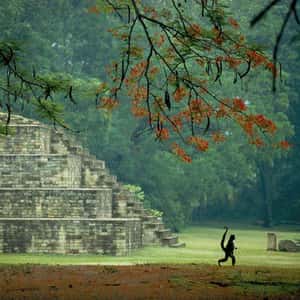
- Guatemala CityGuatemala, officially the Republic of Guatemala, is a country in Central America bordered by Mexico to the north and west, the Pacific Ocean to the southwest, Belize to the northeast, the Caribbean to the east, Honduras to the east and El Salvador to the southeast. With an area of 108,890 km² and an estimated population of around 15.8 million, it is both the largest and most populous state in Central America. A representative democracy, Guatemala's capital and largest city is Nueva Guatemala de la Asunción, also known as Guatemala City. The region of modern day Guatemala was for centuries part of the Mayan civilization that extended across Mesoamerica. Most of the country was conquered by the Spanish in the 16th century, becoming part of the colony of New Spain. Guatemala attained its independence in 1821 as part of the Federal Republic of Central America, which dissolved in 1841. From the mid to late 19th century, Guatemala endured the chronic instability and civil strife that was endemic to the region. Beginning in the early 20th century, it was ruled by a series of dictators backed by the United Fruit Company and the United States government.More Guatemala
- Dig Deeper...The Most Corrupt Countries in the World
- And Deeper...Countries with Best Sanitation Facilities
- #110 of 223 onThe Prettiest Flags in the World
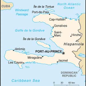
- Port-au-PrinceHaiti, officially the Republic of Haïti, is a Caribbean country. It occupies the western, smaller portion of the island of Hispaniola, in the Greater Antillean archipelago, which it shares with the Dominican Republic. In addition, Haiti also occupies small satellite islands known for tourists, including; Île-à-Vache, which includes Port Morgan and Abaka Bay resorts. In French, the country's nickname is La Perle des Antilles, because of its natural beauty. It is the most mountainous nation in the Caribbean and the country's highest point is Pic la Selle, at 2,680 metres. By area and population, Haiti is the third largest Caribbean nation, with 27,750 square kilometres, and an estimated 9.9 million people; about a million of whom live in the capital city of Port-au-Prince. Haiti's regional, historical, and ethno-linguistic position is unique for several reasons. Originally inhabited by the indigenous Taíno people, the island was first discovered by Christopher Columbus during his first voyage across the Atlantic in 1492. When Columbus first landed in Haiti, he had thought he had found India or Asia.More Haiti
- Dig Deeper...The Most Corrupt Countries in the World
- And Deeper...World Poverty: The Poorest Countries In The World
- #183 of 223 onThe Prettiest Flags in the World
- TegucigalpaHonduras, officially the Republic of Honduras, is a republic in Central America. It was at times referred to as Spanish Honduras to differentiate it from British Honduras, which became the modern-day state of Belize. The country is bordered to the west by Guatemala, to the southwest by El Salvador, to the southeast by Nicaragua, to the south by the Pacific Ocean at the Gulf of Fonseca, and to the north by the Gulf of Honduras, a large inlet of the Caribbean Sea. Honduras was home to several important Mesoamerican cultures, most notably the Maya, prior to being conquered by Spain in the sixteenth century. The Spanish introduced Roman Catholicism and the now predominant Spanish language, along with numerous customs that have blended with the indigenous culture. The country became independent in 1821 and has since been a republic, although it has consistently endured much social strife and political instability, remaining one of the poorest countries in the Western Hemisphere. Honduras spans an area of about 112,492 km² and has a population exceeding 8 million. Its northern portions are part of the Western Caribbean Zone, as reflected in the area's demographics and culture.More Honduras
- Dig Deeper...The Most Corrupt Countries in the World
- And Deeper...Countries With the Highest Murder Rates
- #163 of 223 onThe Prettiest Flags in the World
- JakartaIndonesia, officially the Republic of Indonesia, is a sovereign state in Southeast Asia. Indonesia is an archipelago comprising thousands of islands. With an estimated total population of over 252 million people, Indonesia is the world's fourth-most-populous country. Indonesia's republican form of government comprises an elected legislature and president. It encompasses 34 provinces, of which five have Special Administrative status. The nation's capital city is Jakarta. The country shares land borders with Papua New Guinea, East Timor, and Malaysia. Other neighbouring countries include Singapore, the Philippines, Australia, Palau, and the Indian territory of the Andaman and Nicobar Islands. Indonesia is a founding member of ASEAN and a member of the G-20 major economies. The Indonesian economy is the world's 17th largest by nominal GDP. The Indonesian archipelago has been an important trade region since at least the 7th century, when Srivijaya and then later Majapahit traded with China and India. Local rulers gradually absorbed foreign cultural, religious and political models from the early centuries CE, and Hindu and Buddhist kingdoms flourished.More Indonesia
- Dig Deeper...The Most Corrupt Countries in the World
- And Deeper...Countries with Best Sanitation Facilities
- #208 of 223 onThe Prettiest Flags in the World
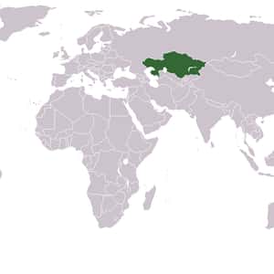
- AstanaKazakhstan, officially the Republic of Kazakhstan, is a country in Central Asia, with its smaller part west of the Ural River in Europe. Kazakhstan is the world's largest landlocked country by land area and the ninth largest country in the world; its territory of 2,724,900 square kilometres is larger than Western Europe. It has borders with Russia, China, Kyrgyzstan, Uzbekistan, and Turkmenistan, and also adjoins a large part of the Caspian Sea. The terrain of Kazakhstan includes flatlands, steppe, taiga, rock canyons, hills, deltas, snow-capped mountains, and deserts. With an estimated 17 million people as of 2013 Kazakhstan is the 61st most populous country in the world, though its population density is among the lowest, at less than 6 people per square kilometre. The capital is Astana, where it was moved from Almaty in 1997. The territory of Kazakhstan has historically been inhabited by nomadic tribes. This changed in the 13th century, when Genghis Khan occupied the country. Following internal struggles among the conquerors, power eventually reverted to the nomads. By the 16th century, the Kazakhs emerged as a distinct group, divided into three jüz.More Kazakhstan
- Dig Deeper...The Most Corrupt Countries in the World
- And Deeper...Life Expectancy by Country | Life Expectancy Trends
- #33 of 223 onThe Prettiest Flags in the World
- BishkekKyrgyzstan, officially the Kyrgyz Republic, formerly known as Kirghizia, is a country located in Central Asia. Landlocked and mountainous, Kyrgyzstan is bordered by Kazakhstan to the north, Uzbekistan to the west, Tajikistan to the southwest and China to the east. Its capital and largest city is Bishkek. Kyrgyzstan's history spans over 2,000 years, encompassing a variety of cultures and empires. Although geographically isolated by its highly mountainous terrain – which has helped preserve its ancient culture – Kyrgyzstan has historically been at the crossroads of several great civilizations, namely as part of the Silk Road and other commercial and cultural routes. Though long inhabited by a succession of independent tribes and clans, Kyrgyzstan has periodically come under foreign domination due to its strategic location, attaining sovereignty as a nation-state only after the breakup of the Soviet Union in 1991. Since independence, Kyrgyzstan has officially been a unitary parliamentary republic, although it continues to endure ethnic conflicts, revolts, economic troubles, transitional governments, and political party conflicts.More Kyrgyzstan
- Dig Deeper...The Most Corrupt Countries in the World
- And Deeper...Life Expectancy by Country | Life Expectancy Trends
- #103 of 223 onThe Prettiest Flags in the World
- MonroviaLiberia, officially the Republic of Liberia, is a country in West Africa bordered by Sierra Leone to its west, Guinea to its north and Ivory Coast to its east. It covers an area of 111,369 square kilometres and is home to about 4 million people. English is the official language; 15 indigenous languages are also spoken within Liberia. Its coastline is composed mostly of mangroves, while its more sparsely populated inland consists of forests opening onto a plateau of drier grasslands. The climate is hot and equatorial, with significant rainfall during the May–October rainy season and harsh harmattan winds the remainder of the year. Liberia possesses about forty percent of the remaining Upper Guinean rainforest. Beginning in 1822, the area was settled by African Americans, most of whom were free blacks. The settlers established a new home with the help of the American Colonization Society, a private organization whose leaders encouraged African Americans to resettle in Africa.
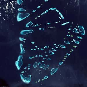
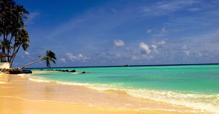
- MaléMaldives, officially the Republic of Maldives, is an island nation in the Indian Ocean–Arabian Sea area, consisting of a double chain of twenty-six atolls, oriented north-south, that lie between Minicoy Island and the Chagos Archipelago. The chains stand in the Laccadive Sea, and the capital, Malé, is about 600 kilometres south-west of India and 750 kilometres south-west of Sri Lanka. From the mid-sixteenth century, the Maldives was dominated by colonial powers: Portugal, the Netherlands and Britain. The islands gained independence from the British Empire in 1965, and in 1968 became a republic ruled by a president and an authoritarian government. The archipelago is located atop the Chagos-Maldives-Laccadive Ridge, a vast submarine mountain range in the Indian Ocean, which also forms a terrestrial ecoregion together with the Chagos and the Lakshadweep. Their atolls encompass a territory spread over roughly 90,000 square kilometres, making the country one of the world's most geographically dispersed. Its population of 328,536 inhabits 192 of its 1,192 islands. In 2006 the capital and largest city Malé, located at the southern edge of North Malé Atoll, had a population of 103,693.
- MajuroThe Marshall Islands, officially the Republic of the Marshall Islands, is an island country located near the equator in the Pacific Ocean, slightly west of the International Date Line. Geographically, the country is part of the larger island group of Micronesia, with the population of 68,480 people spread out over 24 low-lying coral atolls, comprising 1,156 individual islands and islets. The islands share maritime boundaries with the Federated States of Micronesia to the west, Wake Island to the north, Kiribati to the south-east, and Nauru to the south. The most populous atoll is Majuro, which also acts as the capital. Micronesian colonists gradually settled the Marshall Islands during the 2nd millennium BC, with inter-island navigation made possible using traditional stick charts. Islands in the archipelago were first explored by Europeans in the 1520s, with Spanish explorer Alonso de Salazar sighting an atoll in August 1526. Other expeditions by Spanish and English ships followed, with the islands' current name stemming from British explorer John Marshall. The European powers recognized the islands as part of the Spanish East Indies in 1874.More Marshall Islands
- Dig Deeper...Life Expectancy by Country | Life Expectancy Trends
- And Deeper...Countries with Best Sanitation Facilities
- #19 of 20 onThe Best Vacation Spots for Animal Lovers
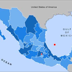
- Mexico CityMexico, officially the United Mexican States, is a federal republic in North America. It is bordered on the north by the United States; on the south and west by the Pacific Ocean; on the southeast by Guatemala, Belize, and the Caribbean Sea; and on the east by the Gulf of Mexico. Covering almost two million square kilometres, Mexico is the fifth largest country in the Americas by total area and the 13th largest independent nation in the world. With an estimated population of over 113 million, it is the eleventh most populous and the most populous Spanish-speaking country in the world and the second most populous country in Latin America. Mexico is a federation comprising thirty-one states and a Federal District, its capital and largest city. In pre-Columbian Mexico many cultures matured into advanced civilizations such as the Olmec, the Toltec, the Teotihuacan, the Zapotec, the Maya and the Aztec before first contact with Europeans. In 1521, the Spanish Empire conquered and colonized the territory from its base in Mexico-Tenochtitlan, which was administered as the Viceroyalty of New Spain.More Mexico
- Dig Deeper...This Museum Has 111 Eerily Preserved 'Screaming Mummies'
- And Deeper...The 100+ Best Soccer Players From Mexico, Ranked
- And Deeper...The Most Corrupt Countries in the World
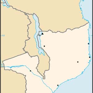
- MaputoMozambique, officially the Republic of Mozambique, is a country in Southeast Africa bordered by the Indian Ocean to the east, Tanzania to the north, Malawi and Zambia to the northwest, Zimbabwe to the west, and Swaziland and South Africa to the southwest. It is separated from Madagascar by the Mozambique Channel to the east. The capital and largest city is Maputo. Between the 1st and 5th centuries AD, Bantu-speaking peoples migrated from farther north and west. Swahili, and later also Arab, commercial ports existed along the coasts until the arrival of Europeans. The area was explored by Vasco da Gama in 1498 and colonized by Portugal from 1505. After over four centuries of Portuguese rule, Mozambique gained independence in 1975, becoming the People's Republic of Mozambique shortly thereafter. After only two years of independence, the country descended into an intense and protracted civil war lasting from 1977 to 1992. In 1994, Mozambique held its first multiparty elections and has remained a relatively stable presidential republic since. Mozambique is endowed with rich and extensive natural resources.