Pennsylvania officially known as the Commonwealth of Pennsylvania is a beautiful state that is spreading in the North-eastern, Appalachian, and Mid-Atlantic regions of the United State of America. This state also has two nicknames – Quaker State and Keystone State. Its capital city is Harrisburg. You may explore more about this state with the help of a map of Pennsylvania because a map will help you a lot in traveling or journeys. So, please scroll down the page and check our collection of maps related to Pennsylvania state. You should also have a look at our other Roads and Highways Maps of Pennsylvania (PA), USA.
Pennsylvania State Maps Collection:
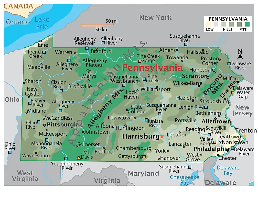
1. Pennsylvania Map:
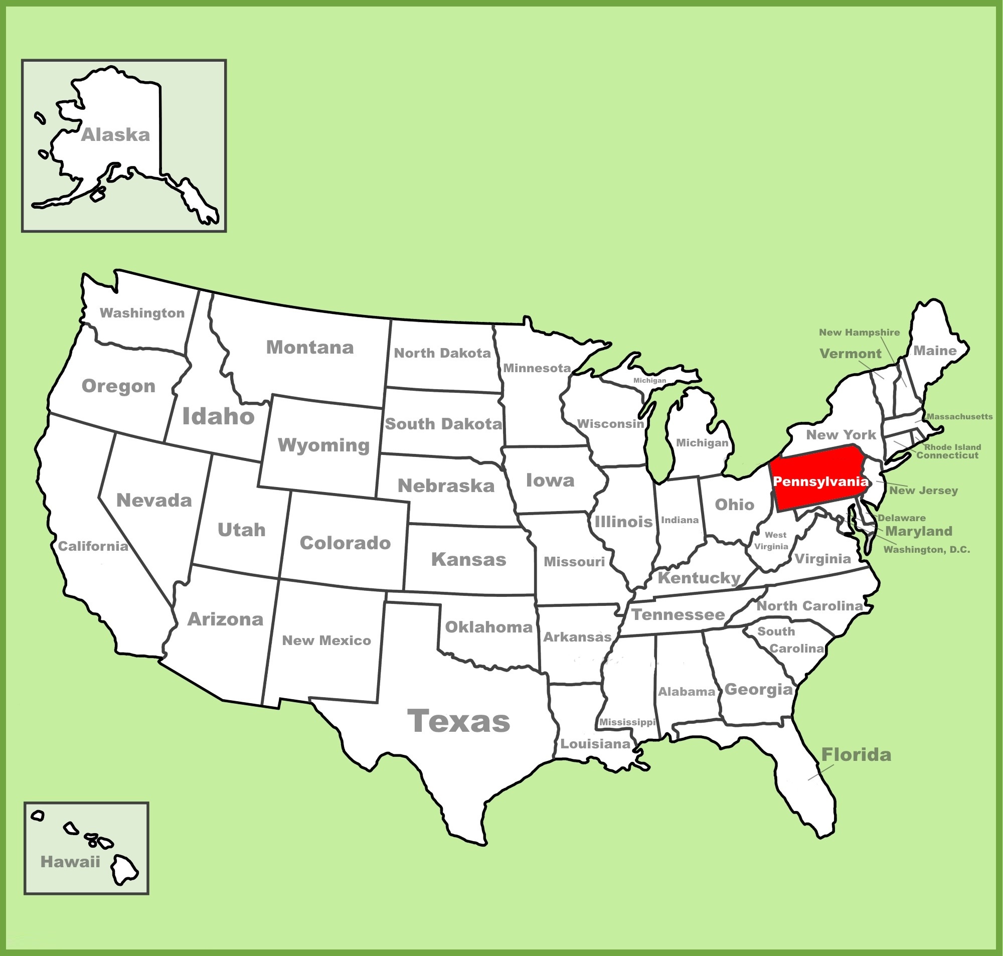
2. PA in US Map:
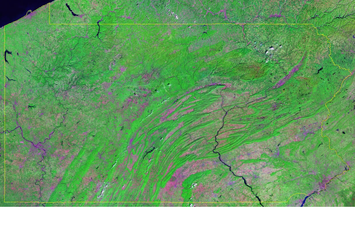
3. Satellite Image of Pennsylvania:
4. Google Map of Pennsylvania:

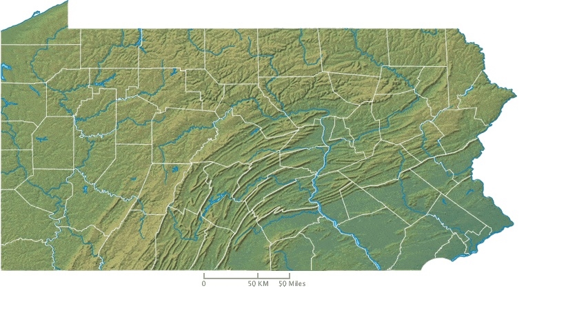
5. Topographic Image of Pennsylvania:
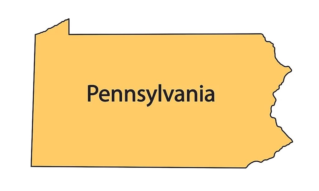
6. Outline of Pennsylvania:
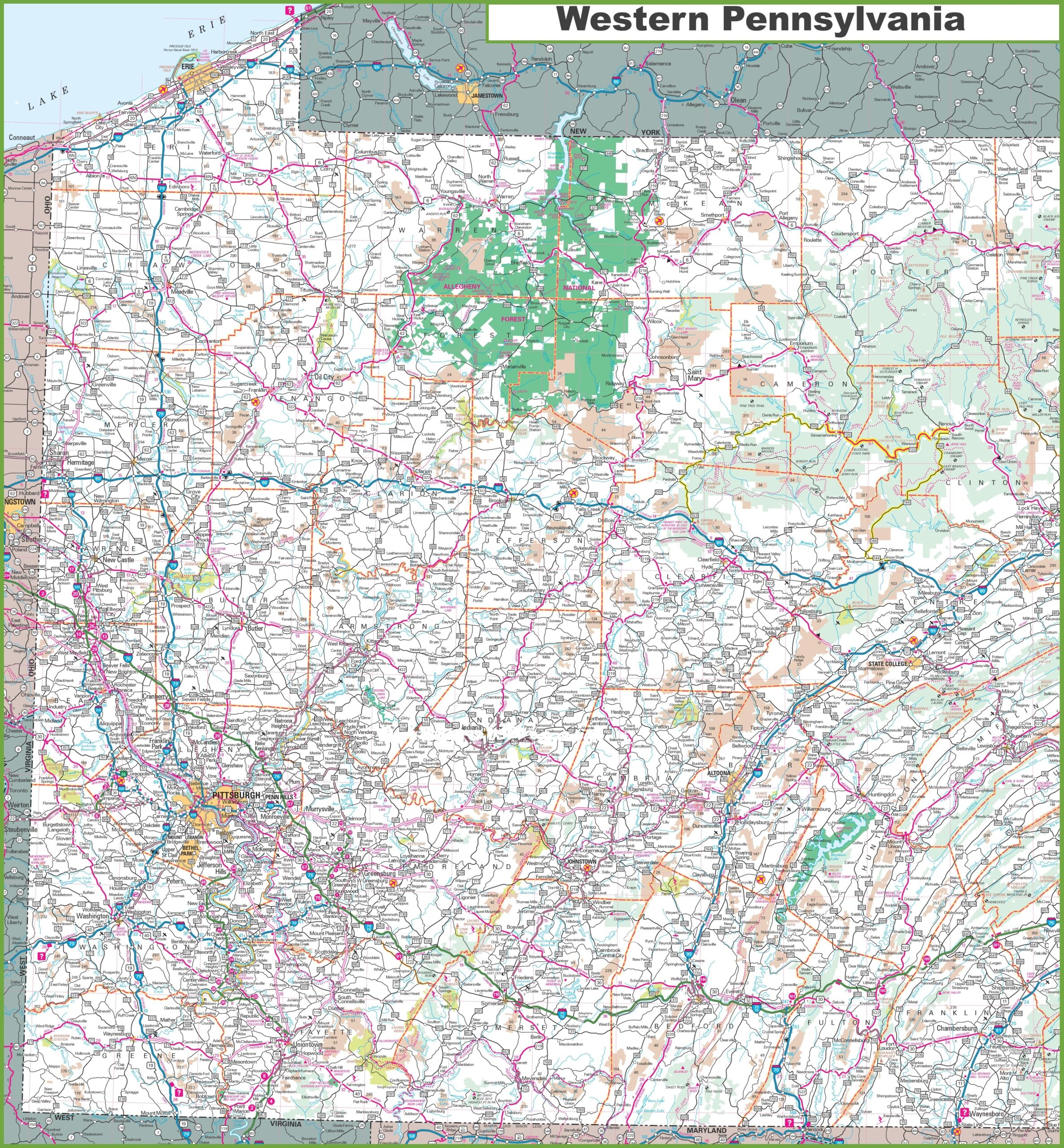
7. Map of Western Pennsylvania:
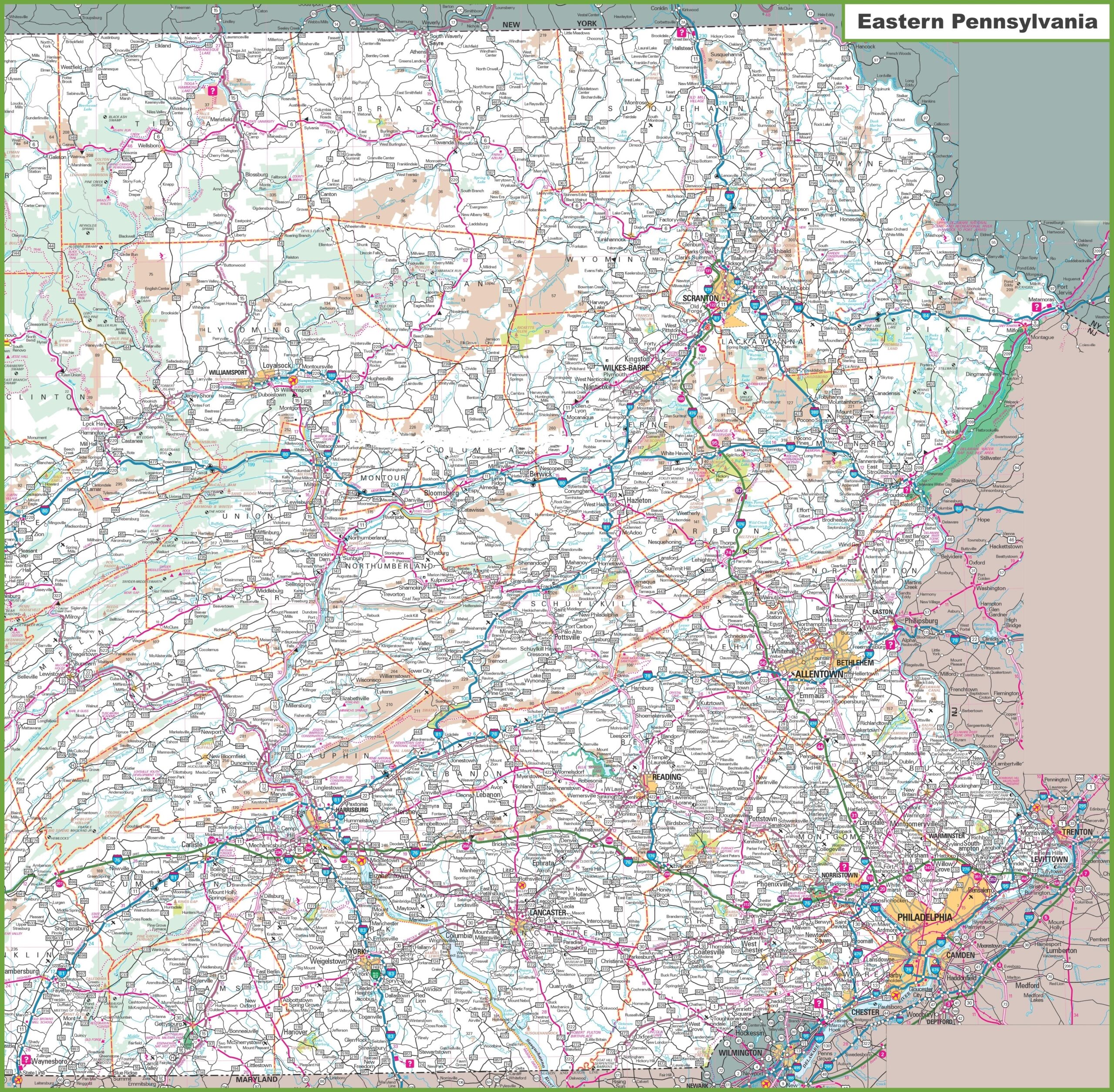
8. Map of Eastern Pennsylvania:
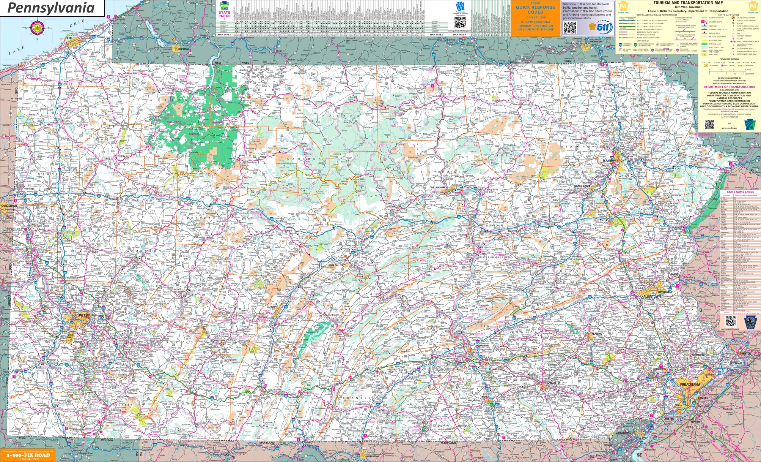
9. Pennsylvania Map with Cities and Towns:
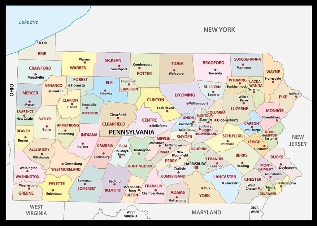
10. PA County Map:
Here, we have added different types of PA map. Each map contains some useful information. For you, we are adding some more useful information about each map here.
The first map is related to the main state map of Pennsylvania, and this map shows some cities, counties, lakes, rivers, and mountain ranges. You can easily locate a major location with the help of this map. The second map shows the location of Pennsylvania on the USA Map. As you can see on the map, the area filled with red color indicates the location of this state on the country map.
The third map is a Satellite image of this state. You will only see the outer boundary on this map. So, if you want a detailed map of this state, please check the first map. The fourth map is titled “Google Map of Pennsylvania.” This map is a type of Google earth map version of this state which shows some cities, towns, and the capital city of Pennsylvania. The next map is a topographic map of Pennsylvania, that shows all county lines. Now, the sixth map is a simple outline or blank map of Pennsylvania, which shows the outer boundary of this state. This map only shows the structure of this state.
The next two maps are the regional maps of Pennsylvania, USA. On the seventh map, you will see all cities, towns, and roads of Western Pennsylvania, and on the eighth map, you will get to know all cities, towns, and roads of Eastern Pennsylvania. Both maps are the specific area maps of Pennsylvania state. The ninth map is a large and detailed map of Pennsylvania with cities and towns. This map shows all cities, towns, roads, highways, railroads, airports, rivers, lakes, mountains, etc. The last map is related to the map of Pennsylvania county. It is a full-detailed county map with cities. County seats are also shown on this map.
So, these were some best and most useful Pennsylvania maps that we have added above. All the maps are available in PDF format and JPG format. You can easily download any map by clicking on the buttons under the preview image. All these maps are free to download.