Moregloed
Moregloed is a suburb in City of Tshwane, Tshwane, Gauteng and has an elevation of 1,294 metres. Moregloed is situated nearby to the suburbs Villieria and Waverley.Notable Places in the Area
Hoërskool Oos-Moot
School
Hoërskool Oos-Moot is a public Afrikaans medium co-educational high school situated in the northern suburbs of Pretoria in the Gauteng province of South Africa.
Embassy of the Republic of Poland
Government office
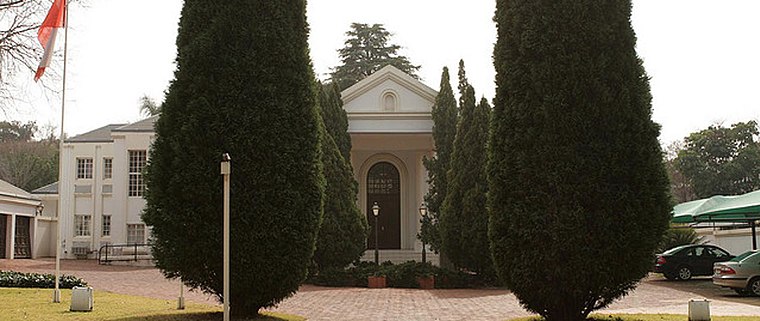
Photo: Wikimedia, CC BY 3.0 pl.
Embassy of the Republic of Poland is a government office situated 3 km south of Moregloed.
Clapham High School
School
Clapham High School is a public, English-speaking high school in Queenswood, Pretoria, in the Gauteng province of South Africa.
Localities in the Area
Colbyn
Suburb
Colbyn is a suburb in central eastern Pretoria, South Africa. Colbyn is situated 3 km south of Moregloed.
Montana Park
Suburb
Montana Park is a residential suburb of Pretoria in Gauteng, South Africa. Montana Park is situated 3½ km northeast of Moregloed.
Bryntirion Estate
Suburb
Bryntirion Estate is an estate in Pretoria, South Africa. Bryntirion Estate is situated 4 km southwest of Moregloed.
Moregloed
- Type: Suburb
- Category: locality
- Location: City of Tshwane, Tshwane, Gauteng, South Africa, Southern Africa, Africa
- View on OpenStreetMap
Latitude
-25.71167° or 25° 42' 42" southLongitude
28.24694° or 28° 14' 49" eastElevation
1,294 metres (4,245 feet)Open Location Code
5G6C76QW+8QOpenStreetMap ID
node 262726137OpenStreetMap Feature
place=suburbGeoNames ID
11279233Moregloed Satellite Map
© OpenStreetMap, Mapbox and Maxar
Also Known As
- Môregloed
Other Places Named Moregloed
Localities in the Area
- VillieriaSuburb
- WaverleySuburb
- Kilner ParkSuburb
- QueenswoodSuburb
- RietfonteinSuburb
Landmarks in the Area
Popular Destinations in Tshwane
Discover Pretoria, Centurion, Rietvlei Nature Reserve and Irene.
Escape to a Random Place
Discover other destinations in the world.
About Mapcarta. Thanks to Mapbox for providing amazing maps. Data © OpenStreetMap contributors and available under the Open Database License. Text is available under the CC BY-SA 4.0 license, excluding photos, directions and the map. Photo: Wikimedia, CC0.