Maps are very useful for travelers, teachers, students, geography studies, some DIY projects, and other kinds of researches. Here you will find all kinds of printable maps of the United States. You can easily get all these maps by clicking on the PDF button or you can directly take a print out in a specific category.
Printable USA Maps:
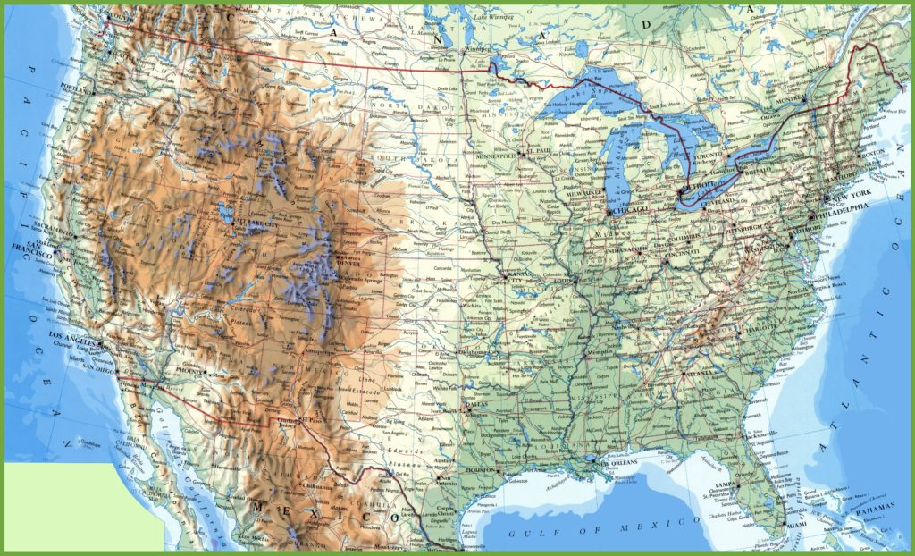
1. United States Map:
2. U.S Map with Major Cities:

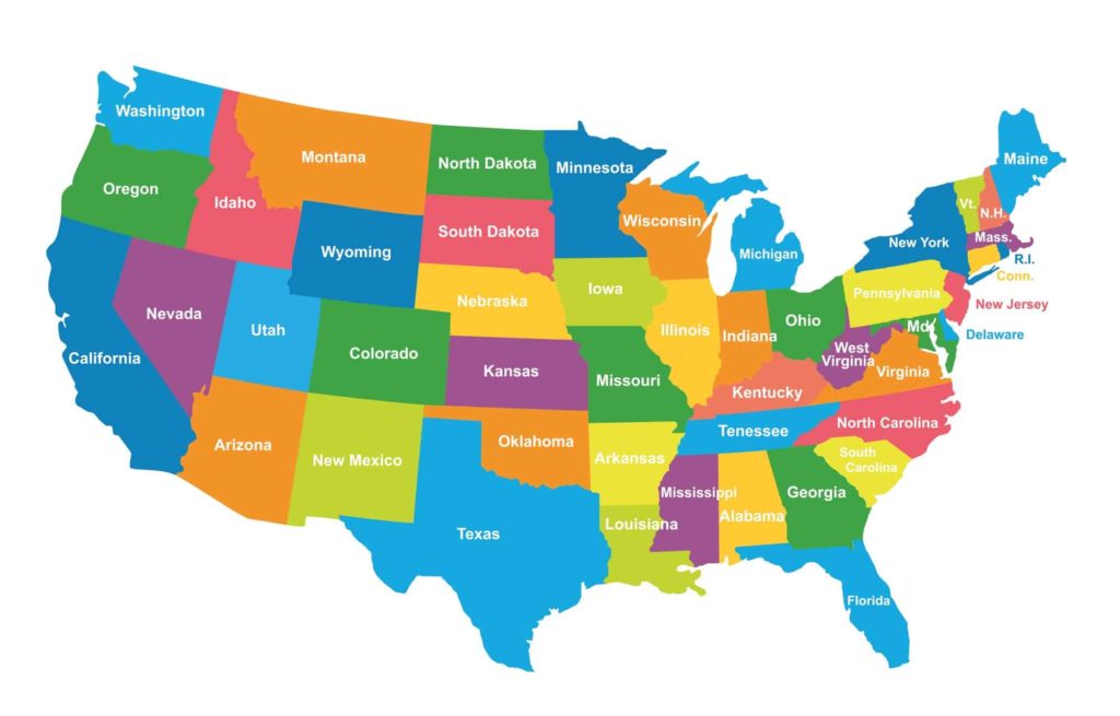
3. U.S State Colorful Map:
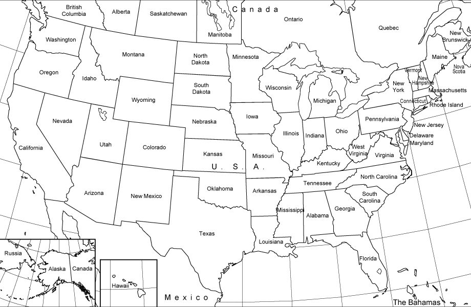
4. United States Map Black and White:
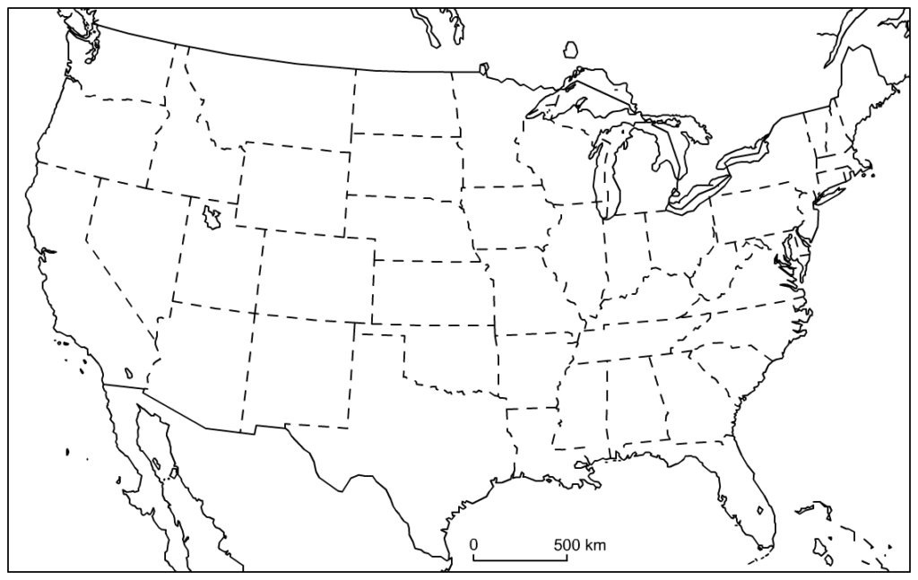
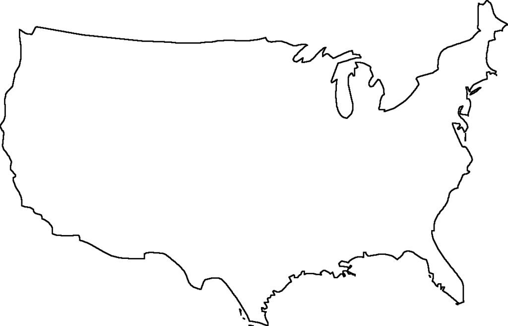
5. Outline Map of the United States:
6. U.S Map with all Cities:
7. Blank Map of the United States:
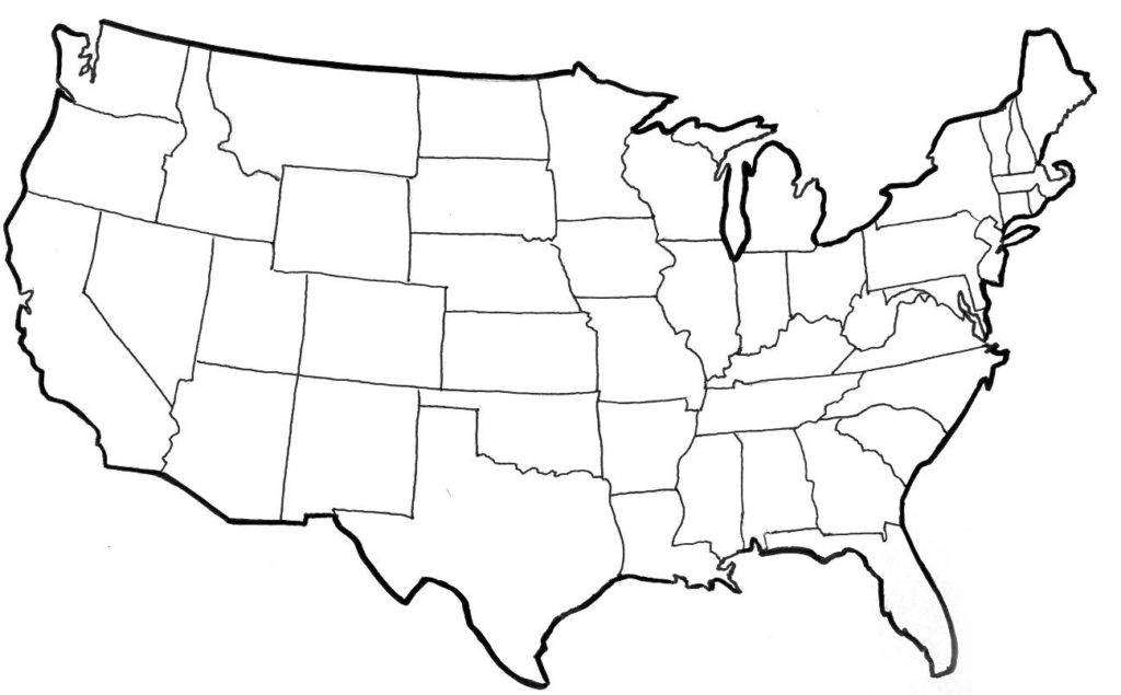
8. U.S Blank Map with no State Boundaries:
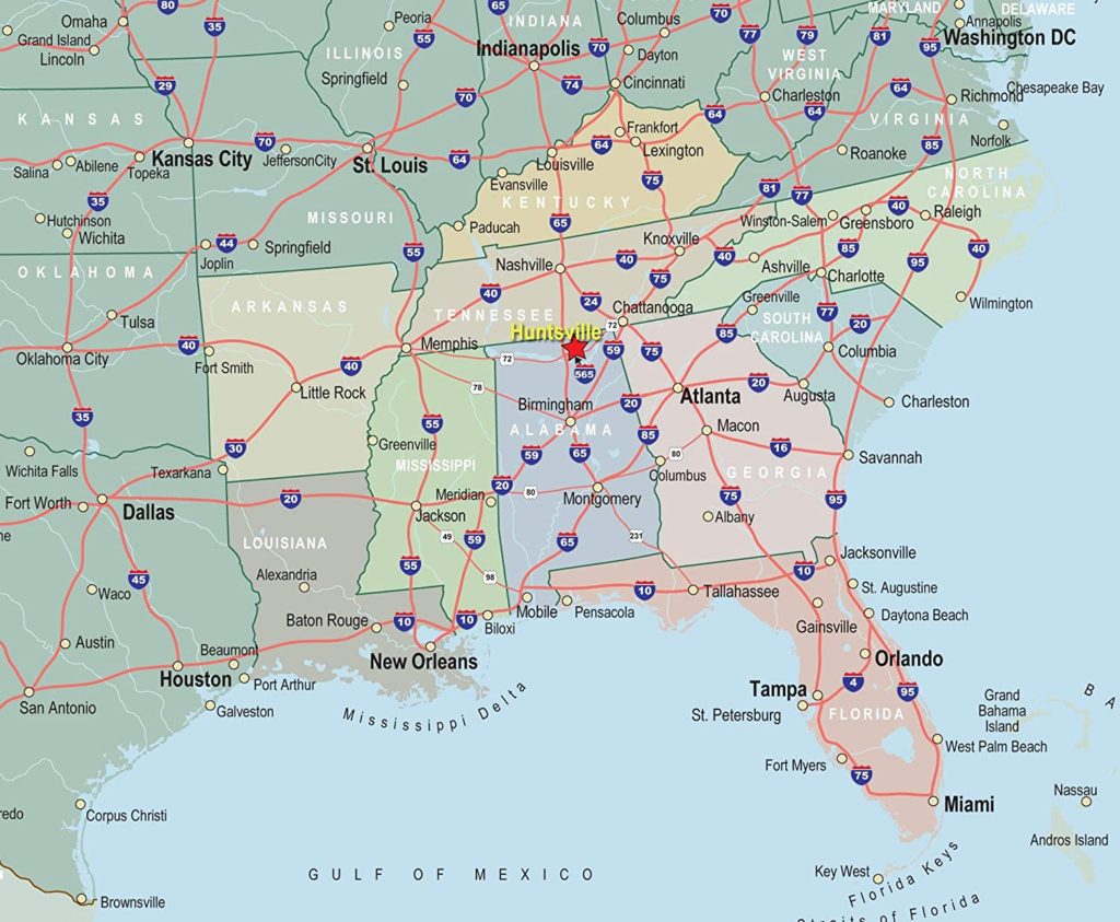
9. Map of Southeast United States:
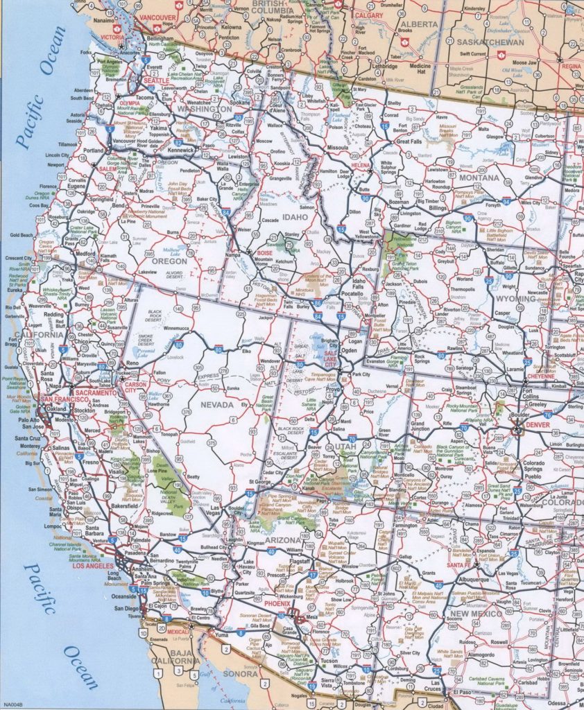
10. Western United States Map:
USA is one of the largest countries. So, you may expect the map of the USA larger than the other country’s map. If you are looking for the USA map for your running projects or researches, then you are at the right place. Here we have a collection of printable United States maps. You can see a preview of a map in the image given. To download the map on your mobile or computer, you have to click on the PDF button or you can connect your printer to get the print outs of the USA map.
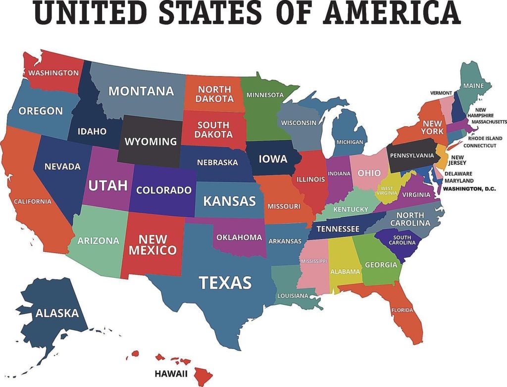
We have added ten types of USA maps here. The first one is the colorful maps including all the U.S States. These colors are helping to show the boundaries of U.S states so that no one gets confused. The second one is also colorful but has more specifications like it shows all the boundaries clearly and shows the capitals of all states. Including capitals, it also shows the name of some major cities, rivers, lakes of a particular state.
Printable U.S State Map:
If you are looking for the best U.S map with states for your project, then all these above-shown maps may help you. All these maps are printable as well. The map is on number third, is full of colors with the name of all the U.S states. All these colors are expressing that particular state on its own. The fourth one is the black and white map for your project or DIY works. It also shows the name of each and every state. If you are a teacher, then it may also help you to teach the students about the state maps of the United States.
The fifth one is an outline map only with its boundaries. There is not a single name of states. It only shows the internal boundaries. This map may help your child to do coloring or filling the space with its name. Outline maps are mostly used for study purposes. You can easily get these maps by pressing the PDF button as shown or have another option that is you can take a printout.
Printable U.S Map with Cities:
If you are looking for a broad map of the United States with cites names, is available here. A sample of a map is shown in the image given. As you can see that it is full of information related to the United States. All the names of cities, states, seas, and gulfs are showing in a single map. All the major cities and non-major cities are showing on this map. If you are doing research on the U.S map, then it may help you to make your research more interesting with all the information required.
This map is free of cost to you. You can easily get this map in two formats. The 1st format will be the PDF format or the other one is the printable format of U.S.A city map.
Free Printable Blank Map of the United States:
As you can see in the image given, The map is on seventh and eight number, is a blank map of the United States. This map of the United States shows only state boundaries with excluding the names of states, cities, rivers, gulfs, etc. This printable blank U.S state map is commonly used for practice purposes in schools or colleges. If you have a similar purpose for getting this map, then this is the best map for you.
This free printable blank map of U.S is downloadable in a PDF format. You can see a PDF button, by clicking on this button you get the PDF of this U.S blank map.
Printable Map of Southeast United States & Western United States:
Most of the time, people always make projects on the specific region of a country. Here, we have added two regional maps of the United States. The second last image of the map is showing the southeast region of the United States. In this map, all the states names, cities names, gulf names are shown.
The last image of the map is showing the western region of the United States. This printable western map of the United States shows the names of all the states, major cities, and non-major cities, western ocean names. All these maps are very useful for your projects or study of the U.S maps.
You don’t need to pay to get all these maps. These maps are free of cost for everyone. You have to click on the PDF button as shown or you can connect your any smart device to your printer to take printouts.