
Whether you're travelling around London by Tube, bus, DLR, London Overground, bicycle, river service or on foot, consult a map or guide to help you get around London quickly.

London Tube map
The London Tube map [PDF 1.2 MB] makes navigating London's Underground rail network simple. This easy-to-use London Tube map shows all nine travel zones, including Zone 1, which covers central London. It also indicates stations with step-free access, riverboat services, trams, airports and more. It's your must-have map when travelling in London!
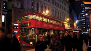
London bus maps
Travelling by bus gets you around London easily and cheaply. These handy maps show key bus routes in central London and further afield, as well as night bus services and spider maps that detail where every bus stop can be found.
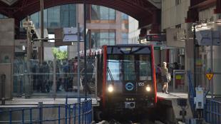
Docklands Light Railway maps
Discover the best places in east and south-east London for eating, drinking, shopping and history with these free guides to the Docklands Light Railway. The DLR serves key locations such as Stratford (Westfield Shopping Centre), Canary Wharf and Cutty Sark (Maritime Greenwich).

London Overground map
Plan your journey on the London Overground with this free map. The London Overground forms a circle around the capital, with branches extending into additional neighbourhoods. London Overground services go through stations such as Stratford, Euston, Shoreditch High Street, Hampstead Heath, Shepherd's Bush and Kensington Olympia.

London river boat services map
See the options for travelling on the river Thames, from regular Uber Boat by Thames Clipper services to leisurely boat tours. Services call at Westminster (Houses of Parliament), London Eye, Embankment (West End), Tower (Tower of London), Greenwich and more.
Accessibility guides
Transport for London produces maps of the London Underground network in many formats, including large print and audio. Find information on step-free London Tube stations and accessibility details for the London Underground, London Overground and TfL Rail.
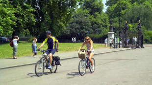
London cycling routes and maps
Use these free maps and guides to discover new areas of London on two wheels. Hire a bike and see the city from a different angle. Find routes to ride on London's Cycleways and leisure routes that reveal the capital's secret gardens, Saturday markets and more.
London Tube station toilet map
Find out which stations on the Tube, DLR and London Overground have toilets, baby-changing stations and accessible facilities. Look at the map key that indicates whether the toilets are inside or outside the ticket barriers.

Walking maps
Follow these suggested walking routes to discover a fresh perspective on London. Routes include Olympic highlights such as The O2, Greenwich Park and the Serpentine, plus central London walks past St Paul's Cathedral and Buckingham Palace.
Get to know the different areas of London, from the West End to South Bank. Discover the capital with a hop-on-hop-off London bus tour, an ideal way to see London's most iconic landmarks and districts.