Lennoxtown training centre
Lennoxtown Training Centre is Celtic F.C.'s training centre, located at Lennoxtown, East Dunbartonshire in Scotland. The complex houses the club's training and educational facilities. Lennoxtown training facility.Photo: Vintagekits, CC BY 3.0.
- Type: Sports venue
- Description: stadium in East Dunbartonshire, Scotland, UK
- Access is restricted, only with permission.
Notable Places in the Area
Glorat House
House
Glorat House is a 19th-century mansion house in East Dunbartonshire, Scotland. Glorat House is situated 2 miles east of Lennoxtown training centre.
Localities in the Area
Lennoxtown
Town

Photo: Dumgoyne, CC BY-SA 3.0.
Lennoxtown is a town in the East Dunbartonshire council area and the historic county of Stirlingshire, Scotland.
Torrance
Village
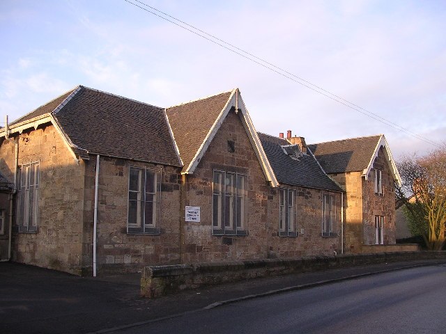
Photo: Chris Upson, CC BY-SA 2.0.
Torrance is a relatively affluent village in East Dunbartonshire, formerly Stirlingshire, Scotland, located eight miles north of Glasgow city centre. Torrance is situated 2½ miles south of Lennoxtown training centre.
Milton of Campsie
Village
Milton of Campsie is a village formerly in the county of Stirlingshire, but now in East Dunbartonshire, Scotland roughly 10 miles north of Glasgow. Milton of Campsie is situated 3 miles east of Lennoxtown training centre.
Lennoxtown training centre
- Categories: stadium, recreation area, football and sports location
- Location: East Dunbartonshire, Scotland, United Kingdom, Britain and Ireland, Europe
- View on OpenStreetMap
Latitude
55.97606° or 55° 58' 34" northLongitude
-4.23011° or 4° 13' 48" westInception
October 9th, 2007Open Location Code
9C7QXQG9+CXOpenStreetMap ID
way 179159252OpenStreetMap Feature
leisure=sports_centreOpenStreetMap Feature
sport=soccerWikidata ID
Q6522896Lennoxtown training centre Satellite Map
© OpenStreetMap, Mapbox and Maxar
Also Known As
- Portuguese: Lennoxtown
- Portuguese: Lennoxtown (centro de treinamento)
- Celtic FC Football Training Centre
In the Area
Lennoxtown training centre is situated close to Lennox Castle and the scenic viewpoint Lovers Leap.
Landmarks
- Saint Machans GraveyardCemetery, 1 mile north
- CapiestonRuins, 1 mile northeast
- Campsie Memorial HallTown hall, 1 mile east
- Lady's LinnWaterfall, 1 mile north
- Peathill WoodConiferous forest
- Campsie Bowling ClubPitch, 1 mile east
Other Places
- Celtic FC Football Training CentreParking lot, 460 feet southwest
- The White HouseHouse, 950 feet southwest
- DarnleyHouse, 1,000 feet southeast
- West LosgeHouse, 2,300 feet northwest
- HaughheadResidential area, 2,900 feet north
- WellbankHouse, 3,400 feet northwest
Escape to a Random Place
Discover the sports venues Sfira in El Salvador and The Olympic Center for Training National Teams in Egypt.
About Mapcarta. Thanks to Mapbox for providing amazing maps. Data © OpenStreetMap contributors and available under the Open Database License. Text is available under the CC BY-SA 4.0 license, excluding photos, directions and the map. Description text is based on the Wikipdia page Lennoxtown training centre. Photo: Vintagekits, CC BY 3.0.