Category:Maps of Kanagawa prefecture
Jump to navigation
Jump to search
日本語: 神奈川県の地図のカテゴリ。 日本全体における県の位置図は"Locator maps of ~"を、県内における各市町村の位置図は"Locator maps of municipalities ~"を、各郡の地図は"Maps of districts ~"を、過去の市町村の地図は"Maps of former municipalities ~"を参照。

Wikimedia category | |||||
| Upload media | |||||
| Instance of | |||||
|---|---|---|---|---|---|
| Category combines topics | |||||
| Kanagawa Prefecture | |||||
prefecture of Japan  someja satełitar in zenaro      | |||||
| Instance of | |||||
| Named after |
| ||||
| Location | Japan | ||||
| Capital | |||||
| Legislative body | |||||
| Executive body | |||||
| Anthem |
| ||||
| Head of government |
| ||||
| Headquarters location | |||||
| Mascot |
| ||||
| Inception |
| ||||
| Highest point | |||||
| Population |
| ||||
| Area |
| ||||
| Replaces |
| ||||
| official website | |||||
 | |||||
Subcategories
This category has the following 12 subcategories, out of 12 total.
Pages in category "Maps of Kanagawa prefecture"
This category contains only the following page.
Media in category "Maps of Kanagawa prefecture"
The following 95 files are in this category, out of 95 total.
-
 Flag map of Kanagawa Prefecture.svg 545 × 399; 8 KB
-
 1882年の相模川河口(彩色).jpg 3,252 × 2,226; 928 KB
-
 Admiralty Chart No 3548 Tsurugi Zaki to Yokohama, Published 1922.jpg 11,084 × 16,182; 68.92 MB
-
 Area-map-of-Tsuchidana.Kanagagawa-Pref.png 814 × 630; 114 KB
-
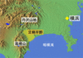 Ashigara Plain 01.gif 300 × 210; 60 KB
-
 D533- N° 520. Yokohama et ses environs. - Liv4-Ch04.png 1,446 × 1,622; 440 KB
-
 General land map of Sagami Province (14558465877).jpg 2,500 × 1,965; 1.9 MB
-

-
 Growth rate map of municipalities of Kanagawa prefecture, Japan.svg 800 × 652; 20 KB
-
 Hadano Basin 01.gif 300 × 210; 57 KB
-
 Japan prov map musashi.png 235 × 300; 6 KB
-
 Japan prov map sagami.png 235 × 300; 6 KB
-
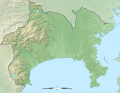 Kanagawa géolocalisation relief.svg 1,720 × 1,331; 1.85 MB
-
 Kanagawa géolocalisation.svg 1,720 × 1,331; 585 KB
-
 Kanagawa Kamakura-gun.png 190 × 110; 4 KB
-
 Kanagawa Kuraki-gun.png 190 × 110; 3 KB
-
 Kanagawa Osumi-gun.png 190 × 110; 3 KB
-
 Kanagawa pref.png 161 × 100; 3 KB
-
 Kanagawa Tachibana-gun.png 190 × 110; 4 KB
-
 Kanagawa Tsuzuki-gun.png 190 × 110; 4 KB
-
 Kanagawa Yurugi-gun.png 190 × 110; 3 KB
-
 Kanagawa-ch-map.png 674 × 446; 13 KB
-
 Kanagawa-geo-stub.png 818 × 599; 57 KB
-
 Kanagawa-map.png 2,000 × 1,540; 1.87 MB
-
 Kanagawa-pref Small ver2.png 275 × 266; 15 KB
-
 KanagawaMap-ch.png 674 × 446; 24 KB
-
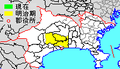
 KanagawaMapCurrent ja.png 1,281 × 801; 147 KB
-
 KanagawaMapCurrent.png 1,281 × 801; 134 KB
-
 Map kanagawa aikawa town p01-01.png 420 × 210; 8 KB
-
 Map kanagawa ayase city p01-01.png 420 × 210; 8 KB
-
 Map kanagawa chigasaki city p01-01.png 420 × 210; 8 KB
-
 Map kanagawa ebina city p01-01.png 420 × 210; 8 KB
-
 Map kanagawa fujisawa city p01-01.png 420 × 210; 8 KB
-
 Map kanagawa hadano city p01-01.png 420 × 210; 8 KB
-
 Map kanagawa hakone town p01-01.png 420 × 210; 8 KB
-
 Map kanagawa hayama town p01-01.png 420 × 210; 8 KB
-
 Map kanagawa kamakura city p01-01.png 420 × 210; 8 KB
-
 Map kanagawa kiyokawa village p01-01.png 420 × 210; 8 KB
-
 Map kanagawa kouza p01-01.PNG 420 × 210; 11 KB
-
 Map kanagawa manazuru town p01-01.png 420 × 210; 8 KB
-
 Map kanagawa matsuda town p01-01.png 420 × 210; 8 KB
-
 Map kanagawa miura city p01-01.png 420 × 210; 8 KB
-
 Map kanagawa nakai town p01-01.png 420 × 210; 8 KB
-
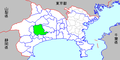
 Map kanagawa pref p01-01.png 420 × 210; 8 KB
-
 Map kanagawa sagamihara city p01-01.png 420 × 210; 10 KB
-
 Map kanagawa samukawa town p01-01.png 420 × 210; 8 KB
-
 Map kanagawa yokohama city p01-01.png 420 × 210; 11 KB
-
 Map kanagawa yokosuka city p01-01.png 420 × 210; 8 KB
-
 Map kanagawa yugawara town p01-01.png 420 × 210; 8 KB
-
 Map kanagawa zama city p01-01.png 420 × 210; 8 KB
-
 Map kanagawa zushi city p01-01.png 420 × 210; 8 KB
-
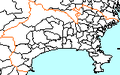
 Map of license plates in Kanagawa Japan.svg 582 × 431; 90 KB
-
 Map.of.Fujisawa-city.Kanagawa-Pref.png 847 × 644; 155 KB
-
 Oiso Hills 01.gif 300 × 210; 46 KB
-
 Shadow picture of Kanagawa prefecture.png 479 × 382; 5 KB
-
 Tokyo-East1879.jpg 1,934 × 1,691; 1.23 MB
-
 Tourist map of Enoden in 1933.jpg 2,969 × 2,109; 1.57 MB
-
 Yedo1879.jpg 1,495 × 2,002; 829 KB
-
 YokosukaSuidouMap.png 640 × 480; 72 KB
-
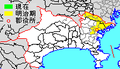
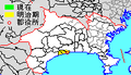
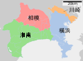
 「湘南」の範囲.png 600 × 600; 20 KB
-
 中原街道周辺の御殿、御茶屋の分布図.png 1,087 × 992; 126 KB
-
 京浜急行バス 久里浜 ワンコインバス20210402 133634.jpg 2,185 × 2,914; 1.48 MB
-
 京浜急行バス 久里浜 系統図 20210216 184928.jpg 4,032 × 3,024; 3.61 MB
-
 地図 ナンバープレート 14000.svg 582 × 431; 10 KB
-
 地図 市郡界 1950 14000.svg 582 × 431; 15 KB
-
 地図-神奈川県-2006.png 420 × 210; 10 KB
-
 地図-神奈川県平塚市-2006.png 420 × 210; 8 KB
-
 地図-神奈川県座間市-2006.png 420 × 210; 8 KB
-
 地図-神奈川県愛川町-2006.png 420 × 210; 8 KB
-
 地図-神奈川県松田町-2006.png 420 × 210; 8 KB
-
 地図-神奈川県横須賀市-2006.png 420 × 210; 8 KB
-
 地図-神奈川県海老名市-2006.png 420 × 210; 8 KB
-
 地図-神奈川県清川村-2006.png 420 × 210; 8 KB
-
 地図-神奈川県湯河原町-2006.png 420 × 210; 8 KB
-
 地図-神奈川県相模原市-2006.png 420 × 210; 8 KB
-
 地図-神奈川県真鶴町-2006.png 420 × 210; 8 KB
-
 地図-神奈川県秦野市-2006.png 420 × 210; 8 KB
-
 地図-神奈川県箱根町-2006.png 420 × 210; 8 KB
-
 地図-神奈川県綾瀬市-2006.png 420 × 210; 8 KB
-
 地図-神奈川県茅ヶ崎市-2006.png 420 × 210; 8 KB
-
 地図-神奈川県葉山町-2006.png 420 × 210; 8 KB
-
 地図-神奈川県藤沢市-2006.png 420 × 210; 8 KB
-
 地図-神奈川県藤野町-2006.png 420 × 210; 8 KB
-
 地図-神奈川県逗子市-2006.png 420 × 210; 8 KB
-
 地図-神奈川県鎌倉市-2006.png 420 × 210; 8 KB
-
 地図-神奈川県開成町-2006.png 420 × 210; 8 KB
-
 基礎自治体位置図 14206.svg 582 × 431; 10 KB
-
 大山通.svg 744 × 1,052; 66 KB
-
 神奈川県内の地裁管轄区域.svg 800 × 652; 14 KB
-
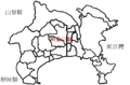
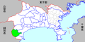
 神奈川県城山町県内位置図.svg 429 × 339; 15 KB
-
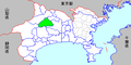
 神奈川県藤野町県内位置図.svg 429 × 339; 15 KB
-
 自治体区画図 1975 14000.svg 582 × 431; 12 KB
-
 衆議院小選挙区 (神奈川県).png 1,500 × 1,110; 196 KB
-
 衆議院小選挙区 神奈川県.png 1,500 × 1,110; 692 KB
-
 衆議院小選挙区 神奈川県.svg 582 × 431; 51 KB

.jpg)


.jpg)


.png)

