Hurricane Katrina: The Essential Timeline
A blow-by-blow of the historic storm, its birth, its path, its landfall, and its aftermath.
TUESDAY, AUGUST 23, 2005
5 p.m.: The National Hurricane Center in Miami, Florida, issues its first advisory about the tropical system that will become Hurricane Katrina. The advisory notes that the season's 12th tropical depression has formed over the Bahamas. The weather system is about 350 miles (560 kilometers) east of Miami.
WEDNESDAY, AUGUST 24
11 a.m.: The storm has strengthened, become more organized, and been given a name. It is now tropical storm Katrina, the 11th named storm of 2005, about 230 miles (370 kilometers) east of Miami. Its strongest winds are blowing at about 40 miles an hour (65 kilometers an hour).
THURSDAY, AUGUST 25
5 p.m.: Katrina has continued to strengthen and is now a hurricane. Its strongest winds are about 75 miles an hour (120 kilometers an hour), making it a Category One hurricane. The storm is about 15 miles (25 kilometers) east of Fort Lauderdale, Florida, and about to make landfall.
7 p.m.: The eye of Hurricane Katrina comes ashore between North Miami Beach and Hallandale Beach on Florida's southeastern coast. The storm's top winds are 80 miles an hour (130 kilometers an hour). Falling trees kill two people.
FRIDAY, AUGUST 26
1 a.m.: Katrina weakens and is reclassified as a tropical storm. Its center is about 45 miles (70 kilometers) northwest of Key Largo, Florida. Its strongest winds are about 70 miles an hour (115 kilometers an hour).
3 a.m.: The storm's center has emerged from the Florida peninsula and starts strengthening almost immediately as it touches the warm waters of the Gulf of Mexico.
5 a.m.: Katrina reintensifies into a hurricane. Its strongest winds are about 75 miles an hour (120 kilometers an hour), and its eye is about 70 miles (115 kilometers) northwest of Key Largo. Keys residents are surprised by Katrina's strength as it passes offshore.
"We went to bed last night expecting some possible rain and woke up this morning to learn that Katrina was 75 miles [120 kilometers] north of Marathon [Florida]," says Dan Gallagher, resident of Grassy Key. "A lot of the live-aboards [people living on houseboats] in Boot Key Harbor were surprised to find their boats in new spots."
11:30 a.m.: The National Hurricane Center reports that the hurricane is "rapidly strengthening" as it crosses the Gulf of Mexico's very warm waters. In only a few hours, the storm's strongest winds have increased to about a hundred miles an hour (160 kilometers an hour).
During the day: Governors Kathleen Blanco of Louisiana and Haley Barbour of Mississippi declare states of emergency in their respective states.
11 p.m.: The National Hurricane Center predicts that Katrina will become a major hurricane by the time it reaches the central Gulf of Mexico. The eye of the storm is now about 460 miles (740 kilometers) southeast of the mouth of the Mississippi River in Louisiana.
SATURDAY, AUGUST 27
5 a.m.: Katrina's strongest winds have reached 115 miles an hour (185 kilometers an hour), making it a Category Three hurricane.
During the day: Hurricane-hunter aircraft fly into Hurricane Katrina to measure wind speed, barometric pressure, ocean surface temperature, and other data.
"It was certainly very strong and also was very large," Chris Landsea said later. Landsea, a meteorologist with the National Oceanic and Atmospheric Administration, was aboard a flight into Hurricane Katrina. "When we were flying into it Saturday, its circulation covered the entire Gulf of Mexico."
SUNDAY, AUGUST 28
2 a.m.: Hurricane Katrina's winds have increased to 145 miles an hour (235 kilometers an hour), making it a Category Four storm. The eye of the storm is about 310 miles (500 kilometers) south of the mouth of the Mississippi River.
9:30 a.m.: New Orleans Mayor Ray Nagin issues a mandatory evacuation order. Tens of thousands of New Orleans residents begin streaming out of the city.
"We're facing the storm most of us have feared," Nagin said. "This is going to be an unprecedented event."
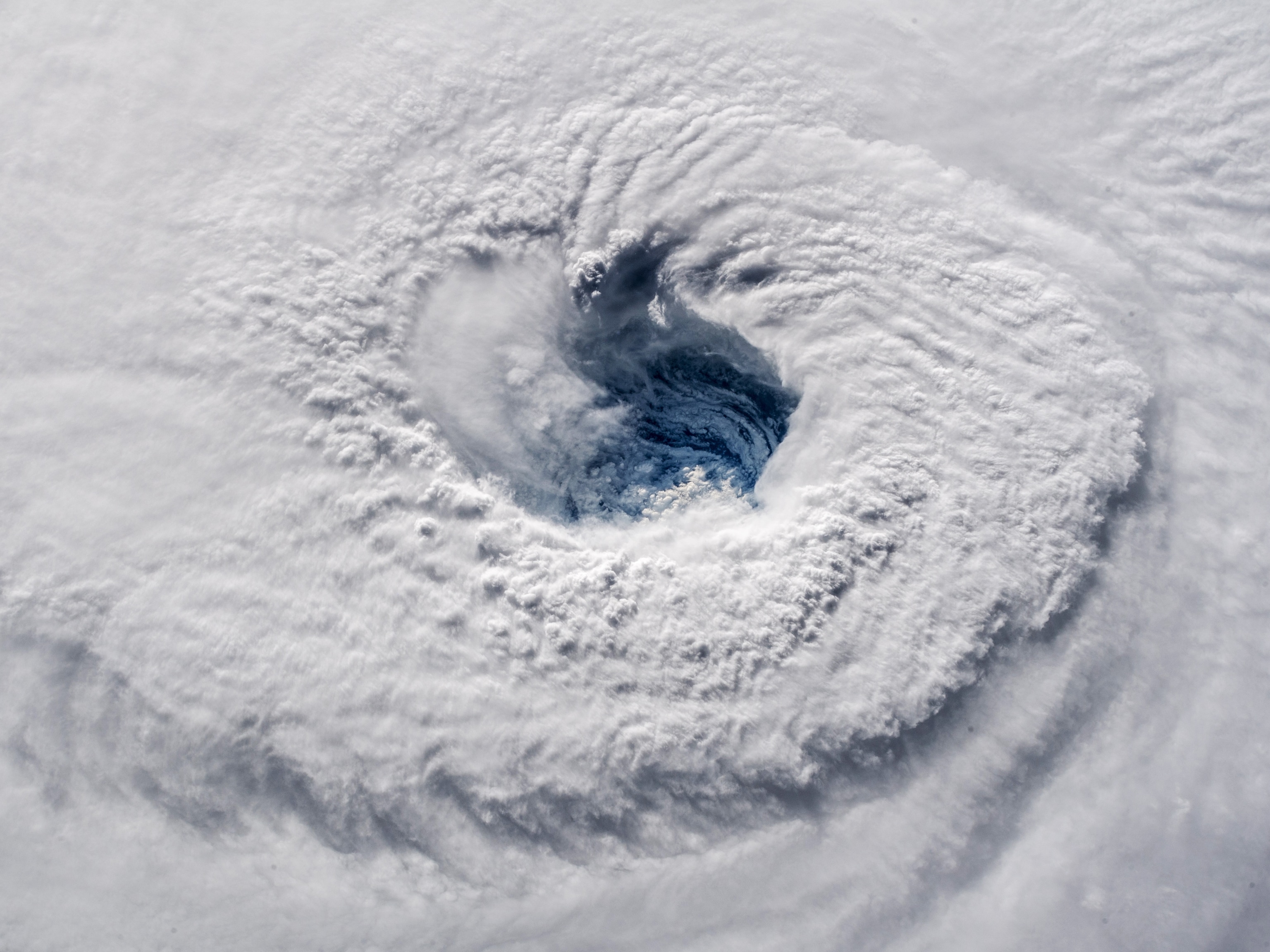
11 a.m.: Hurricane Katrina has mushroomed into one of the most powerful hurricanes ever to form in the Atlantic. The storm's strongest winds are blowing at about 175 miles an hour (280 kilometers an hour), making it a Category Five storm. The center of the storm is about 225 miles (360 kilometers) from the mouth of the Mississippi River.
5 p.m.: The National Hurricane Center describes Katrina as a "potentially catastrophic" hurricane.


"Some levees in the greater New Orleans area could be overtopped," the center warns. "Significant storm surge flooding will occur elsewhere along the central and northeastern Gulf of Mexico coast."
9:15 p.m.: A. J. Holloway, mayor of Biloxi, Mississippi, says his city is "getting some rain, a little wind, and some lightning and thunder" from Hurricane Katrina.
Holloway survived Hurricane Camille in August 1969, and he's worried that this hurricane will be as bad or worse than that catastrophic storm. He's also worried that many new residents of Biloxi have no idea what they may soon be facing.
"There's a lot of new people who moved into Biloxi with the advent of casino gambling who have never experienced a real hurricane, and they may be taking it lightly," Holloway tells National Geographic News. "And even some of the people who were here during Camille are not worried. But just because your house stood up during Camille don't mean it'll stand up to this hurricane."
Late Sunday night: Thousands of New Orleans residents who are unable to leave town or have chosen not to leave seek shelter in the Louisiana Superdome.
MONDAY, AUGUST 29
2 a.m.: Hurricane Katrina turns north toward the Louisiana coast, but the storm's strongest winds have diminished slightly to about 155 miles an hour (250 kilometers an hour). The center of the storm is about 130 miles (210 kilometers) from New Orleans. A weather buoy about 50 miles (80 kilometers) east of the river's mouth reports waves at least 40 feet (12 meters) high.
5 a.m.: The hurricane's strongest winds are now about 150 miles an hour (240 kilometers an hour), and its eye is about 90 miles (145 kilometers) from New Orleans and about 120 miles (195 kilometers) from Biloxi.
7 a.m.: Hurricane Katrina's eye is about to come ashore in Plaquemines Parish, Louisiana. The hurricane's strongest winds are about 145 miles an hour (235 kilometers an hour). The eye is about 70 miles (115 kilometers) from New Orleans.
8 a.m.: Mayor Ray Nagin reports that water is flowing over one of New Orleans's levees.
9 a.m.: The eye is about 40 miles (65 kilometers) from New Orleans and is expected to pass just to the east of the city. The storm's strongest winds are about 135 miles an hour (215 kilometers an hour).
11 a.m.: The hurricane's eye comes ashore again near the Louisiana-Mississippi border. The storm's strongest winds are about 125 miles an hour (200 kilometers an hour). Katrina's front-right quadrant—which contains its strongest winds and peak storm surge—slams into Biloxi and Gulfport, Mississippi, with devastating force, destroying much of both cities.
Meanwhile, a major levee in New Orleans has failed. Water is pouring through the 17th Street Canal, and the city is beginning to flood.
1 p.m.: Hurricane Katrina continues to weaken as it moves farther inland. Its strongest winds are about 105 miles an hour (170 kilometers an hour).
3 p.m.: The center of the hurricane is about 20 miles (30 kilometers) west of Hattiesburg, Mississippi. Its winds are down to about 95 miles an hour (155 kilometers an hour).
TUESDAY, AUGUST 30
11 a.m.: The National Hurricane Center issues its last advisory on the storm that once was Hurricane Katrina. The storm has maximum winds of about 35 miles an hour (55 kilometers an hour), and its center is dumping heavy rainfall on Tennessee.
During the day: Floodwaters continue to pour into New Orleans from breaks in the city's levees.
WEDNESDAY, AUGUST 31
During the day: Health and Human Services Secretary Michael O. Leavitt declares a public health emergency in Louisiana, Mississippi, Alabama, and Florida. Meanwhile, Louisiana Governor Kathleen Blanco orders that all remaining residents leave New Orleans. But buses and trucks aren't available to carry out the order.
THURSDAY, SEPTEMBER 1
2 p.m.: On national television New Orleans Mayor Ray Nagin issues a "desperate SOS" for help from the federal government. Nagin says there's no food for those who took shelter at the Louisiana Superdome and New Orleans convention center.
FRIDAY, SEPTEMBER 2
During the day: A convoy of U.S. National Guard troops and supply trucks arrives in New Orleans and distributes food and water to residents stranded at the Superdome and convention center. Congress approves 10.5 billion dollars (U.S.) in aid for Hurricane Katrina rescue and relief, and President George W. Bush signs the bill.
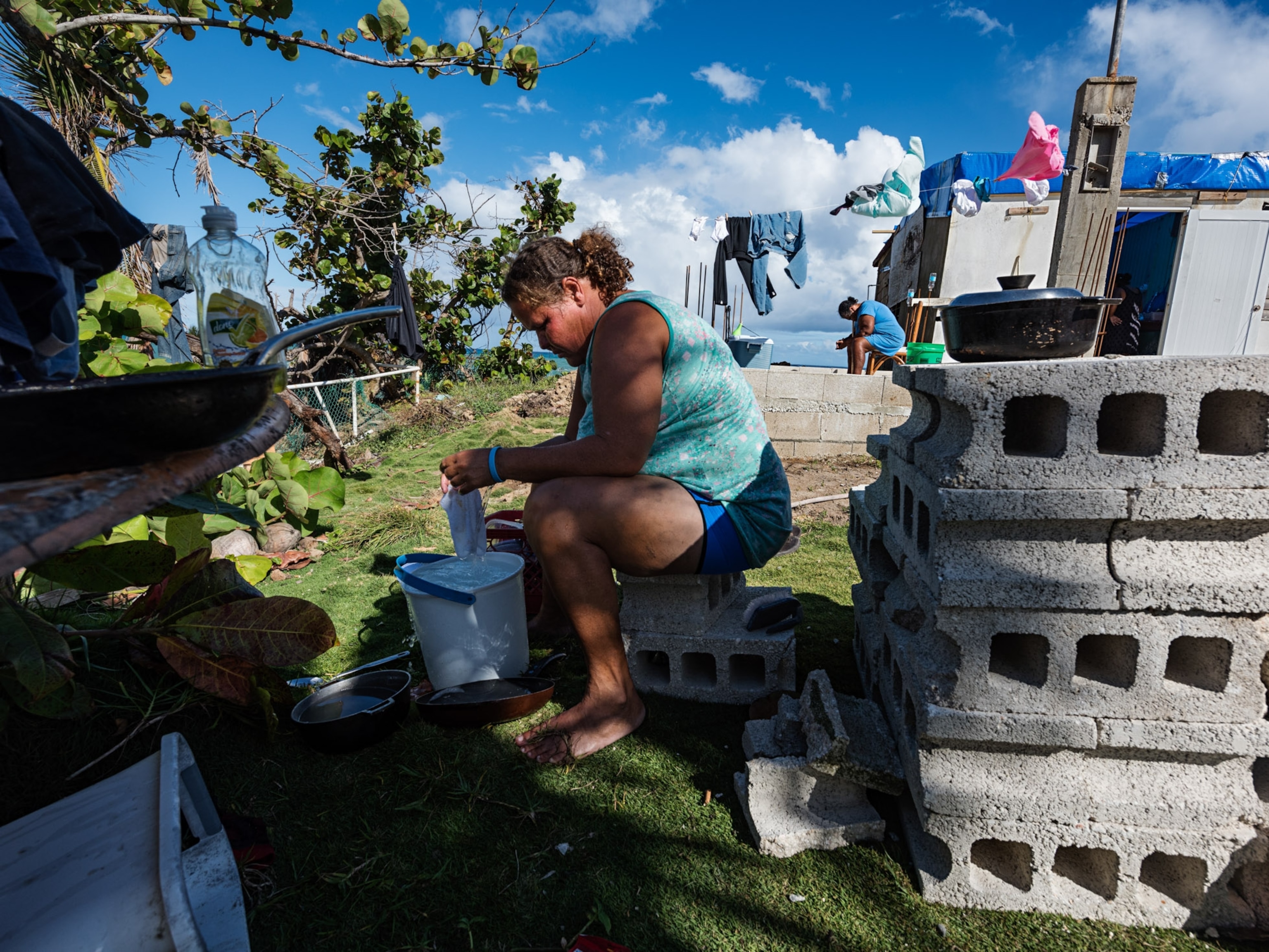
The work of repairing the city's levees, pumping out the floodwaters, and finding homes for tens of thousands of displaced residents is underway.
Related Topics
You May Also Like


Go Further
Animals
- Soy, skim … spider. Are any of these technically milk?Soy, skim … spider. Are any of these technically milk?
- This pristine piece of the Amazon shows nature’s resilienceThis pristine piece of the Amazon shows nature’s resilience
- Octopuses have a lot of secrets. Can you guess 8 of them?
- Animals
- Feature
Octopuses have a lot of secrets. Can you guess 8 of them?
Environment
- This pristine piece of the Amazon shows nature’s resilienceThis pristine piece of the Amazon shows nature’s resilience
- Listen to 30 years of climate change transformed into haunting musicListen to 30 years of climate change transformed into haunting music
- This ancient society tried to stop El Niño—with child sacrificeThis ancient society tried to stop El Niño—with child sacrifice
- U.S. plans to clean its drinking water. What does that mean?U.S. plans to clean its drinking water. What does that mean?
History & Culture
- Gambling is everywhere now. When is that a problem?Gambling is everywhere now. When is that a problem?
- Beauty is pain—at least it was in 17th-century SpainBeauty is pain—at least it was in 17th-century Spain
- The real spies who inspired ‘The Ministry of Ungentlemanly Warfare’The real spies who inspired ‘The Ministry of Ungentlemanly Warfare’
- Heard of Zoroastrianism? The religion still has fervent followersHeard of Zoroastrianism? The religion still has fervent followers
- Strange clues in a Maya temple reveal a fiery political dramaStrange clues in a Maya temple reveal a fiery political drama
Science
- NASA has a plan to clean up space junk—but is going green enough?NASA has a plan to clean up space junk—but is going green enough?
- Soy, skim … spider. Are any of these technically milk?Soy, skim … spider. Are any of these technically milk?
- Can aspirin help protect against colorectal cancers?Can aspirin help protect against colorectal cancers?
- The unexpected health benefits of Ozempic and MounjaroThe unexpected health benefits of Ozempic and Mounjaro
- Do you have an inner monologue? Here’s what it reveals about you.Do you have an inner monologue? Here’s what it reveals about you.
Travel
- Follow in the footsteps of Robin Hood in Sherwood ForestFollow in the footsteps of Robin Hood in Sherwood Forest
- This chef is taking Indian cuisine in a bold new directionThis chef is taking Indian cuisine in a bold new direction
- On the path of Latin America's greatest wildlife migrationOn the path of Latin America's greatest wildlife migration
- Everything you need to know about Everglades National ParkEverything you need to know about Everglades National Park
