


Severe Thunderstorm and Heavy Rainfall Threats for the Center of the Nation; Near Record Warmth for the East
Active weather for the center of the nation today. Severe thunderstorms and flash flooding concerns over portions of the Central and Southern Plains into the Mississippi Valley today into tonight. Meanwhile, cool and snowy in parts of the Northwest and Great Basin with above average and potentially record breaking temperatures for the Ohio Valley and Mid-Atlantic. Read More >
LOADING...
Category 4 Hurricane Harvey: South Texas Landfall & Impacts from August 25th to 29th, 2017
- Overview
- Stats
- Radar
- Satellite
- Winds
- Storm Surge
- Rainfall
- Rivers
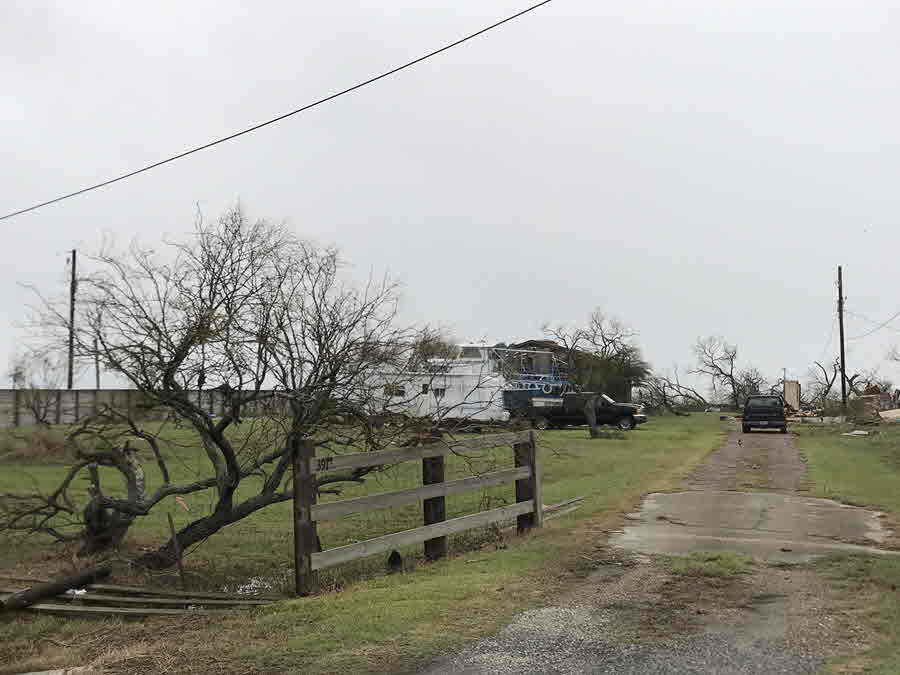
- Seadrift Tornado
- Storm Reports
- Photos
- One Year Later
Hurricane Harvey Summary PDF
...Hurricane Harvey is the first Category 4 (and first major) hurricane to make landfall along the Middle TX Coast since Celia in 1970...
|
|
| NHC Final Best Track of Harvey (Click points above to view additional information.) |
|---|
Over the past several years, meteorologists in South Texas (and other areas) have stated "it's not a matter of if but when" a major hurricane would strike the Middle Texas Coast. The last hurricane to do so was Celia back on August 3rd, 1970. Well, the "when" happened on August 25th 2017, when Harvey made landfall along the Middle Texas Coast. Harvey exploded rapidly from a tropical depression to a major hurricane in around 40 hours. After impacting the Yucatan Peninsula earlier in the month as a tropical storm, Harvey moved into the warm waters of the Gulf of Mexico late on Tuesday August 22nd.
 |
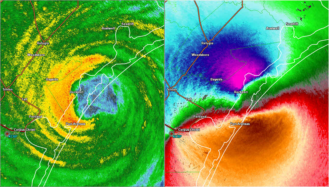
| KCRP Radar Loop - 500 AM CDT August 25 through 912 AM CDT August 26, 2017 |
|---|
The birth of Harvey occurred on Sunday August 13th, 2017 as a tropical wave emerged off the west coast of Africa, eventually merging with a broad area of low pressure near the Cabo Verde Islands. At first, it was thought the wave and the low pressure area would have a more west-northwest track, threatening the Lesser Antilles. However, this low stayed more on a westward course as it moved over the open Atlantic Ocean toward the Eastern Caribbean Sea. For a few days on its westward track, "Harvey" remained disorganized, and there was some uncertainty whether the low would become a tropical cyclone. However, by Thursday August 17th, the National Hurricane Center began issuing advisories and forecasts on Tropical Cyclone Nine Thursday morning, and Tropical Storm Harvey Thursday afternoon. Tropical Storm Warnings were issued that afternoon for Martinique, St. Lucia, Barbados, and St. Vincent and the Grenadines. Tropical Storm Harvey impacted the Windward Islands on Friday, August 18th, entering the Eastern Caribbean Sea as a minimal tropical storm, and eventually weakening to a tropical wave late Saturday evening. Although there was some potential for the remnants of Harvey to reorganize into a tropical cyclone, a tropical cyclone failed to form as the remnants of Harvey moved into the Yucatan Peninsula on Tuesday morning, August 22nd.
| The genesis of Harvey from a Depression to a Major Hurricane: 542 PM CDT 08/23/17 to 657 PM CDT 08/26/17 (GOES-16 data is non-operational.) |
|---|
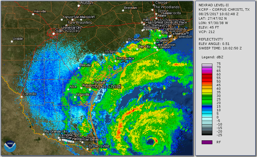
With very warm waters in the Bay of Campeche and the Western Gulf of Mexico, the National Hurricane Center (NHC) was fairly confident that the remnants of Harvey would reform into a tropical cyclone. At 10 AM CDT Wednesday August 23rd, Tropical Depression Harvey reformed. Initially, NHC believed Harvey would become either a strong tropical storm or a Category 1 hurricane before making landfall somewhere between Brownsville (early Friday morning) and Houston (early Saturday morning), with the most likely location near the Rockport area late Friday night . However, with wind shear in the Western Gulf of Mexico weakening, Tropical Storm Harvey was intensifying quickly. By Wednesday evening, Harvey was forecast to make landfall as a hurricane somewhere over the Texas Coast.
On Thursday August 24th, Harvey's impact on the Middle and Upper Texas Coast seemed almost certain and potentially devastating. Not only was Harvey forecast to become a hurricane by Thursday evening, but it was expected to strengthen and make landfall as a major hurricane (Category 3 or higher) on Friday (see forecast). Worse yet, once the storm moved inland, it was forecast to eventually stall and meander over South or Southeast Texas for days. Thus, Major hurricane Harvey was not only forecast to produce devastating winds, but extremely heavy and excessive rainfall, producing devastating and historic flooding over areas especially east of the center of circulation (still most likely just north of Copano Bay).
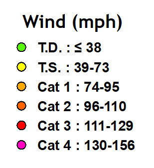
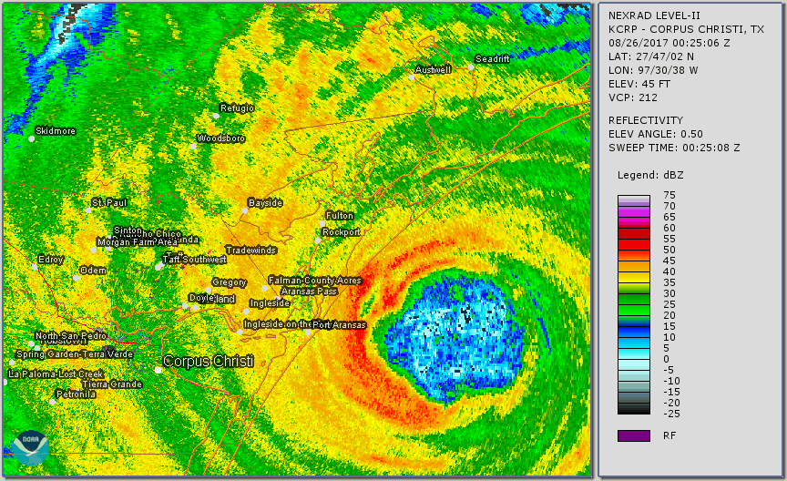
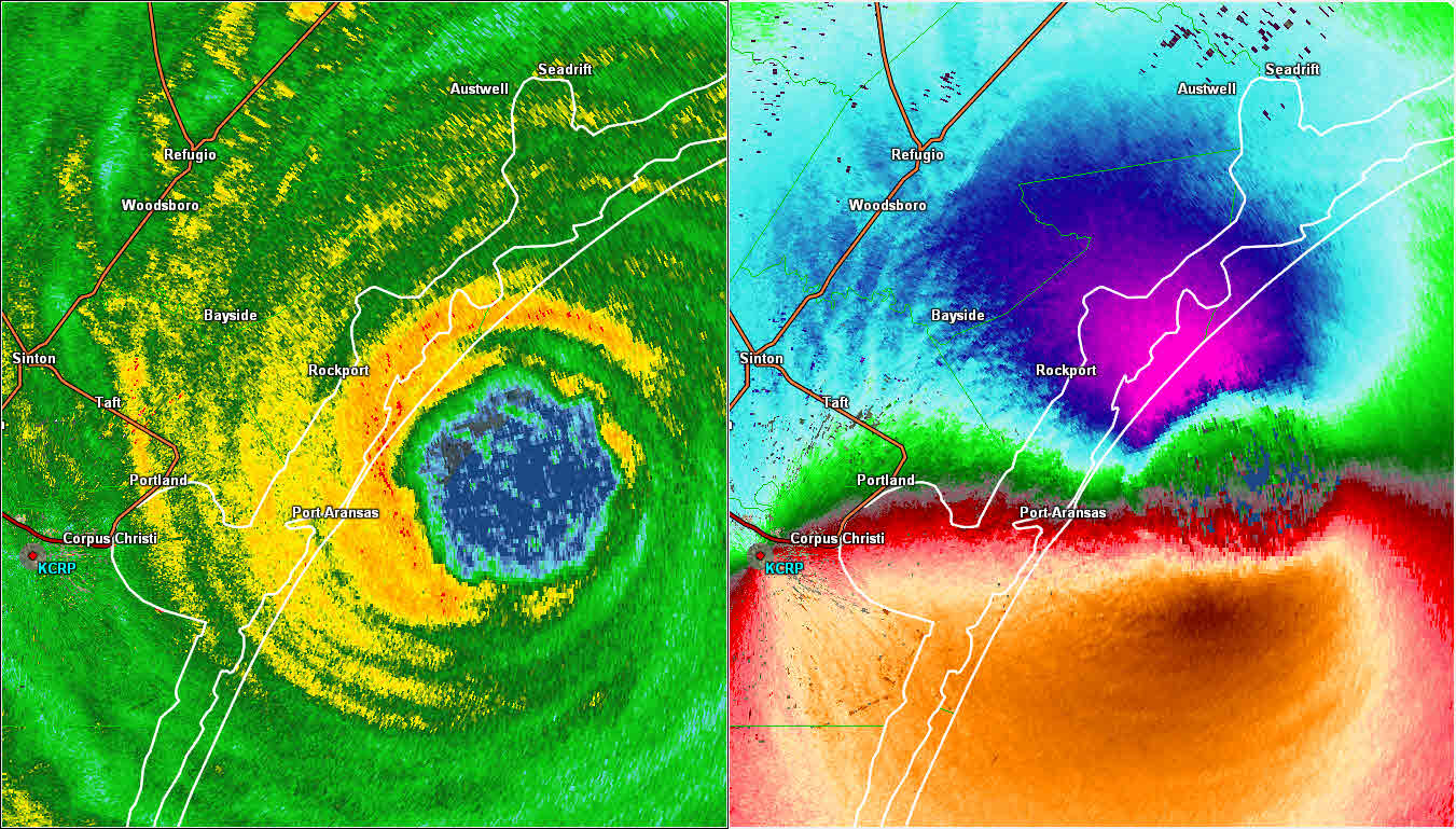
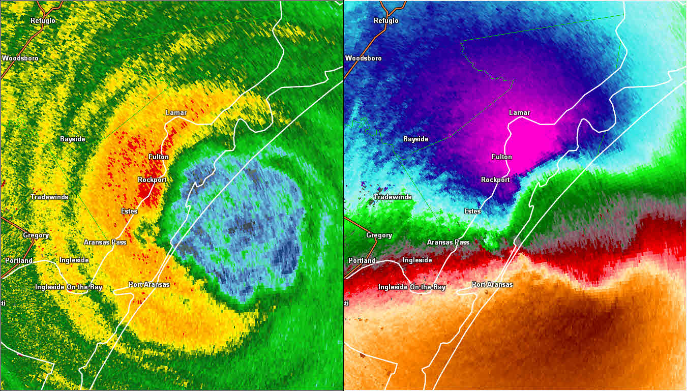
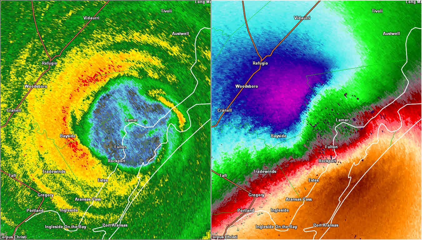
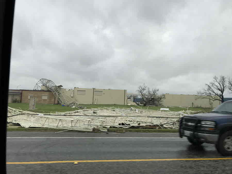
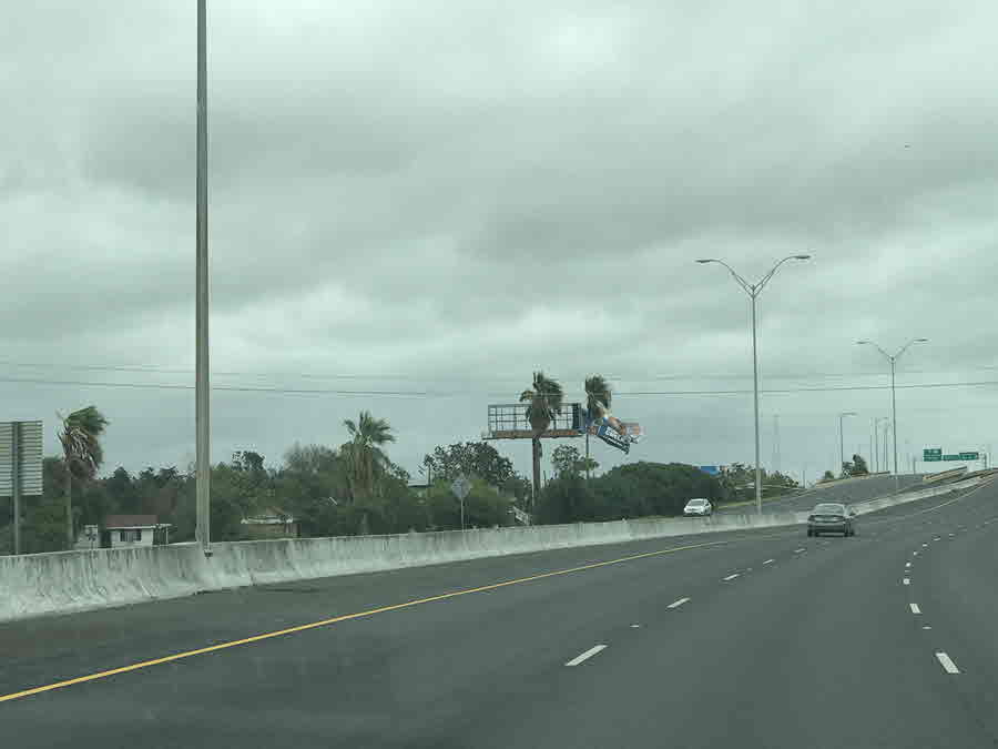
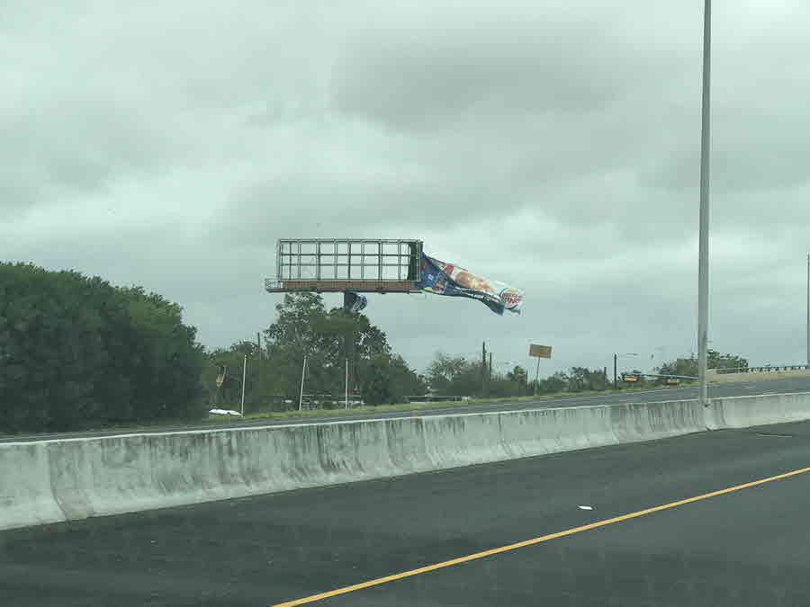
Harvey underwent rapid intensification and quickly became a Category 3 hurricane on Friday at 2 PM (120 mph sustained winds) and then a Category 4 hurricane (130 mph sustained winds) early Friday evening. As Harvey slowly approached the coast, the National Weather Service in Corpus Christi issued a rare Extreme Wind Warning. Extreme wind warnings are issued for landfalling major hurricanes with winds of 115 mph or higher. Harvey was forecast to have winds in the eyewall between 115 and 130 mph! Three extreme wind warnings were ultimately issued for Harvey. The eye of Major Hurricane Harvey first made landfall on San Jose Island and then near the Rockport and Fulton, Texas area at around 10 PM CDT.
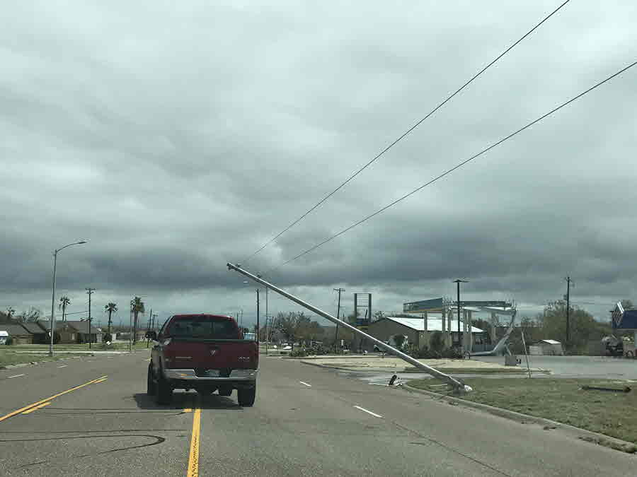
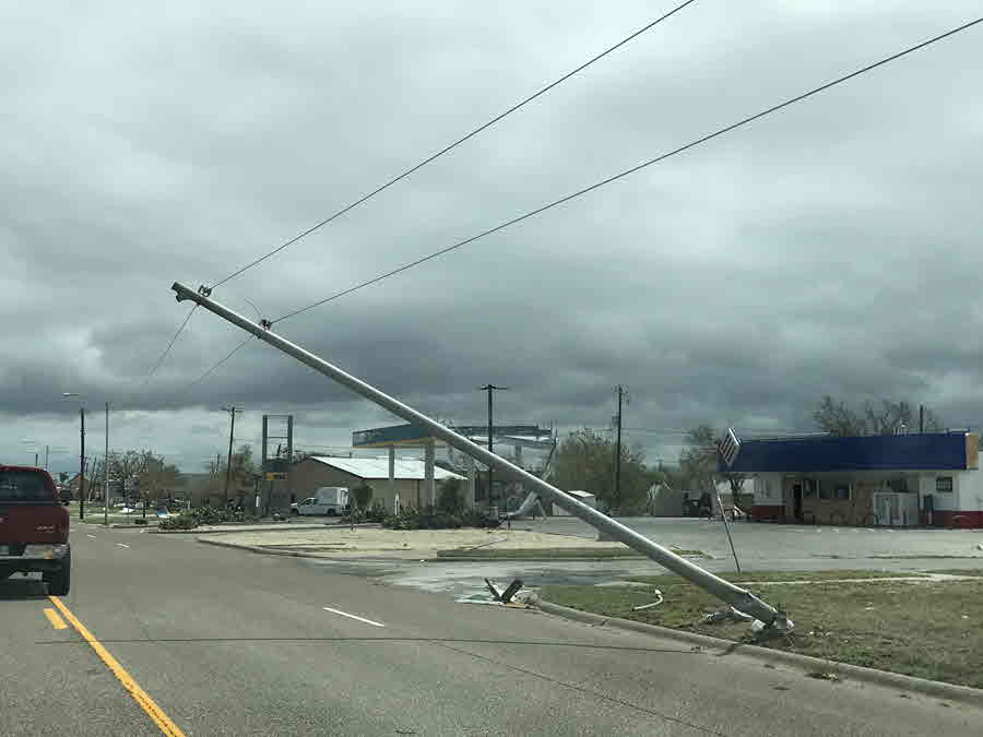
Many observing stations in South Texas with equipment measuring wind speeds were disabled before they could record the highest wind speeds. Thus, some of the observed wind speeds tallied over South Texas may be underestimated, especially over areas near the coast and close to the eyewall of Harvey. The highest measured peak 1-second wind gust was 145 mph at 8 meters AGL (152 mph at 10 m AGL) recorded at the Aransas County Airport in Rockport by the Center for Severe Weather Research. The next highest measured wind gust was 140 mph at 10 m AGL recorded at the Aransas County Airport in Rockport by the University of Florida's Florida Coastal Monitoring Program (FCMP). A peak wind gust of 133 mph was also reported 2 miles ENE of Port Aransas at approximately 13 meters AGL (127 mph at 10 m AGL). A Texas Tech mobile "StickNet" platform located just southeast of Aransas Pass, measured 108 mph wind gust at 2.5 m AGL (135 mph at 10 m AGL).
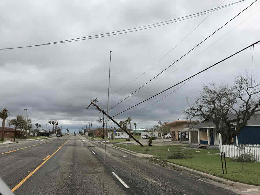
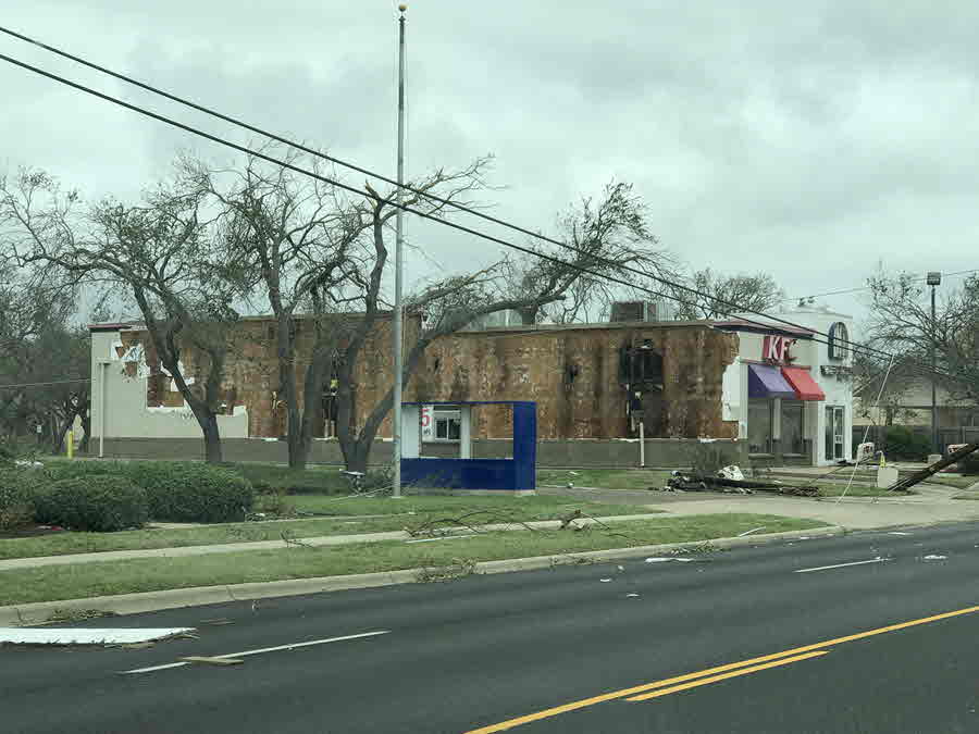
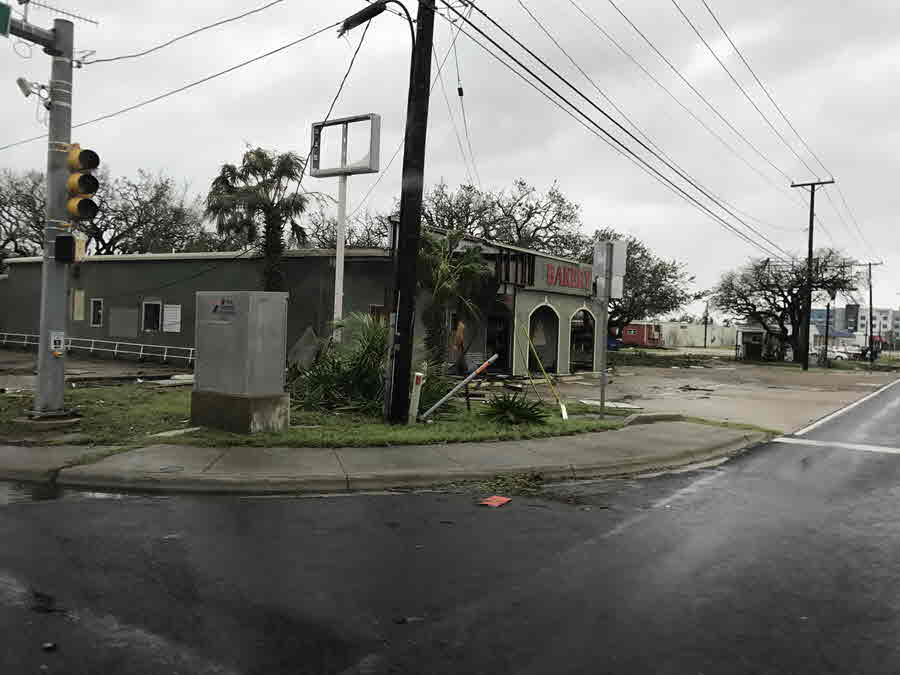
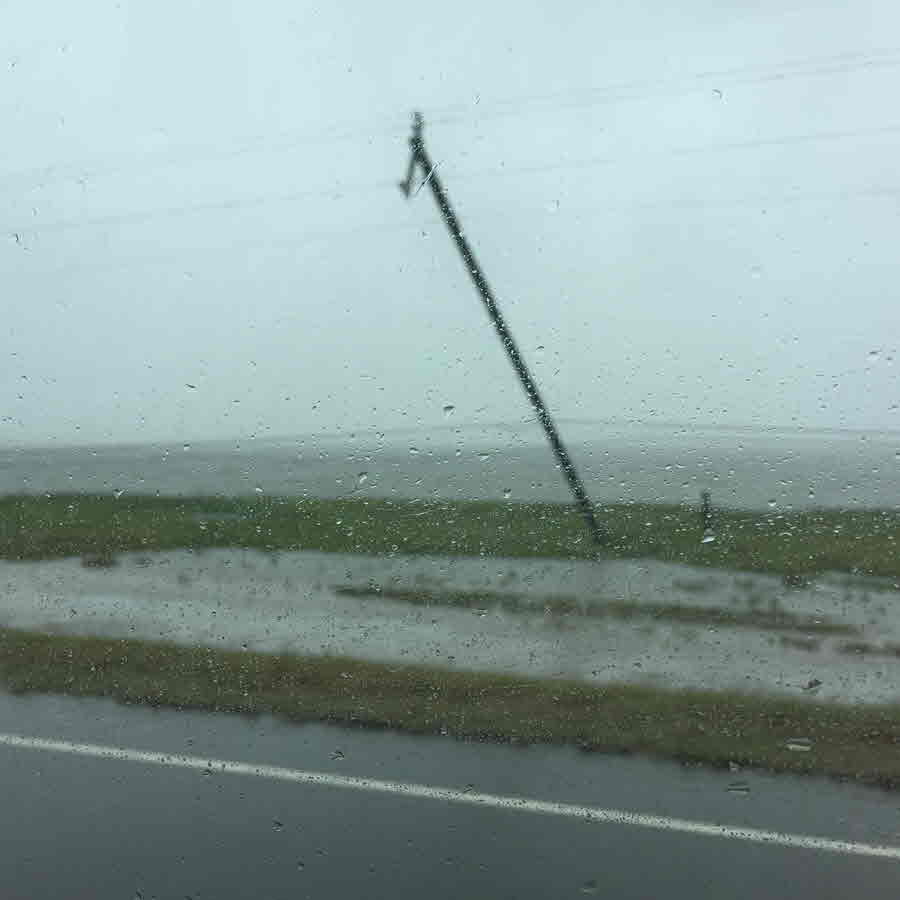
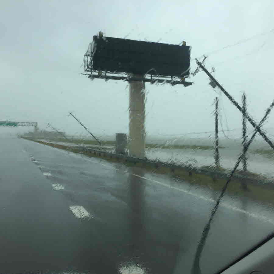
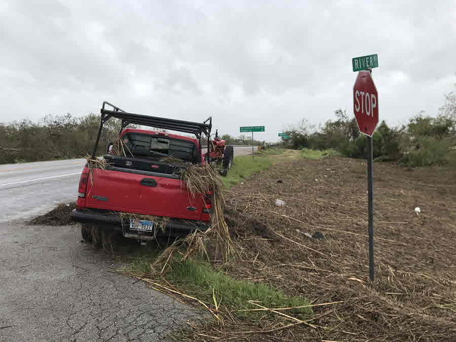
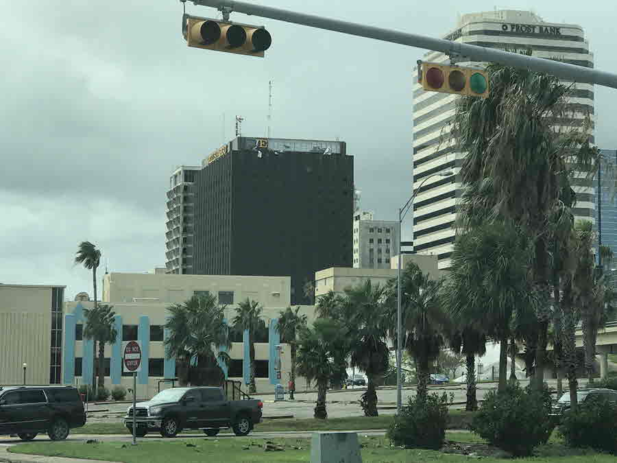
Although the eye of Harvey made landfall around 30 miles northeast of the city of Corpus Christi, strong and damaging wind gusts were experienced away from the center of circulation at the Corpus Christi International Airport and in the city as well as other locations. The Corpus Christi International Airport had a 63 mph gust before it went offline. The Victoria RAWS station had a peak gust of 83 mph. Much higher wind gusts did occur in the city of Corpus Christi, as the Doppler radar showed velocities of 70 mph or more, just a few hundred feet off the surface.
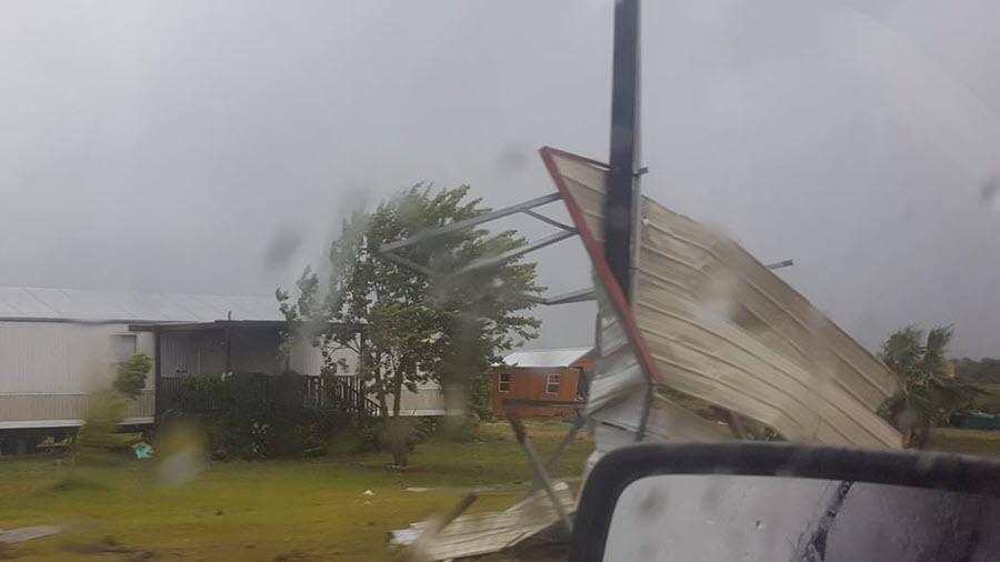
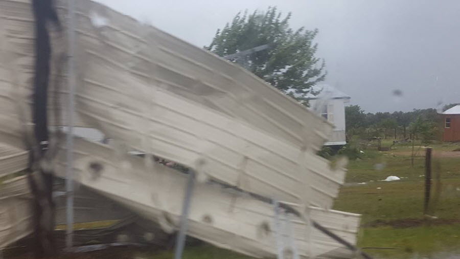
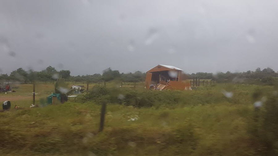
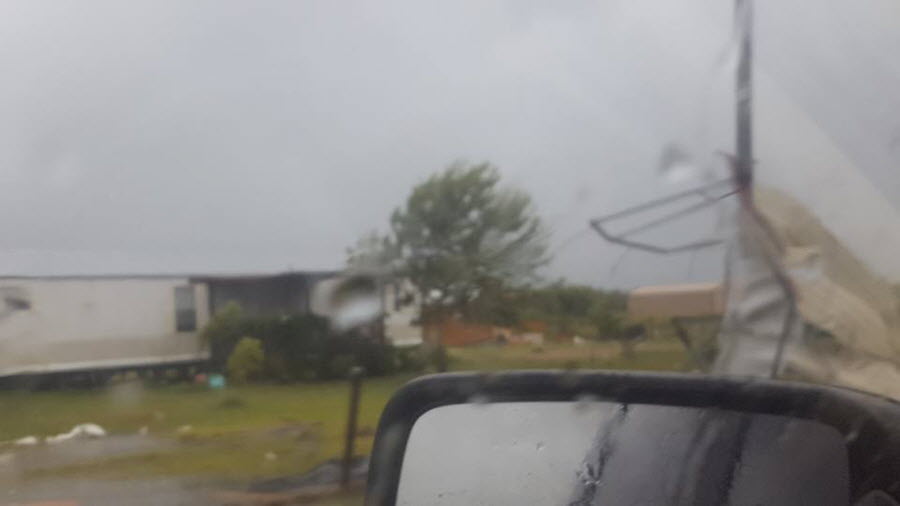
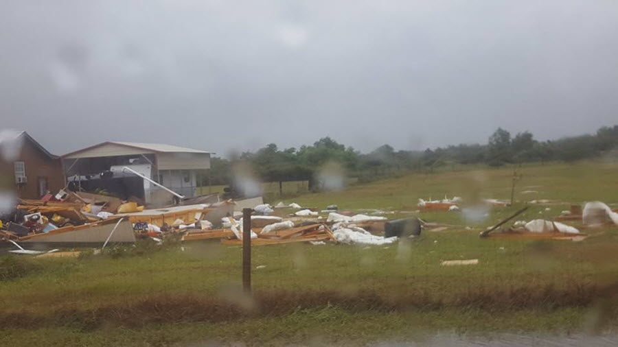
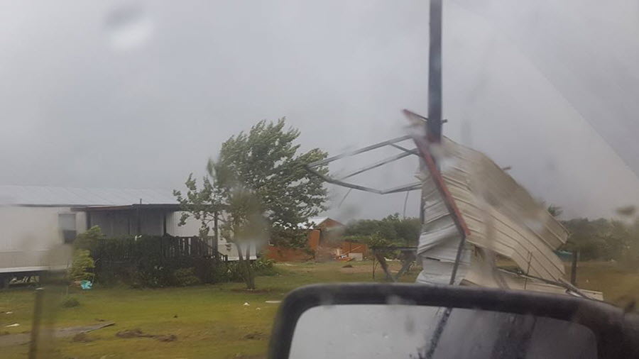
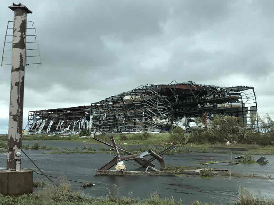
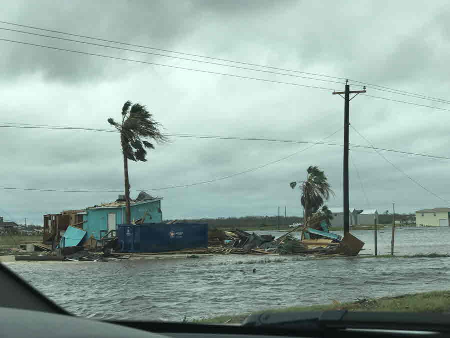
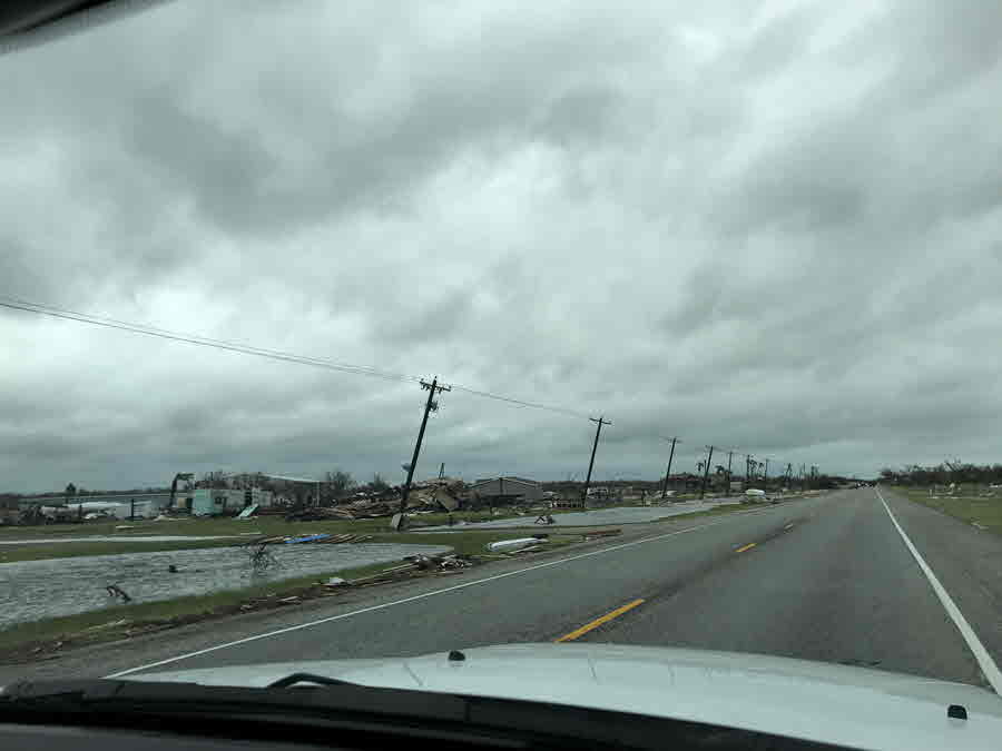
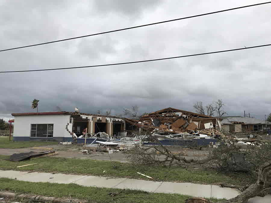
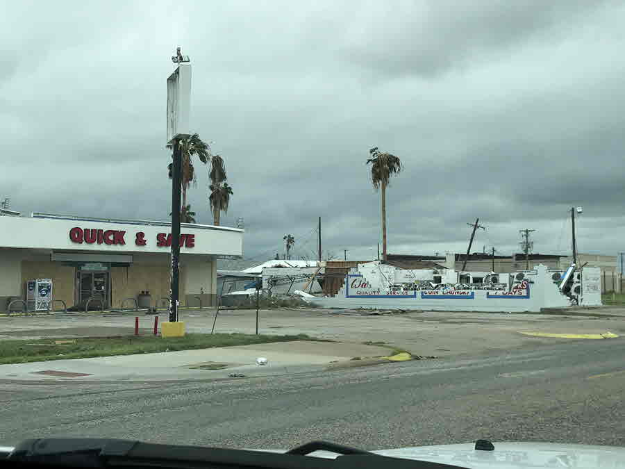
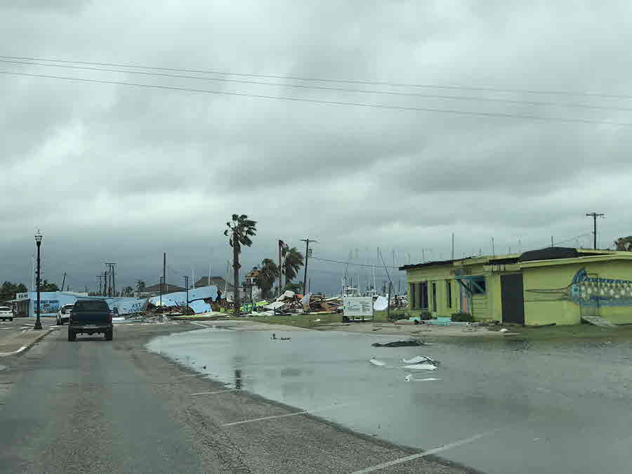
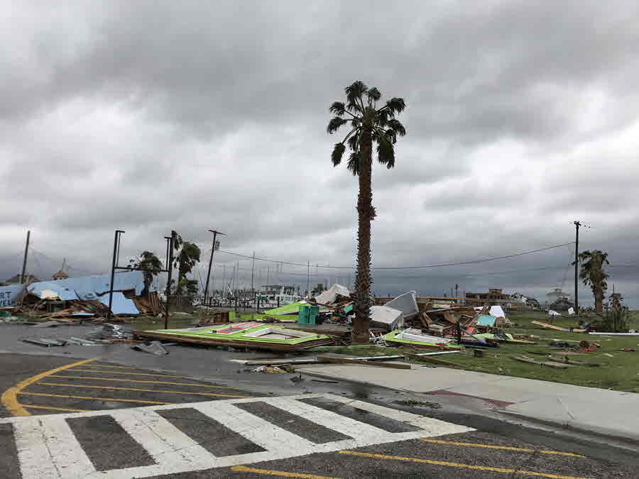
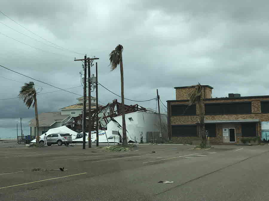
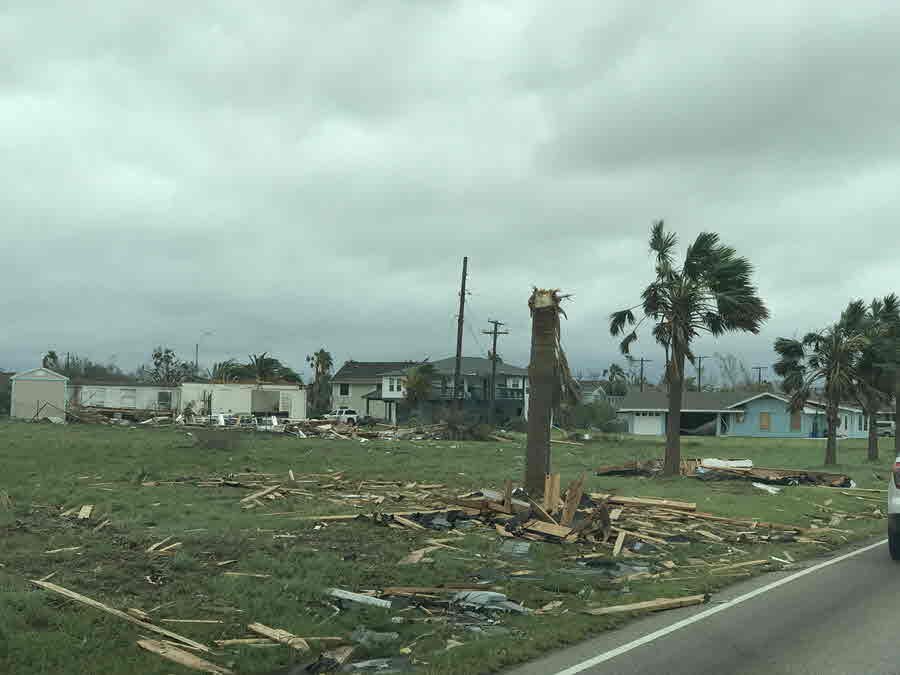
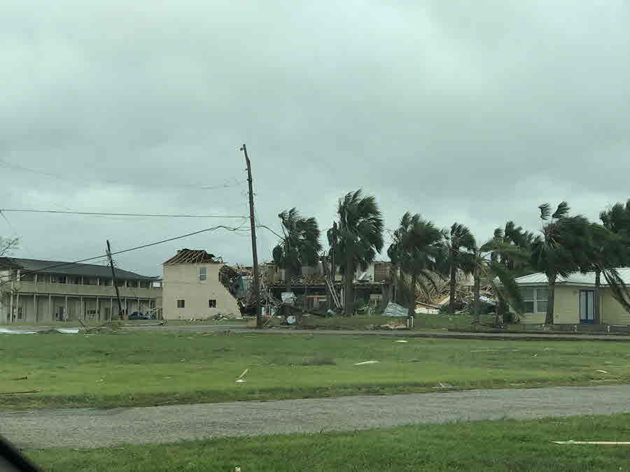
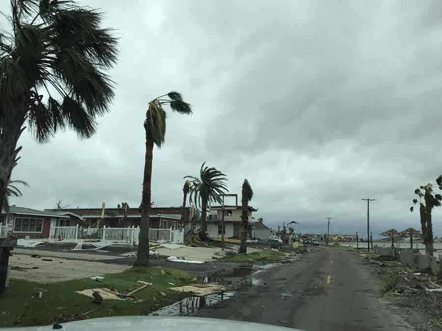
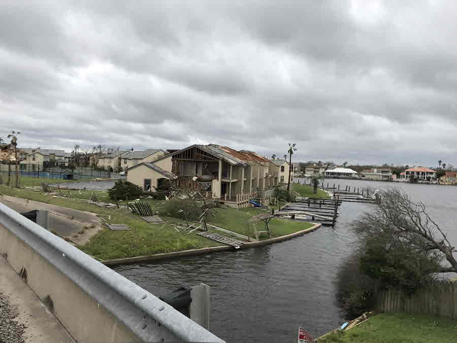
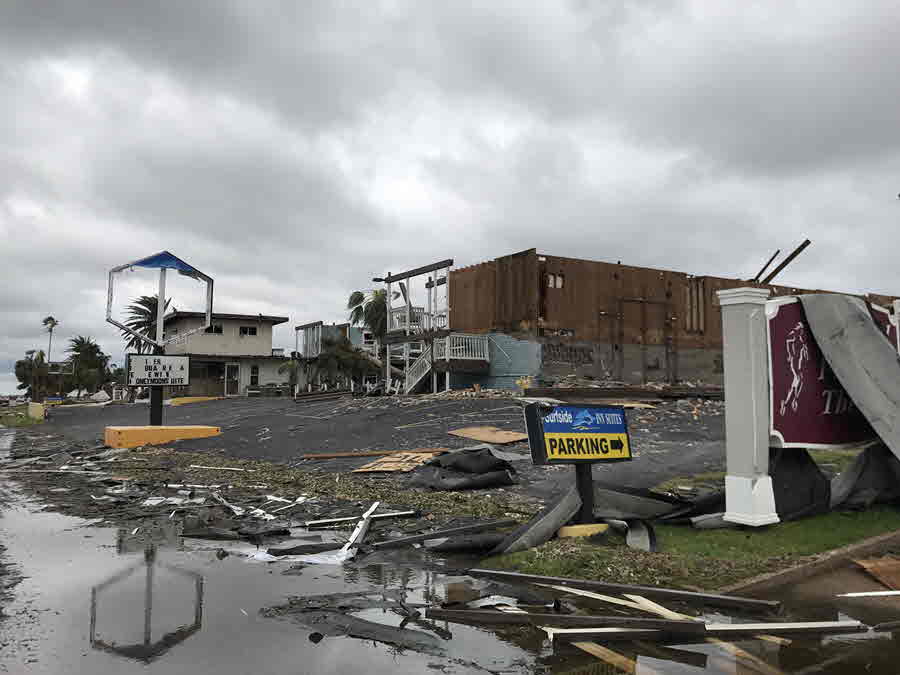
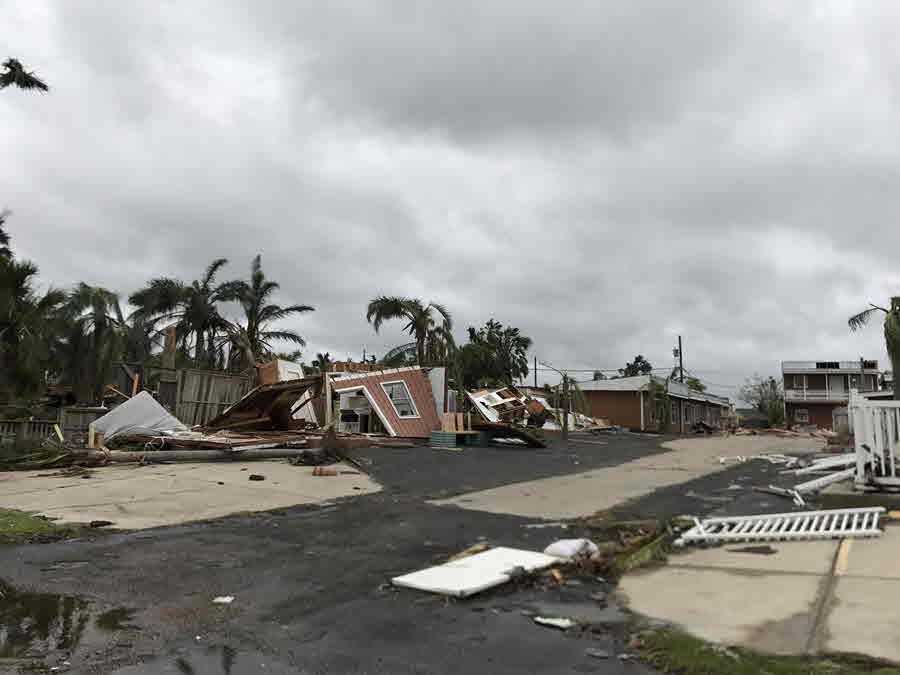
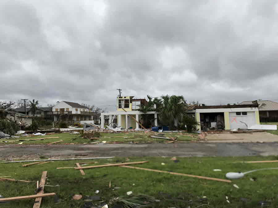
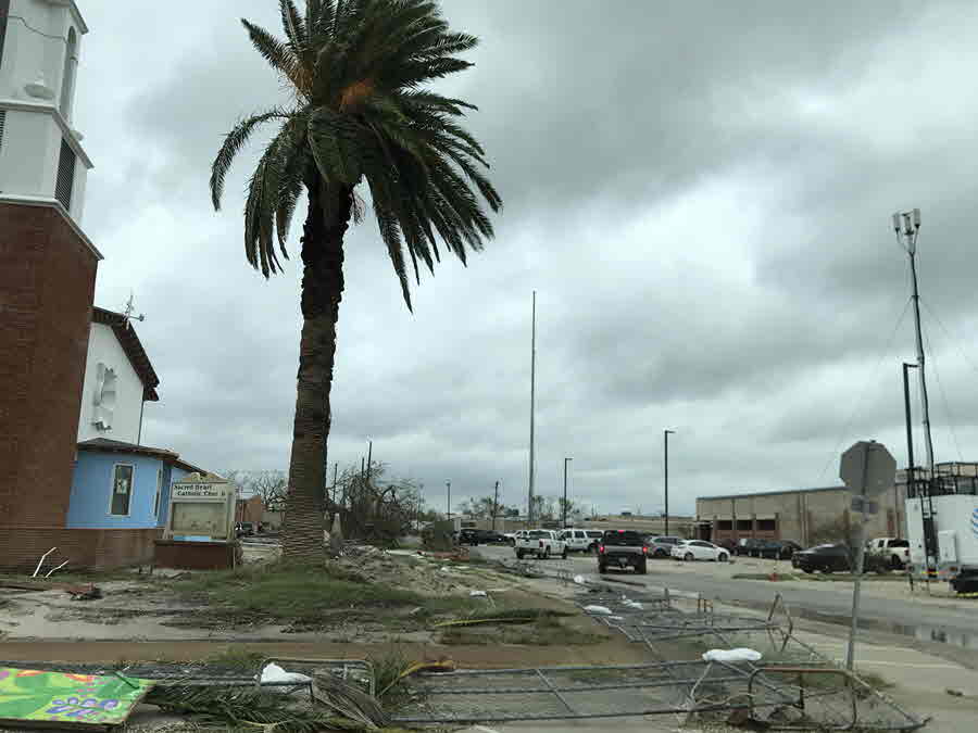
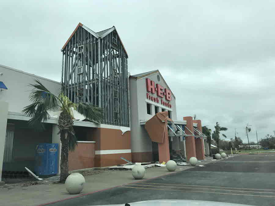
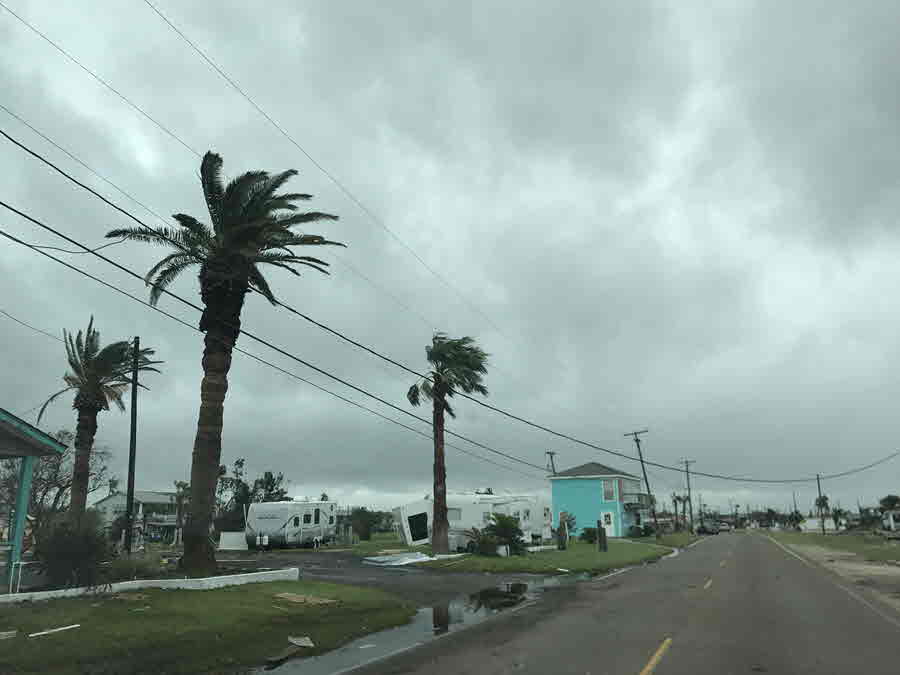
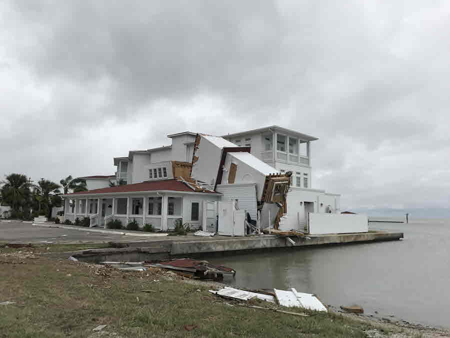
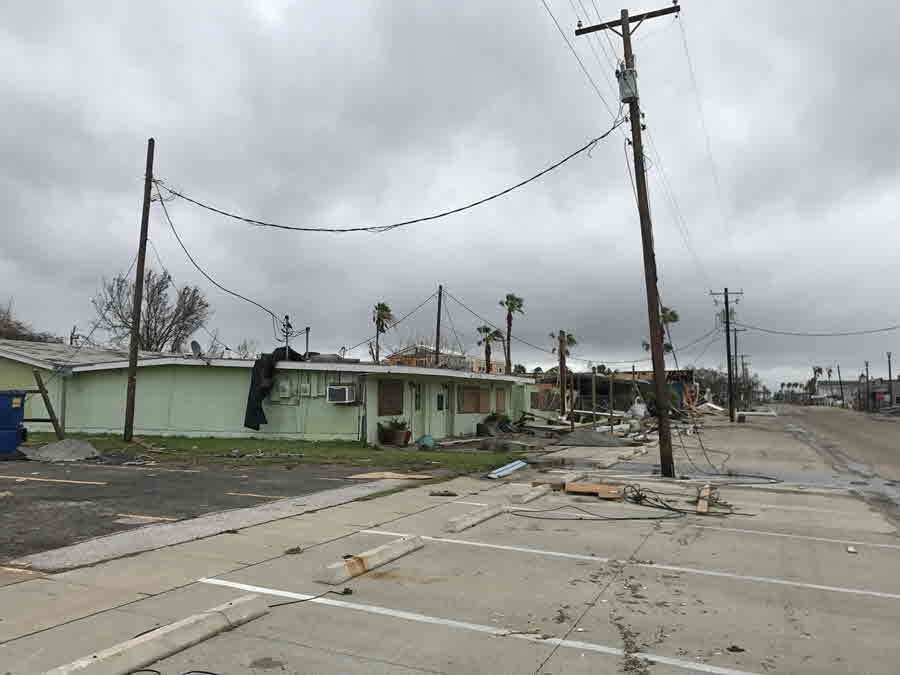
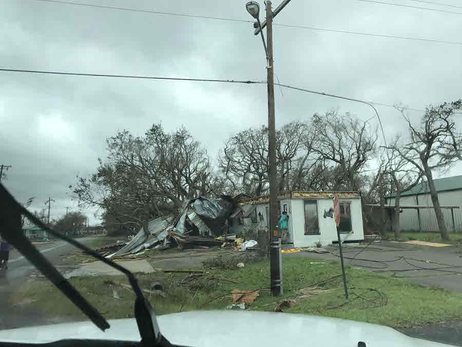
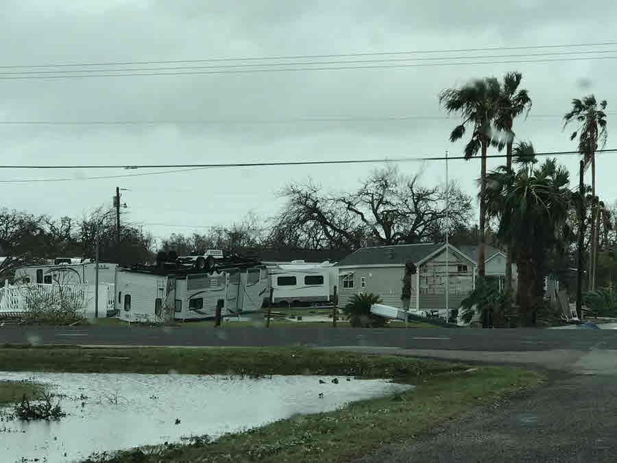
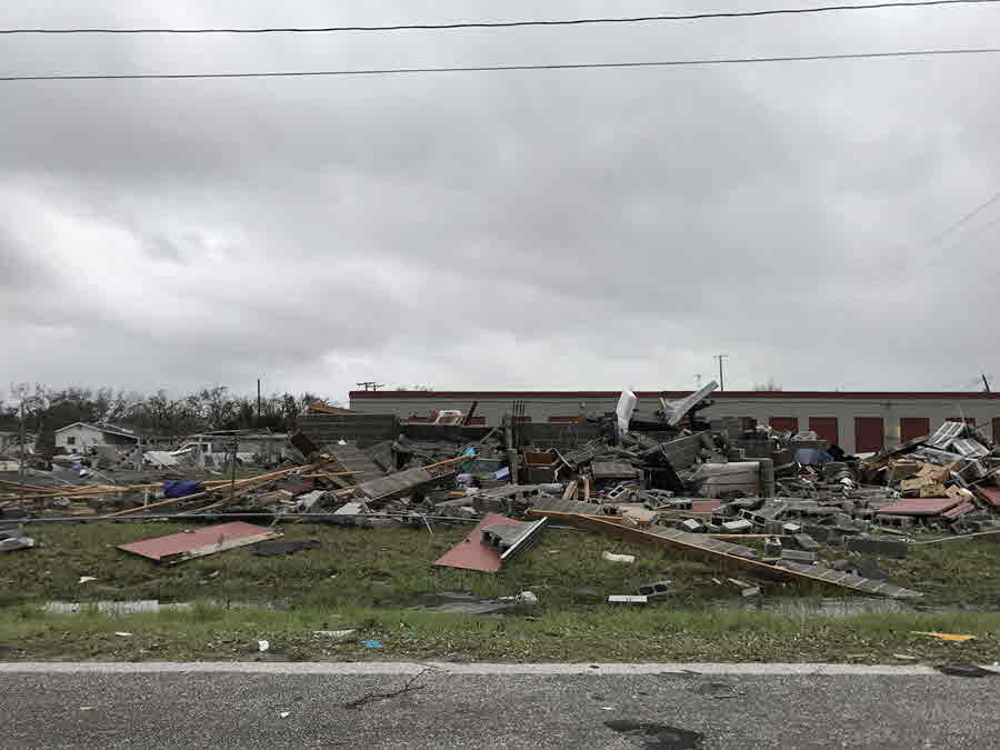
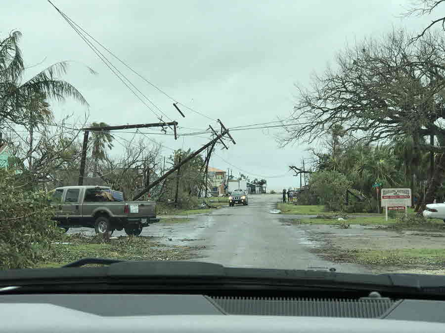
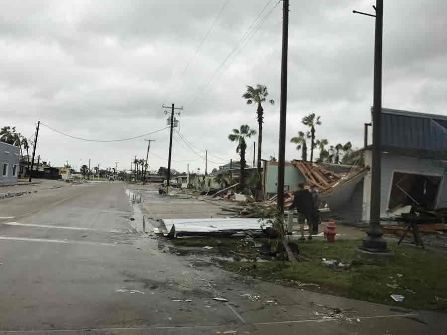
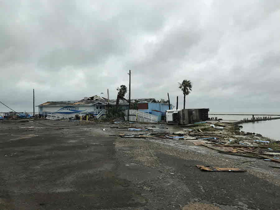
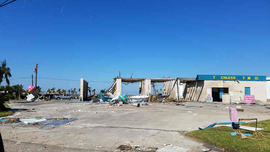
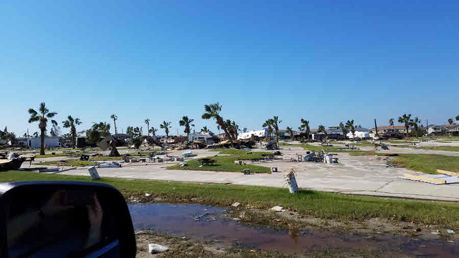
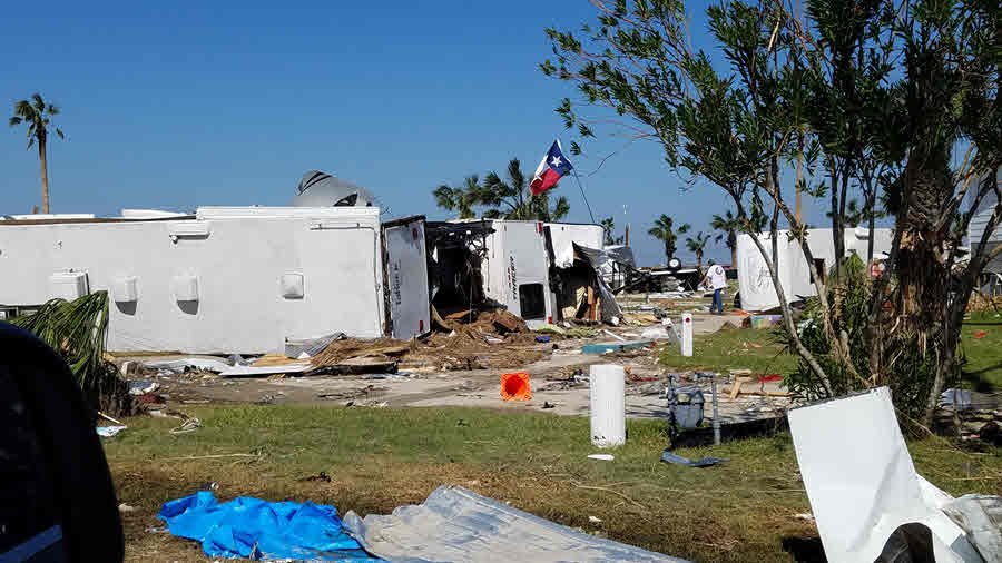
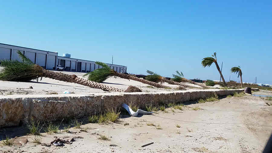
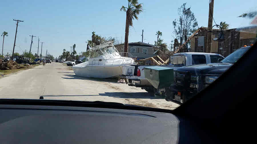
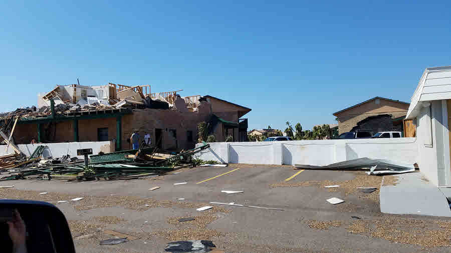
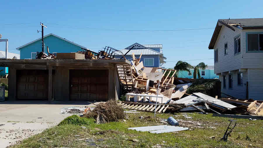
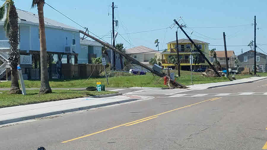
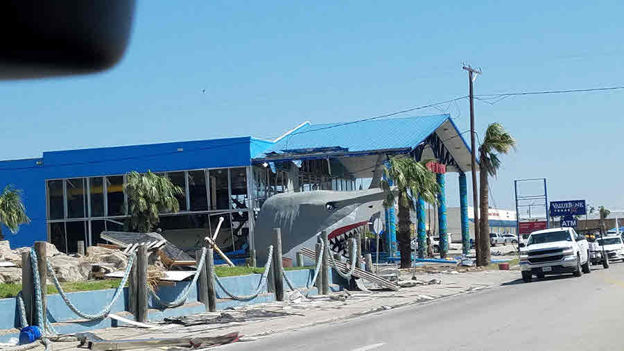
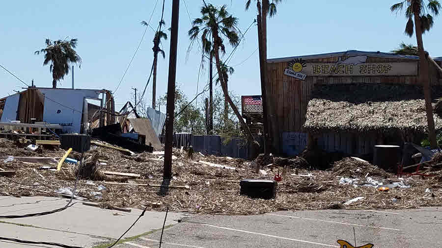
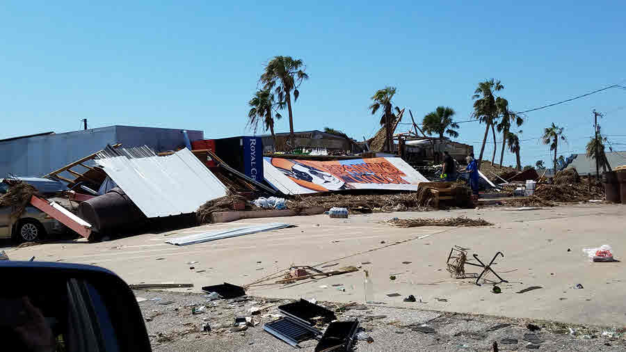
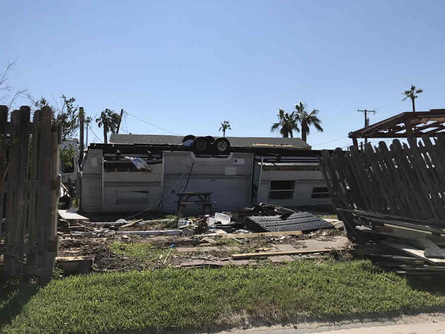
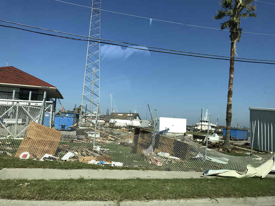
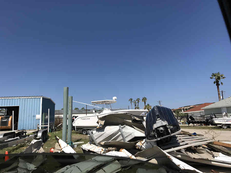
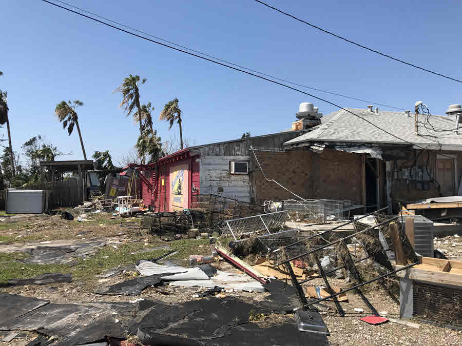
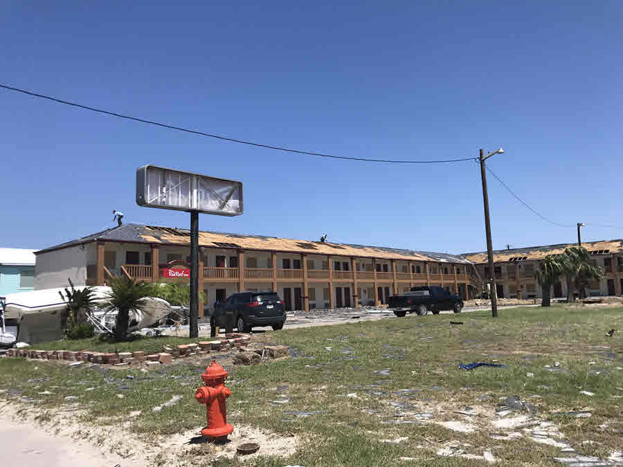
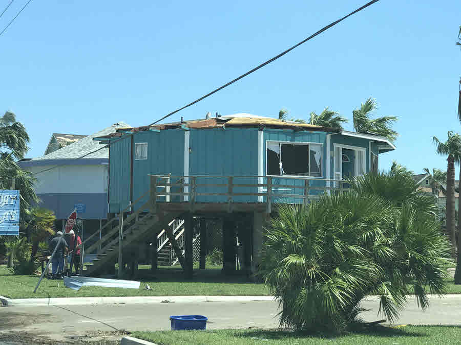
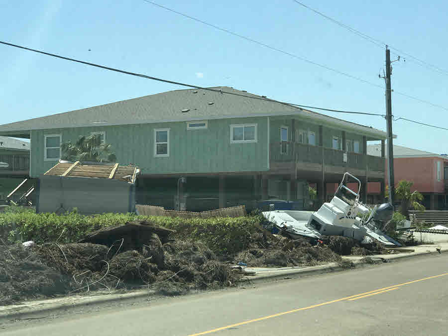
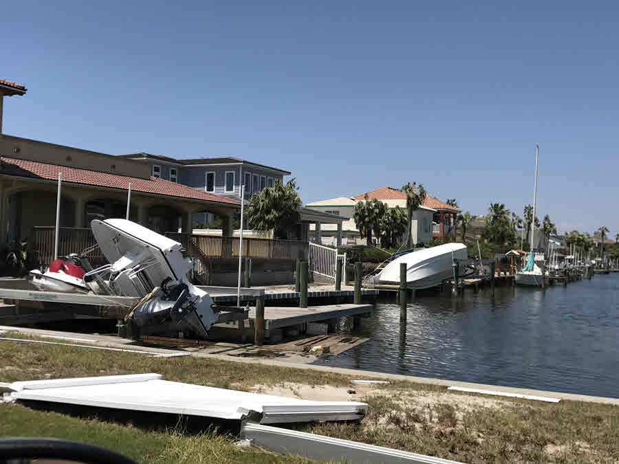
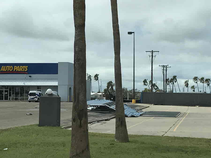
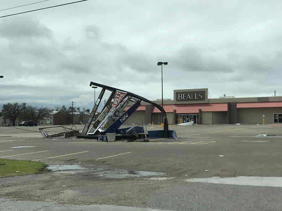
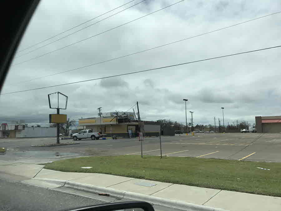
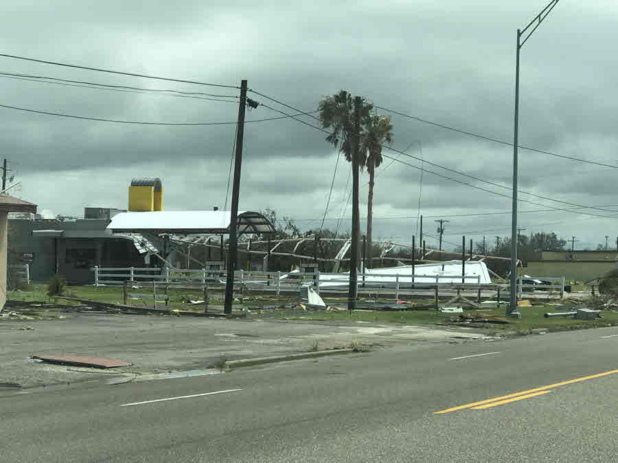
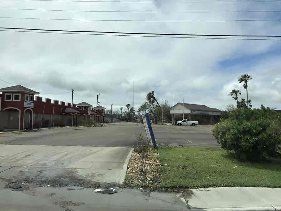
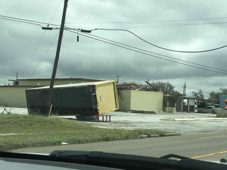
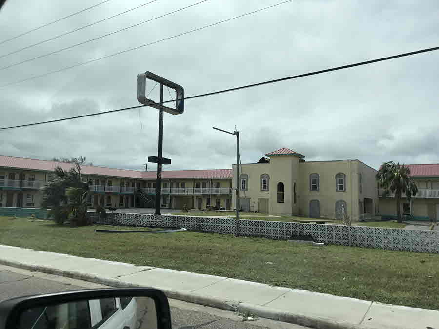
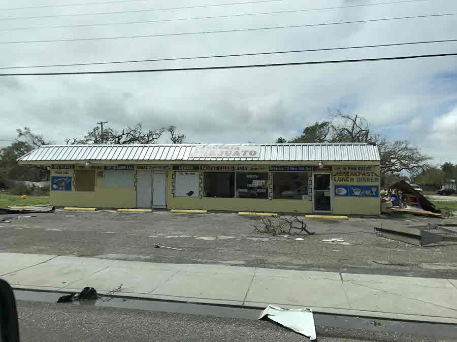
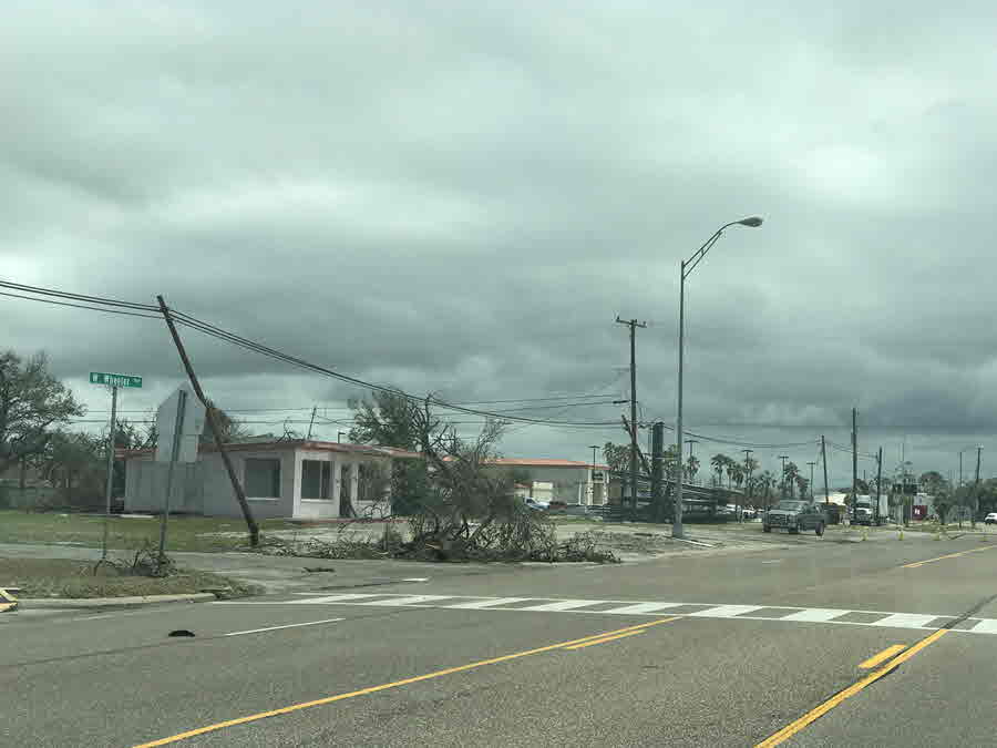
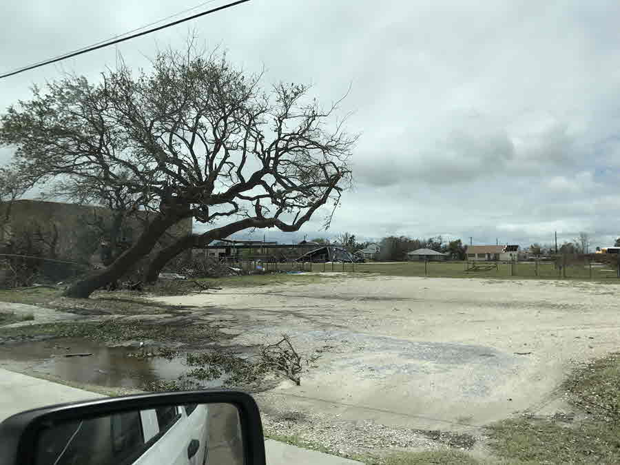
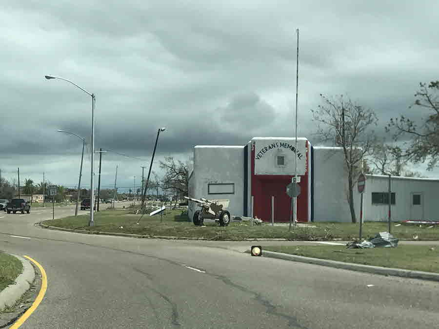
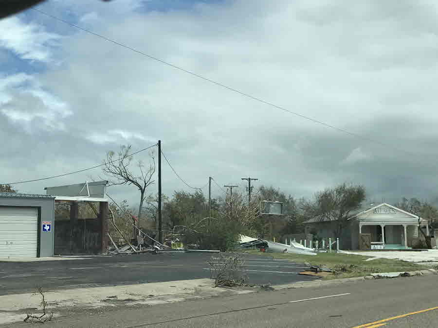
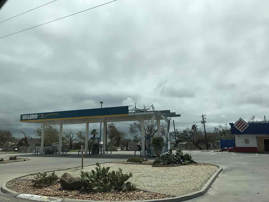
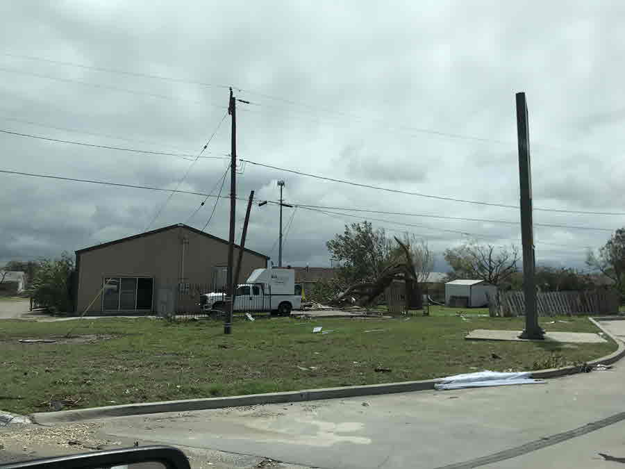
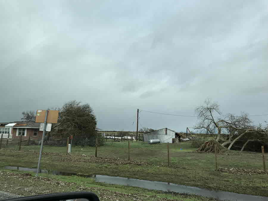
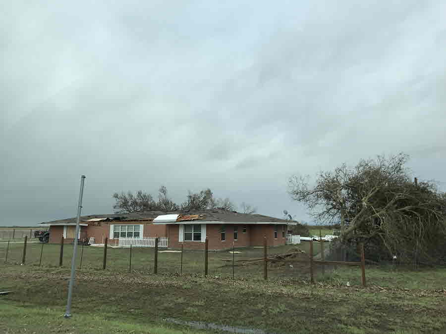
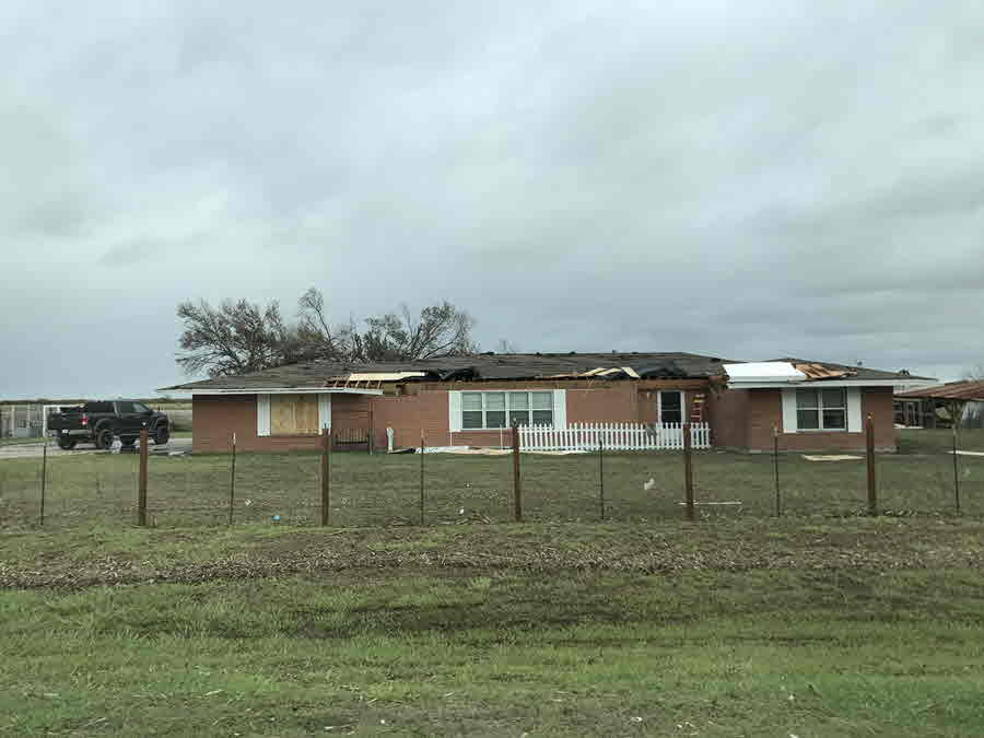
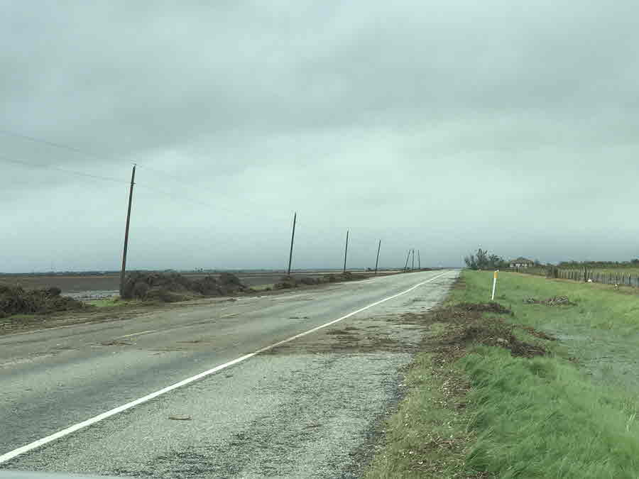
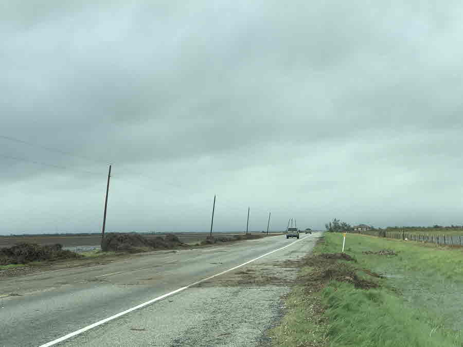
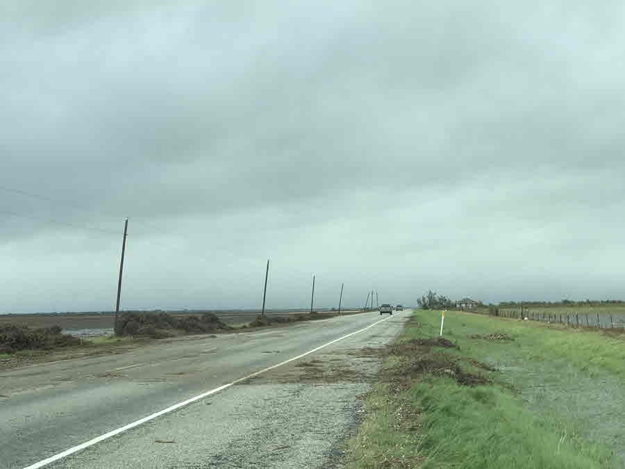
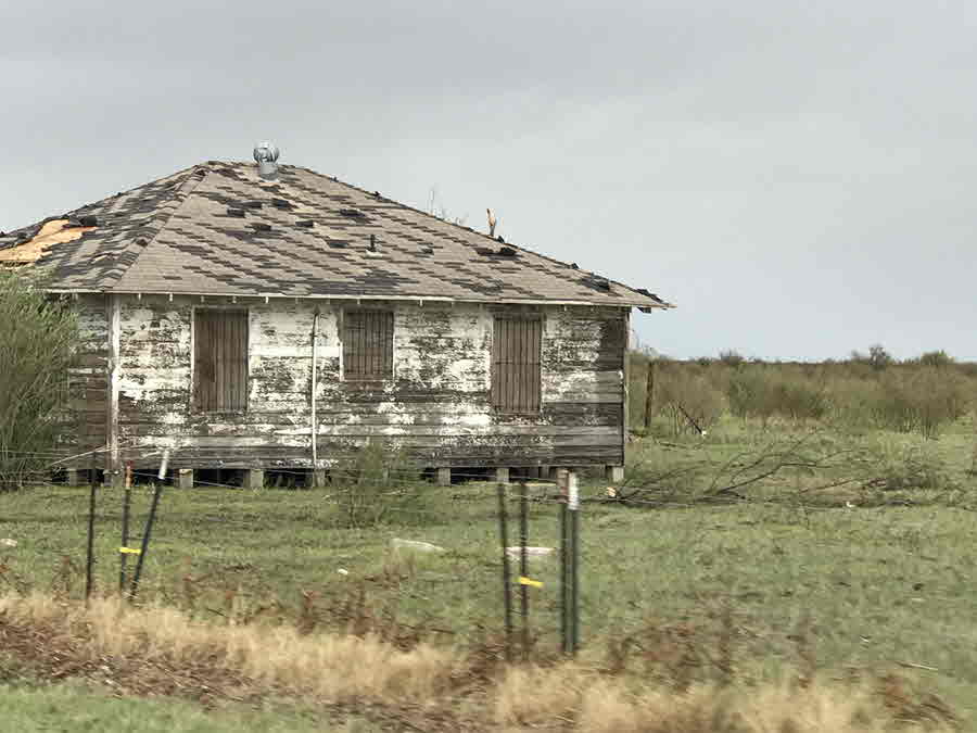
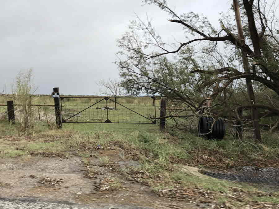
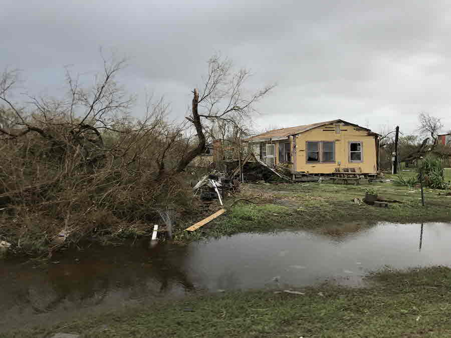
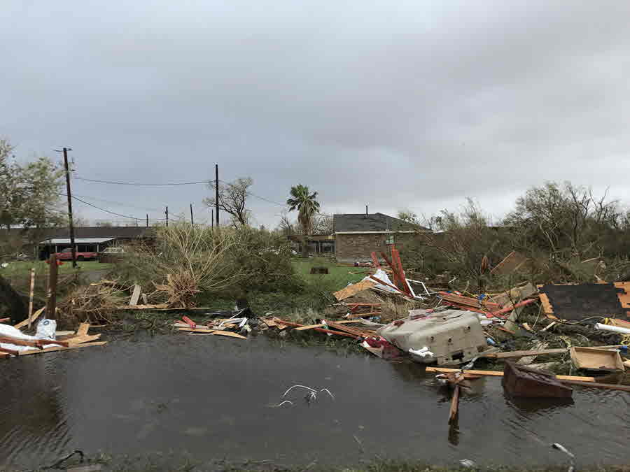
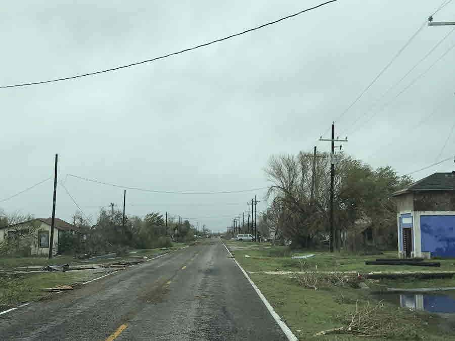
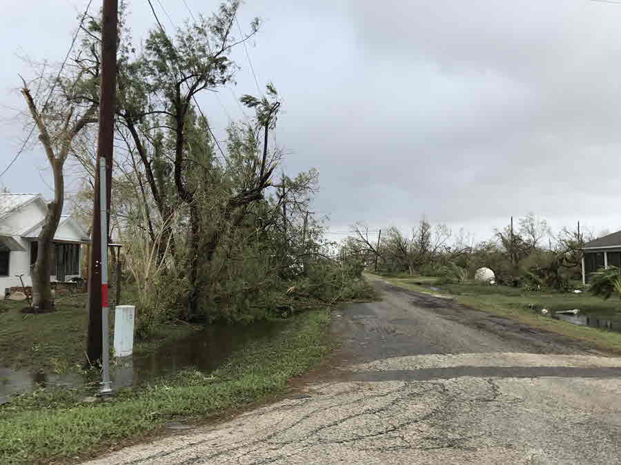
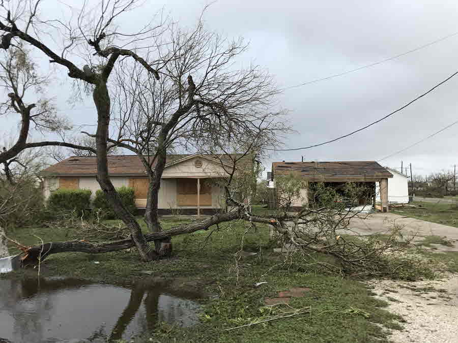
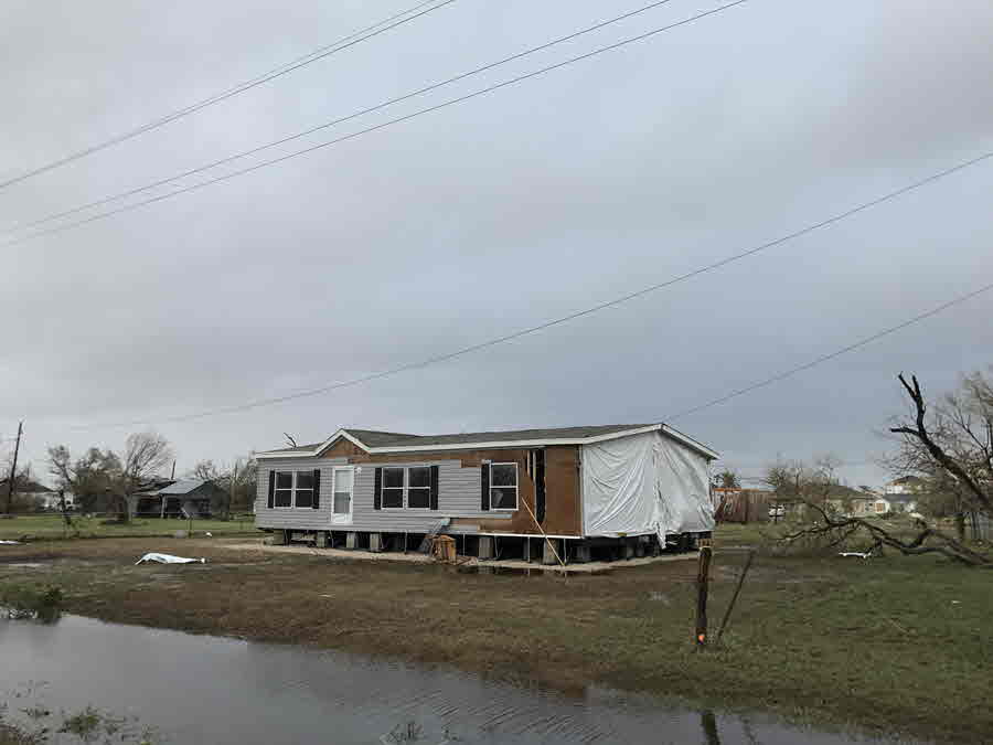
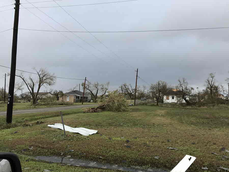
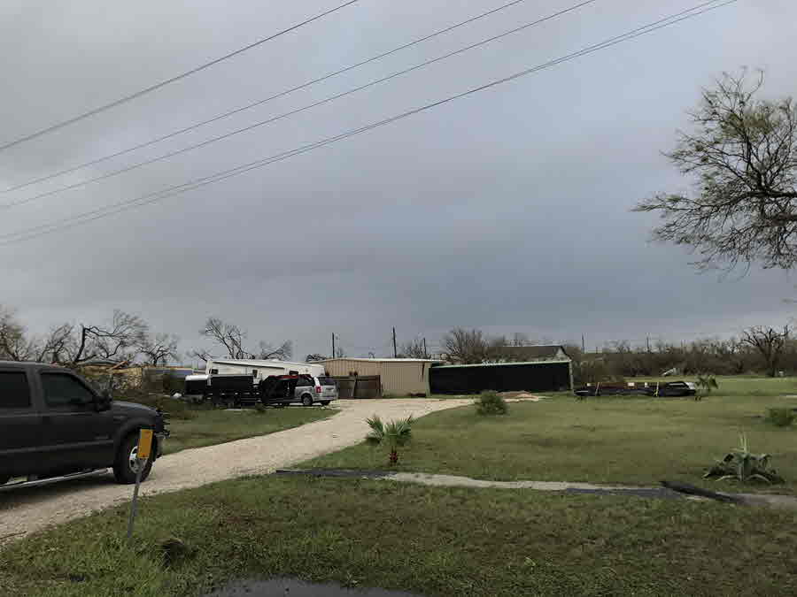
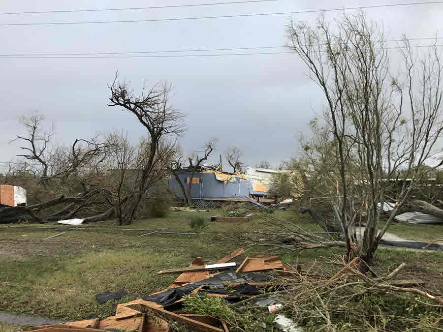
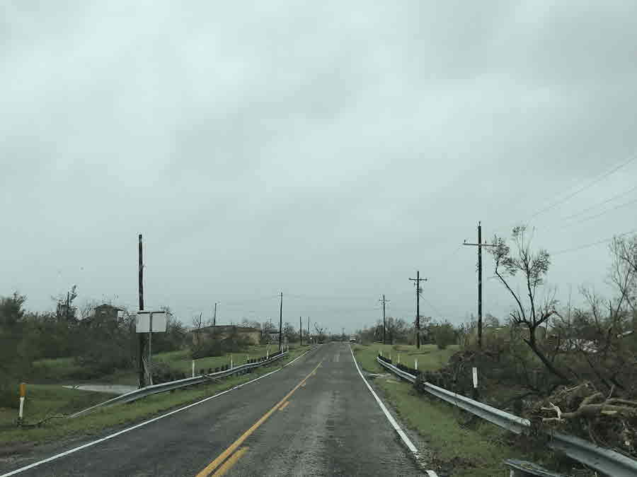
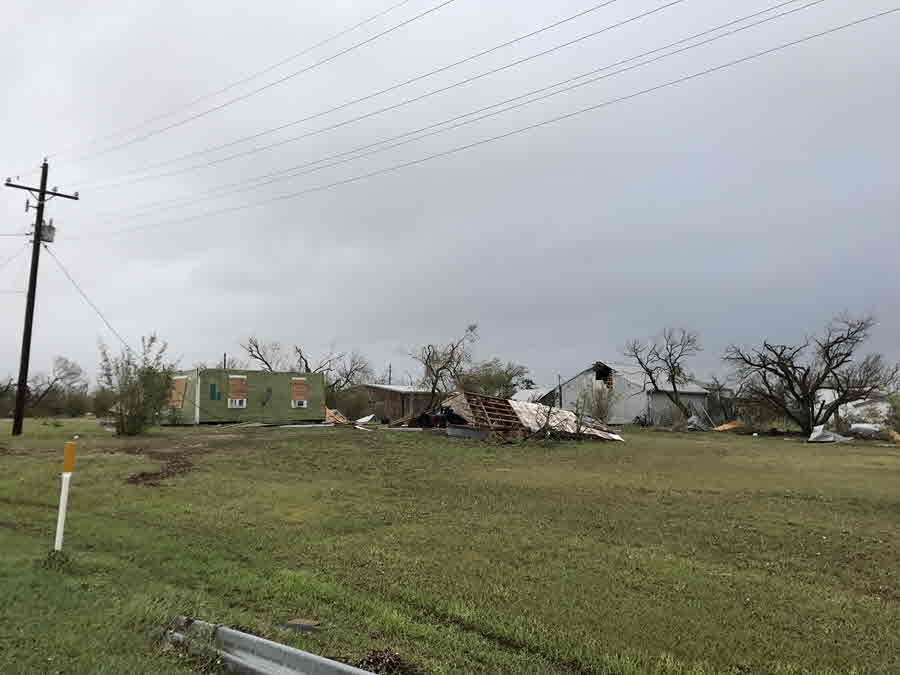
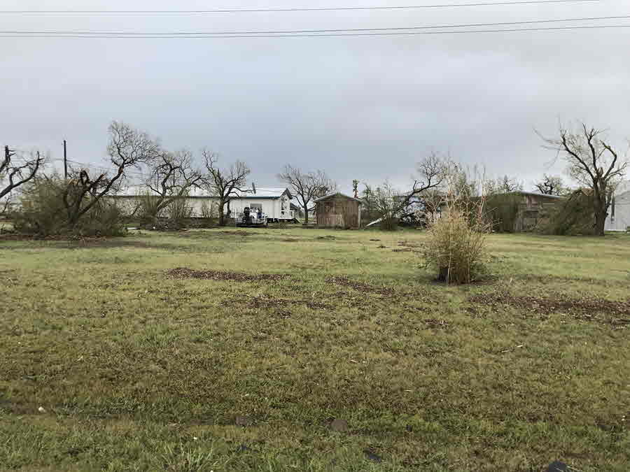
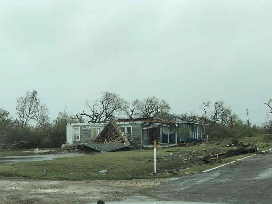
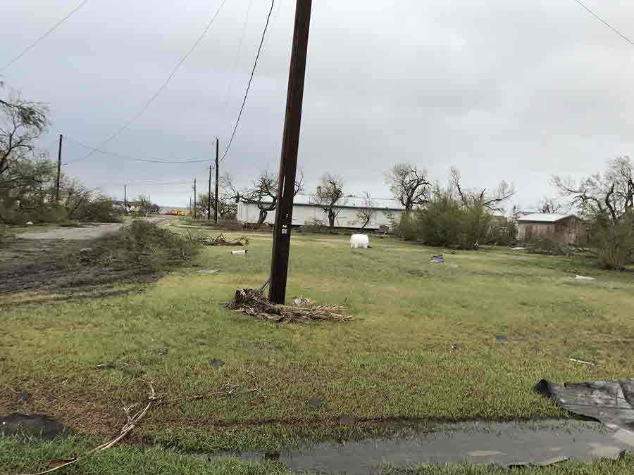
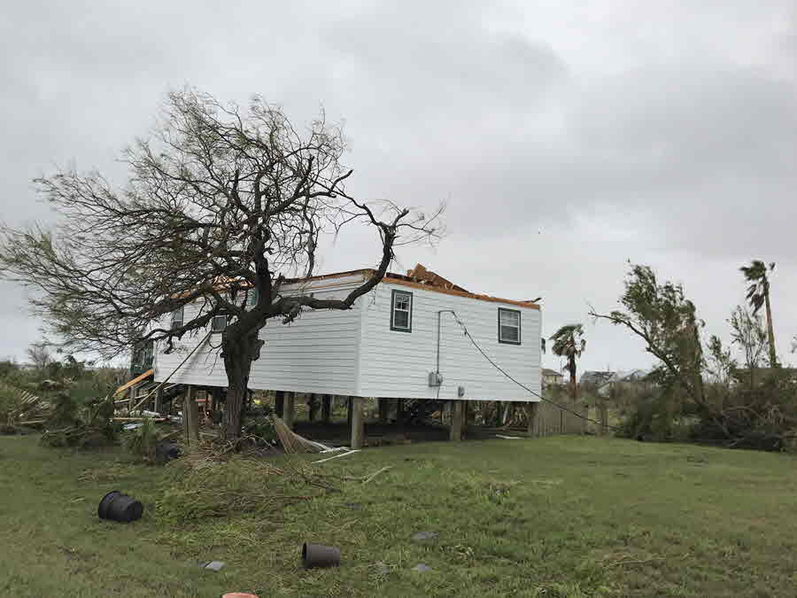
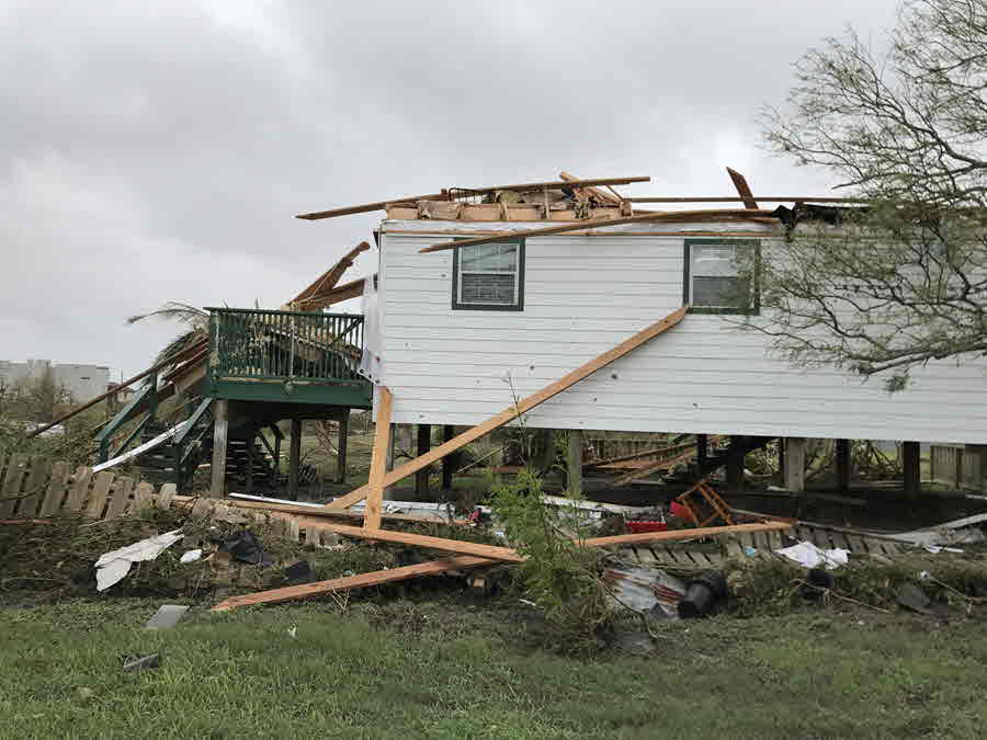
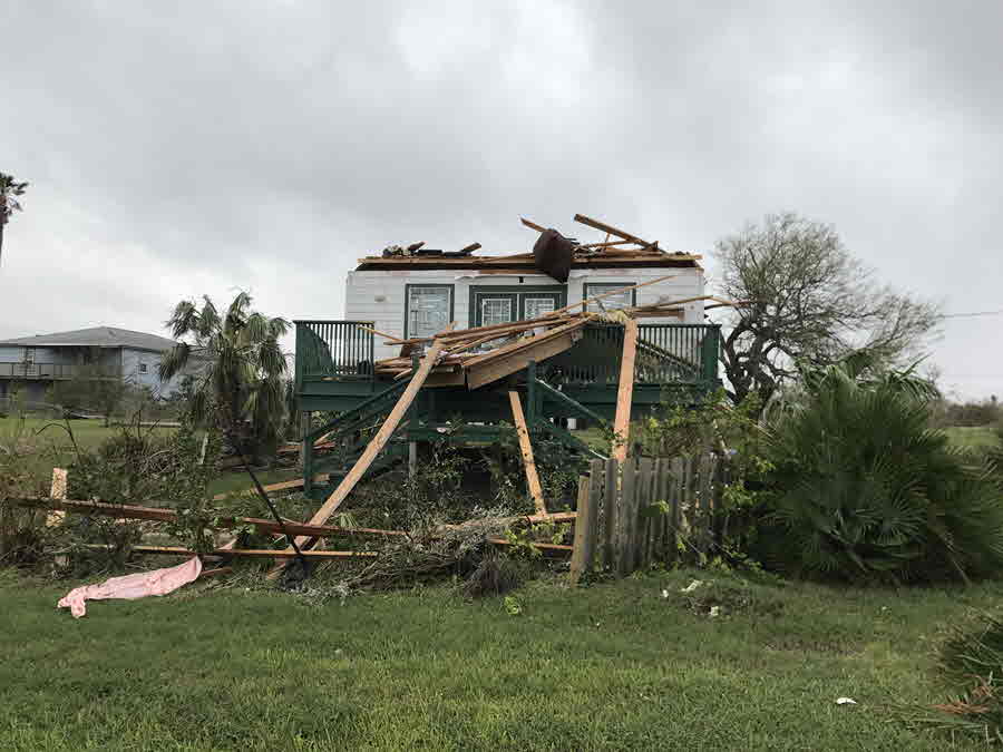
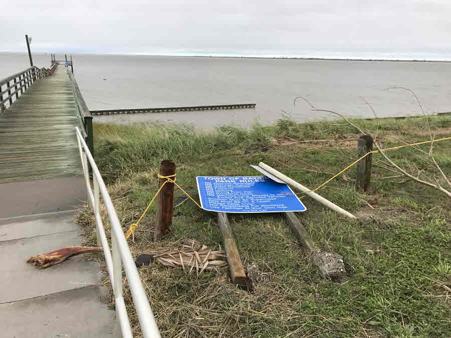
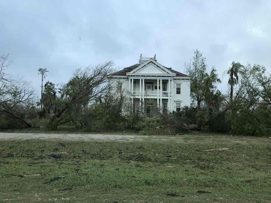
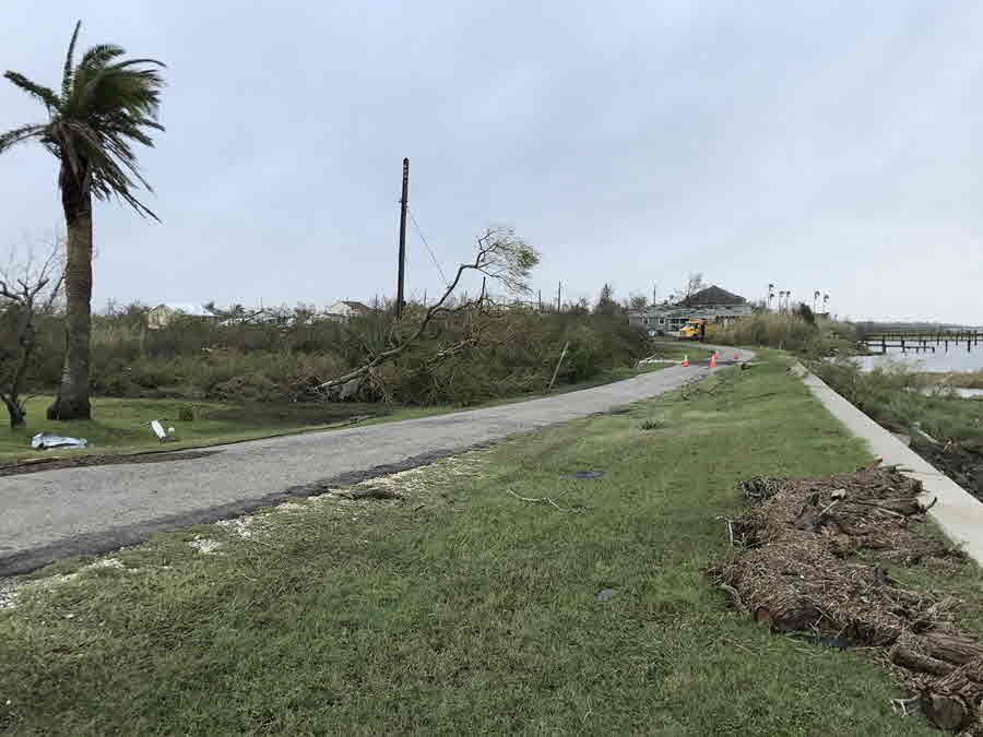
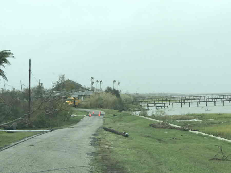
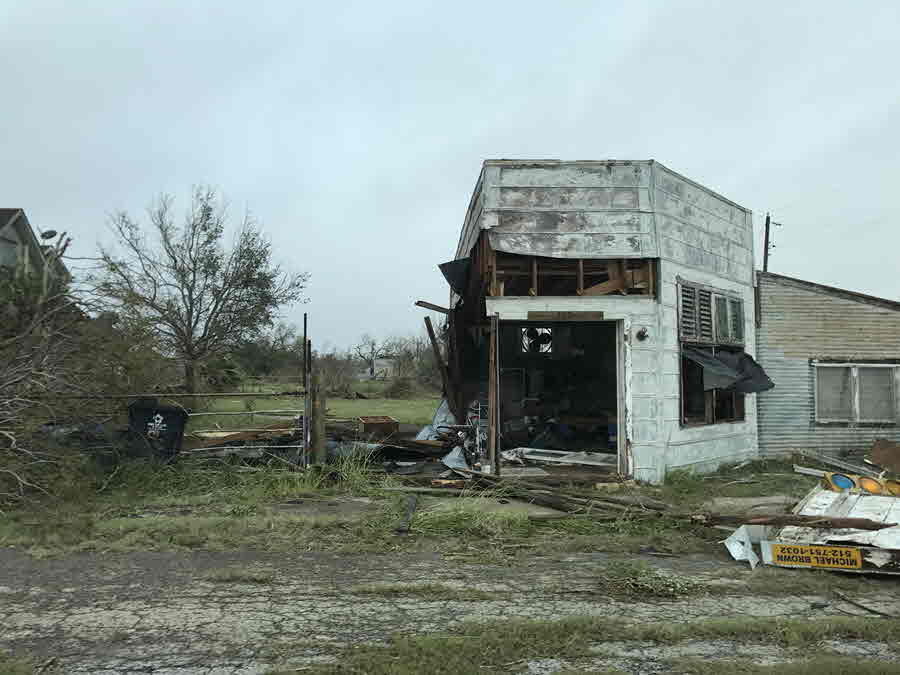
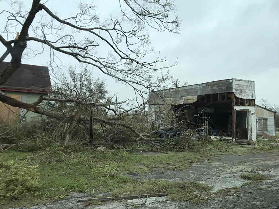
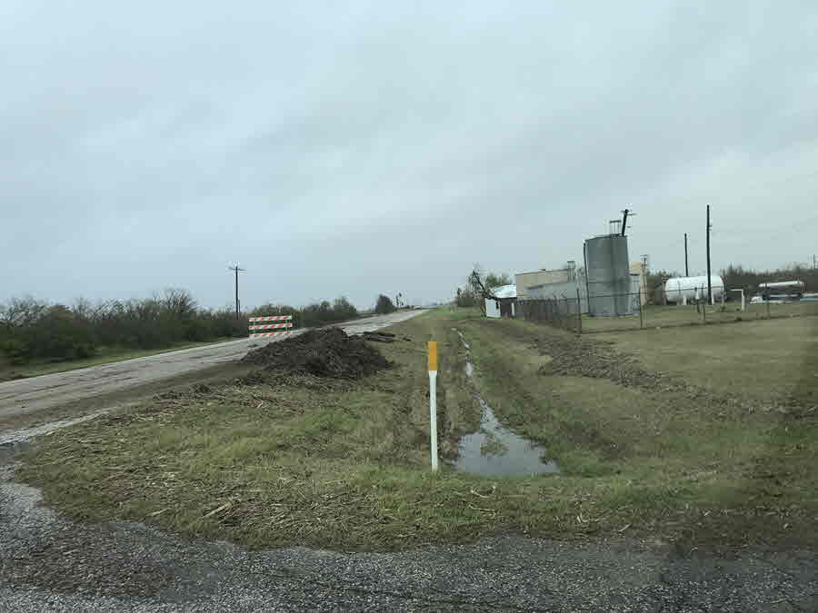
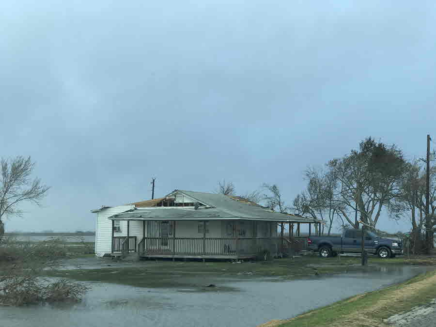
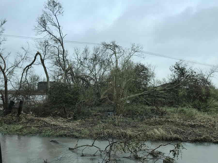
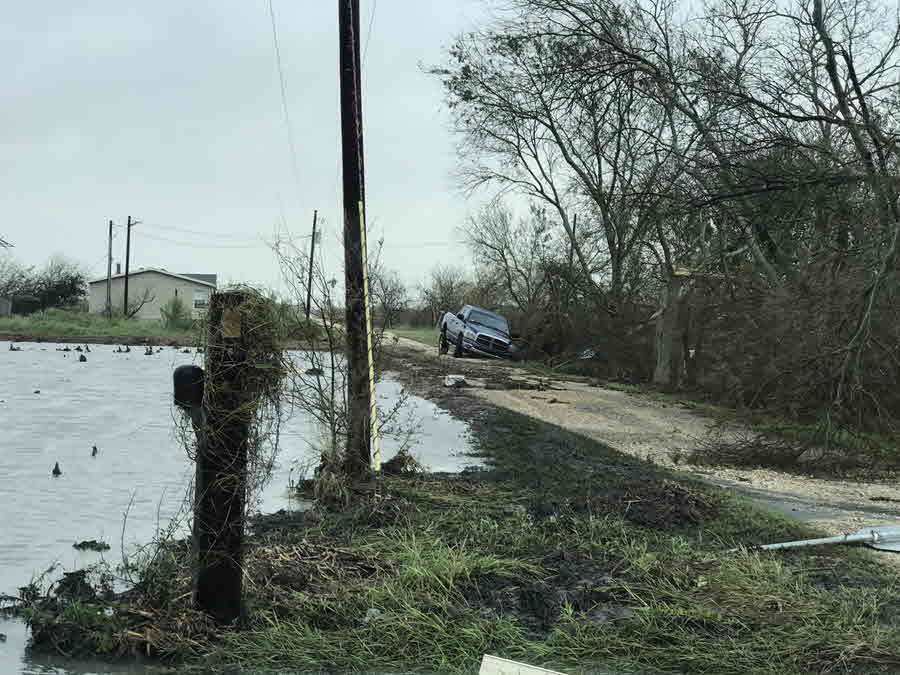
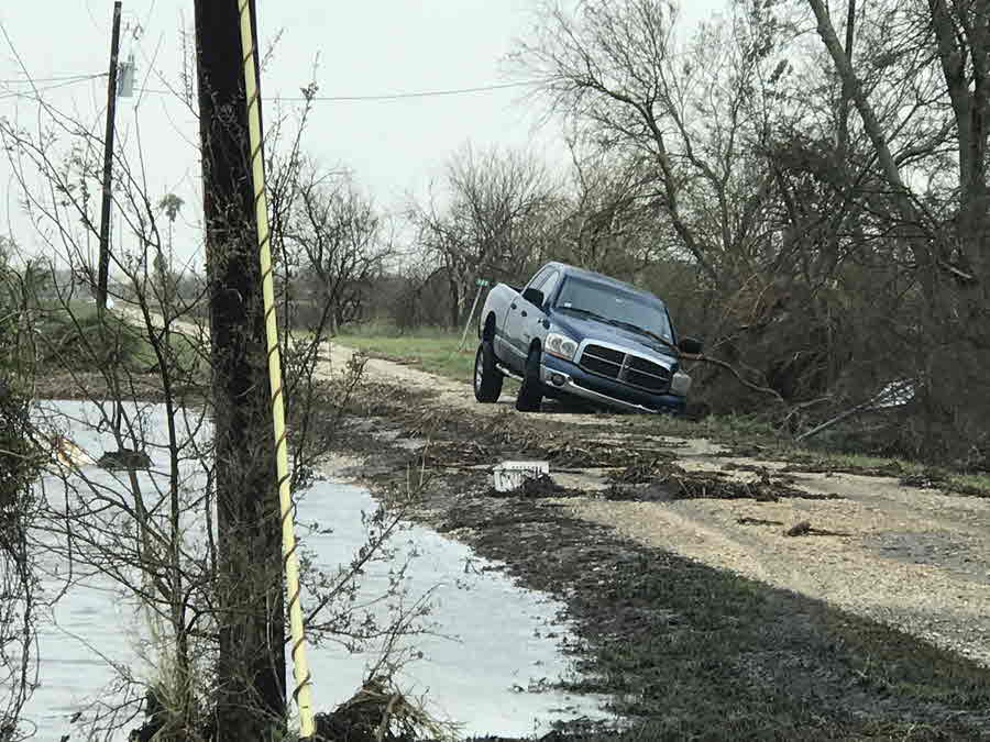
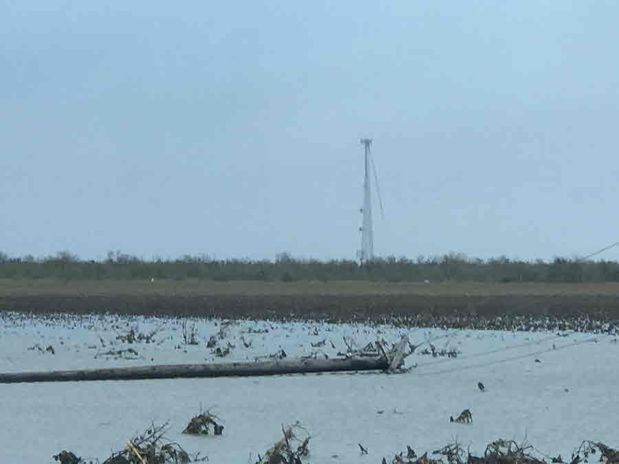
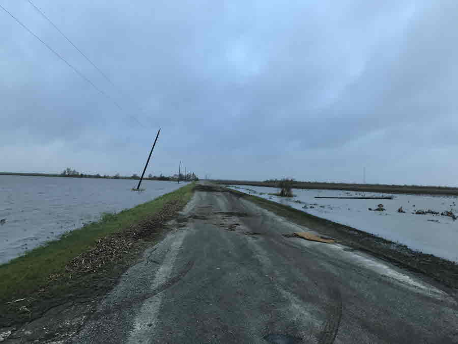
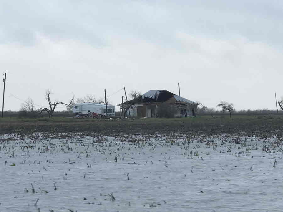
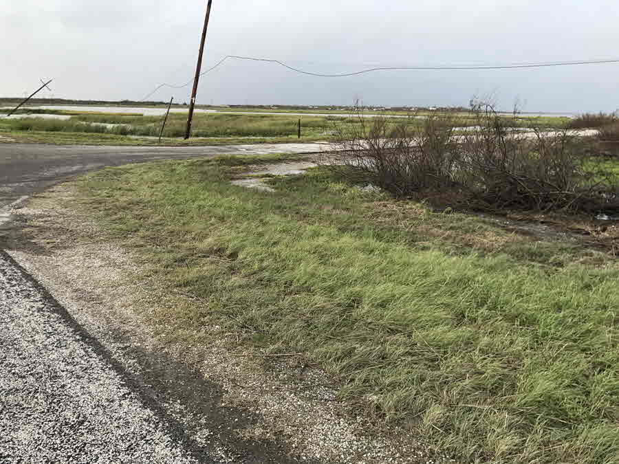
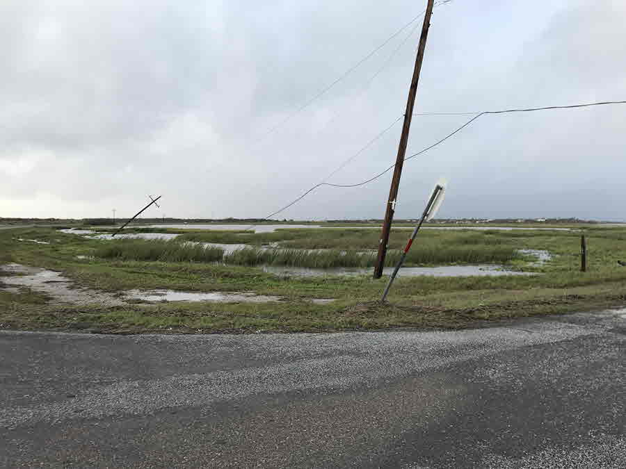
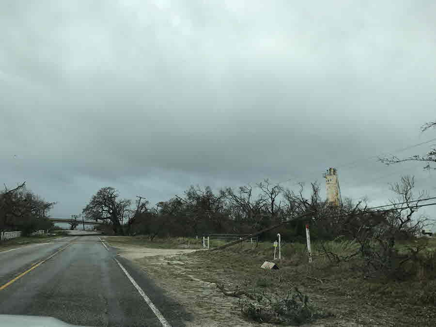
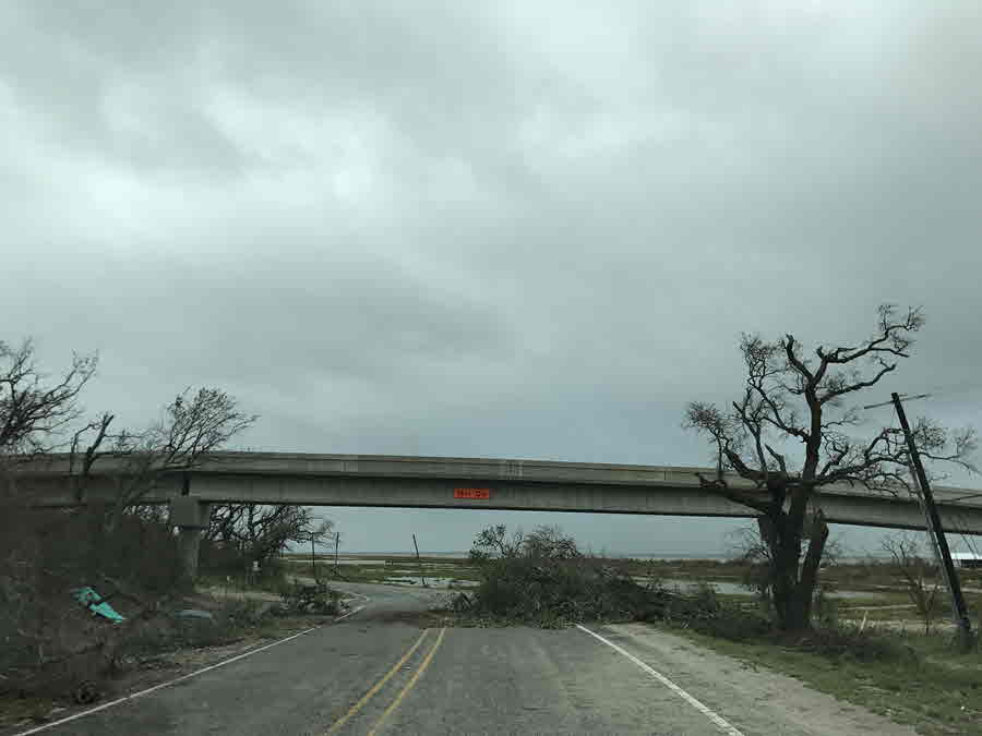
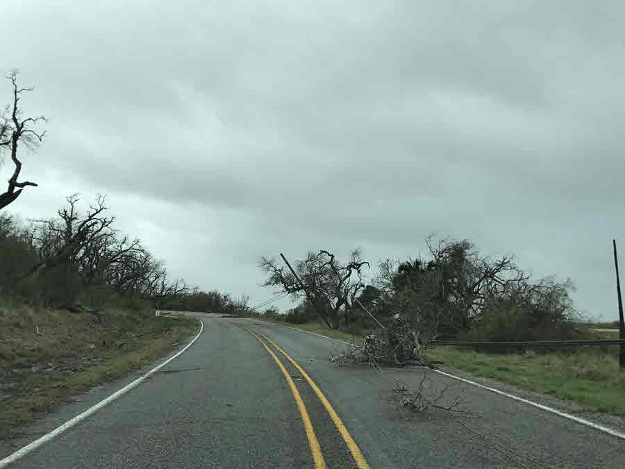
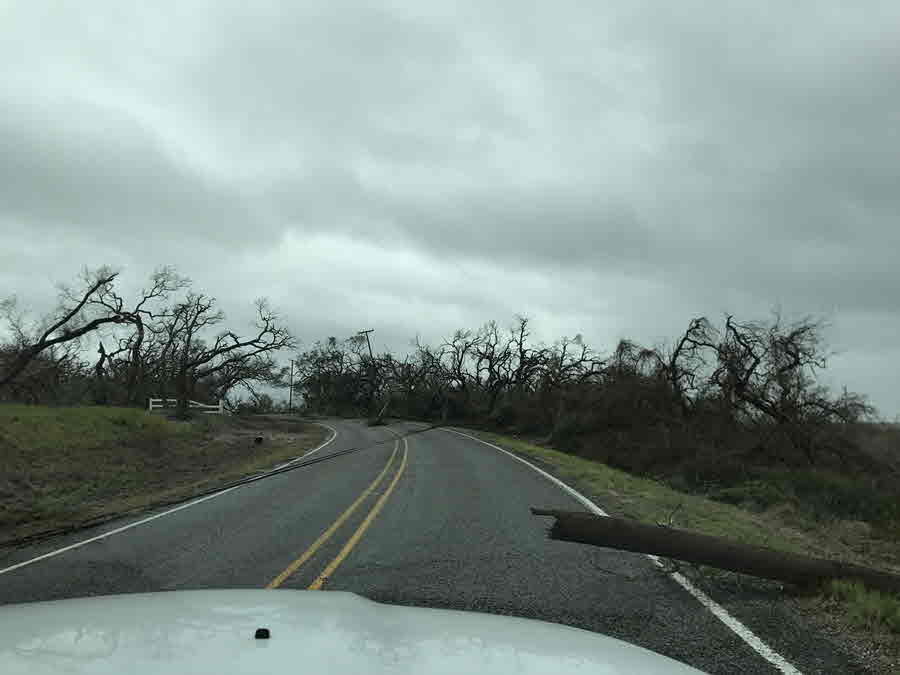
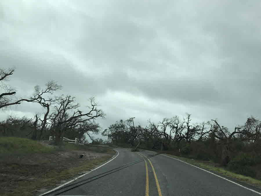
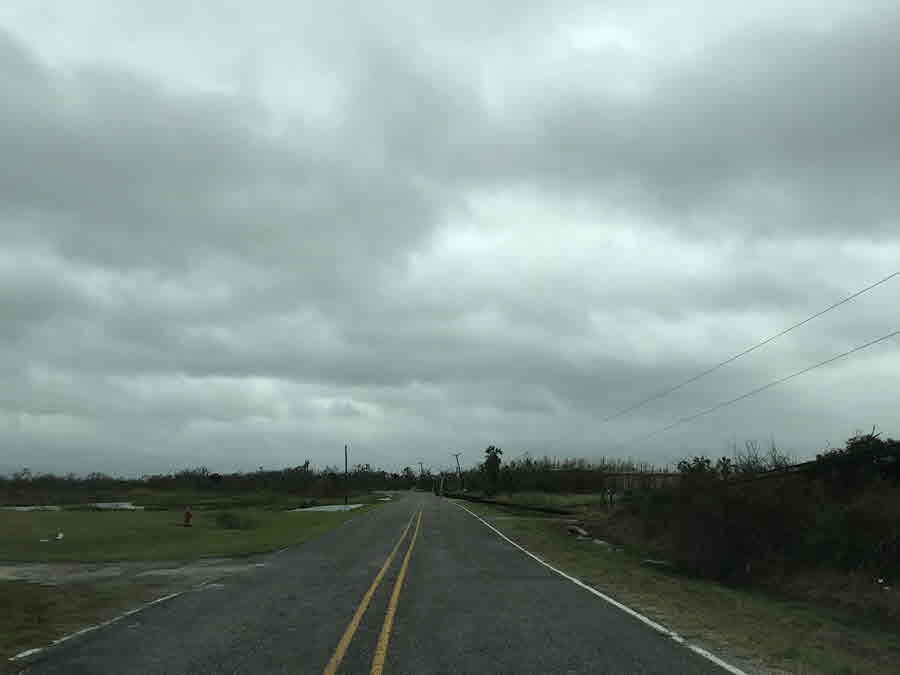
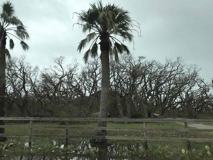
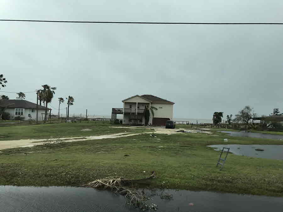
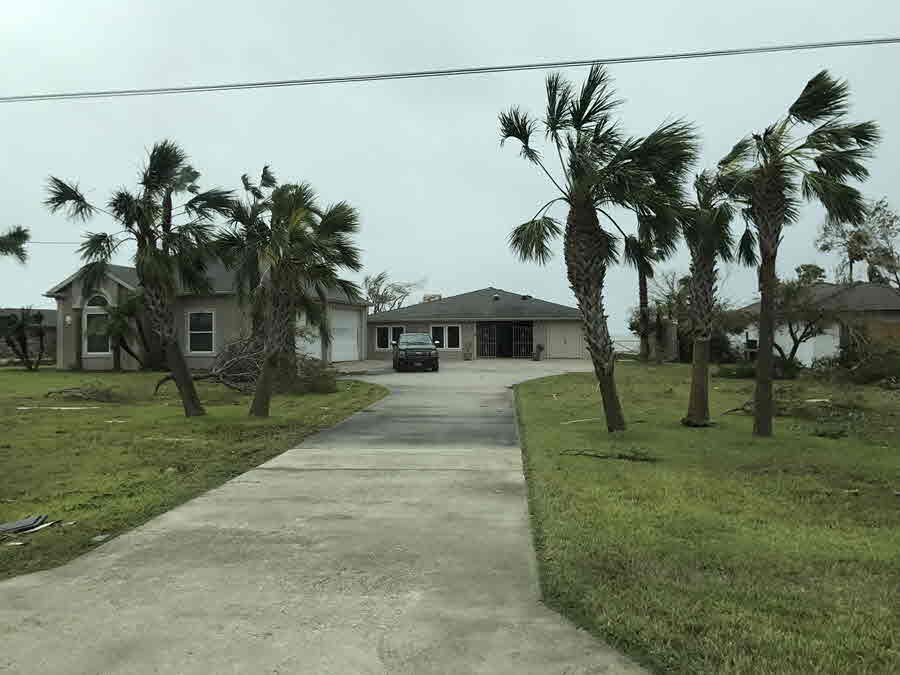
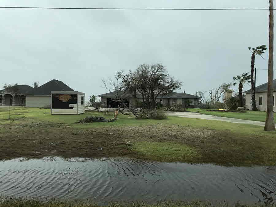
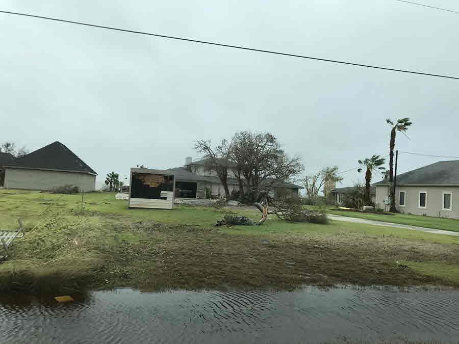
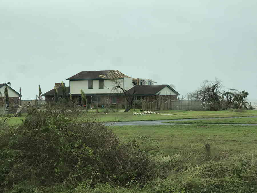
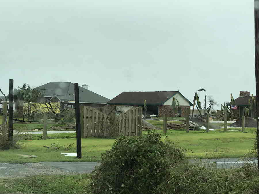
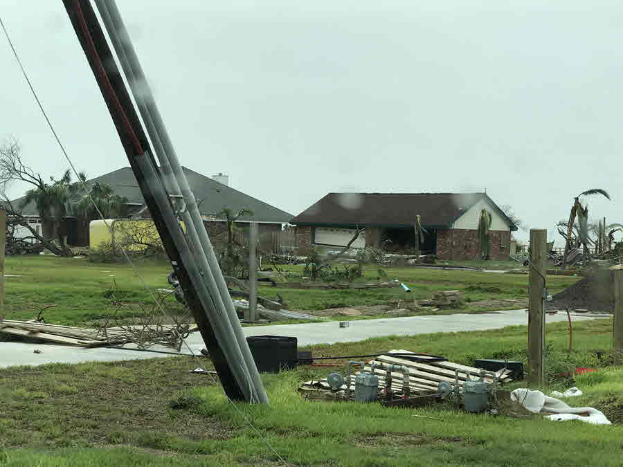
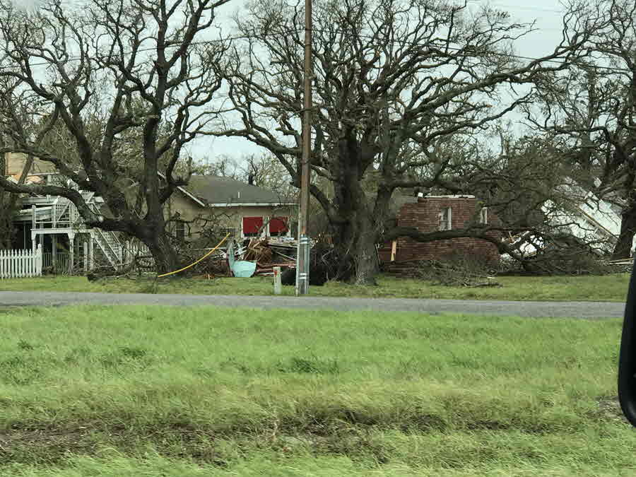
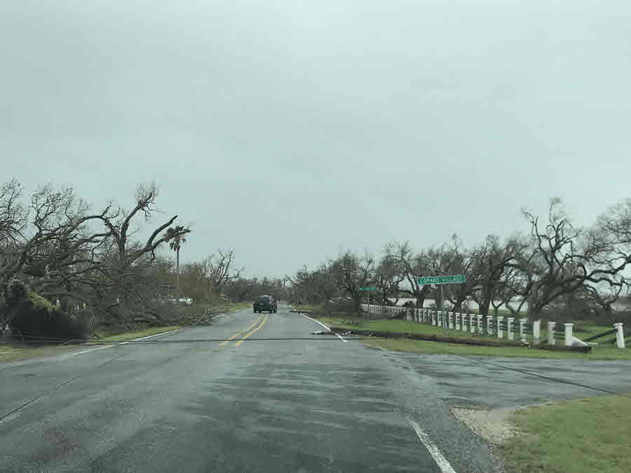
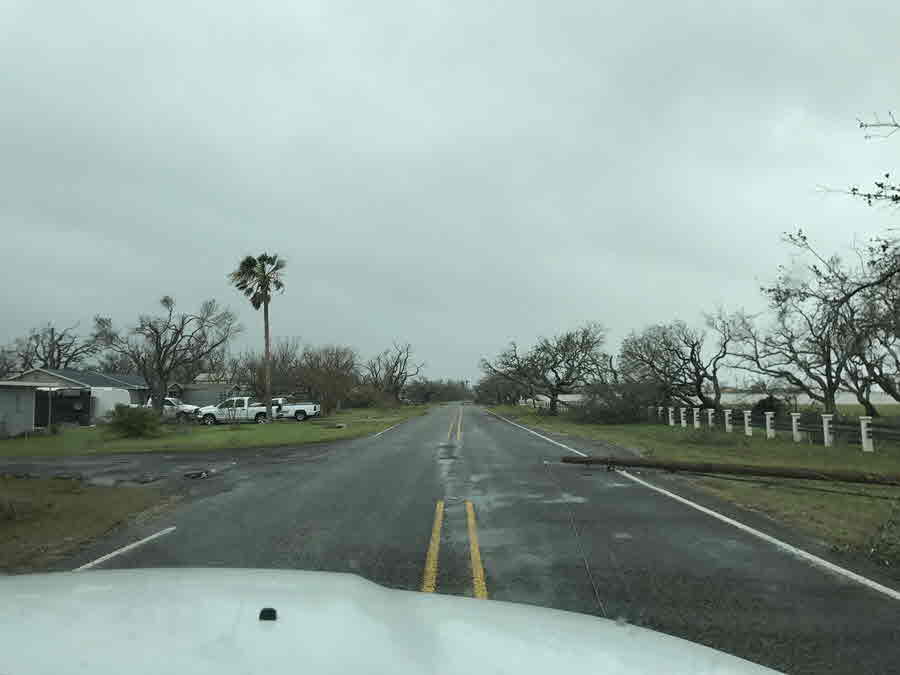
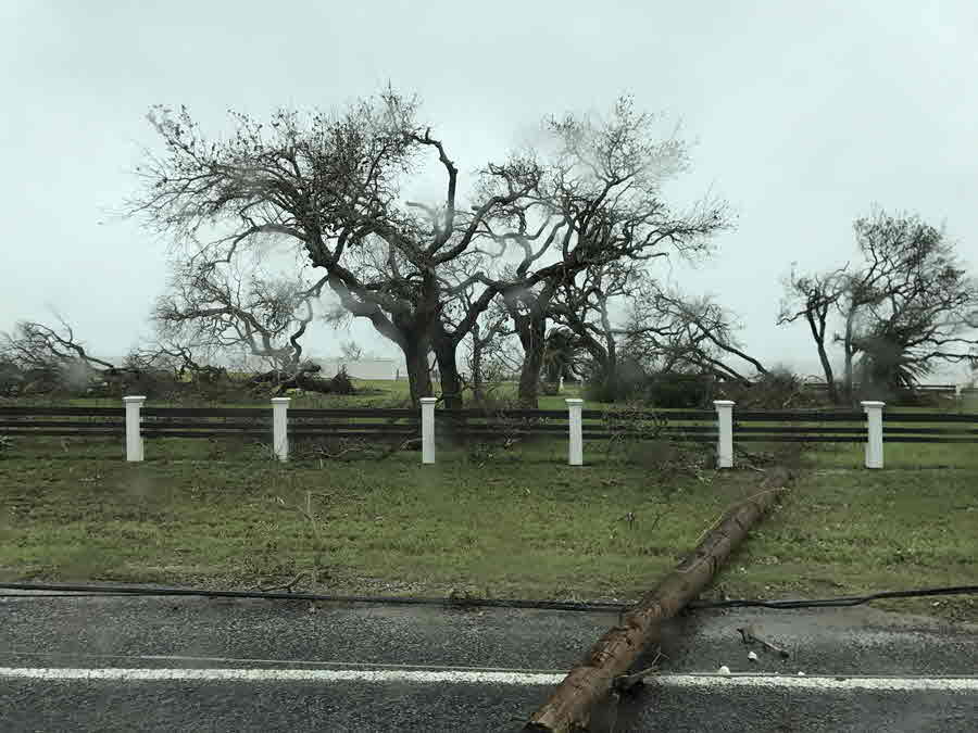
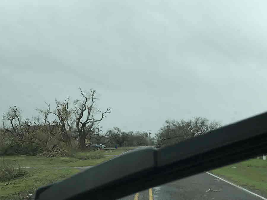
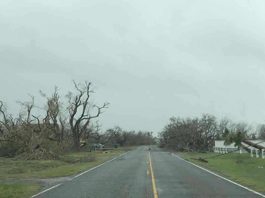
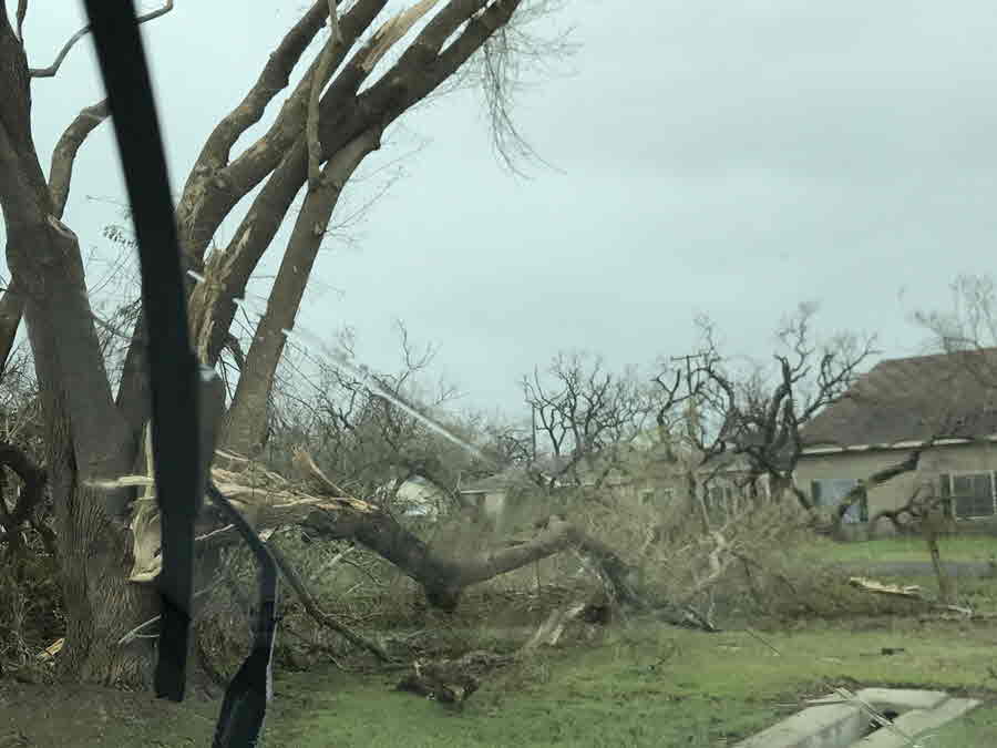
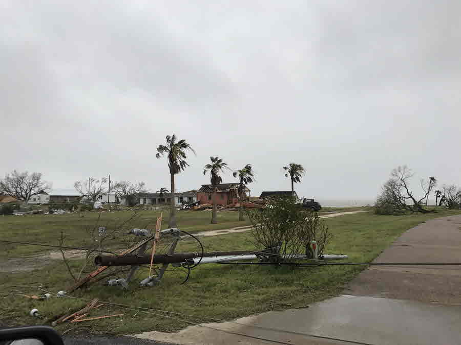
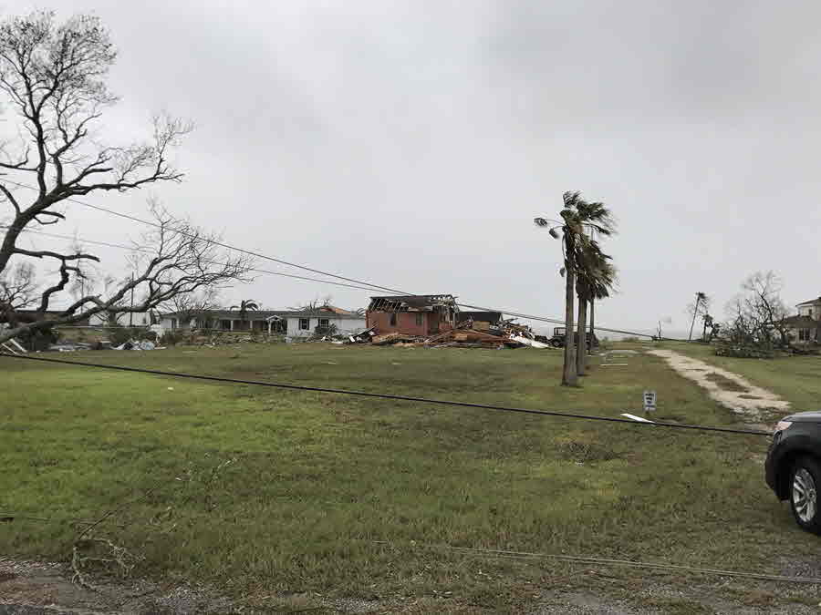
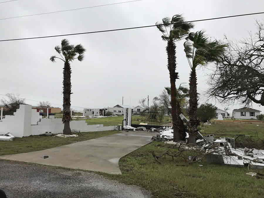
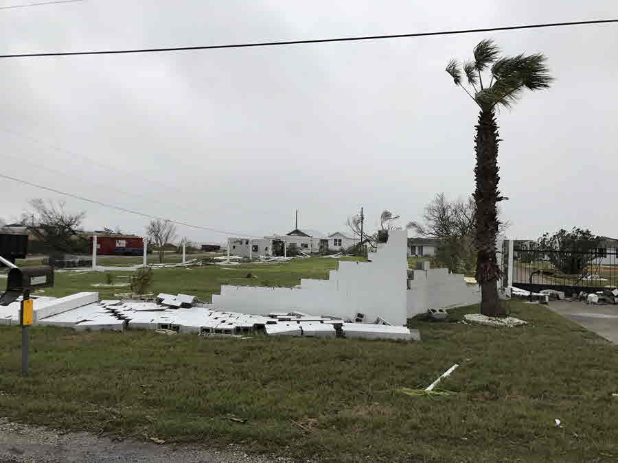
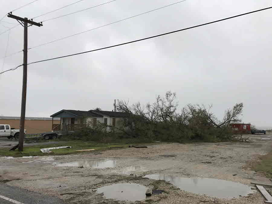
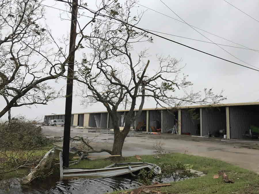
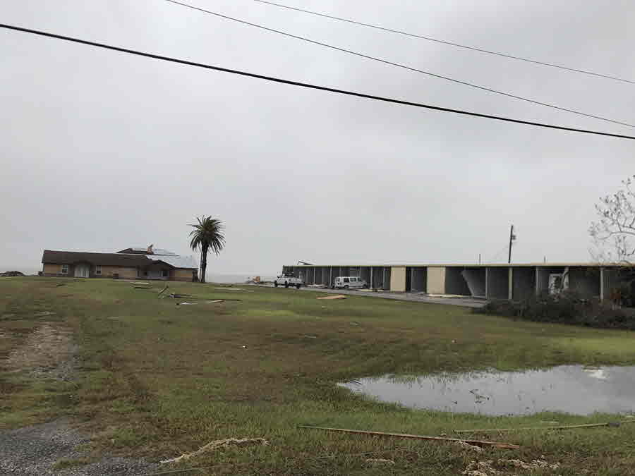
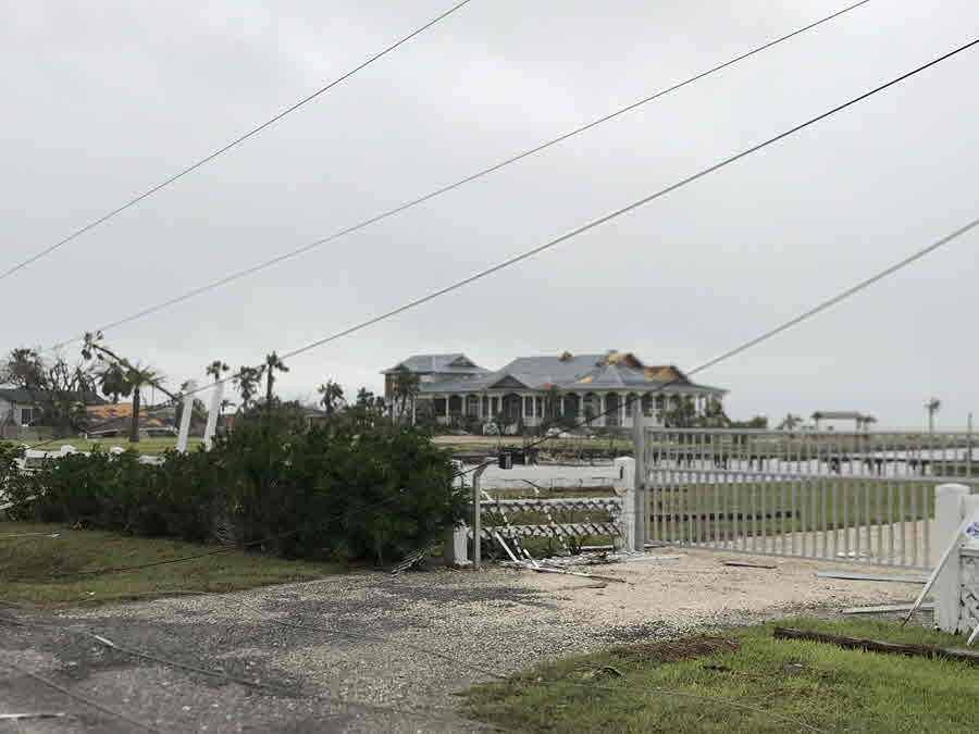
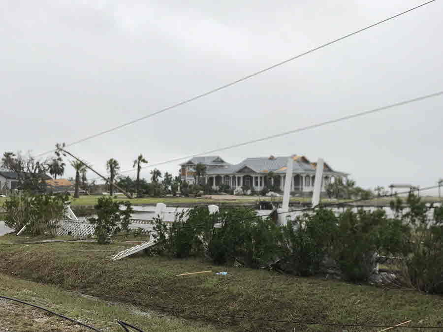
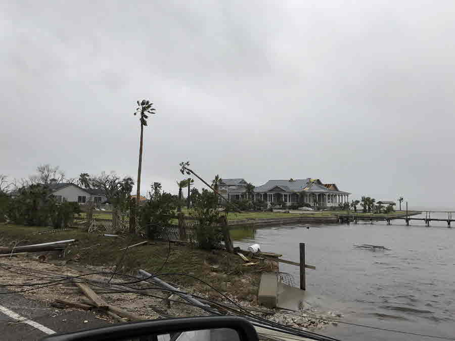
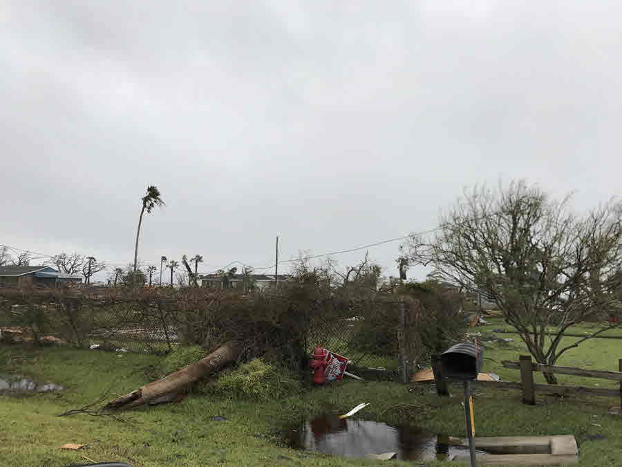
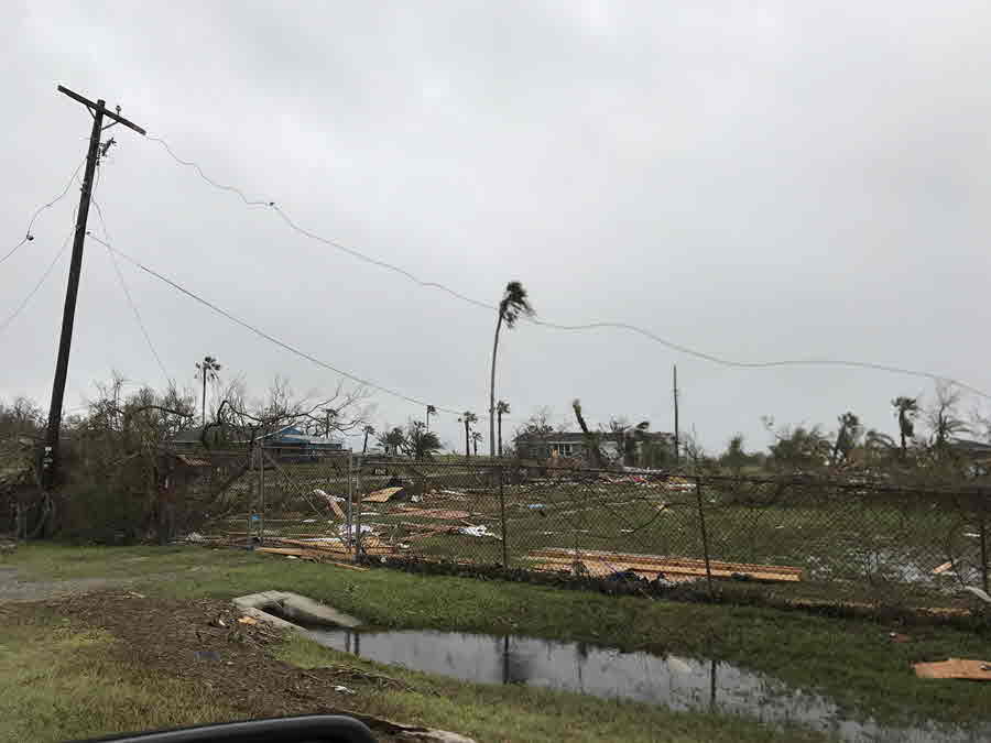
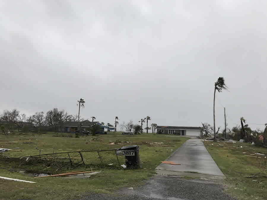
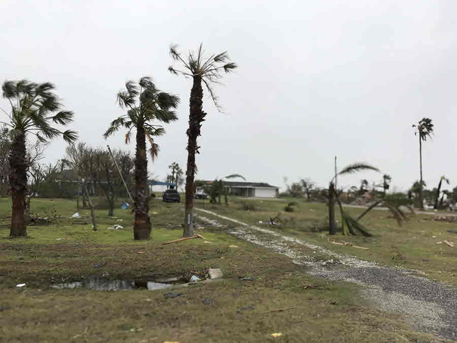
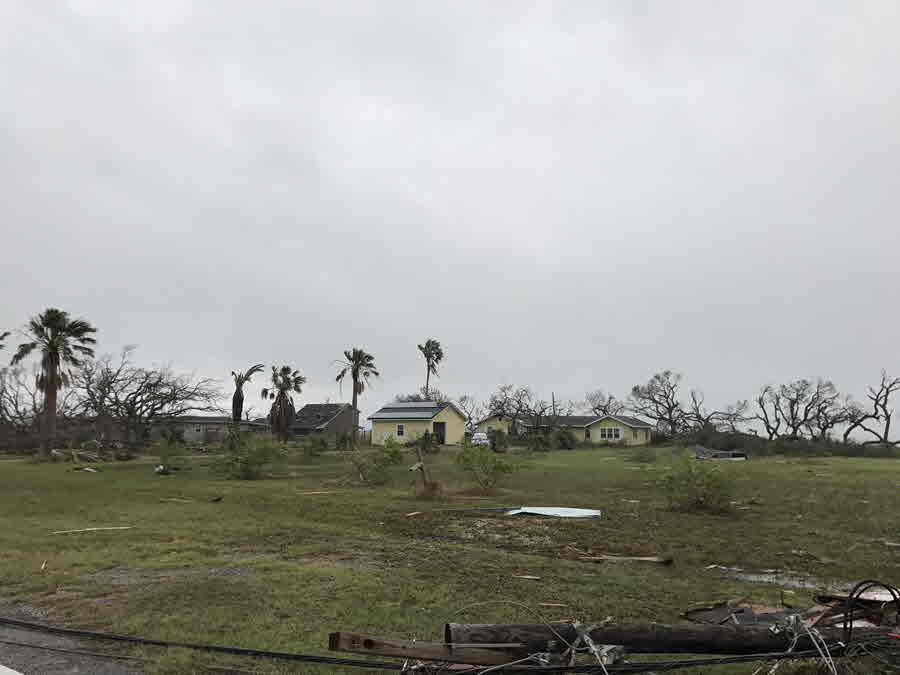
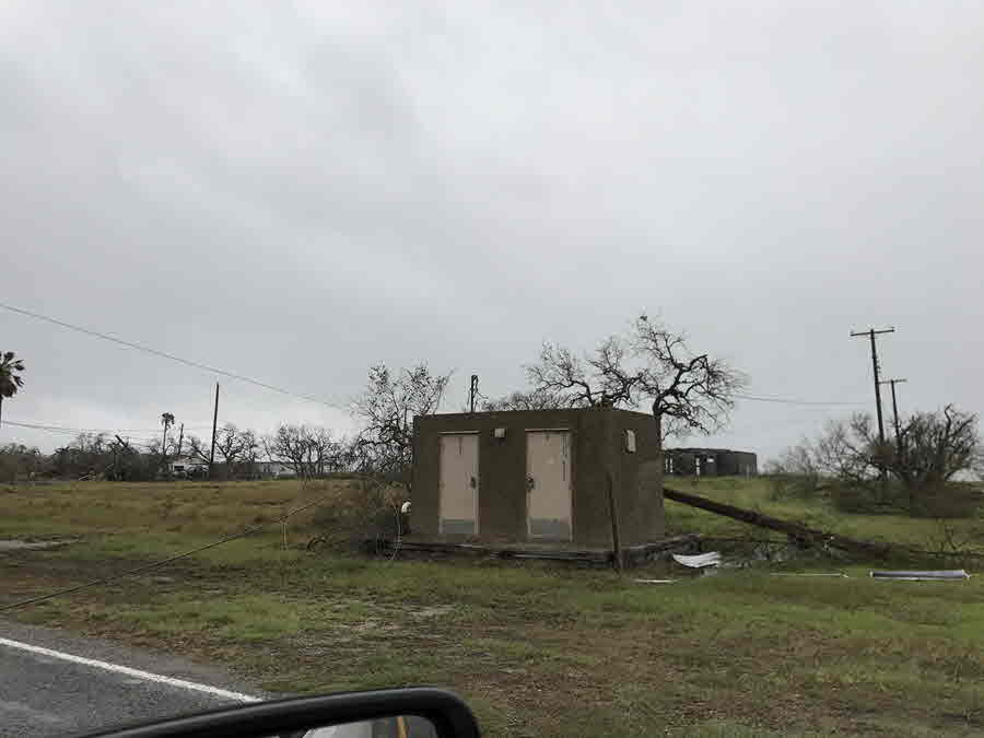
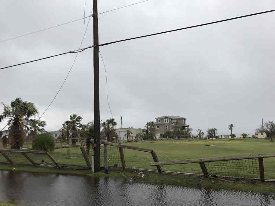
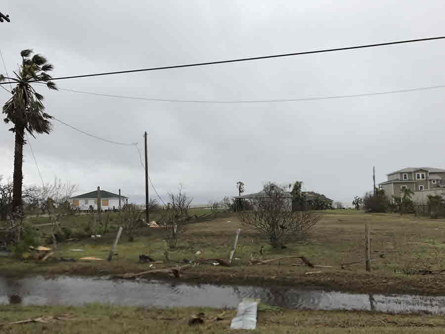
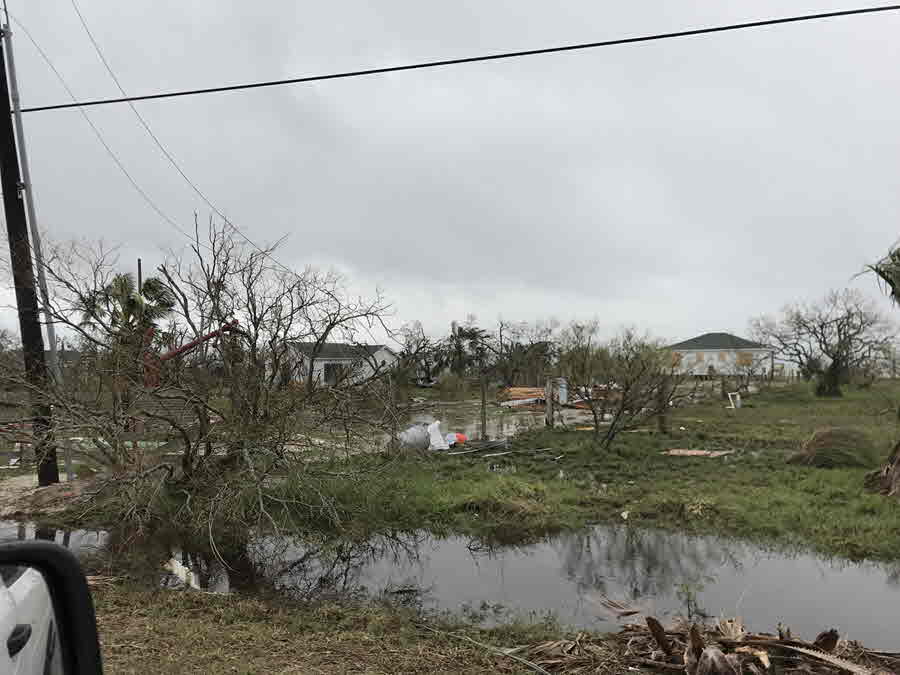
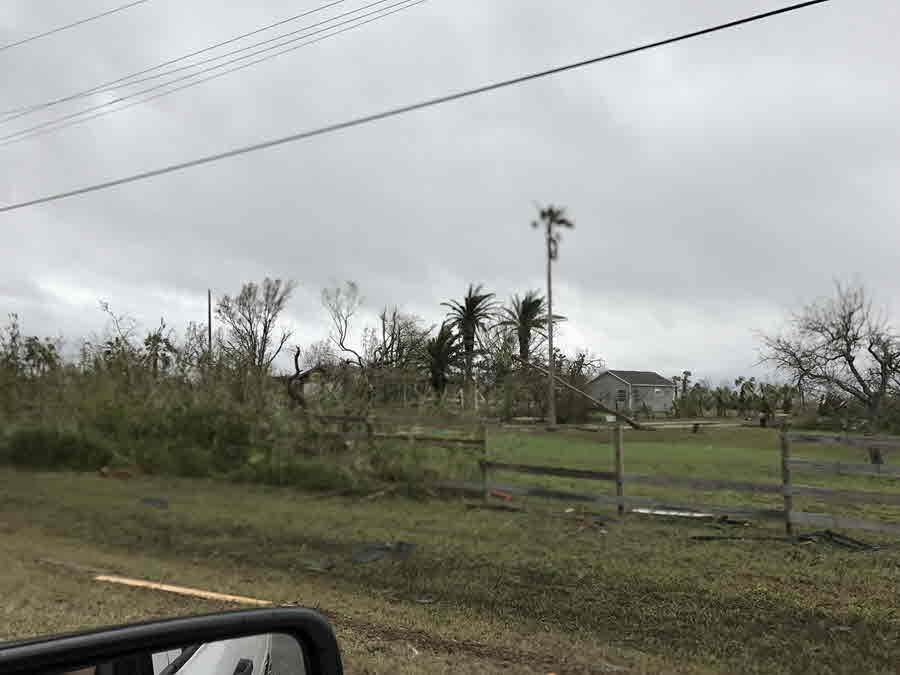
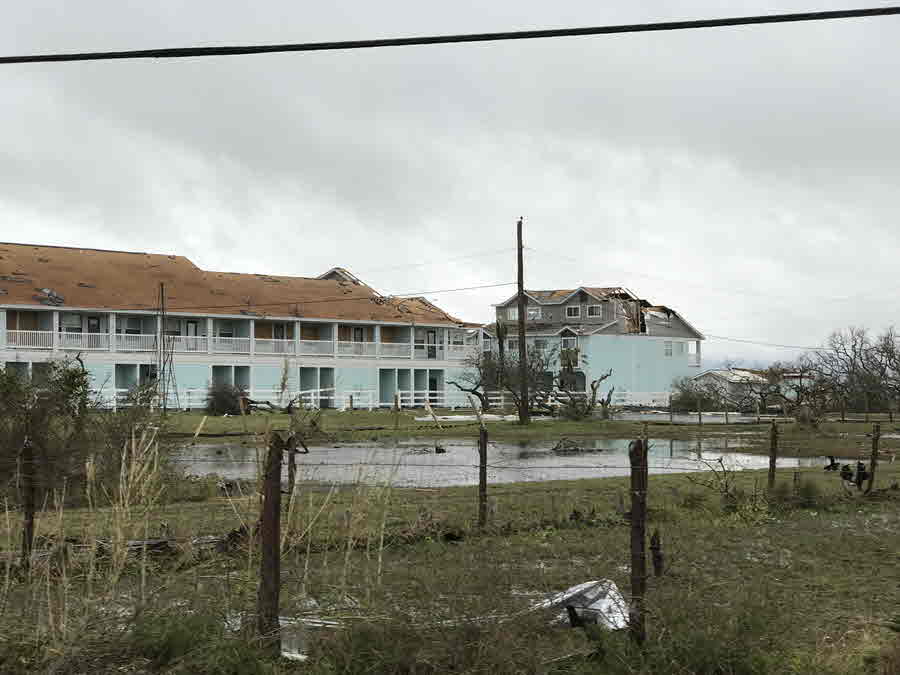
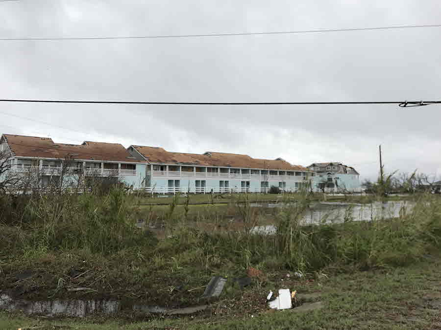
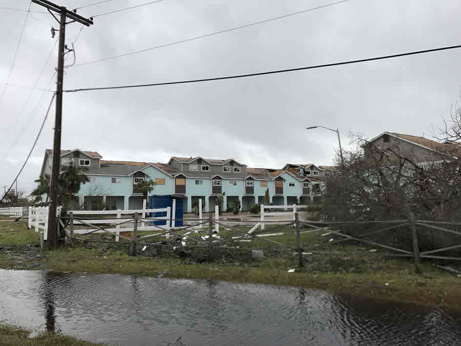
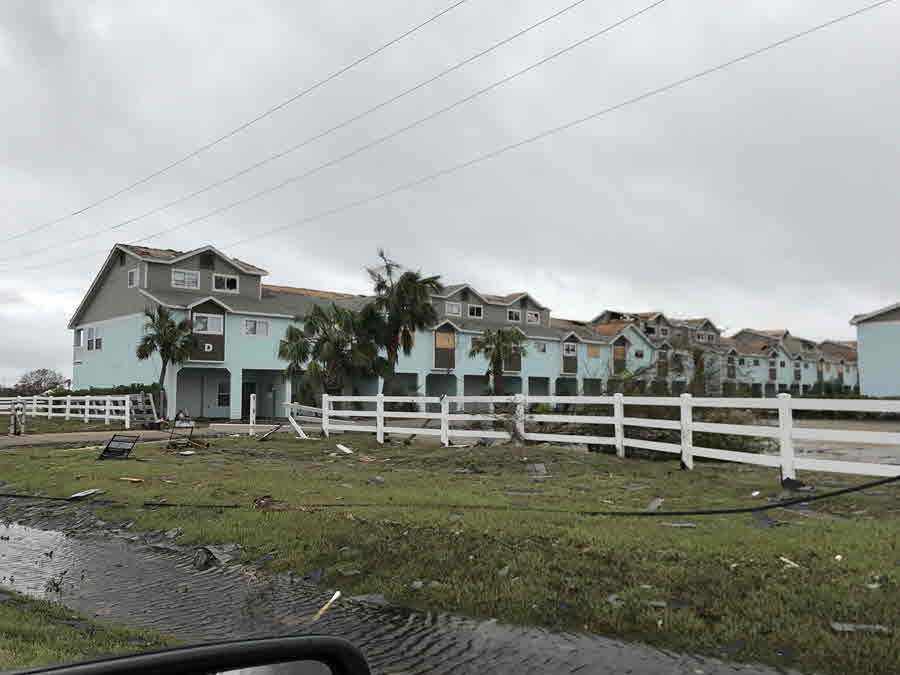
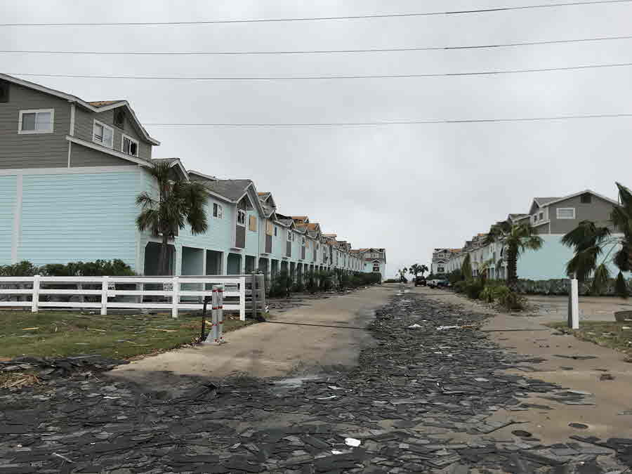
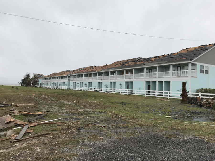
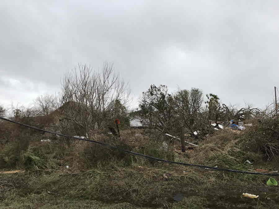
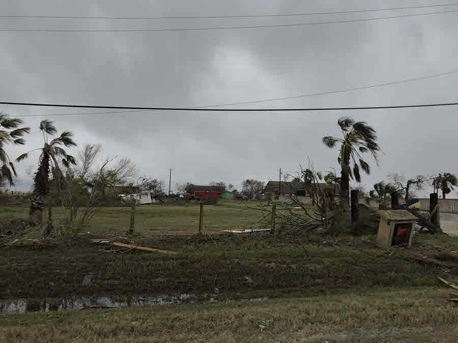
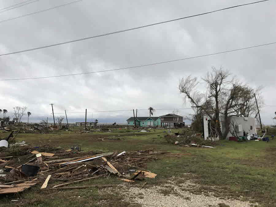
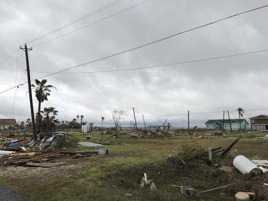
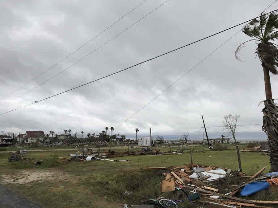
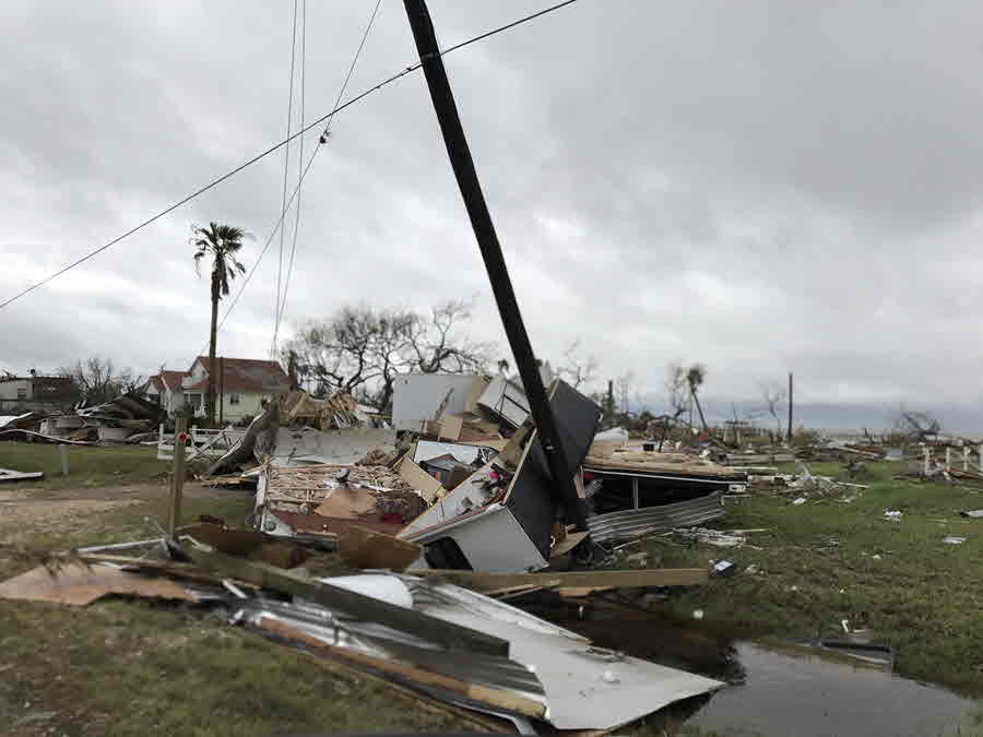
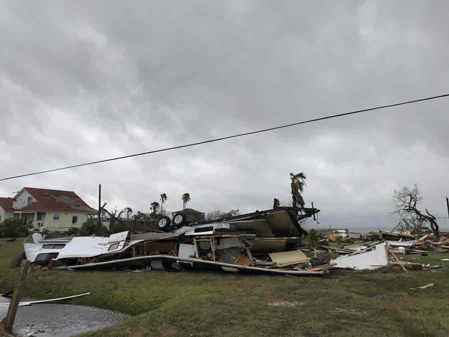
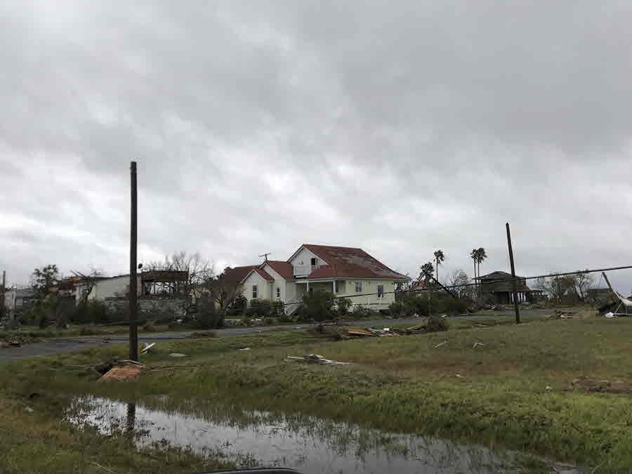
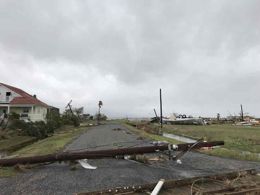
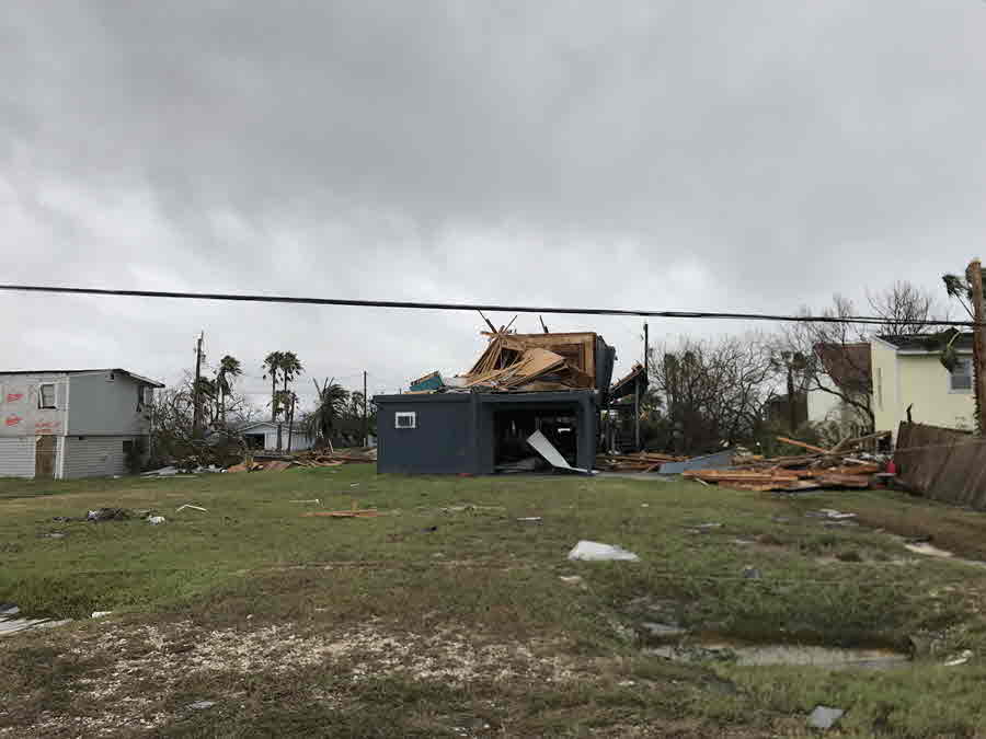
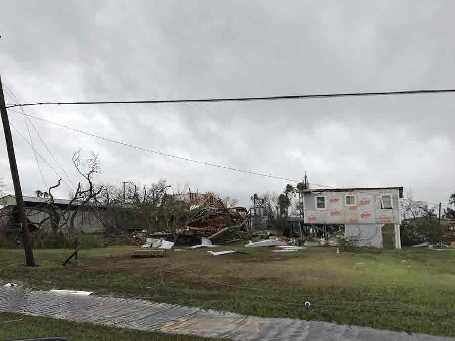
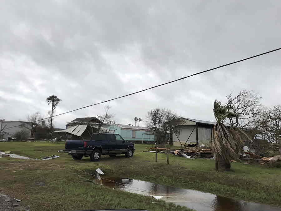
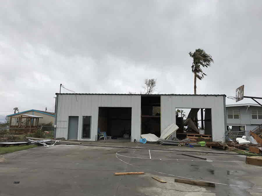
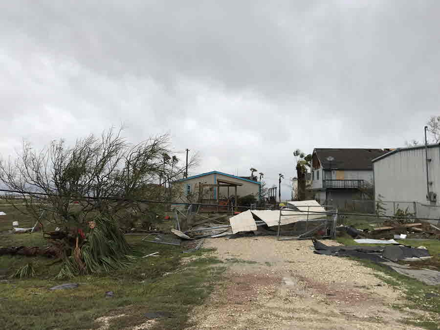
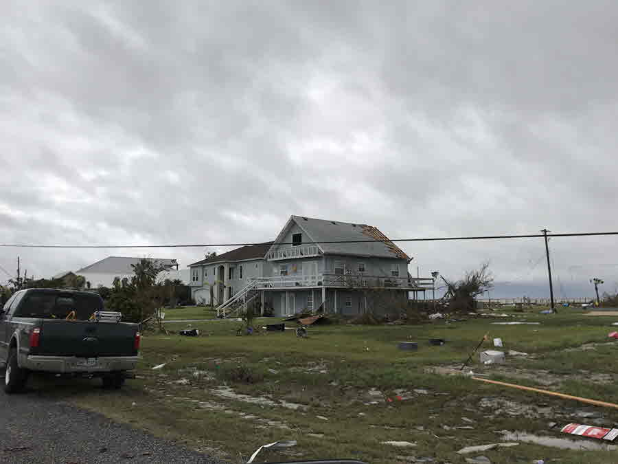
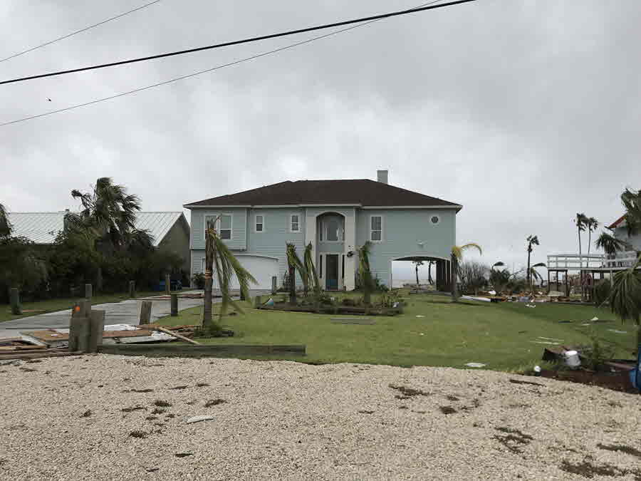
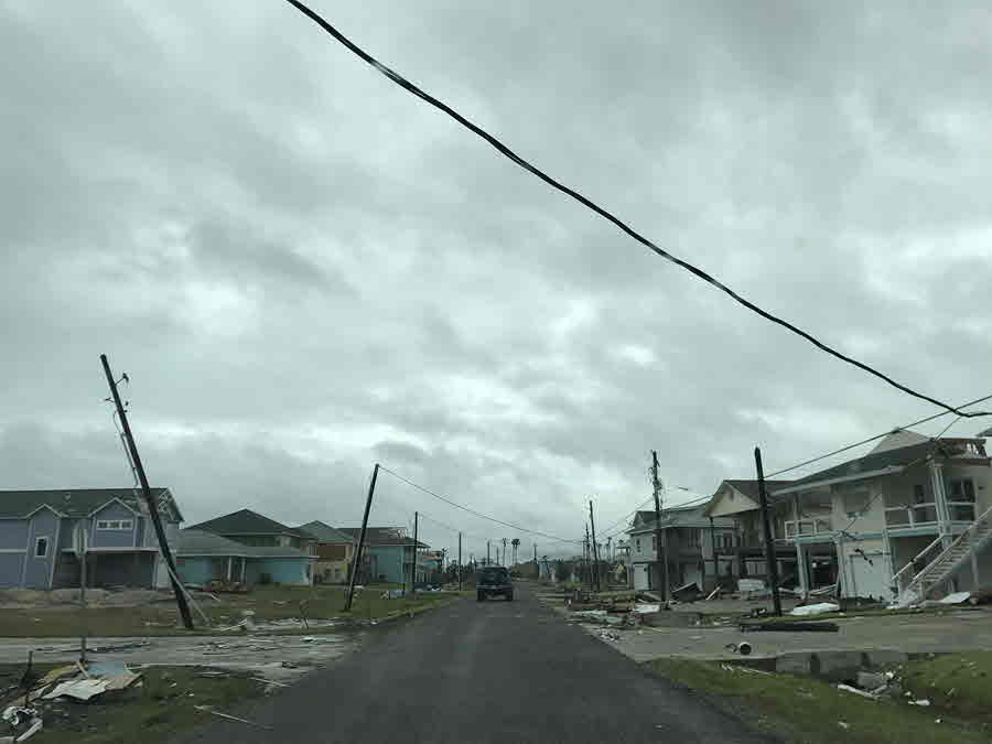
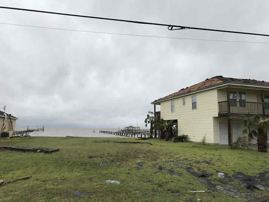
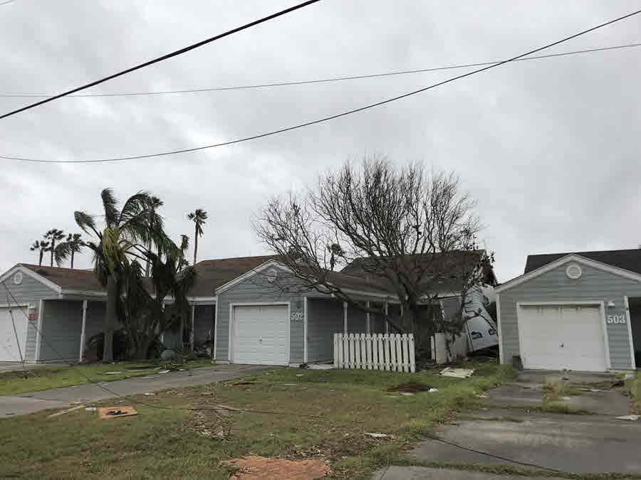
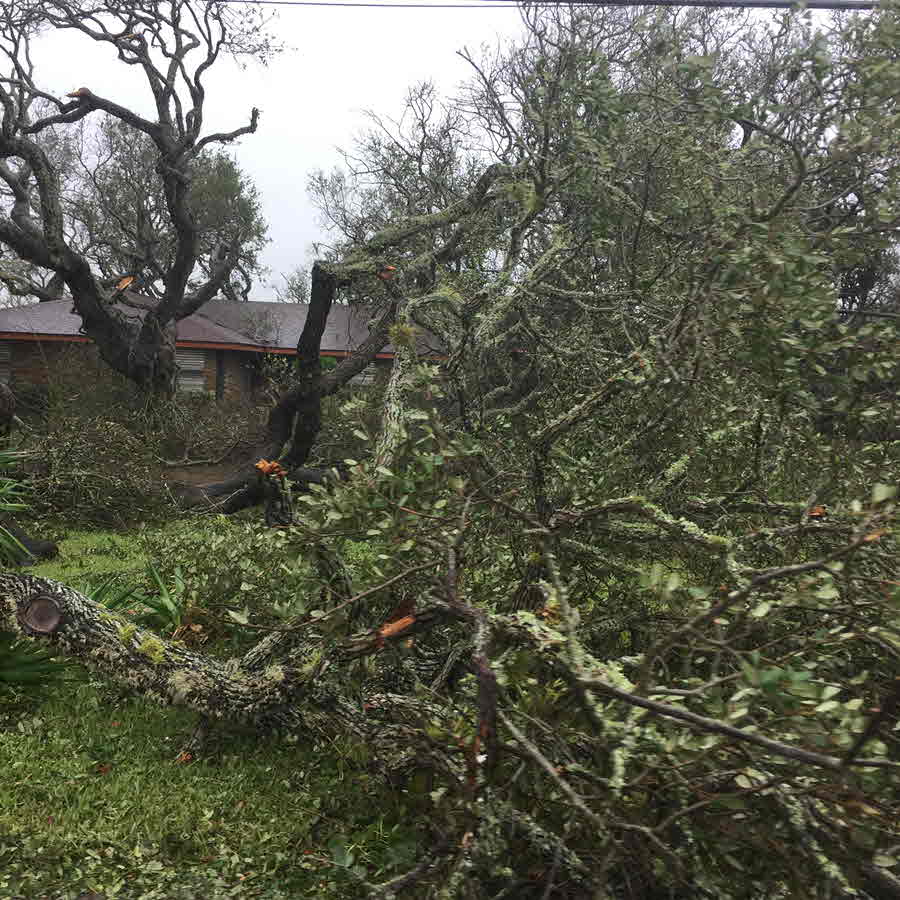
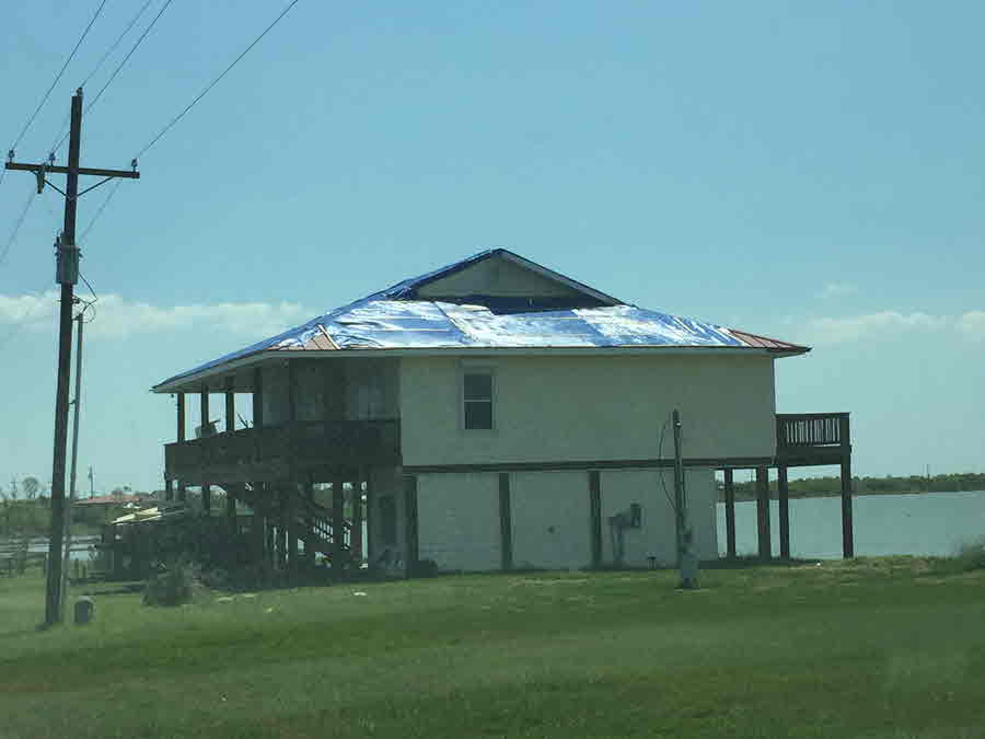
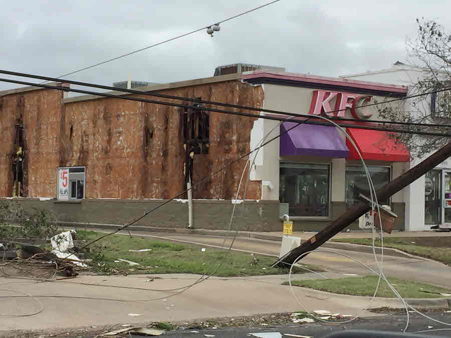
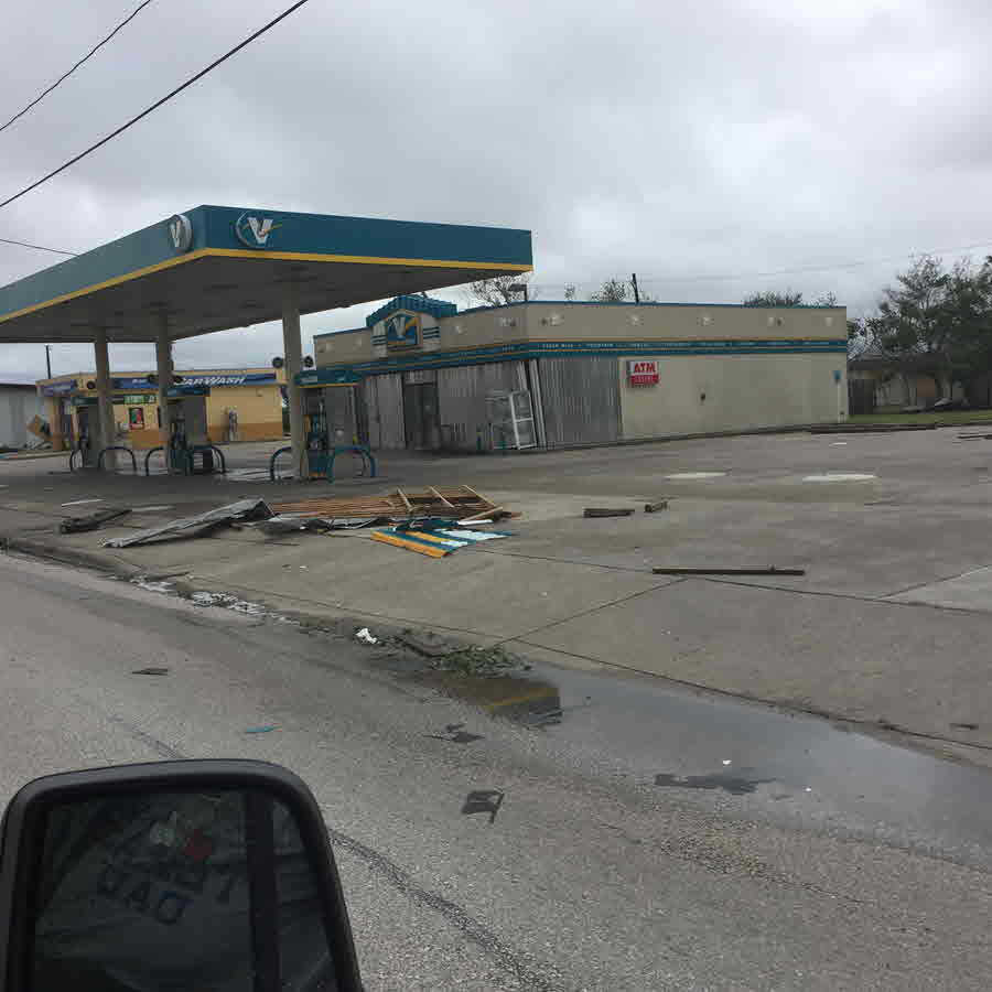
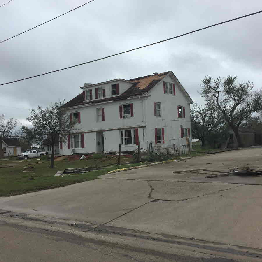
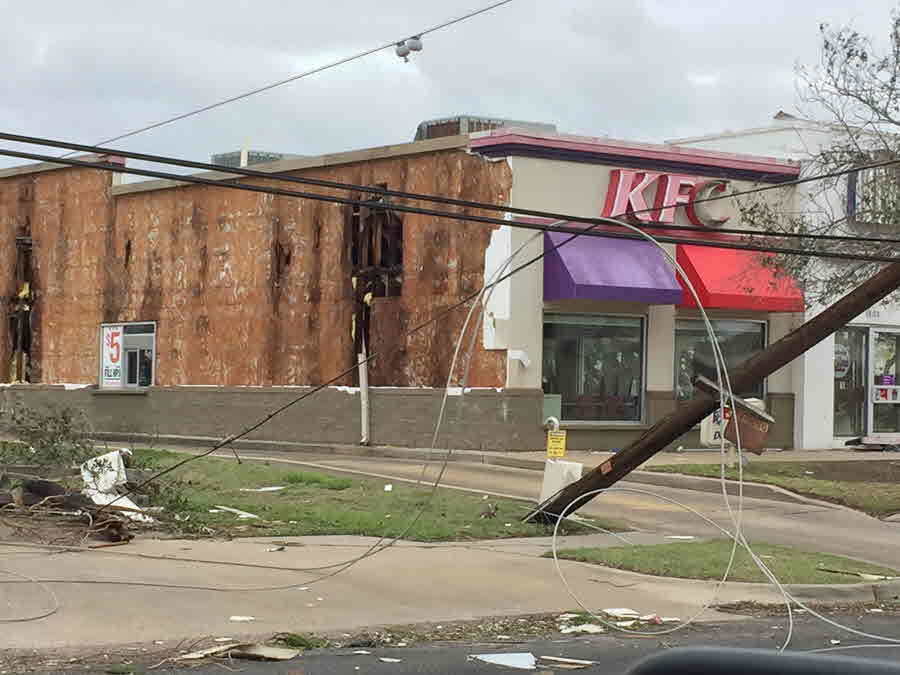
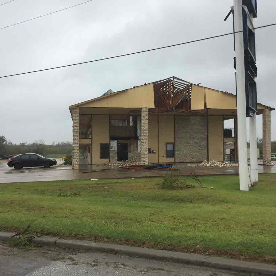
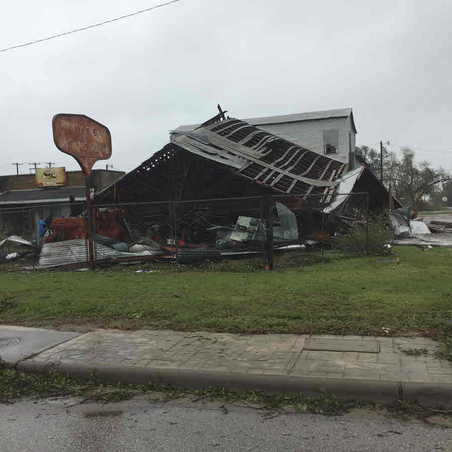
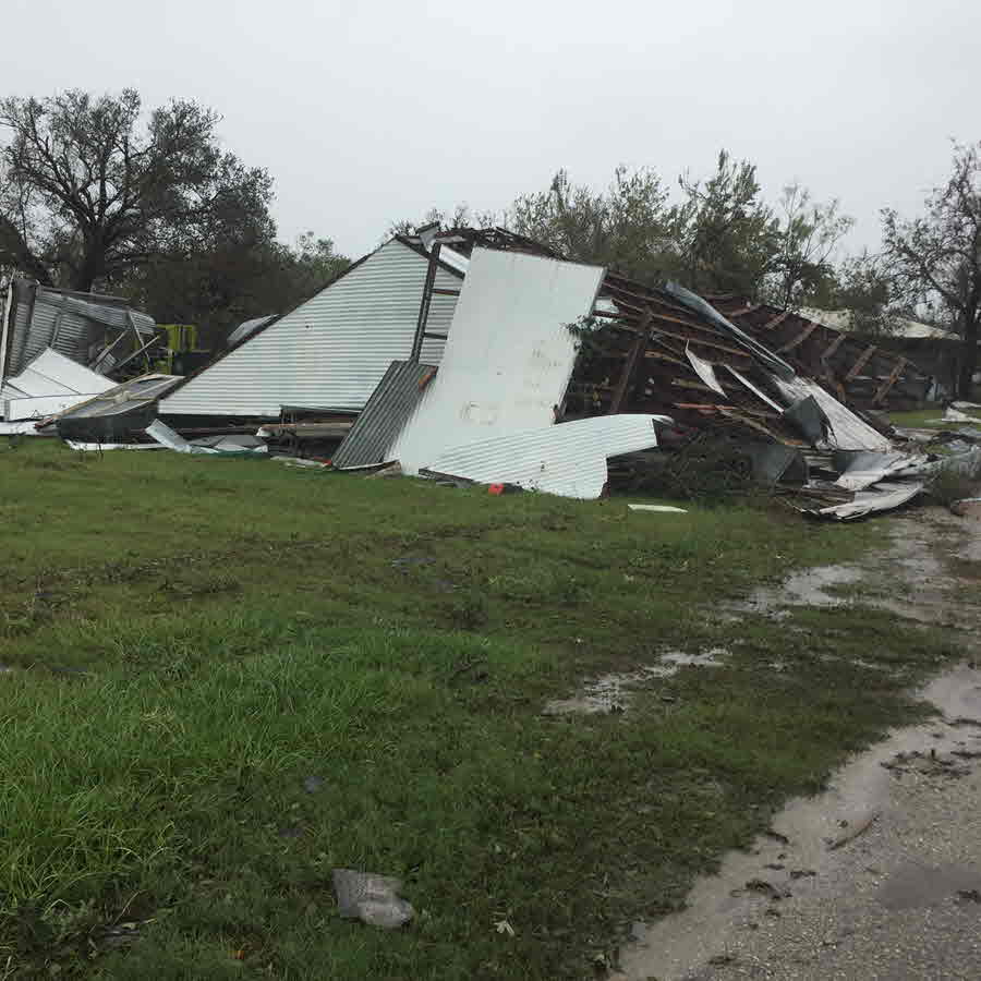
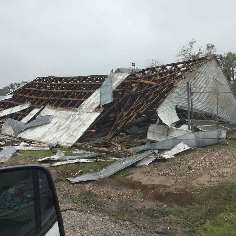
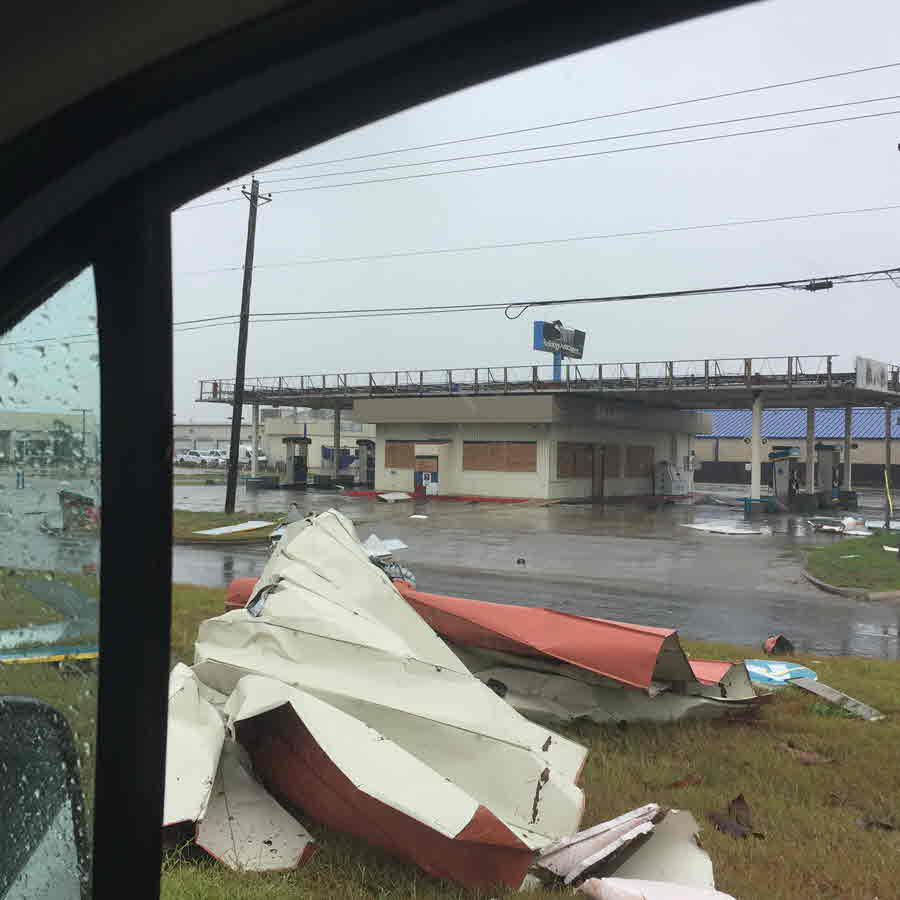
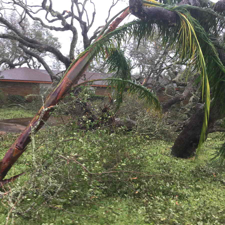
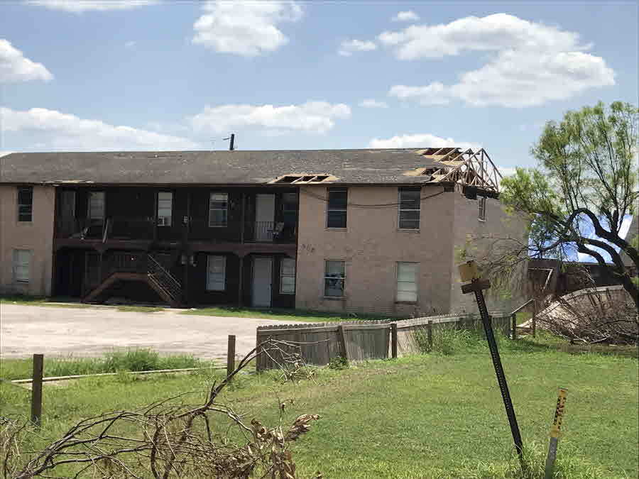
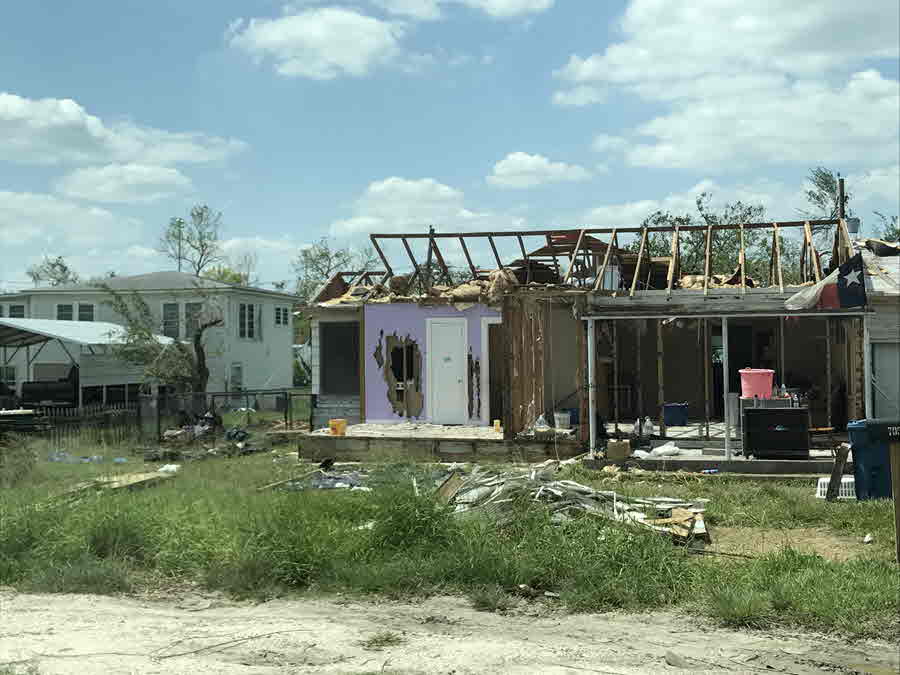
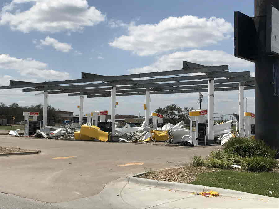
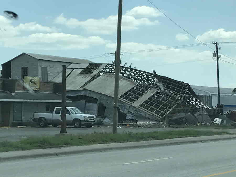
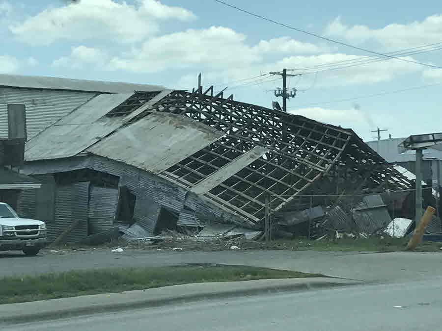
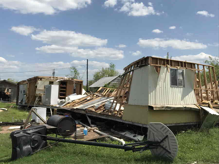
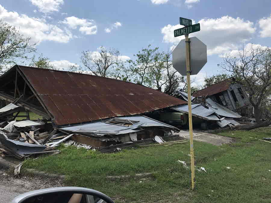
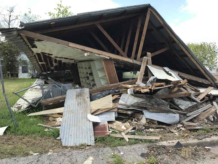
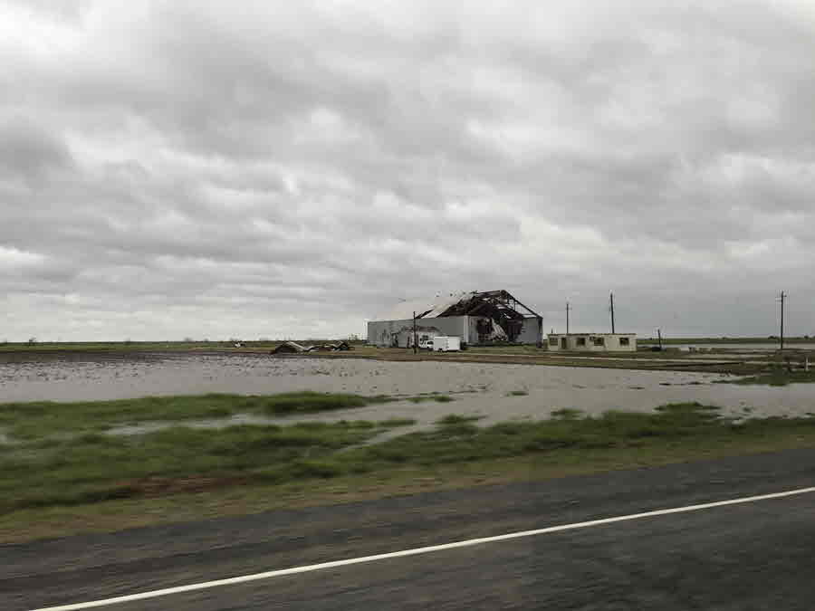
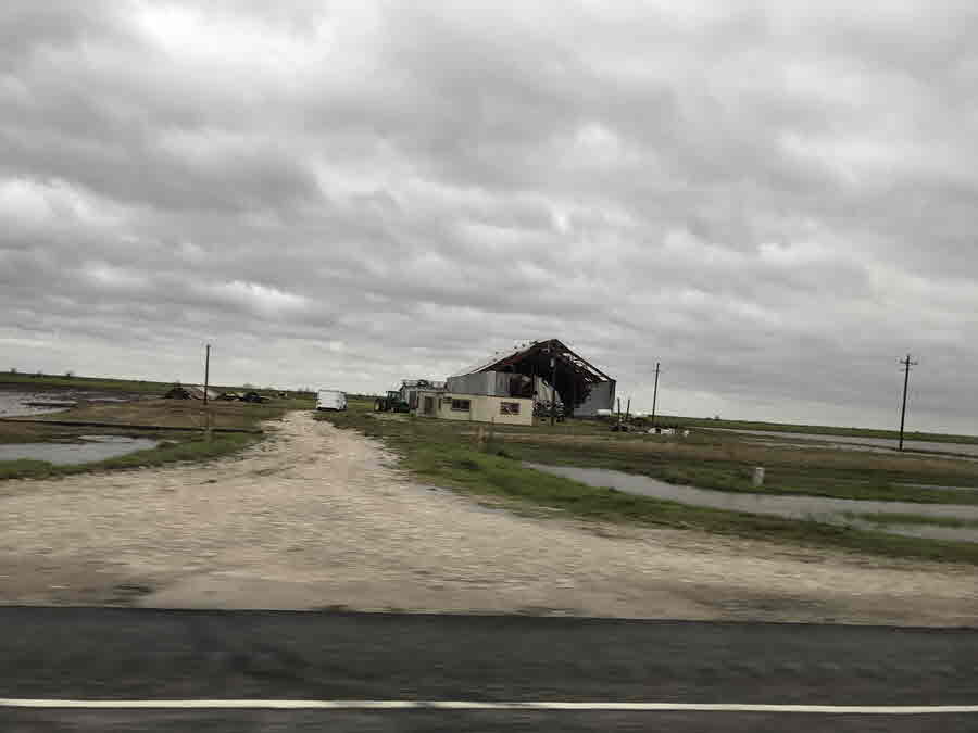
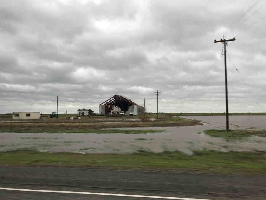
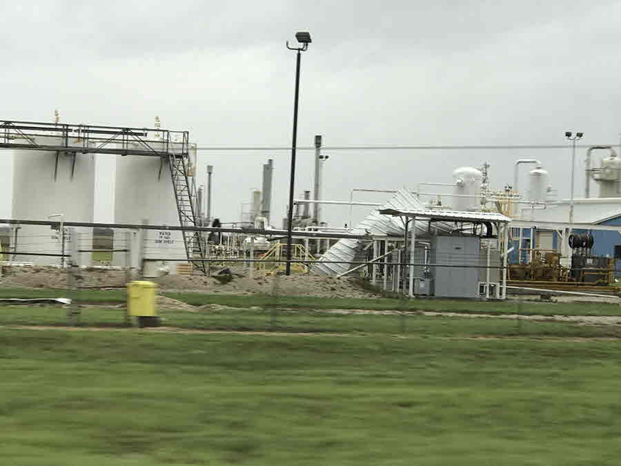
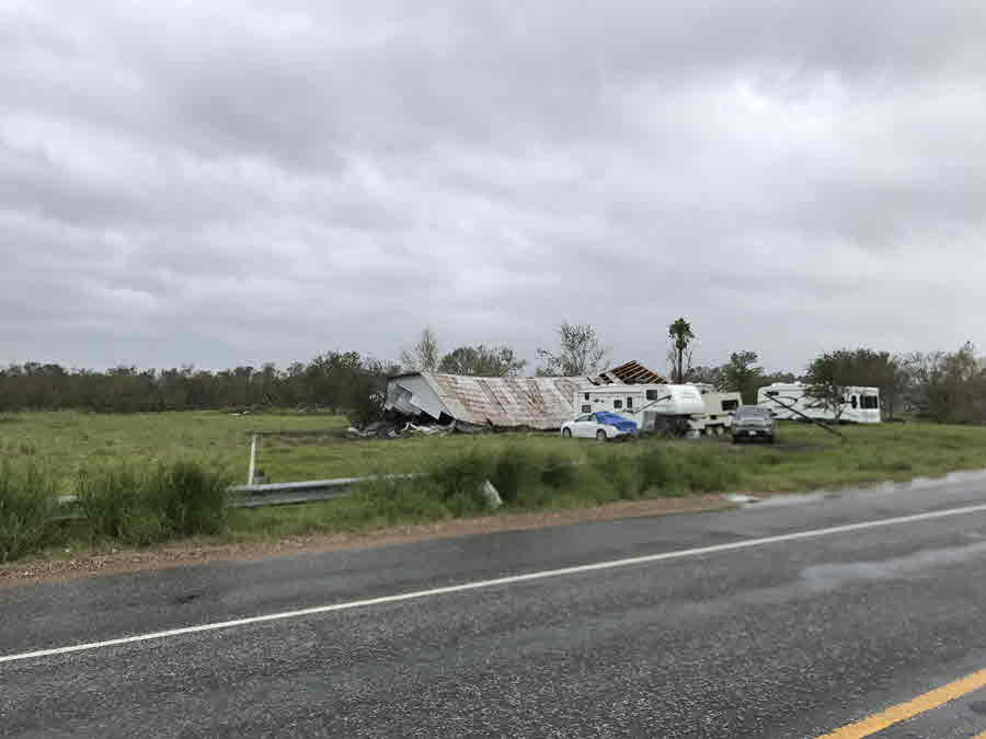
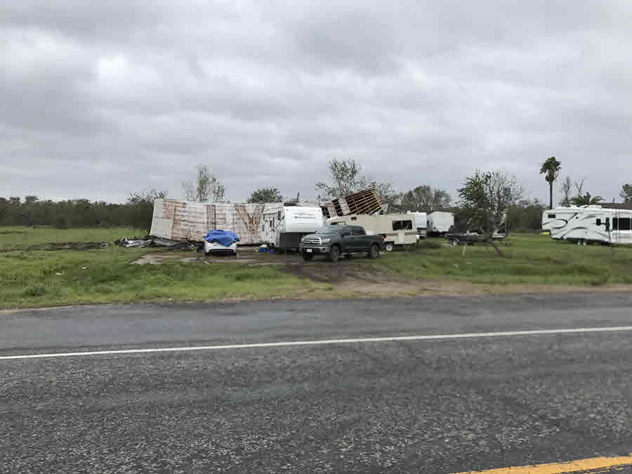
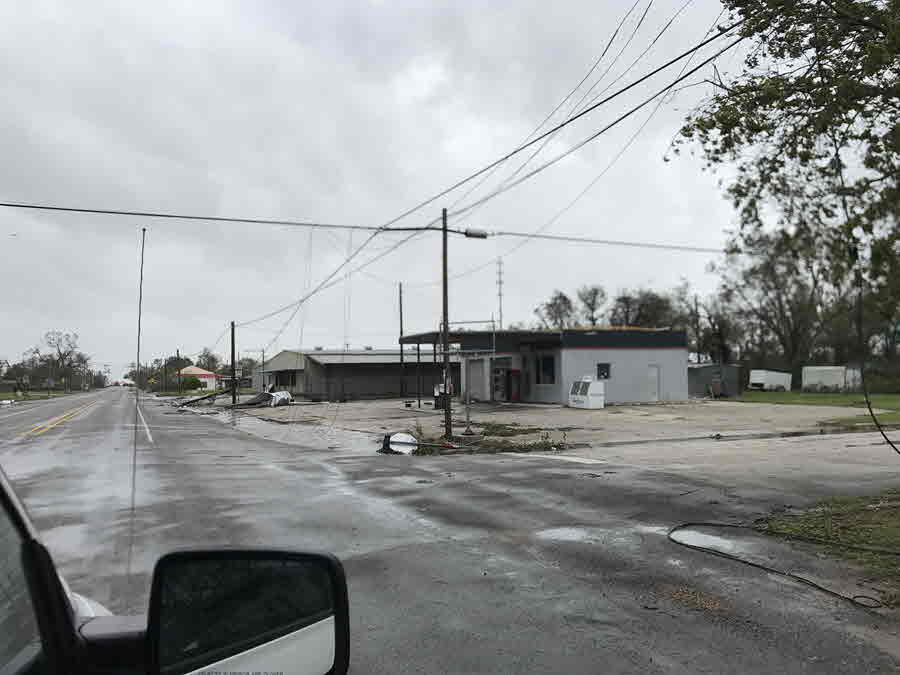
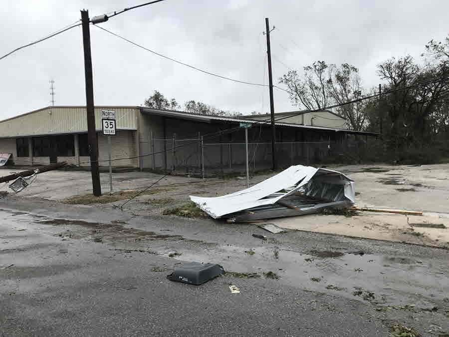
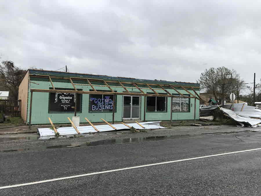
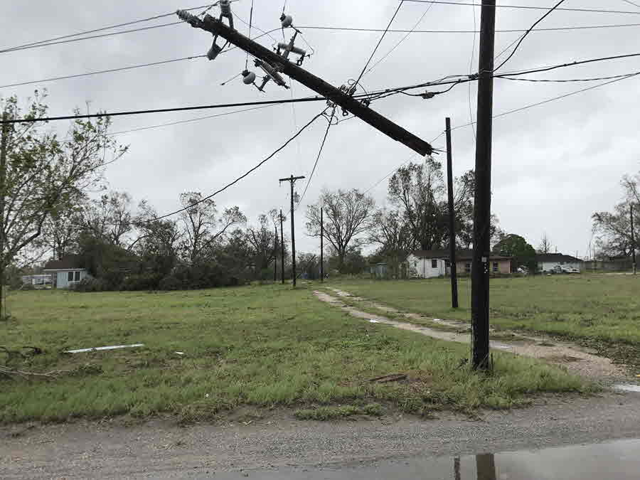
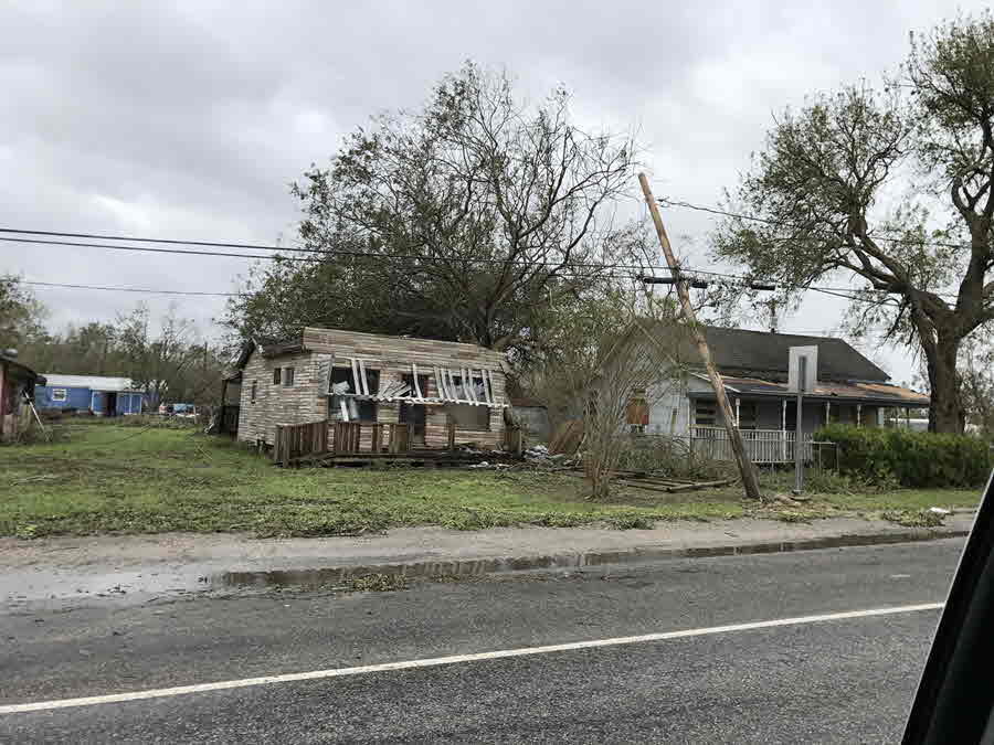
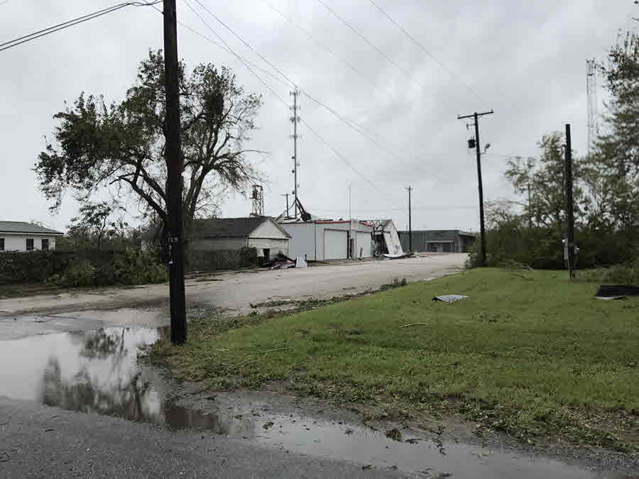
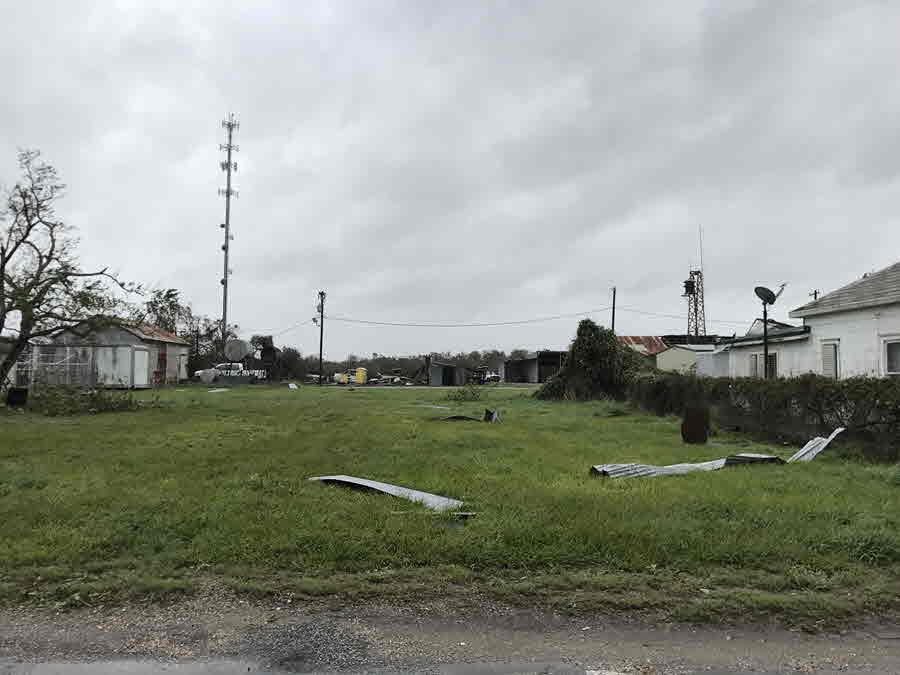
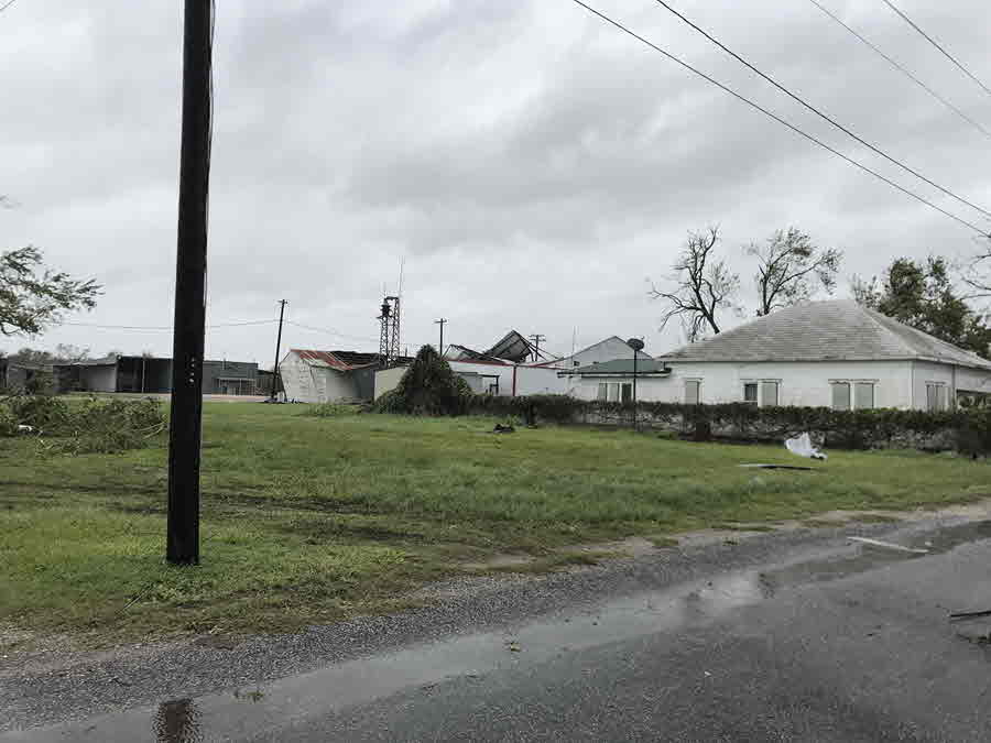
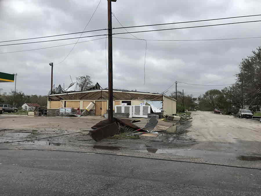
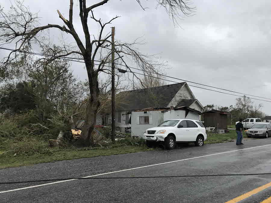
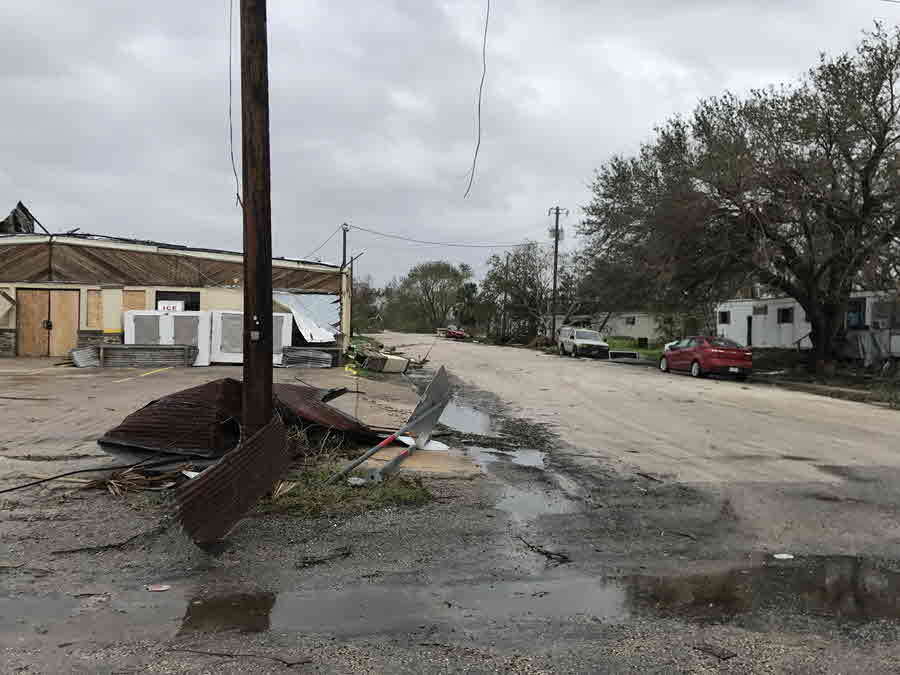
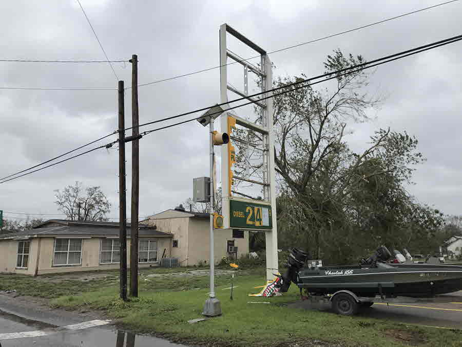
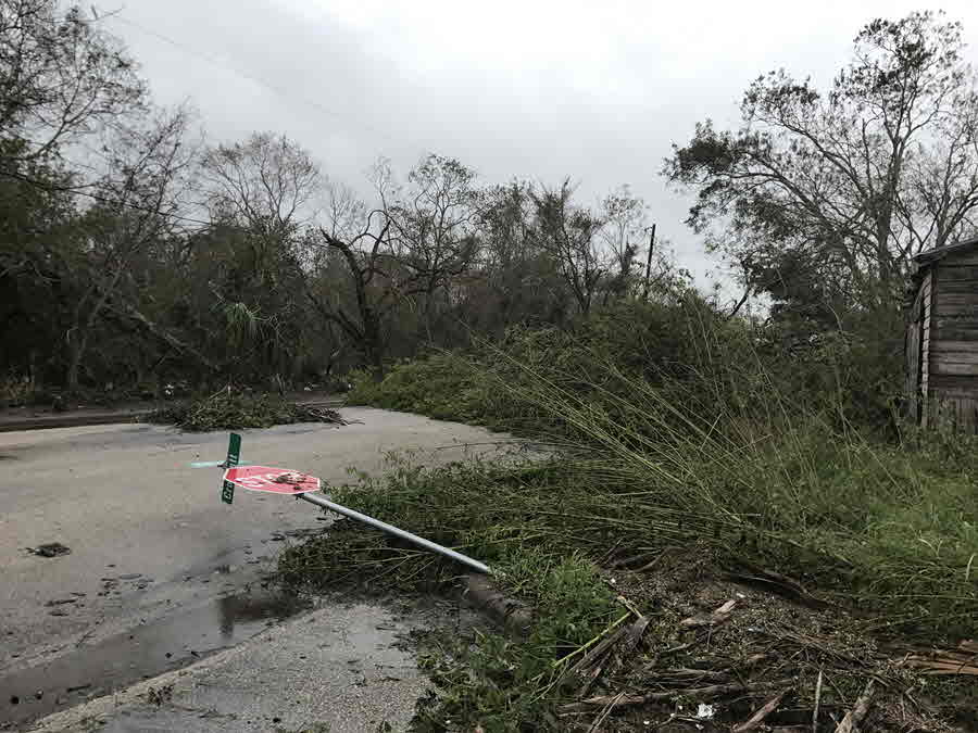
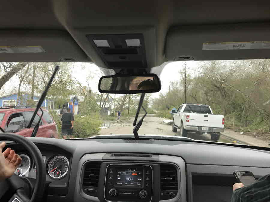
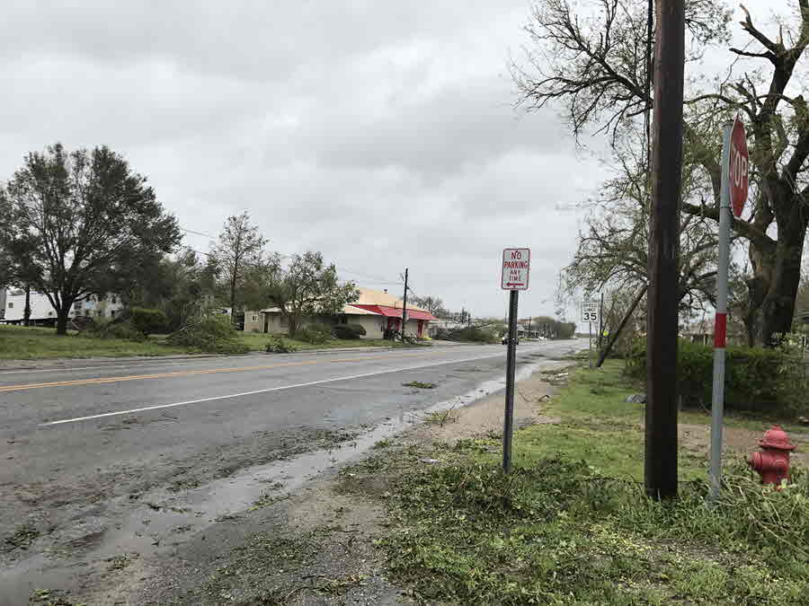
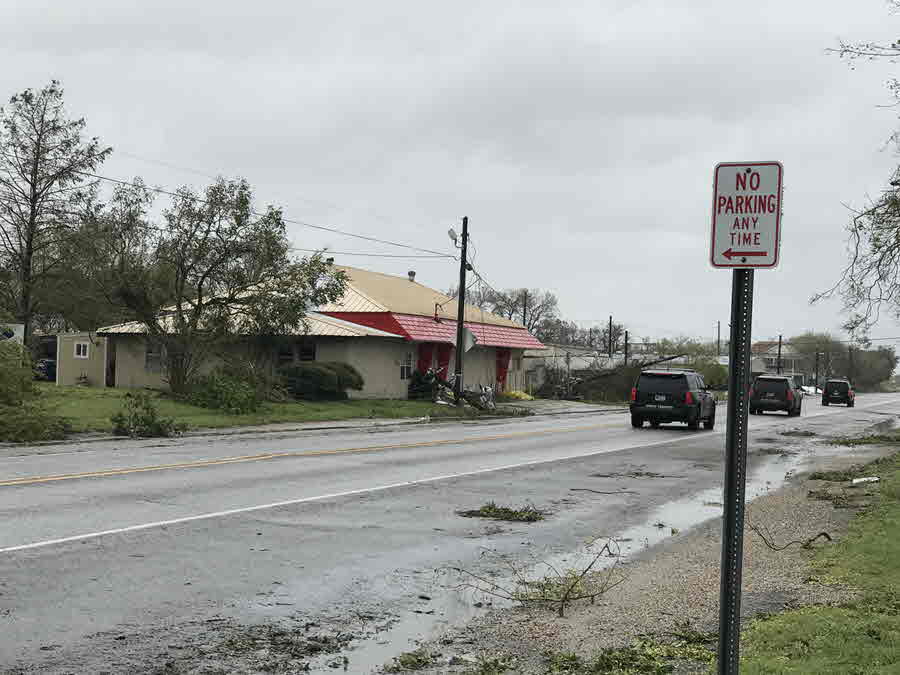
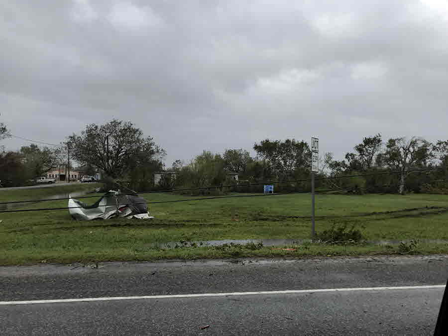
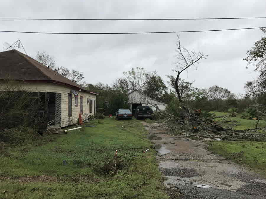
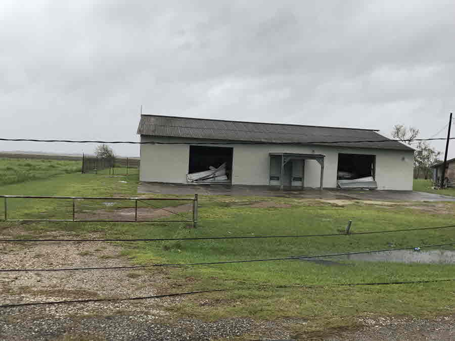
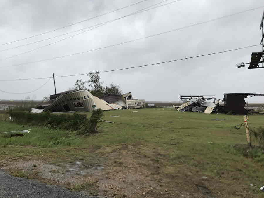
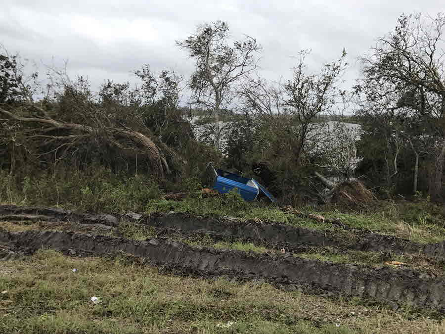
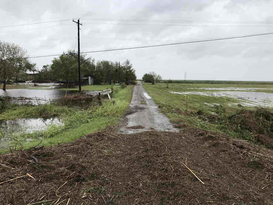
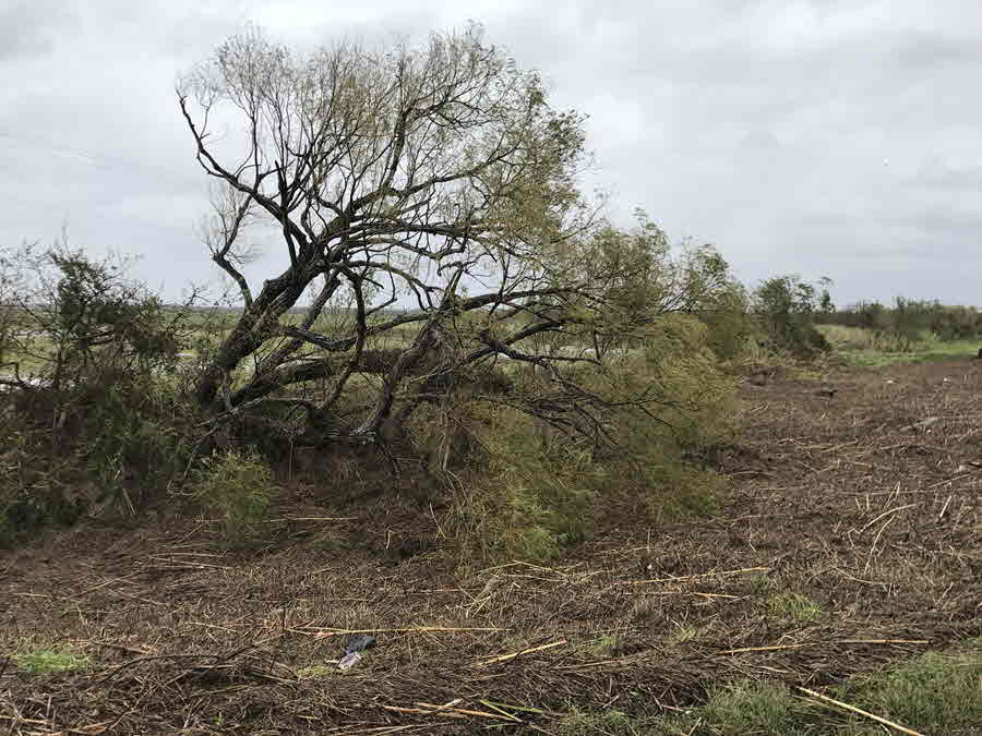
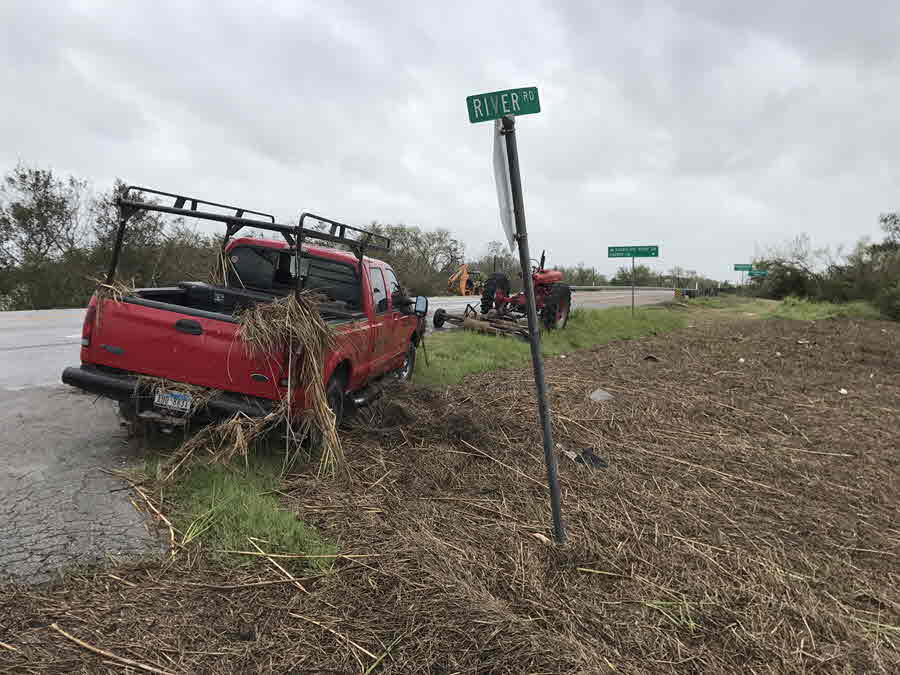
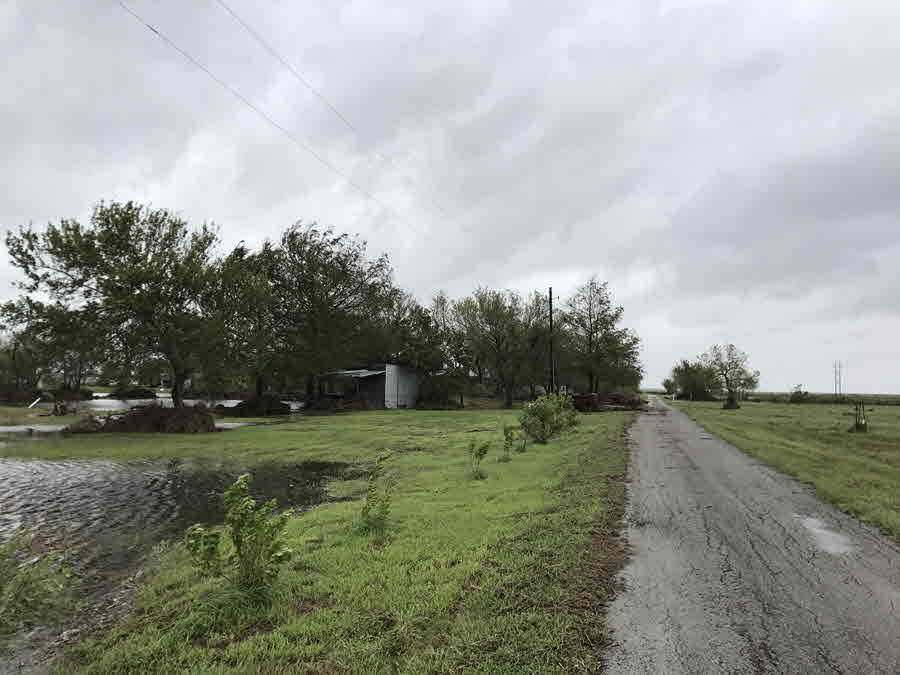
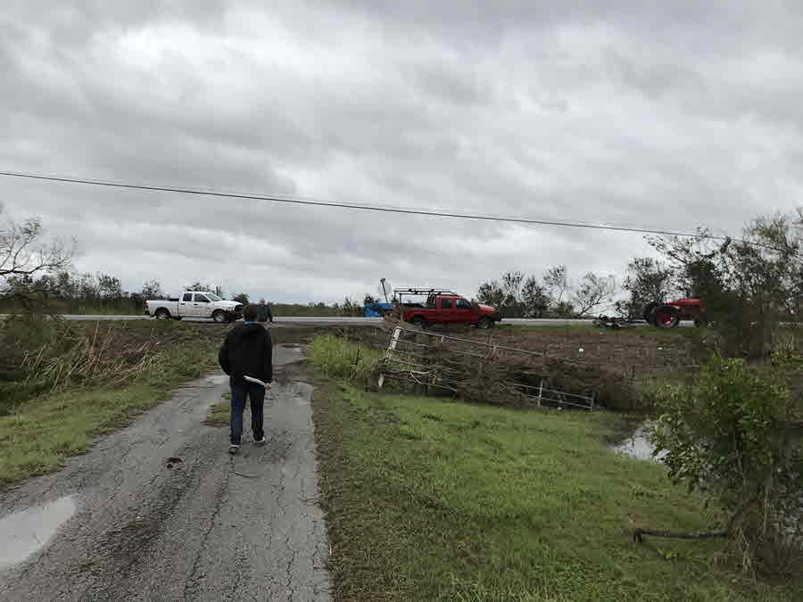
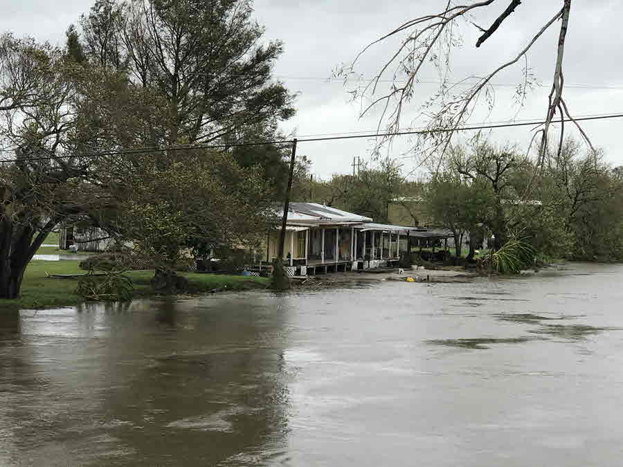
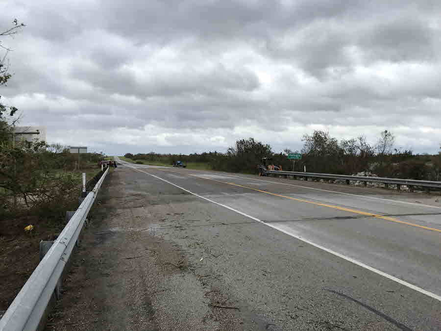
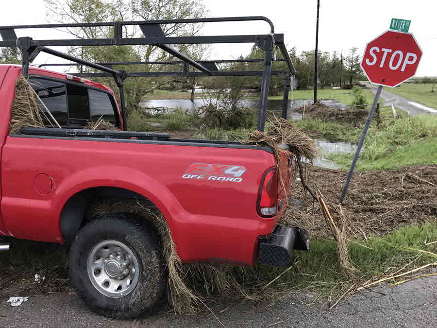
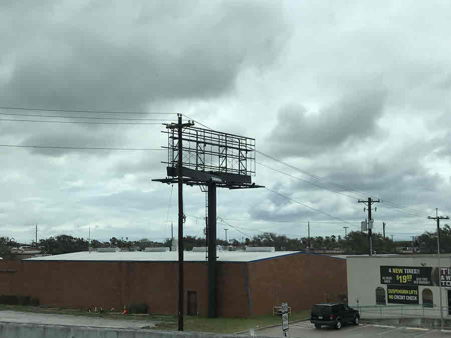
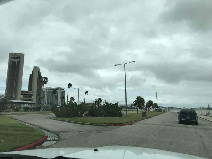
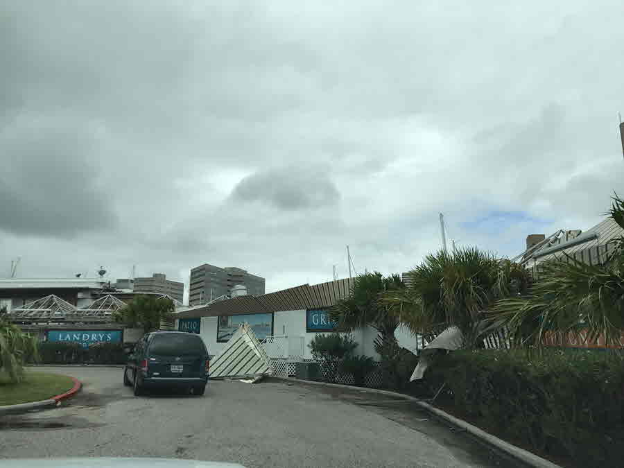
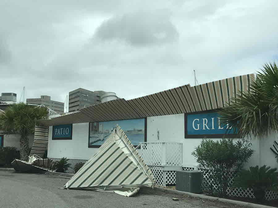
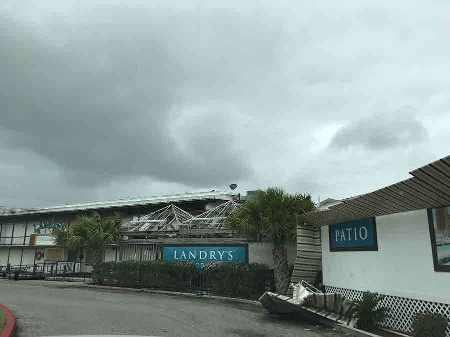
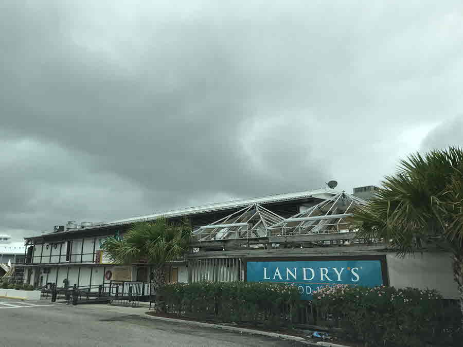
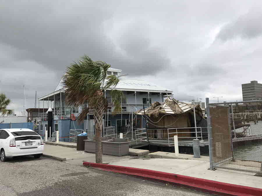
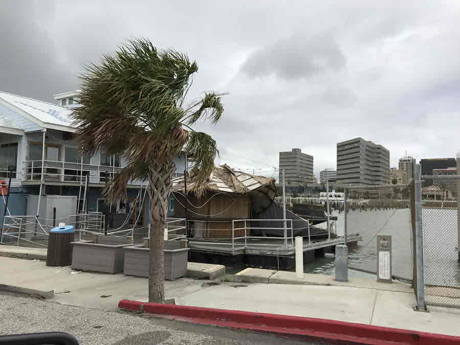
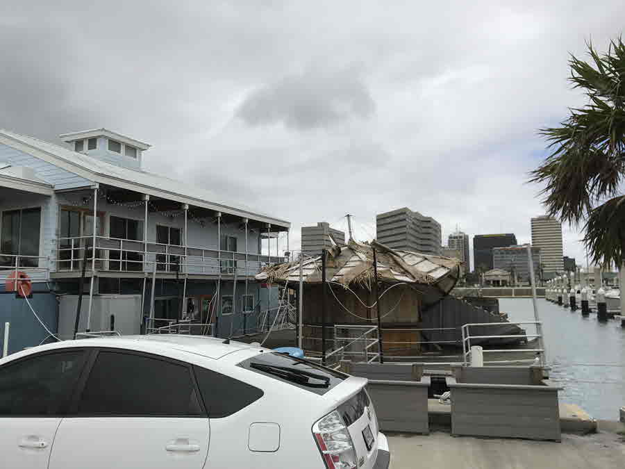
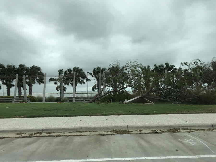
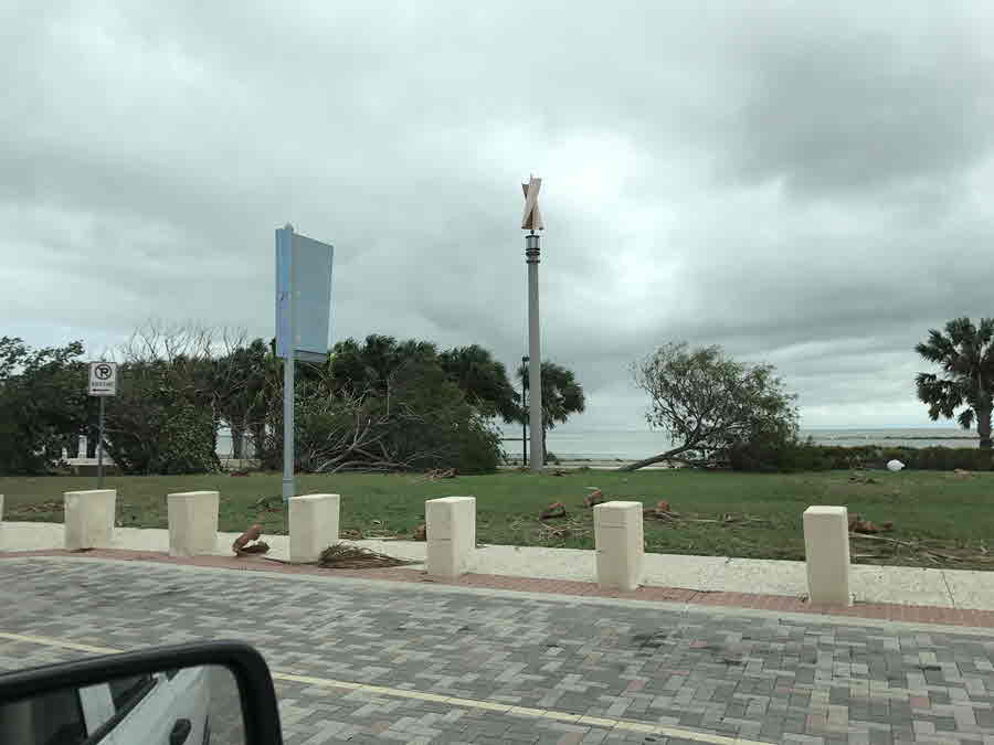
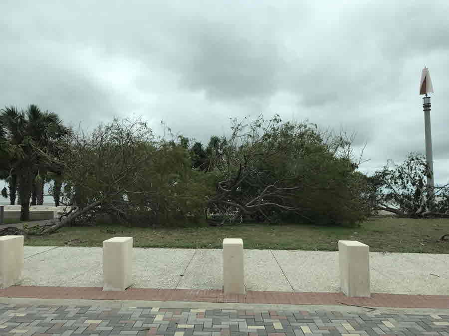
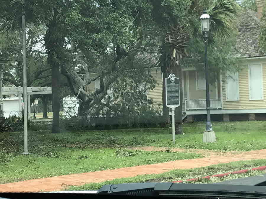
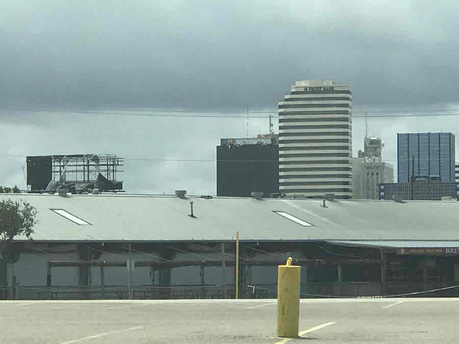
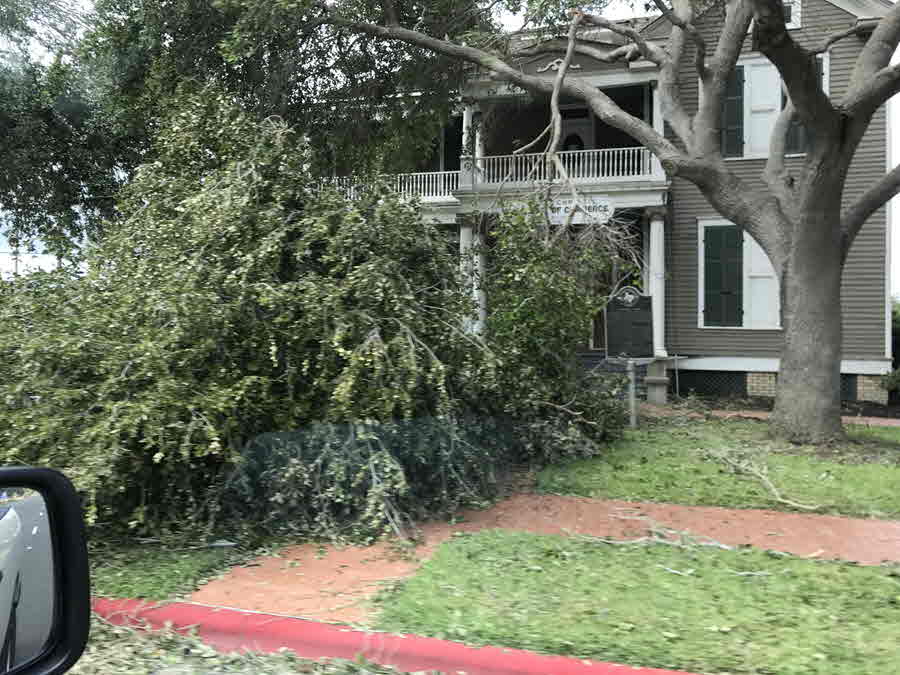
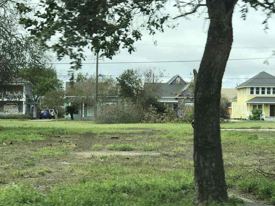
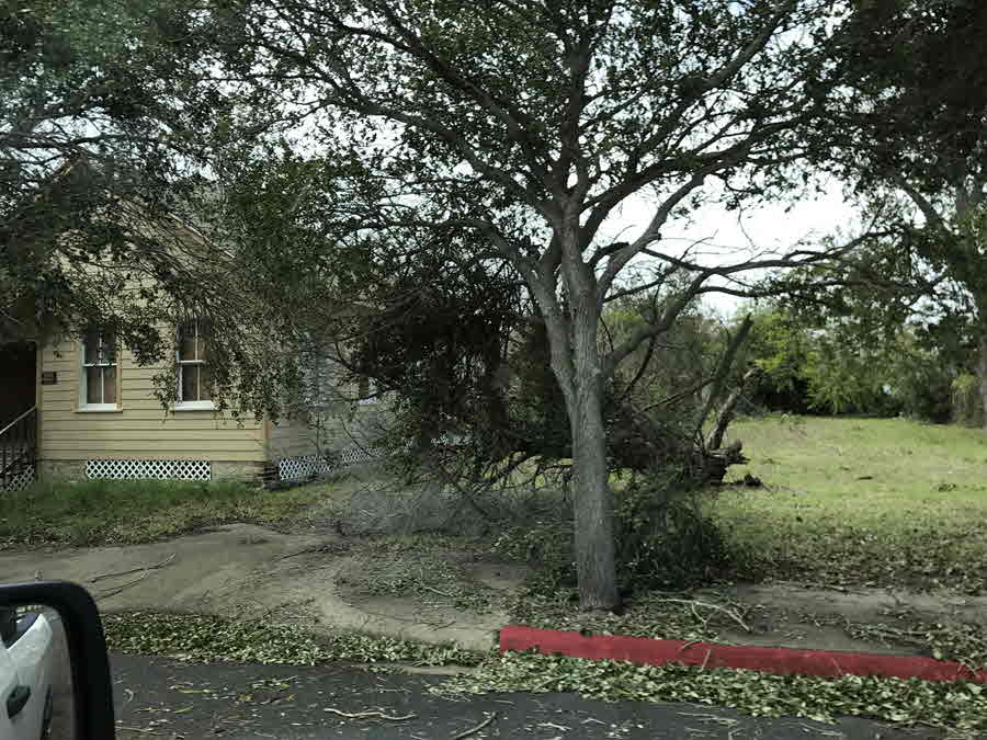
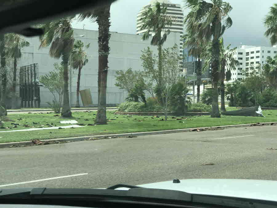
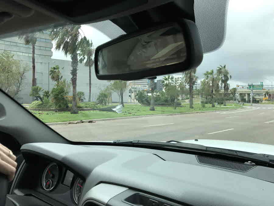
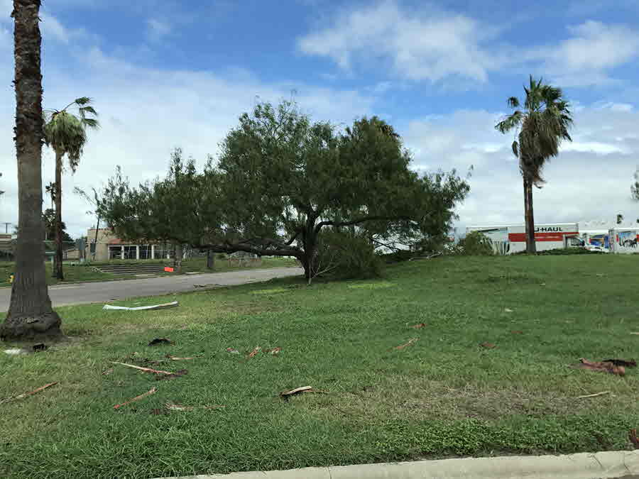
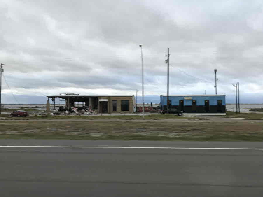
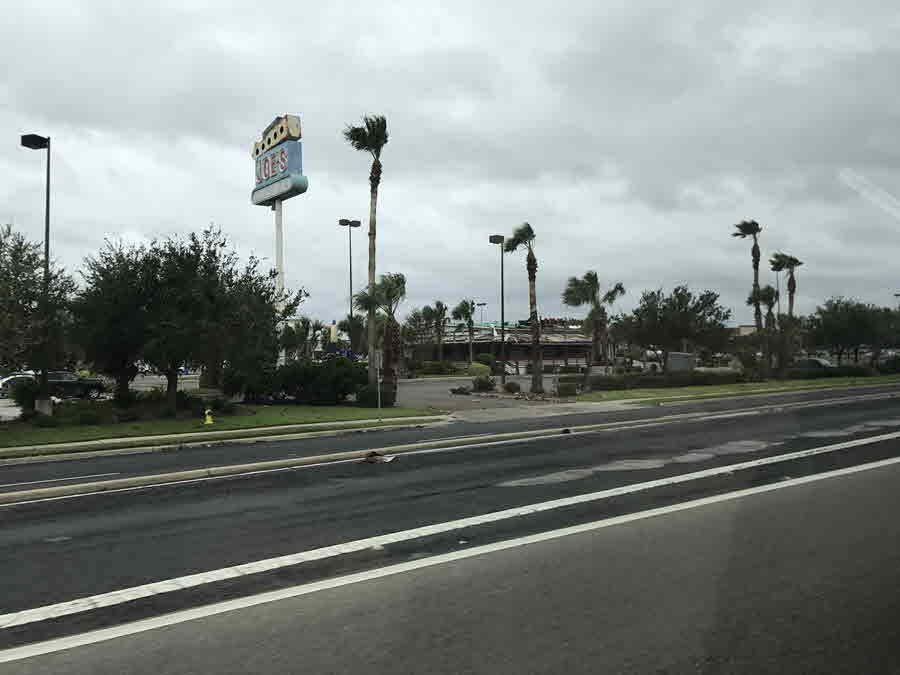
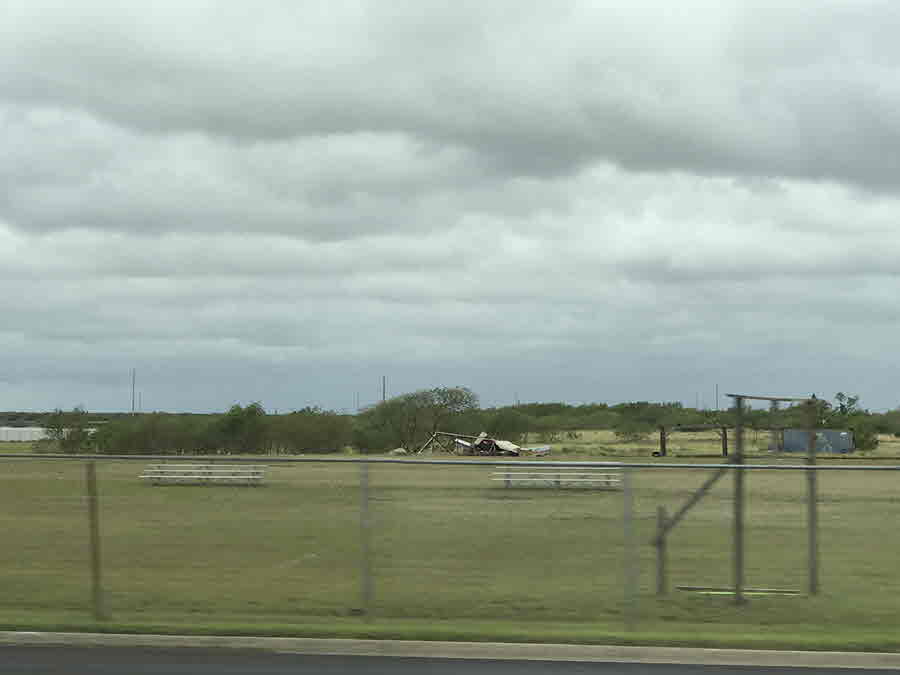
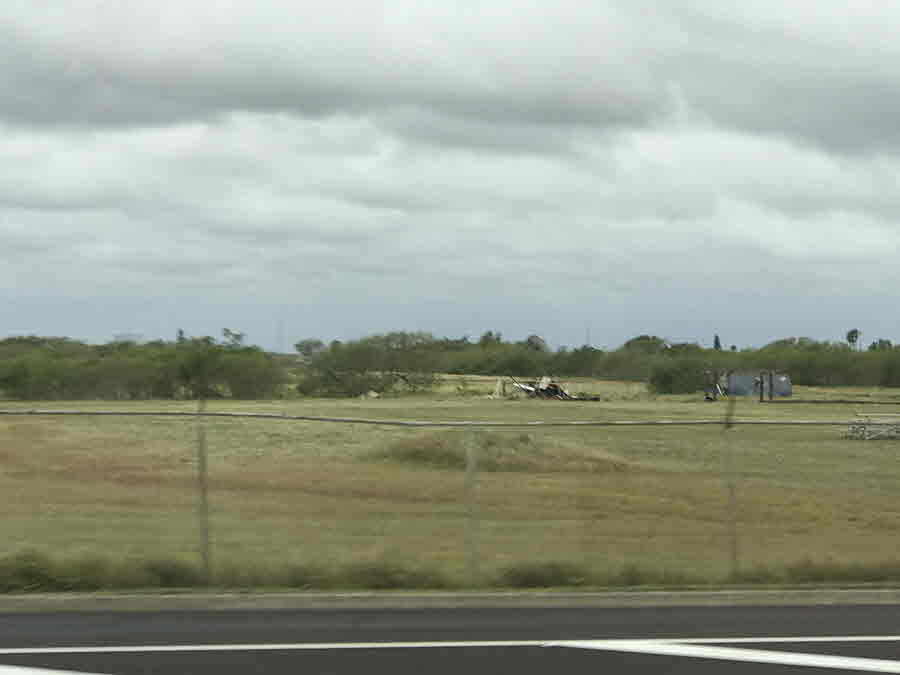
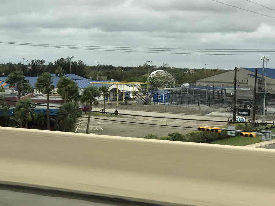
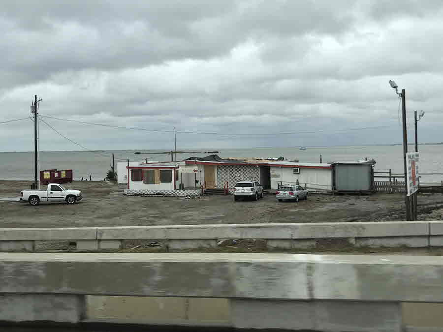
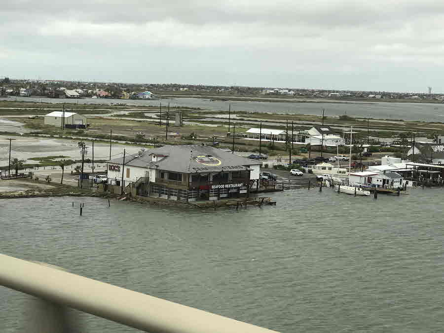
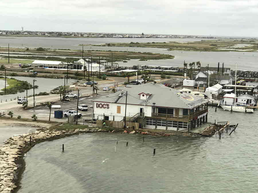
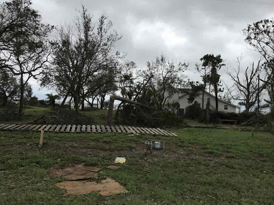
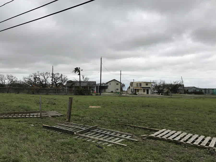
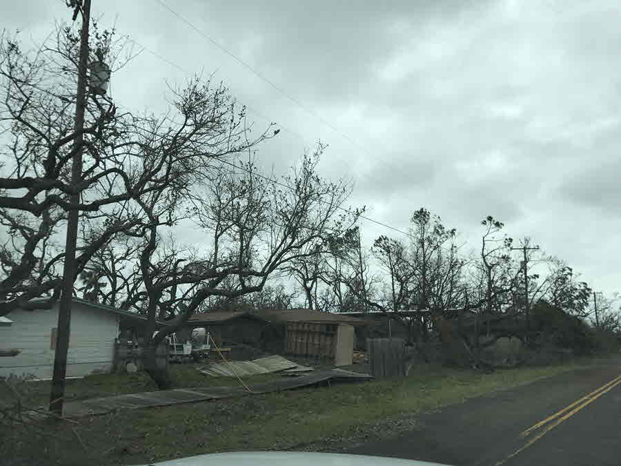
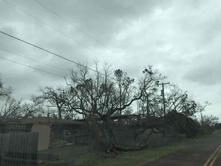
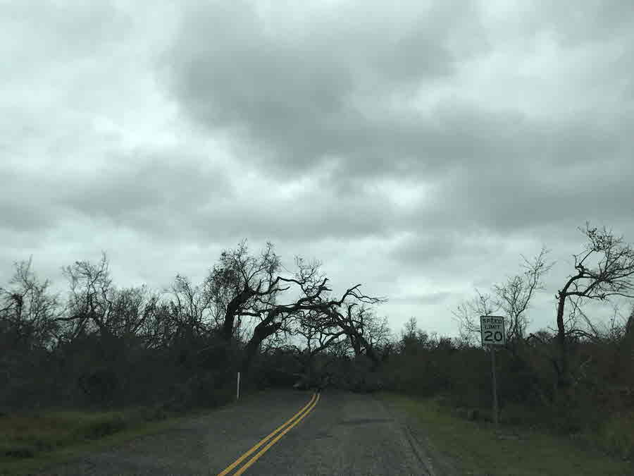
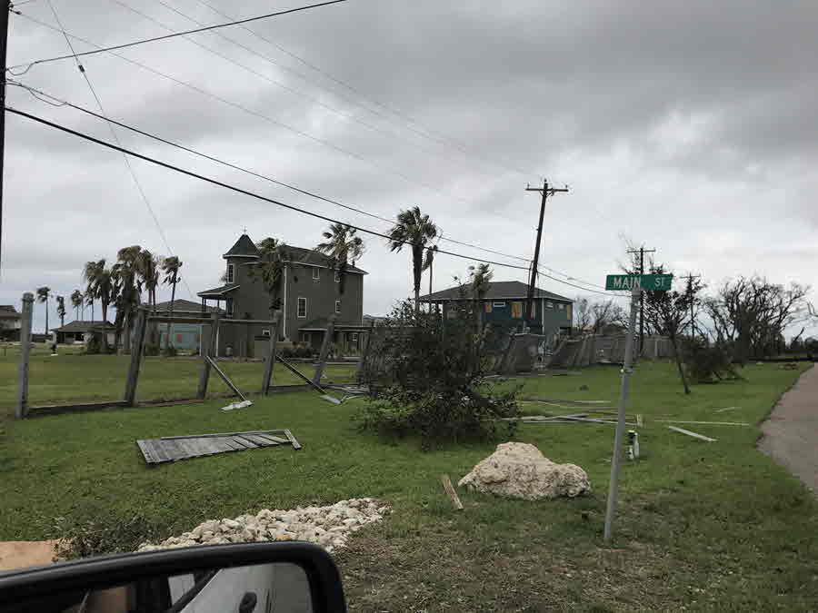
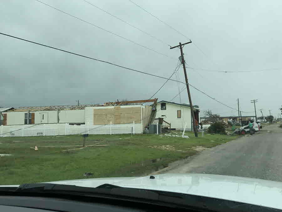
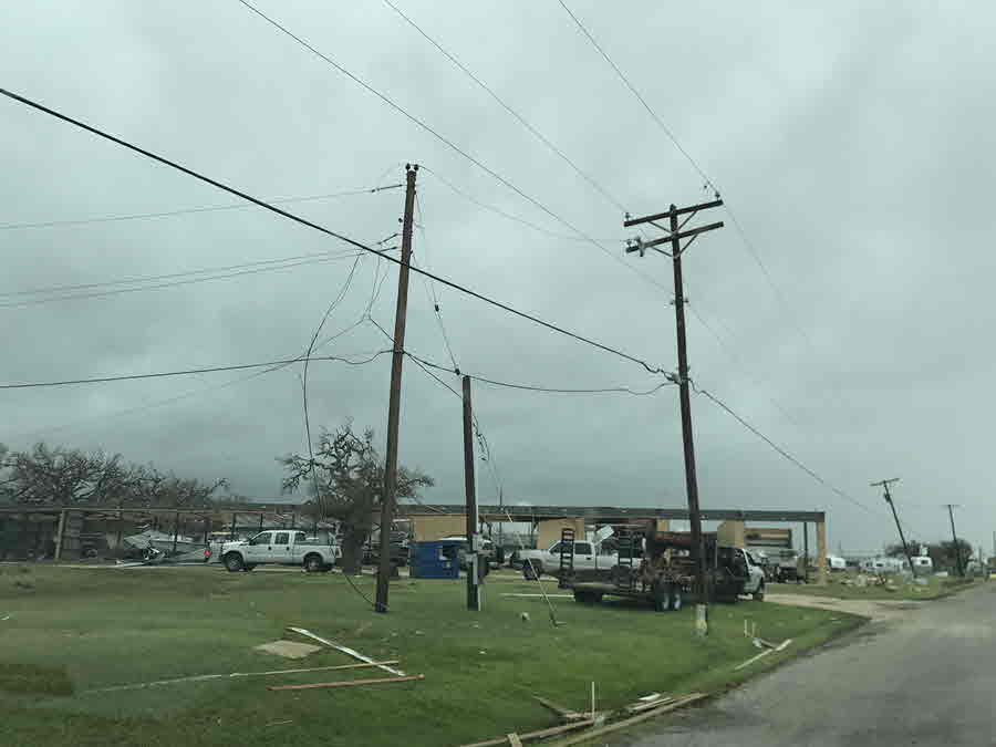
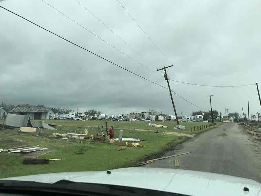
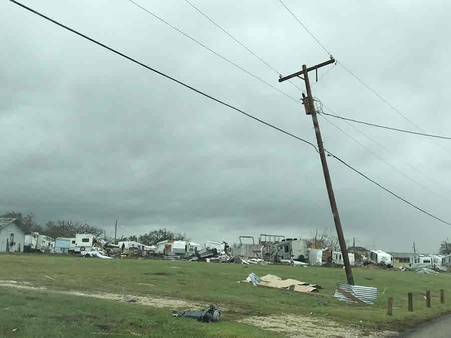
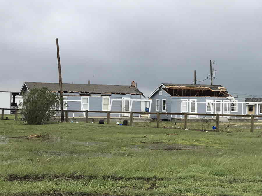
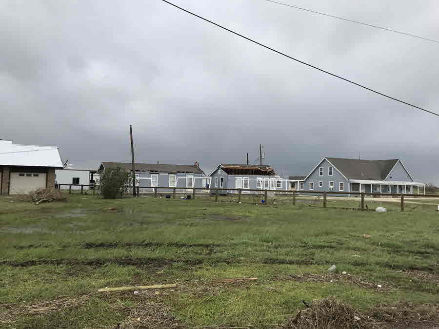
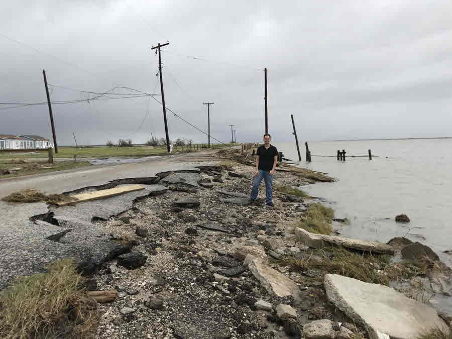
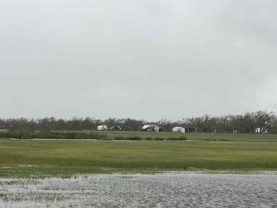
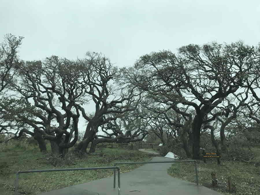
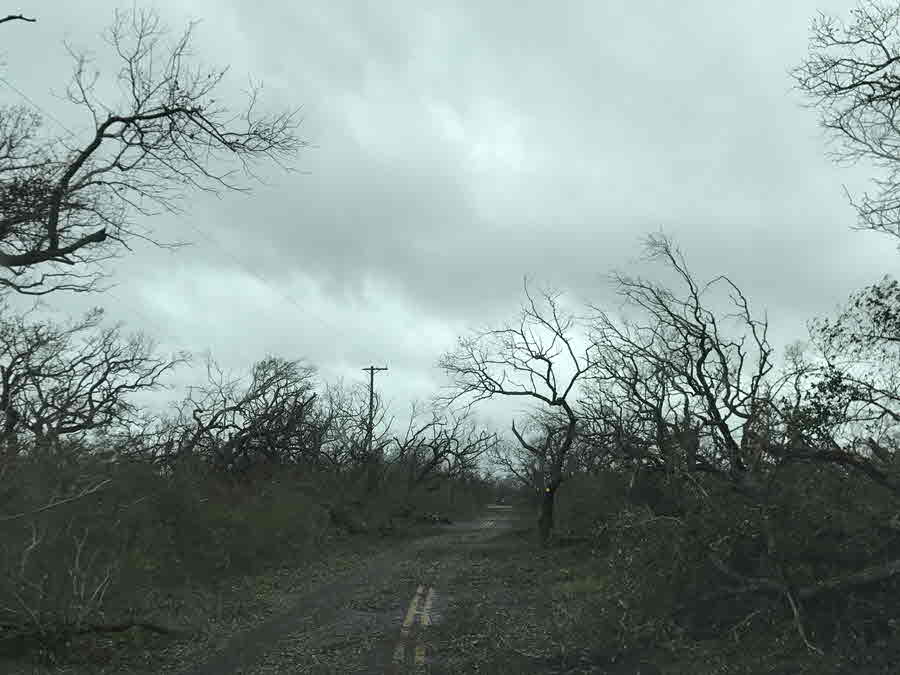
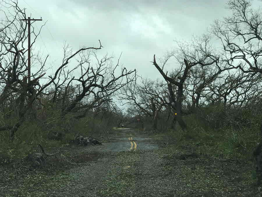
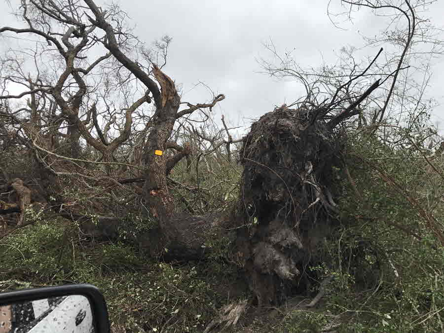
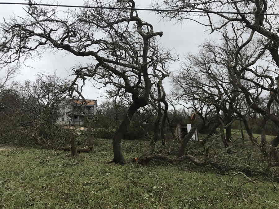
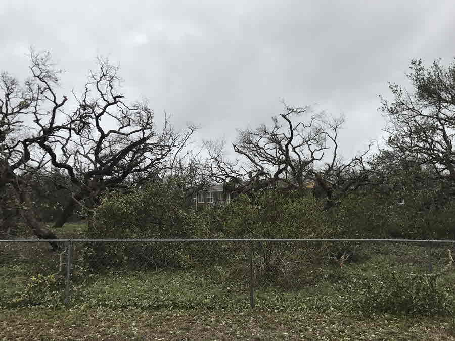
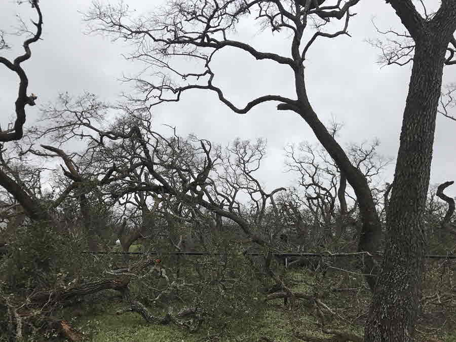
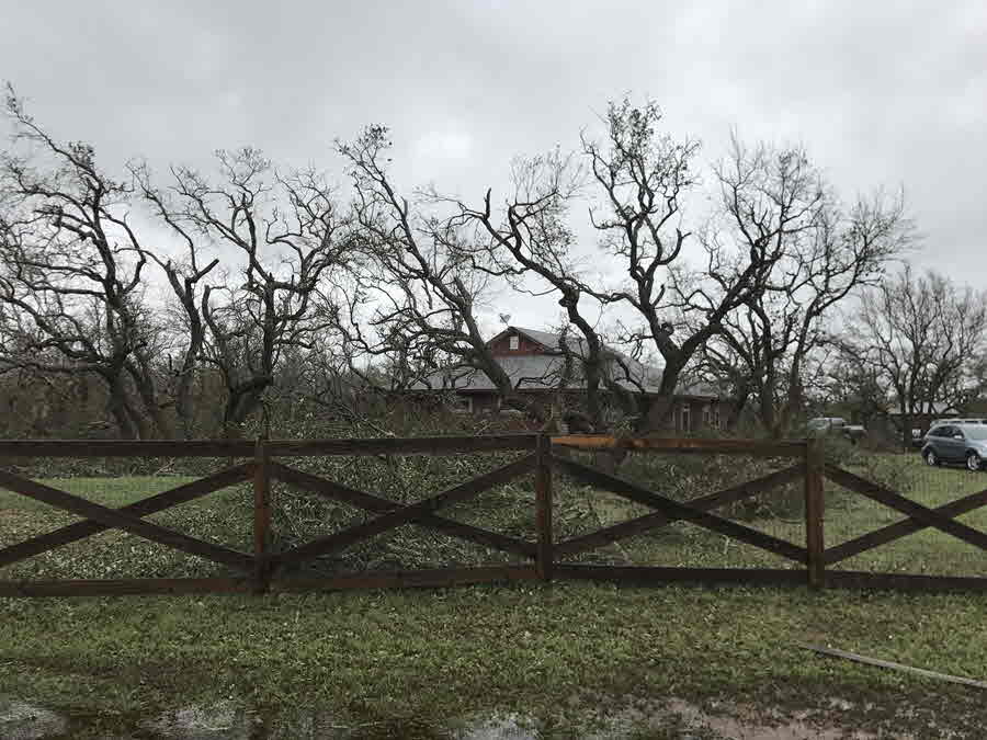
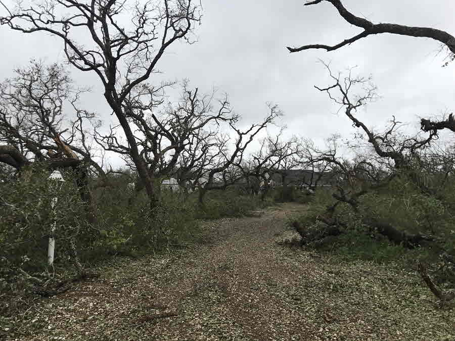
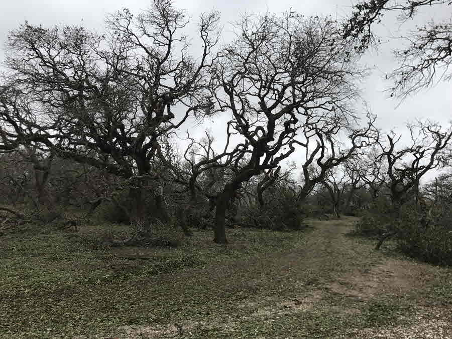
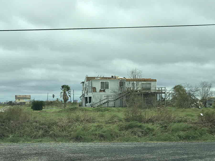
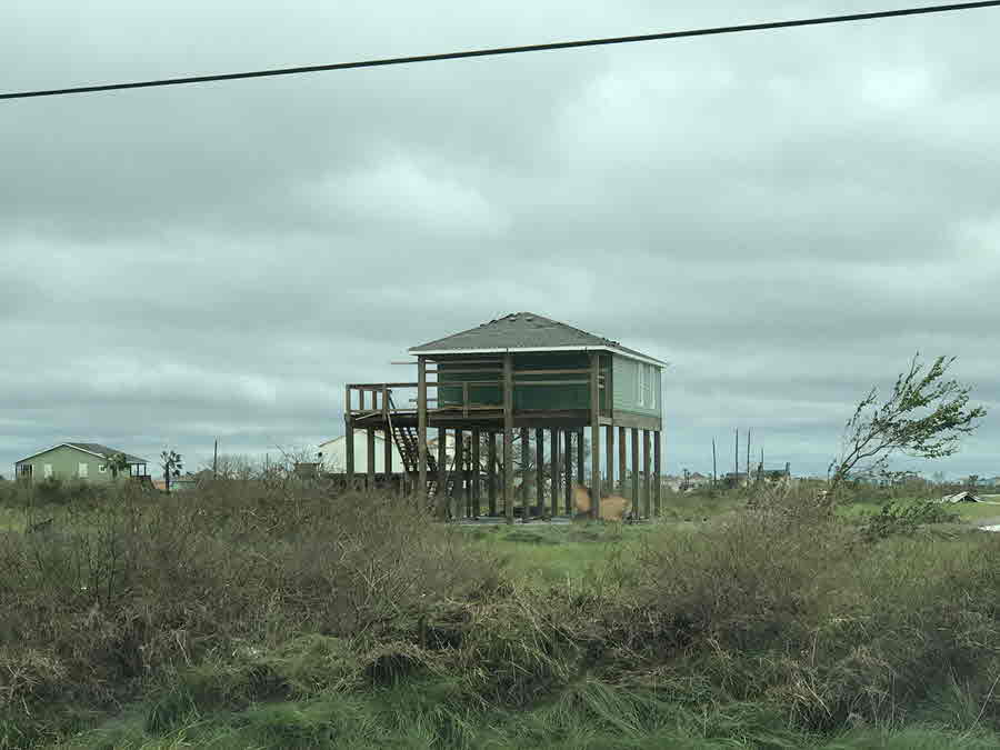
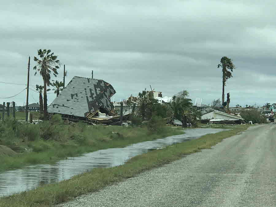
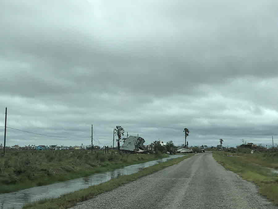
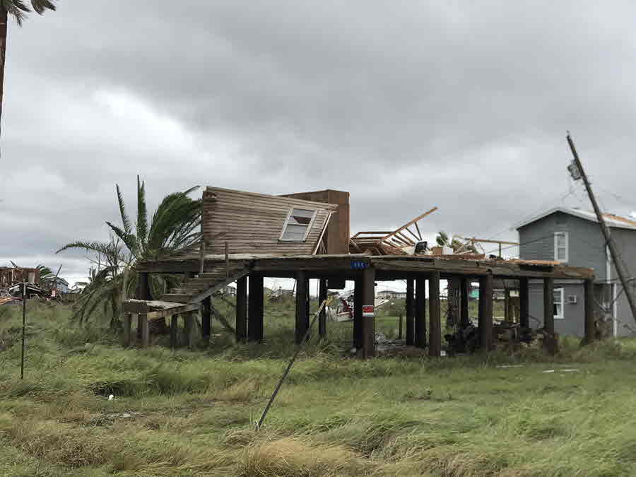
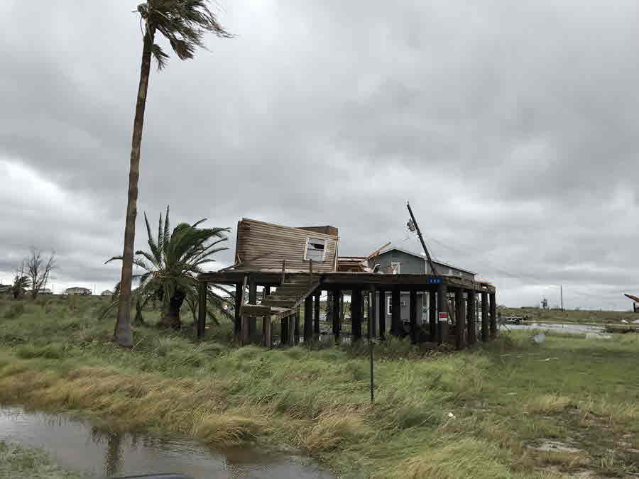
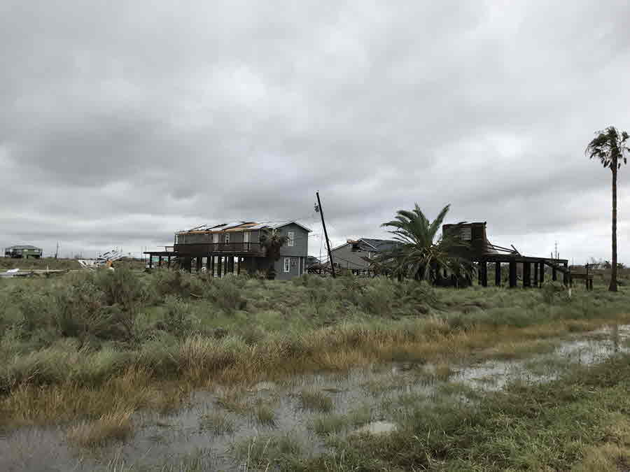
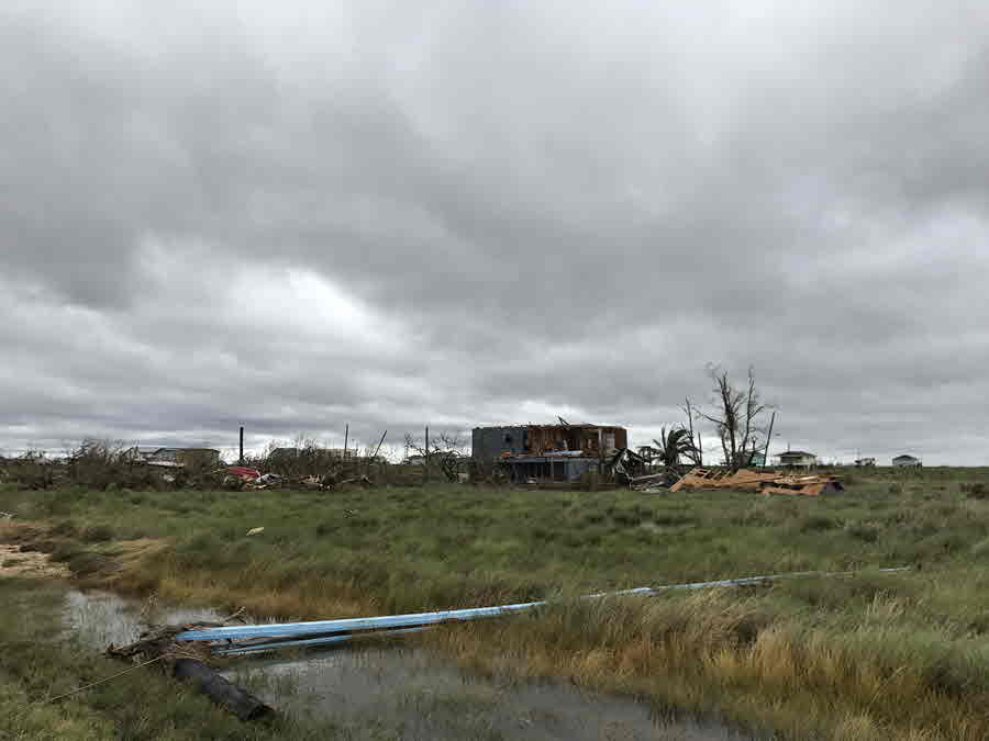
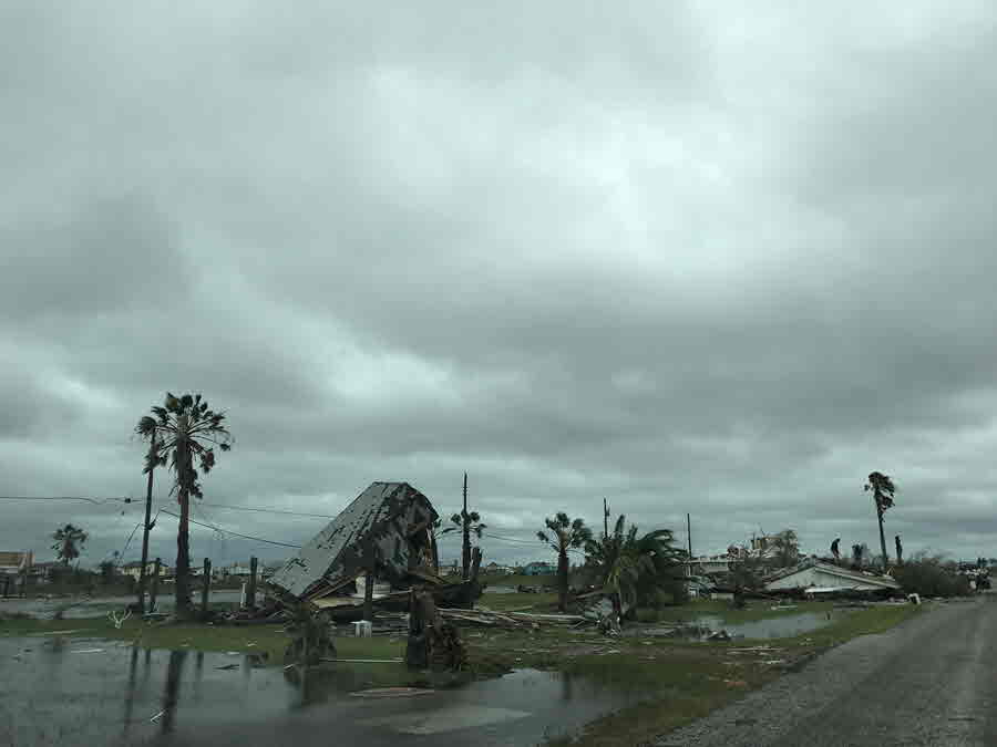
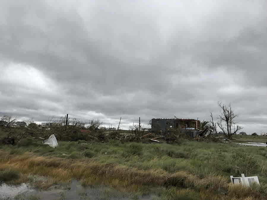
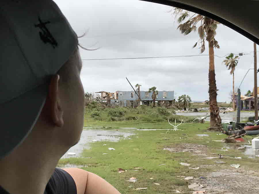
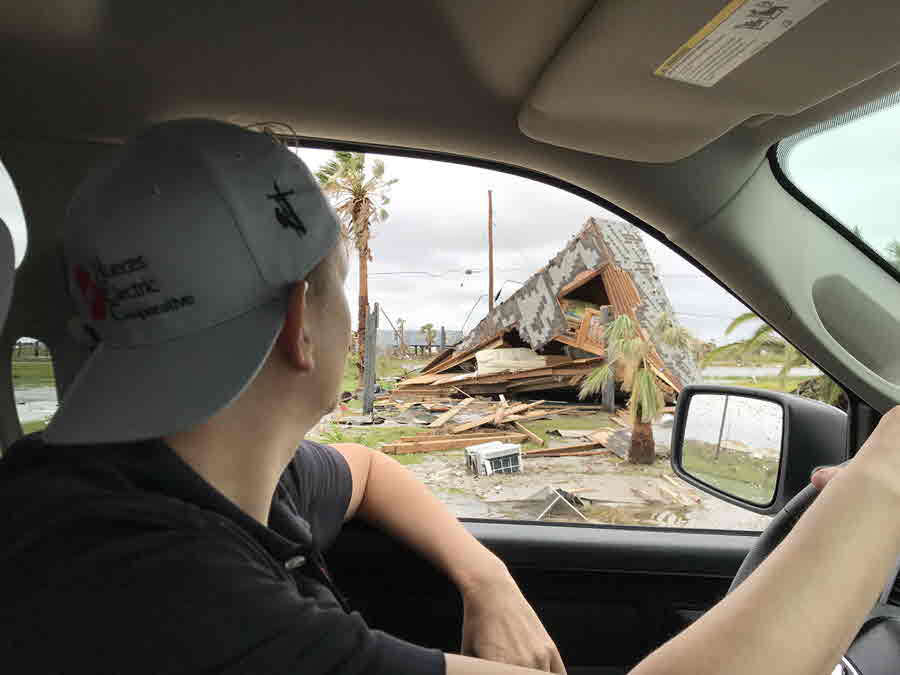
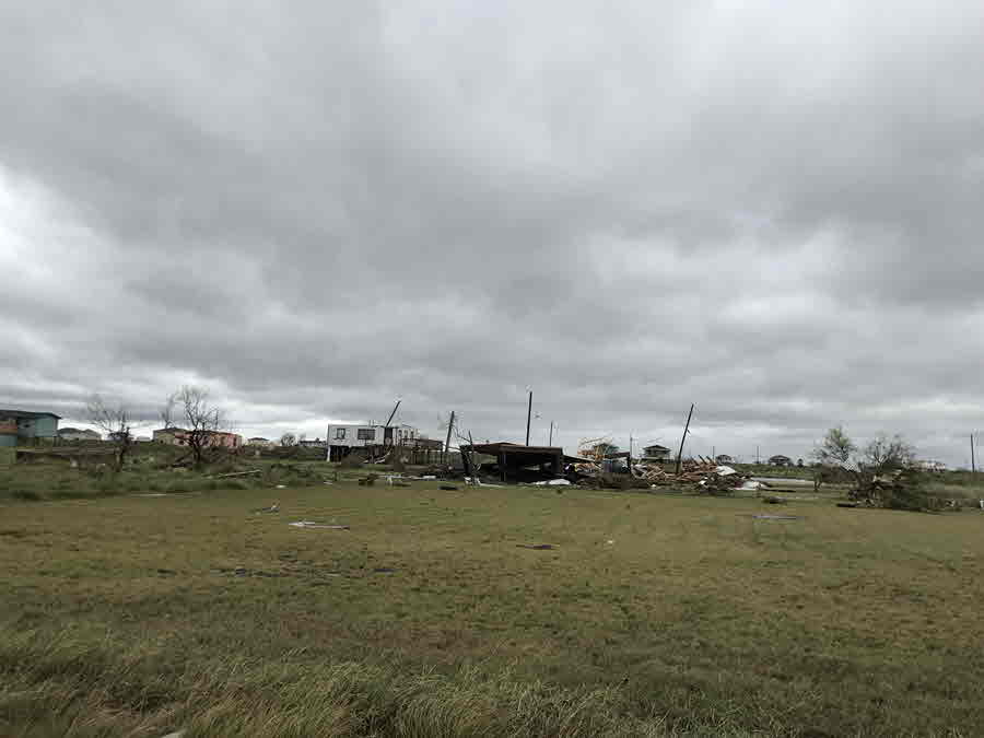
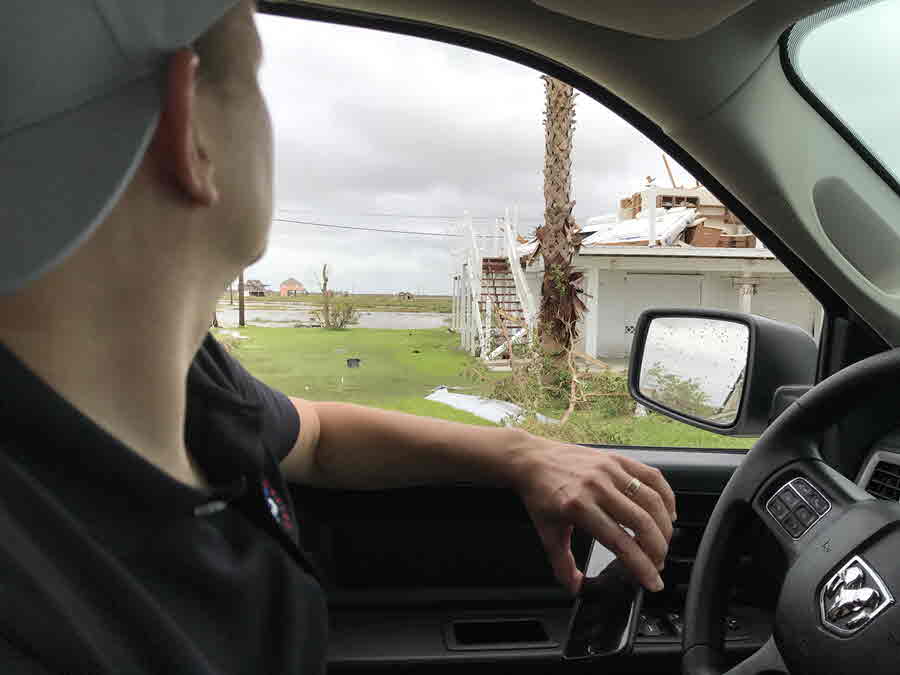
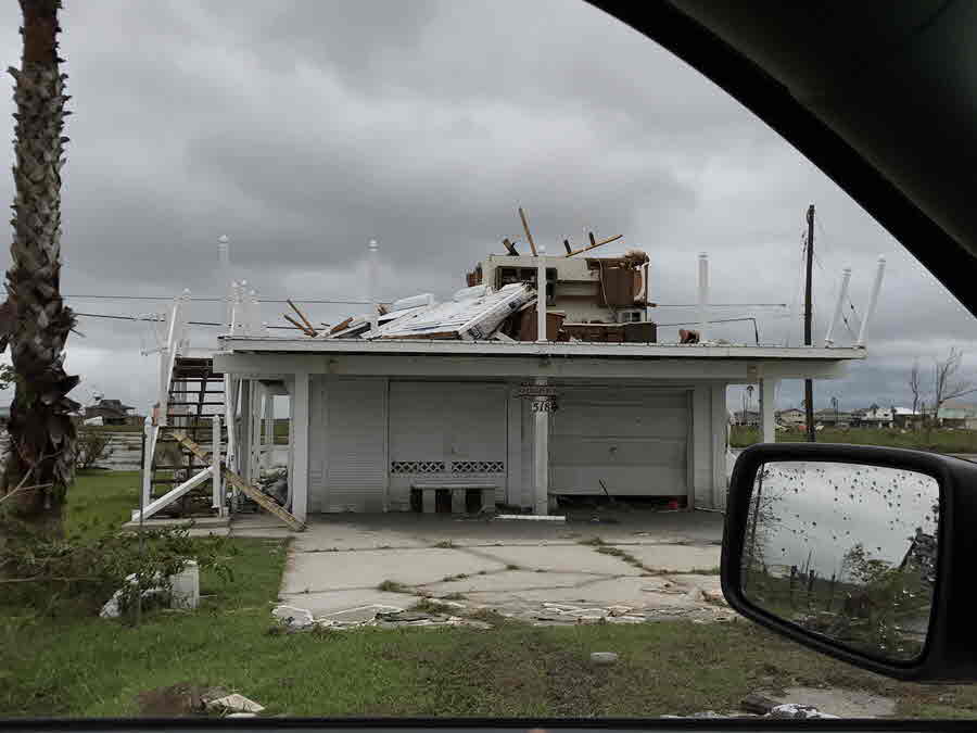
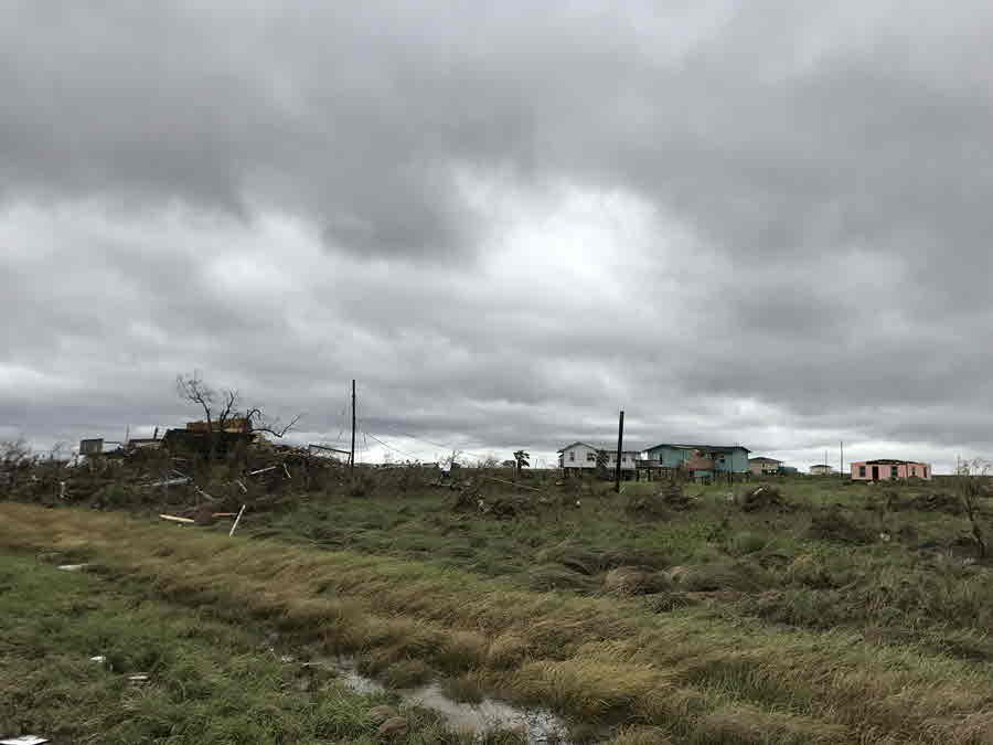
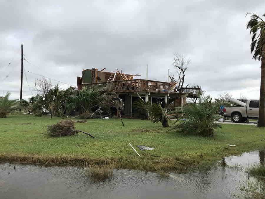
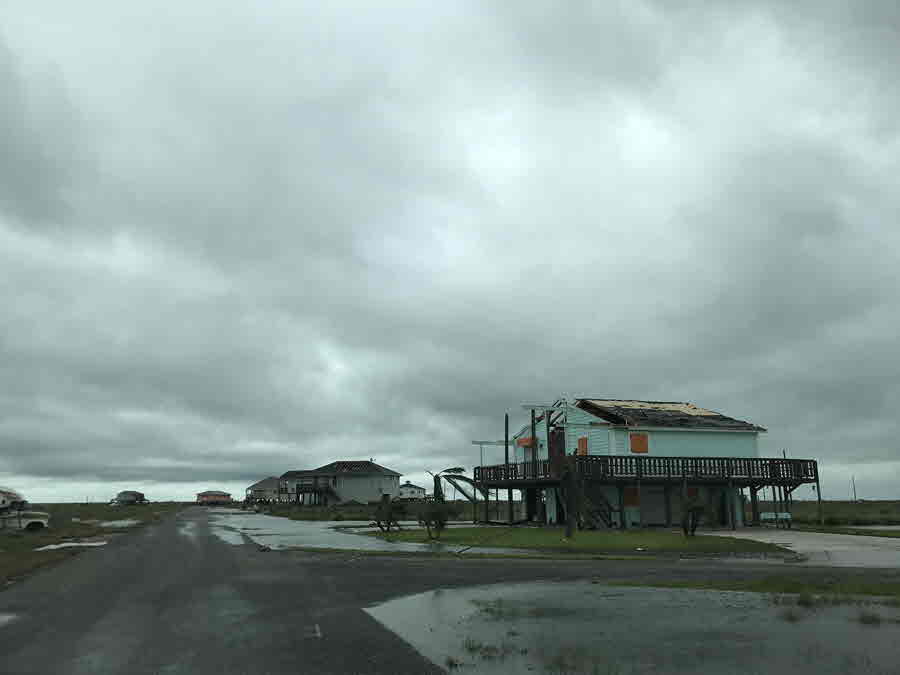
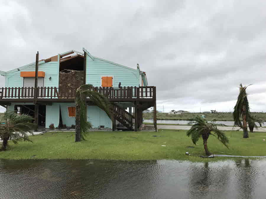
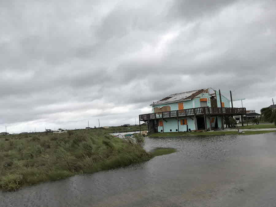
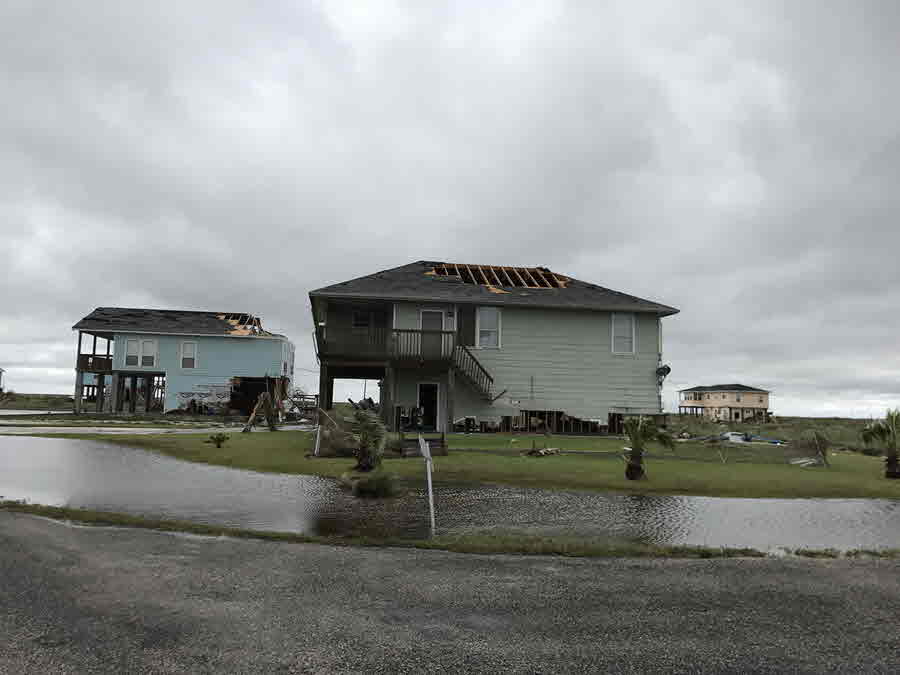
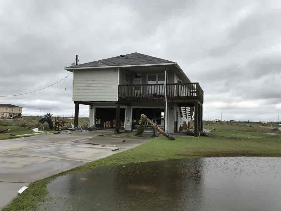
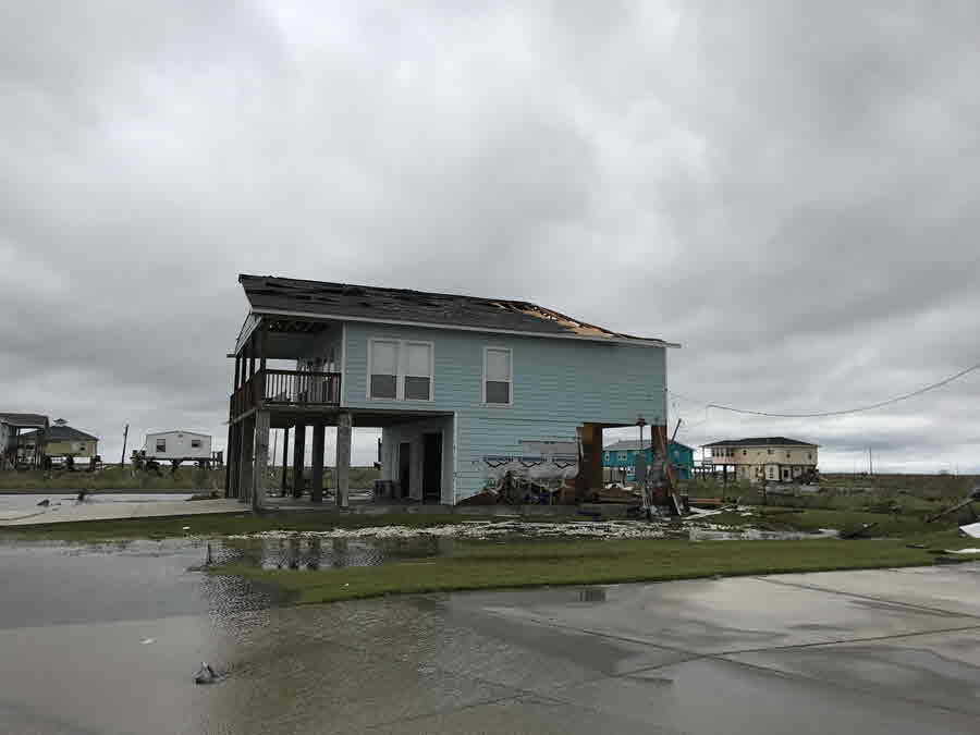
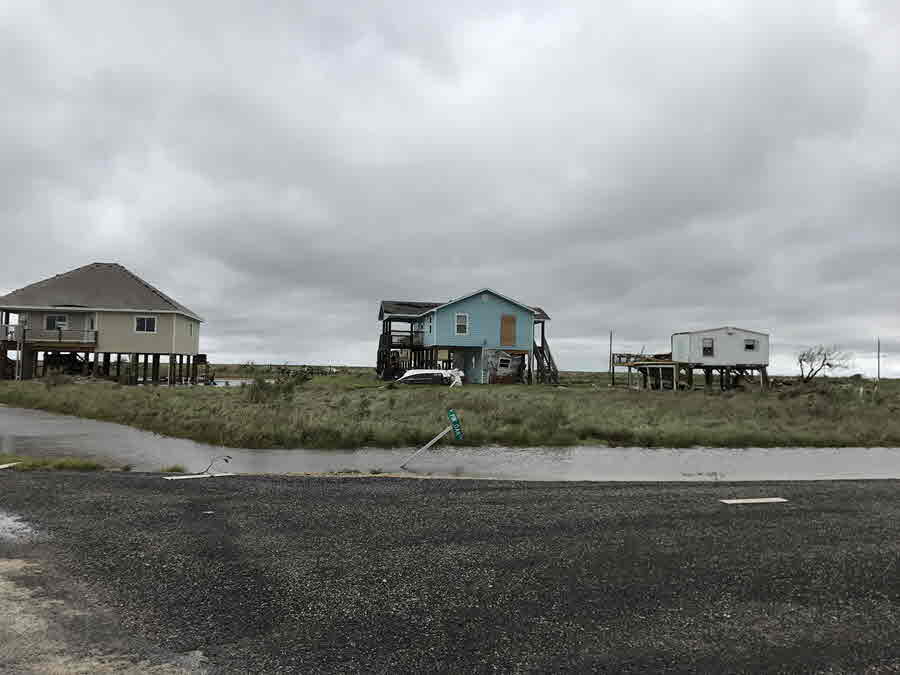
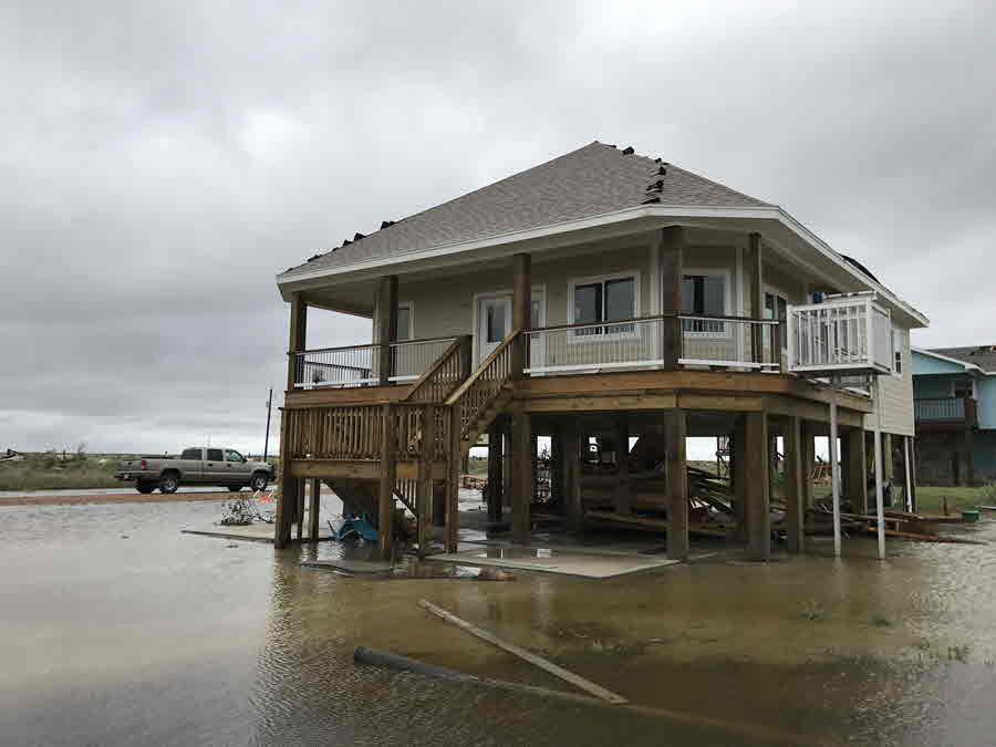
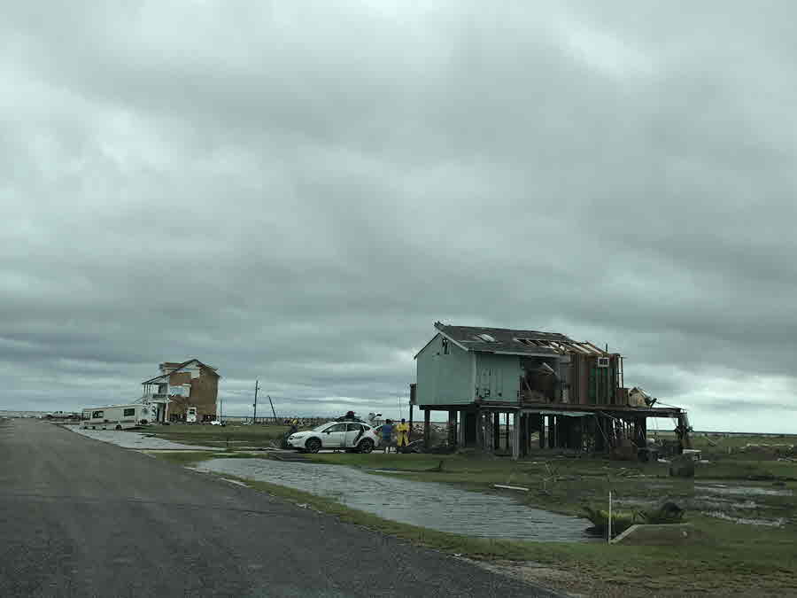
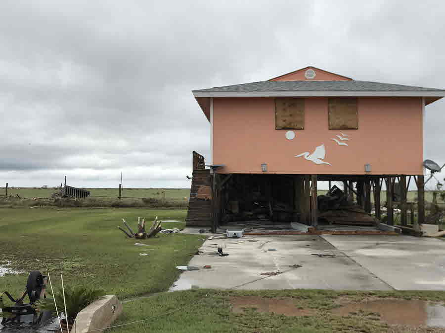
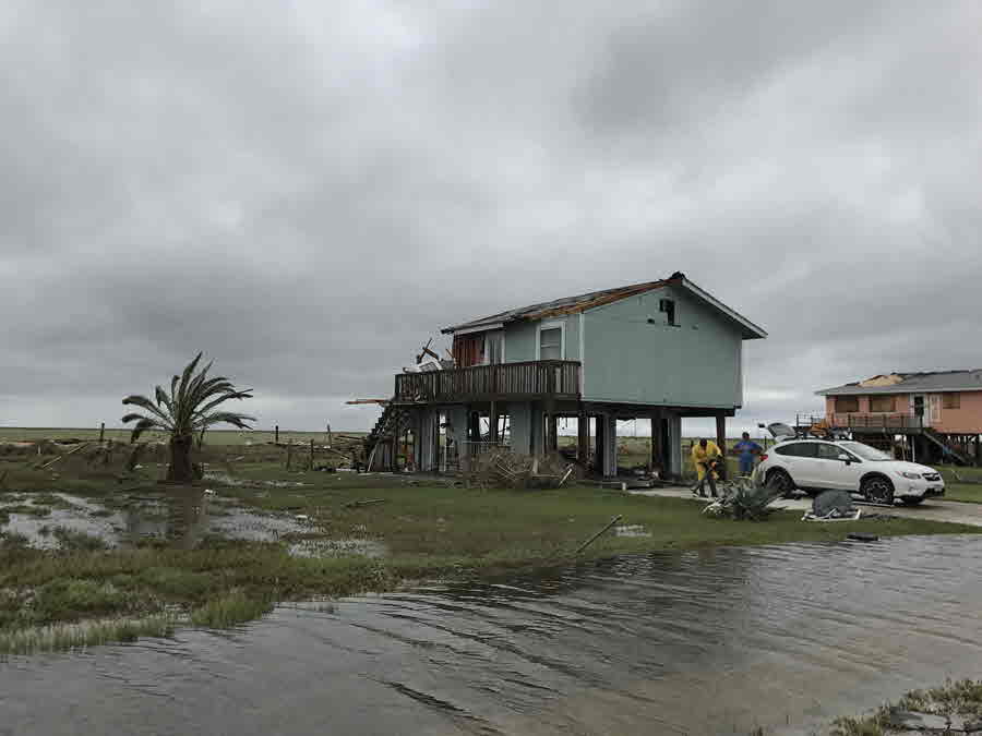
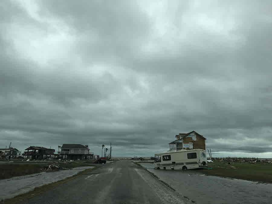
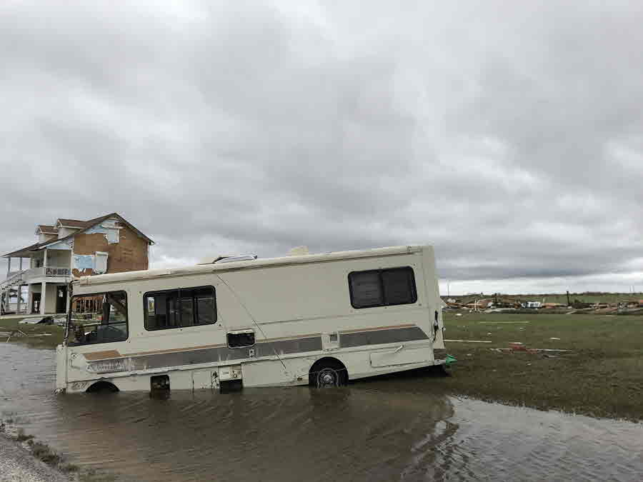
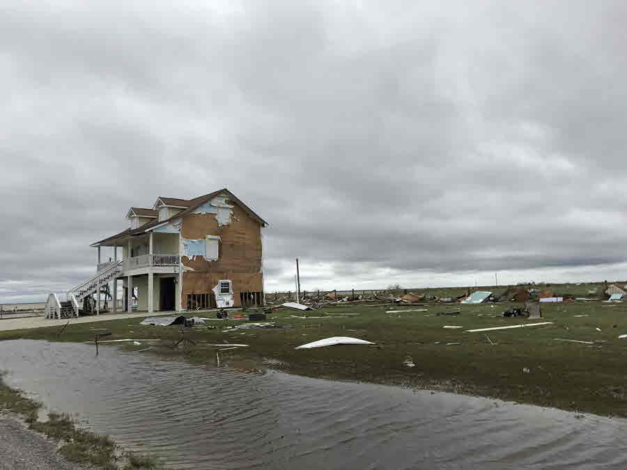
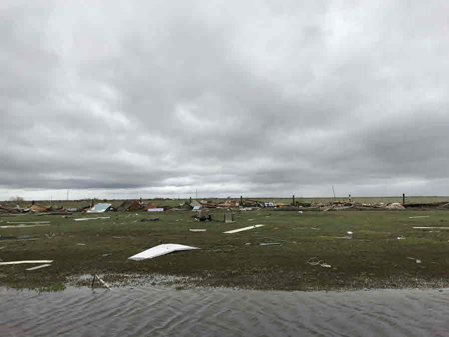
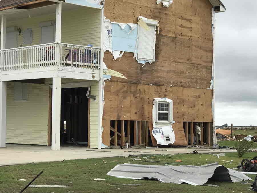
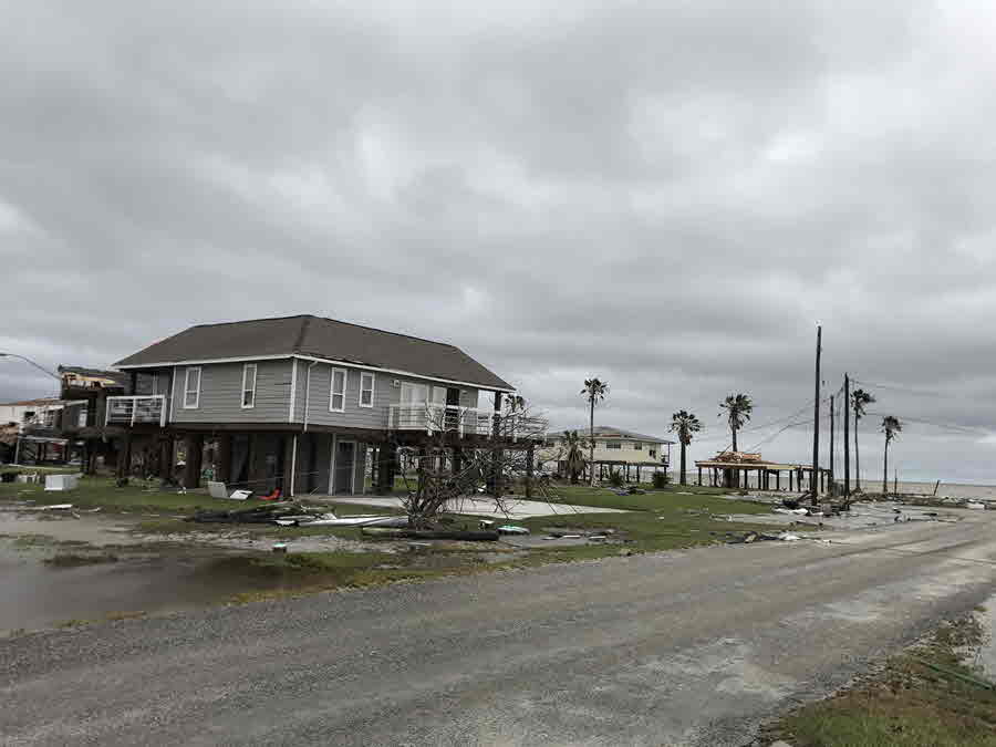
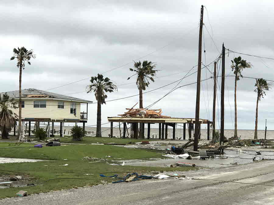
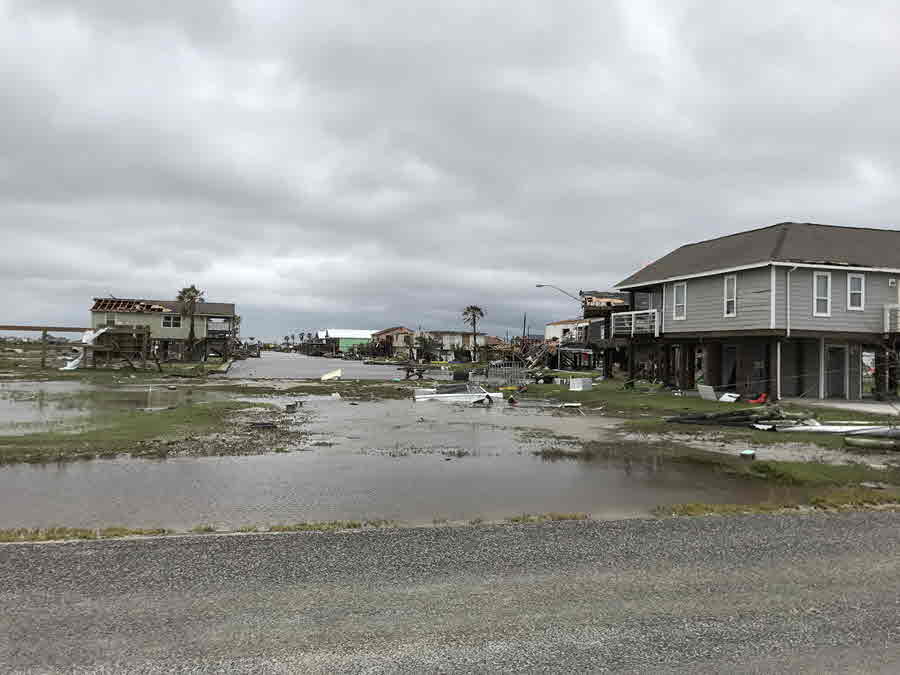
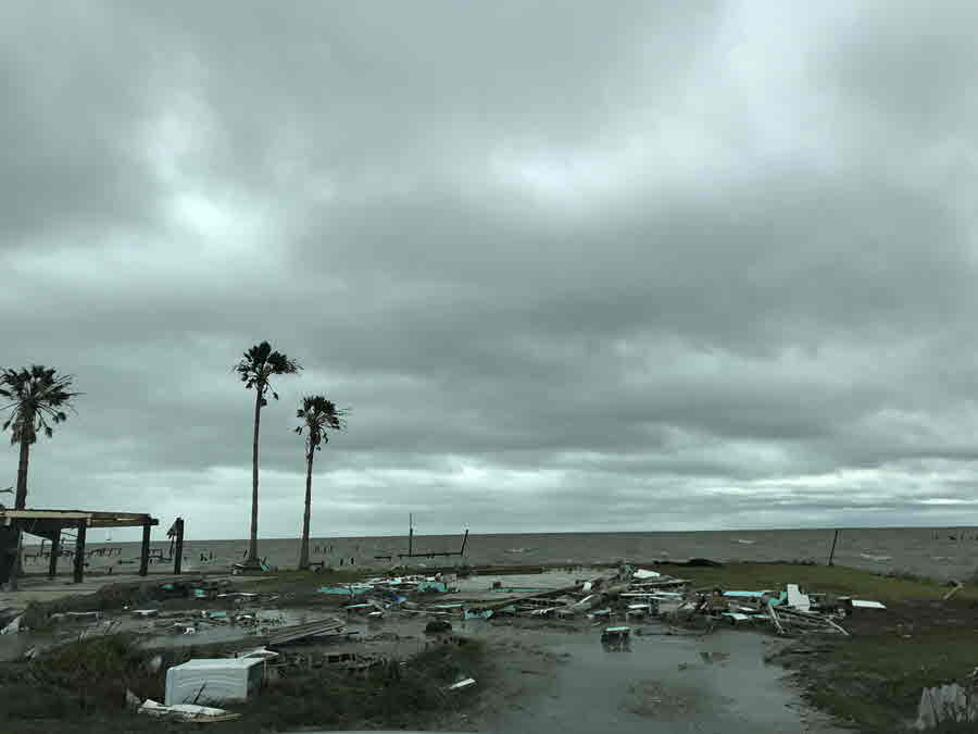
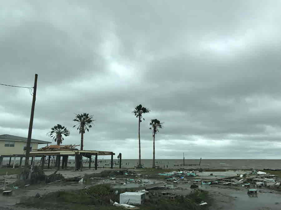
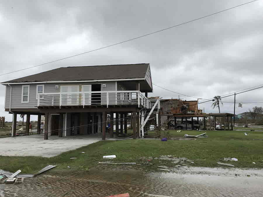
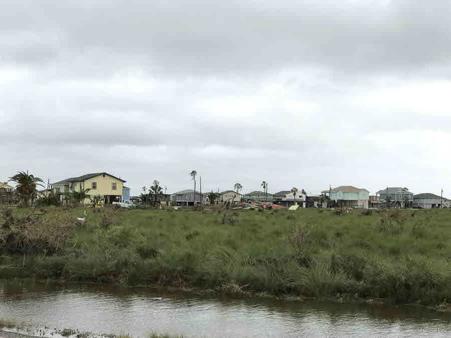
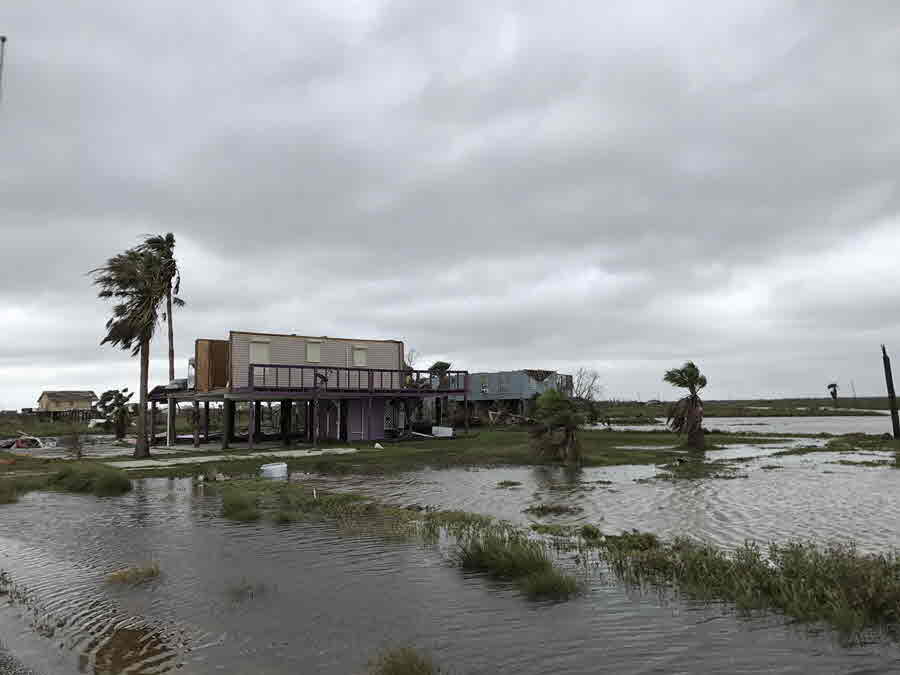
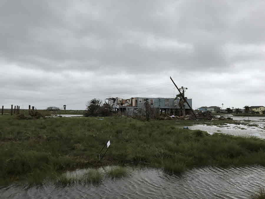
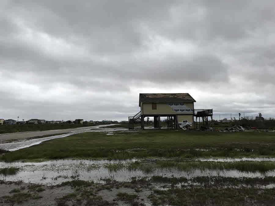
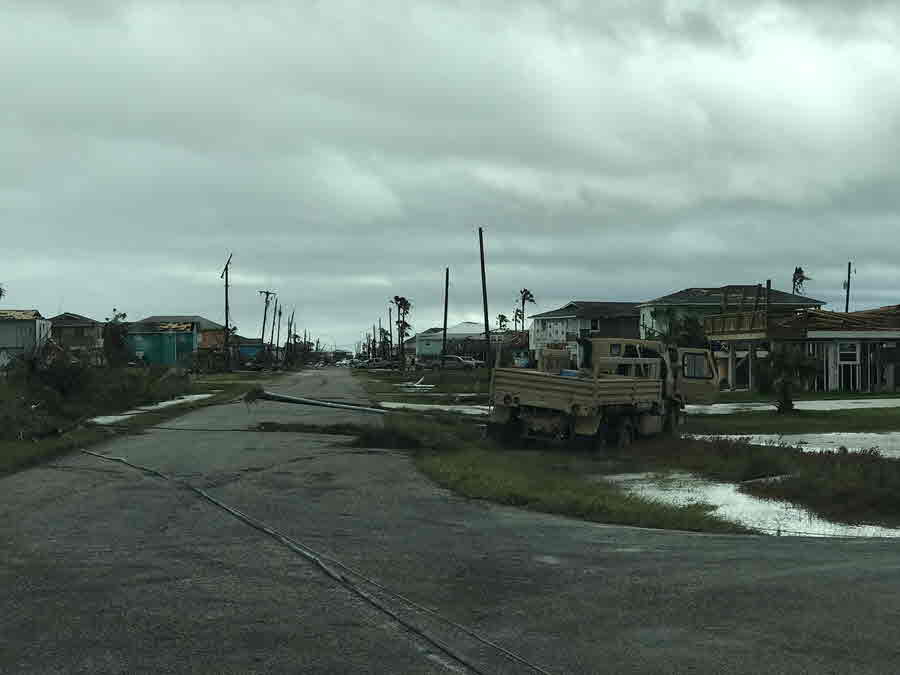
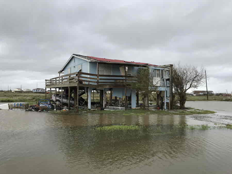
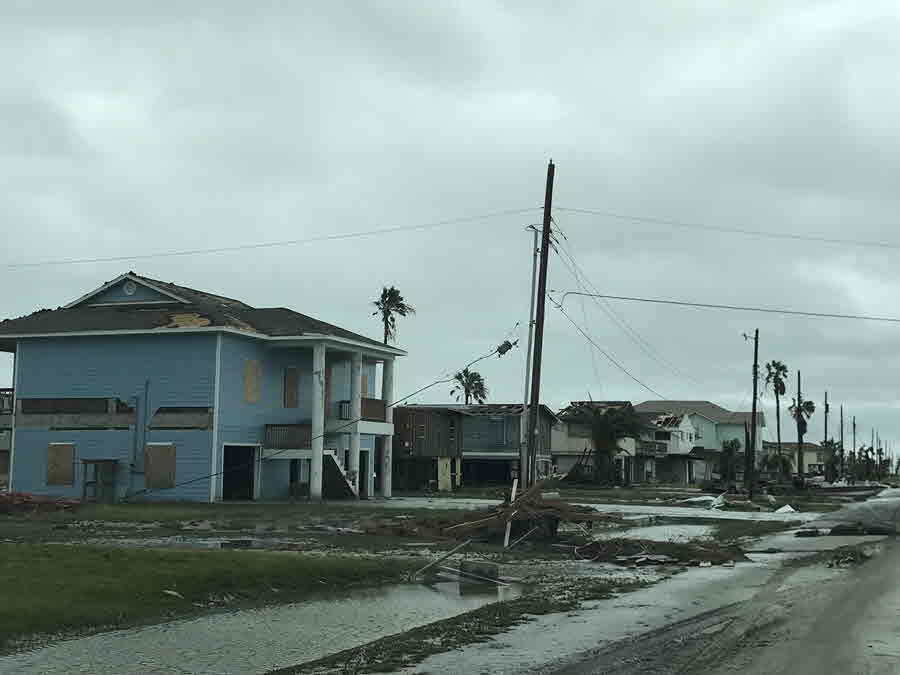
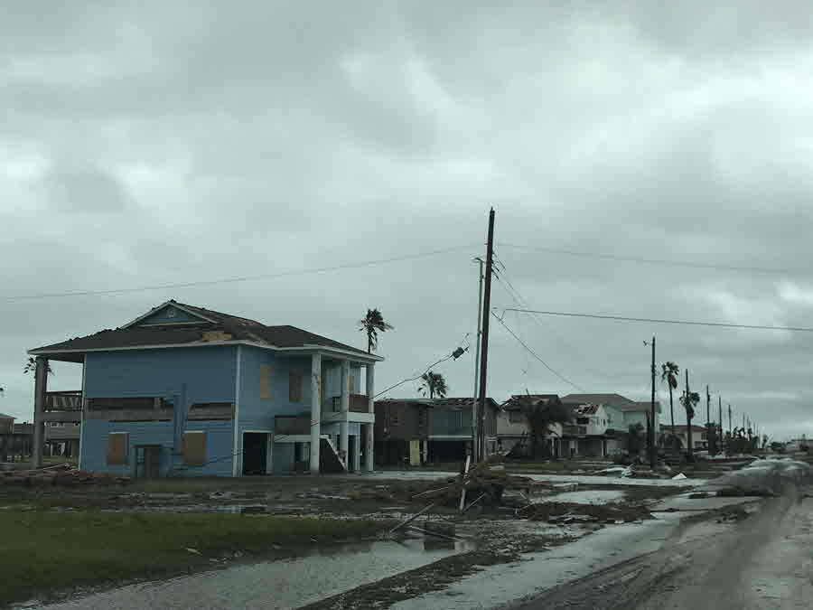
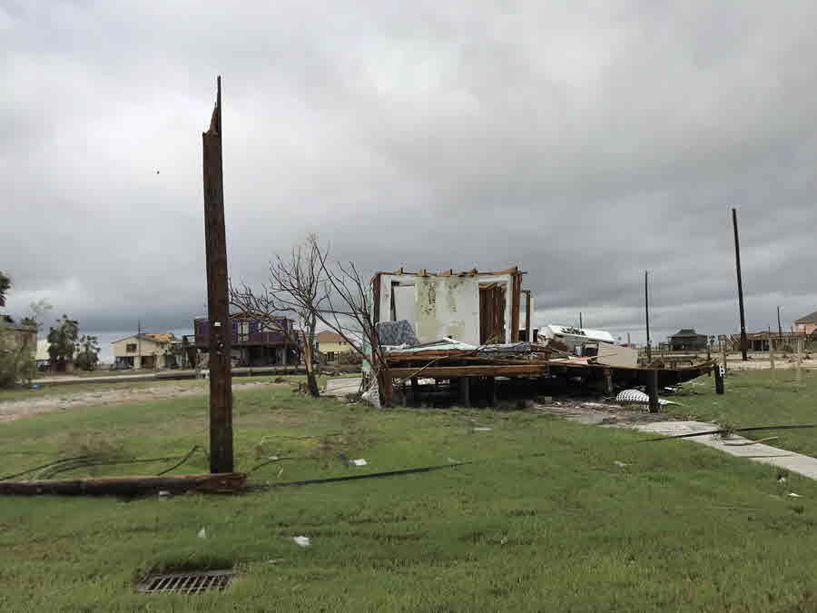
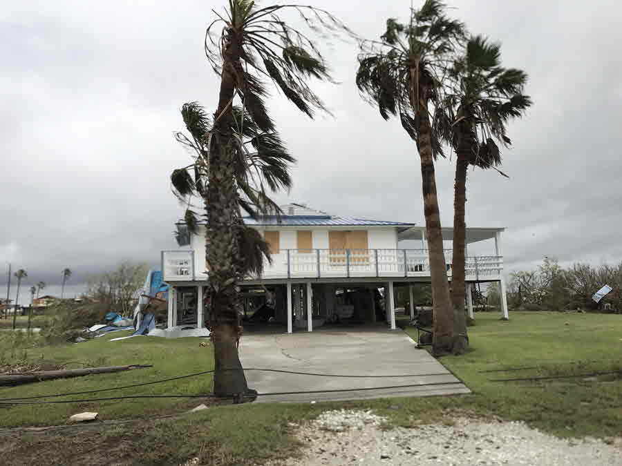
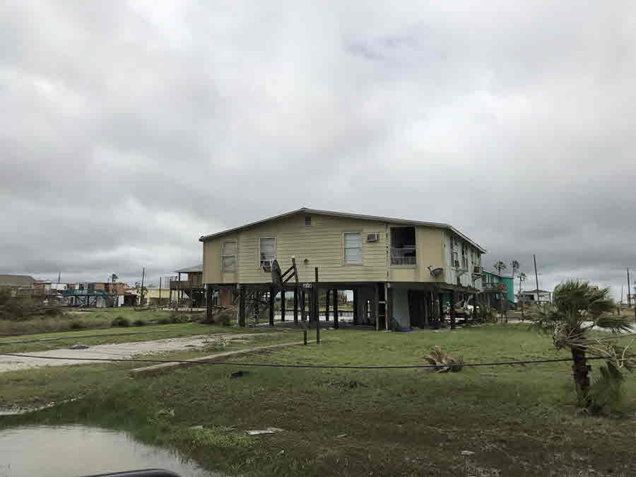
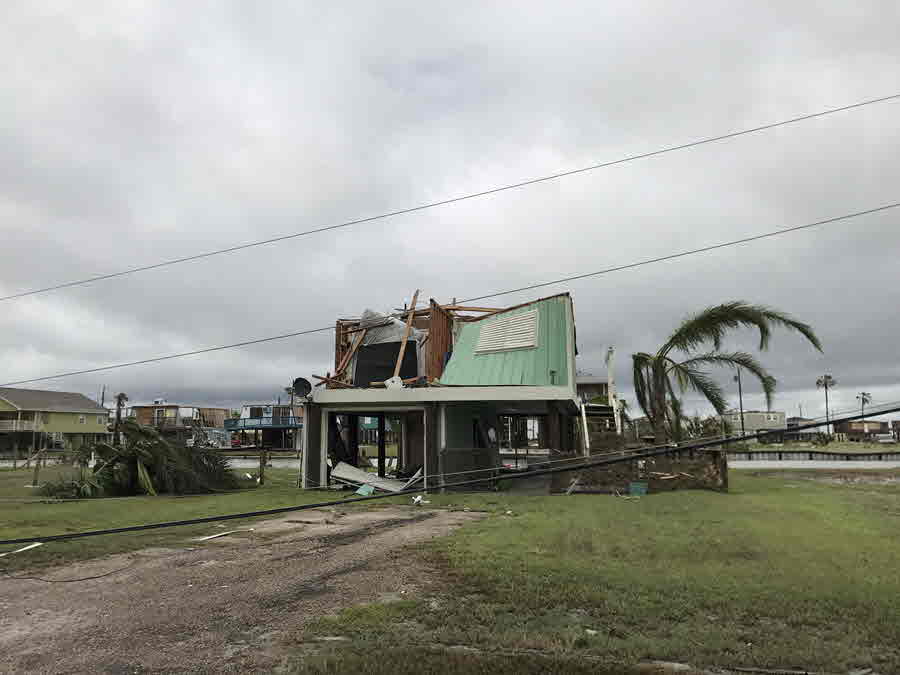
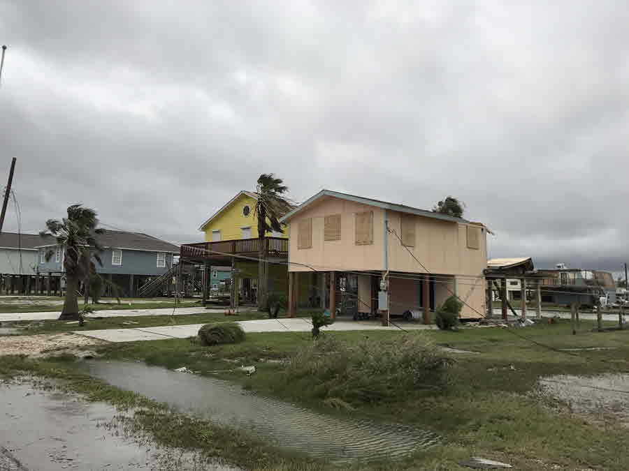
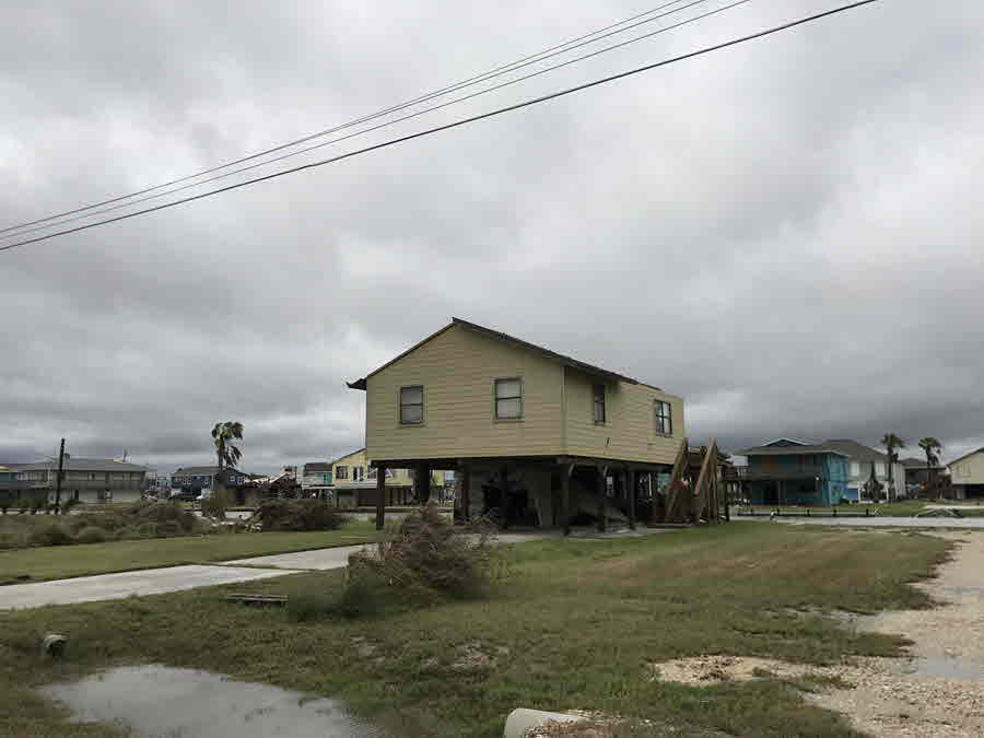
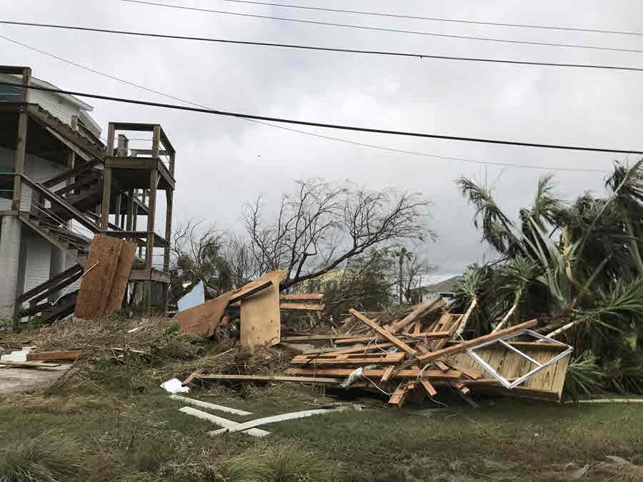
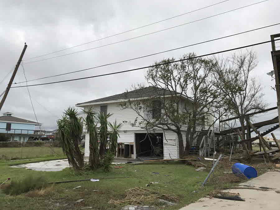
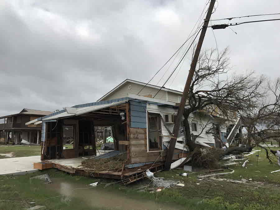
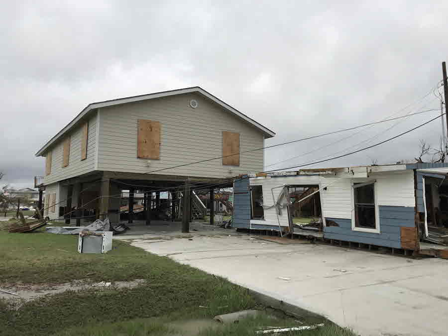
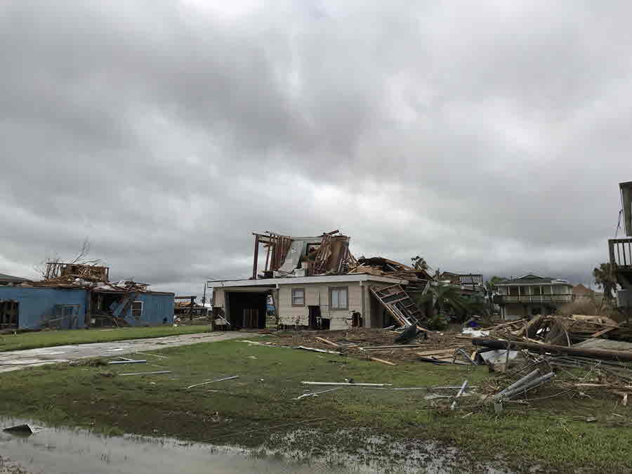
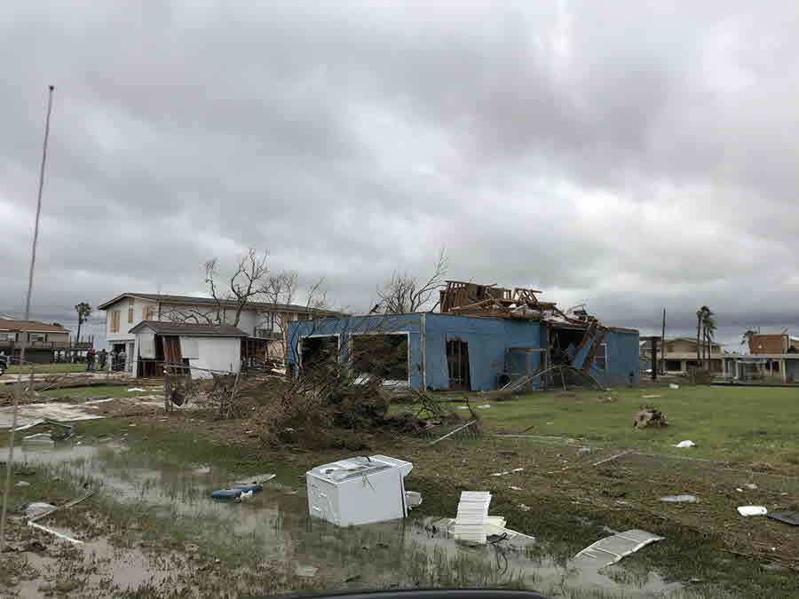
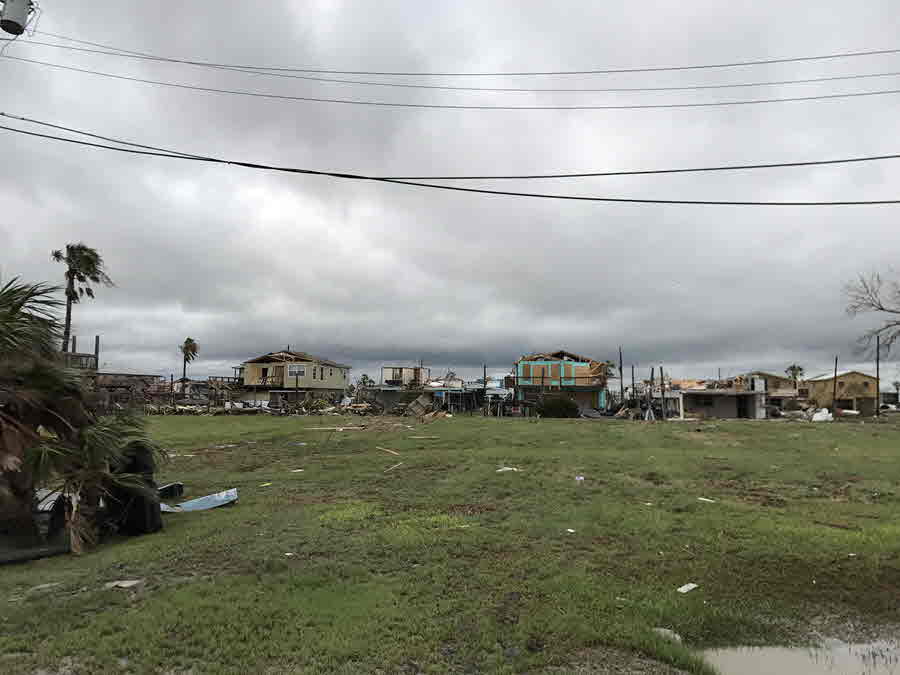
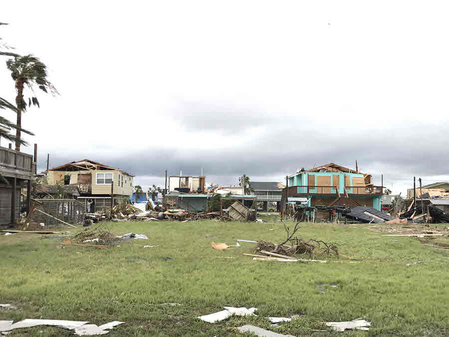
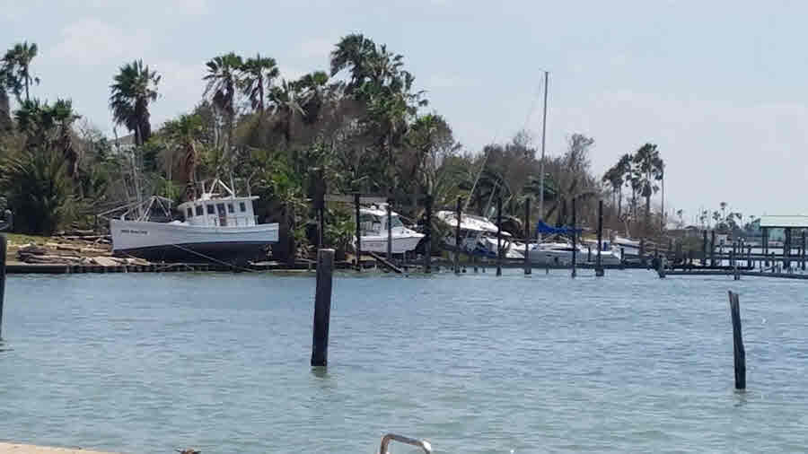
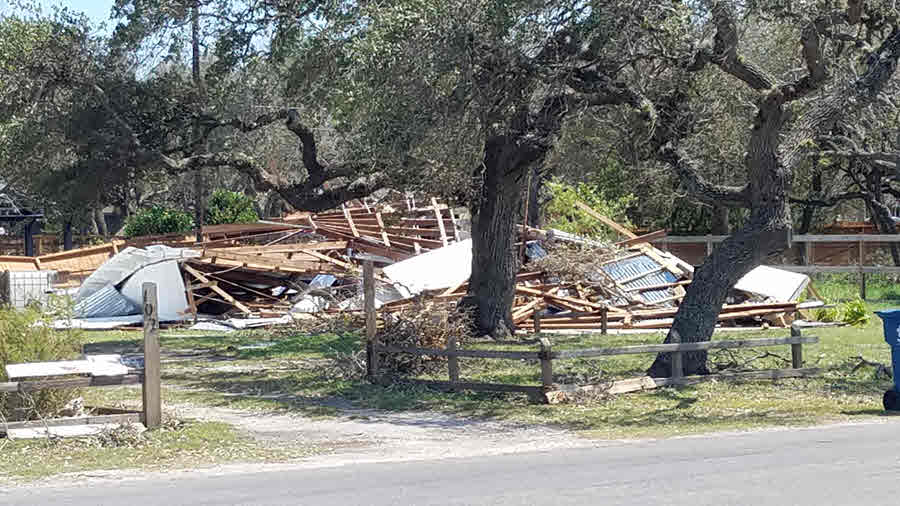
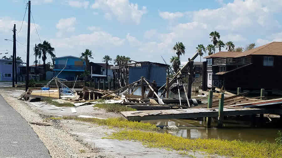
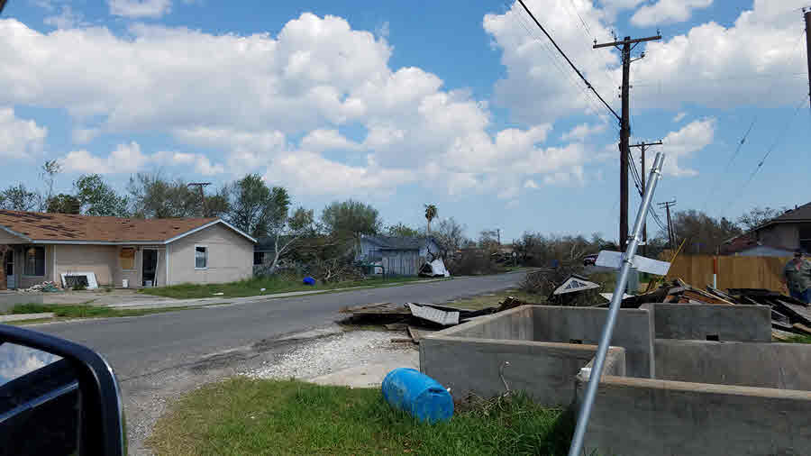
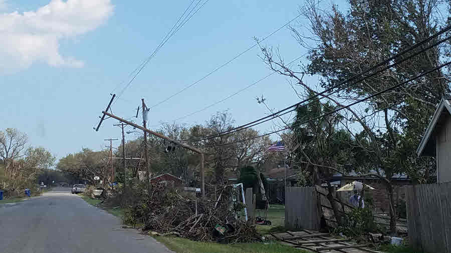
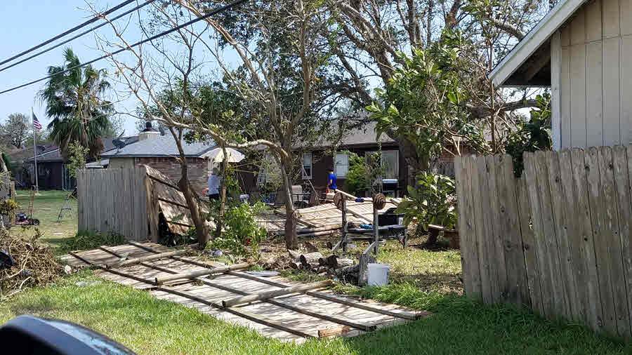
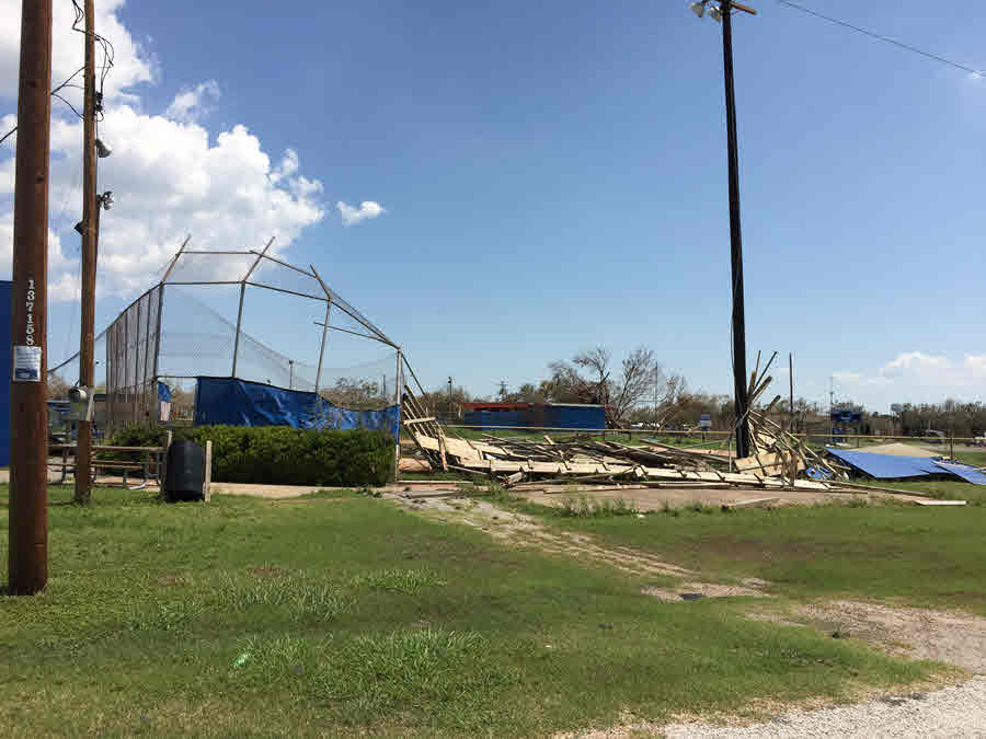
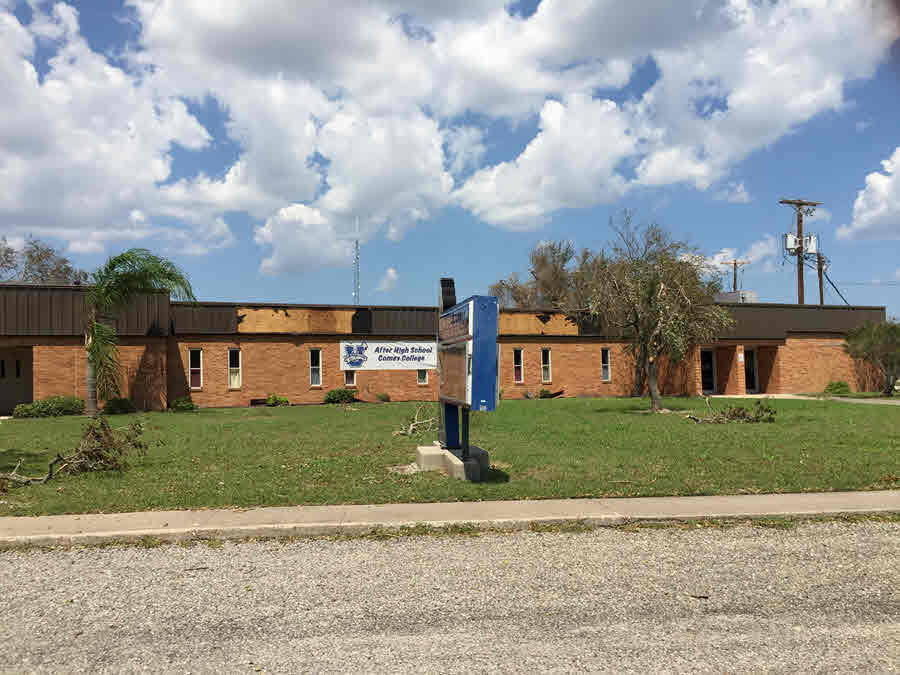
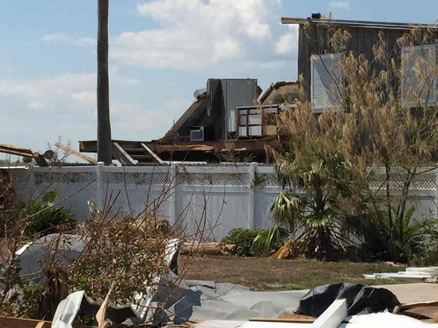
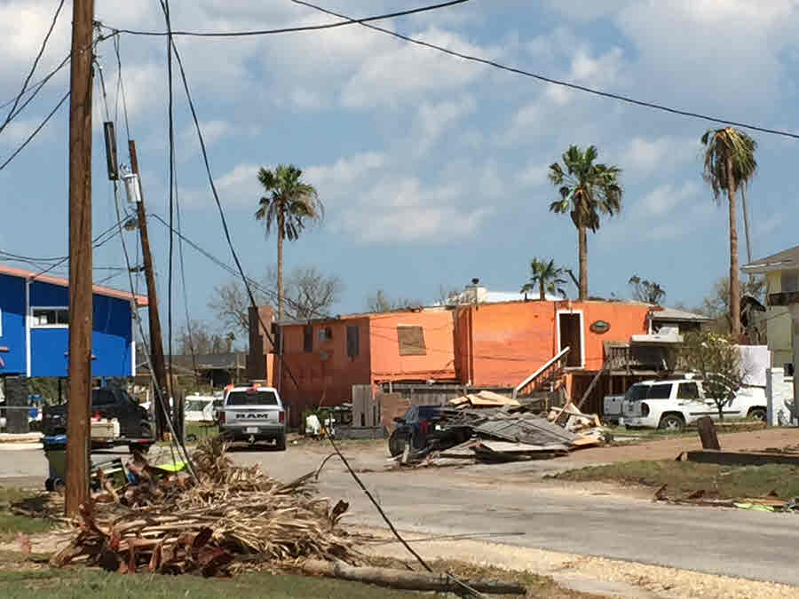
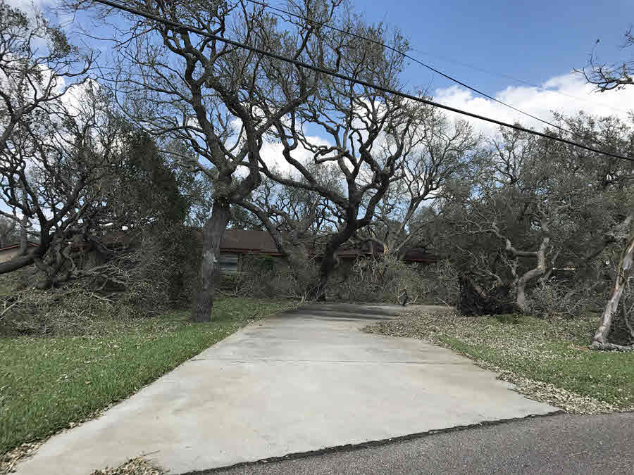
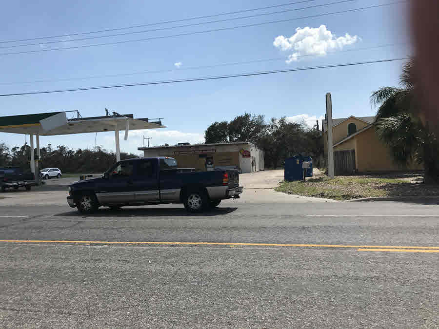
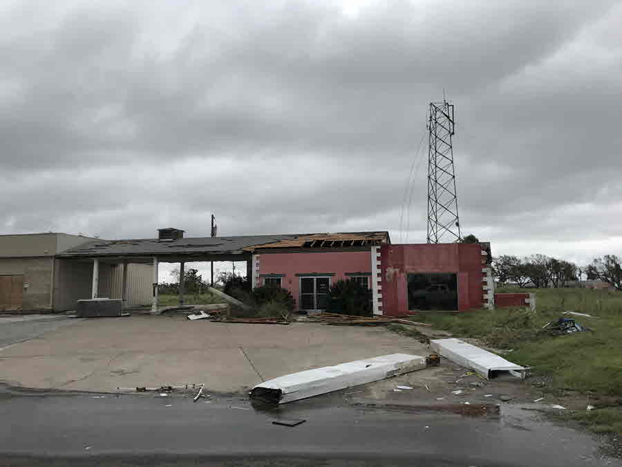
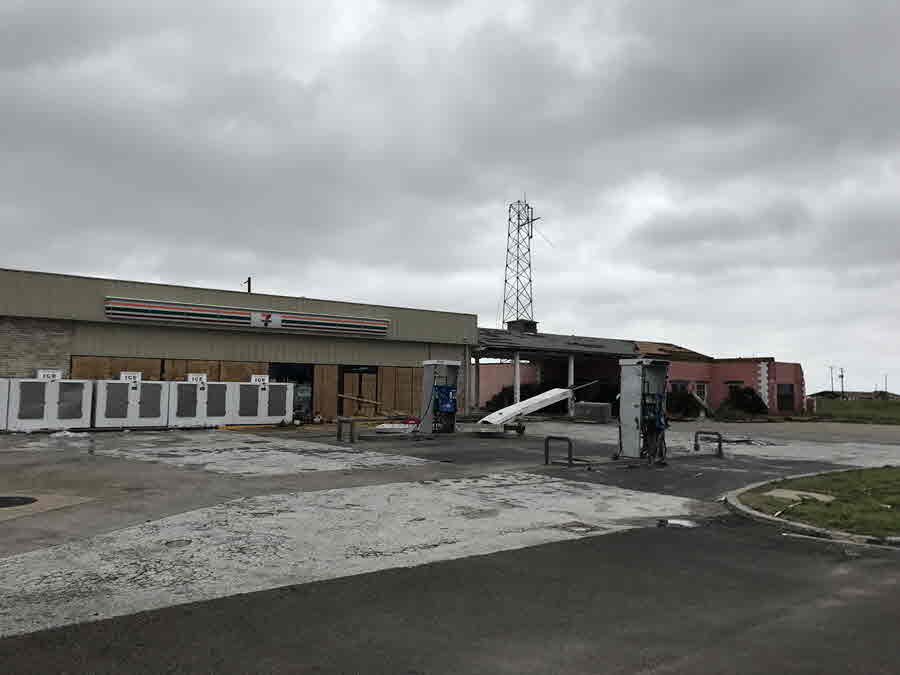
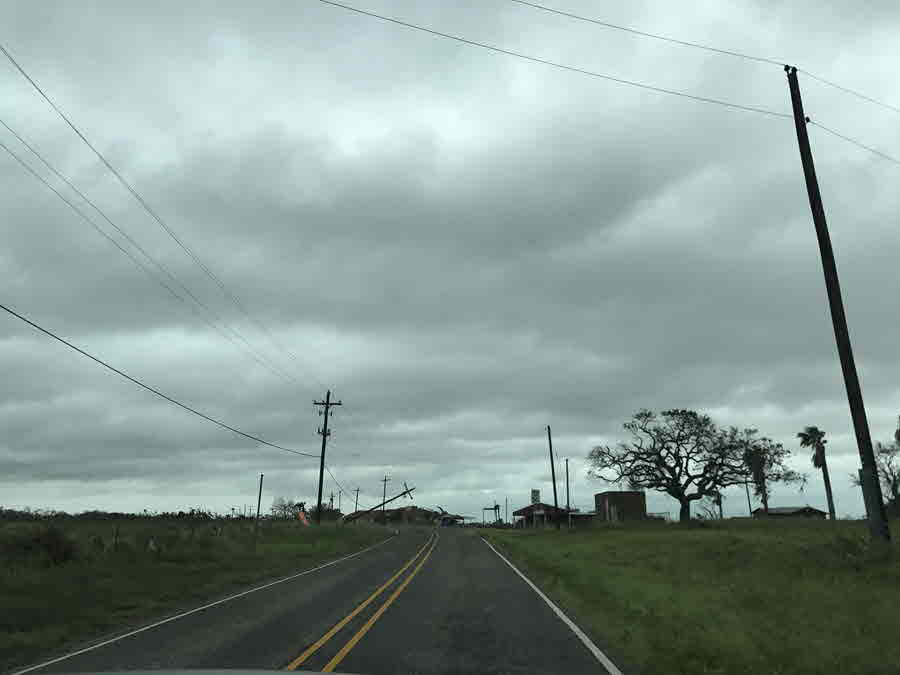
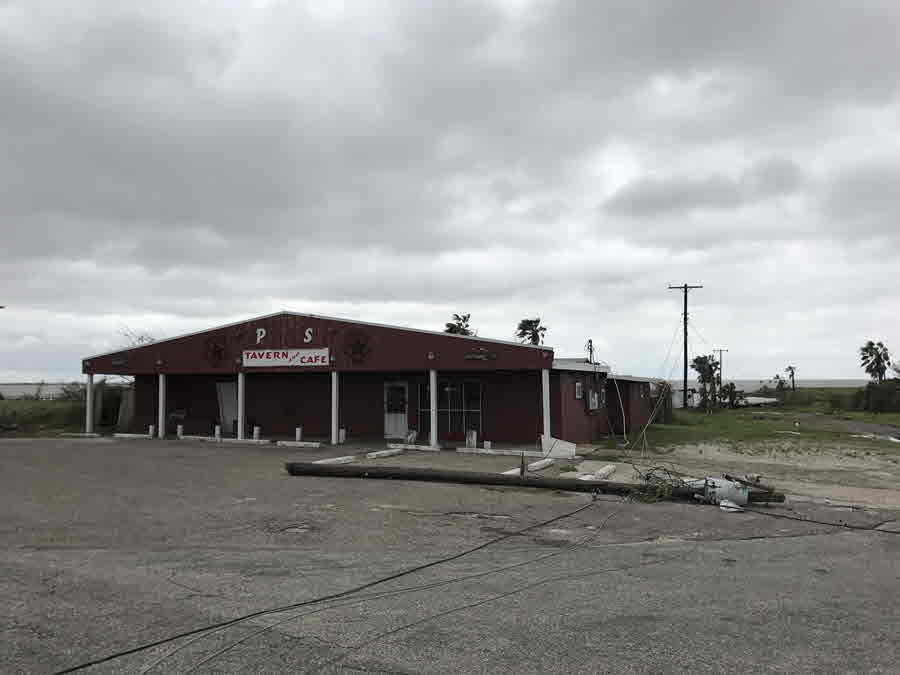
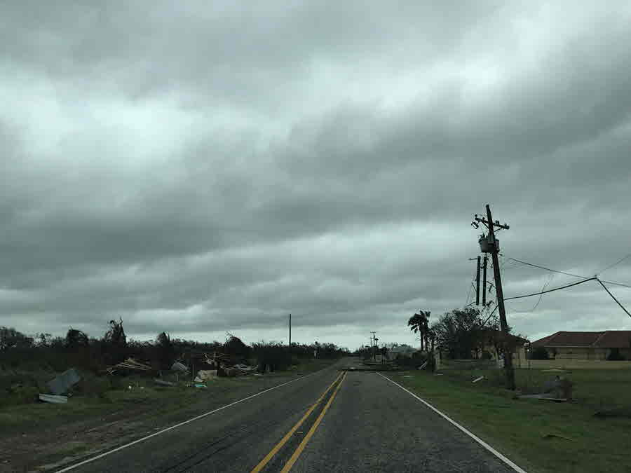
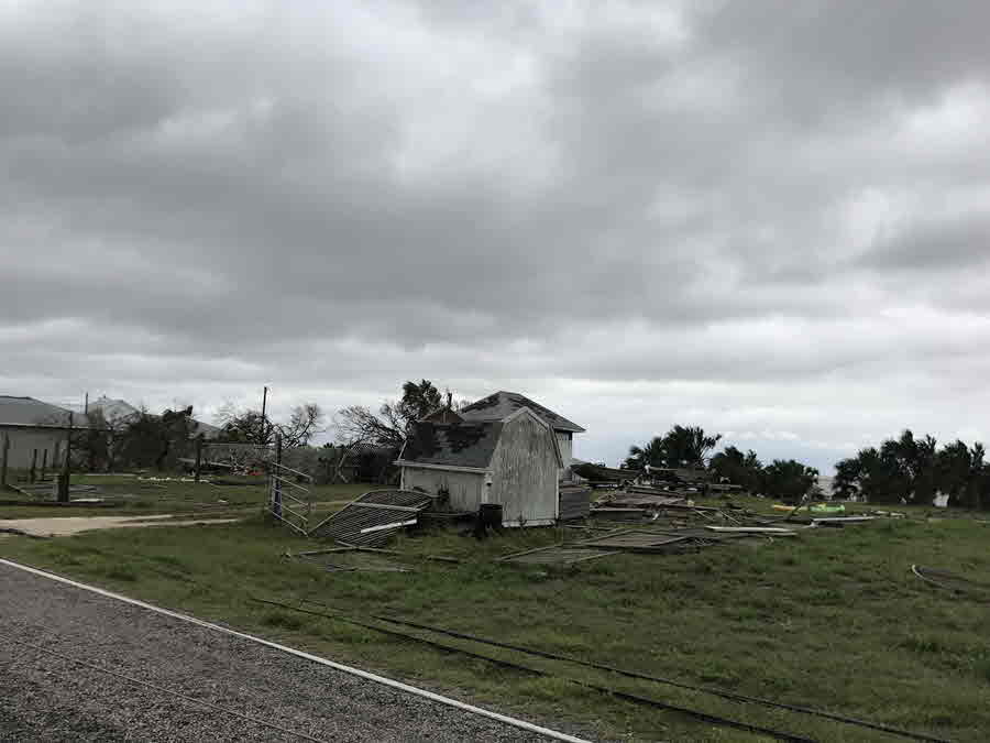
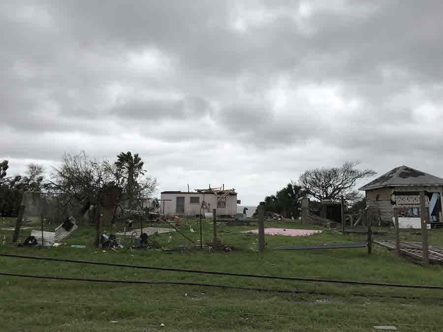
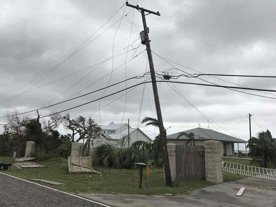
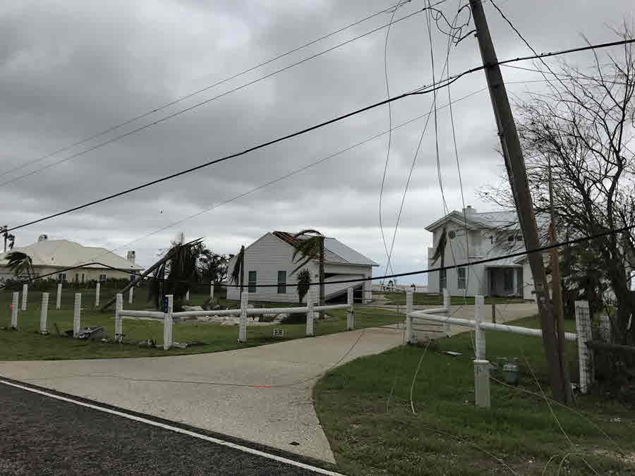
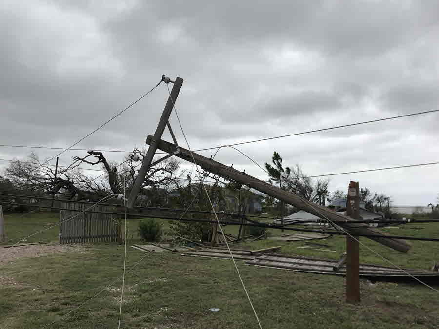
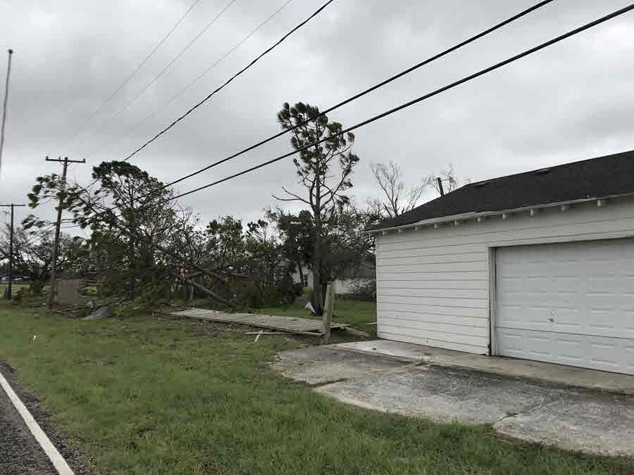
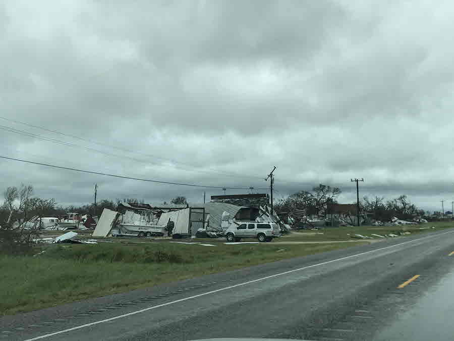
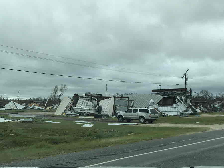
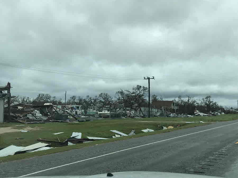
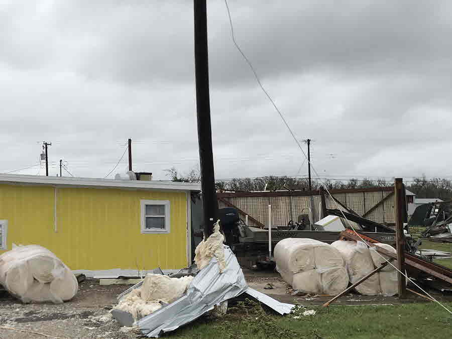
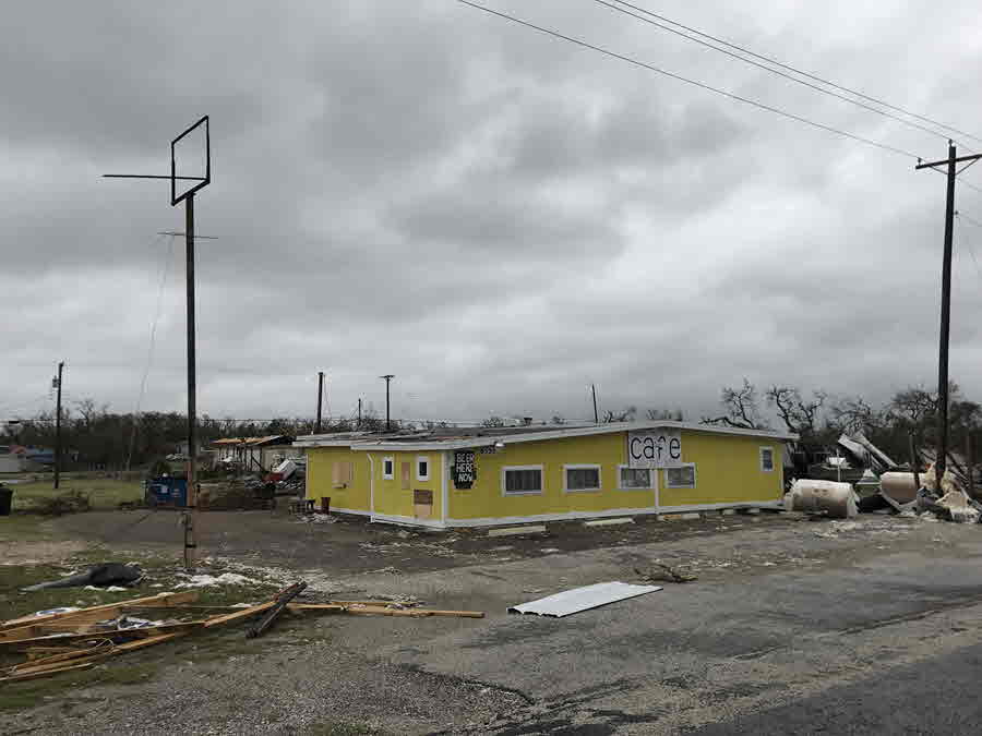
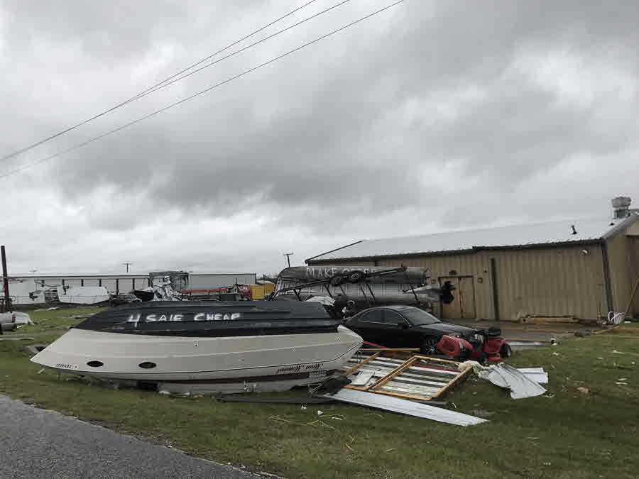
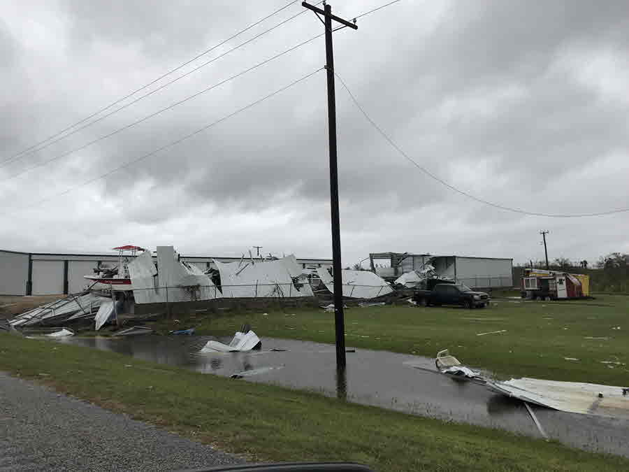
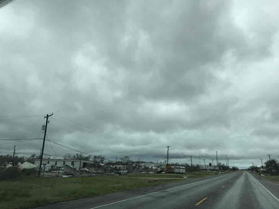
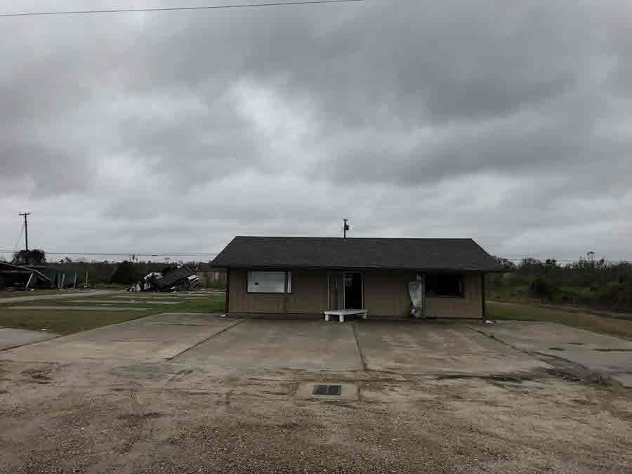
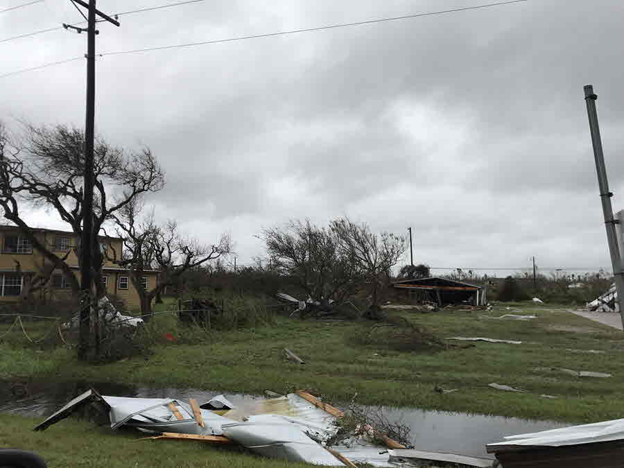
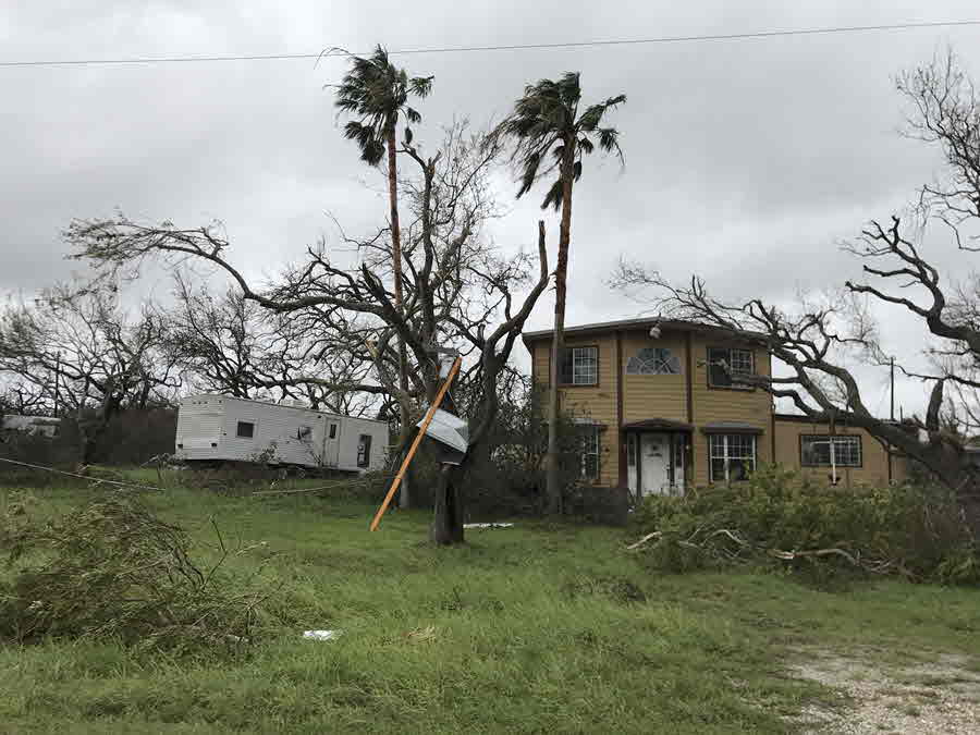
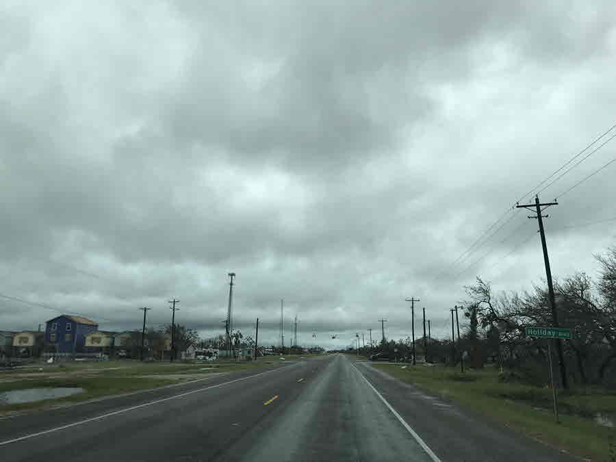
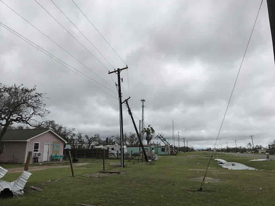
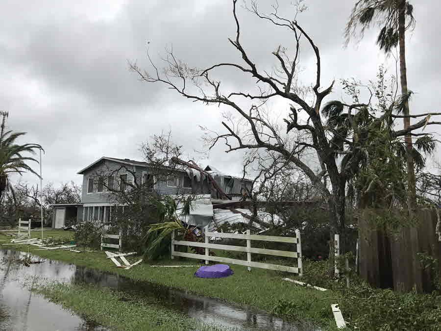
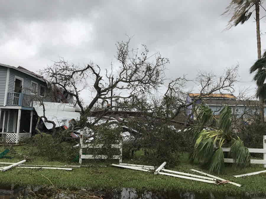
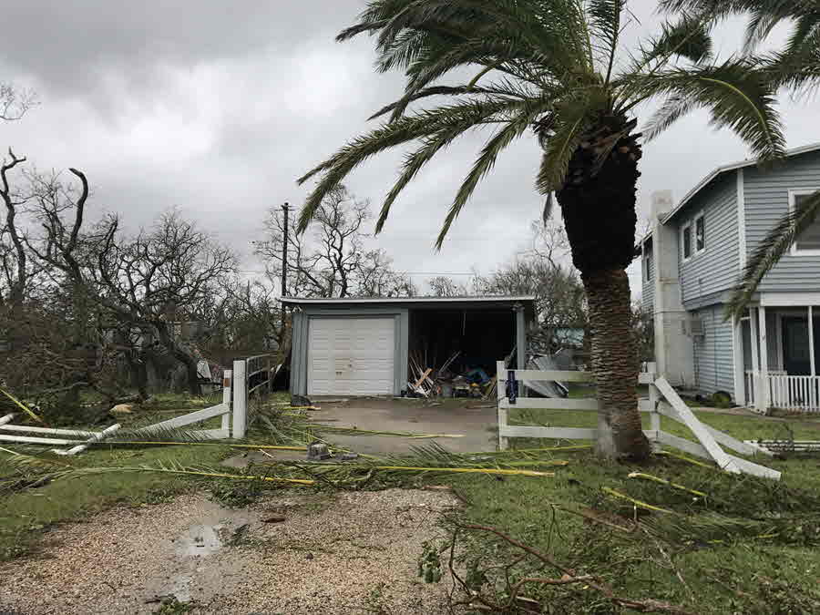
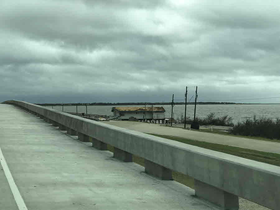
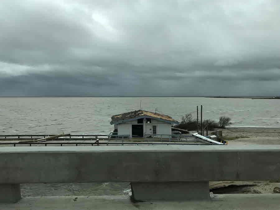
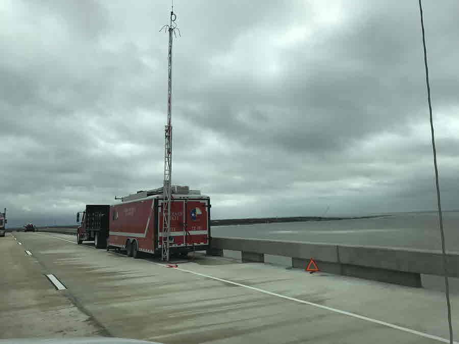
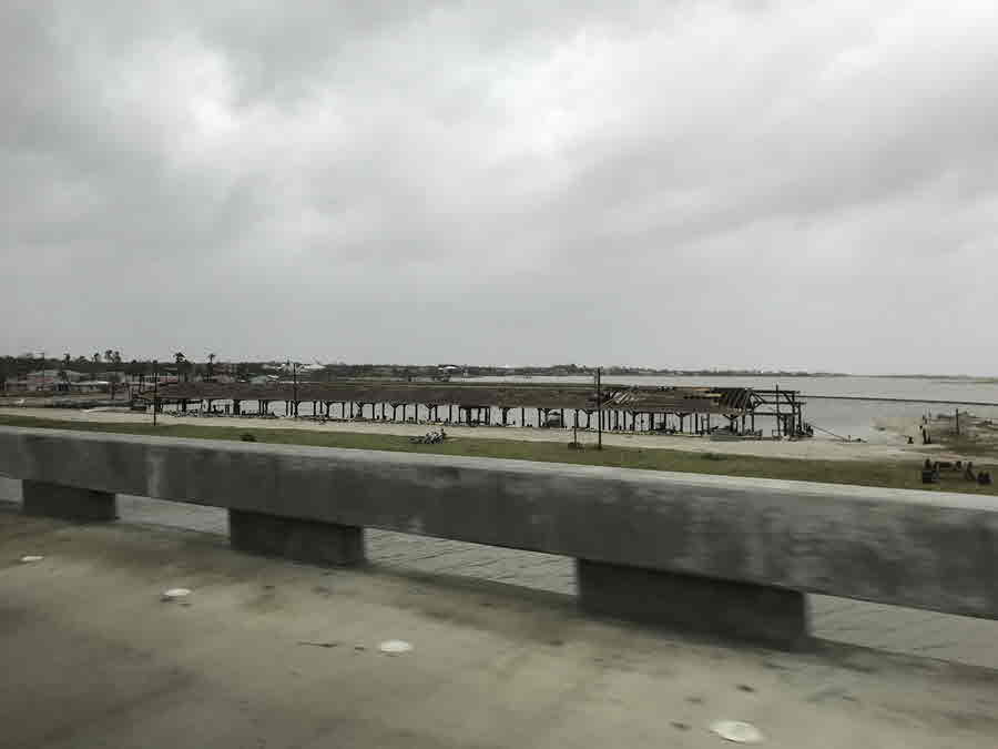
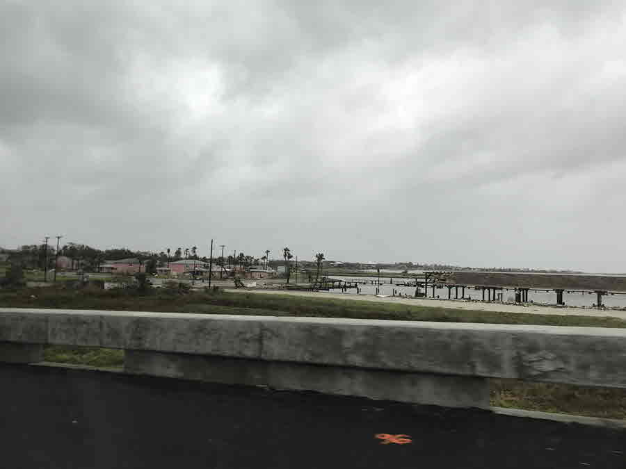
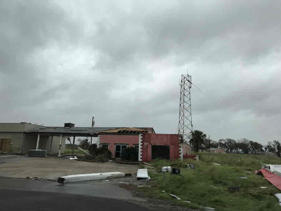
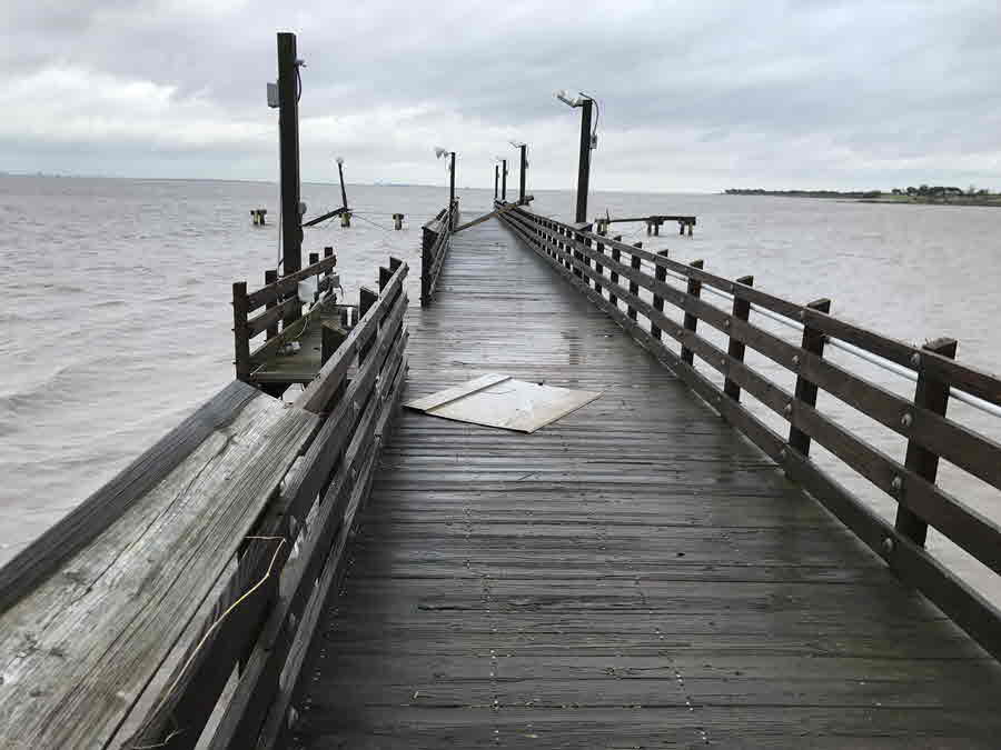
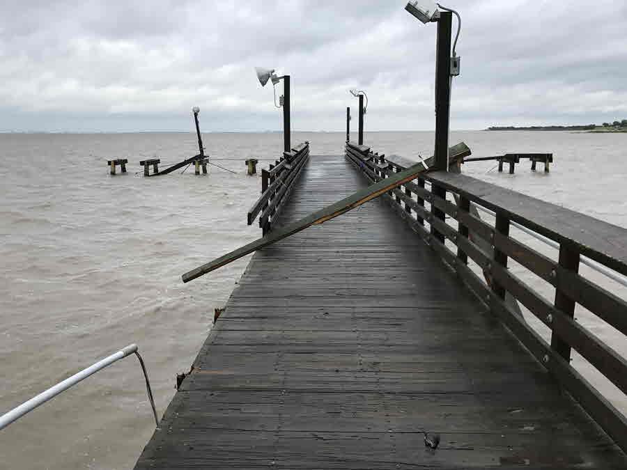
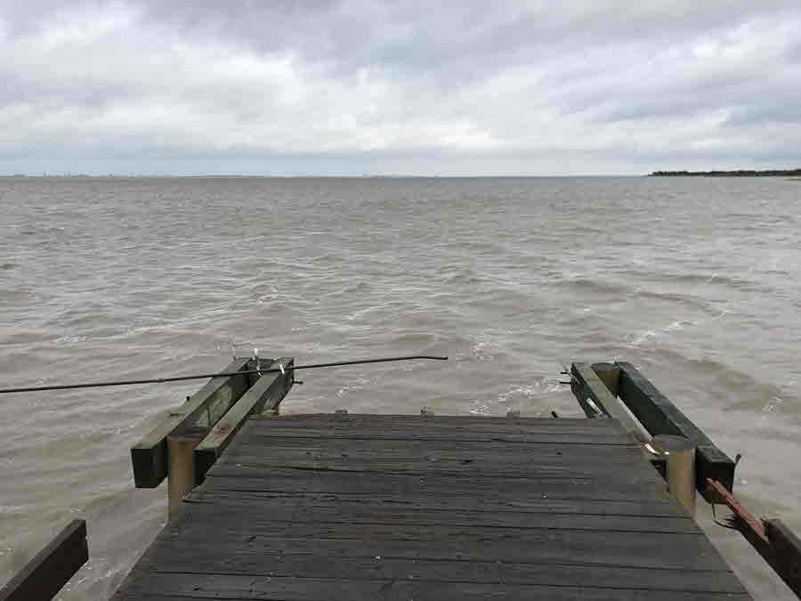
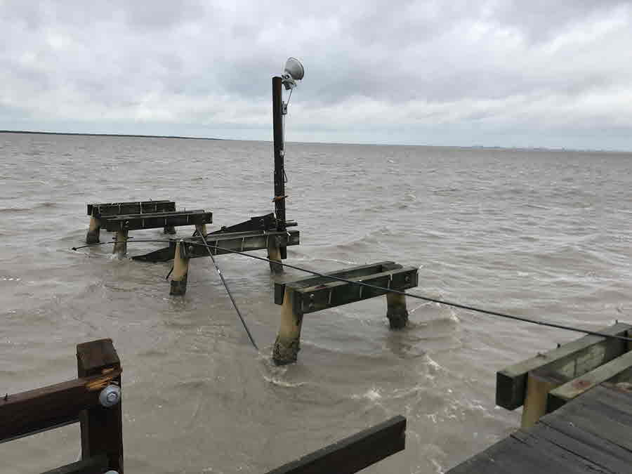
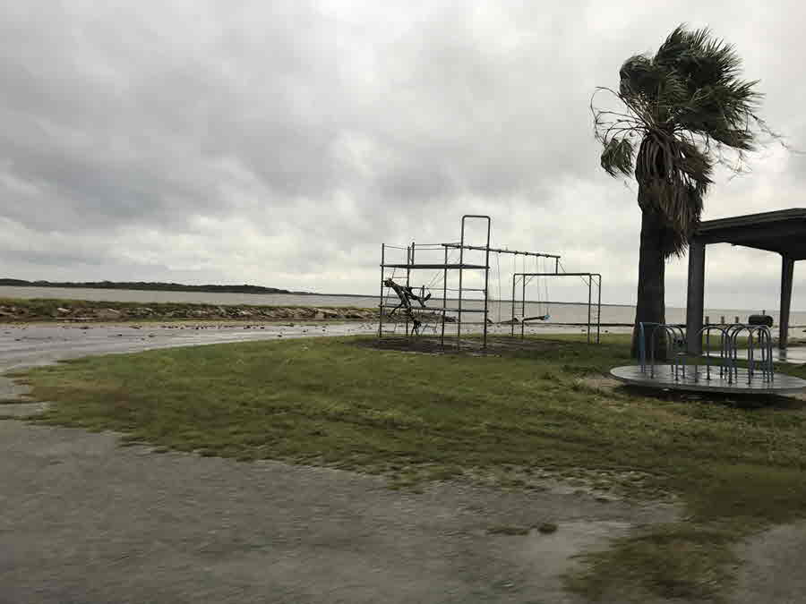
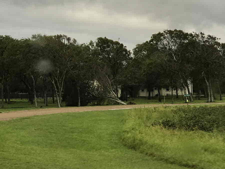
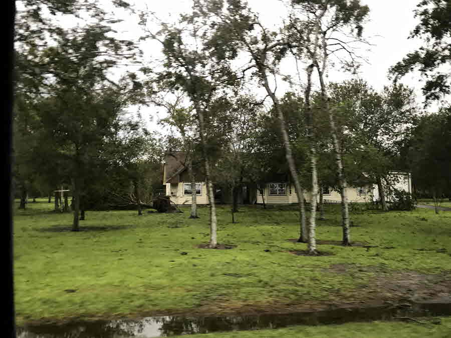
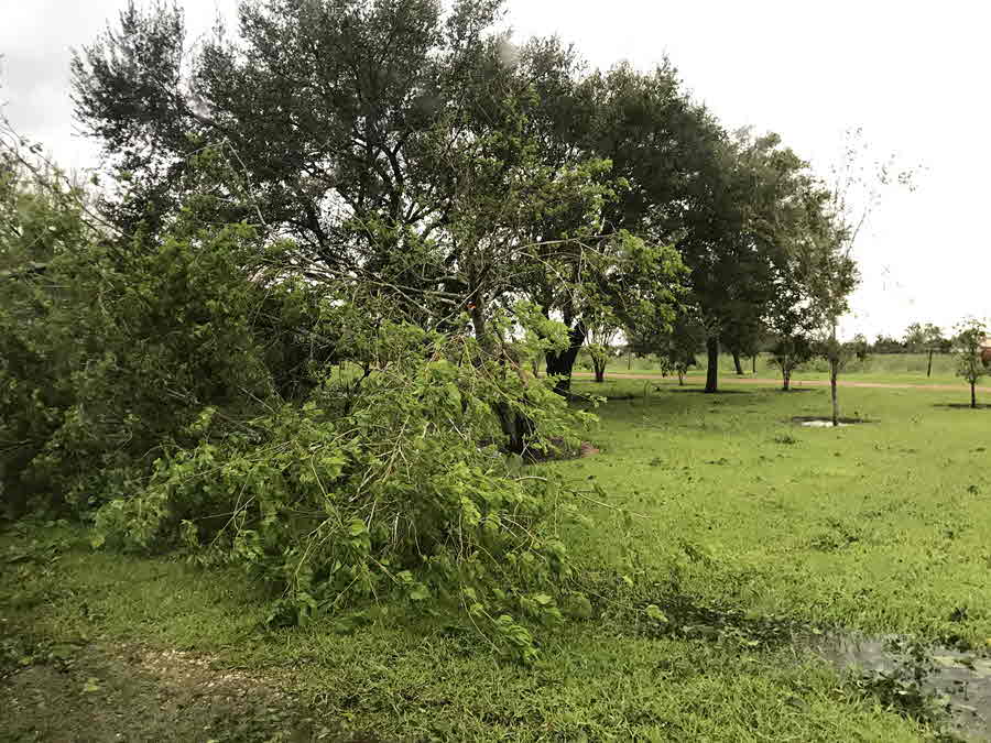
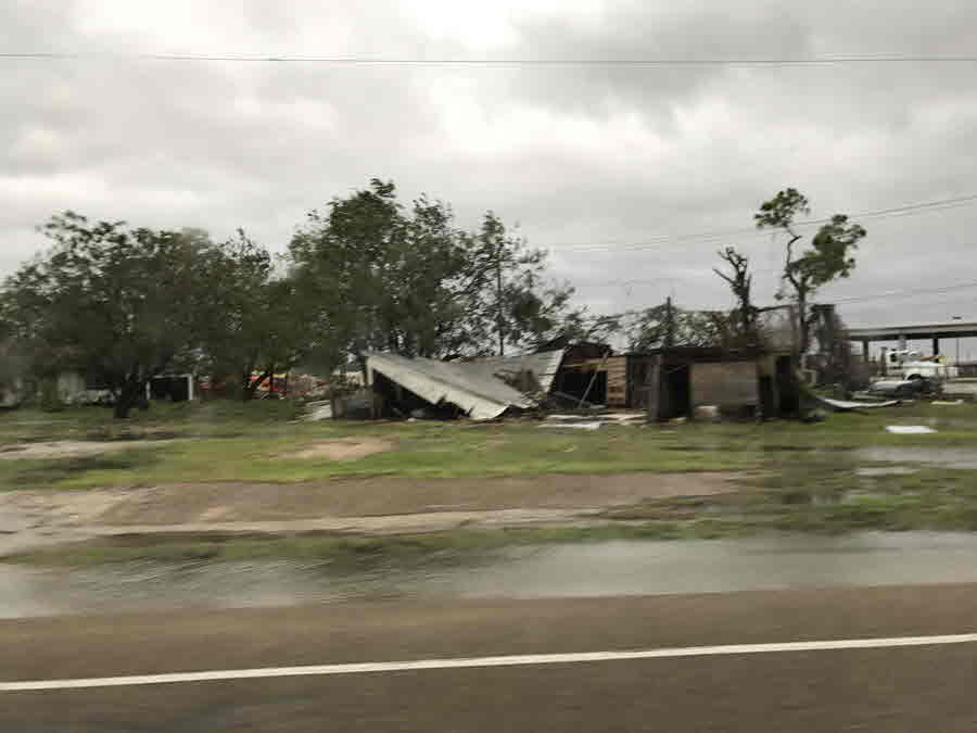
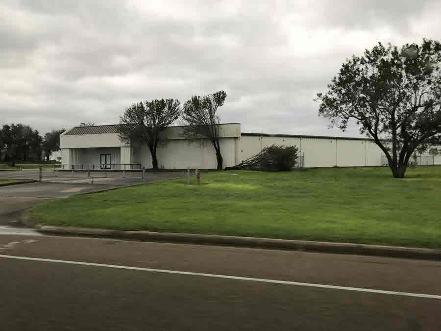
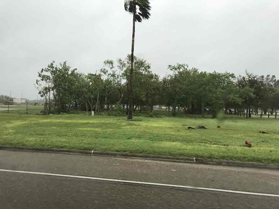
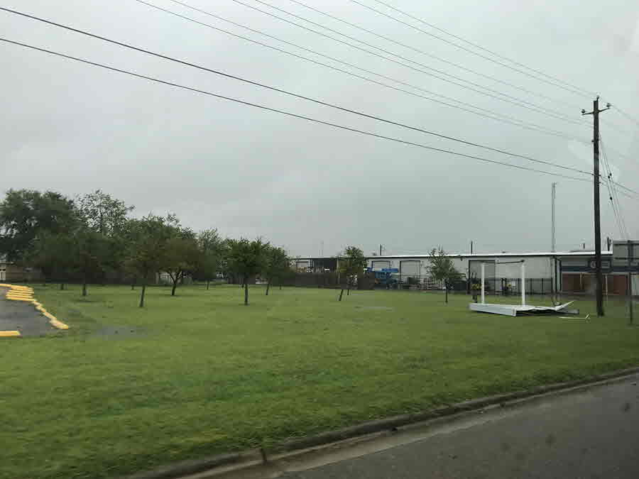
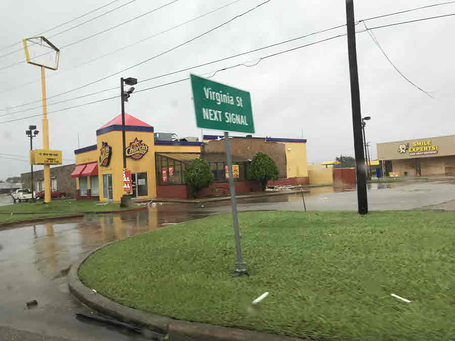
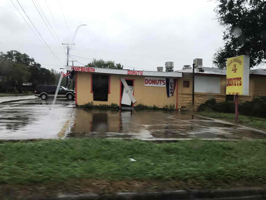
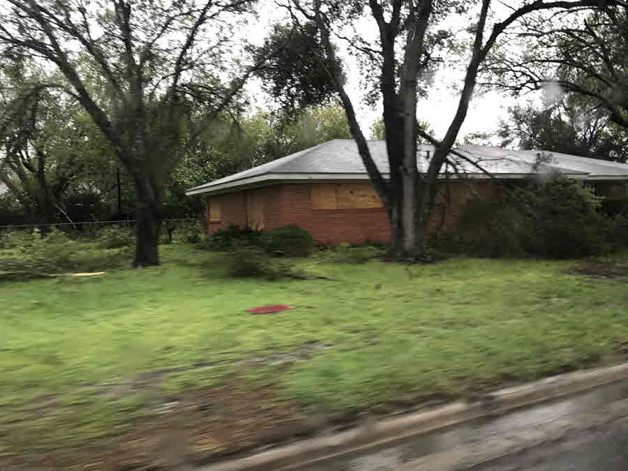
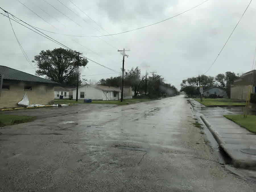
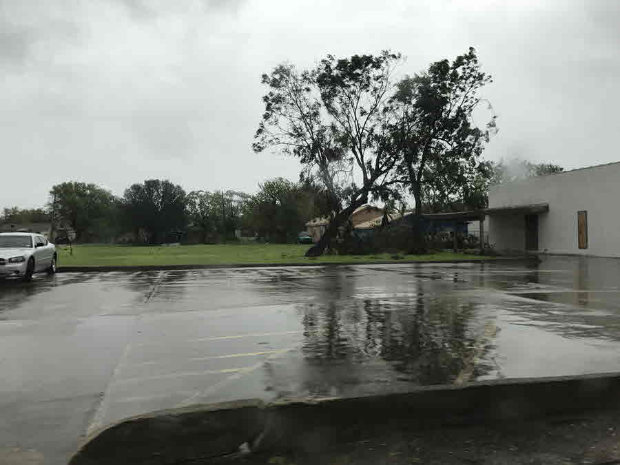
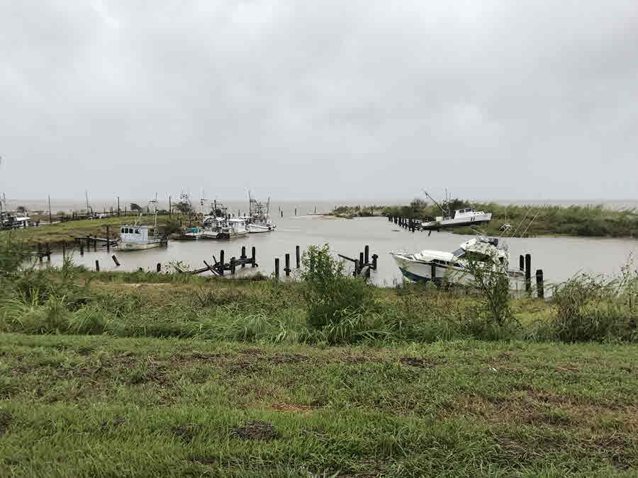
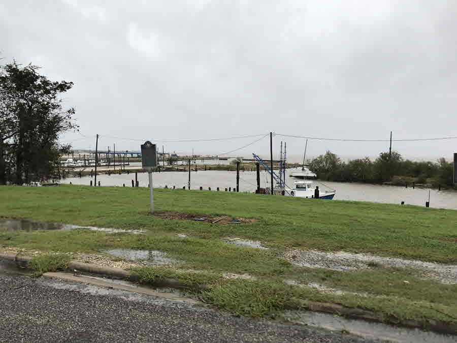
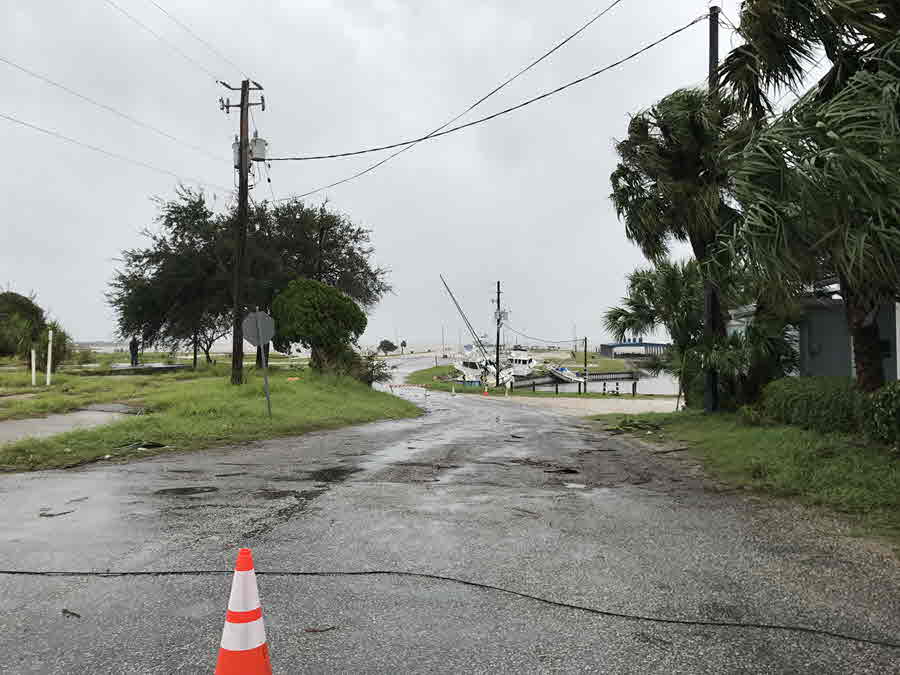
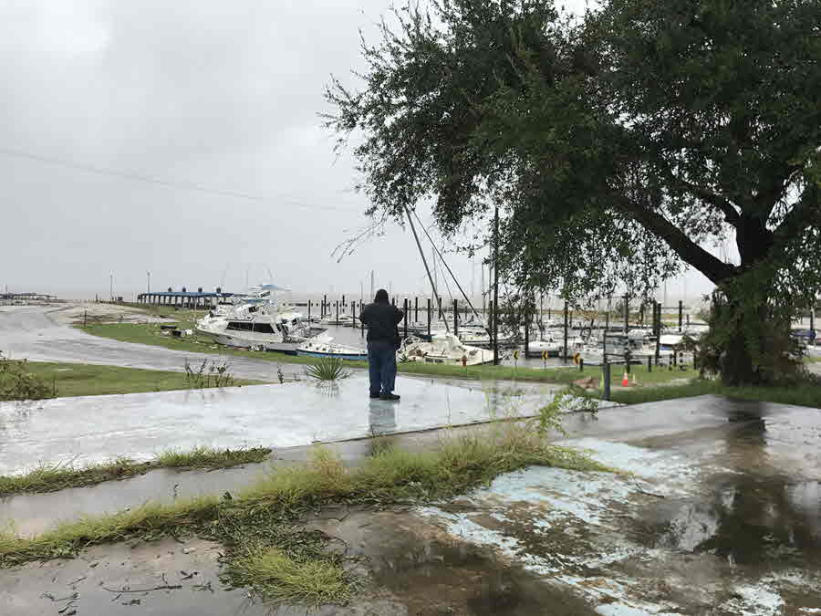
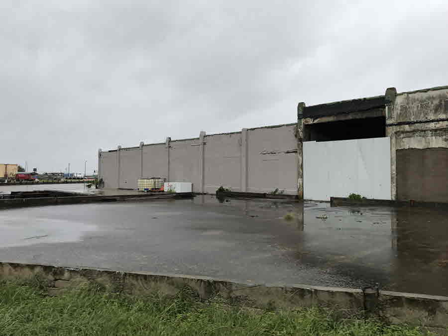
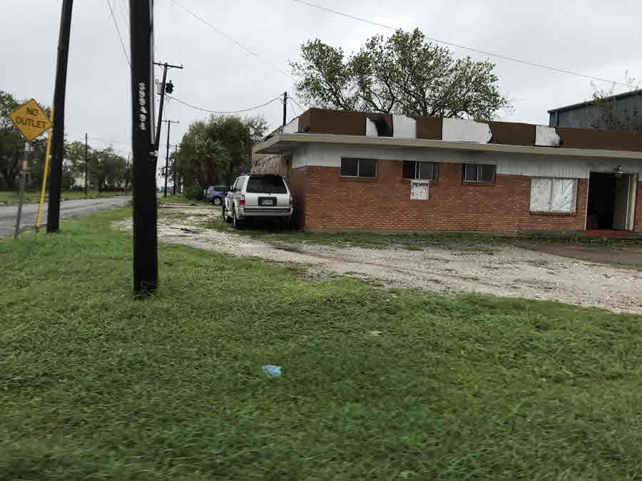
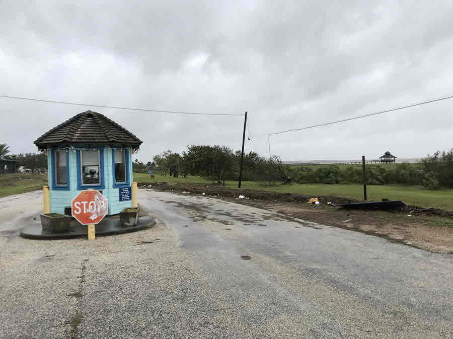
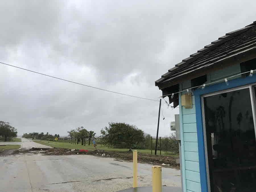
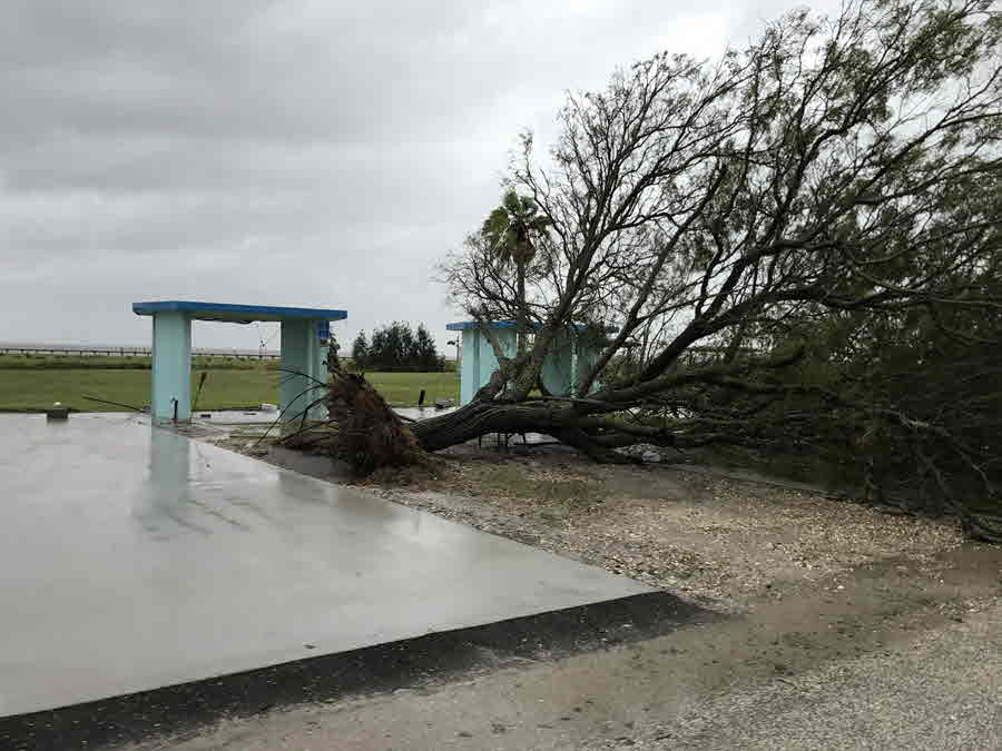
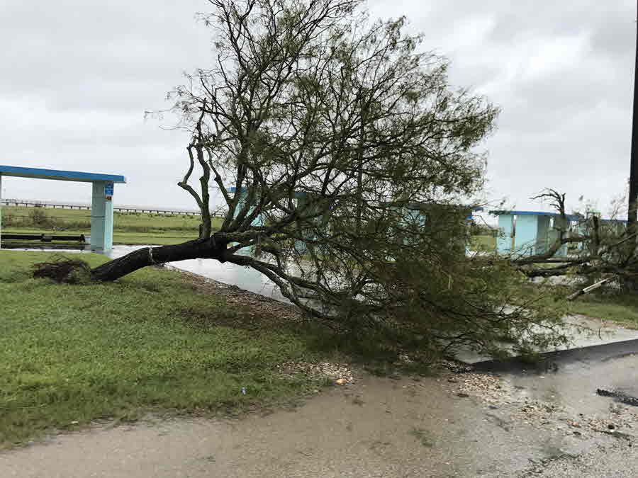
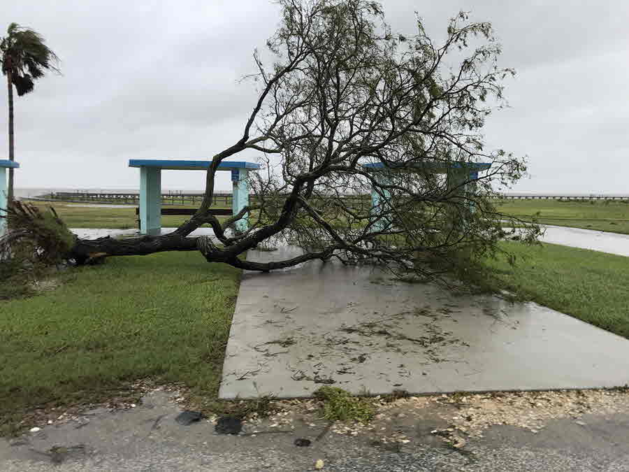
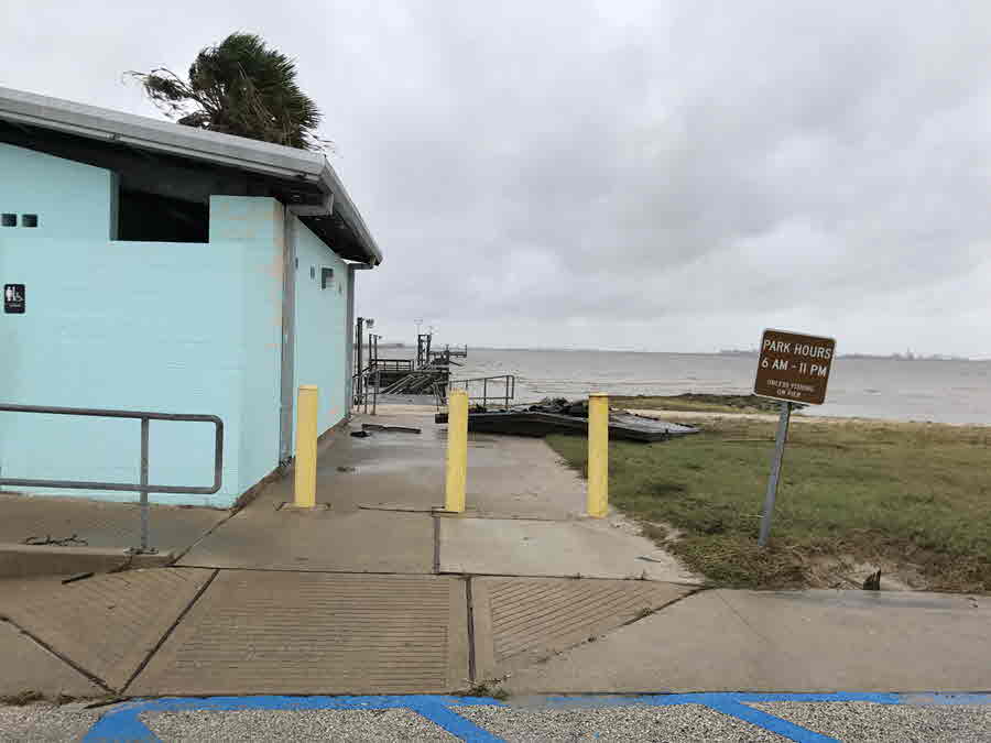
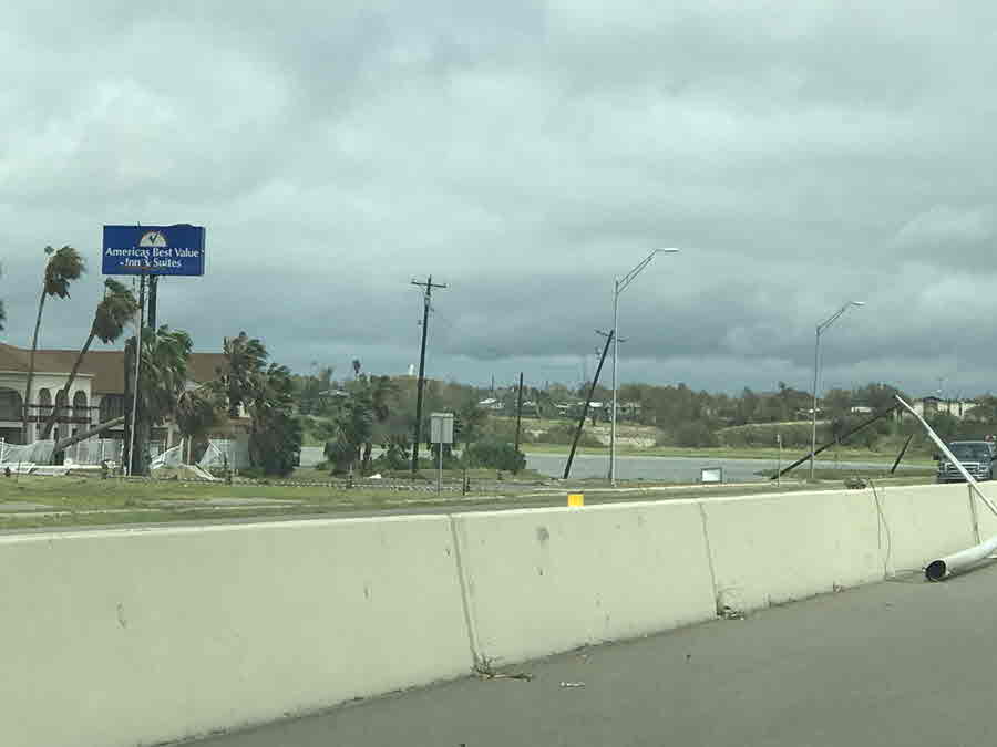
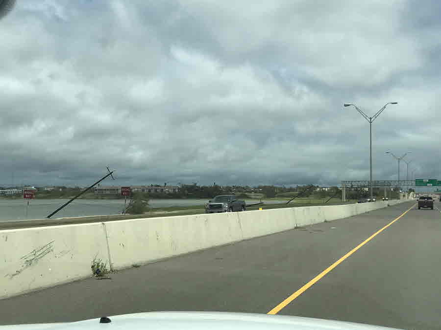
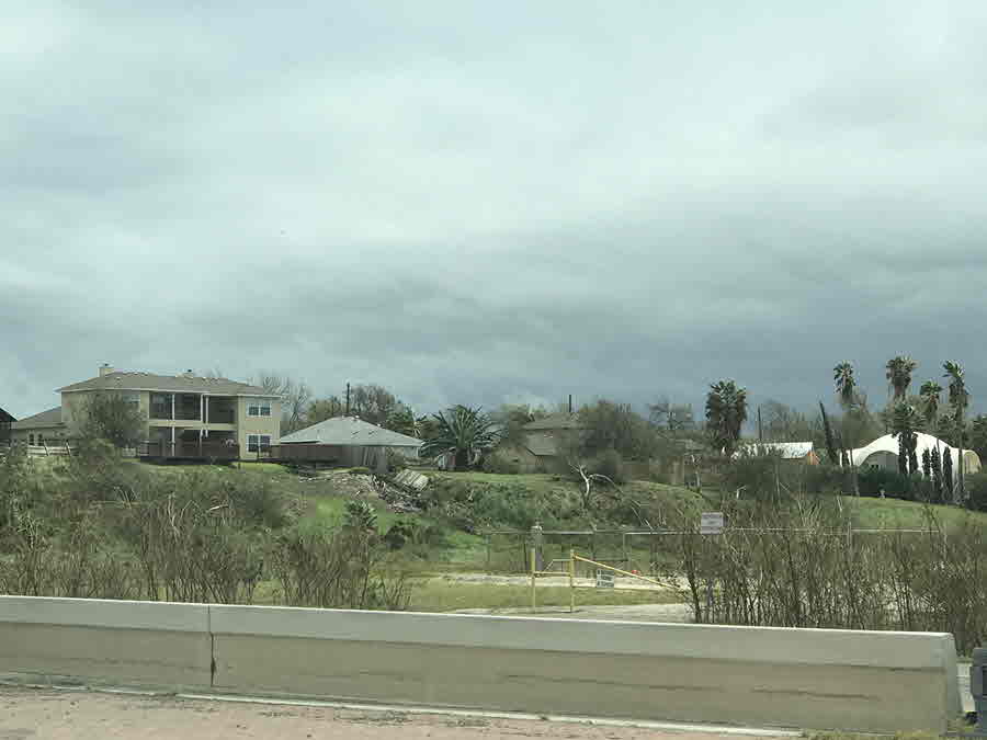
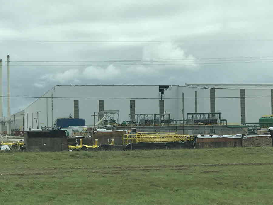
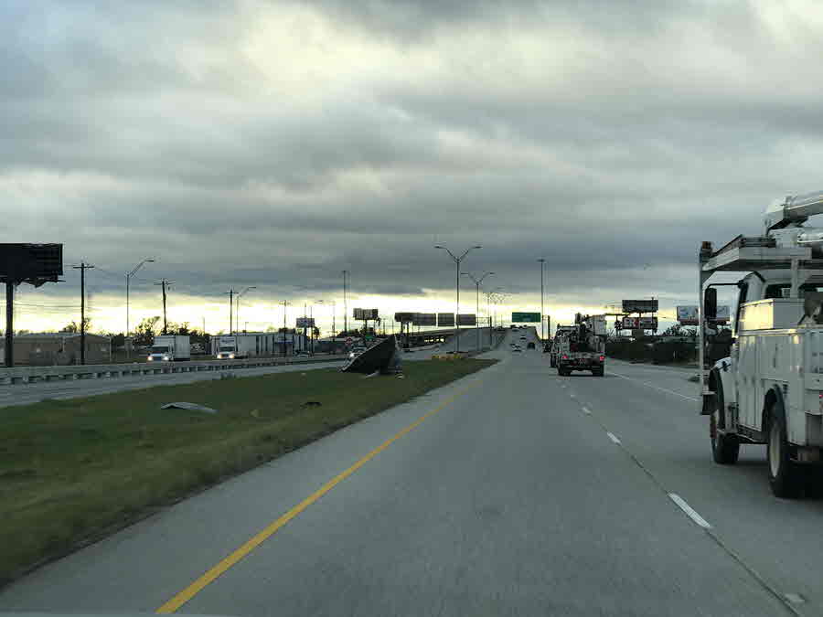
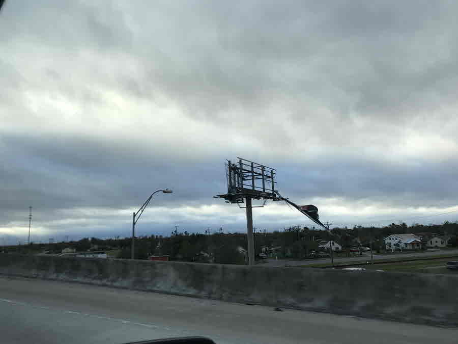
Rockport and Fulton were hardest by the storm as they took a direct hit from Harvey's eyewall. Many structures, residences, and business in and near the Rockport and Fulton area were damaged or destroyed, as roofs were blown off and walls collapsed. Electricity and water services were lost. The city's infrastructure was crippled. Significant structural damage also occurred in numerous other coastal town including Port Lavaca, Copano Village, Aransas Pass, Port Aransas and Ingleside. You can see more damage photos in the Photos section. Tens of thousands of South Texas residents and businesses lost power for days, with the hardest hit areas likely losing power for several weeks. Although there was a significant number of trees, fences and power poles down or damaged in the Corpus Christi Metropolitan area, structural damage was much more isolated.
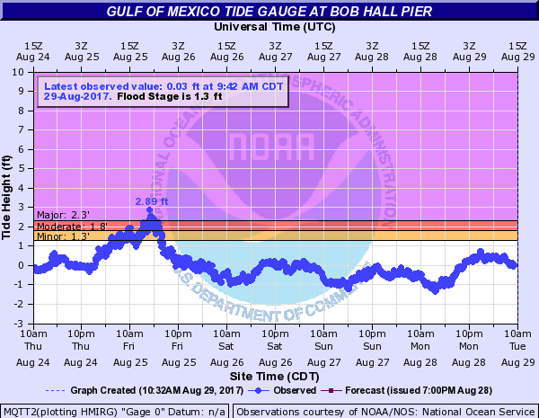
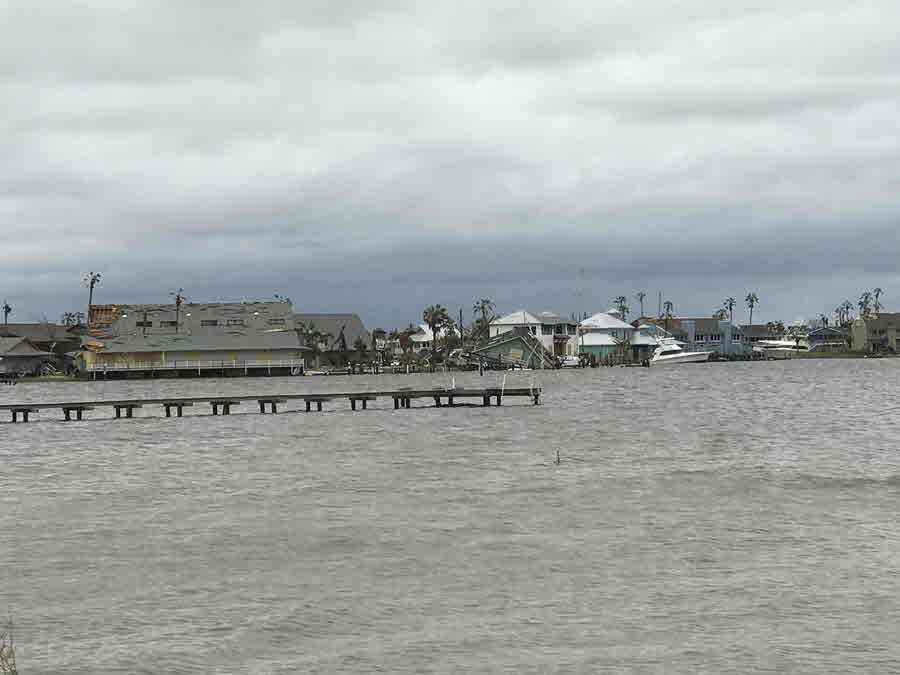
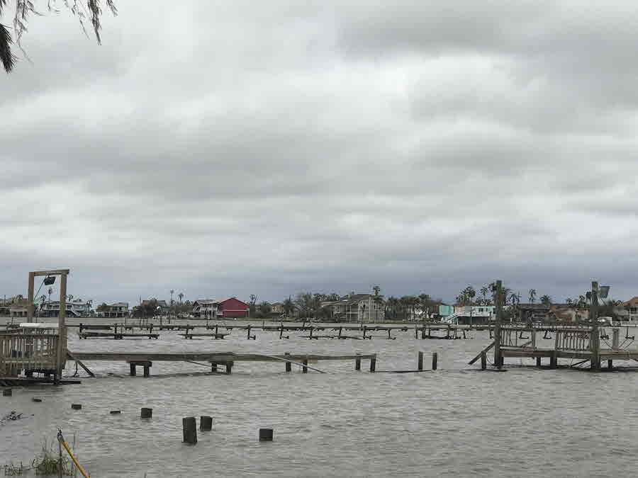
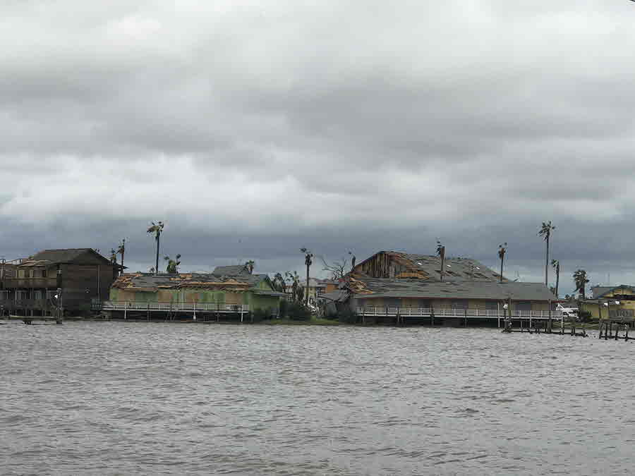
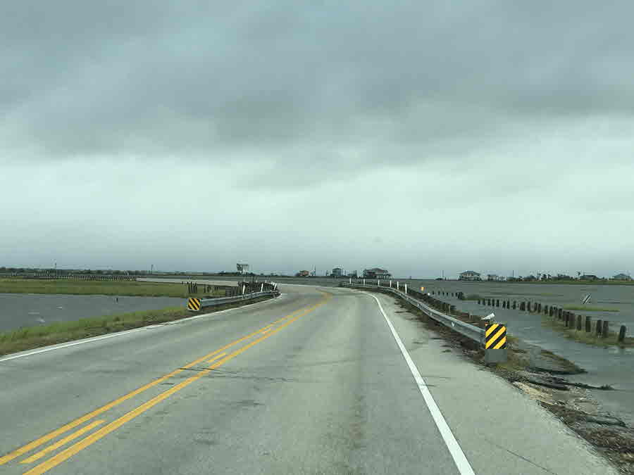
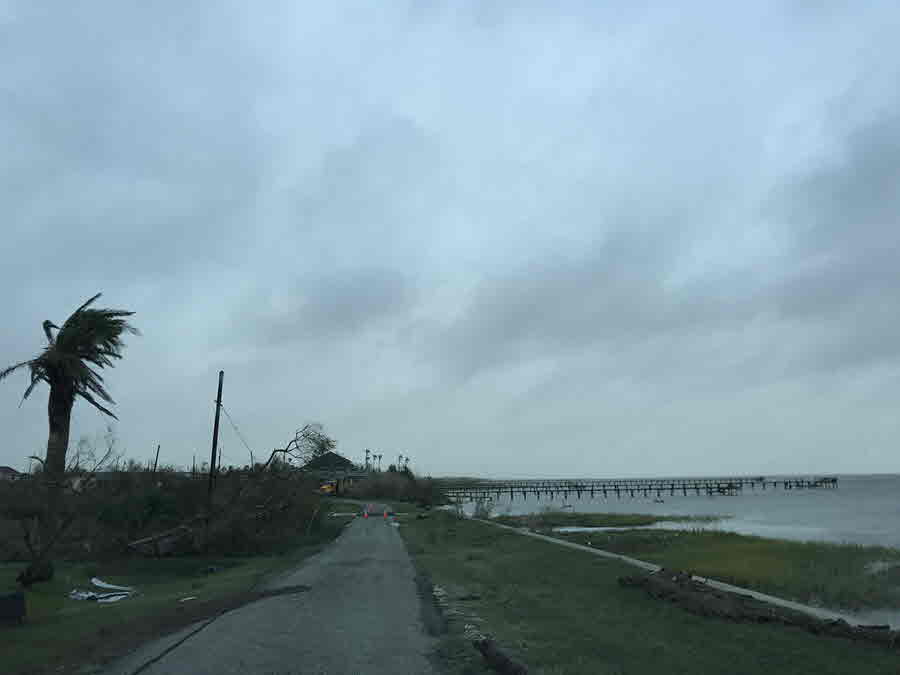
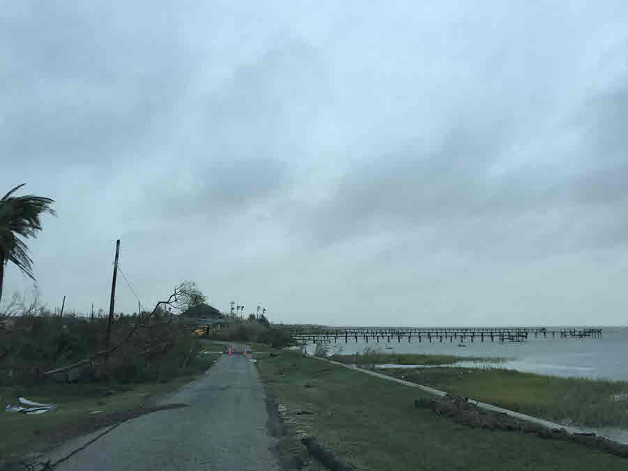
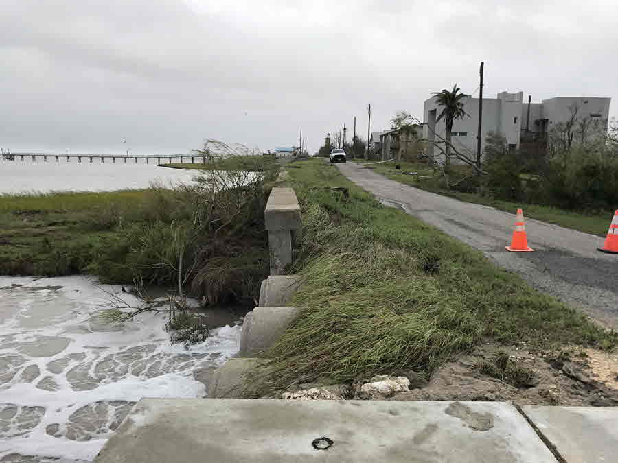
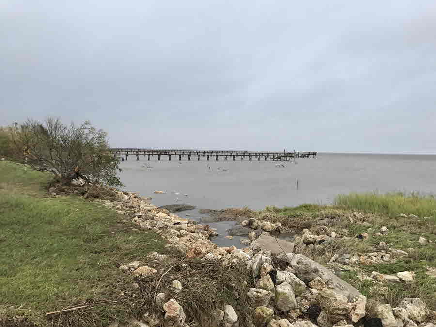
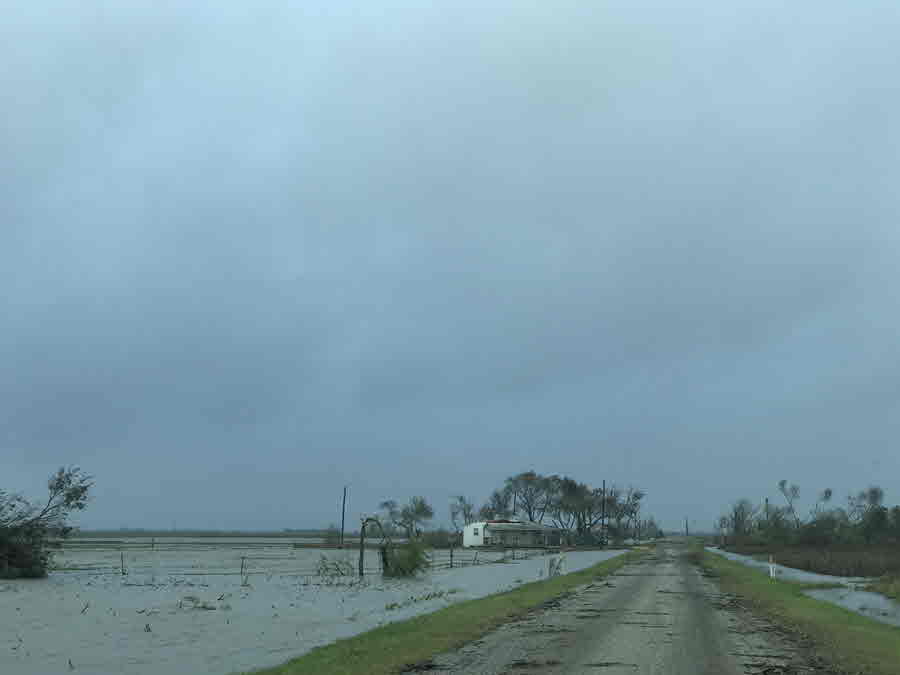
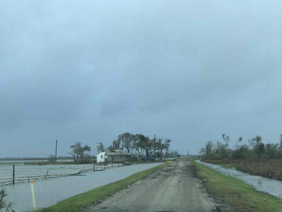
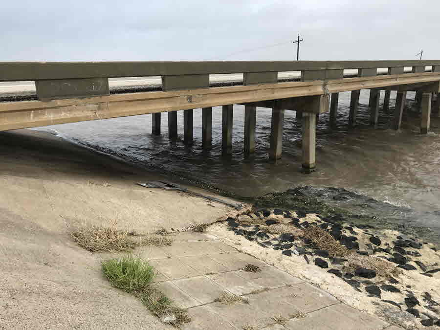
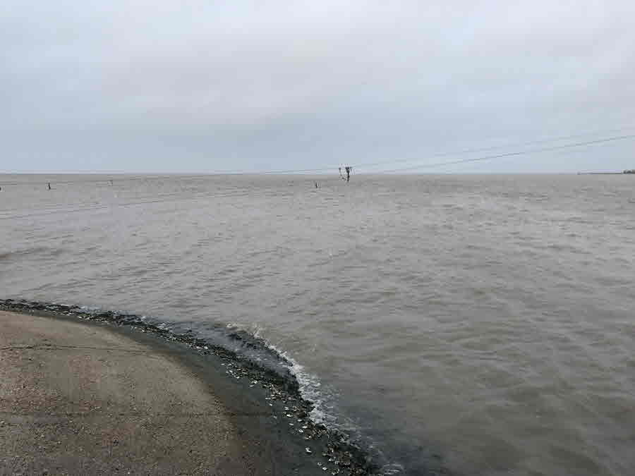
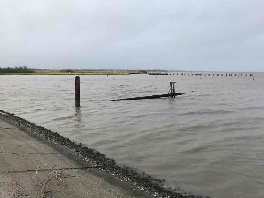
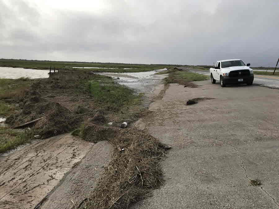
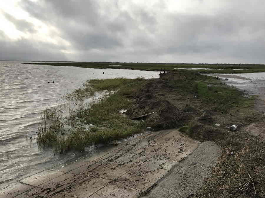
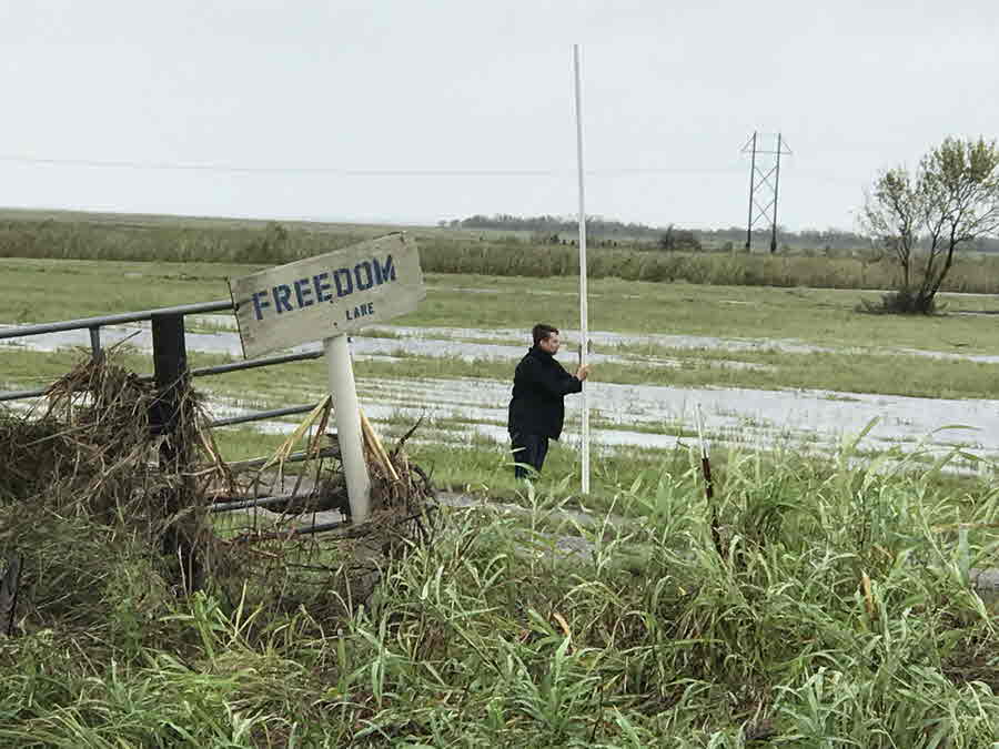
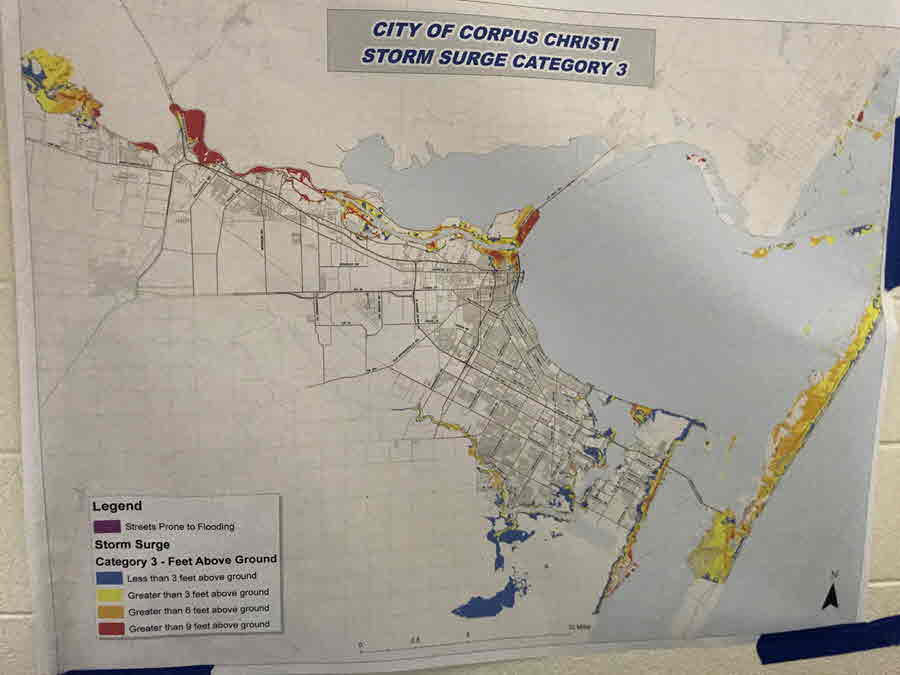
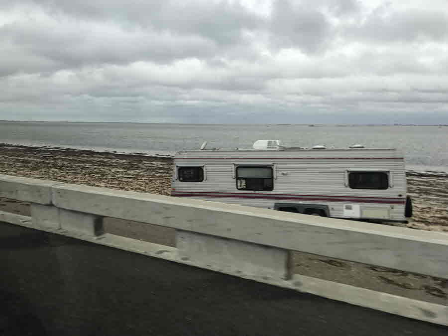
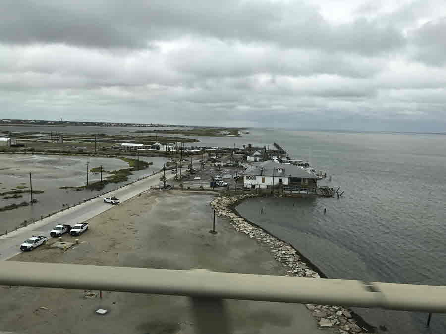
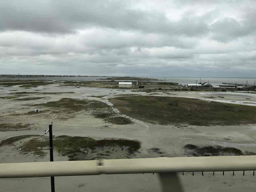
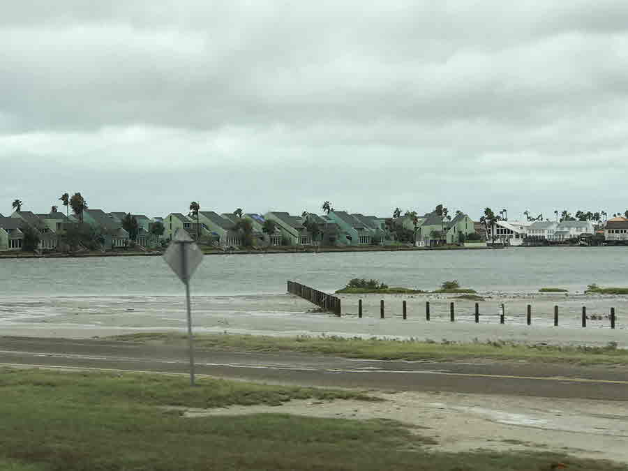
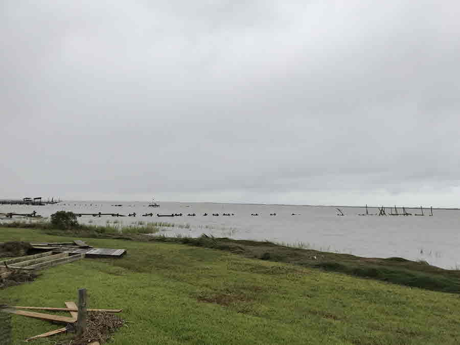
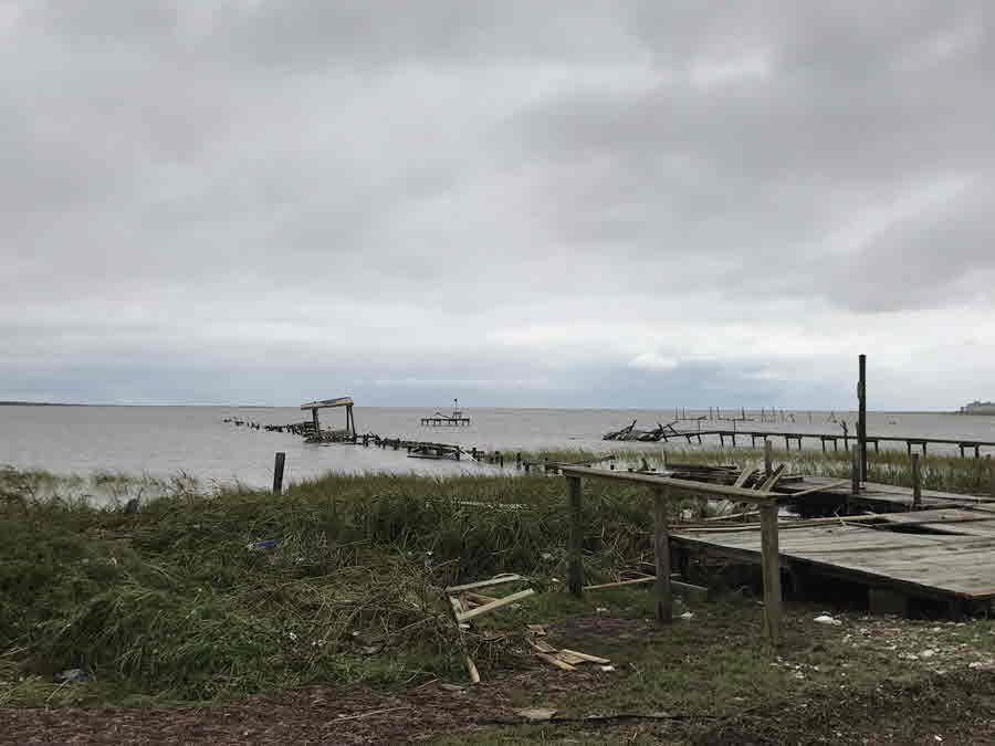
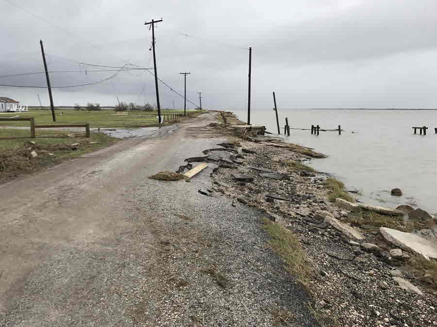
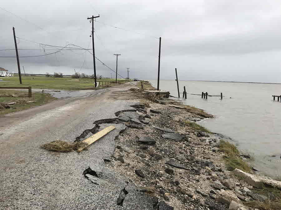
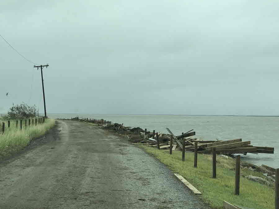
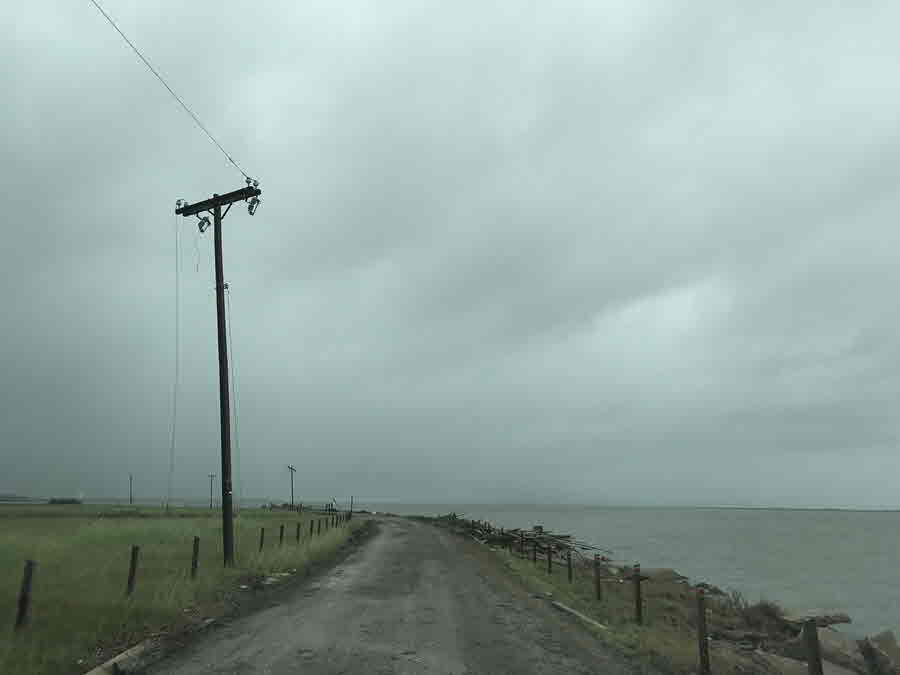
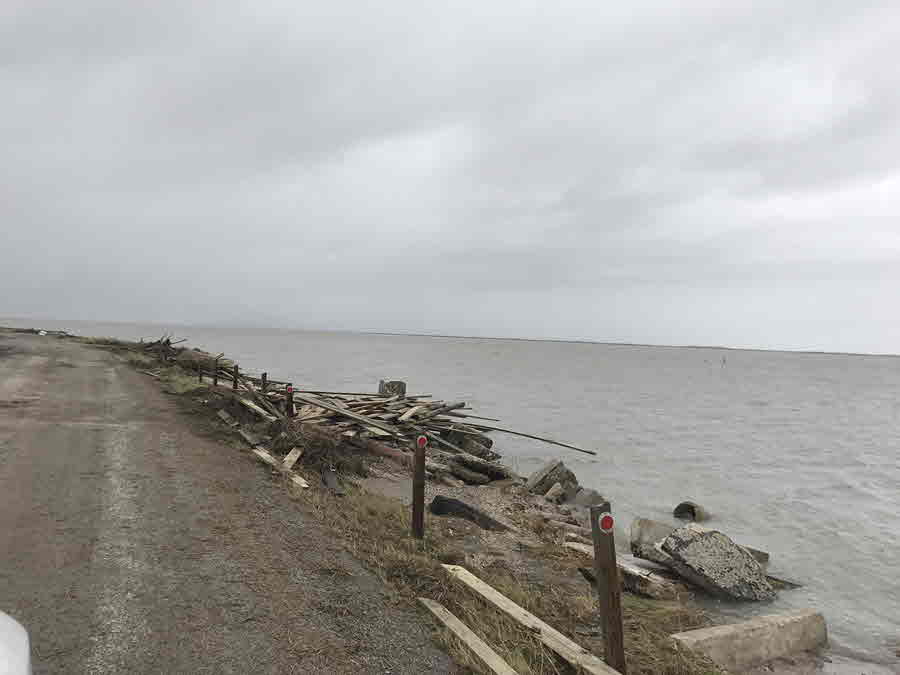
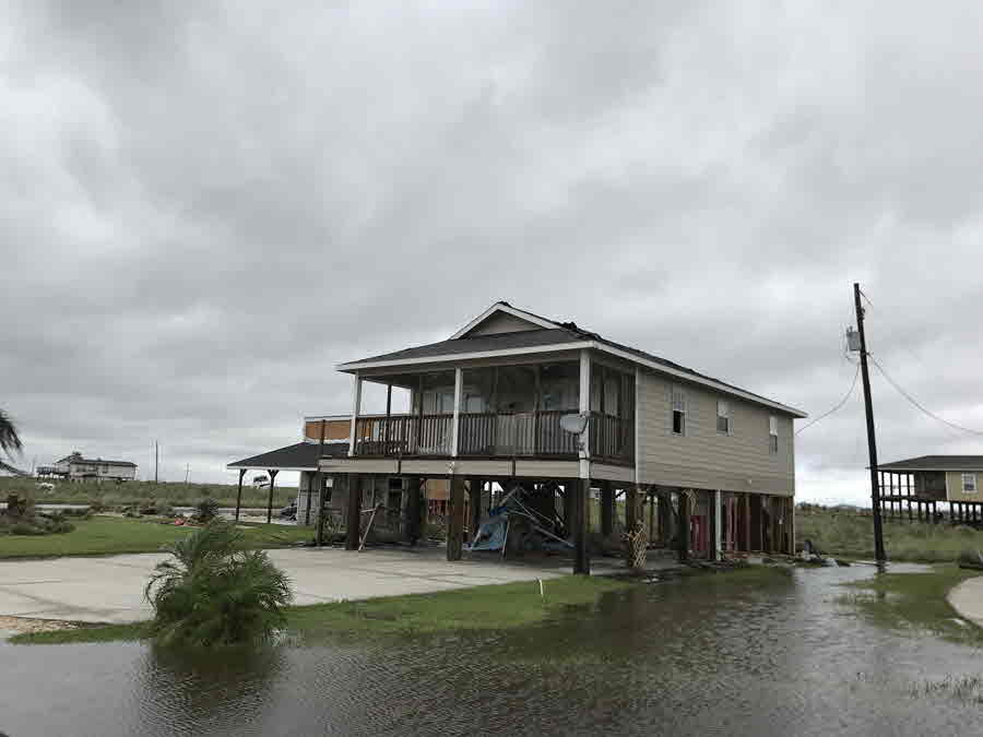
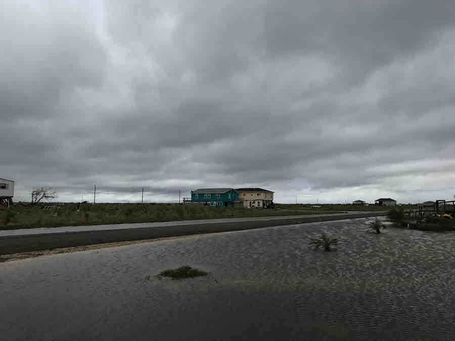
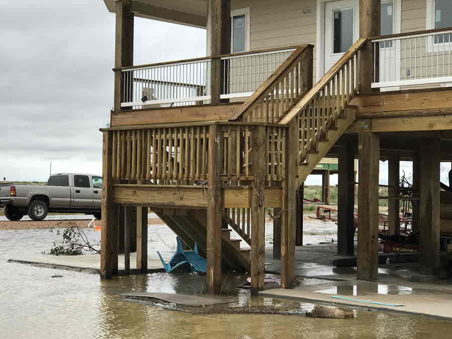
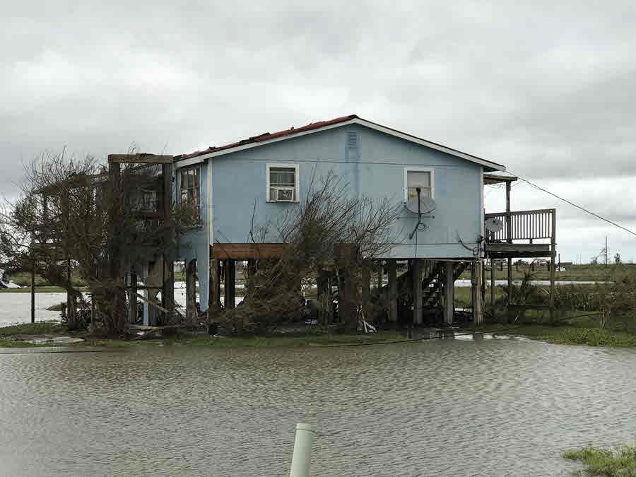
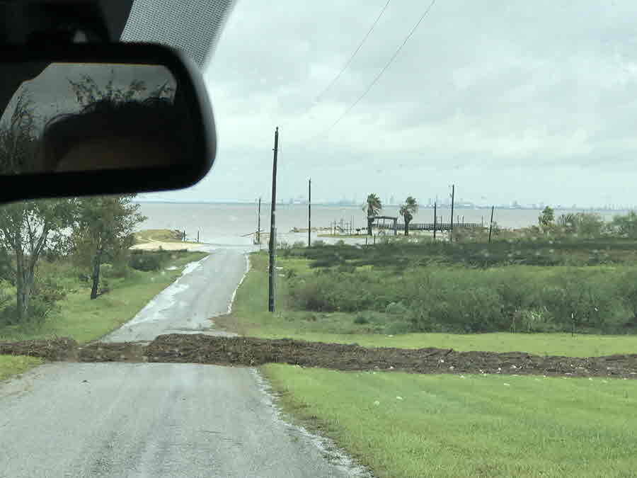
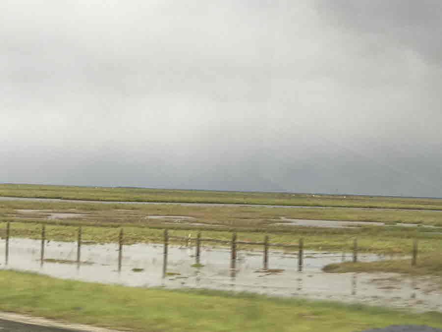
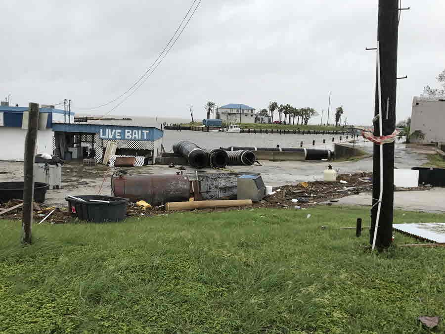
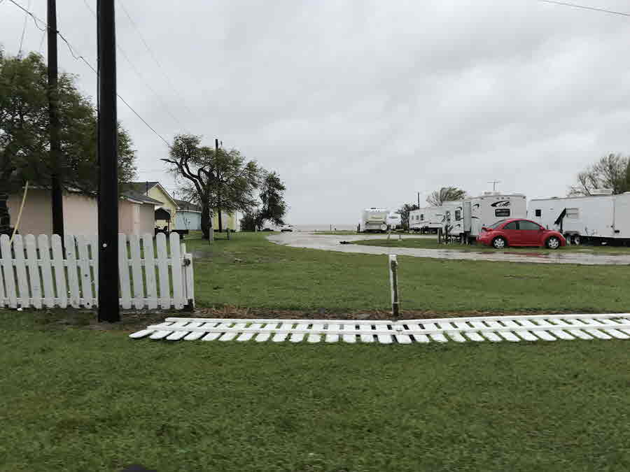
The storm surge from Harvey brought dramatically increased water and tide levels over the Texas Coast. The highest maximum storm tides were observed at the Aransas Wildlife Refuge, where the storm surge levels were more than 12 feet above ground level. Storm surge in Port Lavaca was also more than 10 feet and at least 6 feet in Port Aransas. Elsewhere across South Texas, storm tide levels were from near 3 to 6 feet above ground level at Seadrift, Port O'Connor, Holiday Beach, Copano Bay, Port Aransas, and Bob Hall Pier.
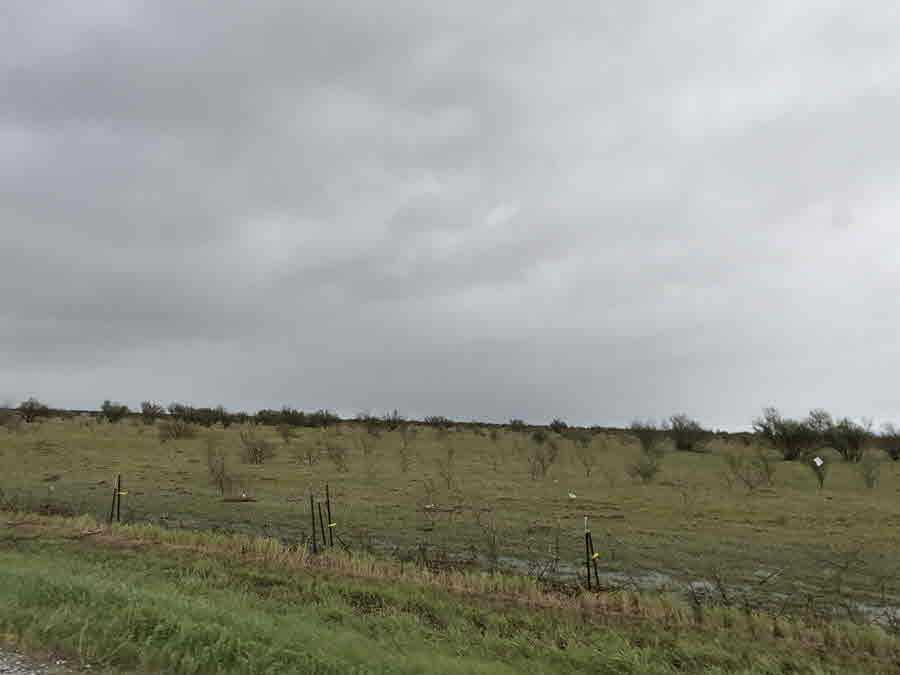
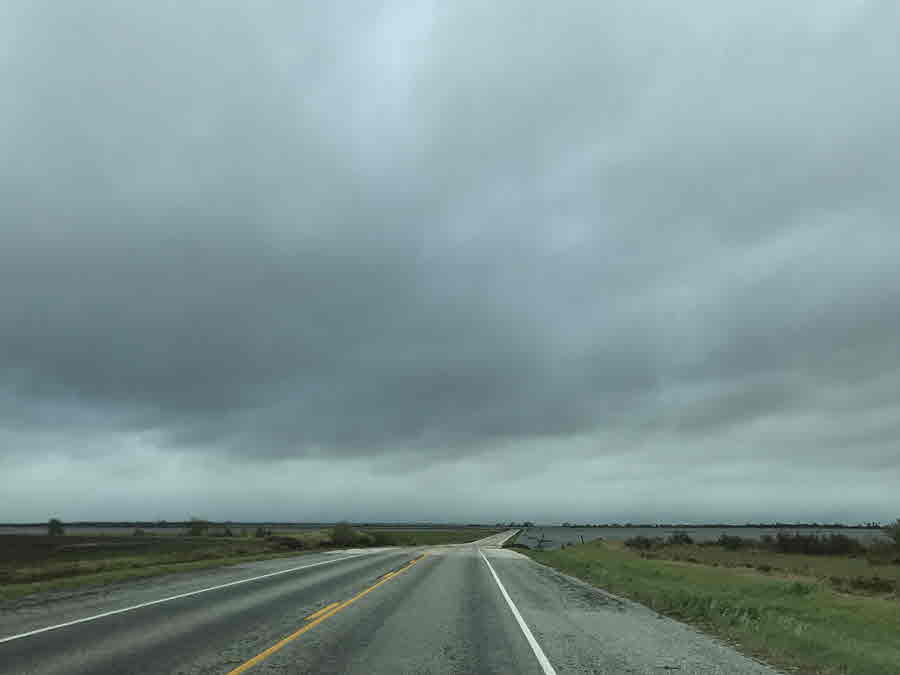
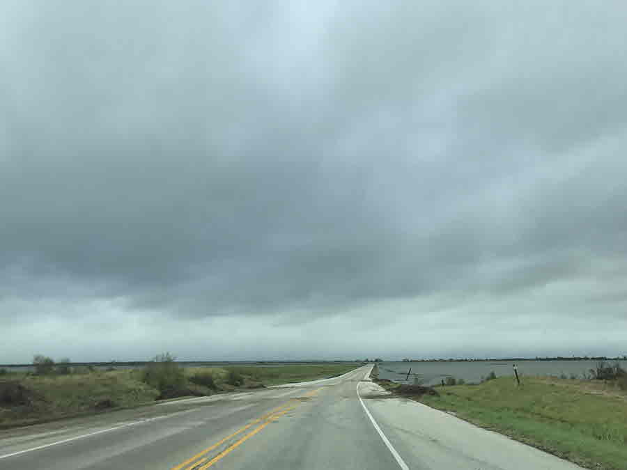
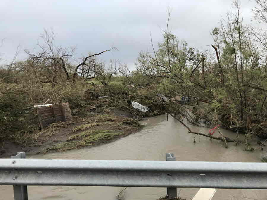
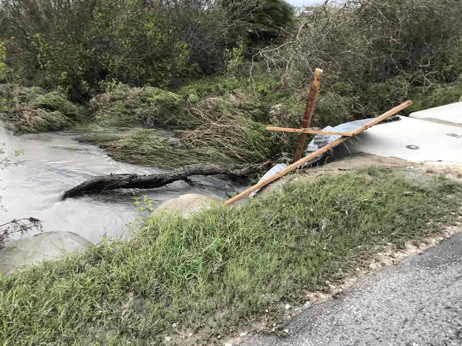
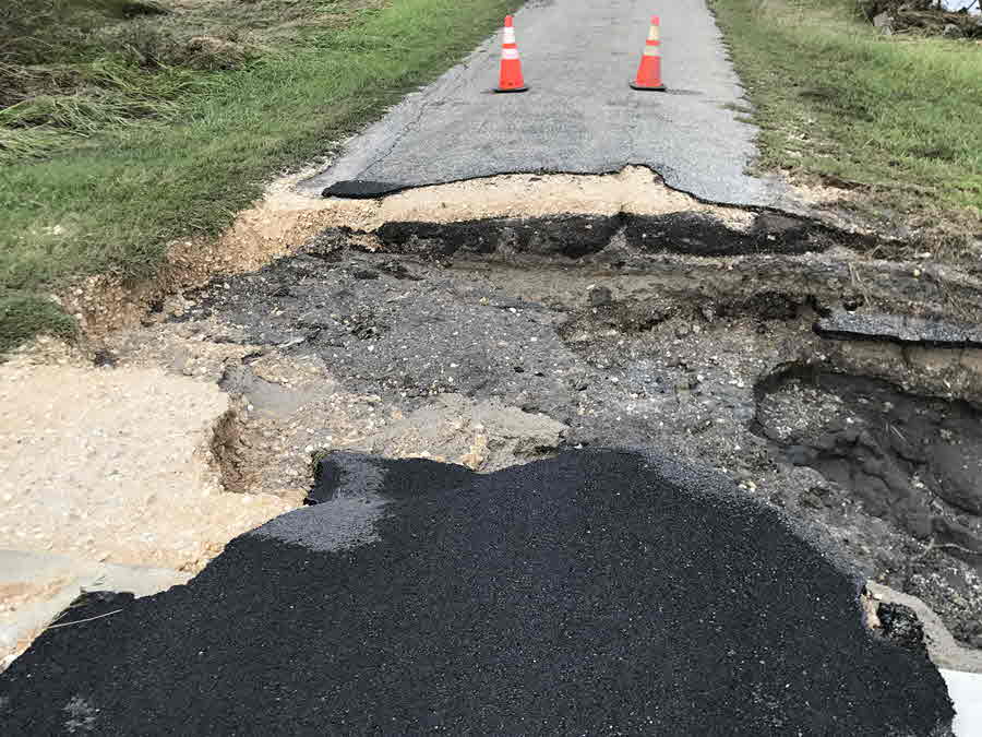
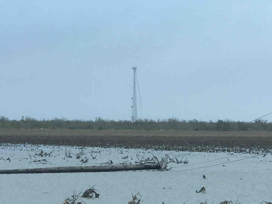
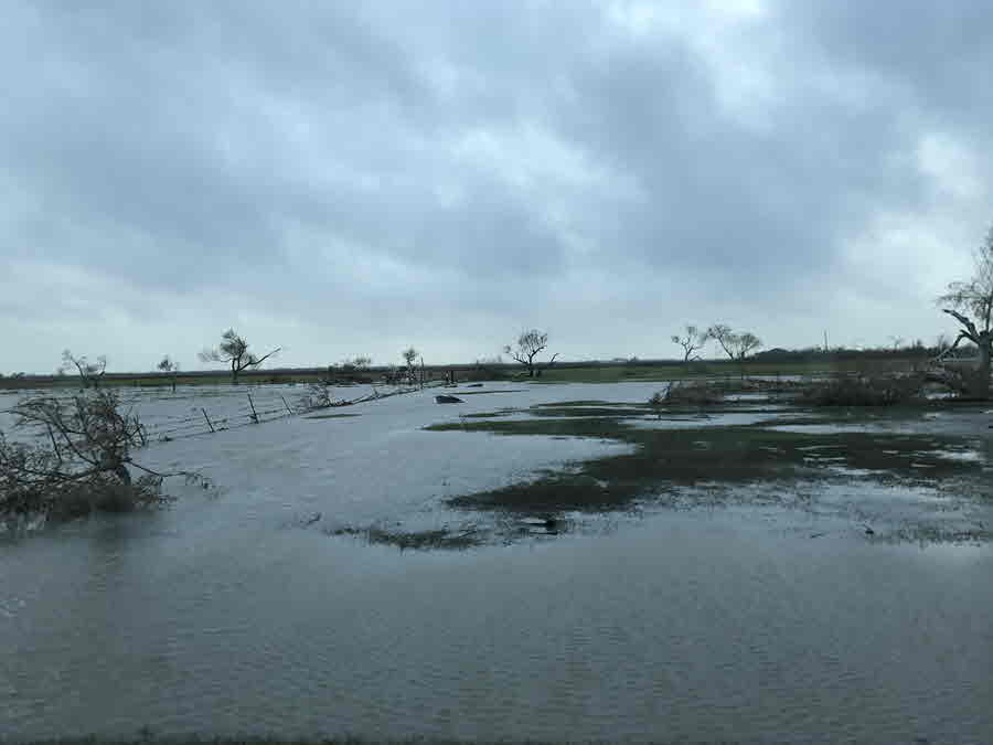
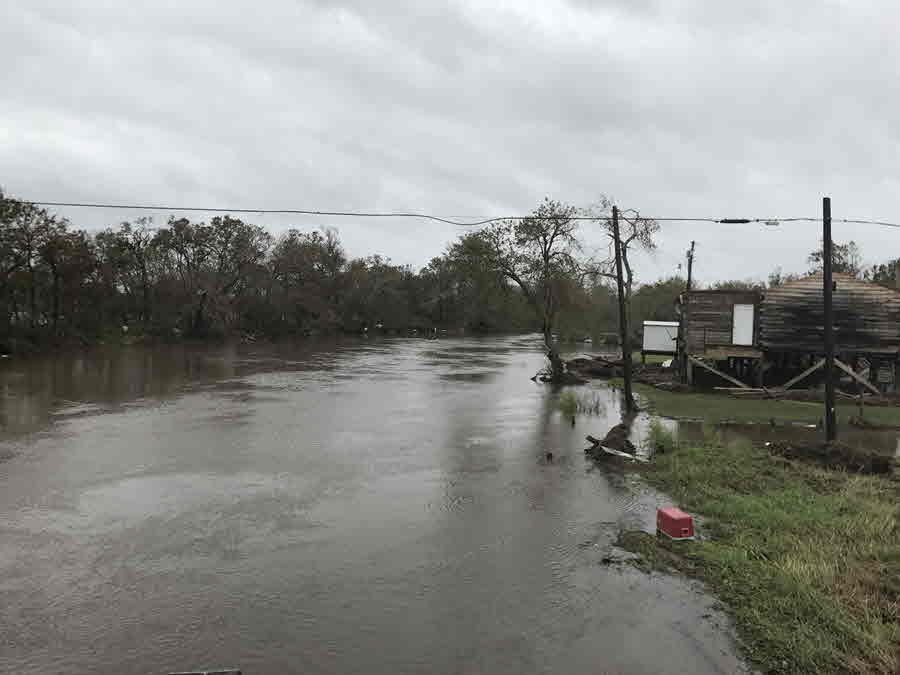
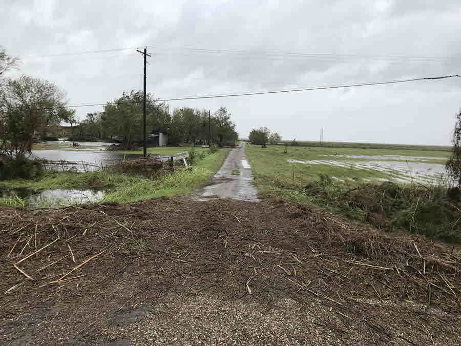
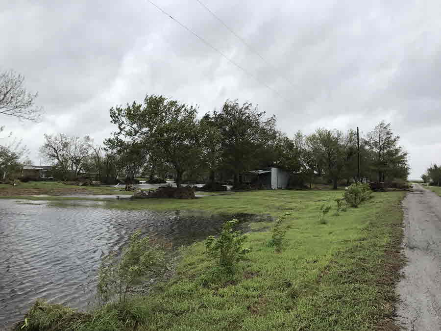
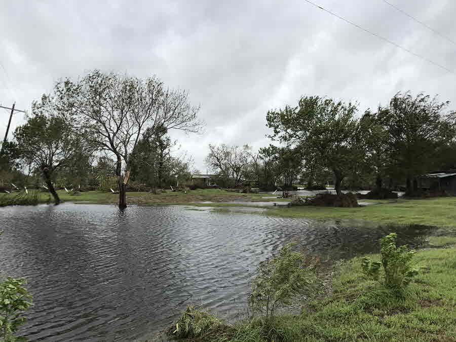
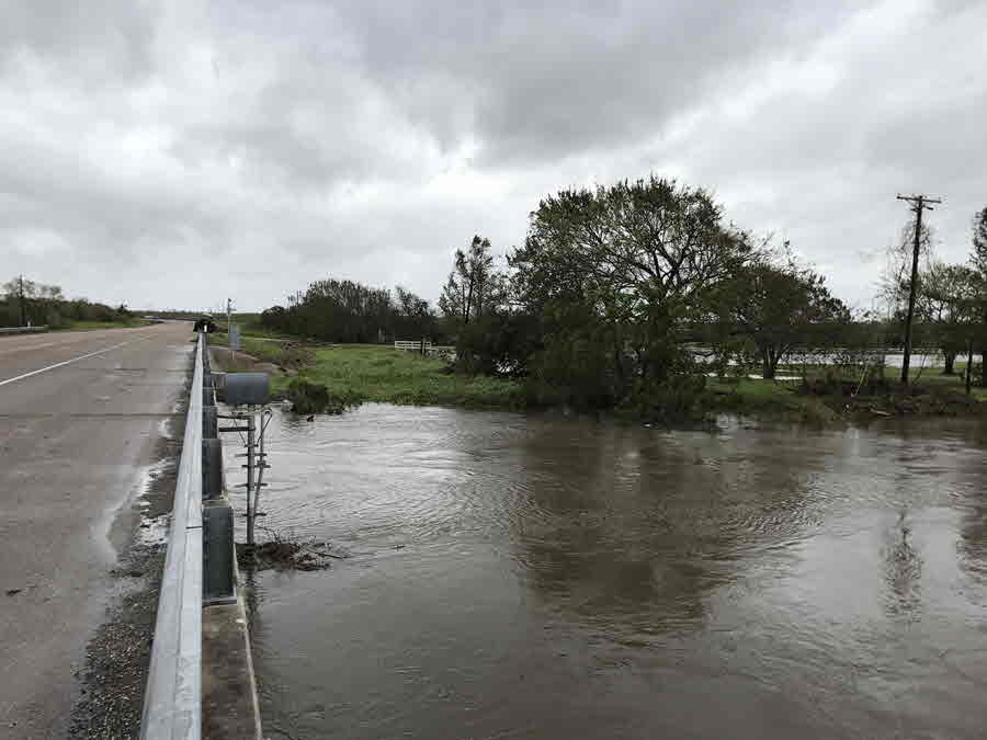
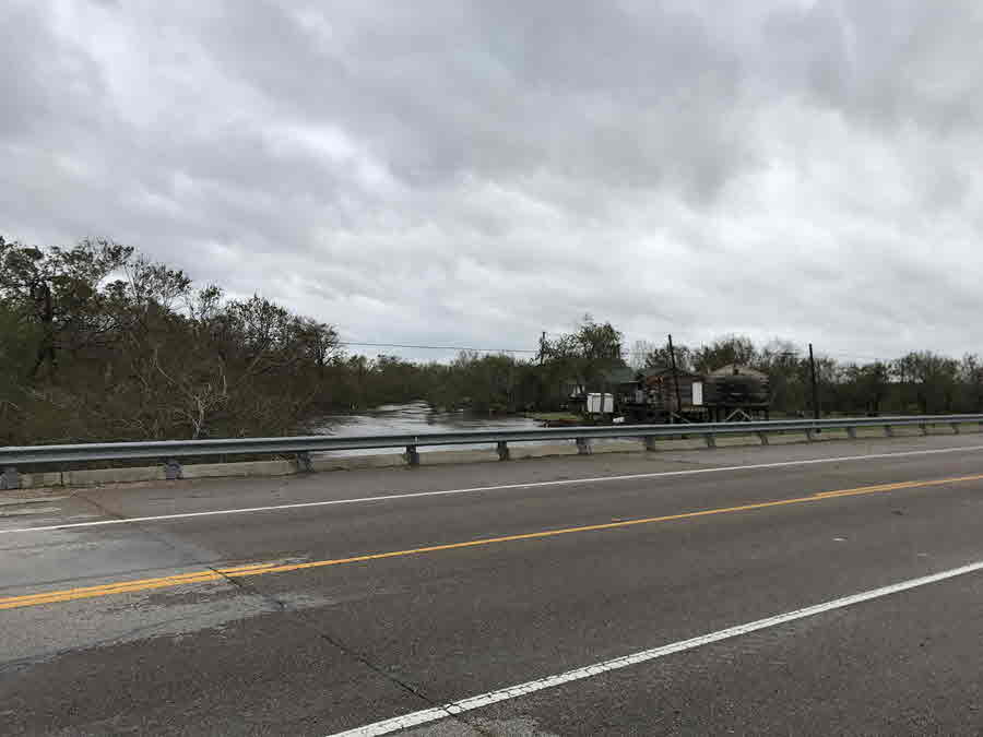
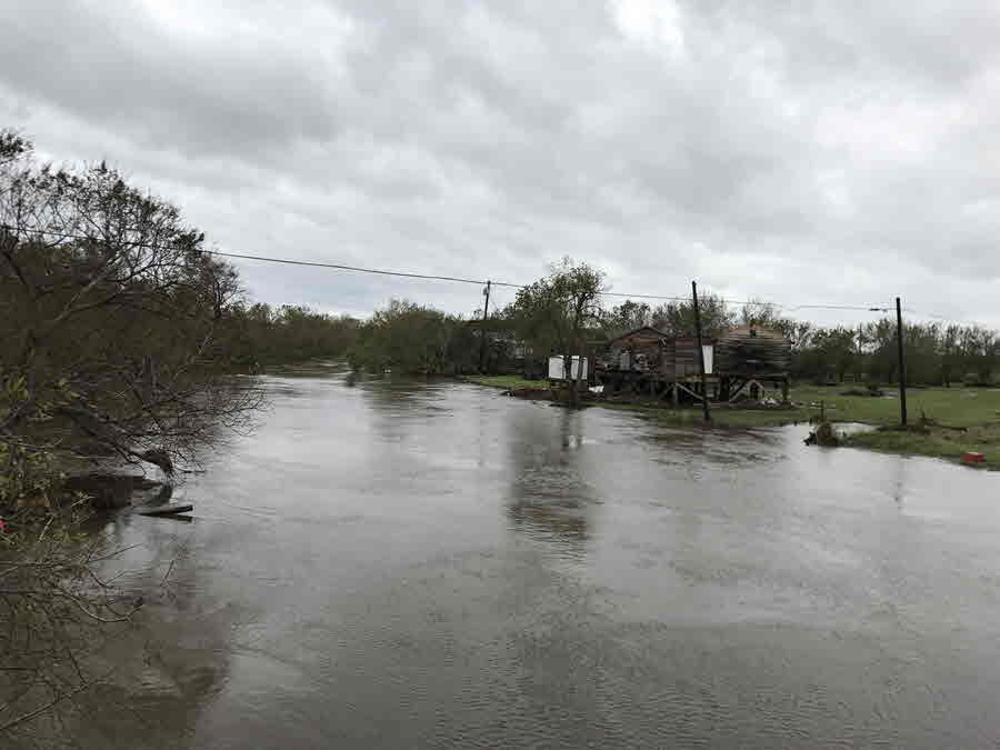
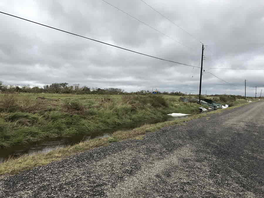
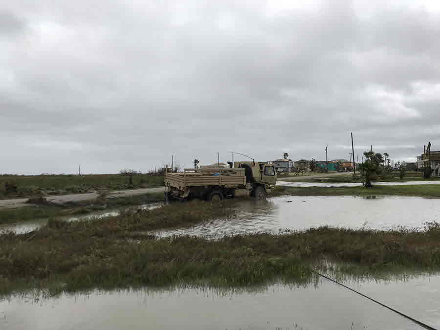
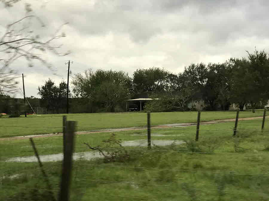
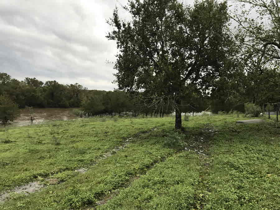
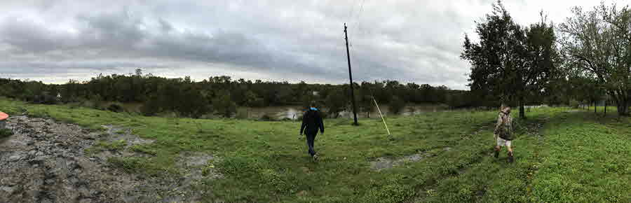
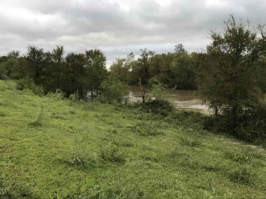
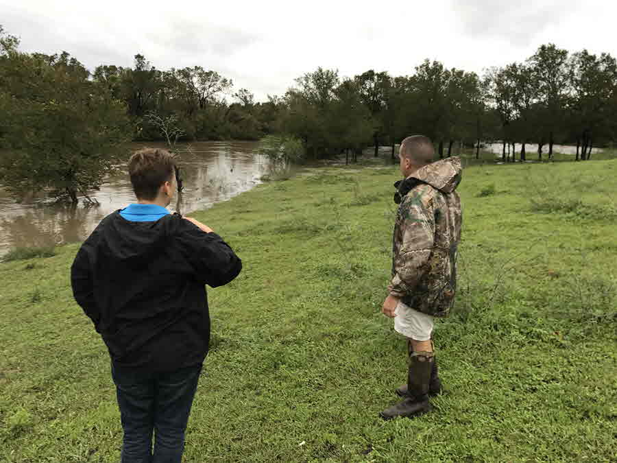
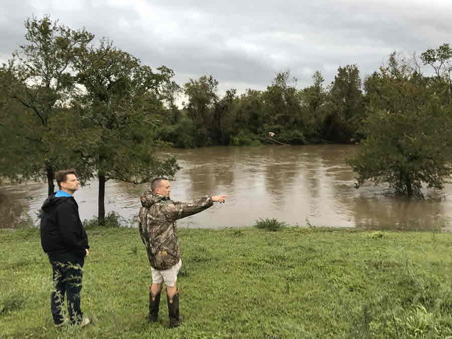
Besides wind and storm surge, hurricanes and tropical storms are notorious for producing torrential rainfall and flash flooding. Unfortunately, Harvey was unique. Instead of moving inland and farther away from the coast, Harvey stalled over South and Southeast Texas for days, producing catastrophic devastating and deadly flash and river flooding. Southeast Texas beared the brunt of the heavy rainfall, with some areas receiving more than 40 inches of rain in less than 48 hours! Cedar Bayou in Houston received a storm total of 51.88 inches of rainfall which is a new North American record. However, South Texas residents were not spared from this impact from Harvey, as heavy rainfall and flash flooding were observed over the eastern portions of the area. Several flash flood warnings were issued during the evening and overnight hours of August 25th and 26th, as torrential tropical rains impacted the coastal counties of the Coastal Bend, as well as the Victoria Crossroads region. 24-hour rainfall amounts ending at 7 AM Saturday August 26th indicated that widespread 10 to 15 inch rainfall amounts (with isolated +15 inch amounts) had fallen over portions of San Patricio, Refugio, and Aransas Counties. Most of the eastern half of South Texas received 3 or more inches of rainfall, with much lower amounts farther west. As Harvey drifted farther north, the heavier rainfall shifted with it, with 24 hour rainfall amounts ending on Sunday August 27th of 3 or more inches over much of Victoria County and portions of Calhoun and Aransas Counties. The heavy rainfall shifted northeast into Southeast Texas on Monday. By then, 15 to 25 inch storm total (72-hour) rainfall amounts were observed over much of Aransas and Refugio Counties, as well as portions of San Patricio and Victoria Counties. Rainfall totals for Harvey decreased dramatically farther south and west, with portions of Webb County receiving no rainfall at all!
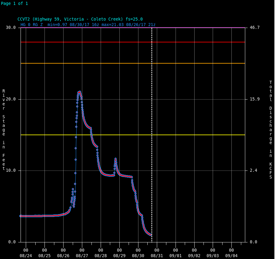
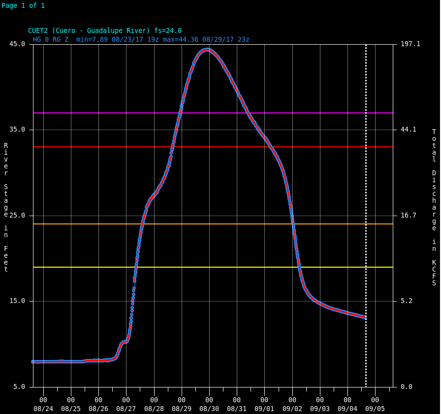
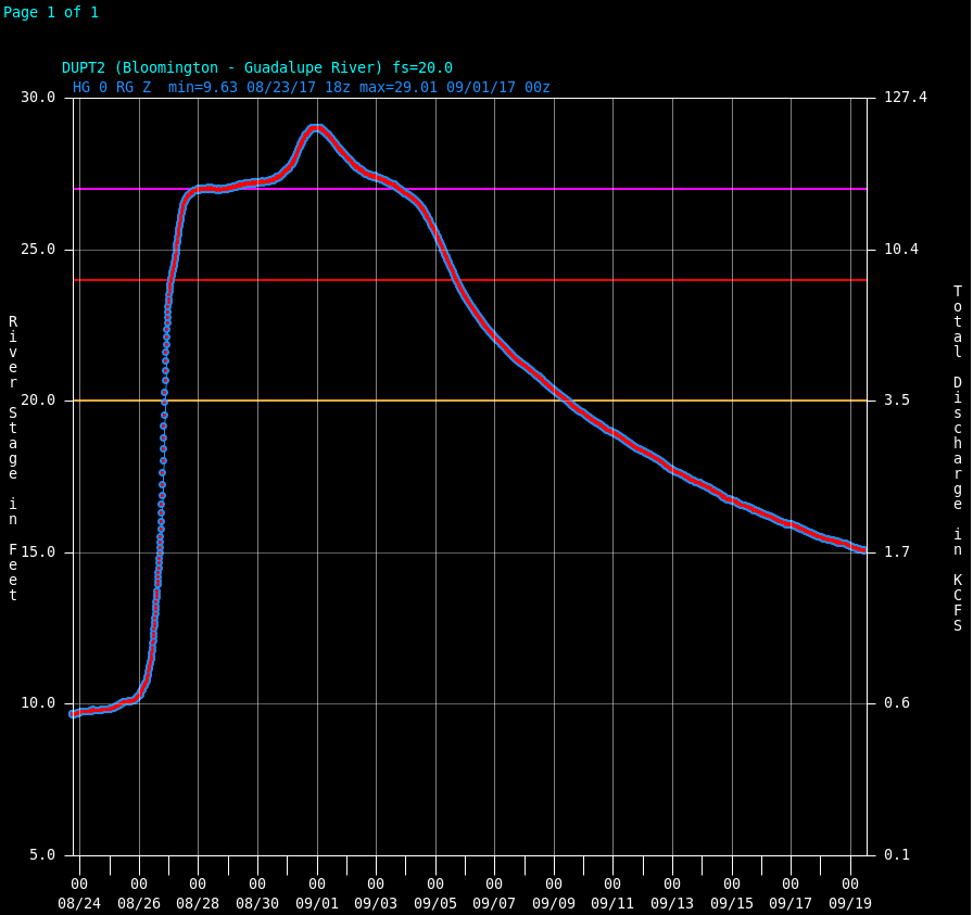
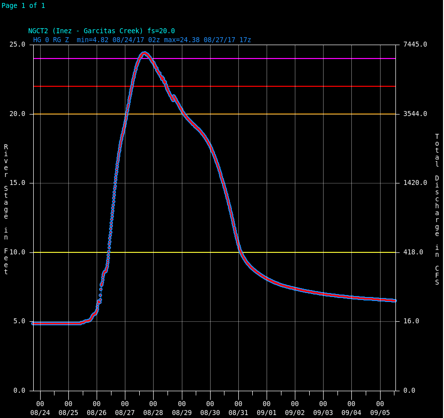
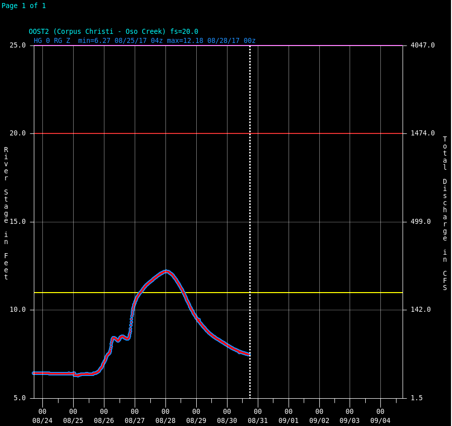
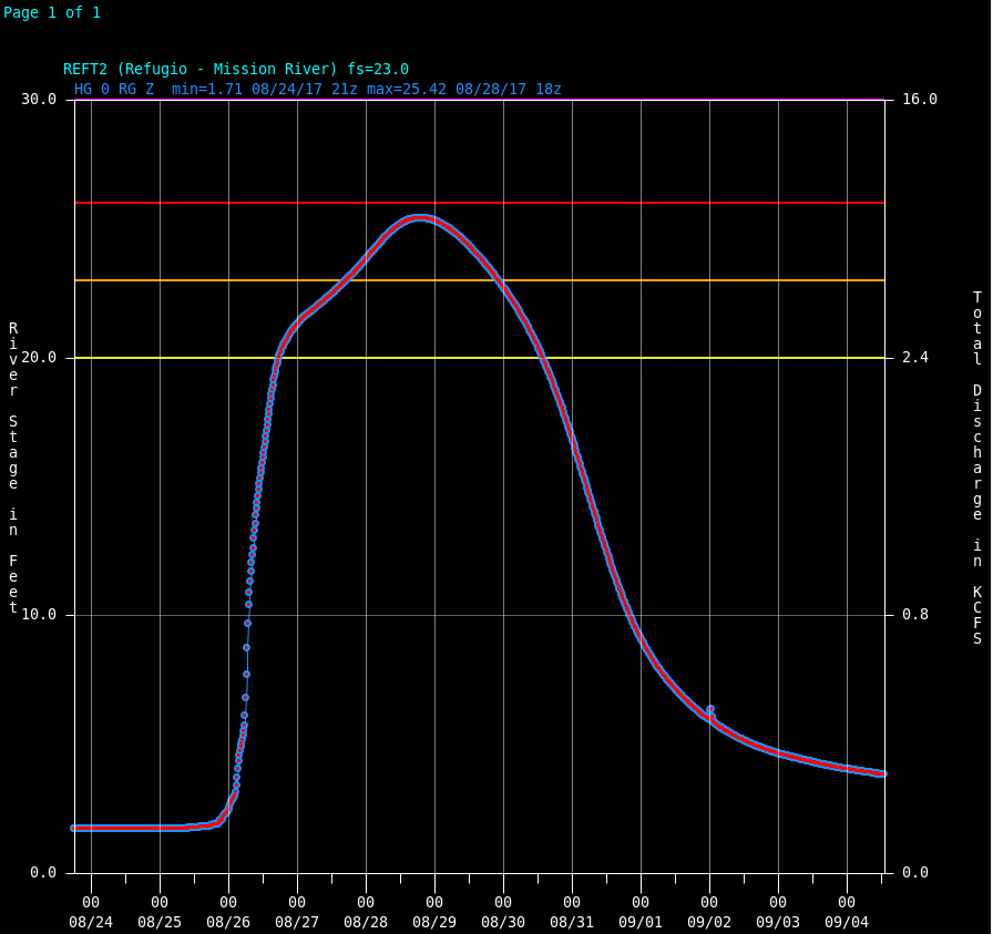
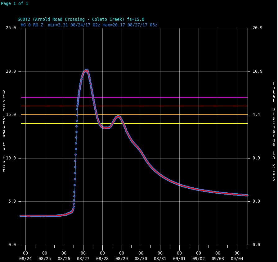
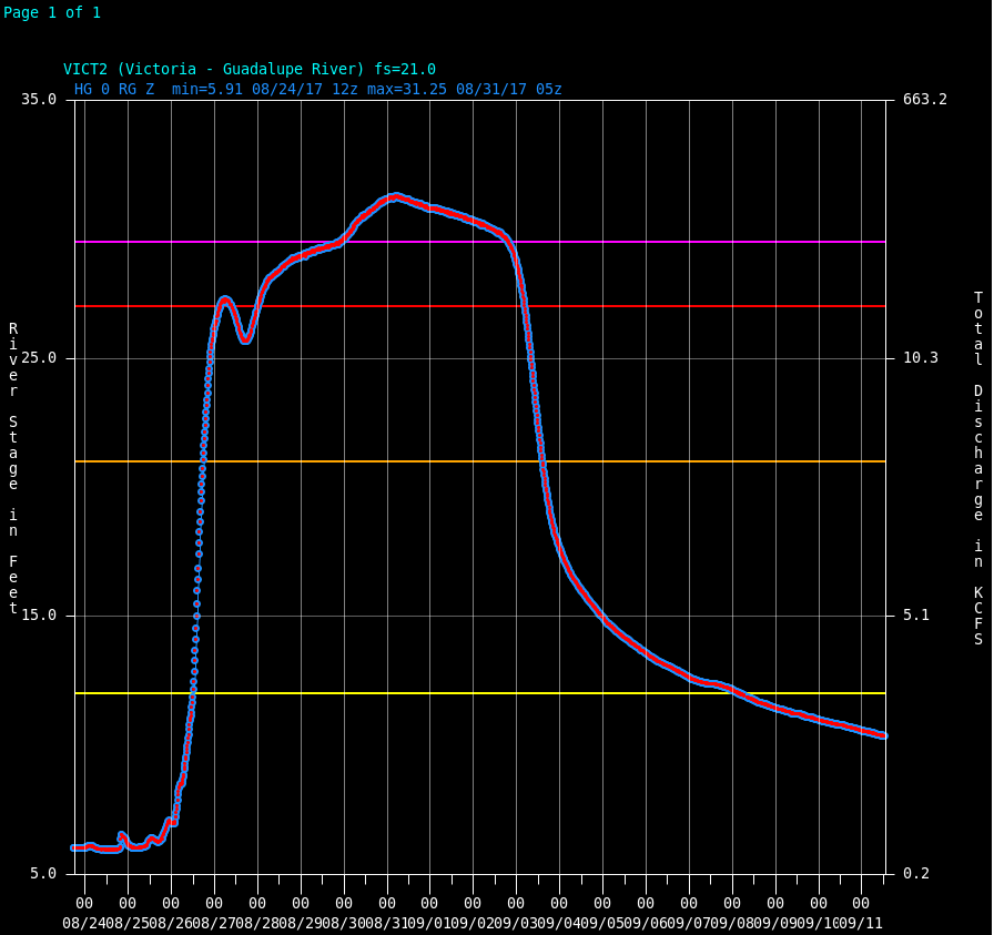
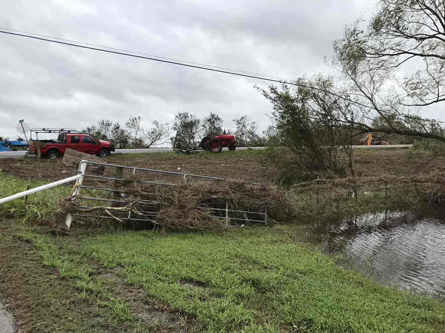
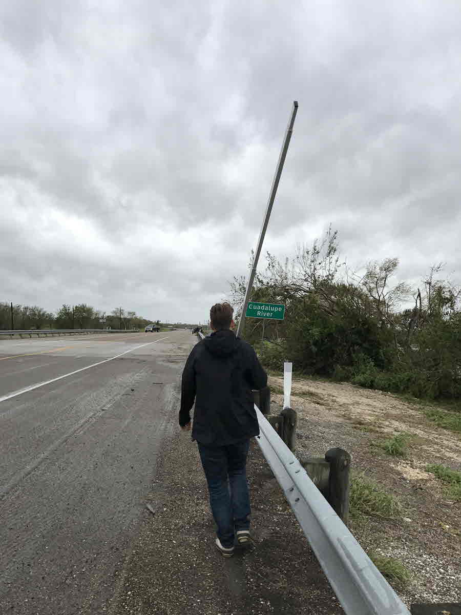
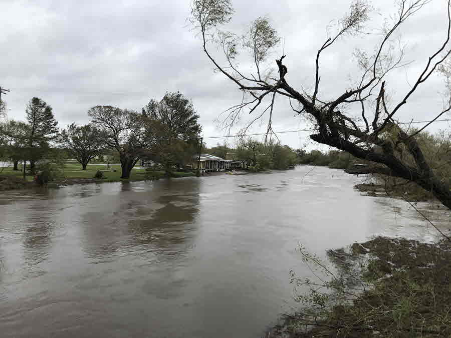
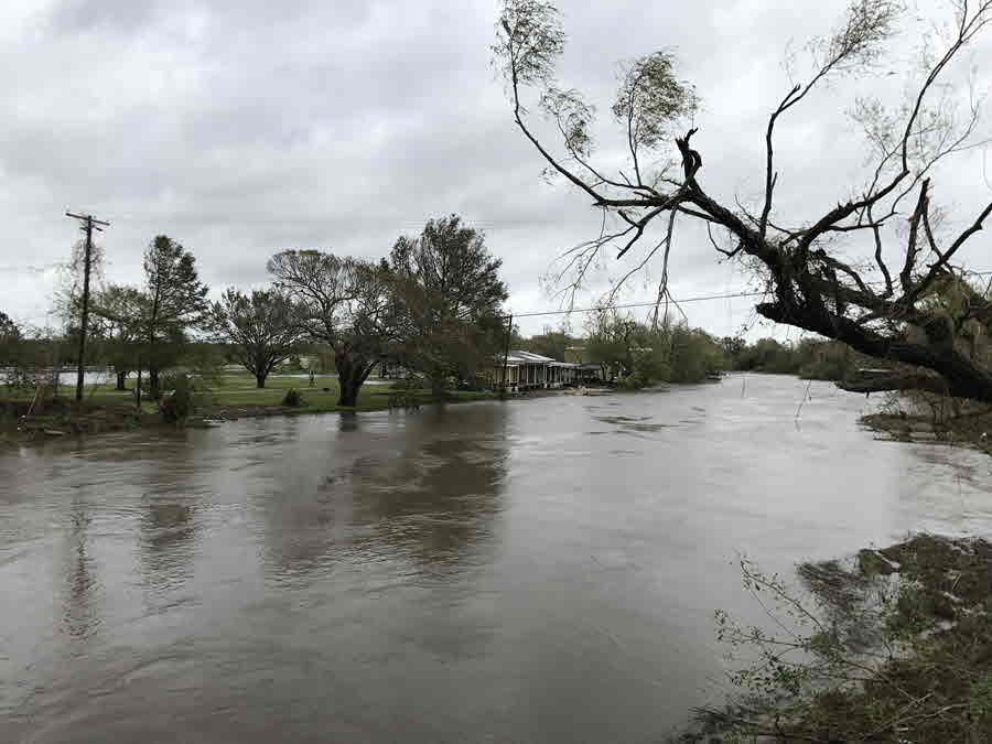
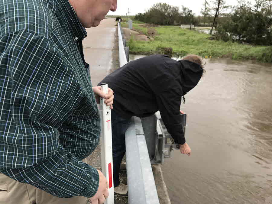
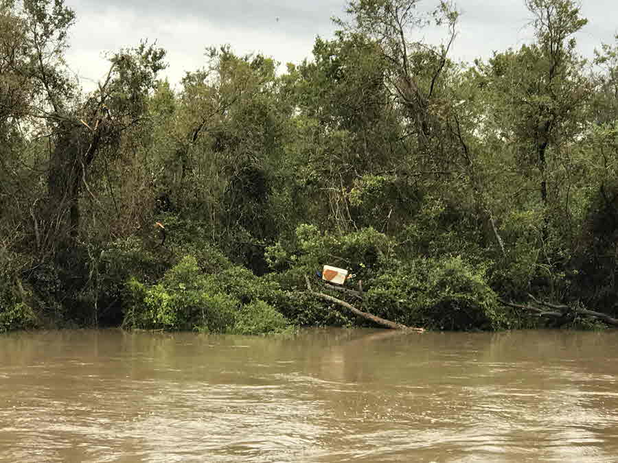
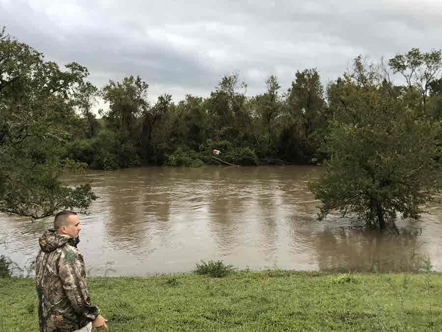
All of this excessive precipitation resulted in major river flooding over the Guadalupe River and the Garcitas and Coleto Creeks. Near major flooding was observed on the Copano Creek near Refugio, with moderate flooding on the Mission River (See the Hydrology Section for the pertinent hydrographs). Other rivers and creeks over the eastern half of South Texas saw rises, but most did not exceed flood stage. As of this writing, the Guadalupe River at Victoria is expected to crest around 31.4 feet, while Bloomington is expected to crest around 30 feet. If these verify, these will be the second highest crests at these two gauges since records have been kept, with the record stage at Victoria occurring on October 20th 1998 (34.04 feet), and 34.00 feet at Bloomington on October 21st 1998.
After causing significant damaging winds and floods to South Texas, and causing catastrophic, historical, devastating, and deadly flooding over Southeast Texas, Harvey finally made its final landfall near Cameron, Louisiana during the overnight hours on Wednesday August 30th. More heavy rainfall and flooding occurred over the Northern Gulf States on its final landfall. South Texas residents who experienced Harvey will long remember the storm and unfortunately many other residents will take a long time to recover from this historic and unusual tropical system.
POST TROPICAL CYCLONE REPORT...HURRICANE HARVEY...UPDATED
NATIONAL WEATHER SERVICE CORPUS CHRISTI TX
459 AM CDT TUE OCT 24 2017
NOTE: THE DATA SHOWN HERE ARE PRELIMINARY....AND SUBJECT TO UPDATES
AND CORRECTIONS AS APPROPRIATE.
THIS REPORT INCLUDES EVENTS OCCURRING WHEN WATCHES AND/OR WARNINGS
WERE IN EFFECT...OR WHEN SIGNIFICANT FLOODING ASSOCIATED WITH HARVEY
COUNTIES INCLUDED...VICTORIA...CALHOUN...ARANSAS...REFUGIO...
GOLIAD...BEE...SAN PATRICIO...NUECES...KLEBERG...JIM WELLS...
LIVE OAK
SEP 05...UPDATED FOR...
1. SECTION E - CHANGED BEACH EROSION CATEGORY FOR PORT LAVACA FROM
UNKNOWN TO MAJOR...PORT OCONNOR FROM UNKNOWN TO MINOR.
2. SECTION G - ADDED CALHOUN COUNTY IMPACTS.
SEP 06...UPDATED FOR...
1. SECTION A - ADDED NON METAR OBSERVATION FOR GOLIAD AND VICTORIA
COUNTIES.
2. SECTION C - ADDED ADDITIONAL RAINFALL OBSERVATIONS FOR GOLIAD AND
VICTORIA COUNTIES.
SEP 06...UPDATED FOR...
1. SECTION A - ADDED NON METAR OBSERVATION FOR GOLIAD AND VICTORIA
COUNTIES.
2. SECTION C - ADDED ADDITIONAL RAINFALL TOTALS FOR GOLIAD AND
VICTORIA COUNTIES.
SEP 12...UPDATED FOR...
1. SECTION A - ADDED NATIONAL SCIENCE FOUNDATION DOW TEAM
DATA...ADDED INLAND RAWS DATA.
2. SECTION E - ADJUSTED MOST BEACH EROSION DEPICTIONS BASED OFF
UPDATED INFORMATION. ADDED SAN JOSE ISLAND.
3. SECTION G - ADDED ADDITIONAL COUNTY IMPACTS.
SEP 15...UPDATED FOR...
1. SECTION A - ADDED TEXAS TECH UNIVERSITY STICKNET DATA. ADDED
COLETO CREEK RESERVOIR WIND DATA.
2. SECTION B - ADJUSTED PEAK WIND SPEEDS...DIRECTION...AND TIMES OF
OCCURRENCE FOR WEATHERFLOW SITES. ALSO ADDED ANEMOMETER HEIGHT AND
WIND AVG PERIOD FOR THOSE SITES.
3. SECTION E - ADDED BRIEF REMARK ABOUT SAN JOSE ISLAND LAND CUTS.
SEP 30...UPDATED FOR...
1. SECTION A - UPDATED KNGP DATA. MIN PRESSURE AND PEAK WIND GUST
ARE FINAL VALUES PROVIDED BY NAVY FLEET WEATHER CENTER. PEAK
SUSTAINED WIND IS STILL INCOMPLETE. ALSO INCREASED CKDT2 PEAK WIND
GUST TO 77 KTS.
OCT 24...UPDATED FOR...
1. SECTION G - OFFICIAL INFORMATION REGARDING
FATALITIES/INJURIES/EVACUATIONS REMAINS DIFFICULT TO COME BY. HAVE
DECIDED TO CHANGE VALUES TO N/A FOR NOW. THERE HAVE BEEN A FEW
CONFIRMED INDIRECT FATALITIES WITH THE HURRICANE. DETAILS REMAIN
MINIMAL...HOWEVER...AND AS SUCH ARE NOT INCLUDED AT THIS TIME.
A. LOWEST SEA LEVEL PRESSURE/MAXIMUM SUSTAINED WINDS AND PEAK GUSTS
---------------------------------------------------------------------
METAR OBSERVATIONS...
NOTE: ANEMOMETER HEIGHT IS 10 METERS AND WIND AVERAGING IS 2 MINUTES
---------------------------------------------------------------------
LOCATION ID MIN DATE/ MAX DATE/ PEAK DATE/
LAT LON PRES TIME SUST TIME GUST TIME
DEG DECIMAL (MB) (UTC) (KT) (UTC) (KT) (UTC)
---------------------------------------------------------------------
KCRP-CORPUS CHRISTI INTERNATIONAL AIRPORT
27.77 -97.50 994.5 25/2351 I 330/036 25/2251 I 330/055 25/2324 I
KVCT-VICTORIA REGIONAL AIRPORT
28.85 -96.92 998.3 26/0451 I 080/037 26/0451 I 070/051 26/0425 I
KALI-ALICE INTERNATIONAL AIRPORT
27.74 -98.03 1000.7 26/0653 280/029 26/0853 290/041 26/0640
KRKP-ARANSAS COUNTY AIRPORT
28.09 -97.04 969.8 26/0153 I 020/044 25/2202 I 010/060 25/2152 I
KNQI-NAVAL AIR STATION KINGSVILLE
27.51 -97.81 999.0 26/0056 330/031 25/1956 320/042 25/2124
KNGP-NAVAL AIR STATION CORPUS CHRISTI
27.69 -97.29 986.1 99/9999 330/054 25/2149 I 300/077 26/0225
KPKV-CALHOUN COUNTY AIRPORT
28.65 -96.68 9999.0 / I 050/034 26/0058 I 050/043 26/0058 I
KRAS-MUSTANG BEACH AIRPORT
27.81 -97.09 9999.0 / I 360/047 25/1955 I 350/059 25/2035 I
KRBO-NUECES COUNTY AIRPORT
27.78 -97.69 9999.0 / I 320/039 26/0315 I 310/051 26/0335 I
KBEA-BEEVILLE MUNICIPAL AIRPORT
28.36 -97.79 9999.0 / I 360/030 26/0015 I 360/038 26/0015 I
REMARKS:
NON-METAR OBSERVATIONS...
NOTE: ANEMOMETER HEIGHT IN METERS AND WIND AVERAGING PERIOD IN
MINUTES INDICATED UNDER MAXIMUM SUSTAINED WIND IF KNOWN
---------------------------------------------------------------------
LOCATION ID MIN DATE/ MAX DATE/ PEAK DATE/
LAT LON PRES TIME SUST TIME GUST TIME
DEG DECIMAL (MB) (UTC) (KT) (UTC) (KT) (UTC)
---------------------------------------------------------------------
TEXAS A&M CORPUS CHRISTI
27.71 -97.32 985.0 26/0153 999/999 99/9999 I 999/075 25/2309
FCMP
28.08 -97.05 9999.0 99/9999 999/088 99/9999 999/122 99/9999
KTXGOLIA4
28.52 -97.41 9999.0 99/9999 I 999/999 99/9999 I 180/054 99/9999 I
TXVC-4
28.82 -96.96 984.4 26/1203 999/999 99/9999 999/074 26/1252
NSFDOW
28.08 -97.04 9999.0 99/9999 999/090 26/9999 999/126 26/9999
VCRT2
28.86 -96.92 9999.0 99/9999 124/050 26/1204 134/072 26/1304
GWRT2
28.36 -98.12 9999.0 99/9999 293/021 26/1406 330/035 26/0806
0102A
27.87 -97.29 99999.0 99/9999 999/051 99/9999 999/066 99/9999
0103A
27.90 -97.13 9999.0 99/9999 999/066 99/9999 999/094 99/9999
0104A
28.11 -97.03 9999.0 99/9999 999/069 99/9999 I 999/088 99/9999 I
0105A
28.33 -96.93 9999.0 99/9999 999/071 99/9999 999/090 99/9999
0106A
28.43 -96.73 9999.0 99/9999 999/057 99/9999 999/076 99/9999
0108A
28.03 -97.24 9999.0 99/9999 999/073 99/9999 999/086 99/9999
0110A
28.40 -96.87 9999.0 99/9999 999/068 99/9999 999/089 99/9999
0111A
28.66 -96.42 9999.0 99/9999 999/040 99/9999 999/053 99/9999
0112A
28.58 -96.63 9999.0 99/9999 999/044 99/9999 999/058 99/9999
0213A
27.70 -97.15 9999.0 99/9999 999/066 99/9999 999/080 99/9999
0214A
27.58 -97.22 9999.0 99/9999 999/053 99/9999 999/068 99/9999
0220A
28.16 -97.21 9999.0 99/9999 999/074 99/9999 I 999/086 99/9999 I
CKDT2
28.72 -97.20 9999.0 99/9999 999/999 99/9999 I 999/077 99/9999 I
REMARKS: FCMP WAS VIA UNIV OF FLORIDA RESEARCH TEAM DEPLOYED NEAR
ARANSAS COUNTY AIRPORT. PEAK GUST LISTED ABOVE IS 1 SECOND GUST AT
10 METERS. A PEAK 1 SECOND GUST OF 131 KTS AT 15 METERS WAS ALSO
RECORDED. KTXGOLIA4 IS A PERSONALLY OWNED SITE DEEMED TO BE ACCURATE
AND RELIABLE LOCATED APPROX 10 MILES SOUTH OF GOLIAD. PEAK GUST WAS
NEARLY 55 KTS AROUND 26/0200Z BEFORE SITE STOPPED REPORTING.NSFDOW
IS NATIONAL SCIENCE FOUNDATION DOPPLER ON WHEELS ANEMOMETER DATA
LOCATED NEAR ARANSAS COUNTY AIRPORT. PEAK GUST LISTED ABOVE IS 1
SECOND GUST AT 10 METERS AND PEAK SUSTAINED VALUE IS 1 MINUTE
SUSTAINED AT 10 METERS. A 3 SECOND GUST OF 116 KTS WAS ALSO MEASURED
AT 10 METERS.
0102A THROUGH 0220A SITES ARE TEXAS TECH UNIV STICKNET DATA
DEPLOYED ALONG COAST. PEAK SUSTAINED WIND SPEEDS ARE 1 MINUTE AND
PEAK GUSTS ARE 3 SECOND. NOTE THAT 0104A WAS STRUCK BY DEBRIS AND
DID NOT CAPTURE WIND VALUES. 0220A ALSO DID NOT CAPTURE PEAK VALUES.
B. MARINE OBSERVATIONS...
NOTE: ANEMOMETER HEIGHT IN METERS AND WIND AVERAGING PERIOD IN
MINUTES INDICATED UNDER MAXIMUM SUSTAINED WIND IF KNOWN
---------------------------------------------------------------------
LOCATION ID MIN DATE/ MAX DATE/ PEAK DATE/
LAT LON PRES TIME SUST TIME GUST TIME
DEG DECIMAL (MB) (UTC) (KT) (UTC) (KT) (UTC)
---------------------------------------------------------------------
RCPT2-ROCKPORT
28.02 -97.05 941.8 26/0336 I 017/059 26/0154 I 016/094 26/0148 I
MQTT2-BOB HALL PIER
27.58 -97.21 986.3 26/0112 298/050 25/2242 304/066 25/2154
RTAT2-PORT ARANSAS
27.84 -97.07 959.3 26/0224 354/050 25/2242 I 339/069 25/2354 I
CPNT2-COPANO BAY
28.11 -97.02 944.0 26/0400 I 021/089 26/0306 I 020/101 26/0306 I
NUET2-NUECES BAY
27.83 -97.49 989.3 26/0254 325/051 26/0324 331/065 26/0254
VCAT2-PORT LAVACA
28.64 -96.61 993.3 26/0942 122/053 26/0806 119/067 26/0736
BABT2-BAFFIN BAY
27.30 -97.41 995.5 25/2306 I 293/044 25/2230 293/055 25/2230
PACT2-PACKERY CHANNEL
27.63 -97.24 986.1 26/0136 289/058 25/2318 310/072 25/2242
SDRT2-SEADRIFT
28.40 -96.71 985.5 26/0606 119/054 26/0630 118/074 26/0618
PCNT2-PORT OCONNOR
28.44 -96.40 994.2 26/0354 170/054 26/1054 138/070 26/0612
AWRT2-ARANSAS WILDLIFE REFUGE
28.22 -96.80 970.5 26/0424 087/068 26/0324 087/092 26/0324
IRDT2-S BIRD ISLAND
27.48 -97.32 991.7 25/2306 203/047 26/0142 203/062 26/0142
ANPT2 - PORT ARANSAS SENTINEL
27.83 -97.04 964.0 26/0202 I 264/096 26/0142 I 246/115 26/0242 I
XPOE-WEATHERFLOW POENISCH PARK
27.72 -97.34 988.4 26/0220 999/049 26/0115 999/064 25/2210
10/01
XLAG-WEATHERFLOW LAGUNA SHORES
27.63 -97.29 985.4 260206 339/052 25/2217 335/071 25/2221
10/01
XCRP-WEATHERFLOW HURRNET
27.59 -97.30 986.0 26/0132 291/047 26/0304 297/065 26/0132
10/01
XWLD-WEATHERFLOW WILDCAT PORTLAND
27.86 -97.32 984.7 26/0335 I 298/048 26/0355 I 306/064 26/0325 I
05/05
PTAT2-PORT ARANSAS CMAN
27.82 -97.05 961.7 26/0200 281/083 26/0220 292/108 26/0150
MAXT2-COPANO EAST
28.13 -97.03 972.0 26/0200 I 020/073 26/0200 I 020/102 26/0200 I
MIST2-ARANSAS SHIP CHANNEL
27.83 -97.05 967.0 26/0115 I 020/057 25/2200 I I
AFWT2-ARANSAS WILDLIFE REFUGE RAWS
28.30 -96.82 087/045 25/2259 105/094 25/2359
MIRT2-MATAGORDA ISLAND RAWS
28.12 -96.80 059/044 25/2312 I 059/072 25/2312 I
REMARKS: RCPT2 ANEMOMETER DESTROYED AT APPROX 26/0200Z AND STATION
DESTROYED AT APPROX 26/0800Z. RTAT2 TCOON STATION ANEMOMETER FAILED.
COPANO BAY DATA LOST AFTER APPROX 06Z. ANPT2 SENTINEL STOPPED
REPORTING AND MAY NOT HAVE RECORDED MAXIMUM EVENT VALUES. XWLD
FAILED WHEN PIER SENSOR WAS ON WAS SWEPT AWAY. NOS SITE MAXT2 ON
COPANO BAY EAST STOPPED REPORTING AND MAY NOT HAVE RECORDED MAXIMUM
WIND VALUES. MIST2 ANEMOMETER STOPPED REPORTING BEFORE TIME OF
MAXIMUM WINDS. MIRT2 STOPPED REPORTING BEFORE TIME OF MAXIMUM WINDS.
C. STORM TOTAL RAINFALL FROM 0000 UTC AUG 24 UNTIL 2345 UTC AUG 30
---------------------------------------------------------------------
CITY/TOWN COUNTY ID RAINFALL
LAT LON (IN)
DEG DECIMAL
---------------------------------------------------------------------
10 S GOLIAD GOLIAD KTXGOLIA 22.68
28.52 -97.39
3.8 NW VICTORIA VICTORIA TX-VC-26 17.08
28.86 -97.03
9.5 SW VICTORIA VICTORIA TX-VC-29 14.45
28.72 -97.09
VICTORIA VICTORIA TXVC-4 14.29
28.82 -96.98
1.9 NW WESER GOLIAD TX-GD-15 13.02
28.89 -97.38
1.0 NNW REFUGIO REFUGIO TX-RF-08 13.00
28.31 -97.28
12.10 W VICTORIA VICTORIA TX-VC-22 11.85
28.82 -97.18
0.4 NNW NURSERY VICTORIA TX-VC-27 11.52
28.92 -97.11
14.3 NNE GOLIAD GOLIAD TX-GD-25 11.12
28.86 -97.33
5.3 SSW INEZ VICTORIA TX-VC-9 11.09
28.81 -96.81
11.9 SE VICTORIA VICTORIA TX-VC-3 9.78
28.70 -96.84
COLETO CREEK GOLIAD CKDT2 9.42 I
28.73 -97.17
3.60 S CORPUS CHRISTI NUECES TX-NU-73 6.23
27.71 -97.50
7.3 NW BERCLAIR GOLIAD TX-GD-24 6.10
28.61 -97.66
1.3 NW PORTLAND SAN PATRICIO TX-SP-18 5.72
27.89 -97.34
12.6 NNE BEEVILLE GOLIAD TX-GD-16 5.04
28.55 -97.72
CHOKE CANYON DAM NORTH S LIVE OAK TX-LO-05 4.16
28.50 -98.31
8.6 NNE THREE RIVERS LIVE OAK TX-LO-13 4.07
28.60 -98.10
4.50 SE ORANGE GROVE NUECES TX-NU-12 3.70
27.90 -97.89
8.1 WNW ORANGE GROVE JIM WELLS TX-JW-03 3.66
27.99 -98.06
1.6 SW FLOUR BLUFF NUECES TX-NU-10 3.65
27.63 -97.32
5.1 NNW SANDIA LIVE OAK TX-LO-14 3.55
28.07 -97.92
4.3 SW ORANGE GROVE JIM WELLS TX-JW-05 3.48
27.95 -97.94
4.8 W CORPUS CHRISTI NUECES TX-NU-38 3.44
27.76 -97.58
9 S BEEVILLE BEE TX-BEE-1 3.39
28.28 -97.75
CHOKE CANYON DAM LIVE OAK CHOT2 3.19
28.50 -98.31
11.3 S GEORGE WEST LIVE OAK TX-LO-16 3.13
28.16 -98.12
4 SSW MATHIS SAN PATRICIO MTHT2 2.70
28.09 -97.82
8 NE GEORGE WEST LIVE OAK TX-LO-12 2.63
28.41 -98.02
2.9 E GEORGE WEST LIVE OAK TX-LO-11 2.34
28.33 -98.07
3.3 NW ORANGE GROVE JIM WELLS TX-JW-06 2.33
27.98 -97.98
GEORGE WEST 2SW LIVE OAK GEWT2 2.04
28.33 -98.12
1.8 SSW GEORGE WEST LIVE OAK TX-LO-21 2.04
28.30 -98.13
0.6 E KINGSVILLE KLEBERG TX-KL-11 1.84
27.50 -97.85
6.5 SSE KINGSVILLE KLEBERG TX-KL-02 1.81
27.42 -97.82
2.70 NNW GEORGE WEST LIVE OAK TX-LO-09 1.38
28.36 -98.14
REMARKS:
D. INLAND FLOODING...
---------------------------------------------------------------------
---------------------------------------------------------------------
E. MAXIMUM STORM SURGE AND STORM TIDE...
OFFICIAL TIDE GAUGES NOTED WITH LEADING G
---------------------------------------------------------------------
COUNTY CITY/TOWN SURGE TIDE DATE/ BEACH
OR LOCATION (FT) (FT) TIME EROSION
---------------------------------------------------------------------
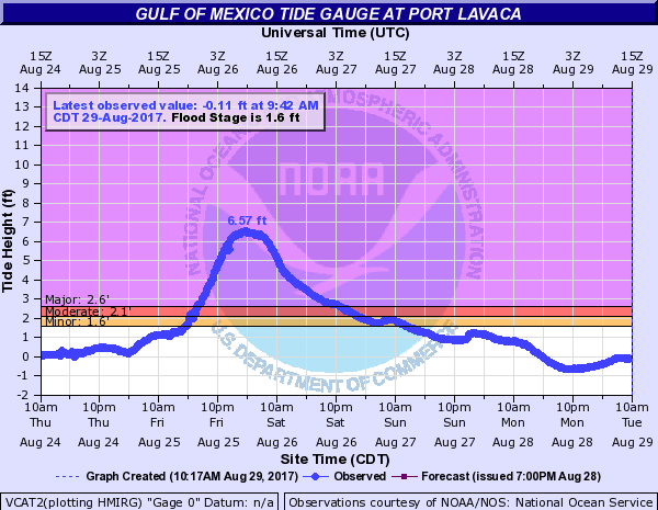
CALHOUN G PORT LAVACA 7.06 6.71 26/1018 MODERATE
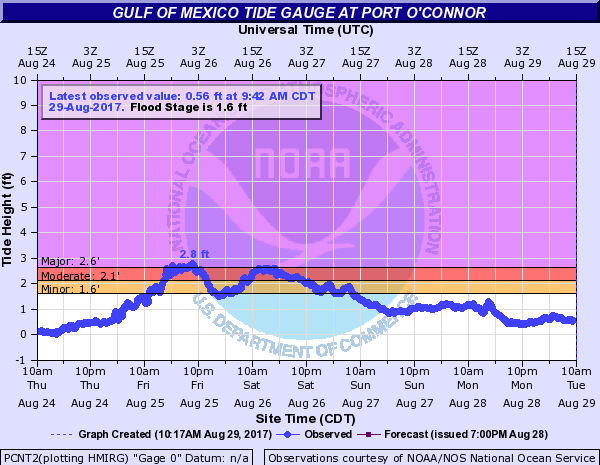
CALHOUN G PORT OCONNOR 3.14 2.80 25/2124 MINOR
ARANSAS G ARANSAS WILDLIF 4.80 4.76 26/0212 MODERATE
ARANSAS G COPANO BAY 4.12 3.97 26/0630 MAJOR I
ARANSAS G ROCKPORT 1.97 1.86 26/0448 MINOR I
NUECES G PORT ARANSAS 5.53 5.21 26/0212 MAJOR
NUECES G USS LEXINGTON 1.11 0.91 25/1800 NONE
NUECES G PACKERY CHANNEL 4.73 4.64 26/0030 MODERATE
NUECES G BOB HALL PIER 4.24 3.53 25/2012 MODERATE
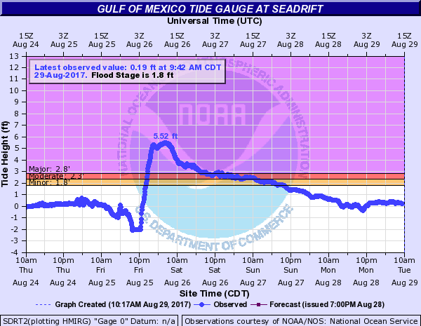
CALHOUN G SEADRIFT 5.77 5.52 26/1130 MODERATE
ARANSAS SAN JOSE ISLAND 9999.00 9999.00 99/9999 MAJOR
REMARKS: STORM TIDE DATUM IS WITH RESPECT TO MEAN HIGHER HIGH
WATER...MHHW. COPANO BAY AND ROCKPORT SITES MALFUNCTIONED DURING
STORM.NOTE...MAJOR BEACH EROSION ALONG BAY AND SHIPPING CHANNEL SIDE
OF PORT ARANSAS. MODERATE BEACH EROSION ALONG GULF SIDE OF PORT
ARANSAS. GENERALLY MINOR BEACH EROSION AT ROCKPORT EXCEPT ALONG
FULTON BEACH ROAD WHERE EROSION WAS MODERATE.
NOTE...AN ESTIMATED 12 TO 14 NEW CUTS WERE FORMED ON SAN JOSE
ISLAND.
F. TORNADOES...
---------------------------------------------------------------------
(DIST)CITY/TOWN COUNTY DATE/ EF SCALE
LAT LON (DEG DECIMAL TIME(UTC) (IF KNOWN)
DESCRIPTION
---------------------------------------------------------------------
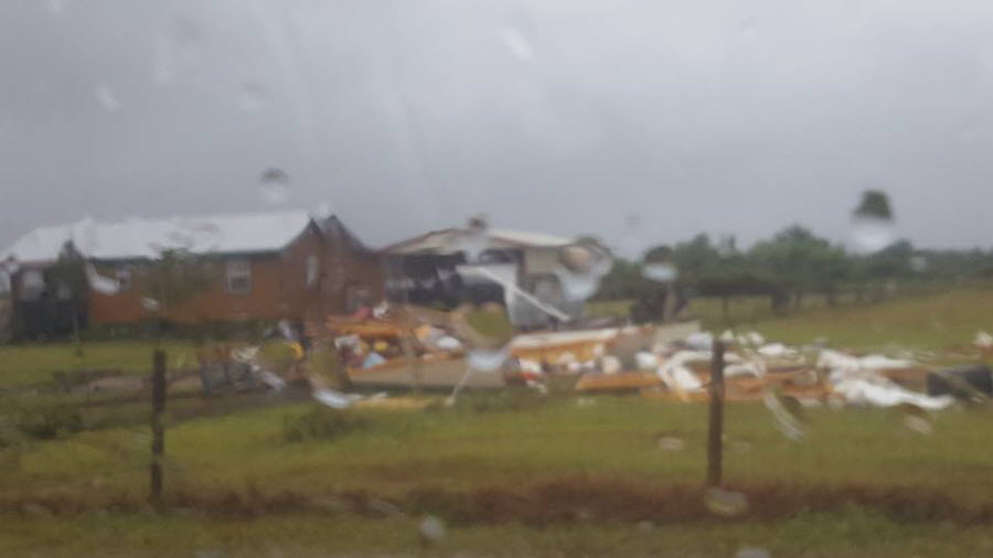
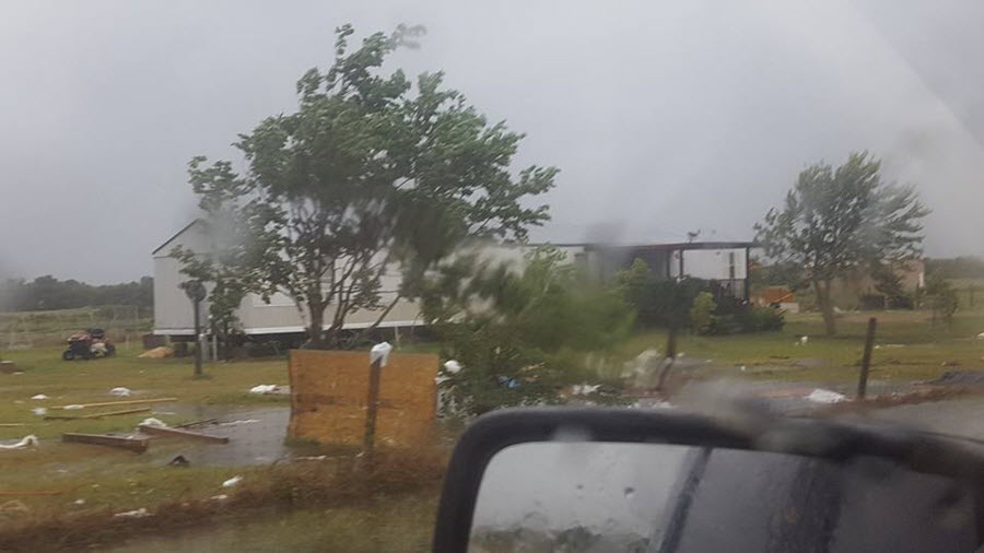
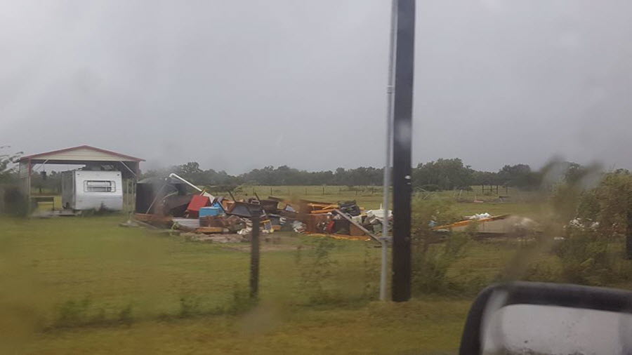
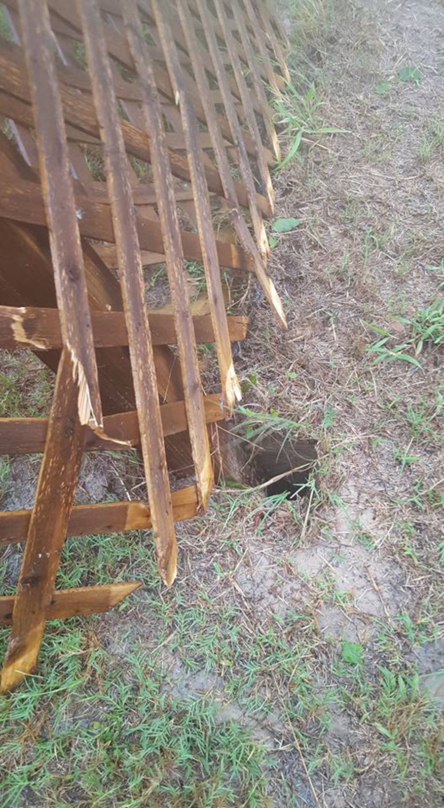
4 NNE SEADRIFT CALHOUN 25/2114 EF0
28.43 -96.67
FACEBOOK PHOTOS AND VIDEO SHOWED A BRIEF TORNADO TOUCHED DOWN ON
GATES ROAD NEAR SEADRIFT. A SHED AND CARPORT WERE DESTROYED AND A
FEW TREES WERE BLOWN DOWN. RATED EF0.
G. STORM IMPACTS BY COUNTY...
---------------------------------------------------------------------
COUNTY DEATHS INJURIES EVACUATIONS
DESCRIPTION
---------------------------------------------------------------------
CALHOUN N/A N/A N/A
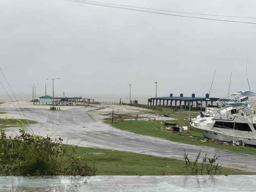
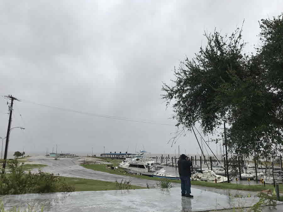
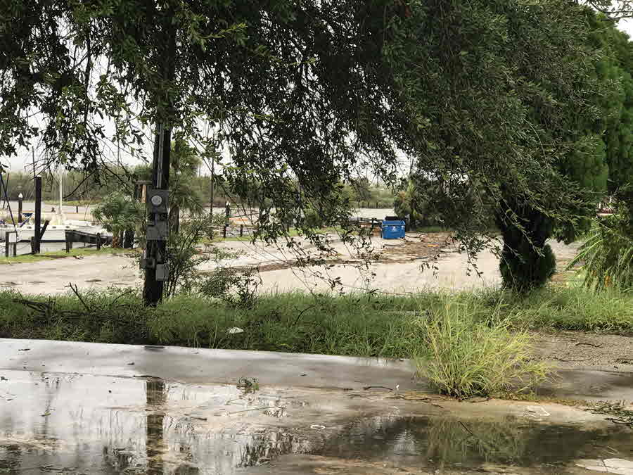
SEADRIFT...NEARLY ENTIRE MARINA WAS INUNDATED FROM STORM SURGE WHICH
RESULTED IN SEVERAL BOATS BEING GROUNDED ONTO THE MARINA PARKING LOT
AND DRIVE. MOST OF THE WOODEN DOCKS AT THE MARINA WERE DESTORYED.
STORM SURGE REACHED APPROX 2/3 OF THE WAY UP THE BEACH FRONT
PAVILION AND PARK...WHICH RESULTED IN WATER APPROACHING BAY AVENUE.
STORM SURGE ALSO INUNDATED YARDS AND POSSIBLY ENTERED HOMES AND
PROPERTIES NEAR THE BAY AVE AND ORANGE ST INTERSECTION. ADDITIONAL
SURGE AND INUNDATION APPROACHED SGT RODNEY TAYLOR AVE. NUMEROUS
TREES WERE BLOWN DOWN ACROSS ALL OF SEADRIFT WITH MANY HOMES
EXPERIENCING MINOR TO MODERATE ROOF AND PROPERTY DAMAGE. SOME POORLY
CONSTRUCTED PROPERTIES EXPERIENCED MAJOR ROOF DAMAGE. A FEW WOODEN
PIERS WERE DESTORYED. PORT OCONNOR...STORM SURGE AND INUNDATION FROM
MATAGORDA BAY REACHED ROUGHLY 1/2 OF THE WAY UP KING FISHER BEACH
TOWARDS PARK ST. NUMEROUS TREES WERE BLOWN DOWN ACROSS TOWN WITH
ROUGHLY 3/4 OF THE COMMUNITY EXPERIENCING MINOR ROOF DAMAGE. A FEW
POWER POLES WERE ALSO BLOWN DOWN. MAGNOLIA BEACH AND
INDIANOLA...MINOR TO MODERATE PROPERTY DAMAGE WAS OBSERVED AND WAS
CONFINED MAINLY TO ROOF DAMAGE. STORM SURGE AND INUNDATION FLOODED
NEARLY ALL OF MAGNOLIA PUBLIC BEACH AND CROSSED N OCEAN DR IN A FEW
LOCATIONS. A FEW AREAS OF S OCEAN DRIVE IN AND NEAR INDIANOLA WERE
ALSO INUNDATED. SEVERAL OLDER WOODEN DOCKS AND PIERS WERE DESTROYED.
ONE NEWER AND STRONGLY REINFORCED WOODEN PIER NEAR MAGNOLIA BEACH
SURVIVED BUT CONTAINED WATER MARKS THAT INDICATED ENTIRE PIER WAS
INUNDATED FROM STORM SURGE. NEAR ALAMO BEACH...INUNDATION AND STORM
SURGE NEAR GALLINIPPER POINT APPROACHED CARRIGAN AVENUE. MOST
PROPERTIES EXPERIENCED ONLY MINOR ROOF DAMAGE.PORT LAVACA...WATER
FROM CHOCOLATE BAY/BAYOU INUNDATED THE PUBLIC BOAT RAMP NEAR BUREN
ROAD WITH ENTIRE NEARBY FLOOD PLAIN INUNDATED. THE LOWER HALF OF
BUREN ROAD WAS COMPLETELY INUNDATED. THE ENTIRE MARINA ALONG LAVACA
BAY WAS STRONGLY IMPACTED WITH AN ESTIMATED 16 BOATS BEING DECLARED
A TOTAL LOSS...WITH MANY SINKING IN THE MARINA. WATER LEVELS ROSE
HIGH ENOUGH TO GROUND SEVERAL BOATS ON LAND NEXT TO THE MARINA.
NEARLY ALL OF BAYFRONT PENINSULA PARK WAS INUNDATED. NEARLY ALL
AREAS EAST OF BROADWAY STREET WERE INUNDATED WITH WATER LEVELS
REACHING RIGHT UP TO AND POSSIBLY ACROSS HWY 35 IN THE AREA NEAR
LIGHTHOUSE BEACH. MINOR TO MODERATE PROPERTY DAMAGE WAS COMMON
ACROSS THE CITY WITH LARGE AREAS OF SIDING REMOVED FROM A FEW WELL
CONSTRUCTED PROPERTIES. PIERS AT LIGHTHOUSE BEACH PARK AND BAYFRONT
PENINSULA PARK WERE DESTROYED.
NUECES N/A N/A N/A
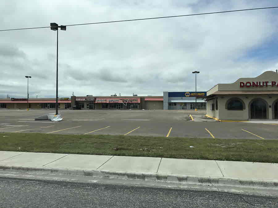
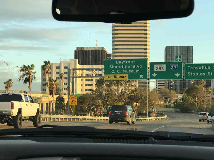
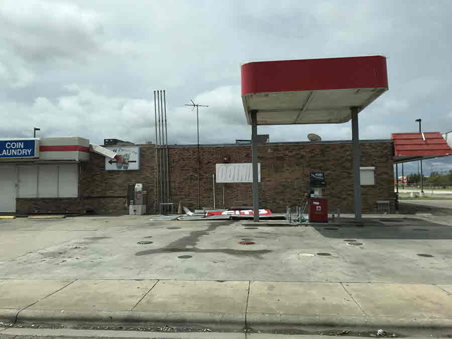
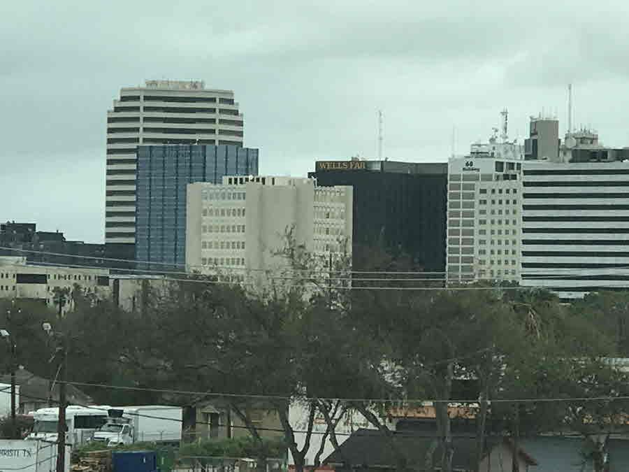
CORPUS CHRISTI...WIDESPREAD MINOR PROPERTY DAMAGE WAS COMMON ACROSS
CORPUS CHRISTI METROPOLITAN AREA WITH MOST HOMES EXPERIENCING
ROOFING ISSUES...PRIMARILY LOST SHINGLES. SOME RESIDENCES AND
BUSINESSES EXPERIENCED MODERATE DAMAGE...PARTICULARLY ACROSS THE
NORTHERN HALF OF THE CITY. NEARLY THE ENTIRE CITY LOST POWER FOR A
COUPLE OF DAYS. TALLER BUILDINGS DOWNTOWN SUFFERED MORE SIGNIFICANT
DAMAGE AND LOST SIGNS. PORT OF CORPUS CHRISTI WAS SHUTDOWN FOR A
RECORD 6 DAYS.PADRE ISLAND...SIGNIFICANT STORM SURGE WAS EXPERIENCED
ALONG THE LAGUNA MADRE WHICH IMPACTED RESIDENCES AND BUSINESSES
LOCATED ALONG THE WATER. MINOR ROOF DAMAGE WAS COMMON TO RESIDENCES
AND BUSINESSES ALONG THE ISLAND WITH ISOLATED LOCATIONS EXPERIENCING
MODERATE DAMAGE.MUSTANG ISLAND...STORM SURGE INUNDATED HIGHWAY 361
ALONG A 10 MILE STRETCH FROM NEAR THE MUSTANG ISLAND STATE PARK TO
POR ARANSAS WITH WATER SEVERAL FEET DEEP. A FEW BOATS BECAME MOORED
NEAR PACKERY CHANNEL. ARNOLD PALMER DESIGNED DUNES STYLE GOLF COURSE
AT PALMILLA BEACH SOUTH OF PORT ARNSAS WAS INUNDATED BY STORM SURGE
WITH WATER COVERING MOST OF THE COURSE. MODERATE TO POCKETS OF MAJOR
STRUCTURAL DAMAGE WERE OBSERVED ALONG THE PACKERY CHANNEL
JETTIES.PORT ARANSAS...WIDESPREAD DAMAGE WITH MORE THAN 6600 HOMES
IMPACTED...WITH MORE THAN 4000 EXPERIENCING MAJOR DAMAGE AND MORE
THAN 1000 DESTROYED. MORE THAN 450 BUSINESSES EXPERIENCED MAJOR
DAMAGE. NUMEROUS BOATS WERE DAMAGED OR DESTROYED AND PUSHED OUT OF
MOORINGS ONTO HIGH GROUND. A LARGE DRIL BOAT BROKE LOOSE...DESTROYED
A PIER...AND BECAME GROUNDED ALONG THE JETTY. TWO TUGS BROKE LOOSE
NEAR THE GULF INTRA COASTAL WATERWAY WITH ONE BECOMING GROUNDED AND
THE OTHER SINKING. TWO FERRIES WERE DAMAGED WHEN THEY WERE PINNED
AGAINST THE LOADING DOCK.
SAN PATRICIO N/A N/A N/A
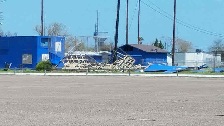
WORST DAMAGE WAS CONFINED TO EASTERN HALF OF COUNTY. MORE THAN 8000
HOMES WERE IMPACTED WITH MORE THAN 400 EXPERIENCING MAJOR DAMAGE OR
BEING DESTROYED. THE HARDEST HIT AREAS WERE ARANSAS PASS AND
INGLESIDE WHERE MOST REPORTS OF MAJOR DAMAGE WERE RECEIVED.
WIDESPREAD POWER OUTAGES OCCURRED WITH SOME AREAS WITHOUT POWER FOR
OVER A WEEK. NUMEROUS WOODEN PIERS AND DOCKS WERE DAMAGED OR
DESTROYED. NUMEROUS LARGE POWER POLES WERE BLOWN DOWN ACROSS EASTERN
HALF OF COUNTY. A COUPLE BOATS WERE DAMAGED IN THE CONN BROWN
HARBOR. MAJOR FLOODING WAS EXPERIENCED IN THE LOW PART OF TOWN
ADJACENT TO THE LEVEE.PORTLAND...WIDESPREAD MINOR ROOF DAMAGE.
NUMEROUS TREES AND POWER POLES DOWN.
REFUGIO N/A N/A N/A
BAYSIDE...WIDESPREAD MODERATE STRUCTURAL DAMAGE OCCURRED IN BAYSIDE.
NUMEROUS TREES AND POWER POLES DOWN ACROSS TOWN INCLUDING SOME HIGH
TENSION POWER POLES. FEW MOBILE HOMES DESTROYED. MODERATE STORM
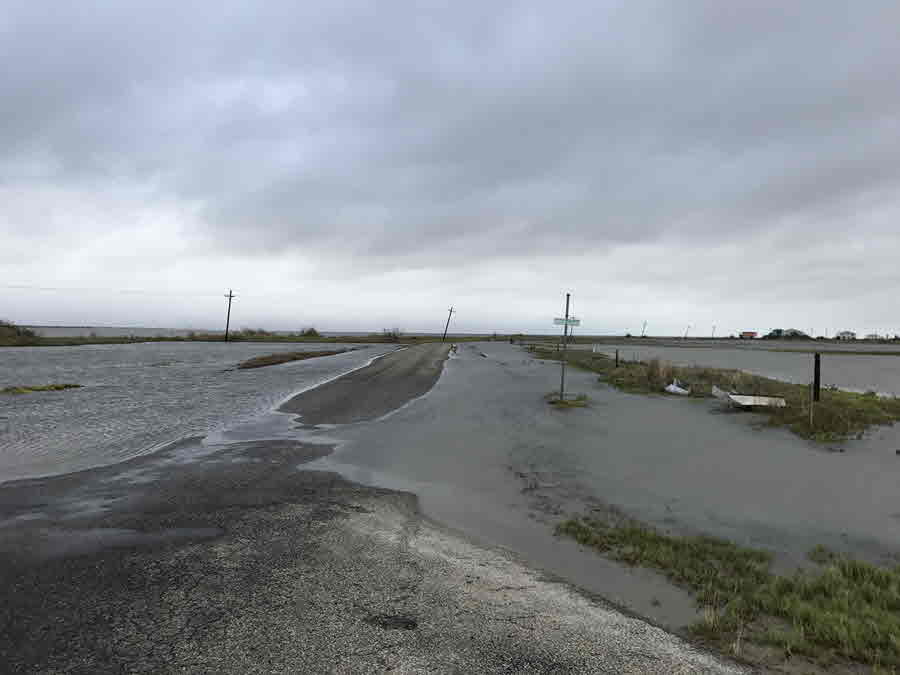
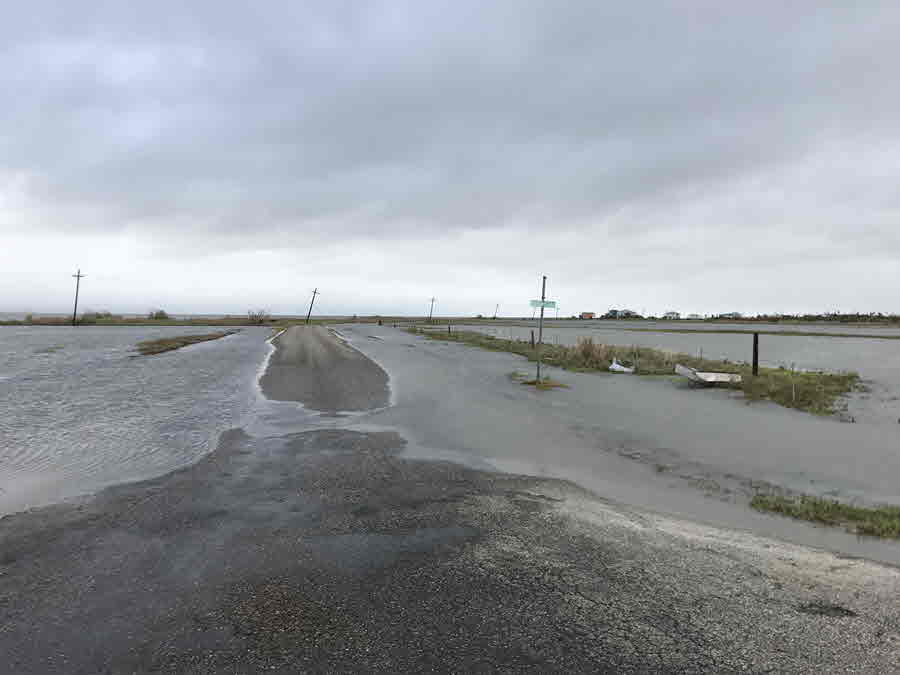
SURGE OBSERVED ALONG COPANO BAY. WATER COVERED FM136 NEAR THE COPANO
BAY BRIDGE.REFUGIO...WIDESPREAD MODERATE STRUCTURAL DAMAGE WITH
POCKETS OF MAJOR STRUCTURAL DAMAGE. MOST HOMES AND BUSINESSES HAD
SOME ROOF DAMAGE...BROKEN WINDOWS...AND GARAGE DOORS. ONE MOTEL
COMPLETELY LOST ITS ROOF. GAS STATION CANOPY AND MANY SIGNS WERE
DESTROYED. A FEW BRICK STRUCTURES EXPERIENCED MODERATE DAMAGE IN
REFUGIO. SEVERAL MOBILE HOMES WERE DESTROYED. WIDESPREAD TREE DAMAGE
WITH A FEW VERY LARGE TREES COMPLETELY
UPROOTED.WOODSBORO...WIDESPREAD MINOR TO MODERATE DAMAGE WITH A FEW
POORLY CONSTRUCTED HOMES EXPERIENCING MAJOR DAMAGE. NUMEROUS TREES
BLOWN DOWN ALONG WITH A FEW POWER POLES.
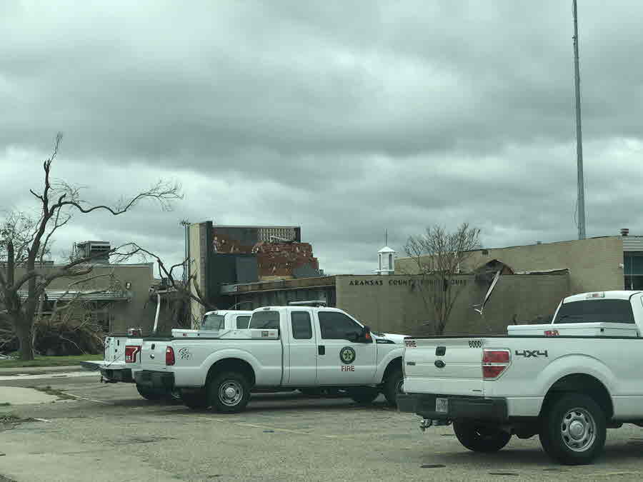
ARANSAS N/A N/A N/A
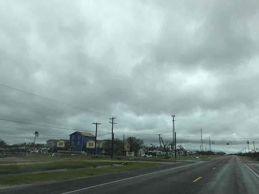
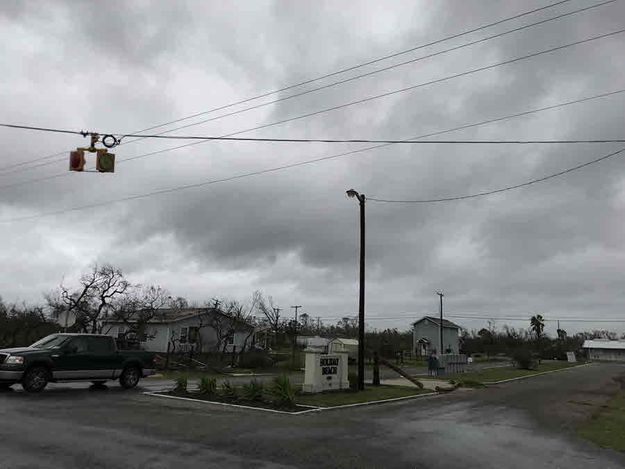
WIDESPREAD MAJOR DAMAGE ACROSS THE COUNTY WITH A FEW AREAS OF
CATASTROPHIC DAMAGE. CATASTROPHIC DAMAGE WAS LOCATED ACROSS COPANO
VILLAGE...HOLIDAY BEACH...AND LAMAR...WHERE NEARLY EVERY STRUCTURE
WAS GREATLY IMPACTED. A COUPLE OF BRICK HOMES WERE DESTROYED NEAR
COPANO VILLAGE. NEARLY ALL TREES IN THE HOLIDAY BEACH...LAMAR...AND
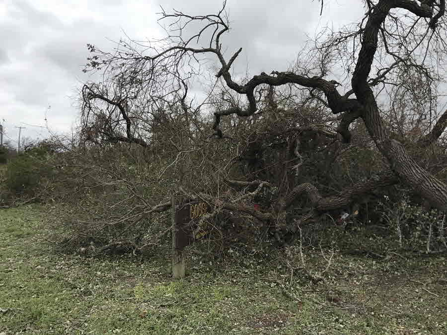
GOOSE ISLAND STATE PARK AREAS WERE DELEAFED AND MANY TRUNKS SNAPPED
OR UPROOTED. MOST OF ROCKPORT AND FULTON EXPERIENCED WIDESPREAD
MAJOR STRUCTURAL DAMAGE WITH NUMEROUS WOODEN PIERS AND DOCKS
DESTROYED. SEVERAL HOMES IN KEY ALLEGRO SUBDIVISION COLLAPSED.
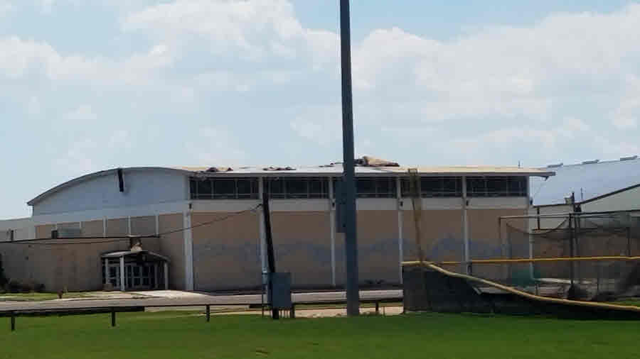
EXTERIOR WALLS COLLAPSED ON THE HIGH SCHOOL GYMNASIUM AND ON SEVERAL
NEW HOTELS. UPPER FLOORS OF SEVERAL APARTMENT BUILDINGS WERE
REMOVED. STORM SURGE GREATLY IMPACTED HOLIDAY BEACH AND COPANO
VILLAGE. THE SRUGE PUNCHED HOLES THROUGH WALLS AND GARAGE DOORS ON
LOWER PORTIONS OF MOST HOMES AND FLOATED VEHICLES...RV`S...AND BOATS
WELL INLAND. THE SURGE ALSO APPROACHED AND FLOWED ACROSS EGERY
ISLAND ROAD AND FM136 IN SEVERAL LOCATIONS ON SOUTHERN EDGE OF
BAYSIDE IN EXTREME WESTERN ARANSAS COUNTY. NUMEROUS CATTLE KILLED
NORTH OF HOLIDAY BEACH. A LARGE PORTION OF RATTLESNAKE POINT ROAD
WAS ERODED AND WASHED AWAY HEADING OUT TO REDFISH LODGE ON COPANO
BAY. PIER SOUTH OF THE LODGE WAS COMPLETELY WASHED AWAY.
VICTORIA N/A N/A N/A
$$
Legend:
I-Incomplete Data
E-Estimated
HART
Complete KCRP Doppler Radar Loop of Harvey - Aug 24-29, 2017
| KCRP Doppler Radar Loop from 904 AM CDT 08/24/17 through 653 PM CDT 08/29/17 (Viewed best in 1080p Full Screen Mode) |
|---|
Radar Loop of Harvey making landfall
Eyewall Reflectivity and Velocity Pics near the time of landfall
 |
 |
| Harvey just before making landfall on San Jose Island | Harvey making landfall on San Jose Island |
|---|---|
 |
 |
| Harvey's eyewall over Fulton, Rockport, and Port Aransas | The center of Harvey over Lamar |
Harvey Aerial Imagery
1-minute GOES-16 visible imagery of Hurricane Harvey: 400 PM CDT through 730 PM CDT 08/25/17
Credit: Cooperative Institute for Research in the Atmosphere (CIRA) and the Regional and Mesoscale Meteorology Branch (RAMMB)1-minute GOES-16 infrared imagery of Hurricane Harvey: 914 AM CDT through 1159 PM CDT 08/25/17
GOES-16 data is non-operational.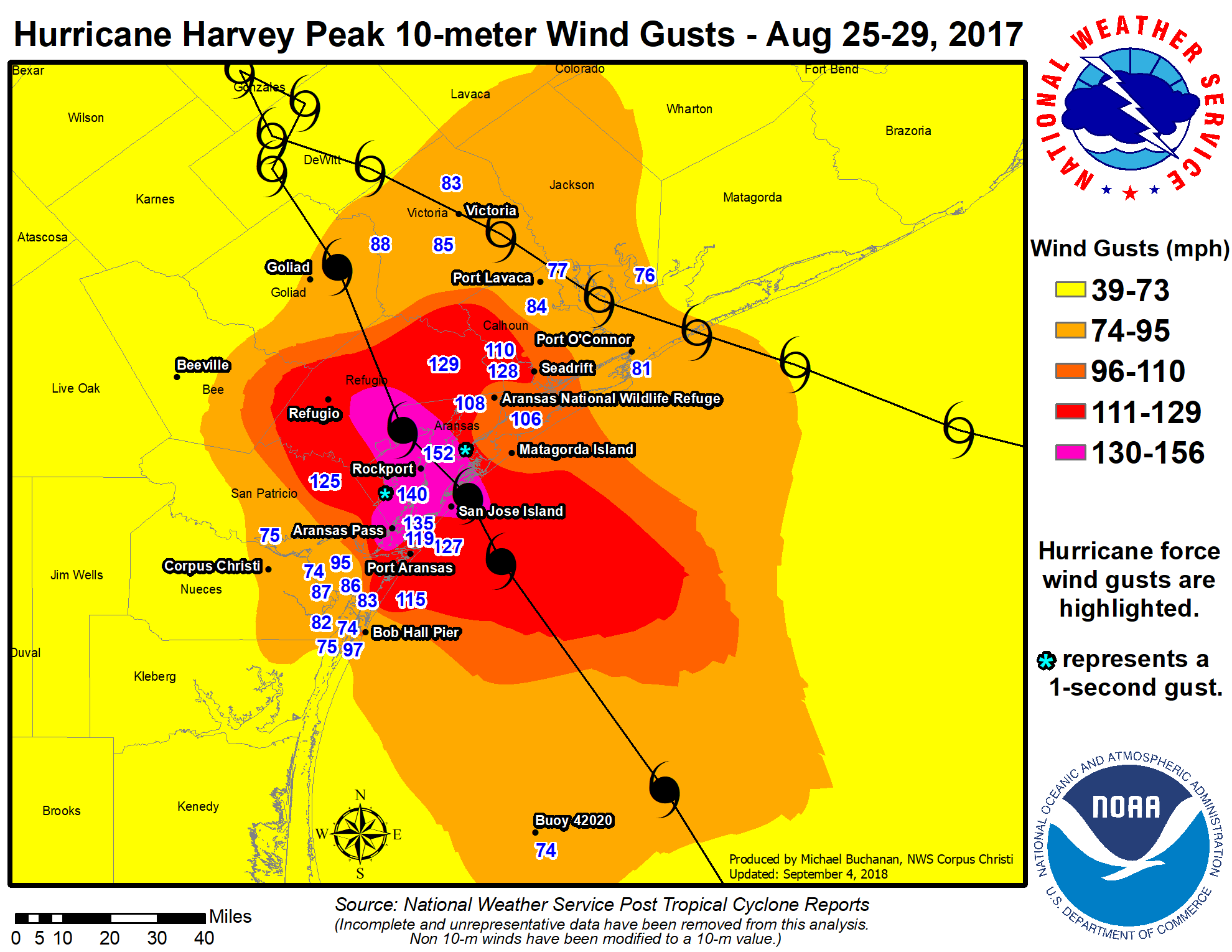
Click above for the full-size image.
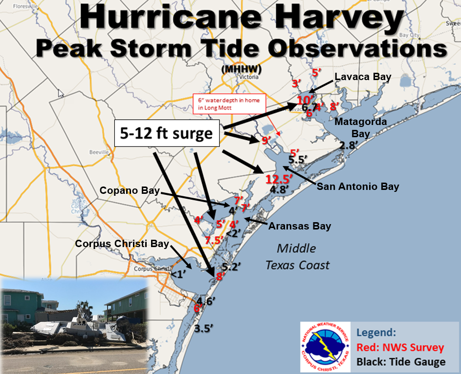
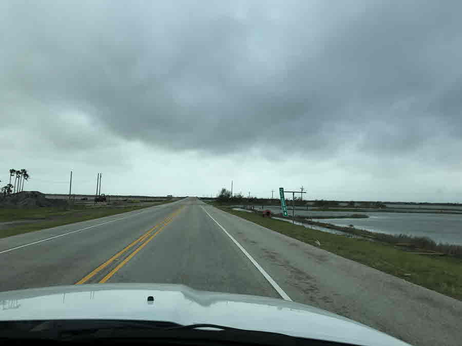
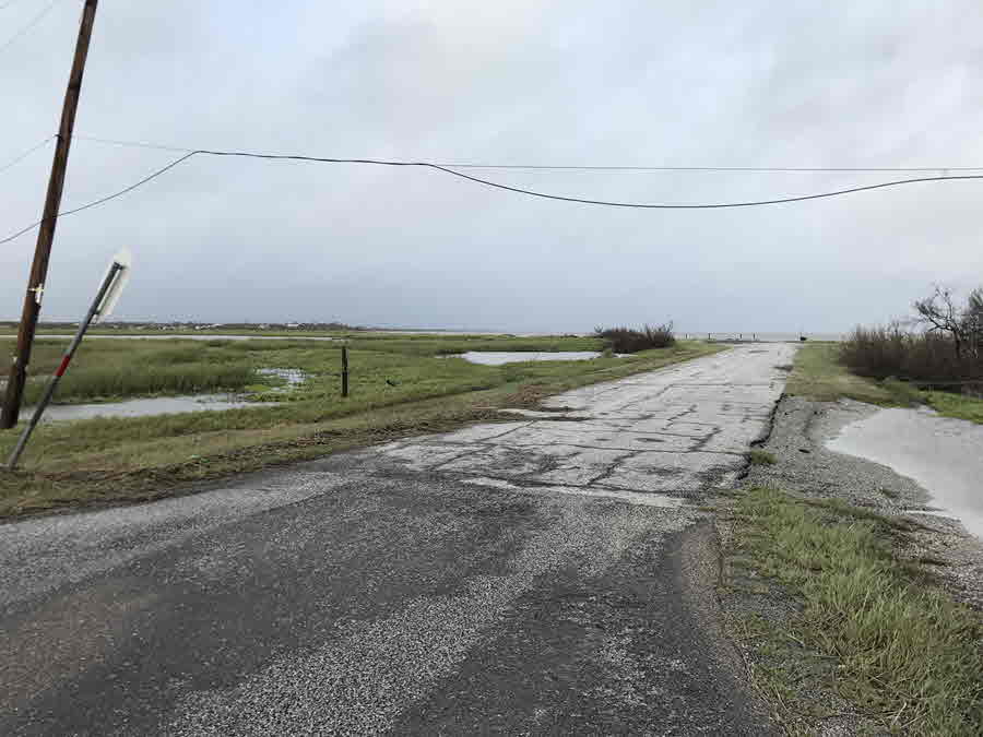
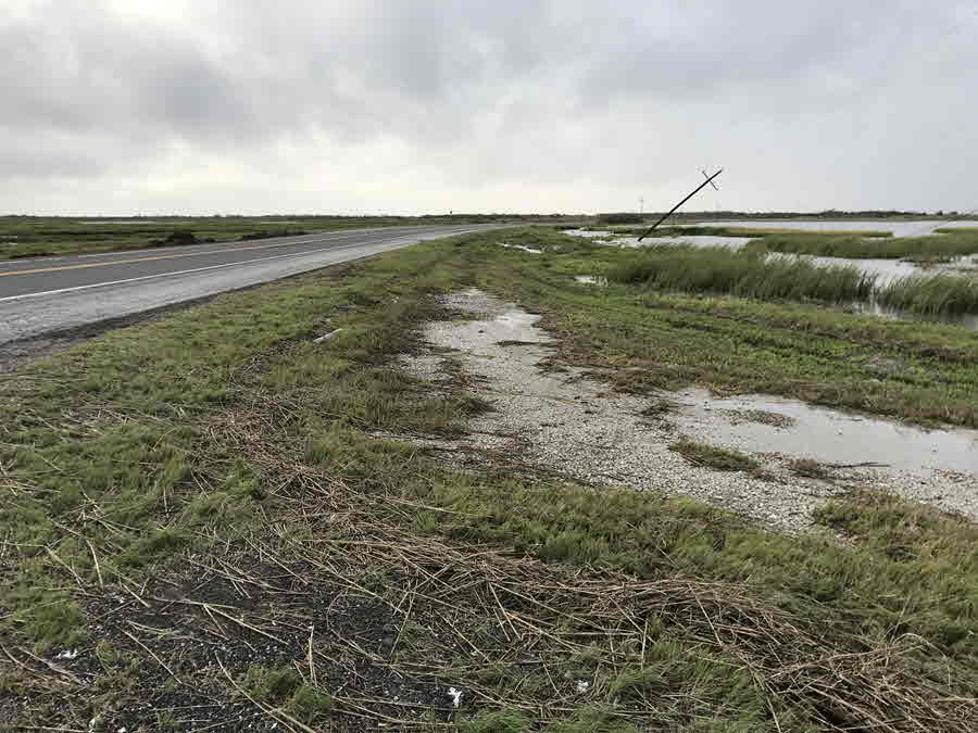
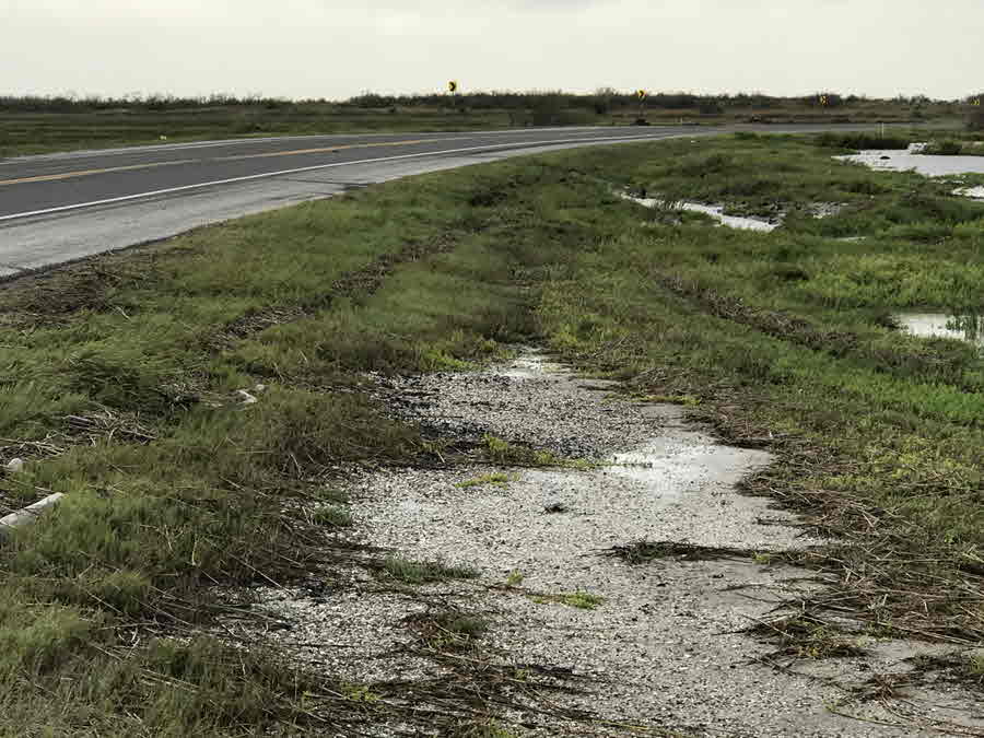
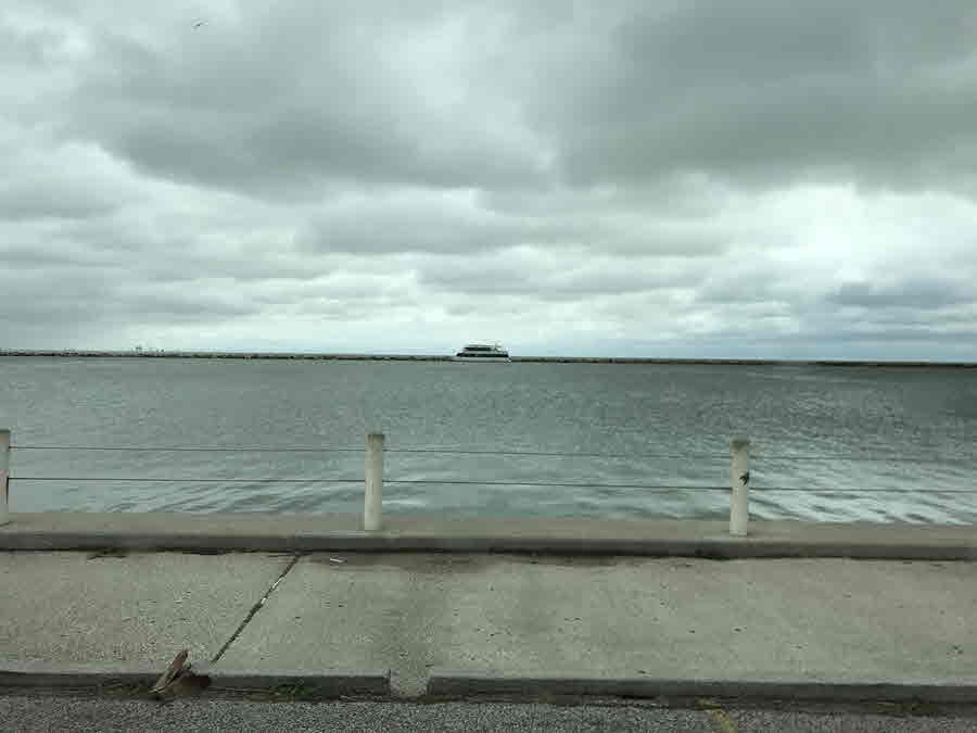
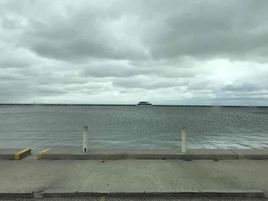
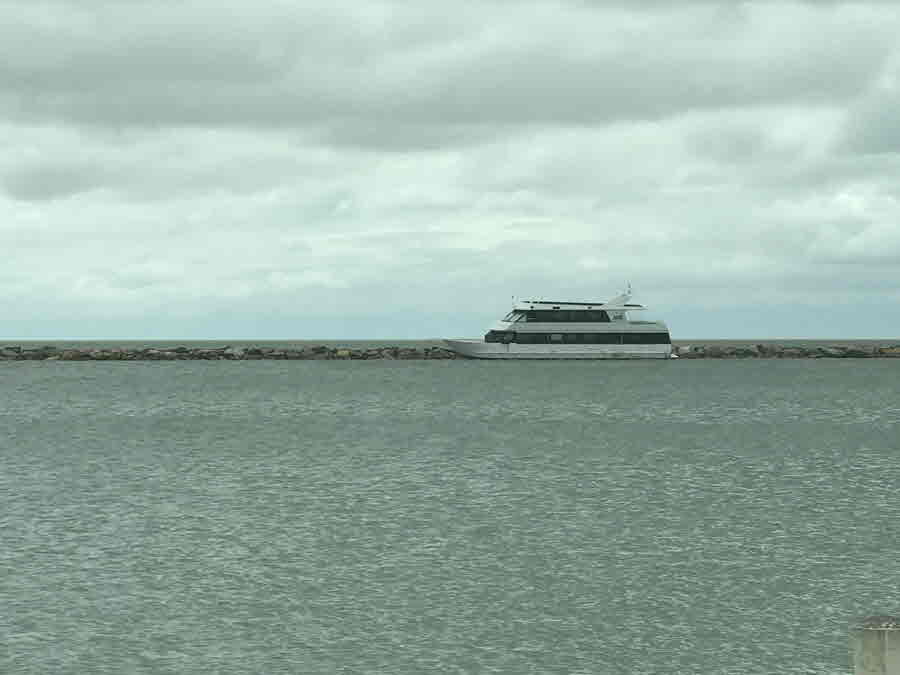
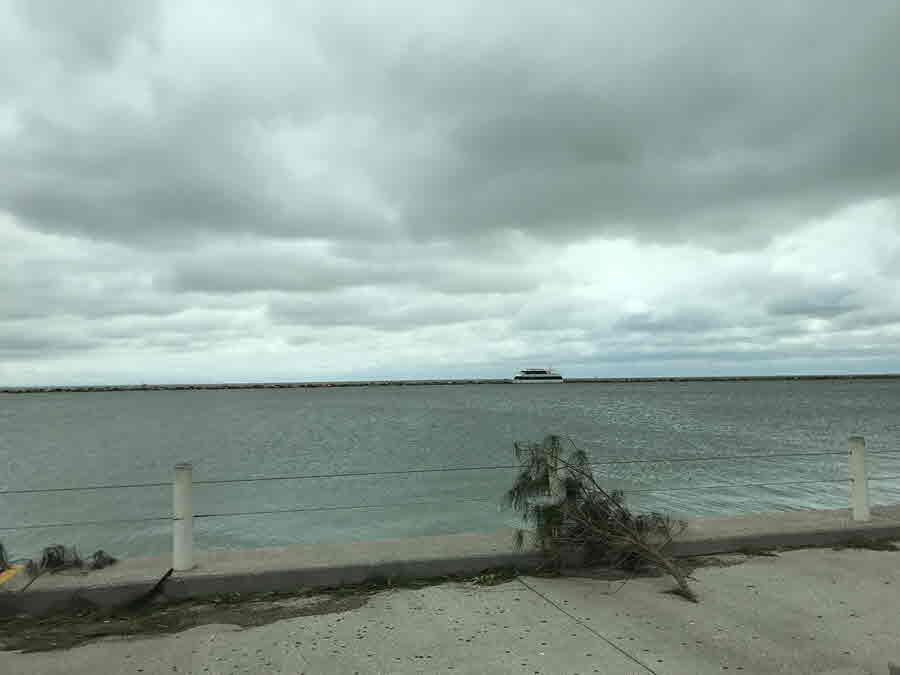
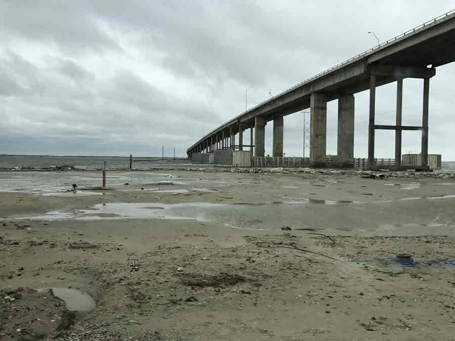
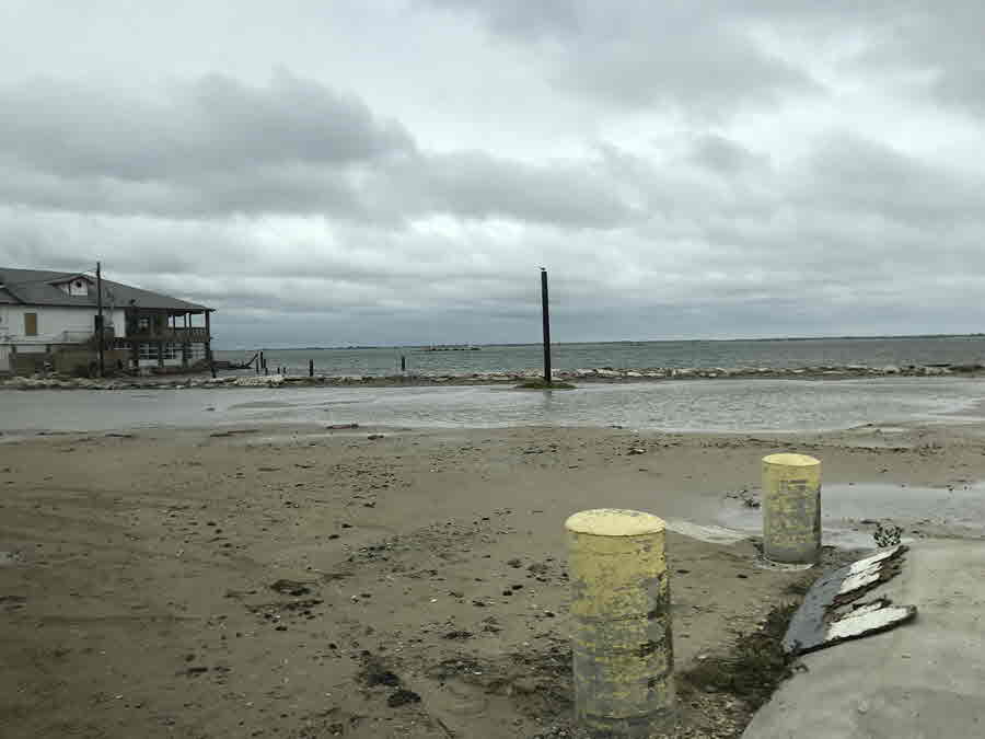
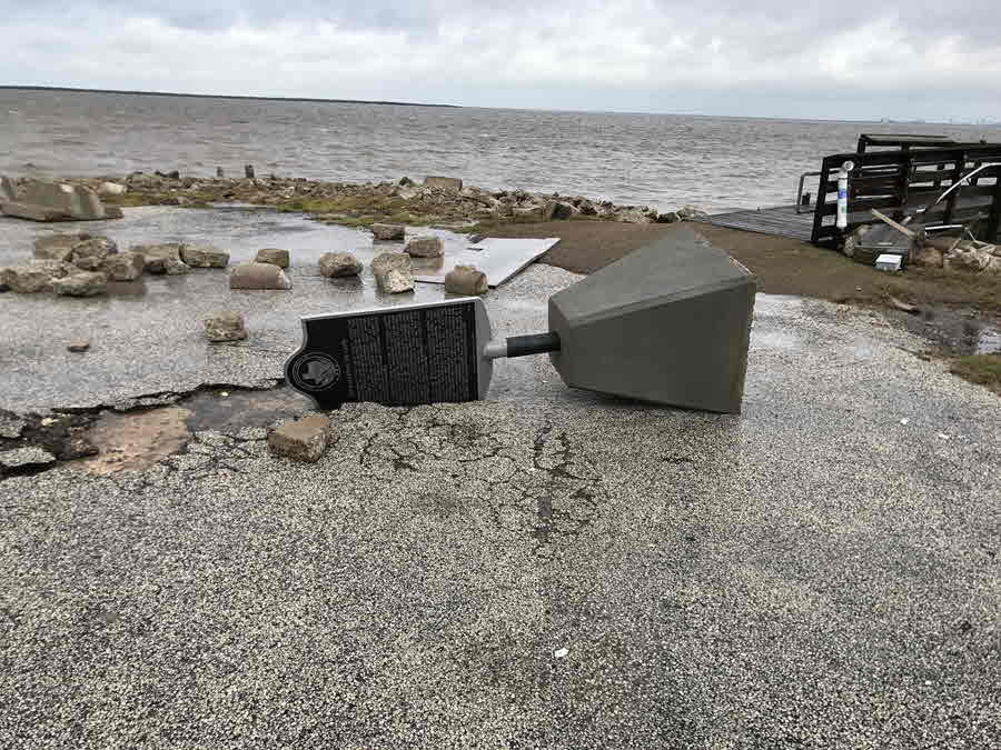
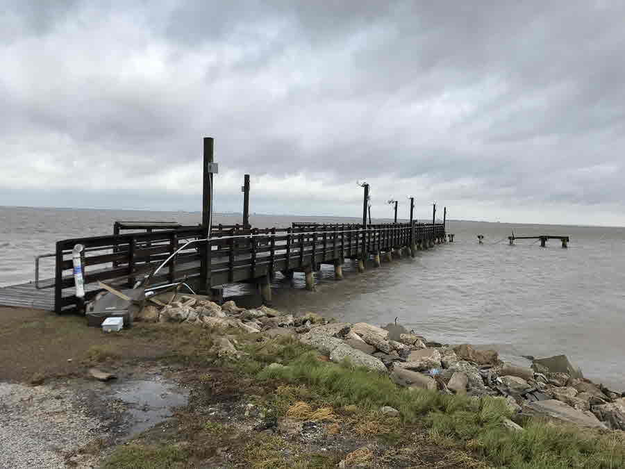
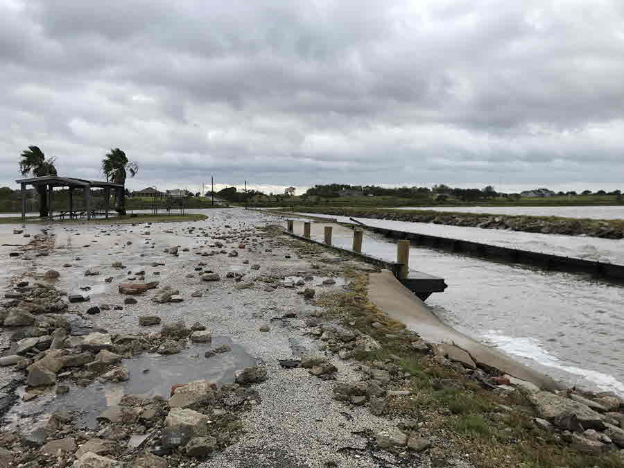
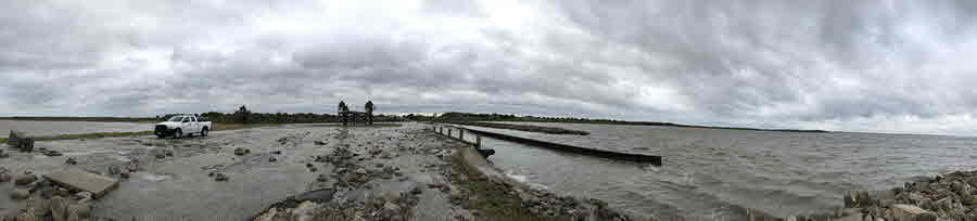
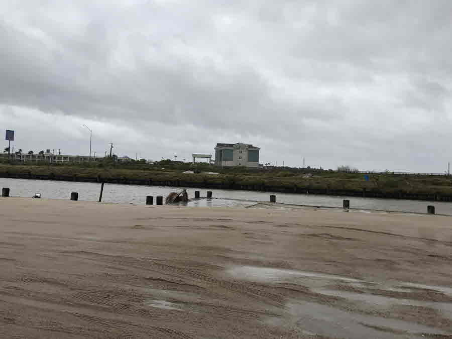
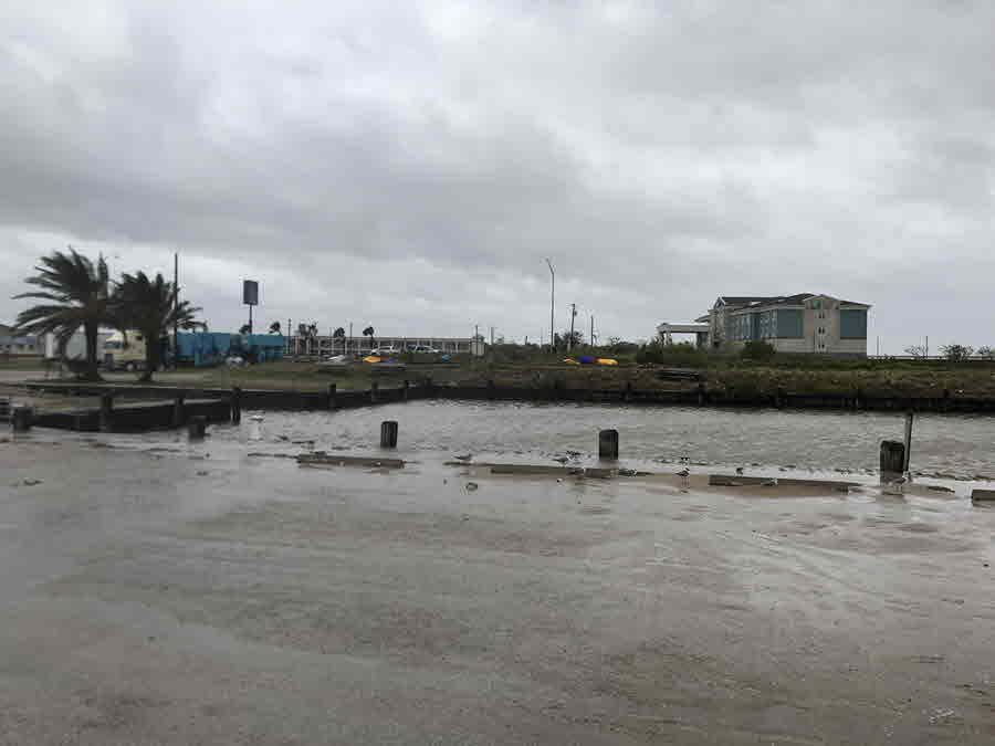
On the west side of Harvey, winds pushed water across Corpus Christi and Copano Bays. This resulted in a storm surge of up to 12 feet that affected Port Aransas and western Aransas county. On the east side of Harvey, a storm surge up to 12.5 feet affected eastern Aransas, southeastern Refugio, and Calhoun counties. The surge in this area peaked across the Aransas National Wildlife Refuge and the northern extent of both San Antonio and Lavaca Bays.
 |
 |
| Port Lavaca | Seadrift |
|---|---|
 |
 |
| Port O'Connor | Rockport |
 |
 |
| Copano Bay | Packery Channel |
 |
 |
| Baffin Bay | Bird Island |
 |
 |
| Port Aransas | Bob Hall Pier |
 |
 |
 |
| Coleto Creek at Highway 59 in Victoria | Guadalupe River at Cuero | Guadalupe River at Bloomington |
|---|---|---|
 |
 |
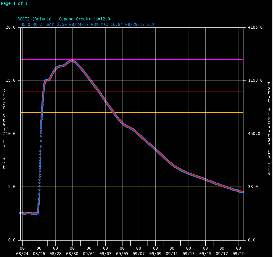 |
| Garcitas Creek at Inez | Oso Creek in Corpus Christi | Copano Creek at Refugio |
 |
 |
 |
| Mission River at Refugio | Coleto Creek at Arnold Road Crossing | Guadalupe River at Victoria |
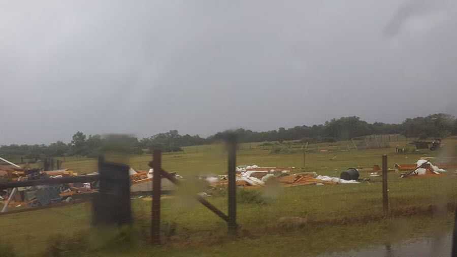
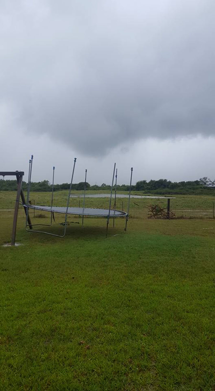
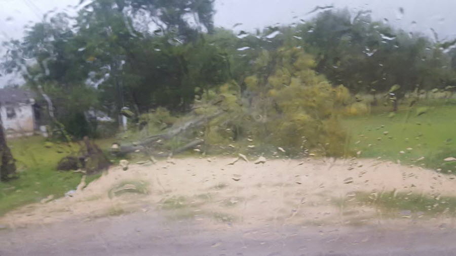
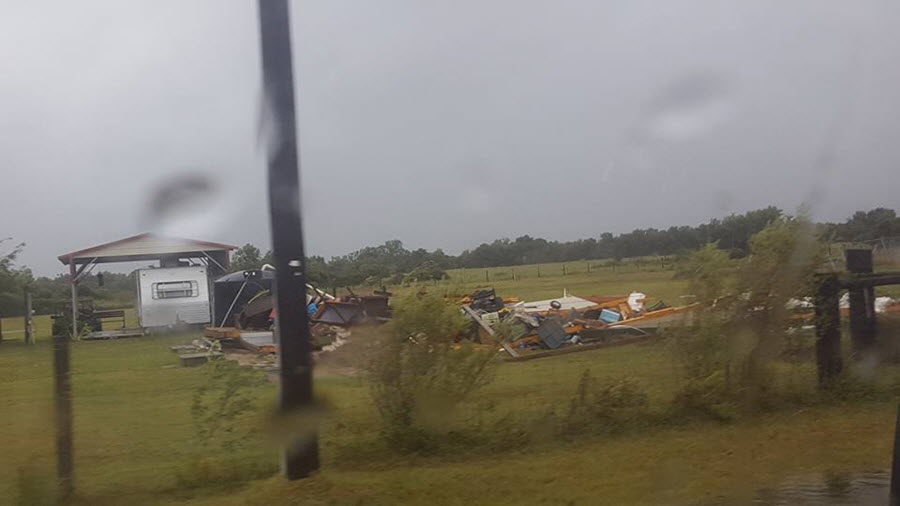
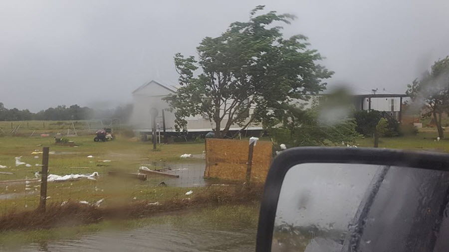
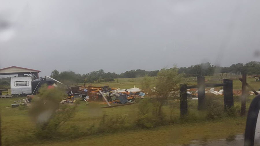
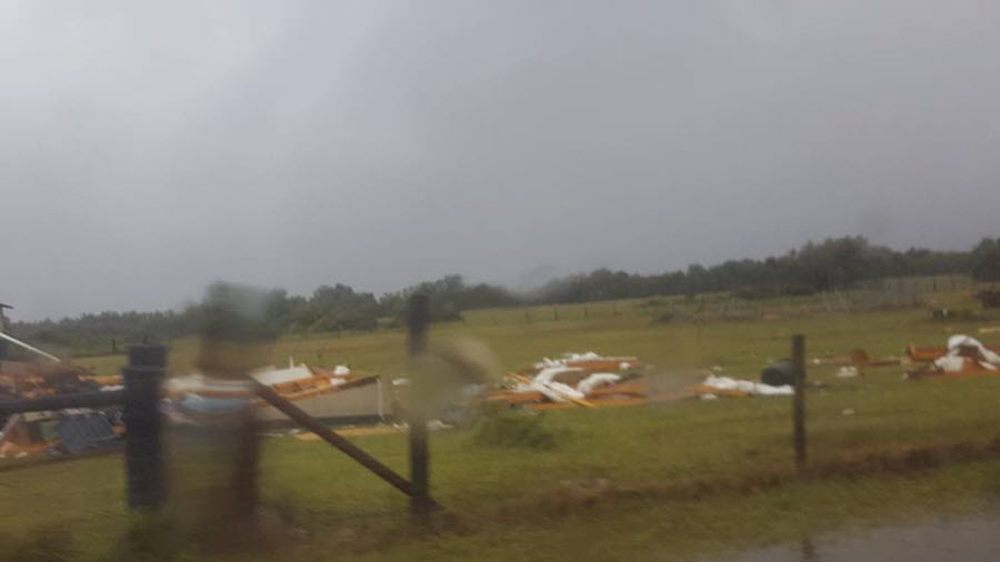
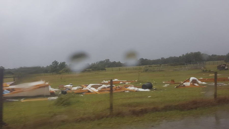
A brief EF-0 tornado touched down around 3 miles east-northeast of Seadrift at around 414 PM CDT on August 25th, 2017. A shed and carport were destroyed.

Weekly Regional Rainfall ending August 30th, 2017

South Texas Daily Rainfall between August 25th and 27th, 2017


Regional Rainfall between August 25th and 30th, 2017


Weekly Texas Rainfall through August 30th, 2017

Click the red points above to view storm damage photos and detailed information. (This may take a few seconds to load.)
PRELIMINARY LOCAL STORM REPORT...SUMMARY
NATIONAL WEATHER SERVICE CORPUS CHRISTI TX
154 PM CDT WED AUG 30 2017
..TIME... ...EVENT... ...CITY LOCATION... ...LAT.LON...
..DATE... ....MAG.... ..COUNTY LOCATION..ST.. ...SOURCE....
..REMARKS..
0414 PM TORNADO 3 ENE SEADRIFT 28.43N 96.67W
08/25/2017 CALHOUN TX SOCIAL MEDIA
FACEBOOK PHOTOS AND VIDEO SHOWED A BRIEF TORNADO
TOUCHED DOWN ON GATES ROAD NEAR SEADRIFT. A SHED AND
CARPORT WERE DESTROYED. PRELIMINARY RATING EF0. TIME
ESTIMATED BASED ON RADAR.
0800 PM HURRICANE PORTLAND 27.88N 97.32W
08/25/2017 SAN PATRICIO TX PUBLIC
LARGE TREES DOWN IN PORTLAND.
0830 PM HURRICANE 2 ENE PORT ARANSAS 27.84N 97.04W
08/25/2017 GMZ255 TX C-MAN STATION
WIND GUSTS MEASURED AT 125 MPH AT ANPT2
0840 PM HURRICANE 2 ENE PORT ARANSAS 27.84N 97.04W
08/25/2017 GMZ255 TX SOCIAL MEDIA
ANPT2 MEASURE 110 MPH SUSTAINED WIND AND 131 MPH WIND
GUST . REPORT VIA SOCIAL MEDIA.
0848 PM HURRICANE 1 S ROCKPORT 28.02N 97.05W
08/25/2017 GMZ235 TX NOS
108 MPH WIND GUST MEASURED AT RCPT2.
0900 PM HURRICANE ROCKPORT 28.04N 97.05W
08/25/2017 ARANSAS TX TRAINED SPOTTER
NUMEROUS STRUCTURES DESTROYED. DEBRIS FILLING THE
AIR... ESTIMATED PEAK WIND GUST 125 MPH.
0900 PM HURRICANE 1 E PORT ARANSAS 27.83N 97.05W
08/25/2017 GMZ250 TX C-MAN STATION
109 MPH MEASURED AT PTAT2
0917 PM HURRICANE 1 ENE COPANO VILLAGE 28.09N 97.05W
08/25/2017 ARANSAS TX UNKNOWN
121 MPH WIND GUST MEASURED AT FCMPT2-XUF2 NEAR ROCKPORT
0942 PM HURRICANE 2 ENE PORT ARANSAS 27.84N 97.04W
08/25/2017 GMZ255 TX C-MAN STATION
ANPT2 MEASURED A PEAK WIND GUST OF 132 MPH.
0945 PM HURRICANE ROCKPORT 28.04N 97.05W
08/25/2017 ARANSAS TX EMERGENCY MNGR
BUILDINGS COLLAPSED WITH PEOPLE TRAPPED INSIDE AND
SQUAD CAR WINDOWS BROKEN IN ROCKPORT.
0948 PM HURRICANE 1 SE CORPUS CHRISTI 27.74N 97.41W
08/25/2017 NUECES TX PUBLIC
MULTIPLE TREES DOWN AT GOLLIHAR AND KOSTORYZ
1018 PM HURRICANE 2 WSW LAMAR 28.13N 97.03W
08/25/2017 GMZ235 TX NOS
110 MPH OBSERVED BY CPNT2.
1024 PM HURRICANE 6 S ARANSAS NWR 28.23N 96.80W
08/25/2017 CALHOUN TX C-MAN STATION
106 MPH WIND GUST MEASURED AT AWRT2.
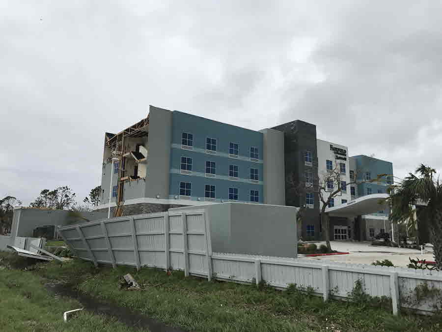
1030 PM HURRICANE 1 S ROCKPORT 28.03N 97.05W
08/25/2017 ARANSAS TX EMERGENCY MNGR
SEVERE DAMAGE TO THE FAIRFIELD INN AND EVACUATED 40
PEOPLE TO HURRICANE SHELTER.
1053 PM HURRICANE PORT ARANSAS 27.83N 97.07W
08/25/2017 NUECES TX LAW ENFORCEMENT
LARGE FISHING BOATS FORCED INLAND AND SIGNIFICANT
DAMAGE ALONG THE WATERFRONT AND SHIPPING CHANNEL IN PORT
ARANSAS
1104 PM HURRICANE ROCKPORT 28.04N 97.05W
08/25/2017 ARANSAS TX BROADCAST MEDIA
LARGE PORTIONS OF ROCKPORT HIGH SCHOOL HAS COLLAPSED
1107 PM HURRICANE 5 NNE TAFT 28.05N 97.36W
08/25/2017 SAN PATRICIO TX STORM CHASER
90 MPH WIND GUST MEASURED VIA MOBILE MESONET
1110 PM HURRICANE ROCKPORT 28.04N 97.05W
08/25/2017 ARANSAS TX SOCIAL MEDIA
ACE HARDWARE IN ROCKPORT DESTRUCTION
1128 PM HURRICANE CORPUS CHRISTI 27.75N 97.42W
08/25/2017 NUECES TX SOCIAL MEDIA
LARGE HIGHWAY ROAD SIGN DOWN ACROSS I-37 IN CORPUS
CHRISTI
0158 AM HURRICANE REFUGIO 28.31N 97.28W
08/26/2017 REFUGIO TX SOCIAL MEDIA
DAMAGE TO A GAS STATION IN REFUGIO.
0300 AM HURRICANE PORTLAND 27.88N 97.32W
08/26/2017 SAN PATRICIO TX LAW ENFORCEMENT
ROOF DAMAGE IN PORTLAND.
0310 AM HURRICANE REFUGIO 28.31N 97.28W
08/26/2017 REFUGIO TX SOCIAL MEDIA
STRUCTURAL DAMAGE TO THE CARPORT AT AMERICAS BEST VALUE
INN
0635 AM FLOOD 1 NNW KINGS CROSSING GO 27.67N 97.40W
08/26/2017 NUECES TX LAW ENFORCEMENT
ROAD FLOODED ON YORKTOWN BLVD BETWEEN EVERHART RD. AND
STAPLES ST.
1100 AM HURRICANE 1 NW TEXAS A&M CORPUS C 27.72N 97.33W
08/26/2017 GMZ230 TX BROADCAST MEDIA
DAMAGE TO THE OSO PIER. HALF OF THE PIER WAS BLOWN INTO
THE WATER. EXACT TIME OF THE EVENT IS UNKNOWN.
1100 AM HURRICANE DOWNTOWN CORPUS CHRISTI 27.79N 97.39W
08/26/2017 NUECES TX NWS EMPLOYEE
MAJORITY OF THE WELLS FARGO SIGN ON TOP OF THE BANK IN
DOWNTOWN CORPUS CHRISTI IS BLOWN OFF. EXACT TIME OF
EVENT IS UNKNOWN.
1218 PM HURRICANE PORTLAND 27.88N 97.32W
08/26/2017 SAN PATRICIO TX BROADCAST MEDIA
EXTENSIVE DAMAGE TO A VALERO STATION IN PORTLAND. SIGNS
ARE BLOWN INTO THE ROAD. EXACT TIME IS UNKOWN.
1223 PM HURRICANE VICTORIA 28.82N 96.98W
08/26/2017 VICTORIA TX SOCIAL MEDIA
SOCIAL MEDIA VIDEO OF FLOODING IN VICTORIA. WATER IS
BEGINNING TO REACH A FEW HOMES.
1233 PM HURRICANE VICTORIA 28.82N 96.98W
08/26/2017 VICTORIA TX UTILITY COMPANY
REPORT FROM AEP OF 40-50 SNAPPED POWER POLES ALONG RT
77 IN VICTORIA COUNTY.
1251 PM STORM SURGE 6 NNE HOLIDAY BEACH 28.25N 96.98W
08/26/2017 ARANSAS TX SOCIAL MEDIA
HIGHWAY 35 NEAR THE ARANSAS WILDLIFE REFUGE IS
COMPLETELY INUNDATED. LIVESTOCK ARE STRANDED.
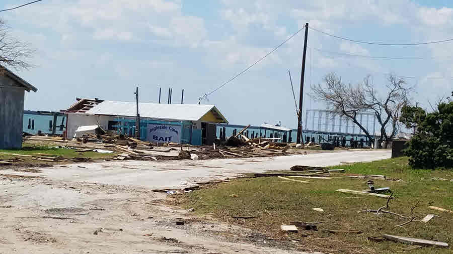
0124 PM HURRICANE INGLESIDE 27.88N 97.21W
08/26/2017 SAN PATRICIO TX SOCIAL MEDIA
EXTENSIVE DAMAGE TO HOMES AND BUSINESSES ACROSS
INGLESIDE
0211 PM HURRICANE ROCKPORT 28.04N 97.05W
08/26/2017 ARANSAS TX SOCIAL MEDIA
MAJOR DAMAGE TO THE FIRST BAPTIST CHURCH IN ROCKPORT.
THE FRONT WALL OF THE BUILDING WAS TORN OFF.
0216 PM HURRICANE NURSERY 28.92N 97.10W
08/26/2017 VICTORIA TX NWS EMPLOYEE
REPORTS OF ROOF DAMAGE AND GARAGE WALLS BLOWN OUT IN
NURSERY.
0219 PM HURRICANE 1 NE ROCKPORT 28.05N 97.04W
08/26/2017 ARANSAS TX SOCIAL MEDIA
EXTENSIVE DAMAGE TO THE FAIRFIELD INN IN ROCKPORT
0300 PM HEAVY RAIN 1 NW PORTLAND 27.90N 97.34W
08/26/2017 M5.22 INCH SAN PATRICIO TX NWS EMPLOYEE
STORM TOTAL PRECIP SO FAR
0338 PM HURRICANE ODEM 27.95N 97.59W
08/26/2017 SAN PATRICIO TX BROADCAST MEDIA
ROOF BLOWN OFF A GAS STATION IN ODEM.
0503 PM HURRICANE 1 NW PORT ARANSAS 27.84N 97.08W
08/26/2017 GMZ230 TX OTHER FEDERAL
DERELICT TUG GROUNDED NEAR GULF INTRACOASTAL
WATERWAY... DERELICT DRILL BOAT ON CORPUS CHRISTI NORTH
JETTY... SUNKEN TUG VICINITY OF GULF INTRACOASTAL
WATERWAY
0536 PM HEAVY RAIN 2 SSE CHRISTUS SPOHN HO 27.66N 97.36W
08/26/2017 M7.82 INCH NUECES TX NWS EMPLOYEE
STORM TOTAL RAINFALL THROUGH 536 PM
0700 AM HEAVY RAIN 1 WNW PORTLAND 27.89N 97.34W
08/27/2017 M7.40 INCH SAN PATRICIO TX NWS EMPLOYEE
HURRICANE HARVEY STORM TOTAL PRECIP AS OF TIME REPORTED
&&
EVENT NUMBER CRP1700288 CRP1700268 CRP1700356 CRP1700265 CRP1700277
CRP1700263 CRP1700279 CRP1700264 CRP1700275 CRP1700266 CRP1700267
CRP1700276 CRP1700278 CRP1700270 CRP1700269 CRP1700273 CRP1700272
CRP1700271 CRP1700274 CRP1700280 CRP1700282 CRP1700281 CRP1700283
CRP1700284 CRP1700285 CRP1700286 CRP1700287 CRP1700289 CRP1700290
CRP1700291 CRP1700292 CRP1700293 CRP1700294 CRP1700296 CRP1700295
CRP1700297 CRP1700298 CRP1700299
Rockport Damage Pictures
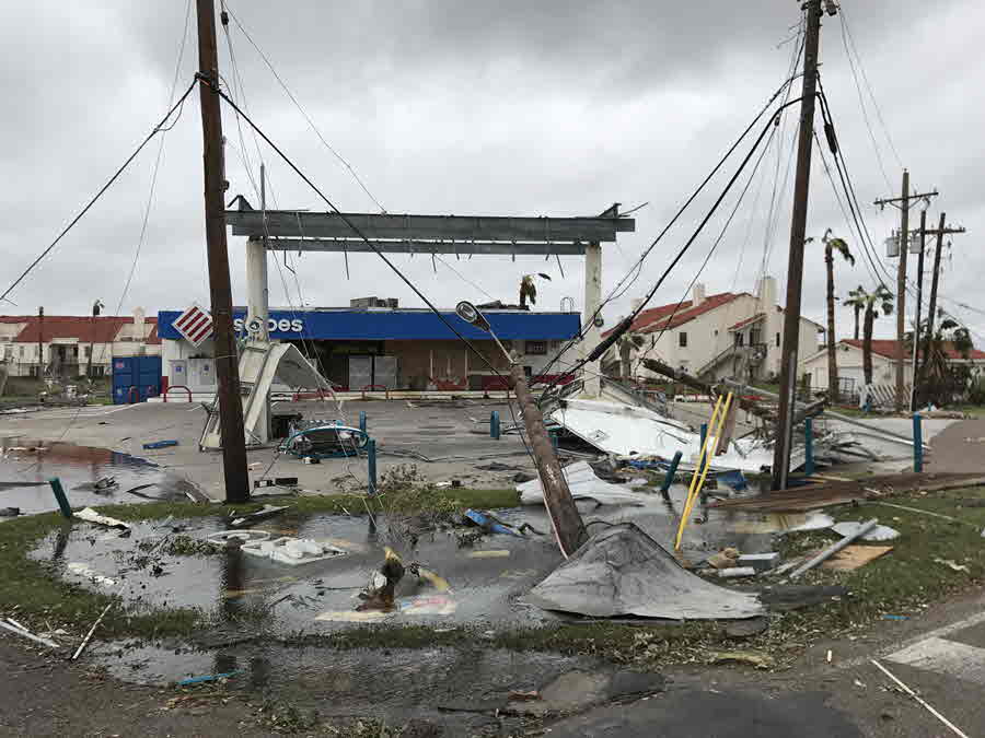
Port Aransas Damage Pictures
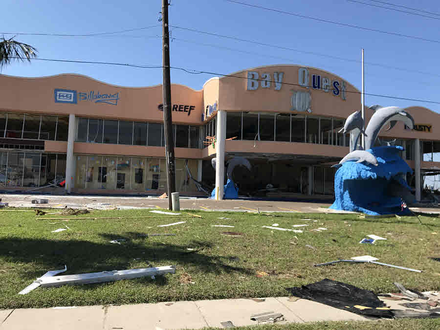
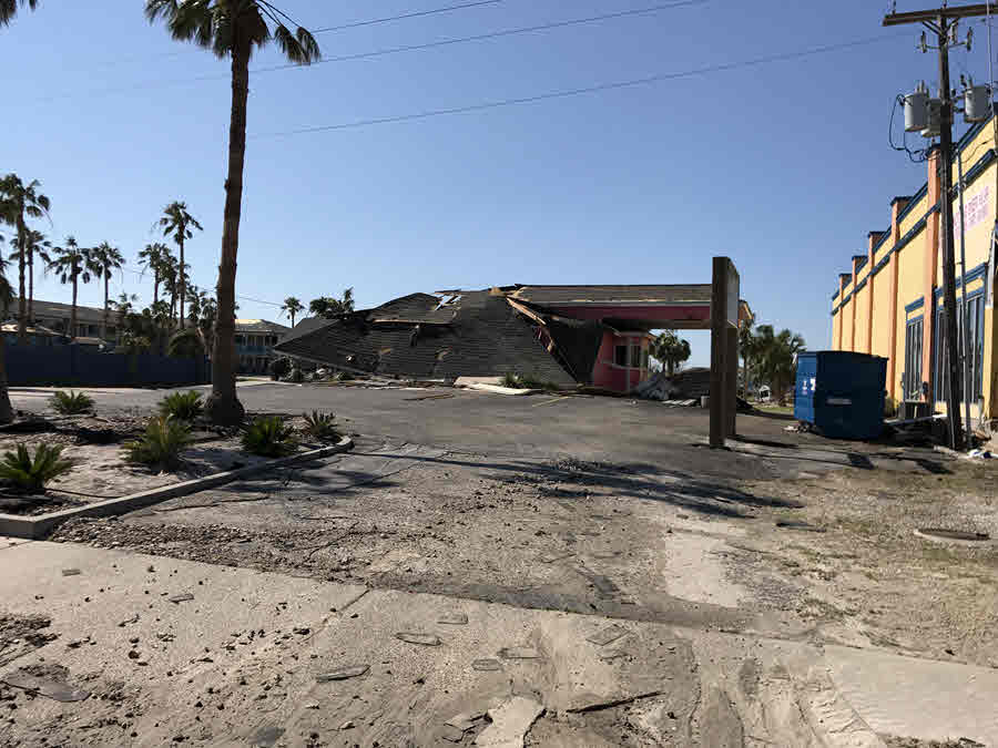
Aransas Pass Damage Pictures


Bayside Damage Pictures

Copano Village Damage Pictures

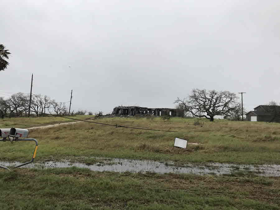
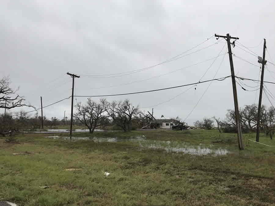
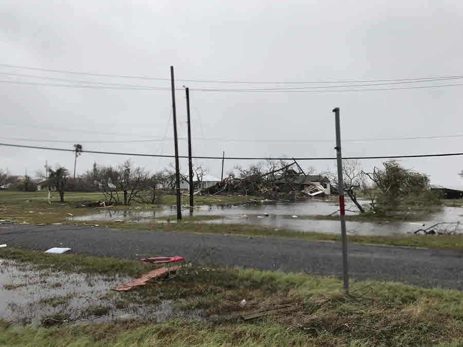
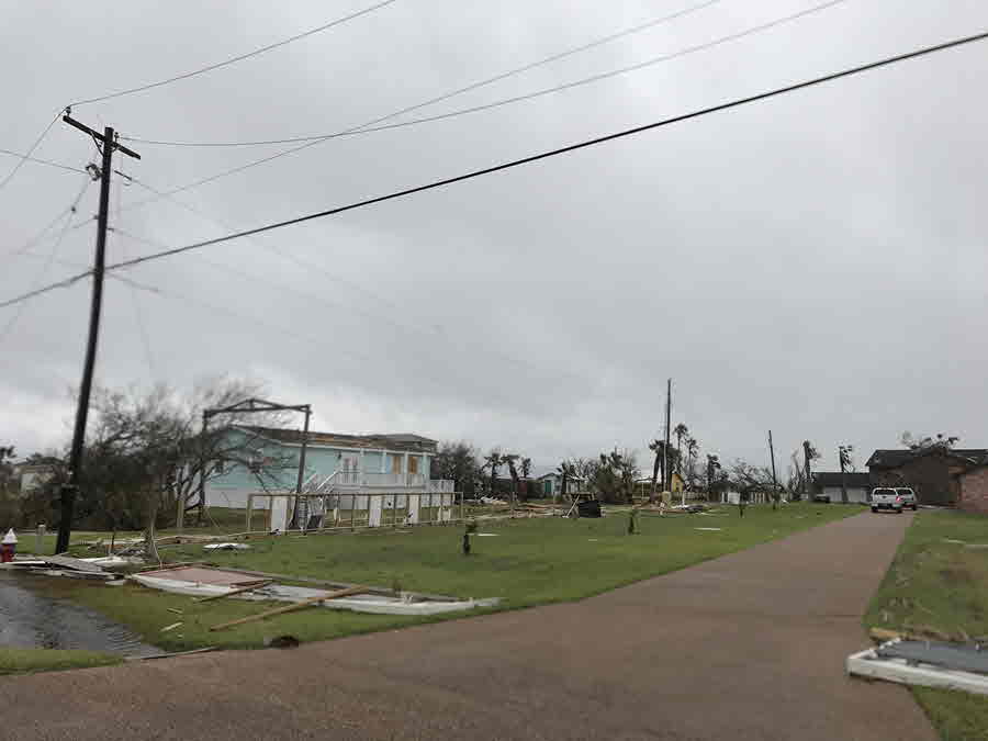

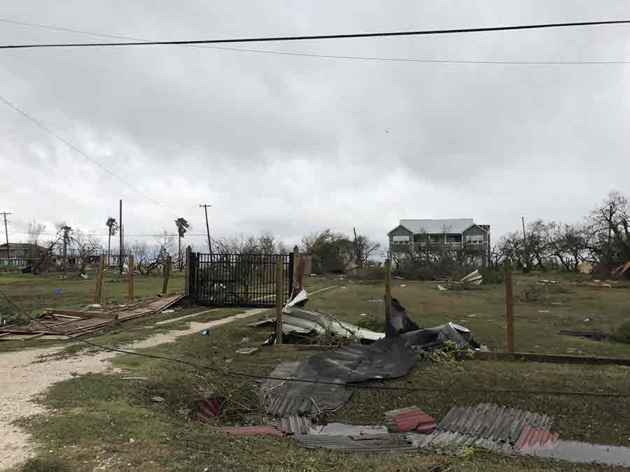
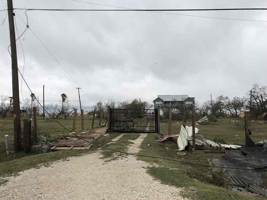
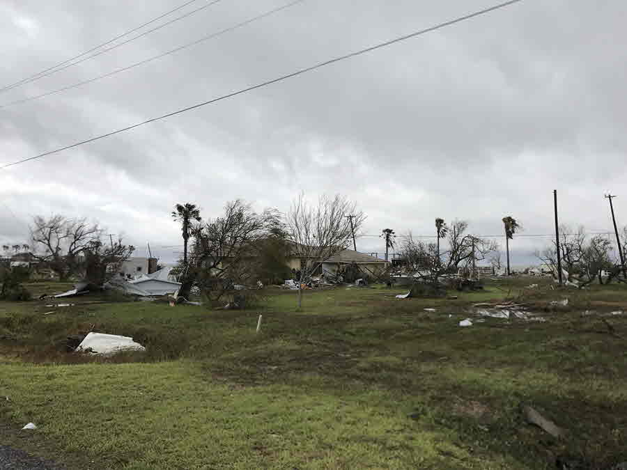
Refugio Damage Pictures
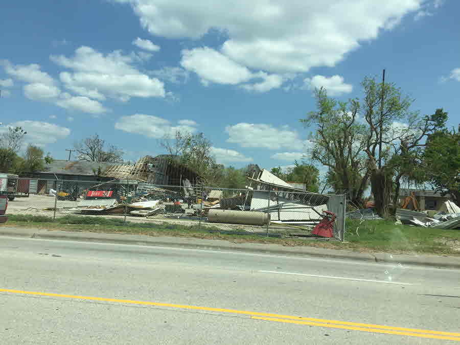
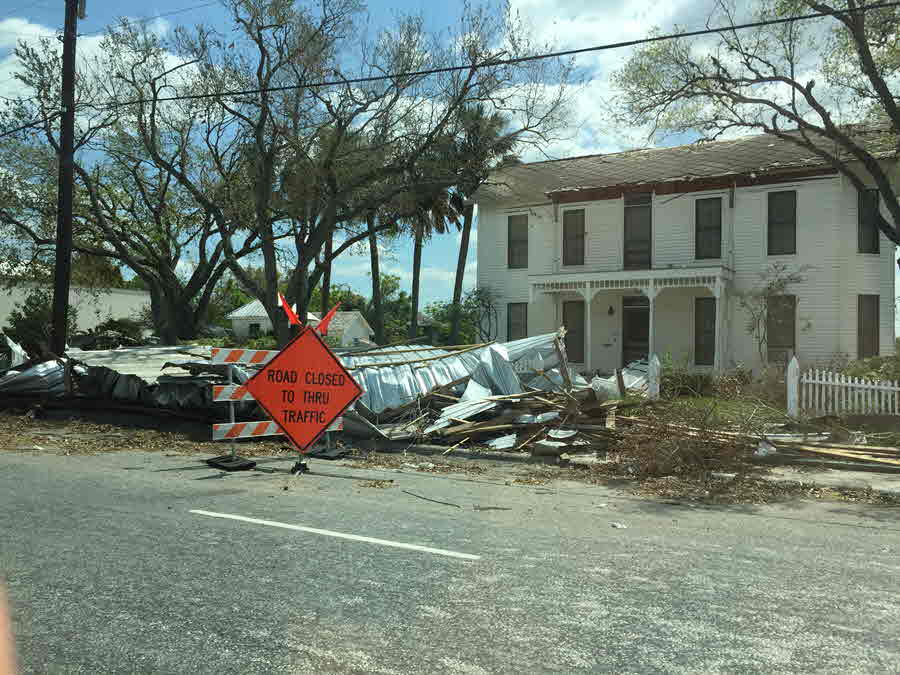

Tivoli Damage Pictures
Corpus Christi Damage Pictures


Goose Island State Park Damage Pictures


Holiday Beach Damage Pictures

Ingleside and Ingleside on the Bay Damage Pictures

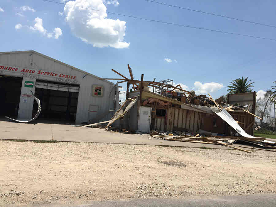
Lamar Damage Pictures
Port Lavaca Damage Pictures


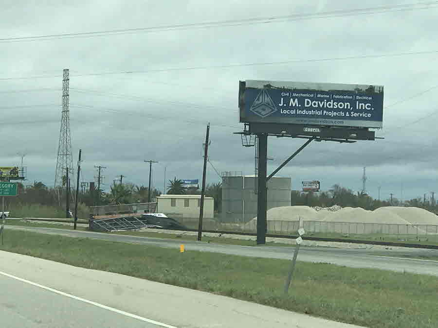
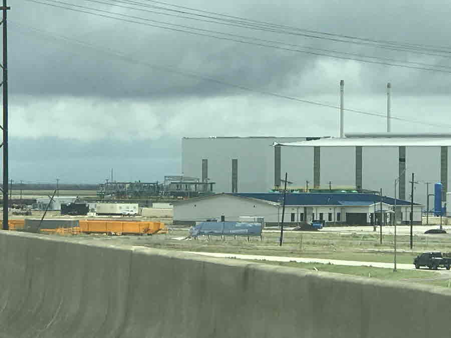
Portland, Gregory, and North Beach Damage Pictures
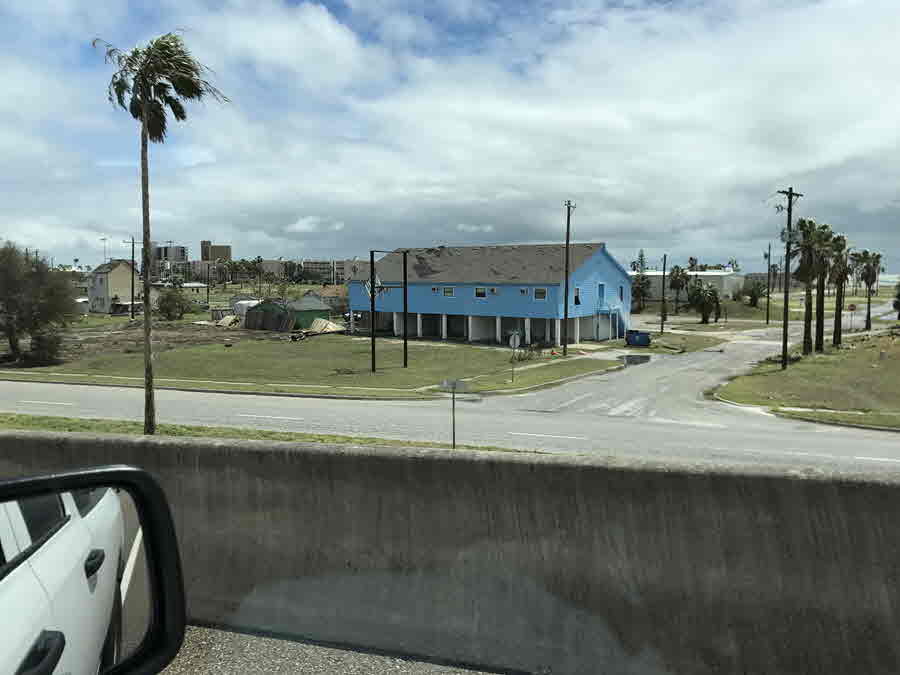
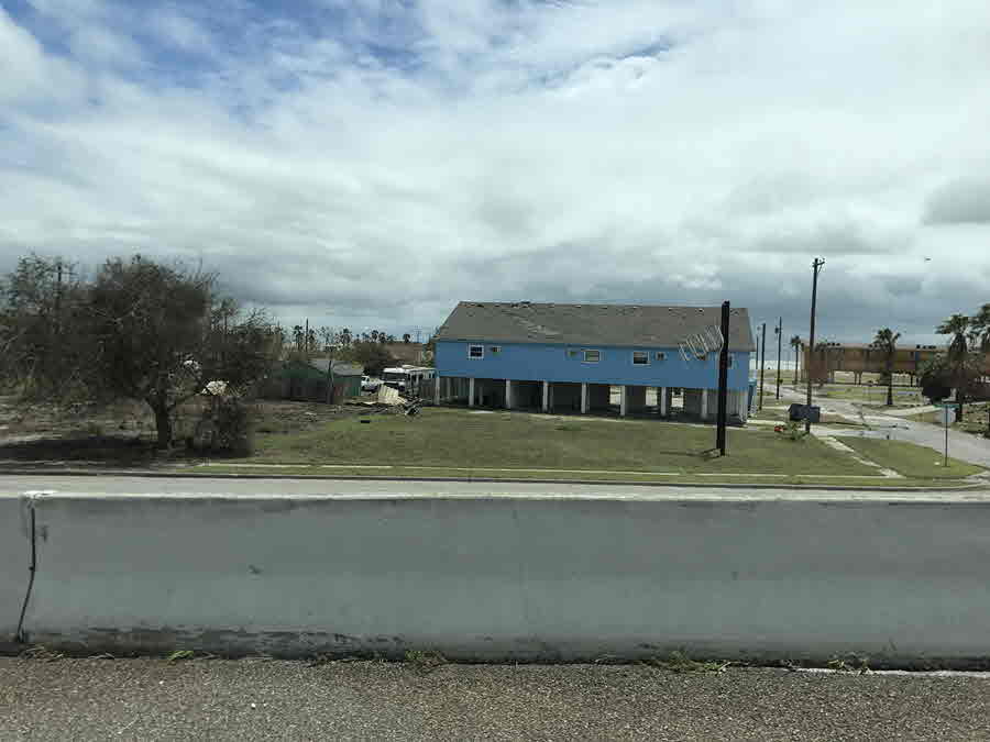
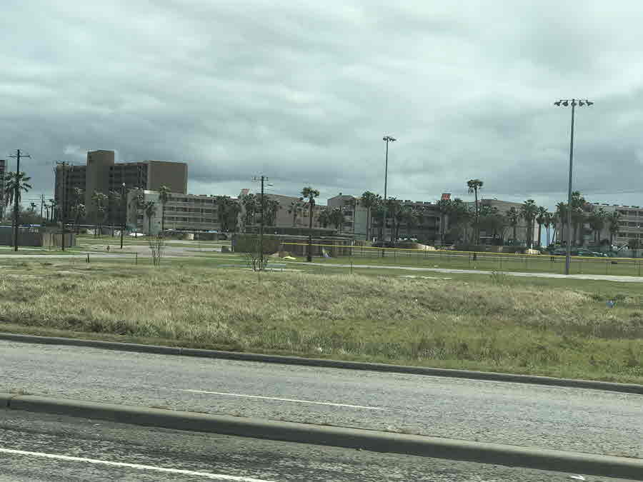
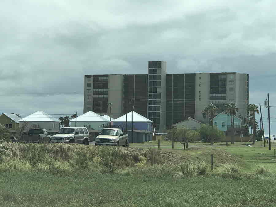
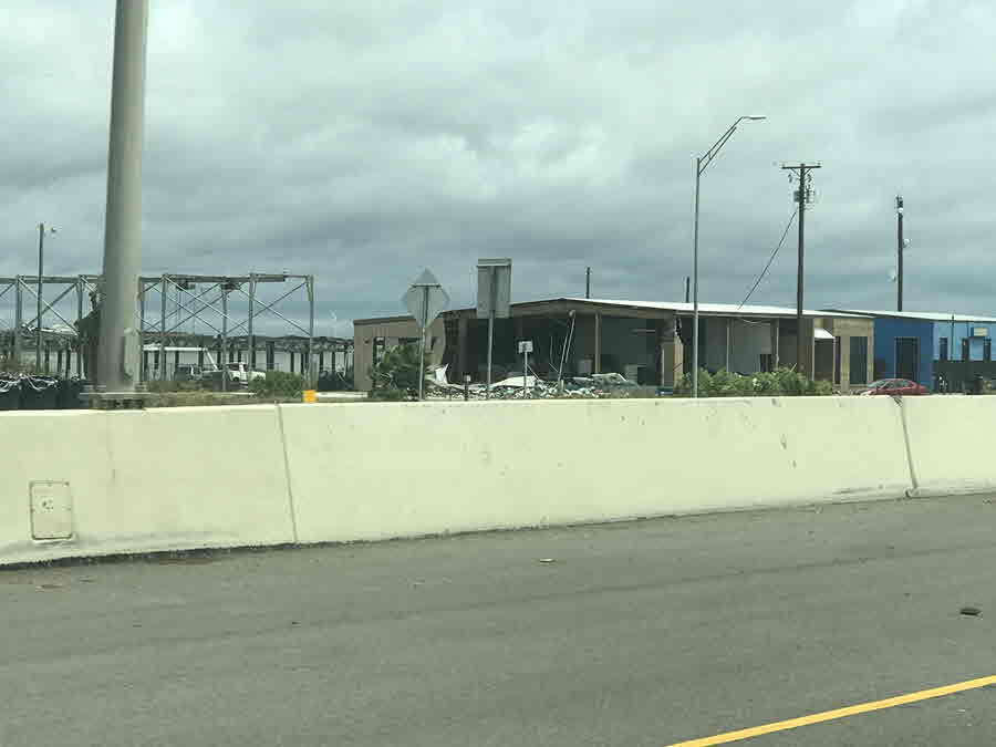
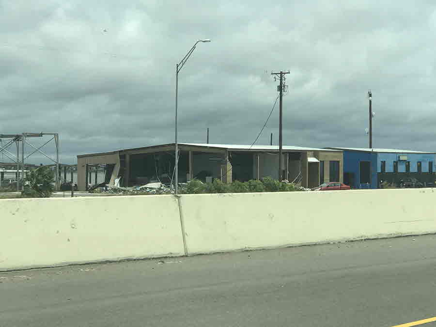
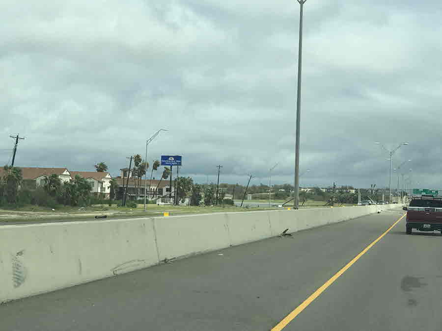

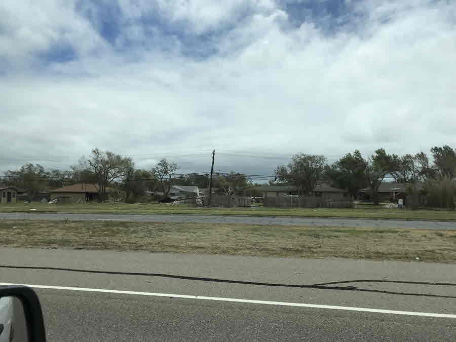
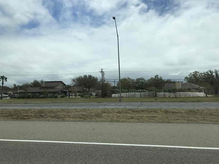
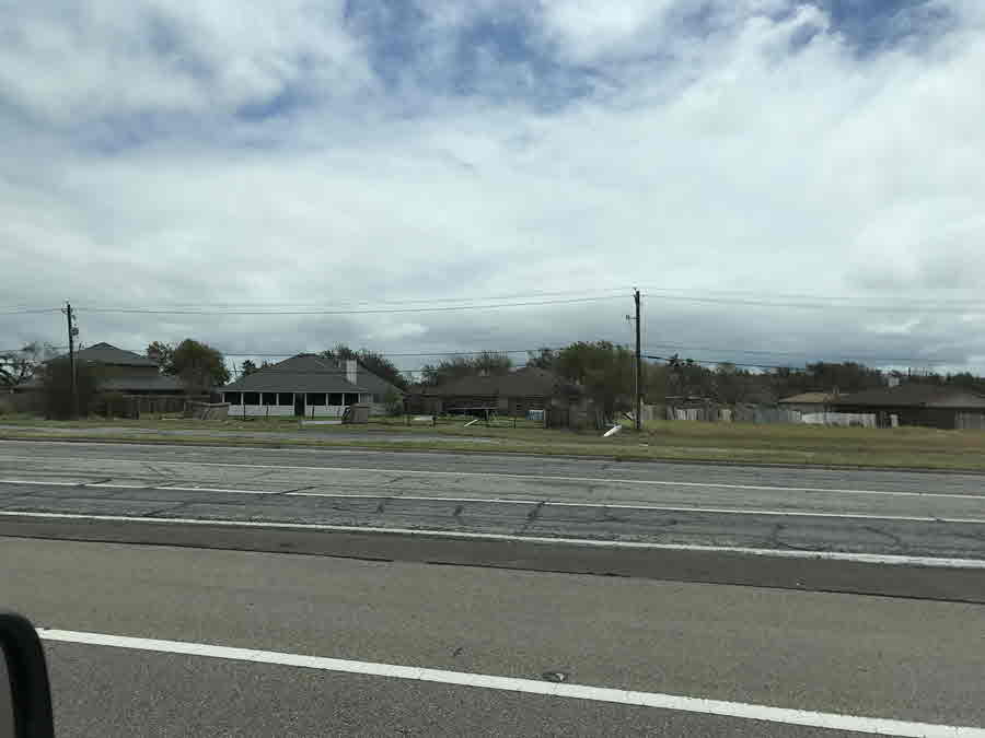
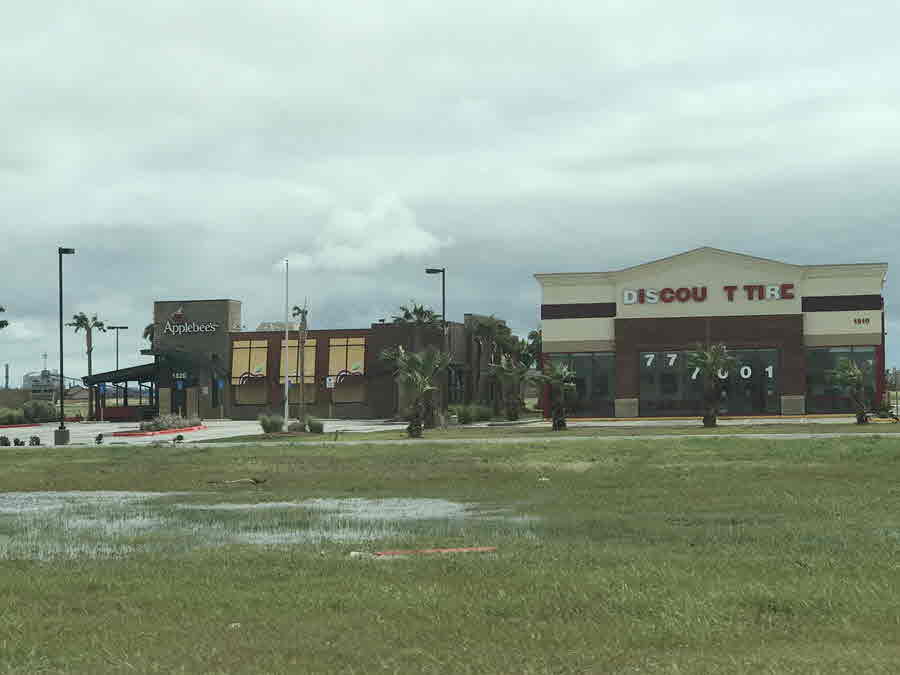
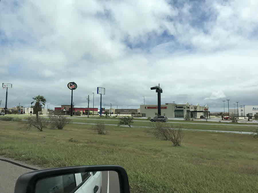
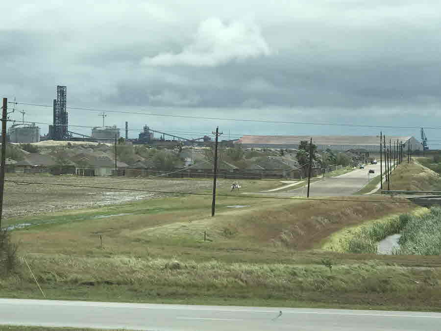
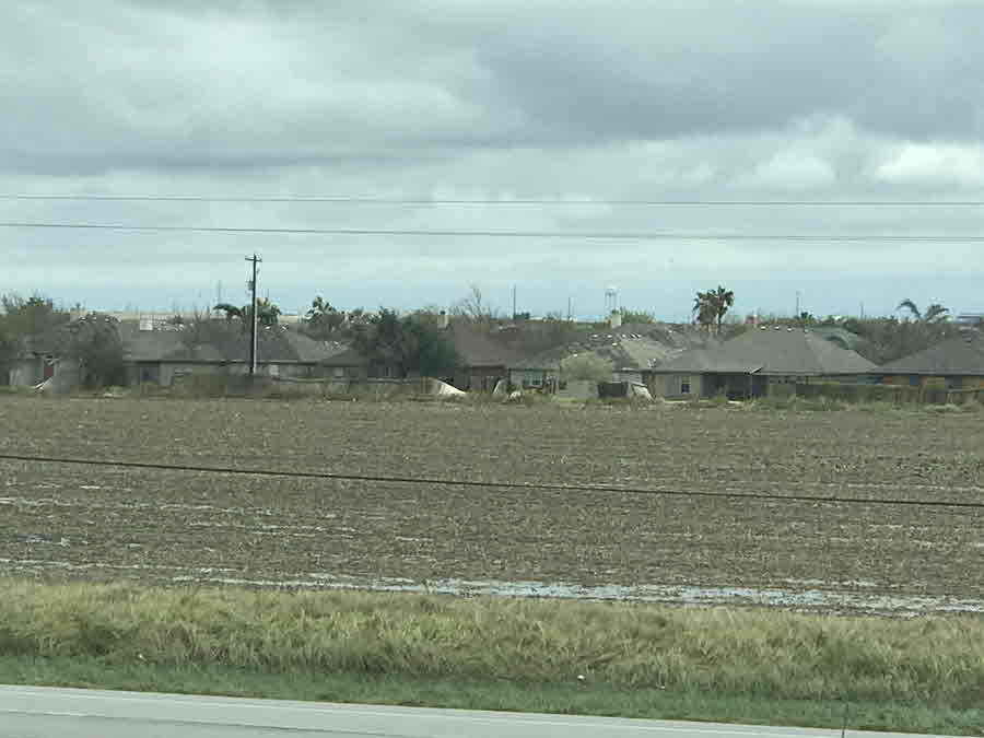
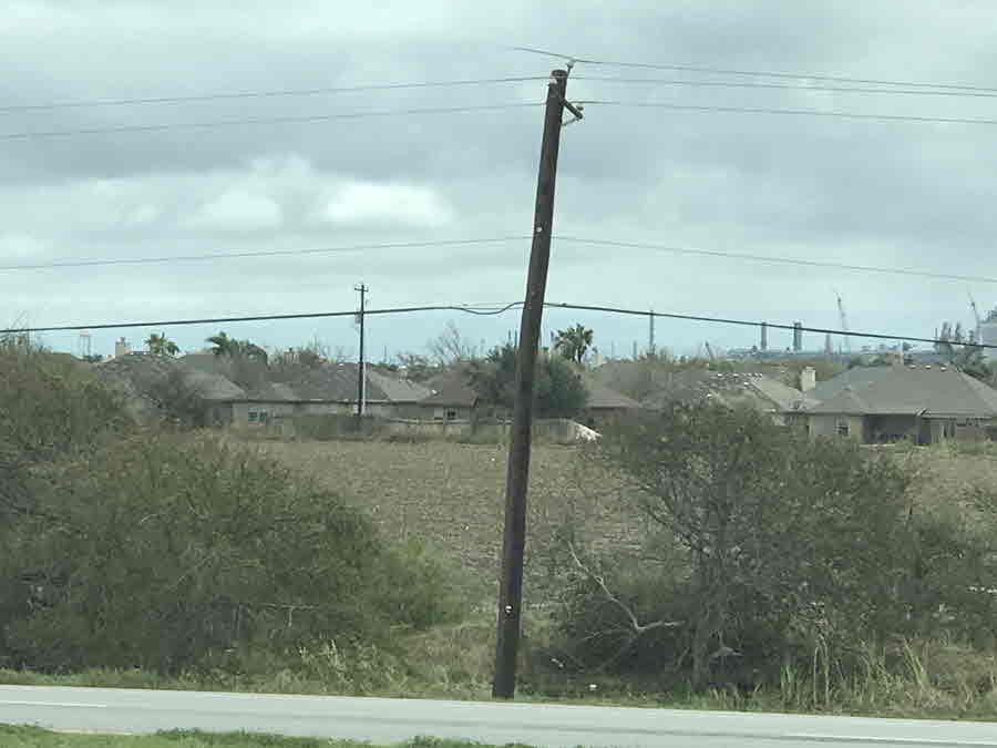
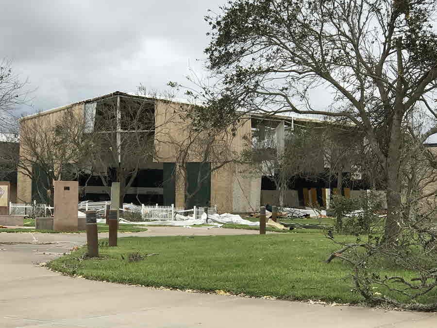
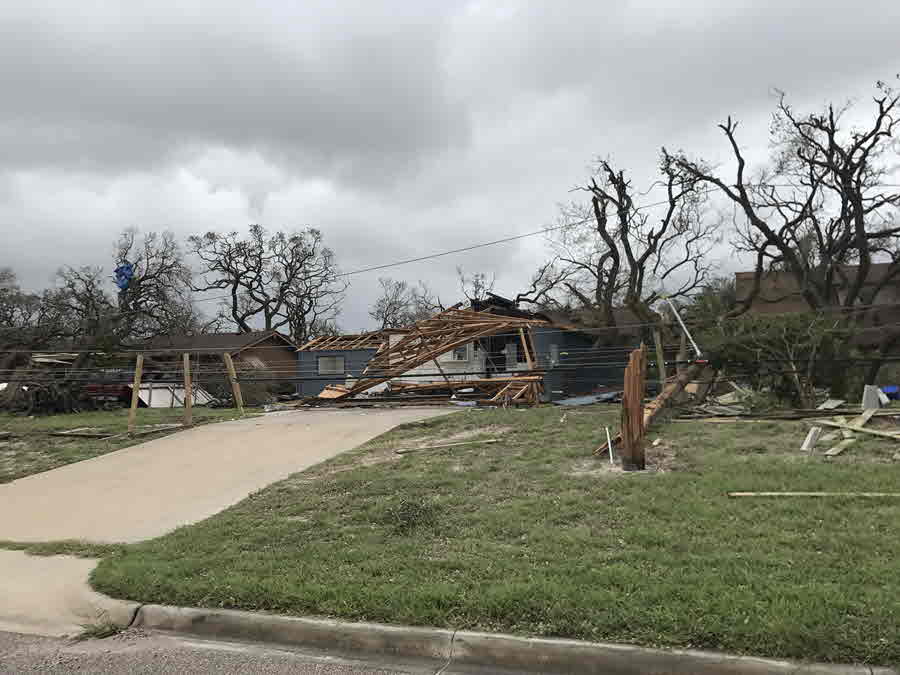
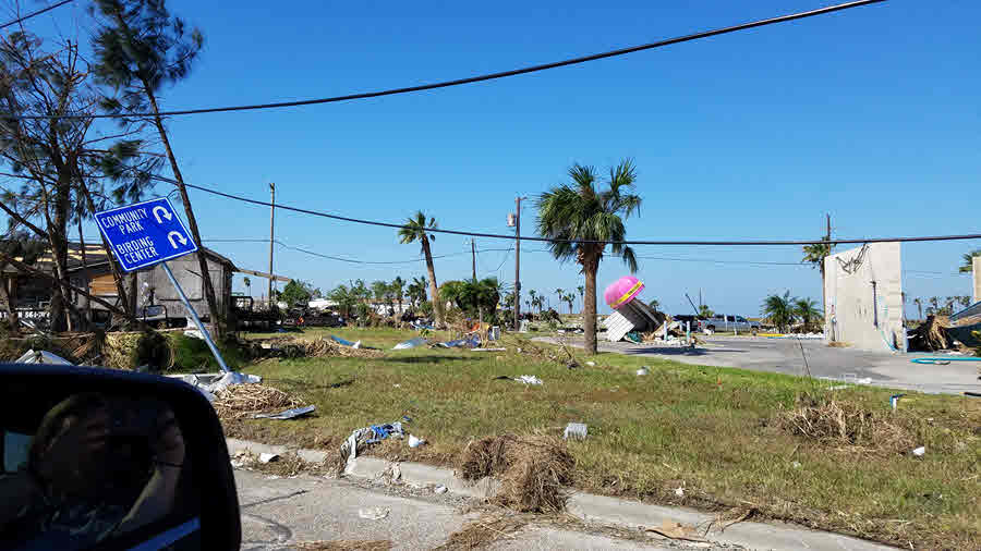
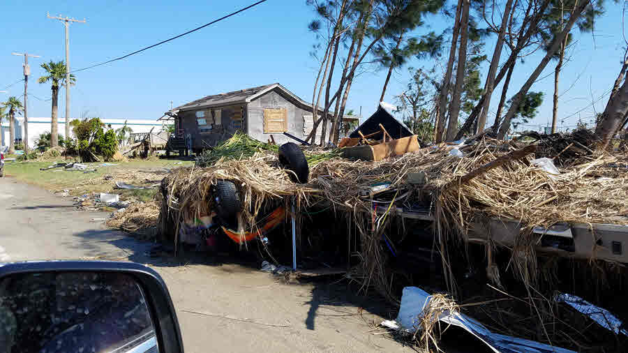
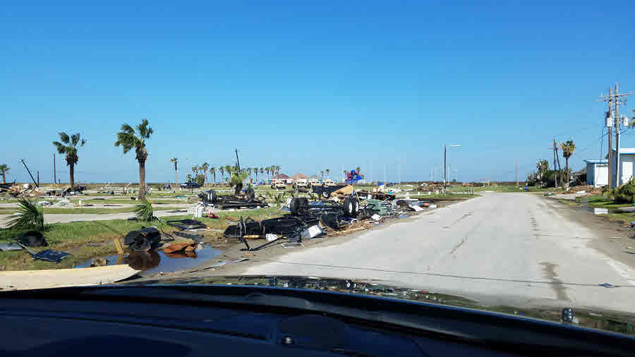
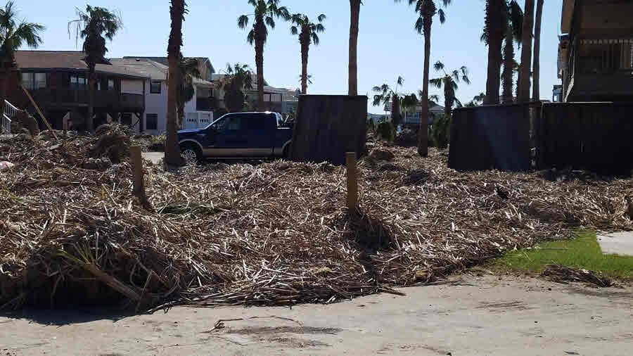
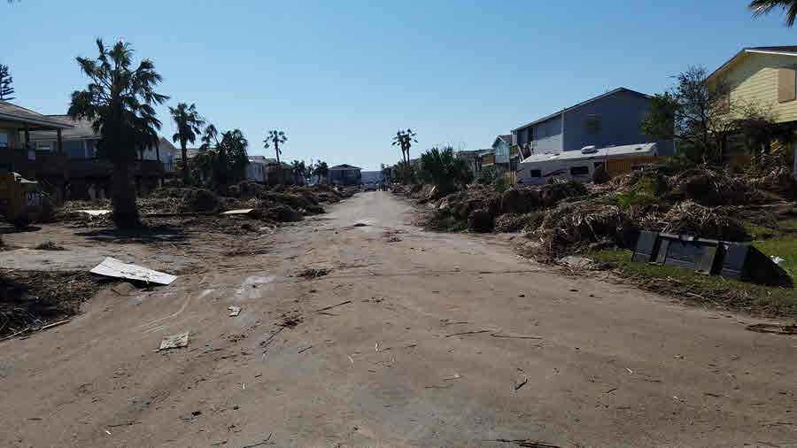
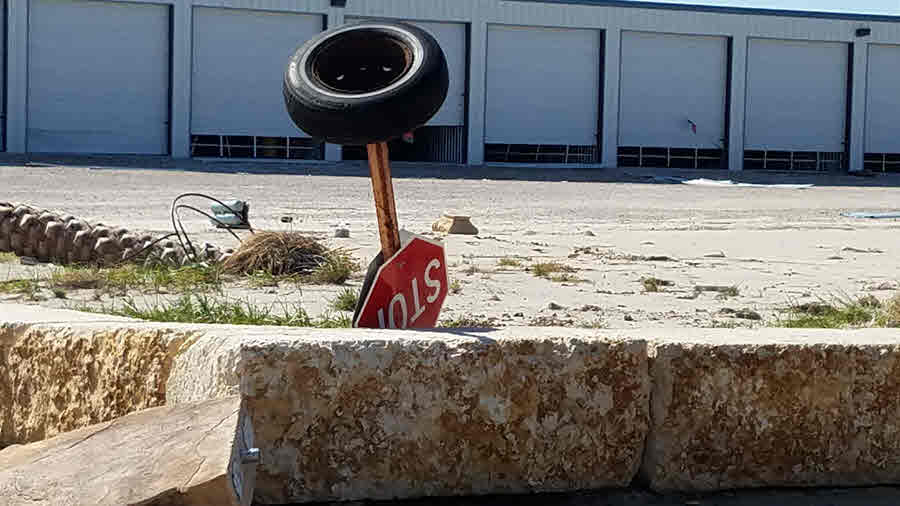
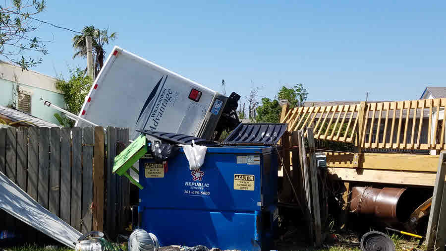
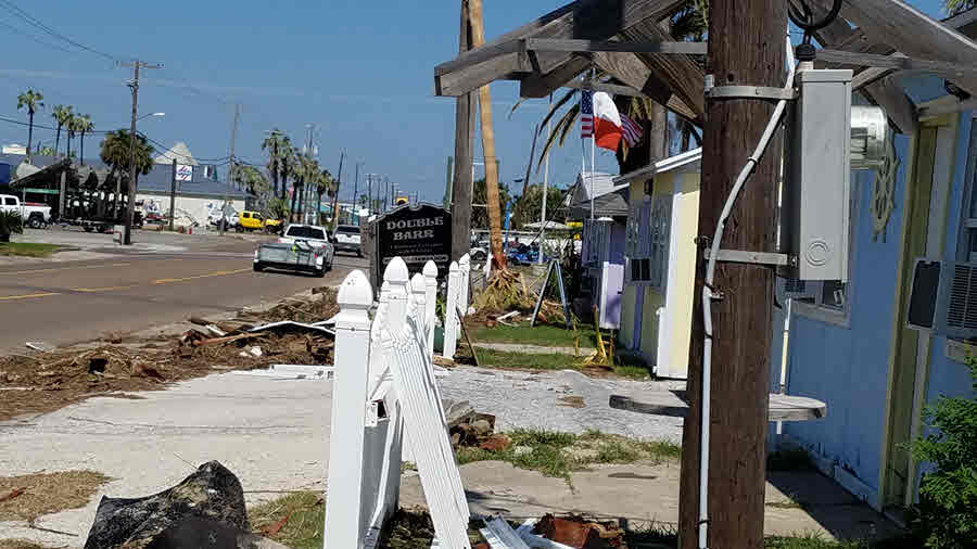
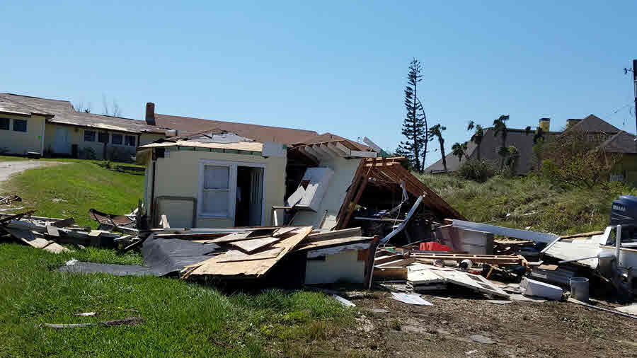
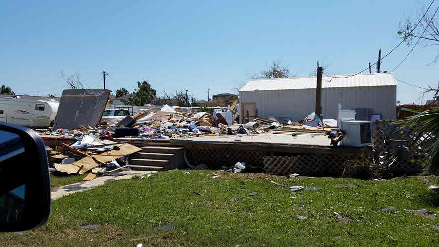
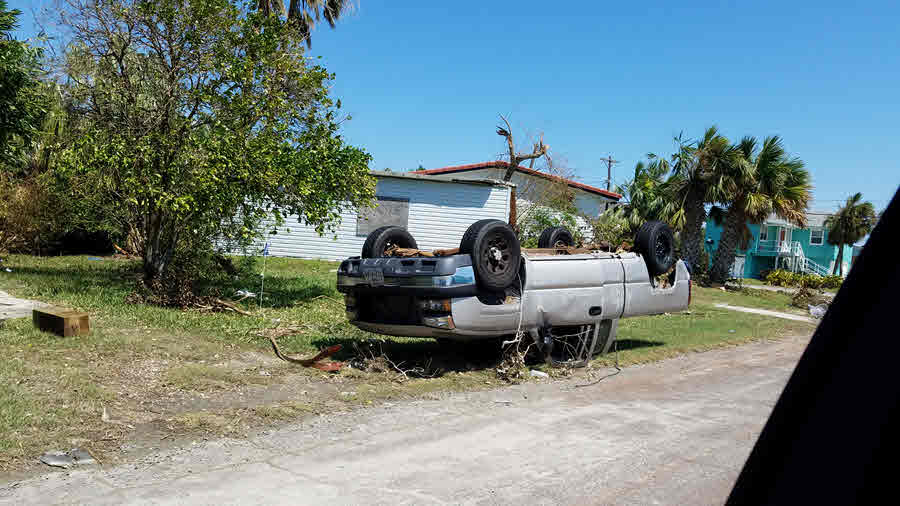
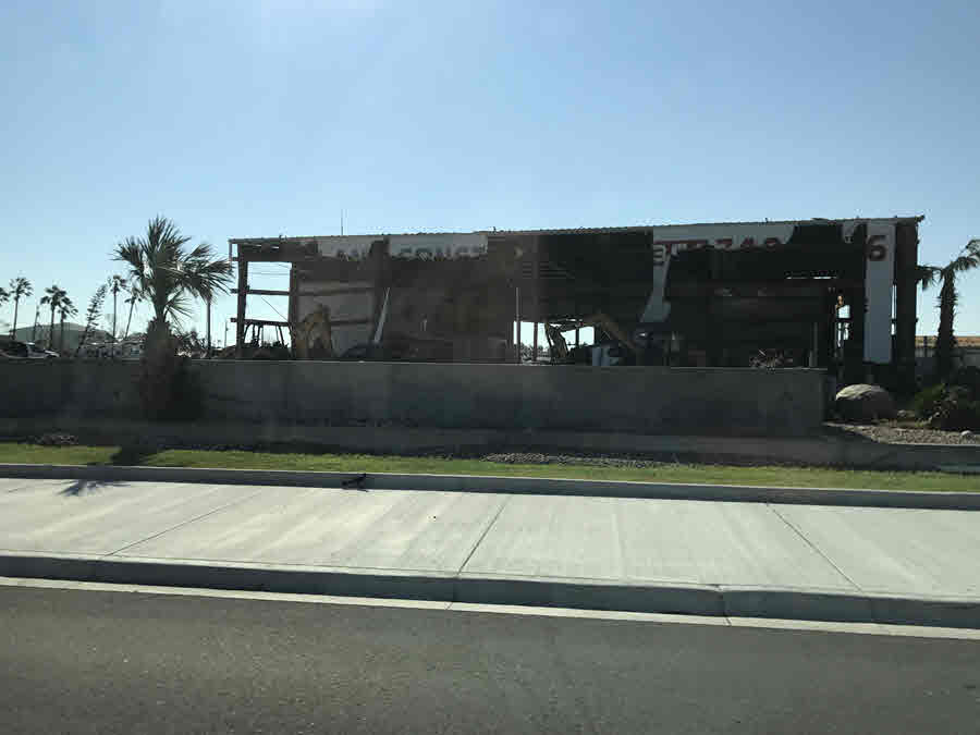
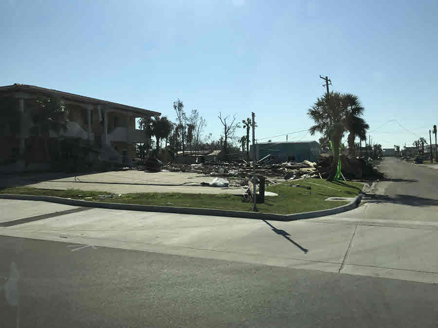
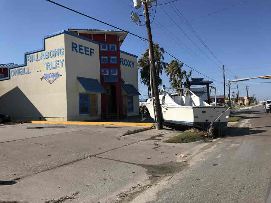
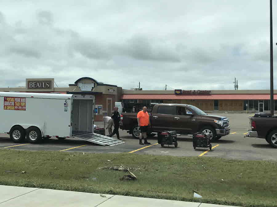
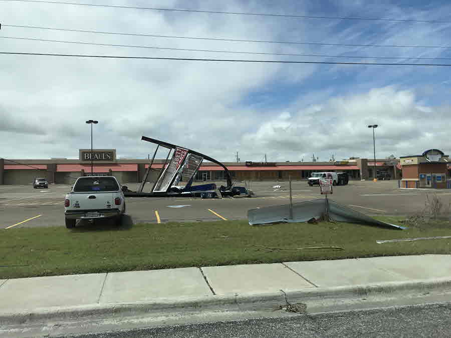
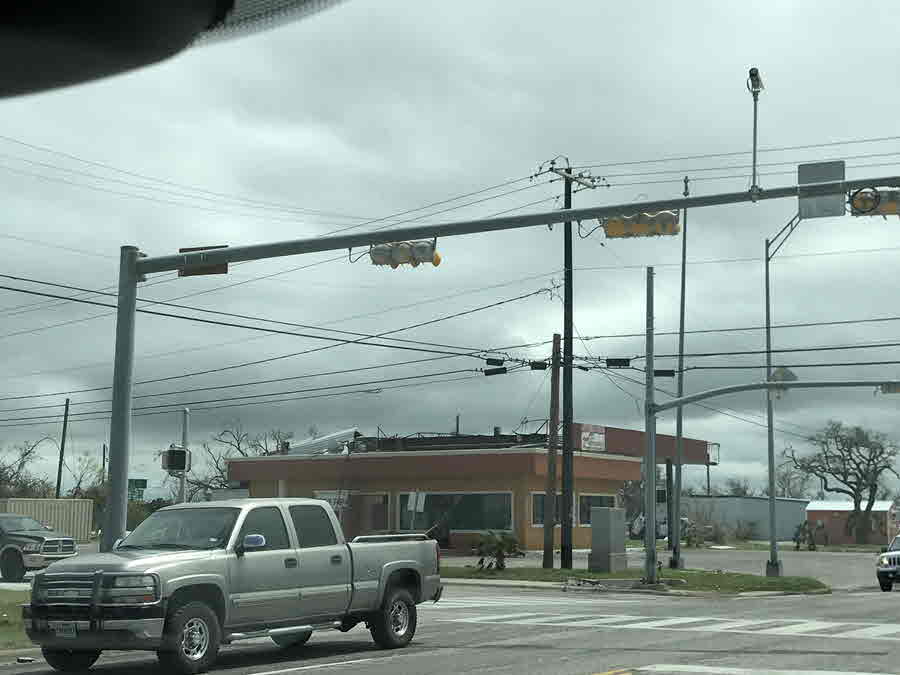
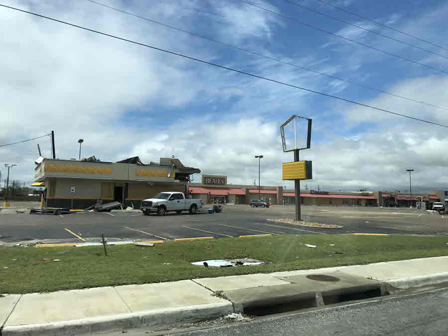
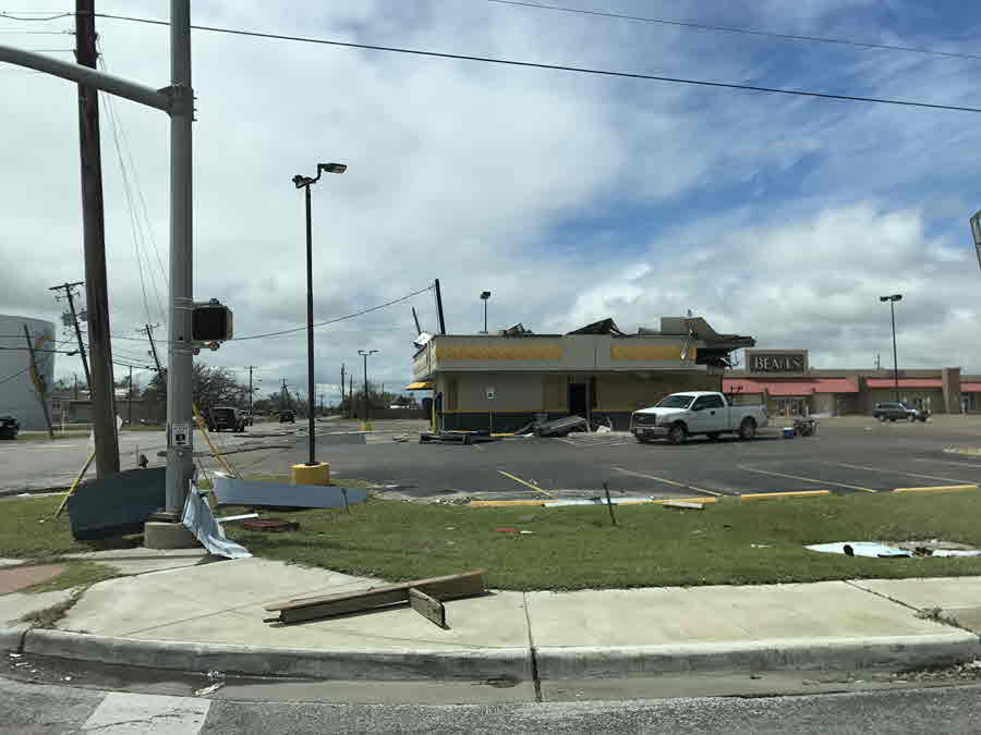
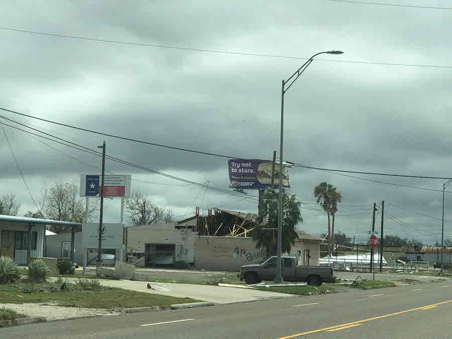
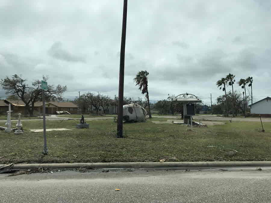
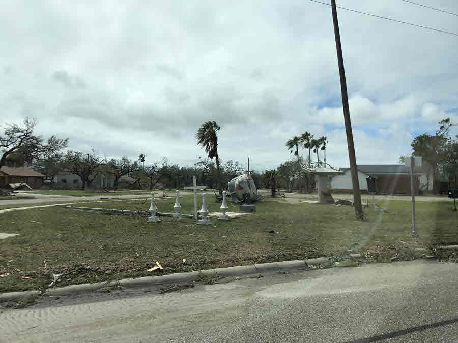
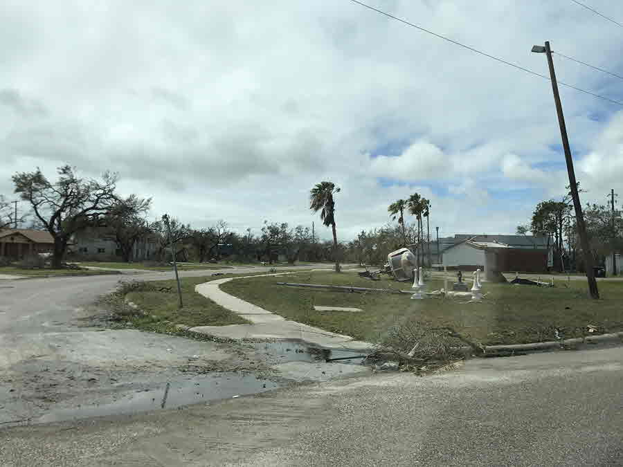
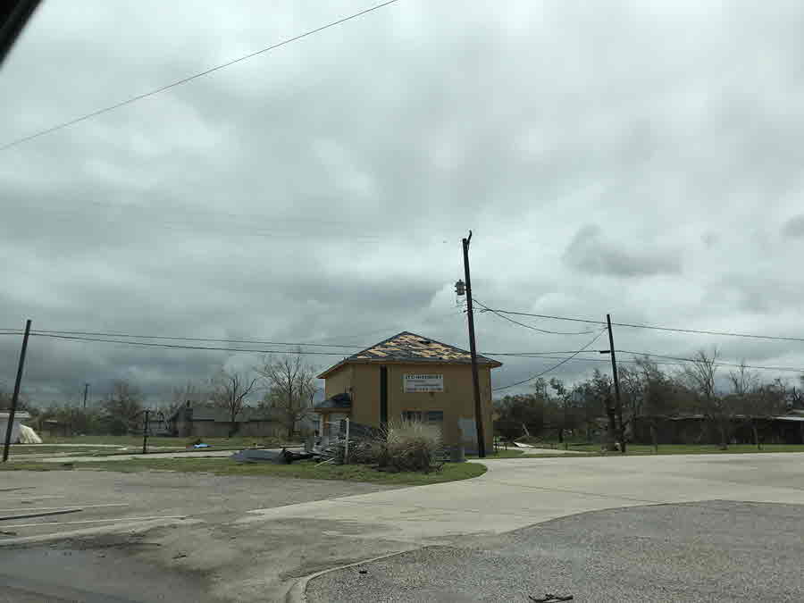
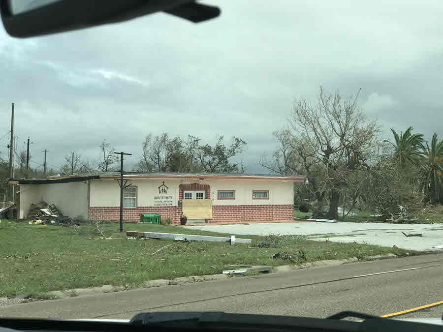
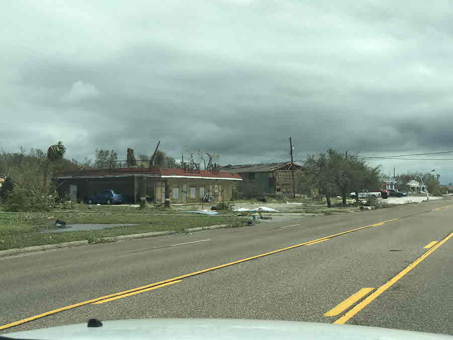
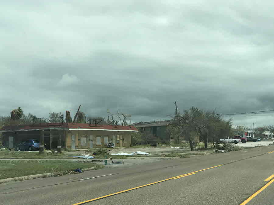
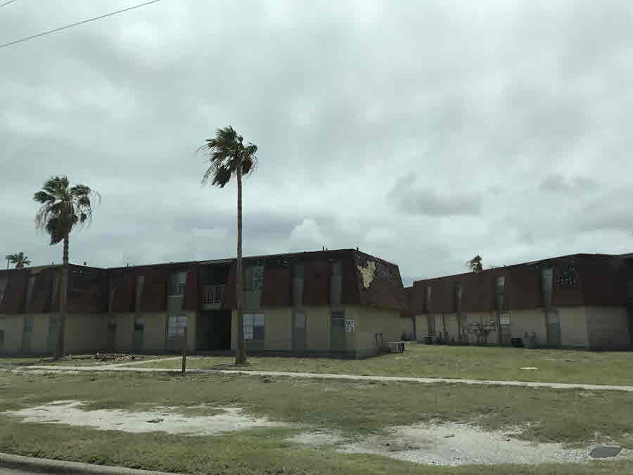
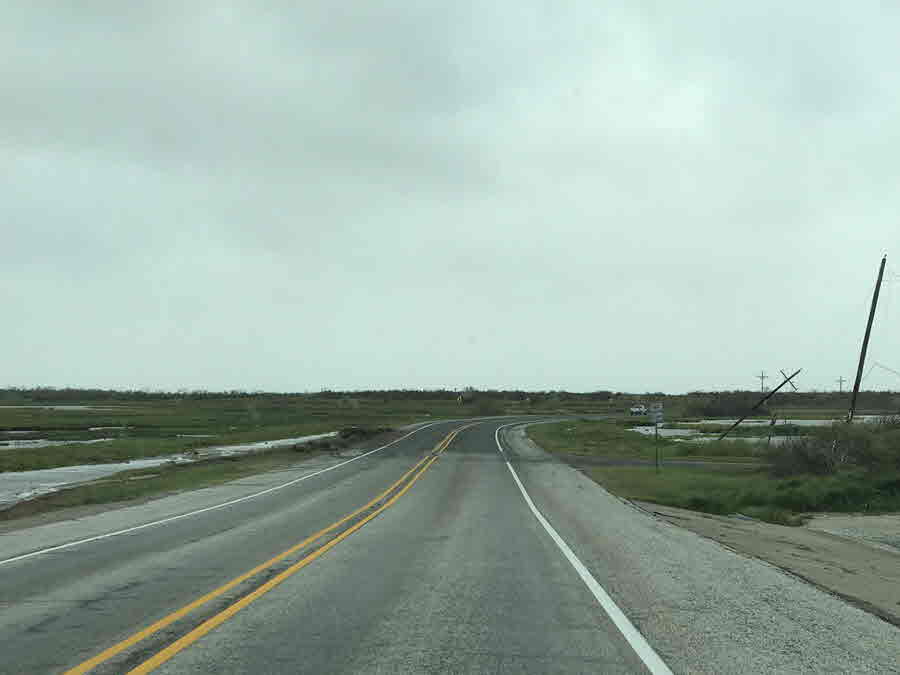
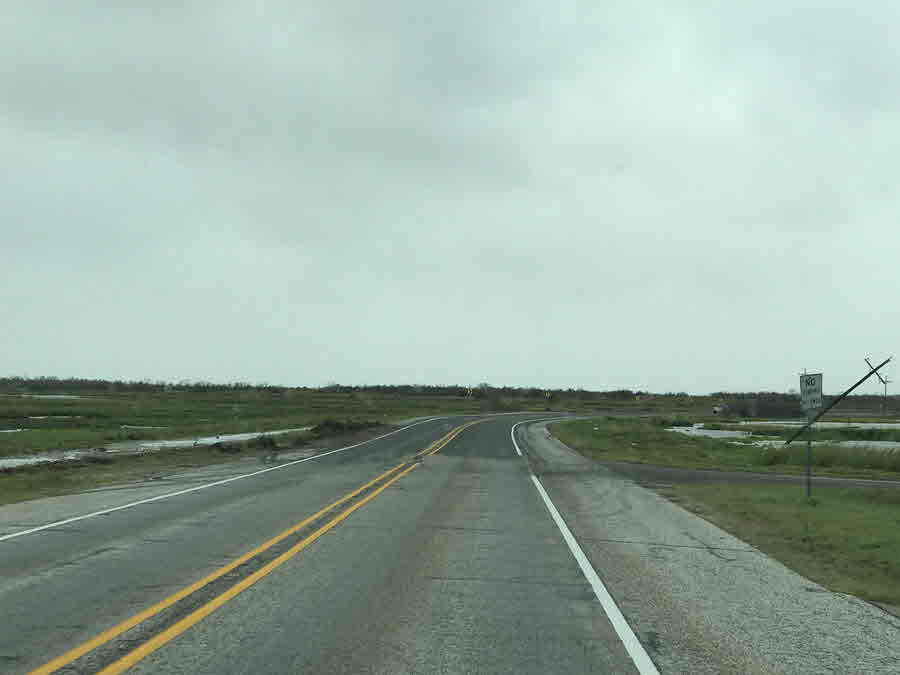
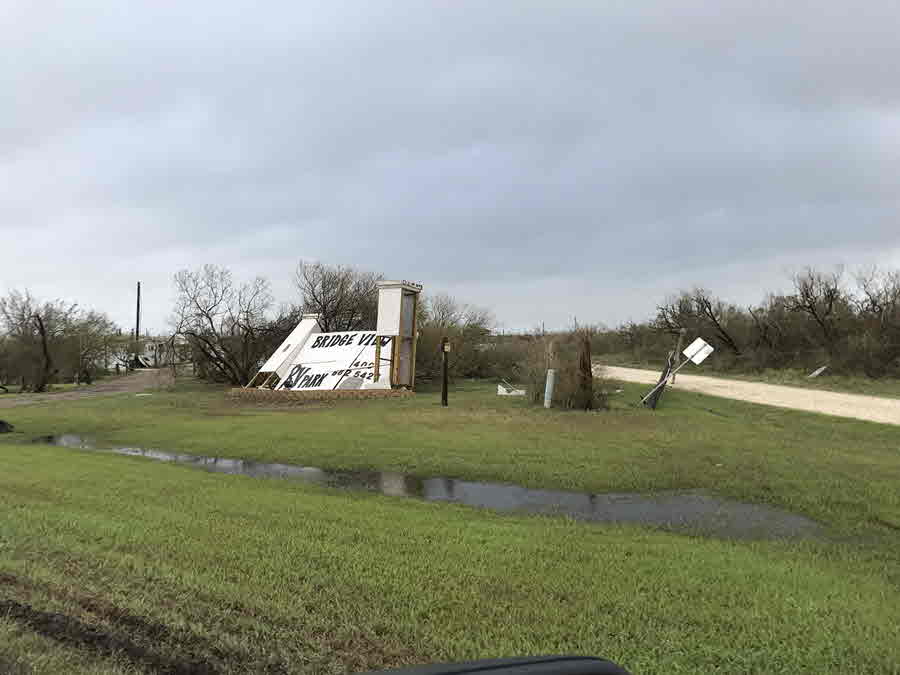
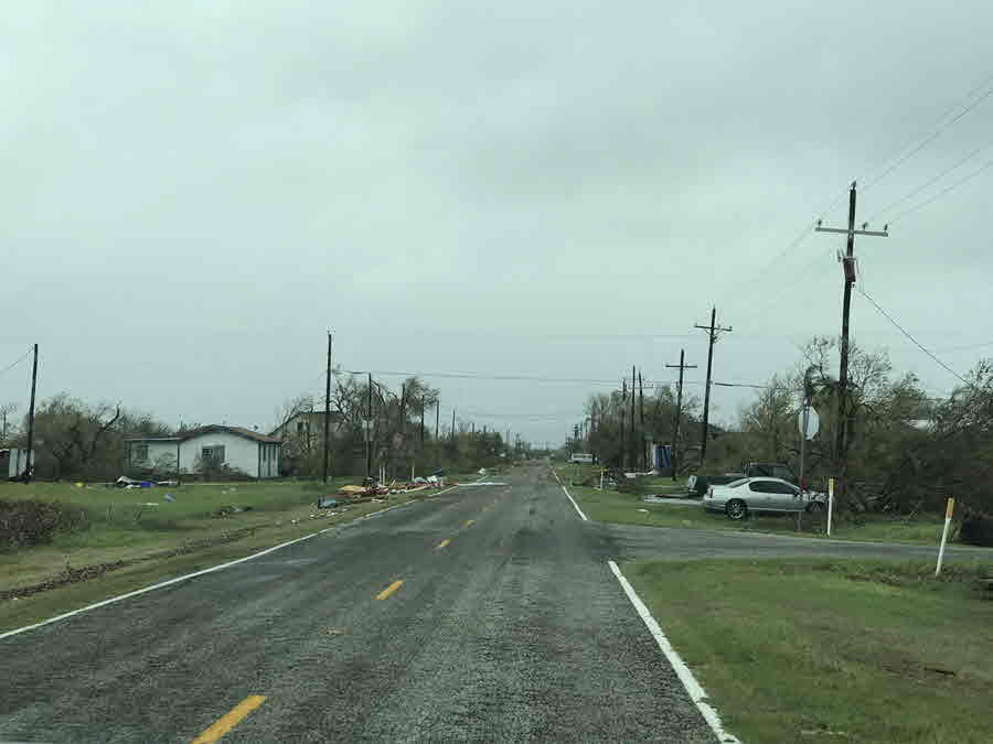
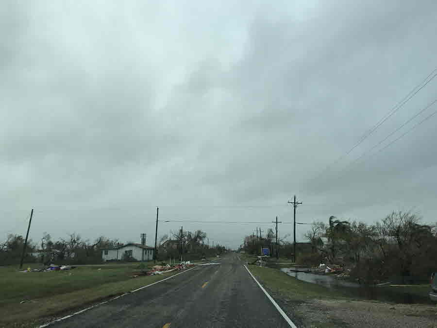
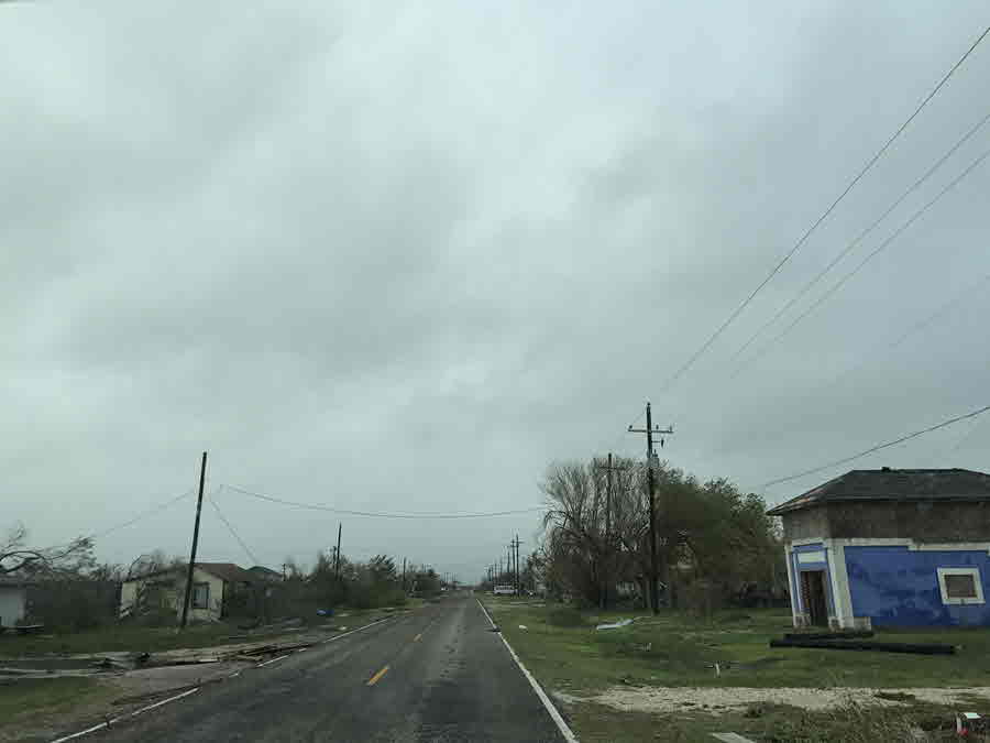
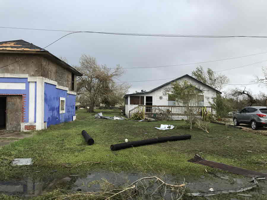
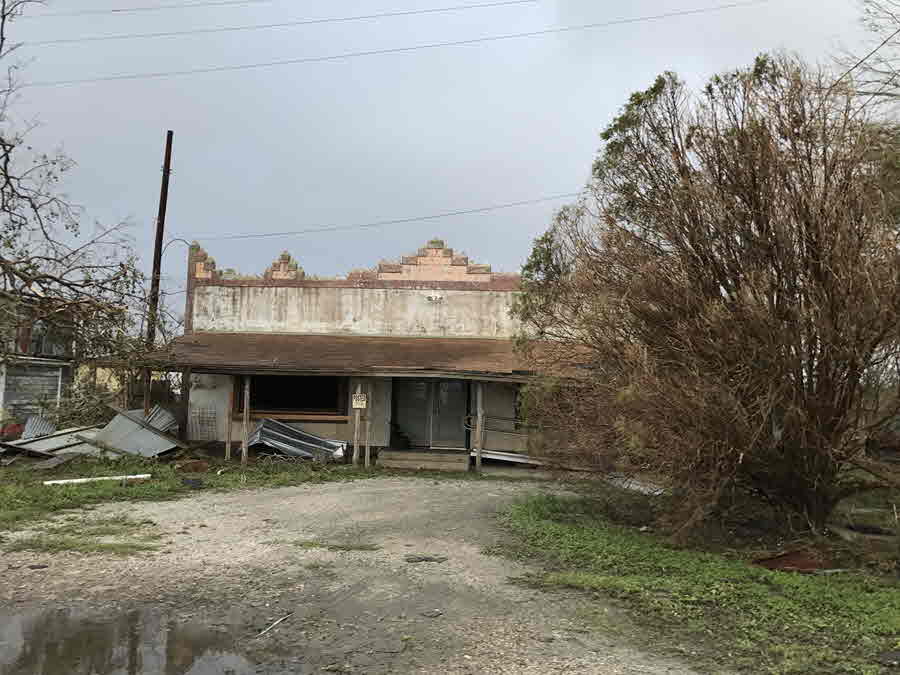
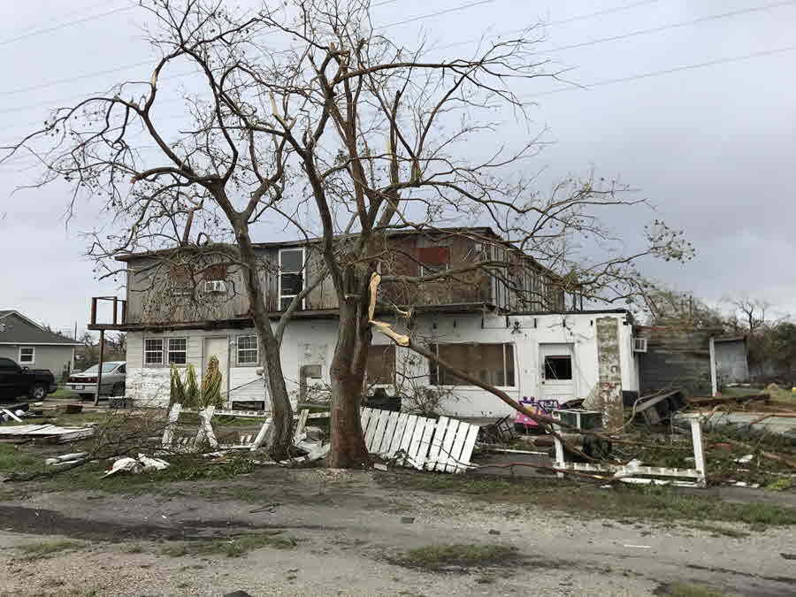
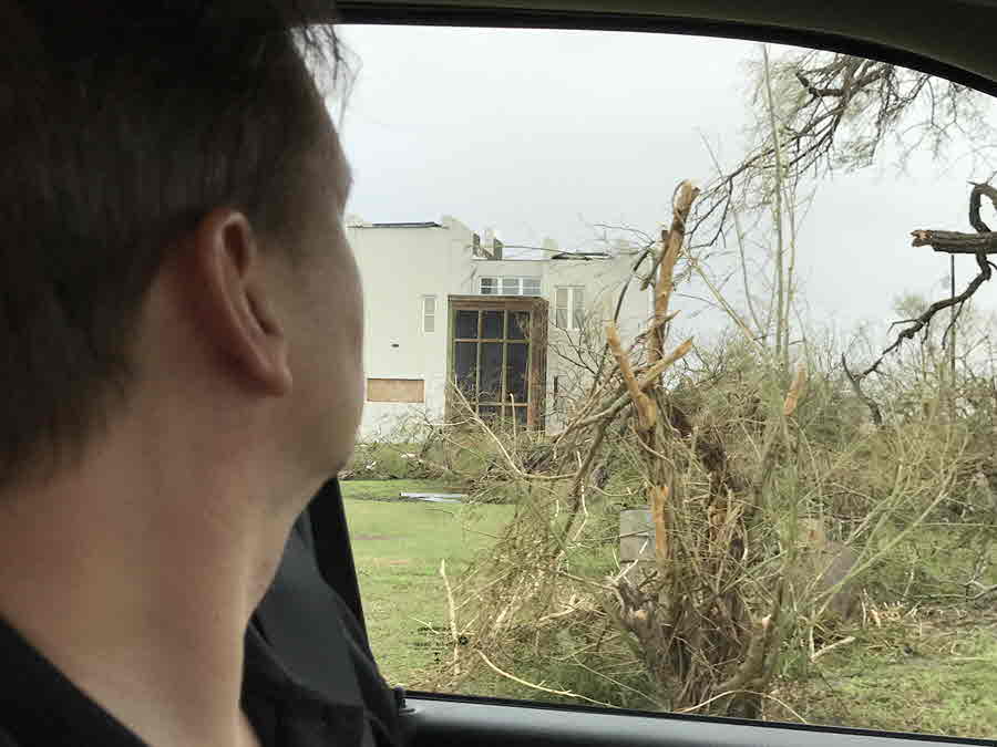
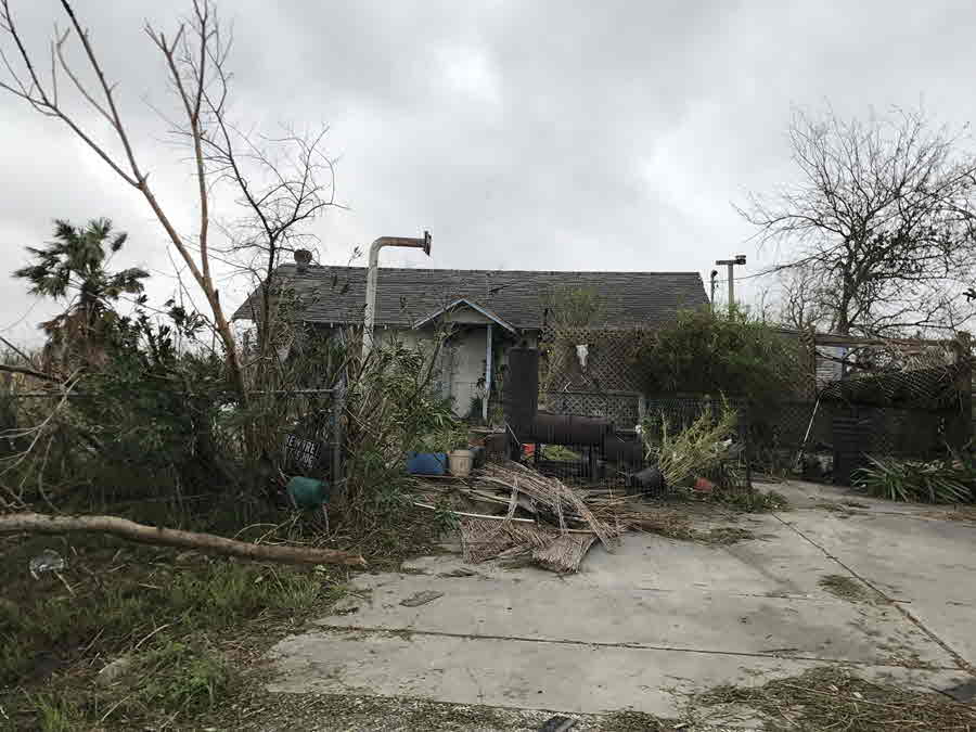
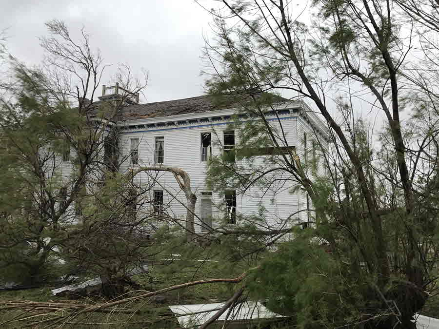
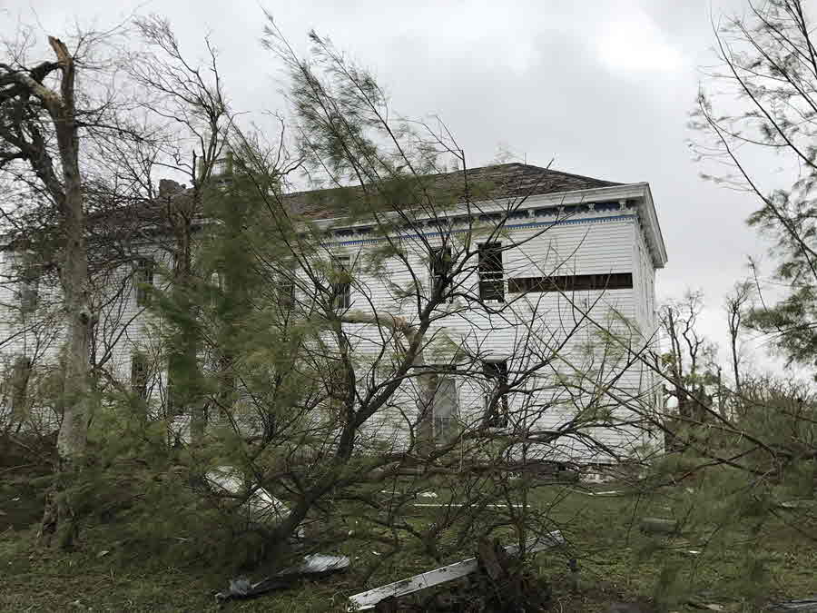
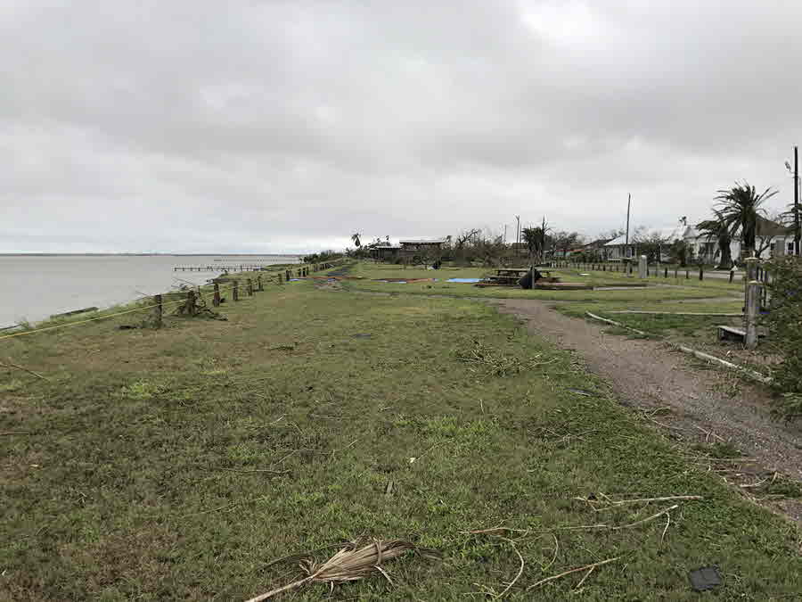
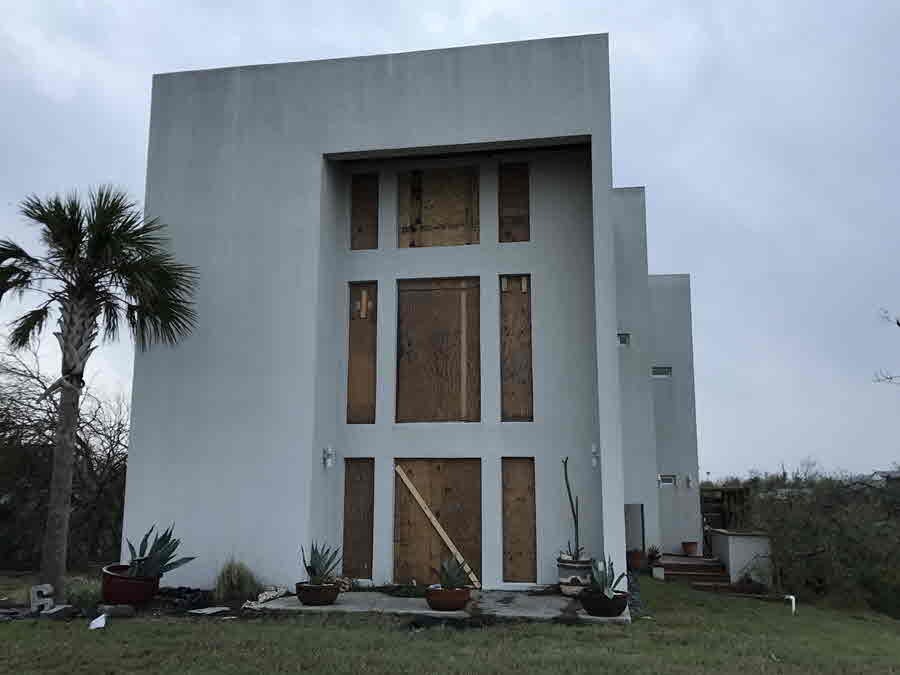
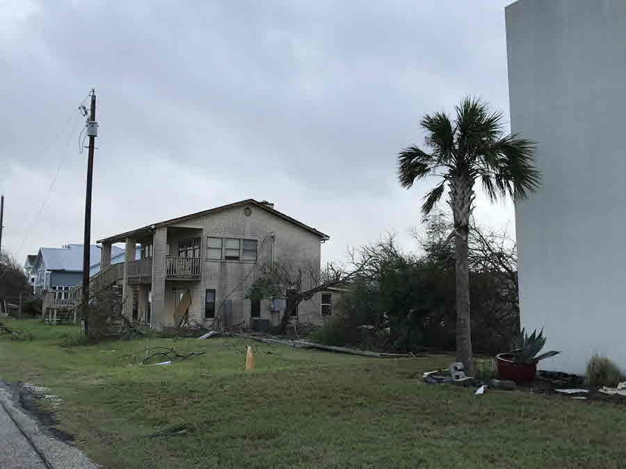
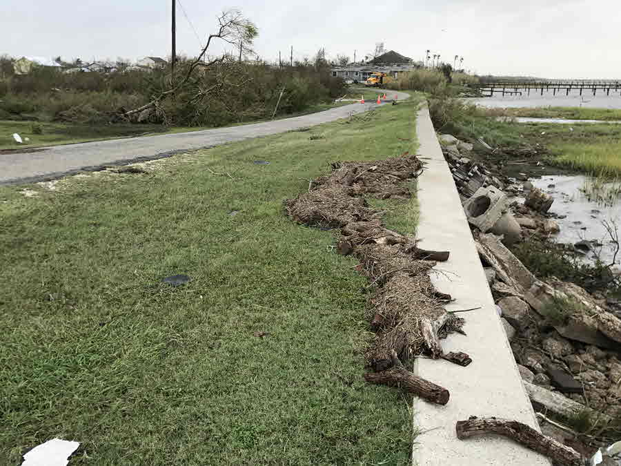
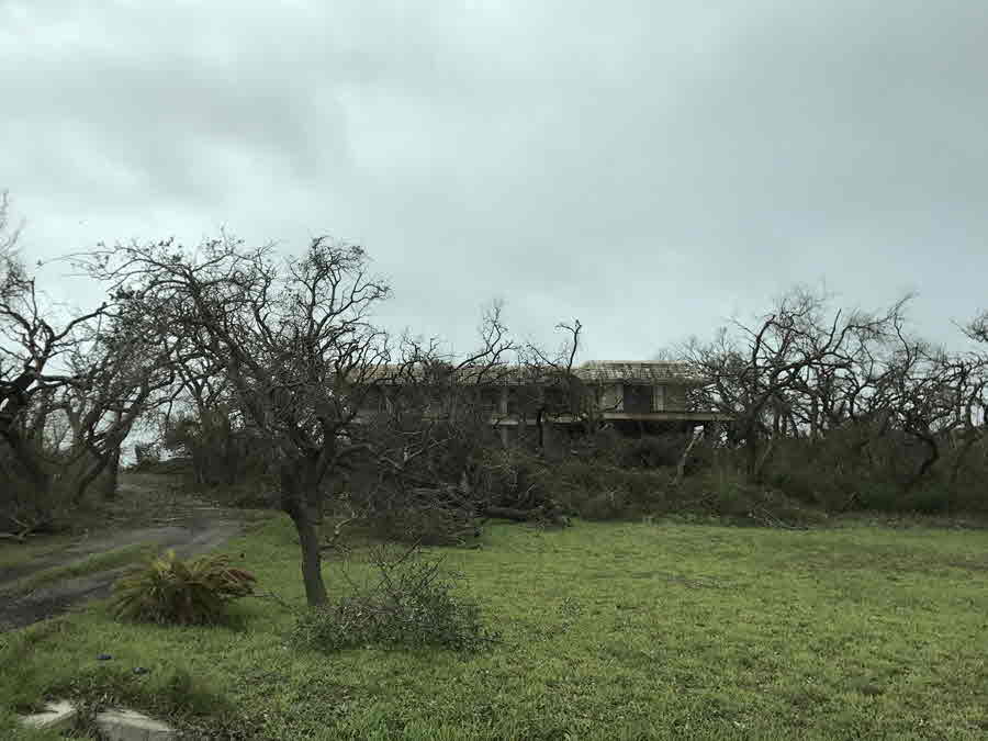
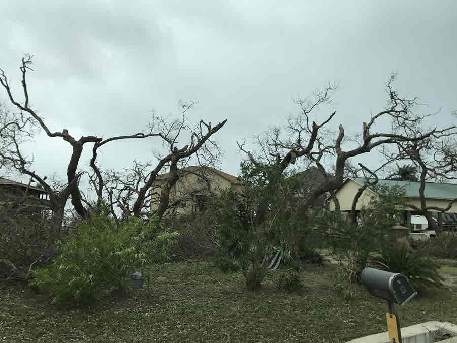
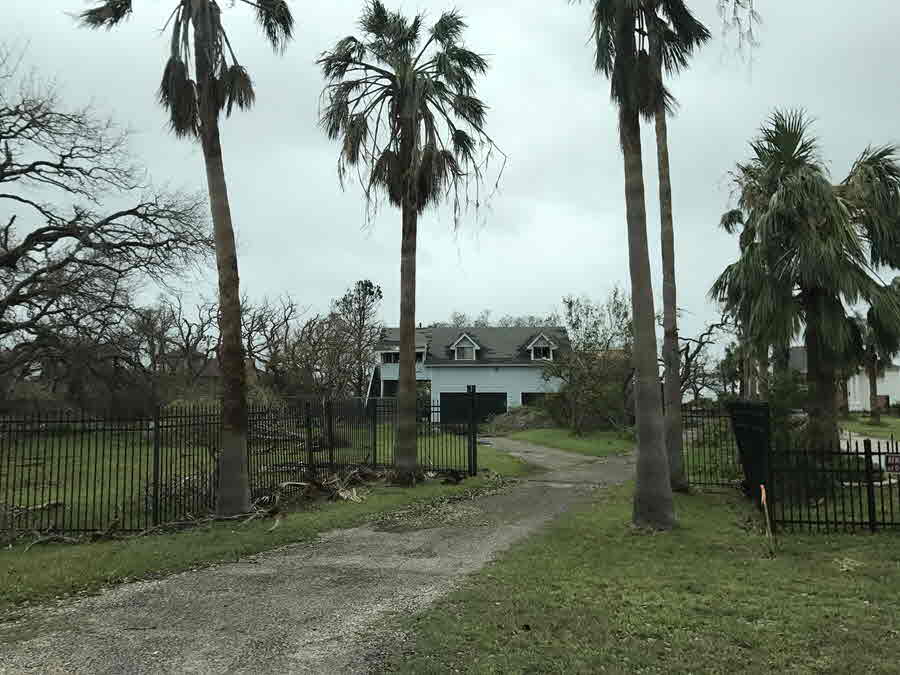
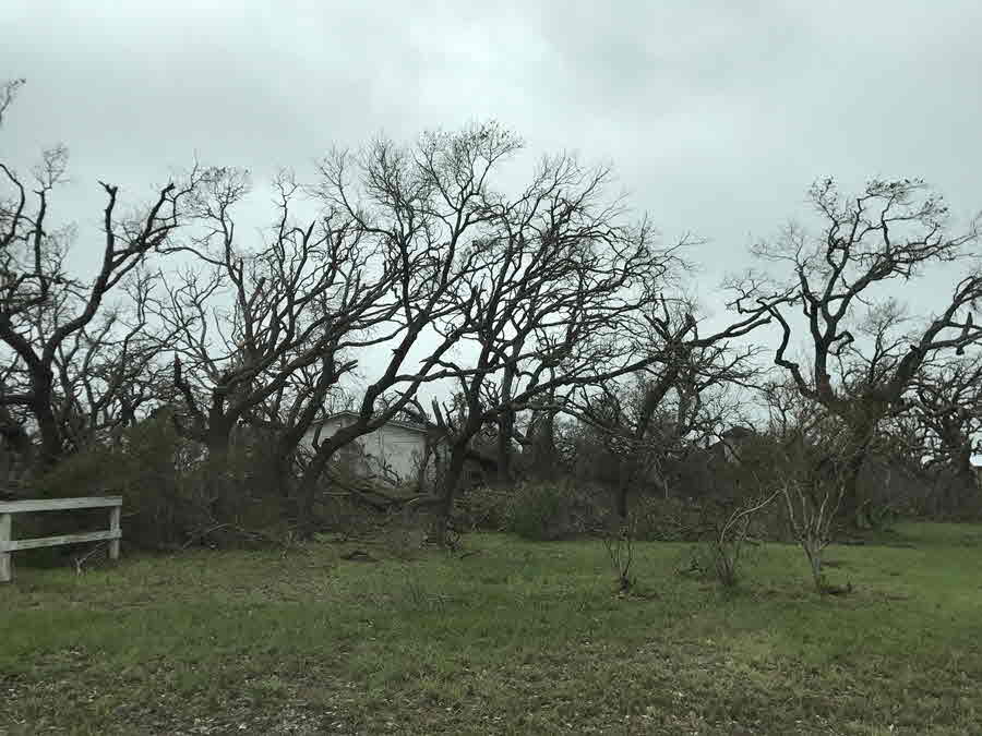
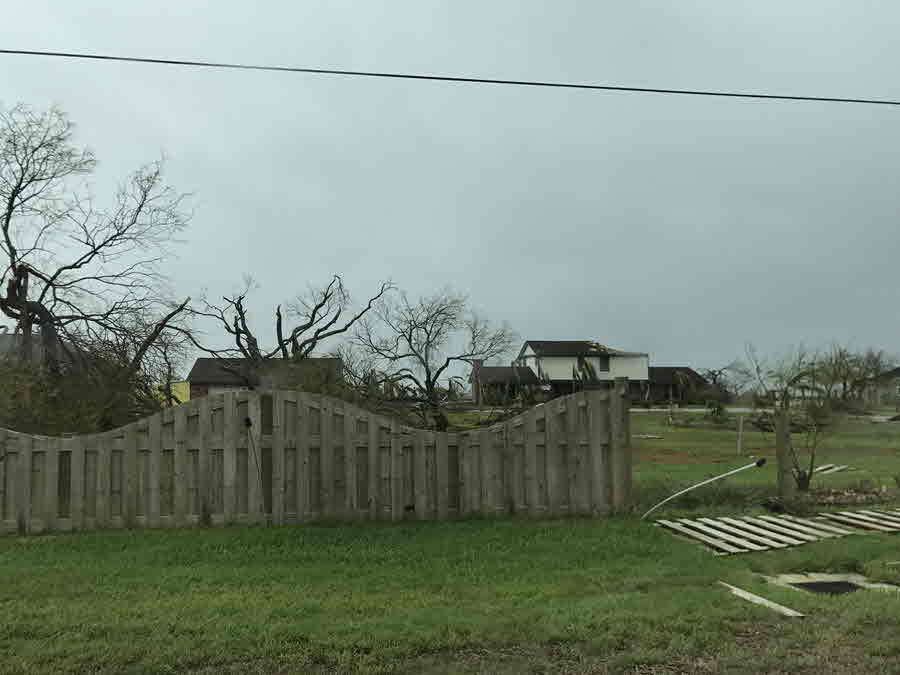
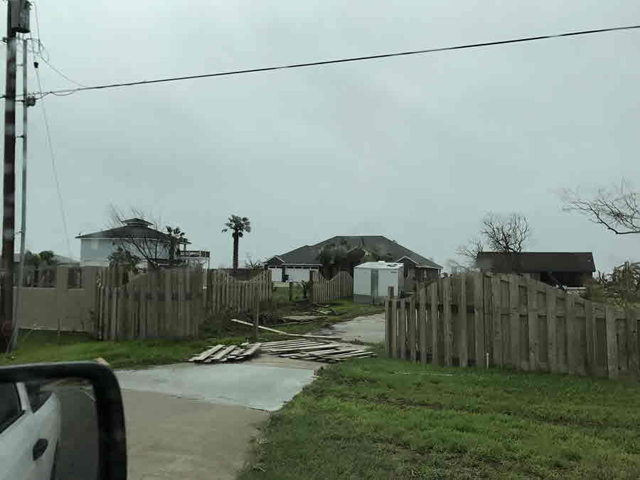
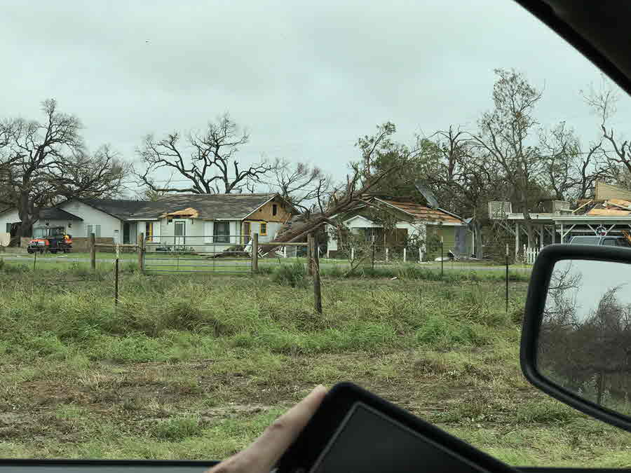
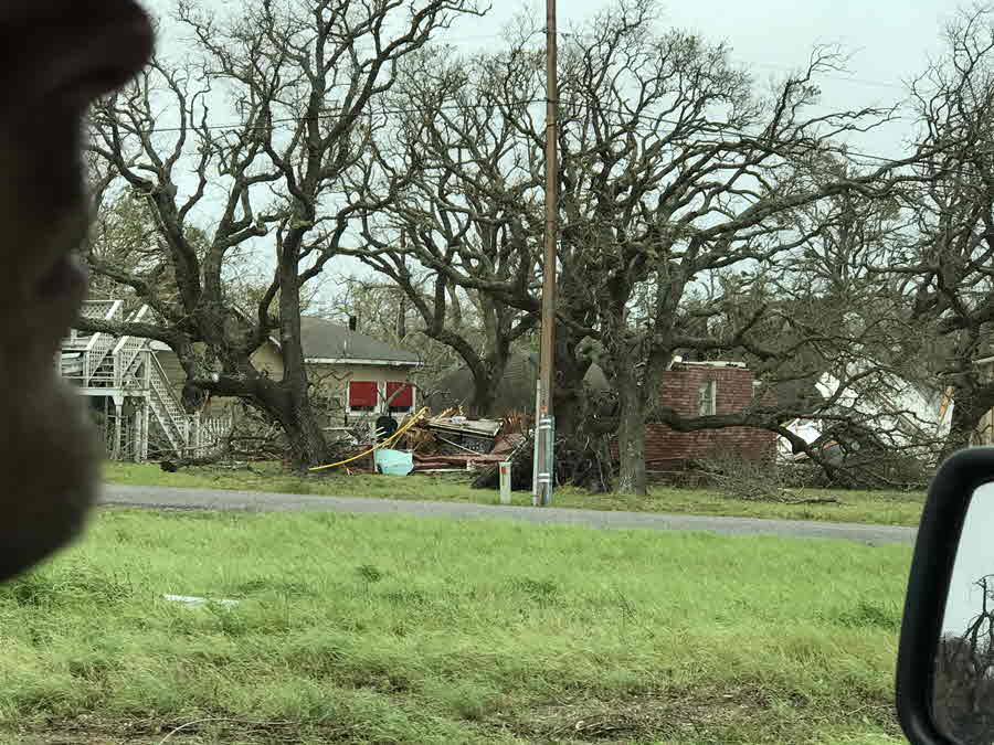
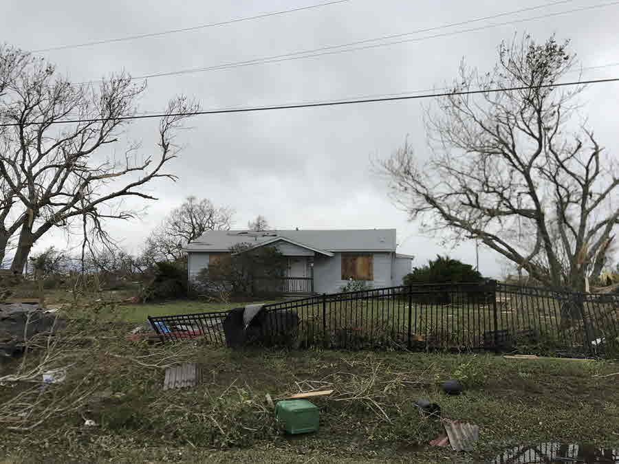
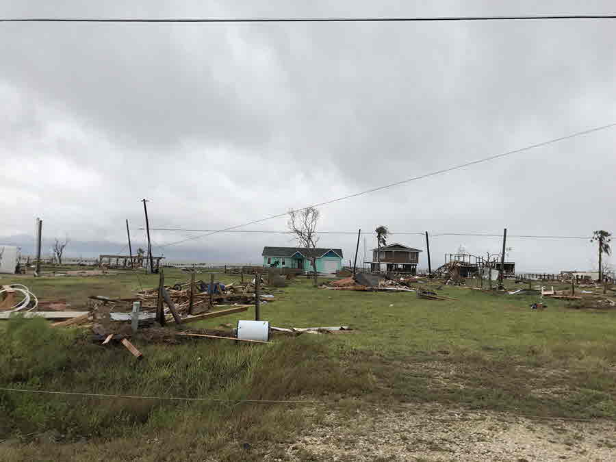
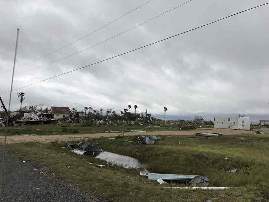
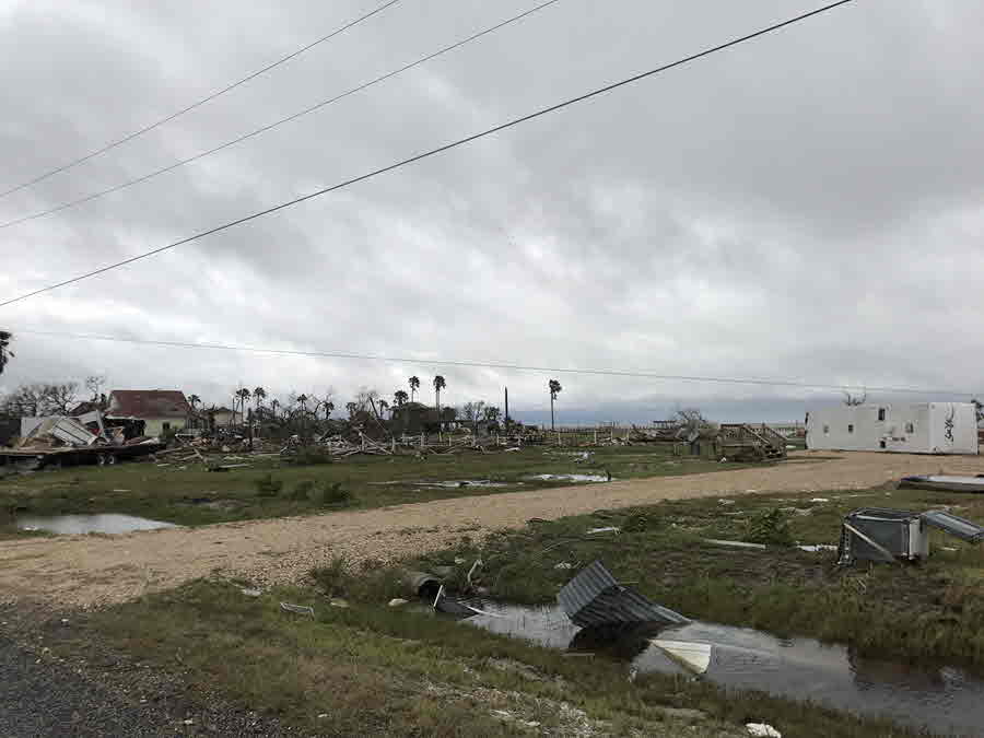
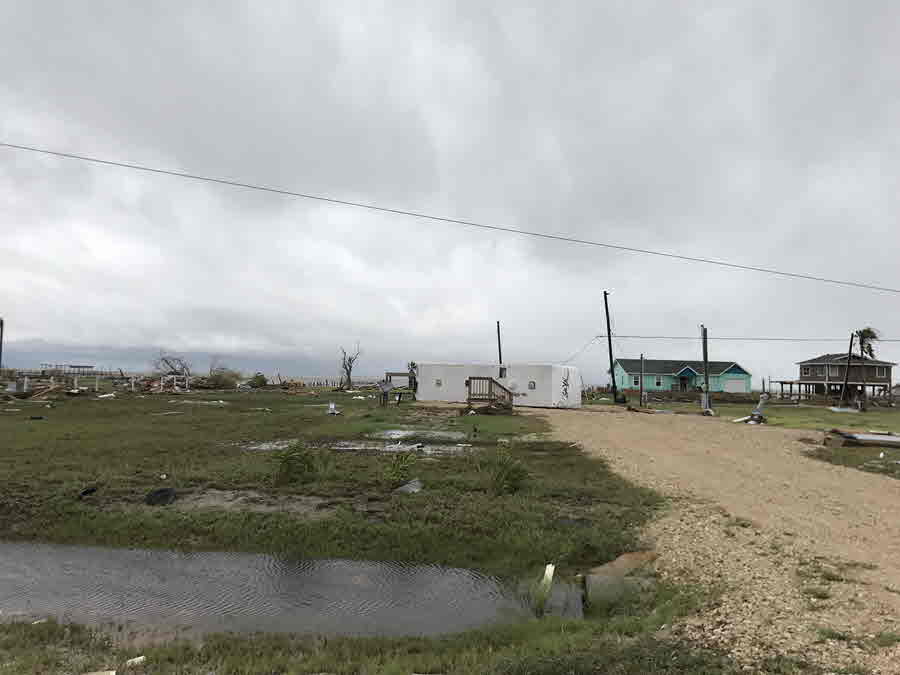
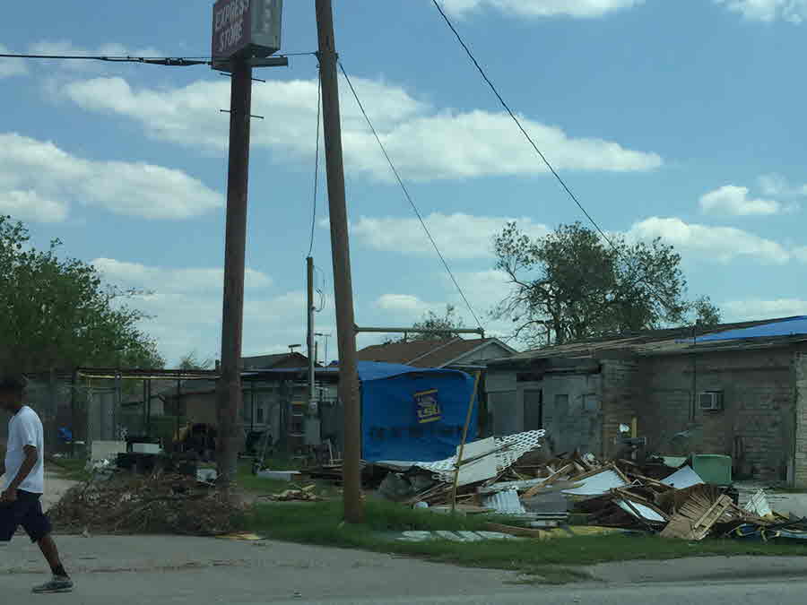
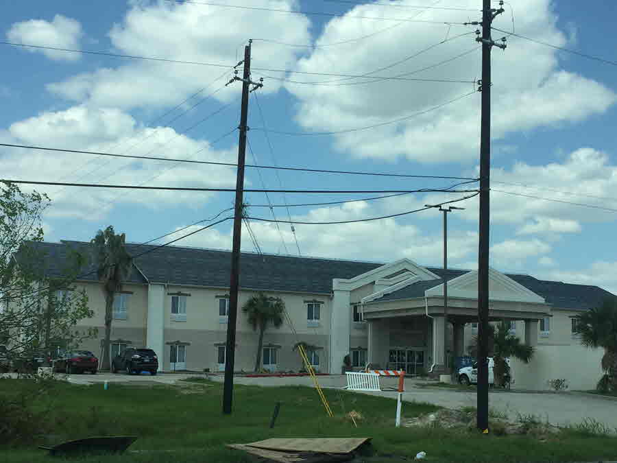
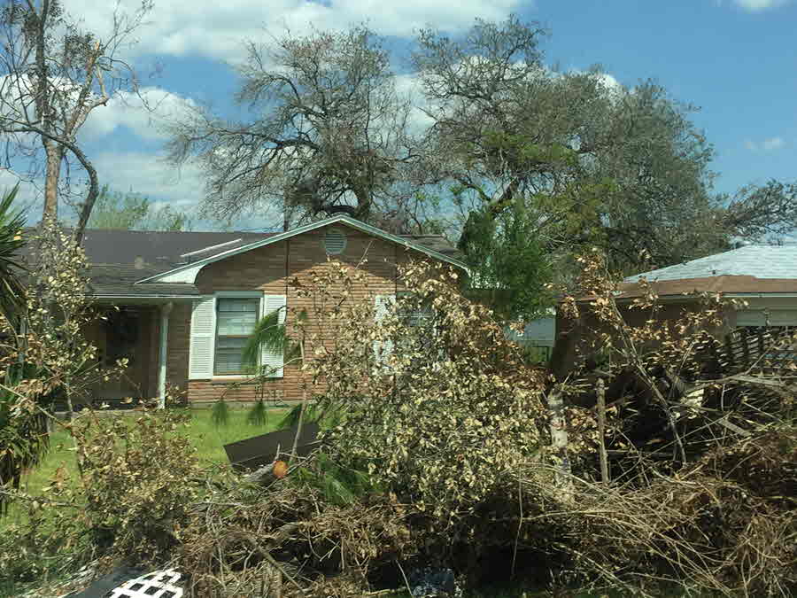
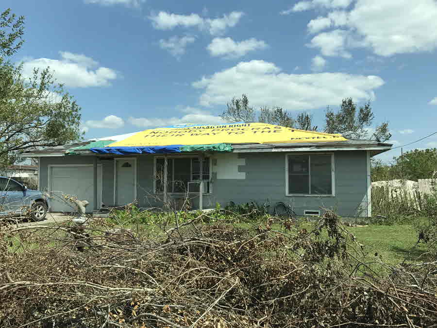
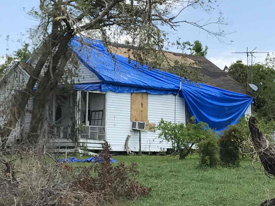
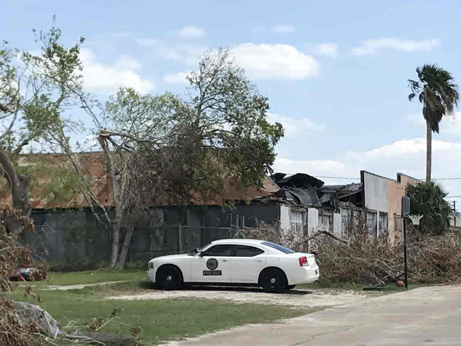
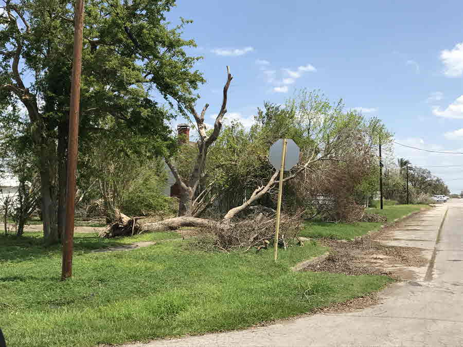
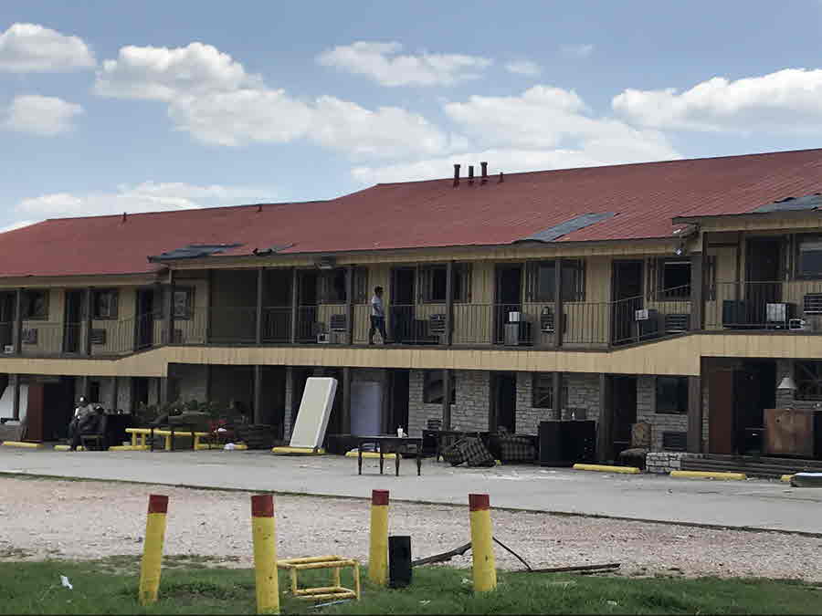
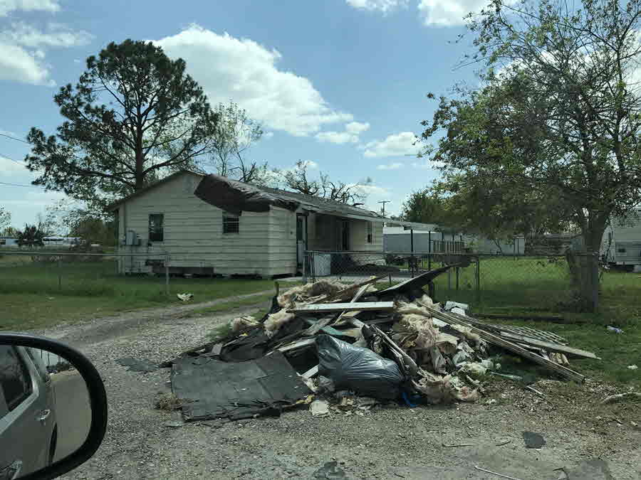
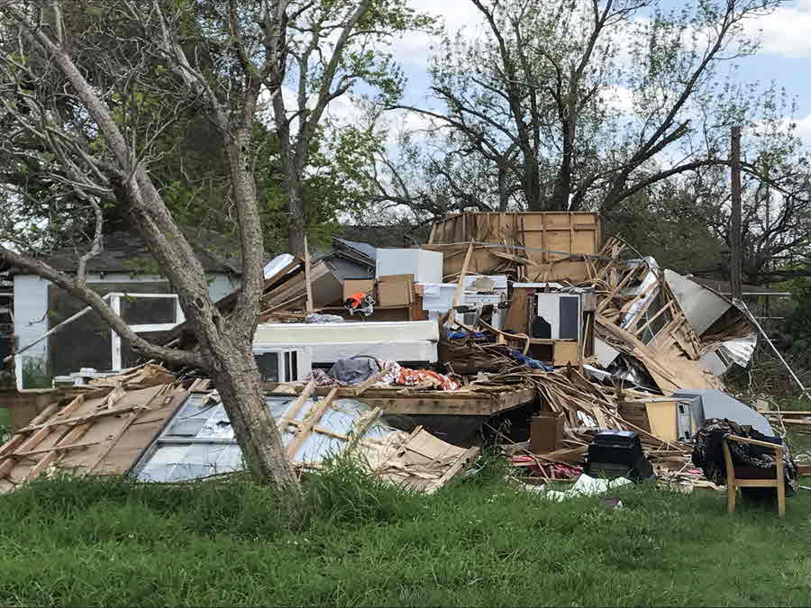
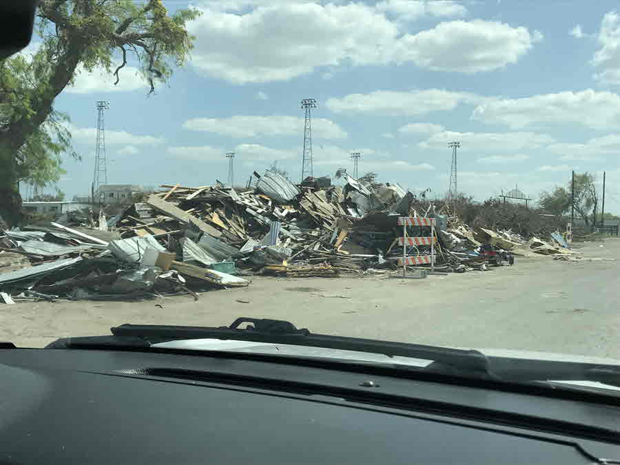
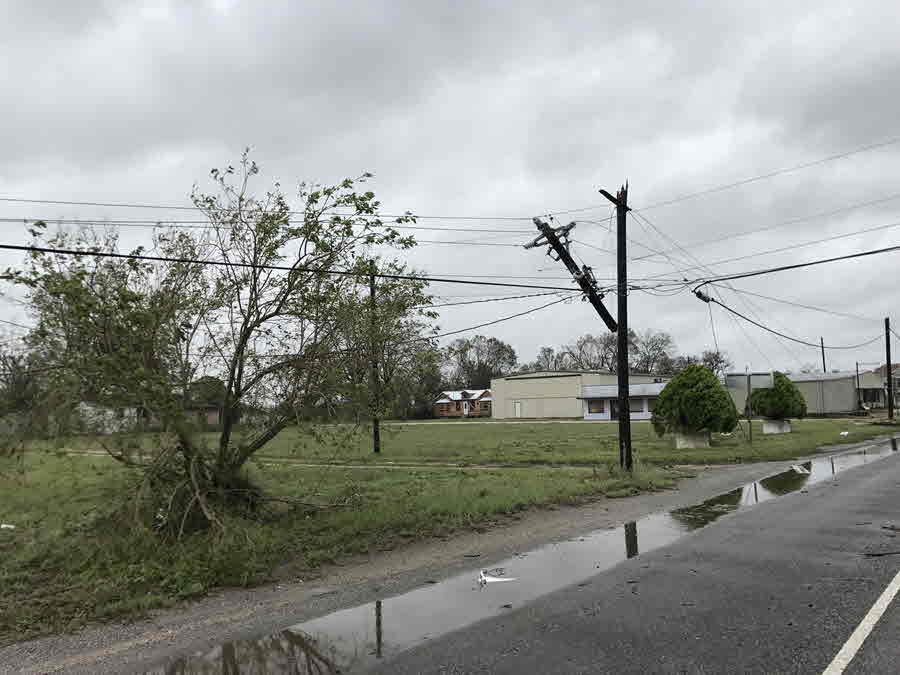
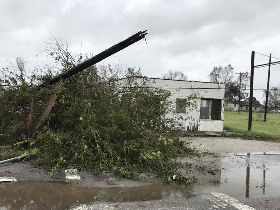
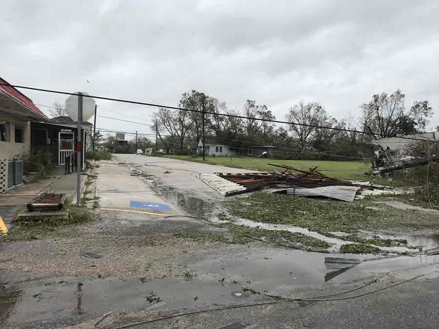
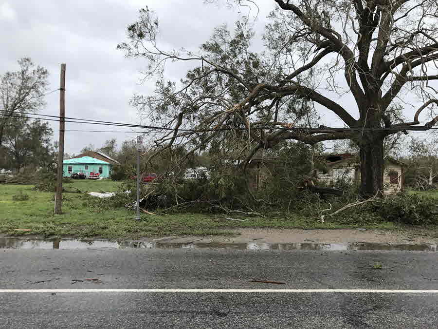
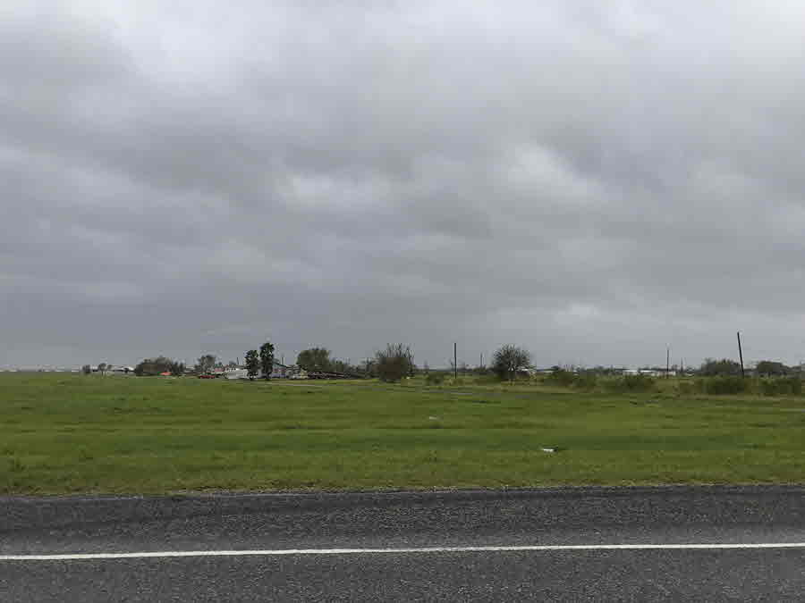
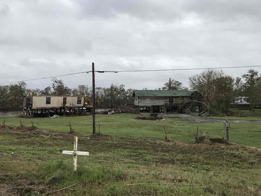
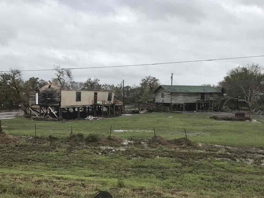
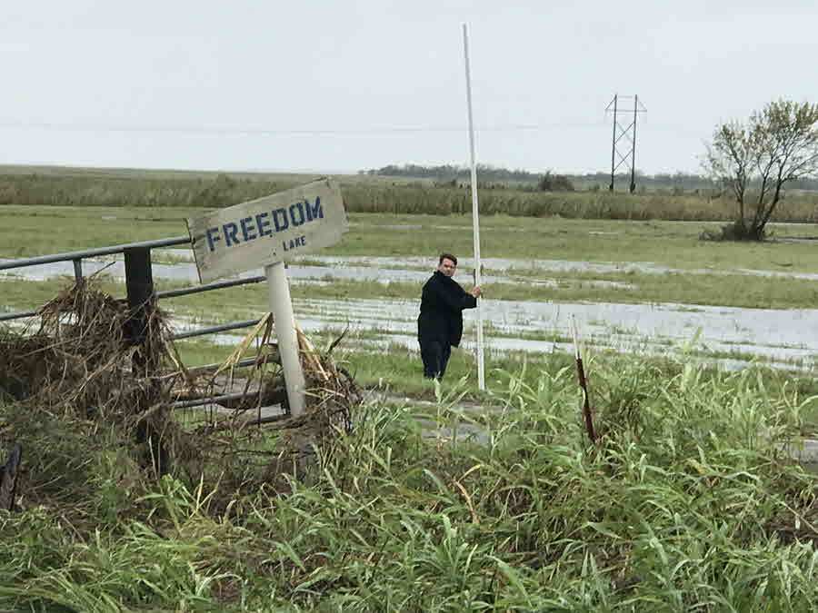
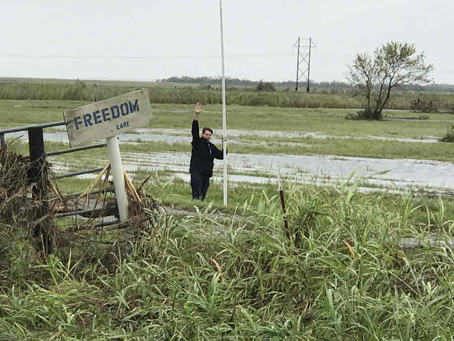
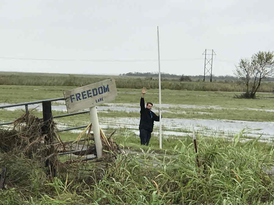
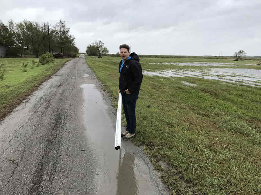
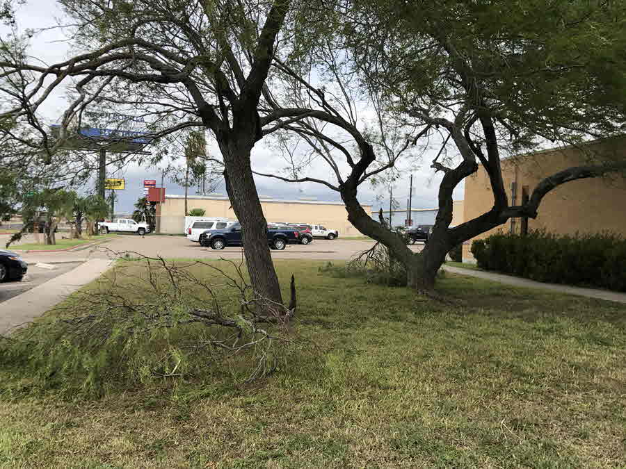
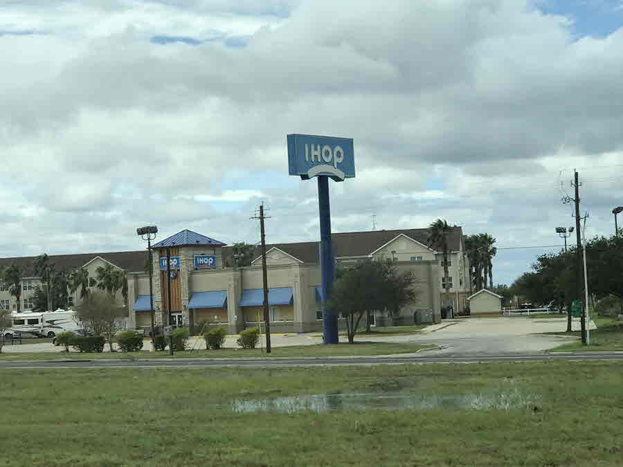
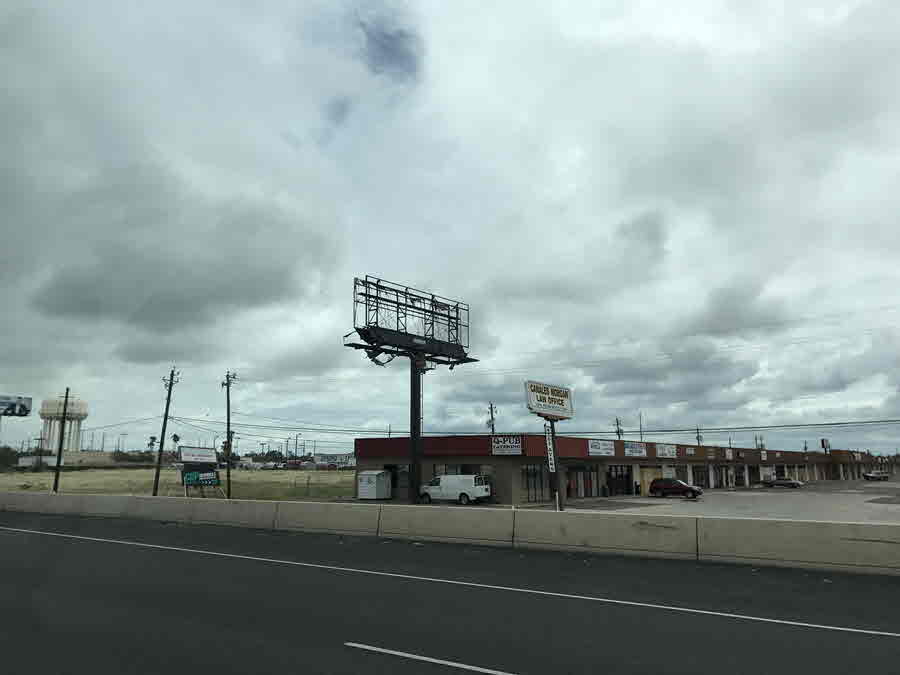
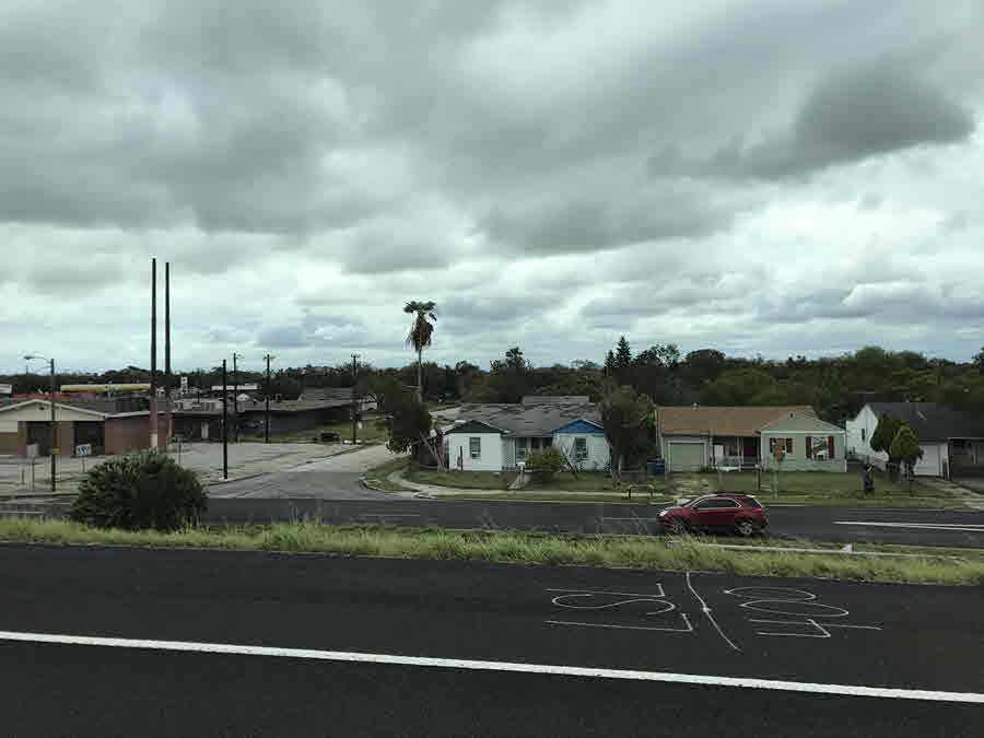
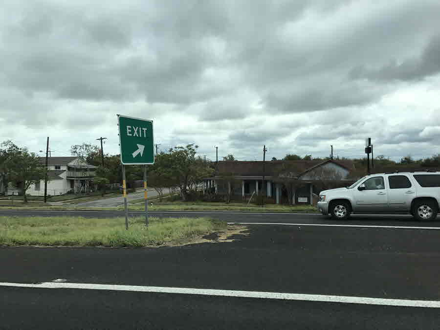
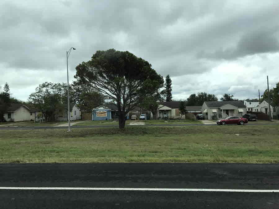
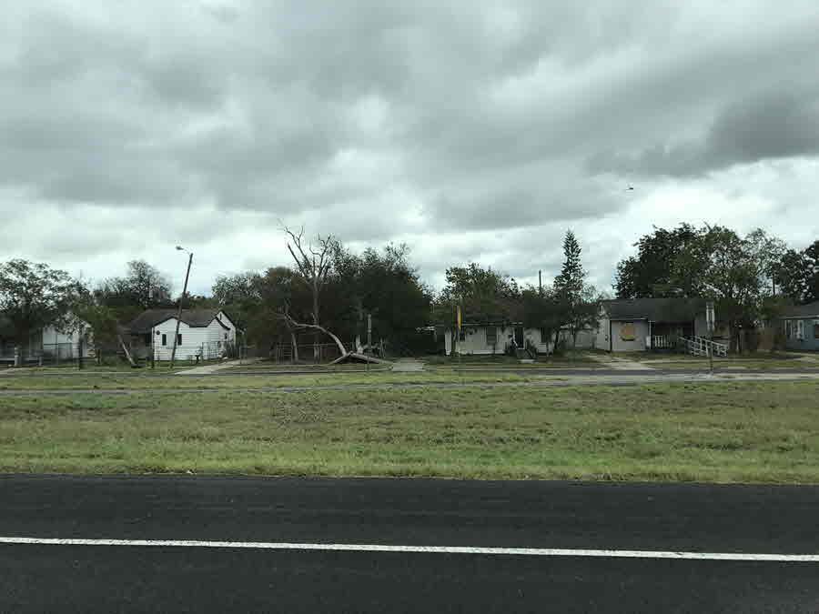
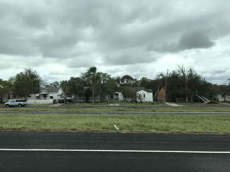
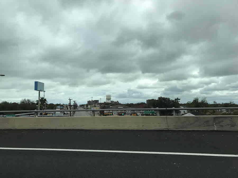
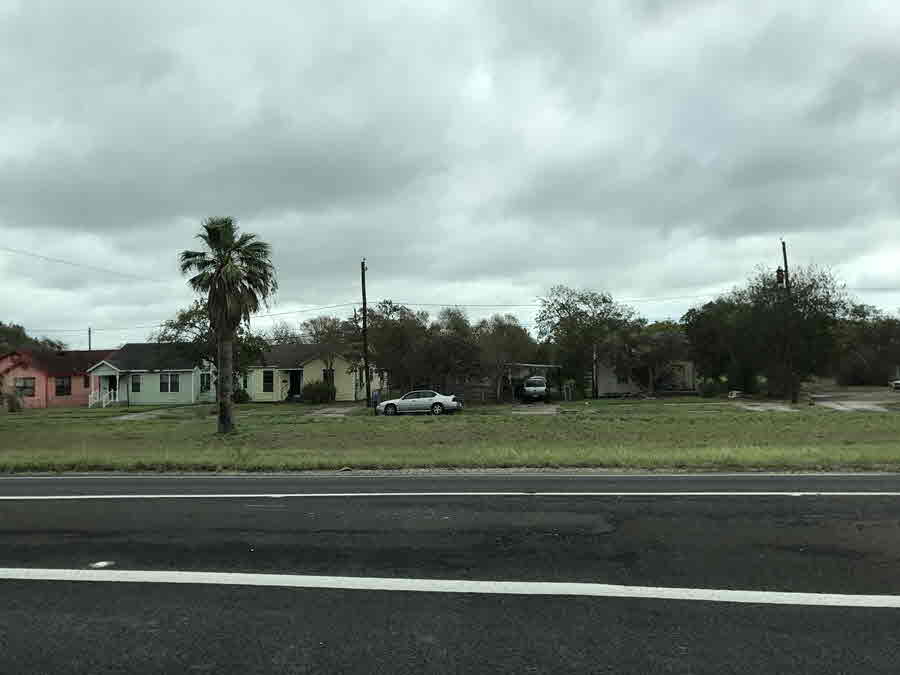
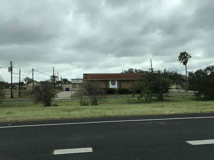
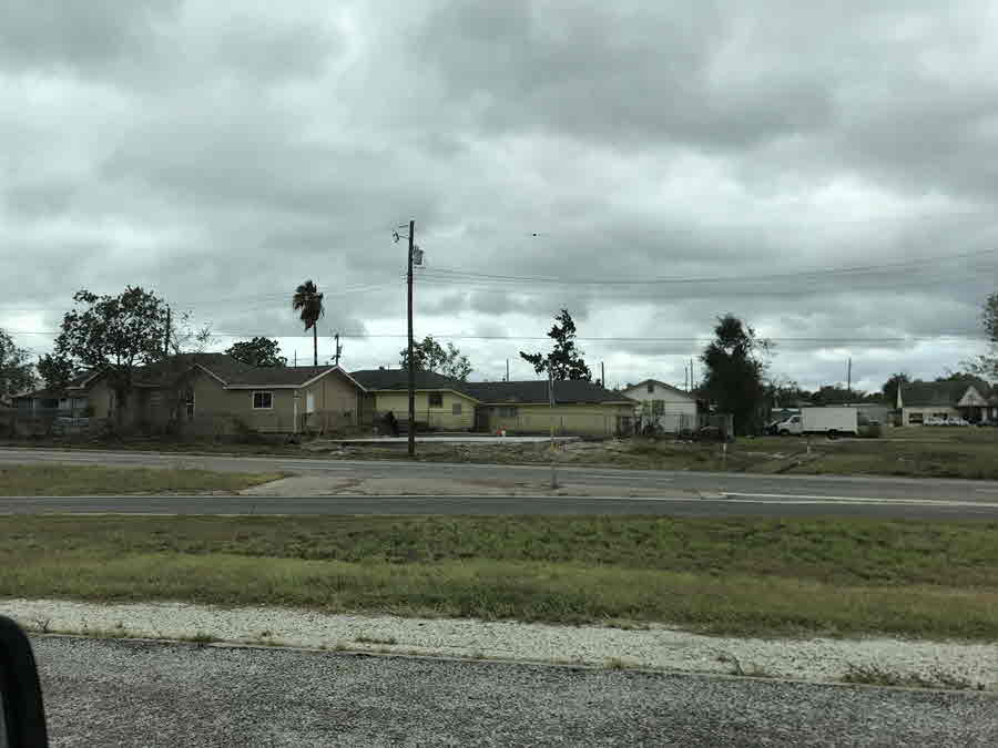
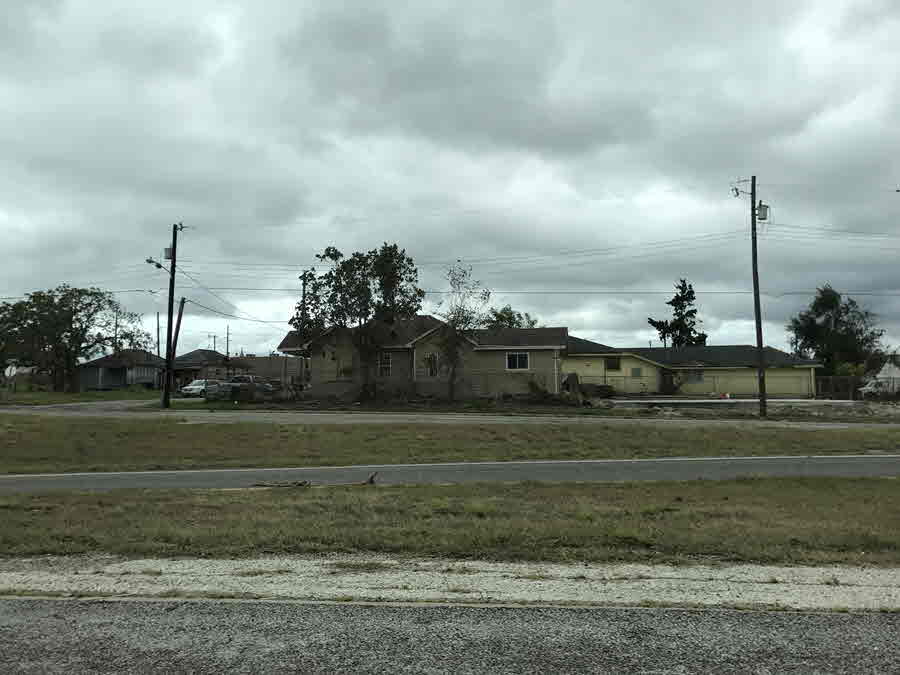
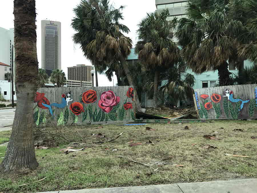
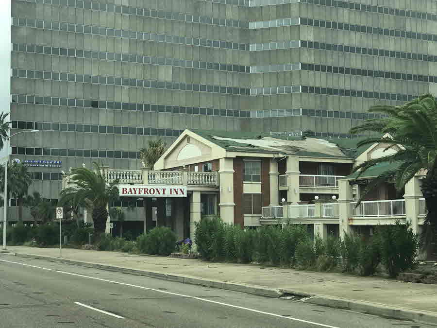
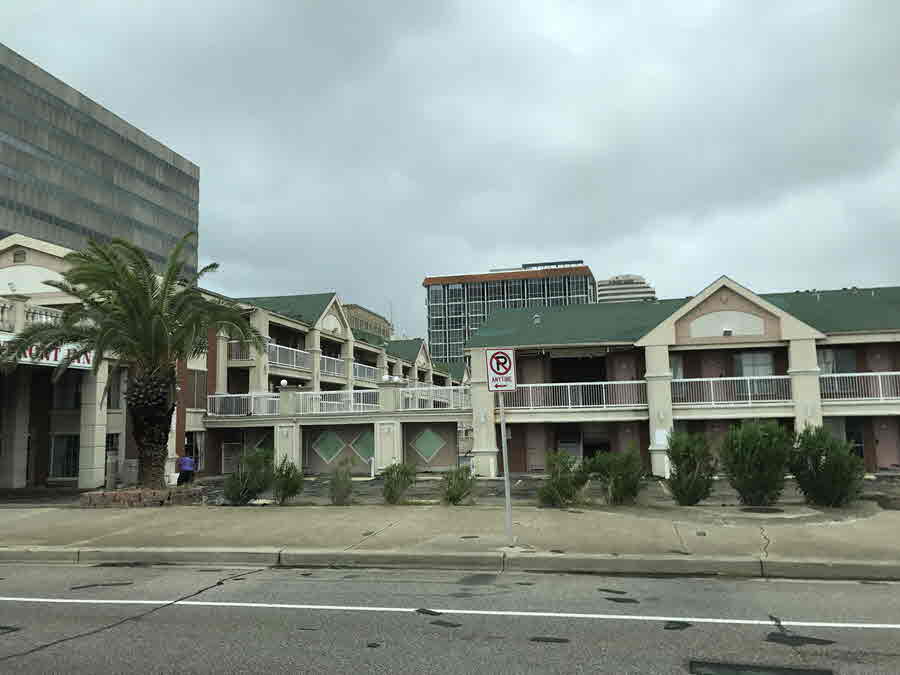
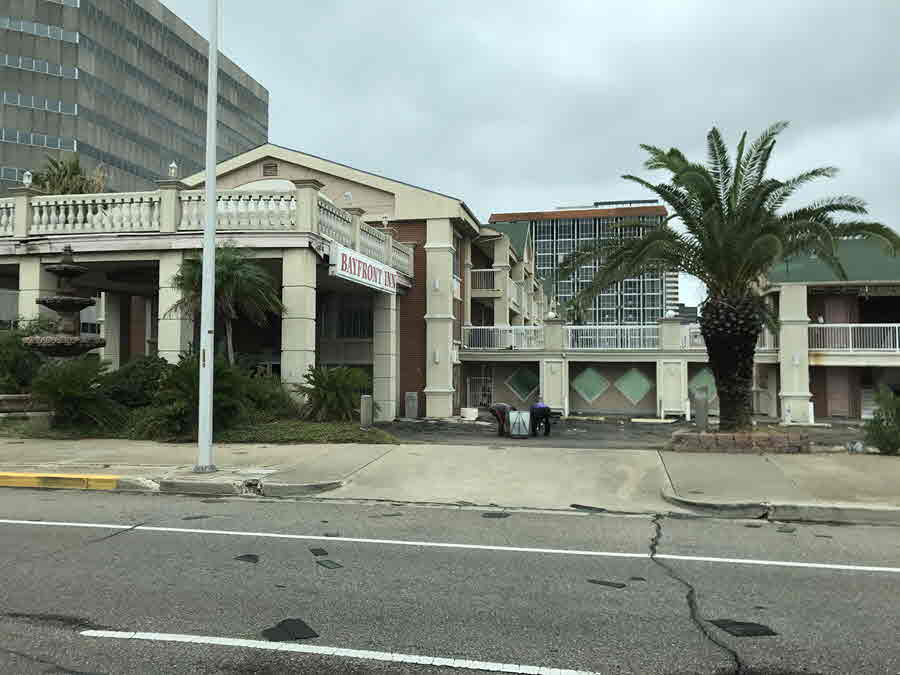
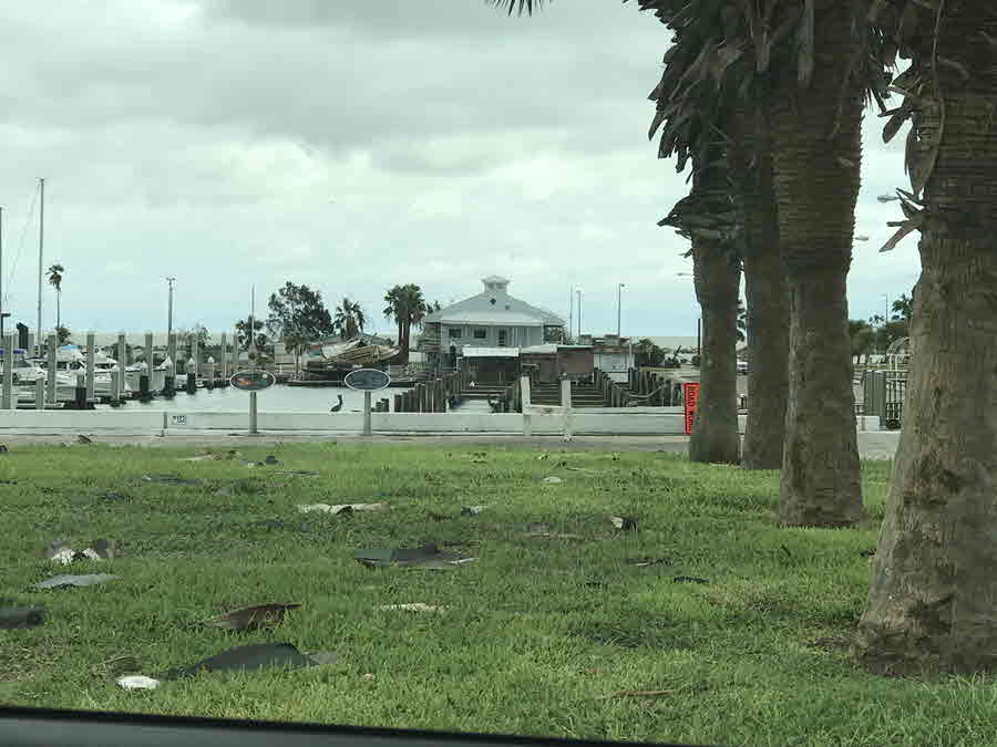
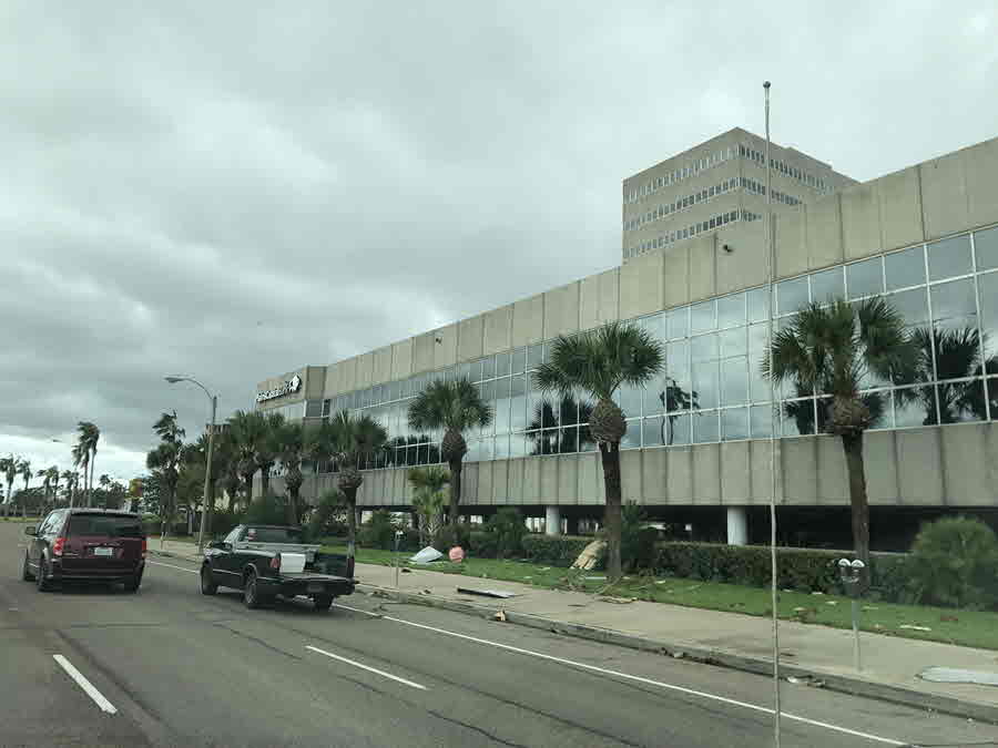
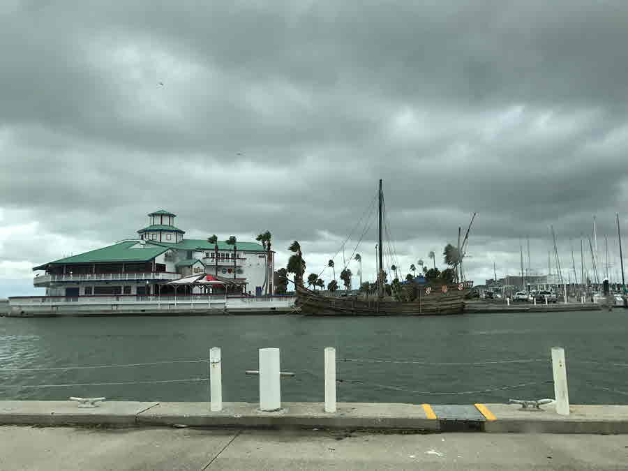
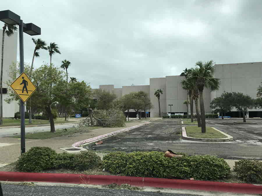
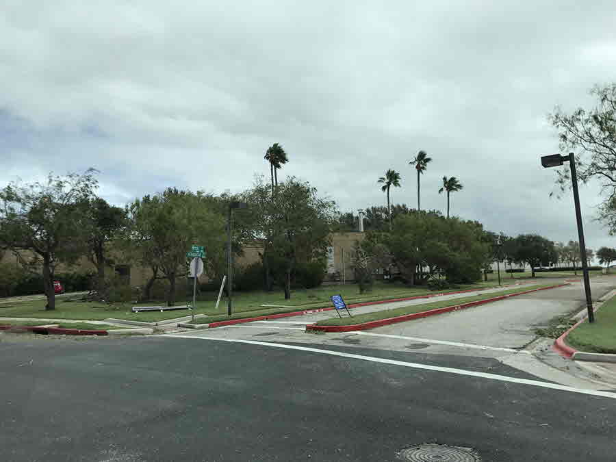
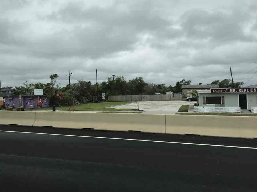
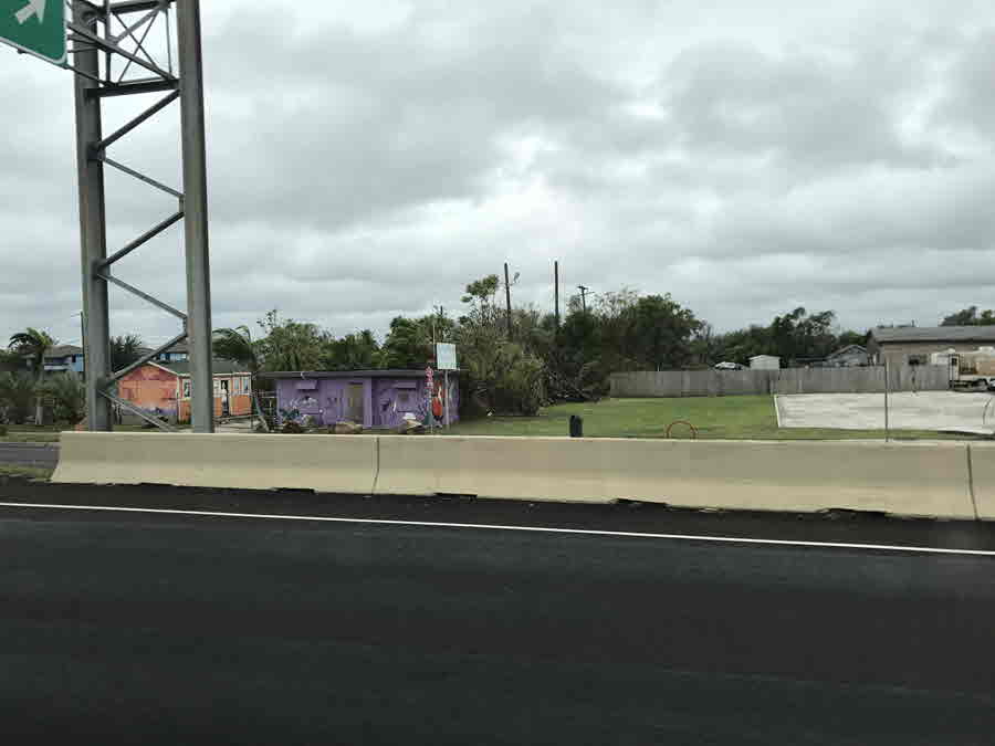
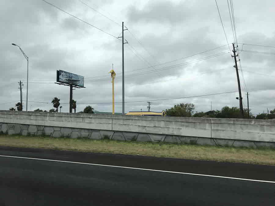
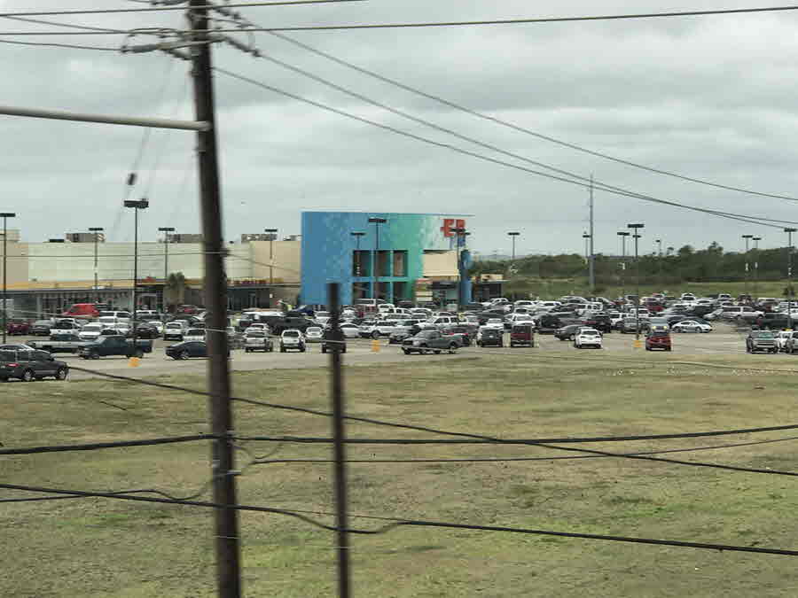
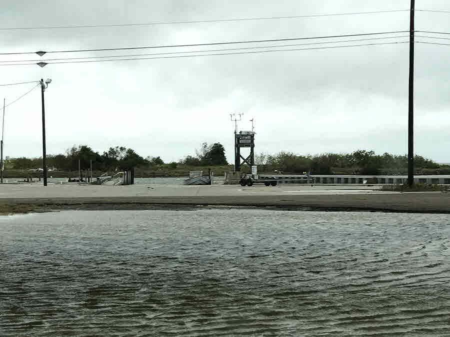
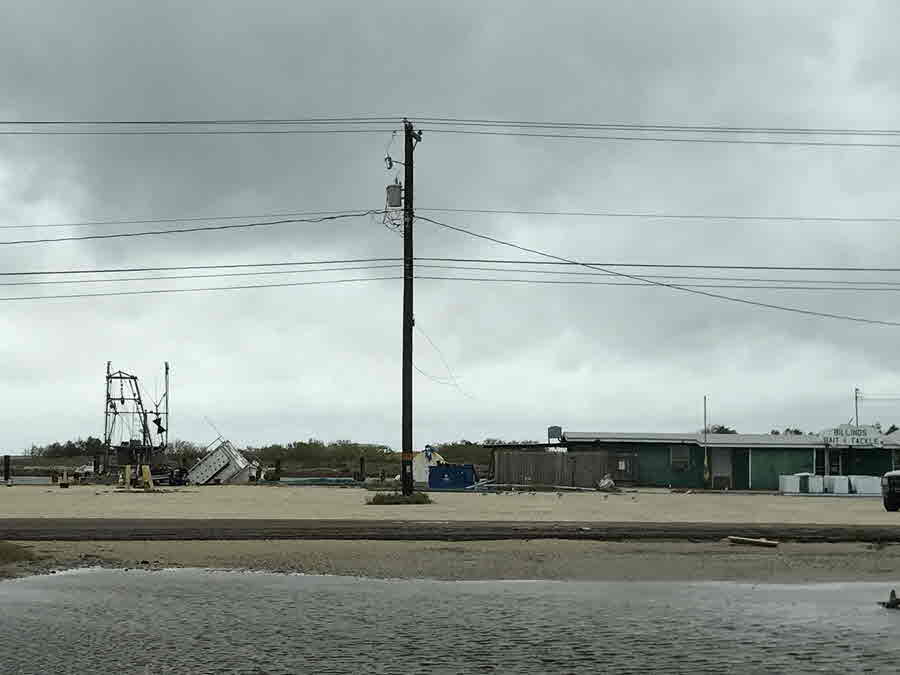
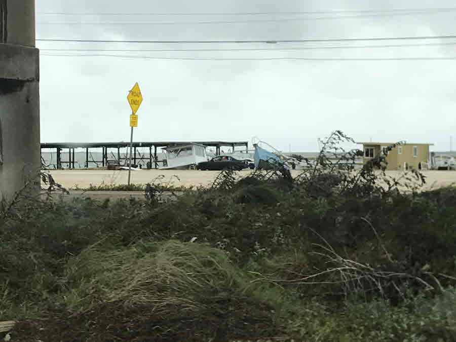
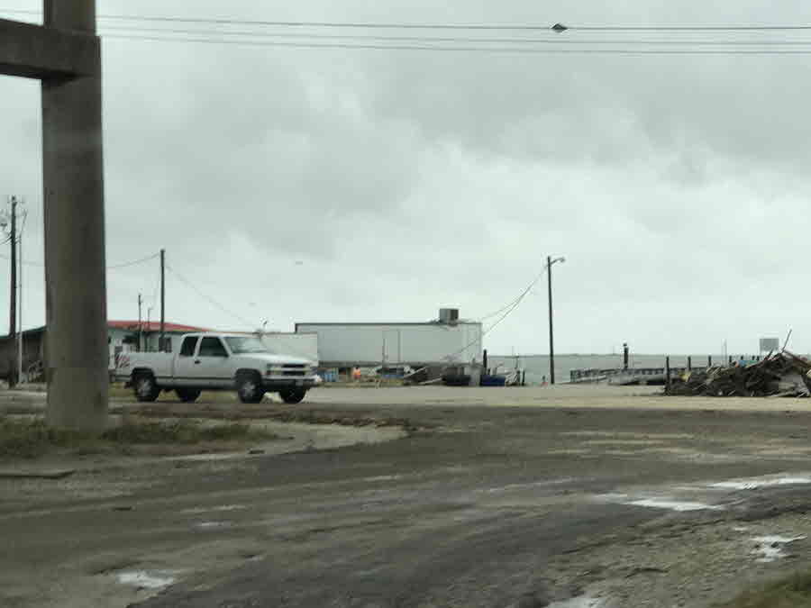
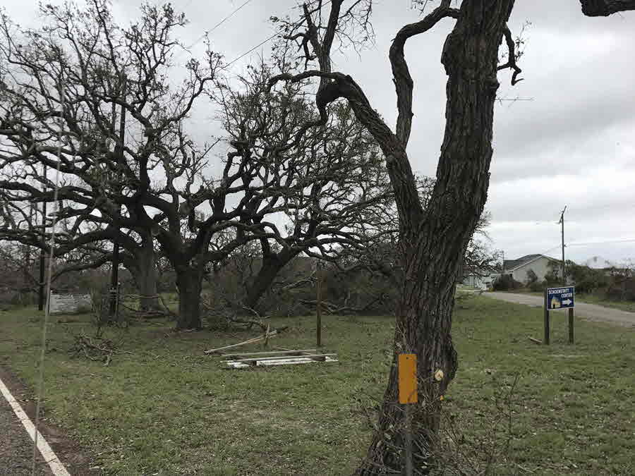
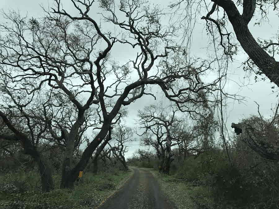
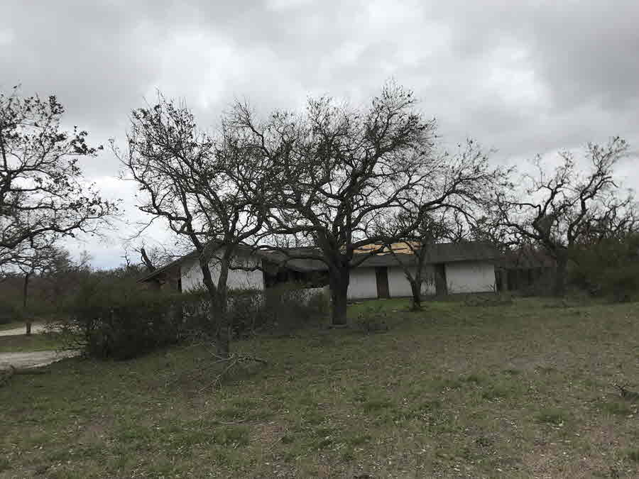
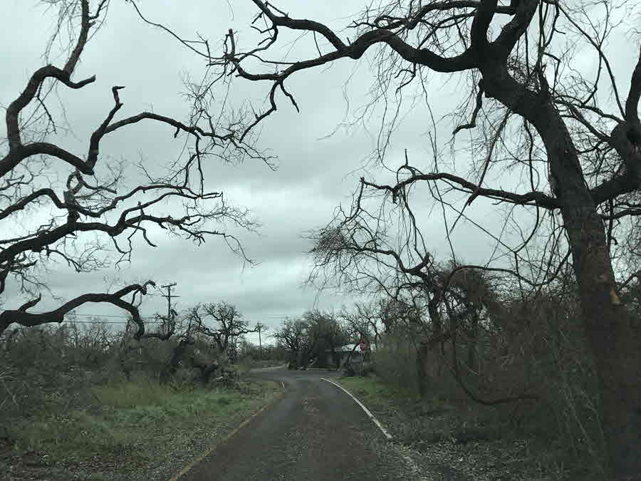
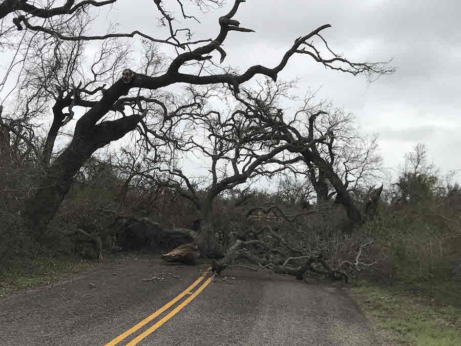
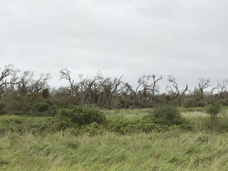
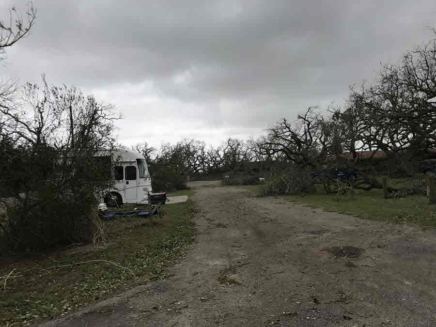
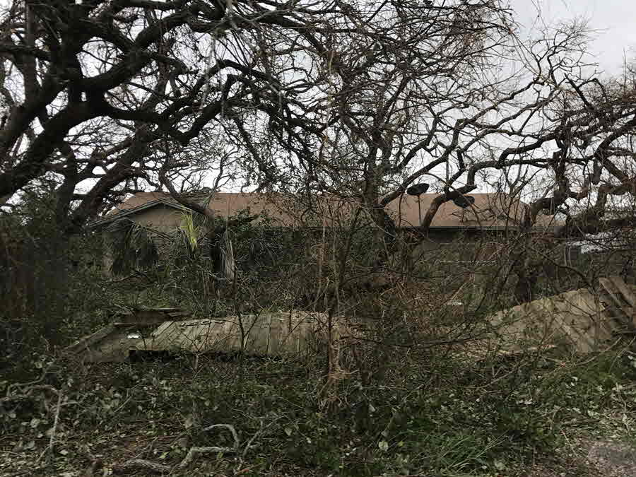
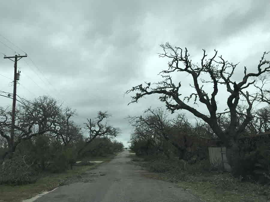
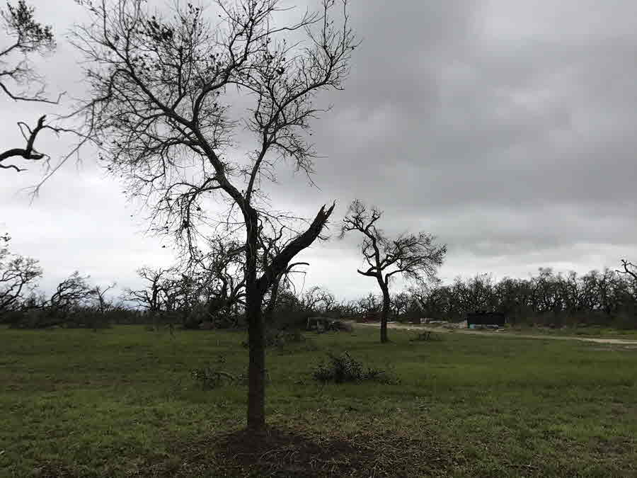
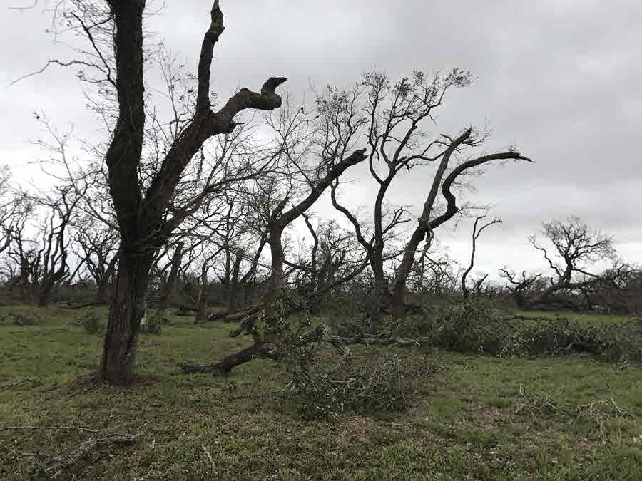
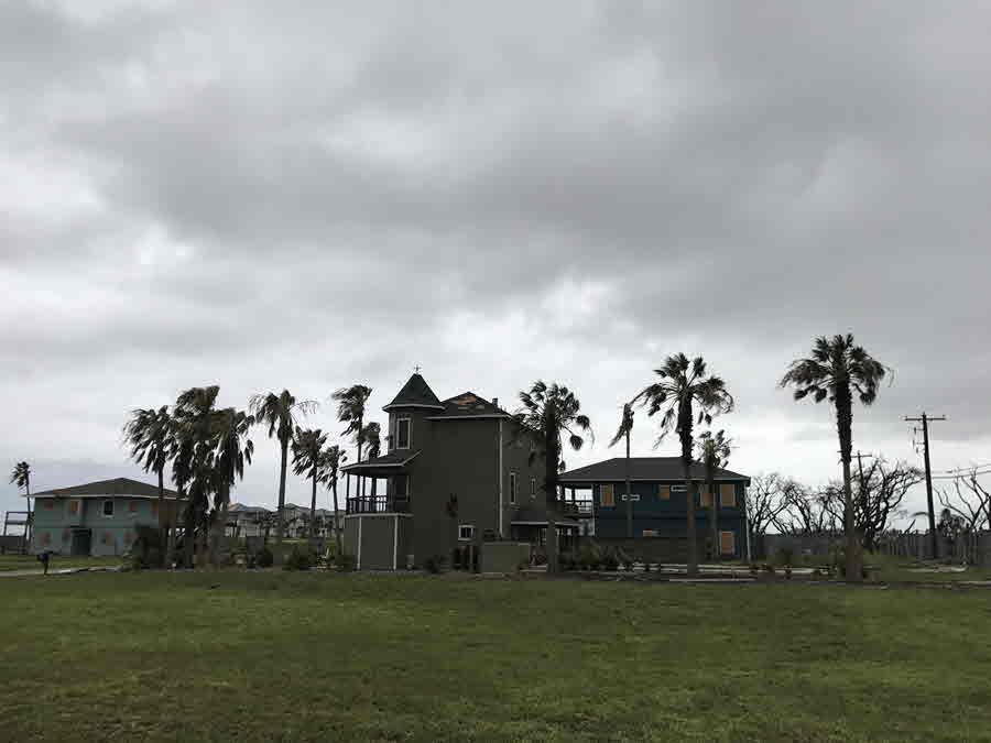
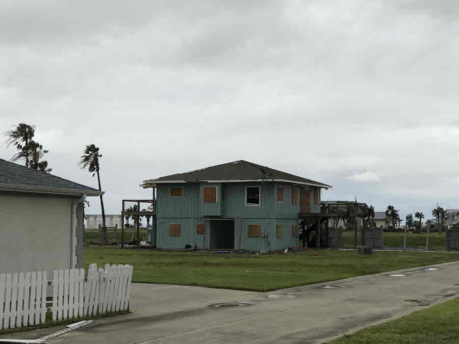
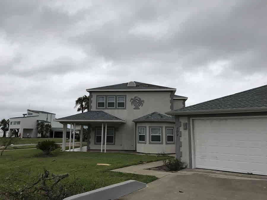
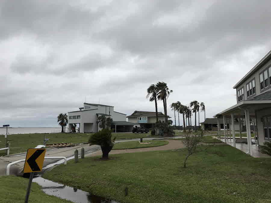
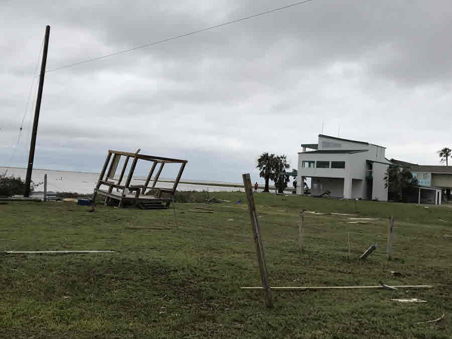
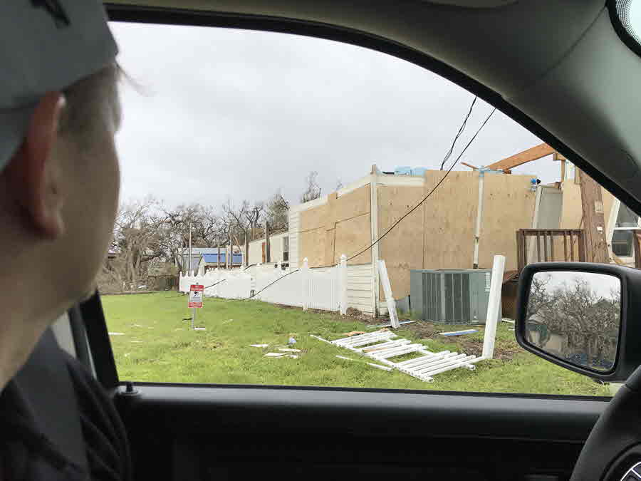
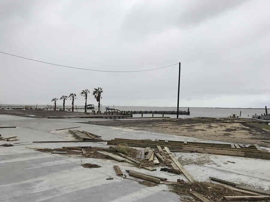
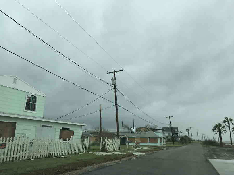
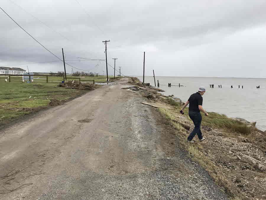
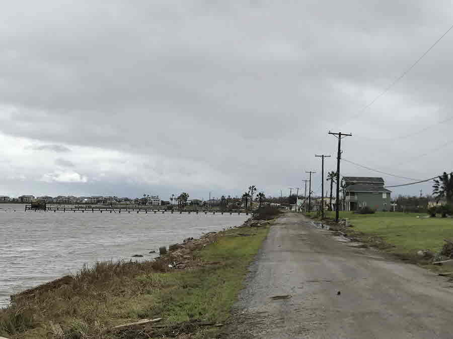
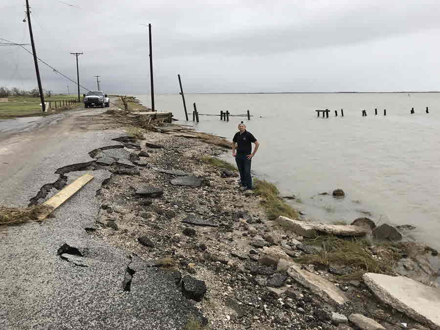
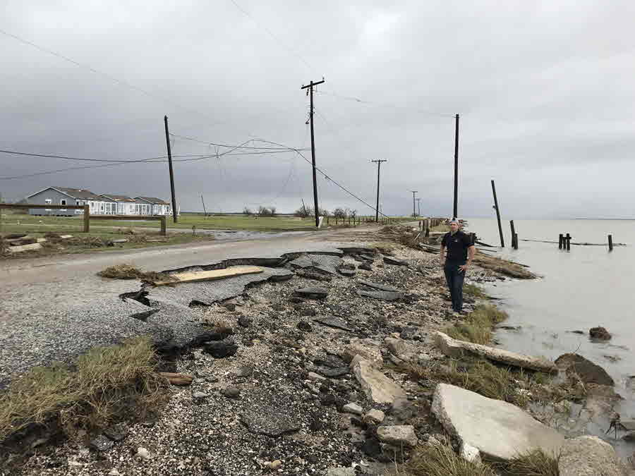
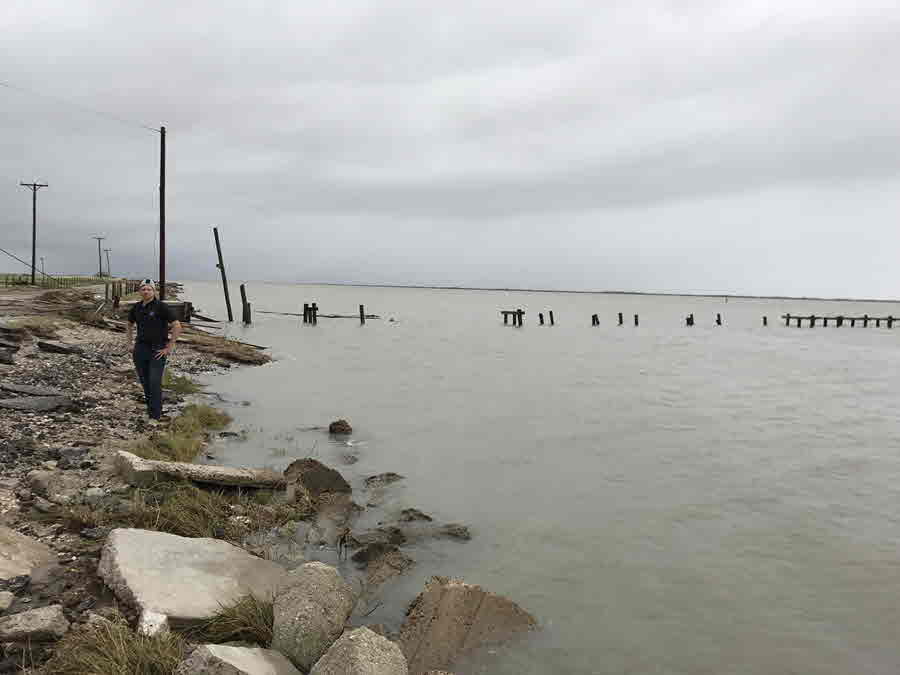
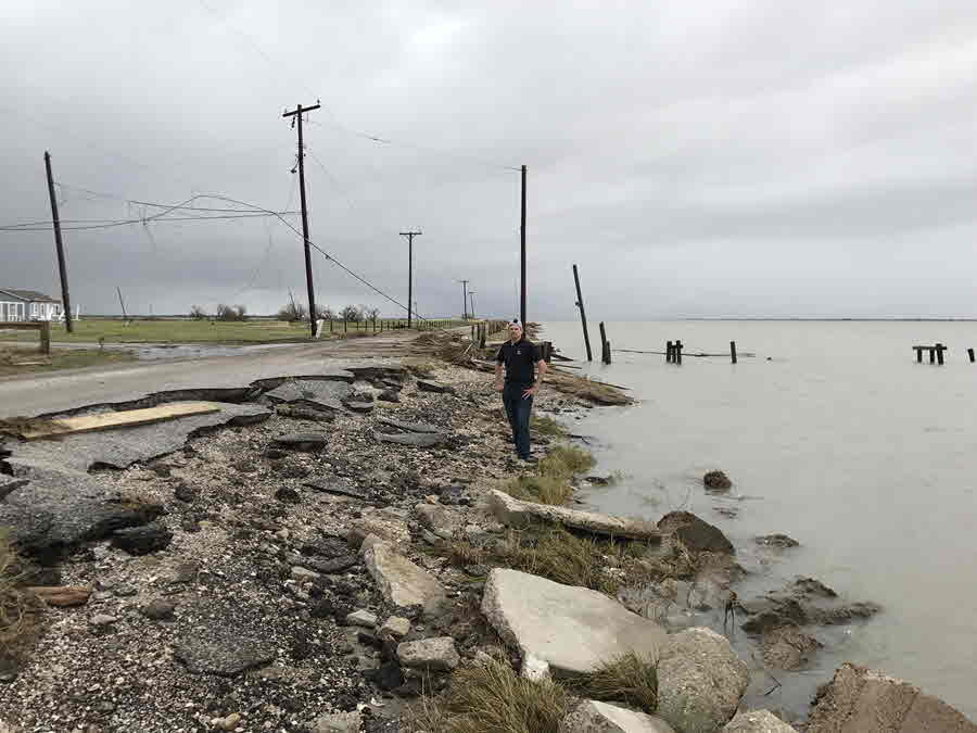
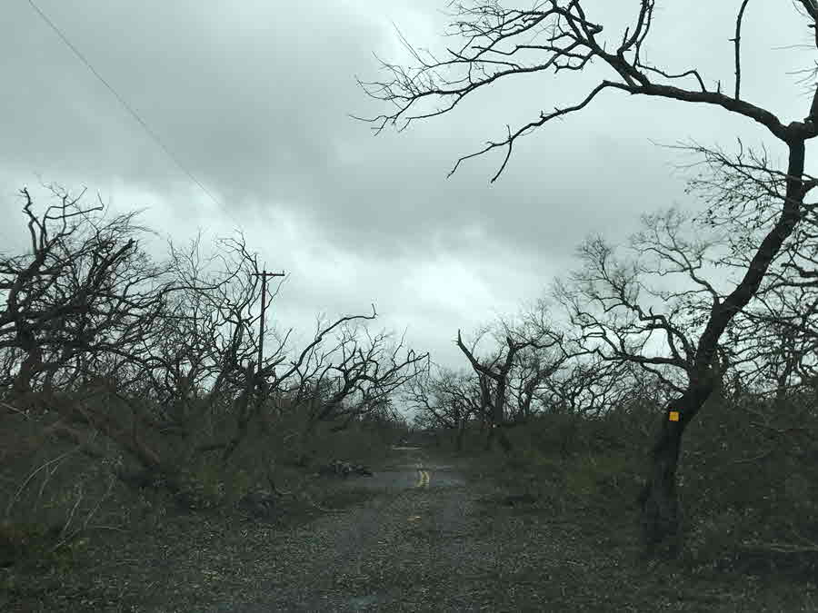
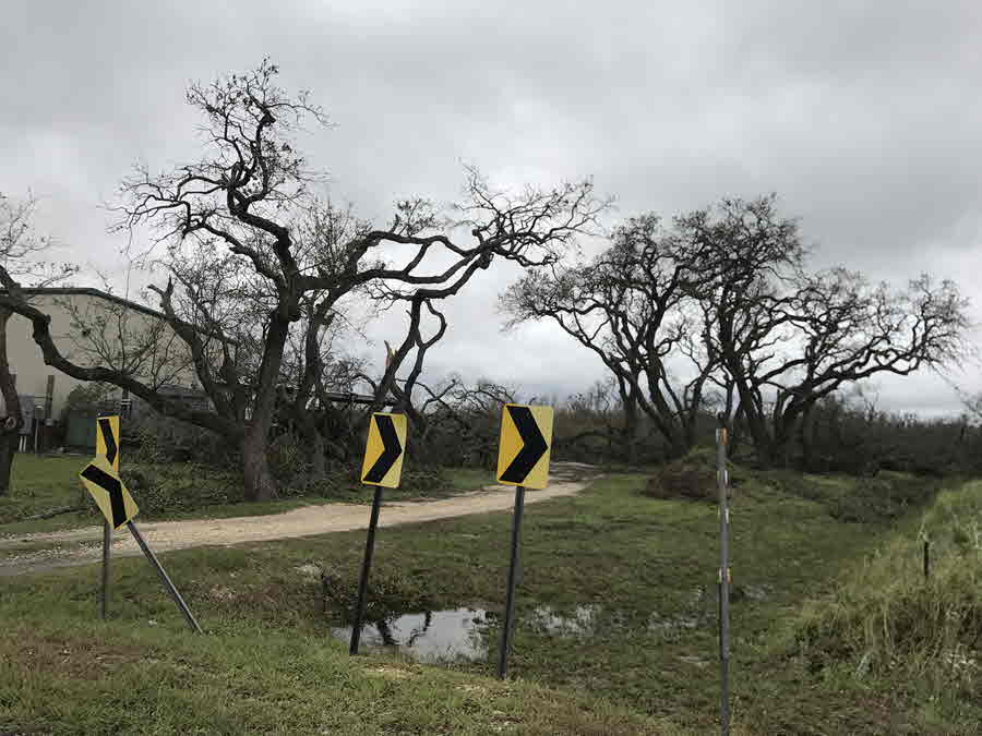
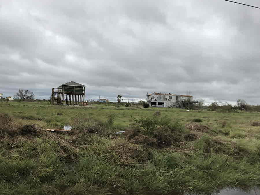
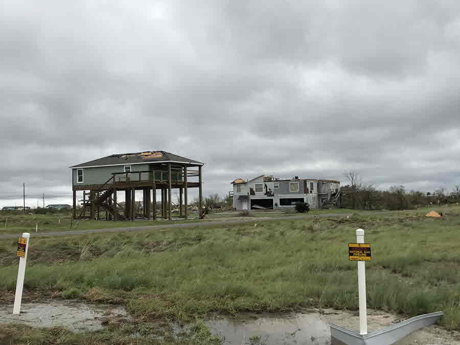
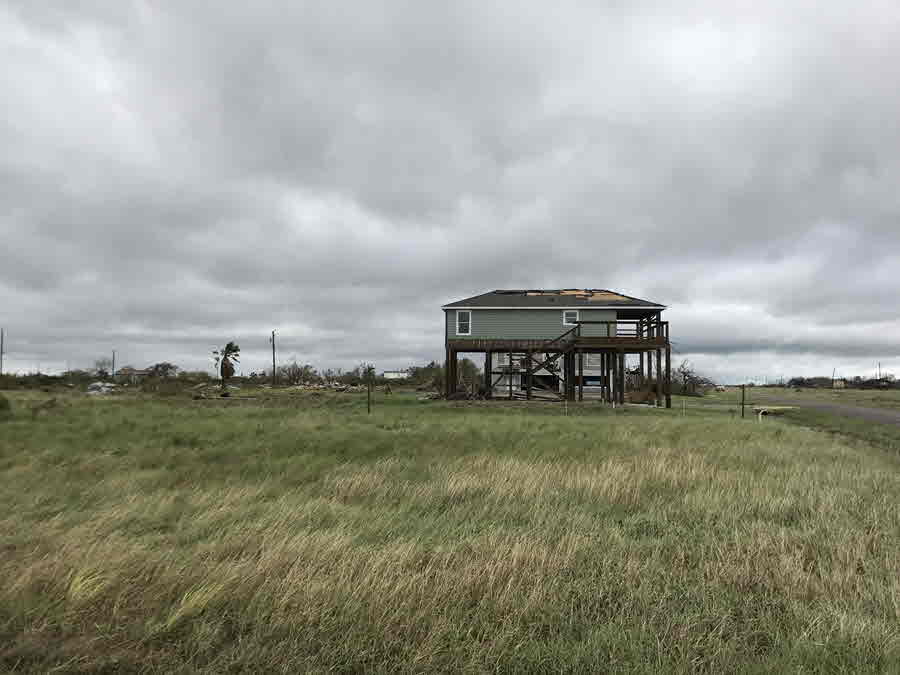
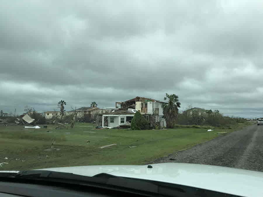
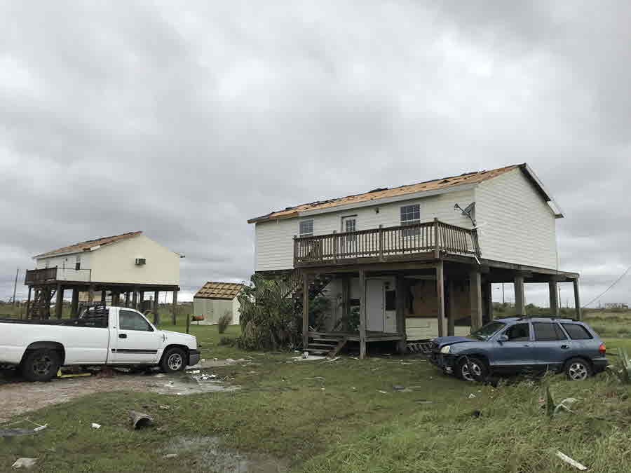
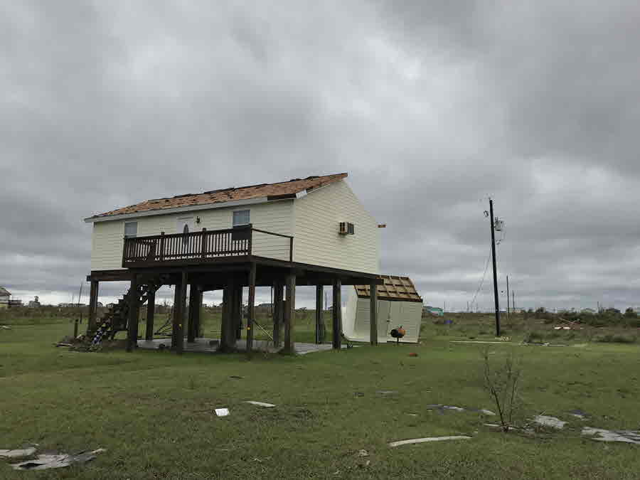
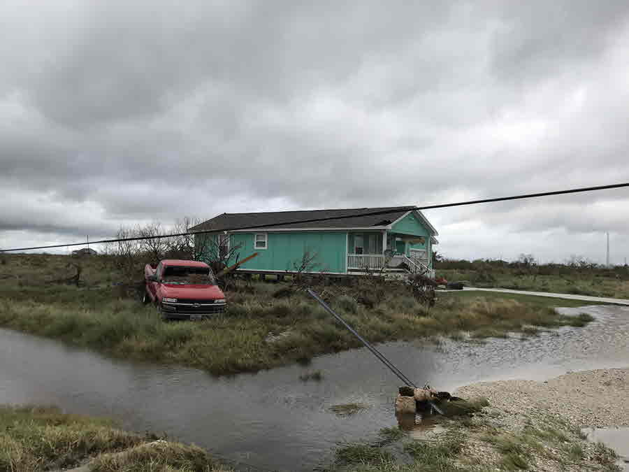
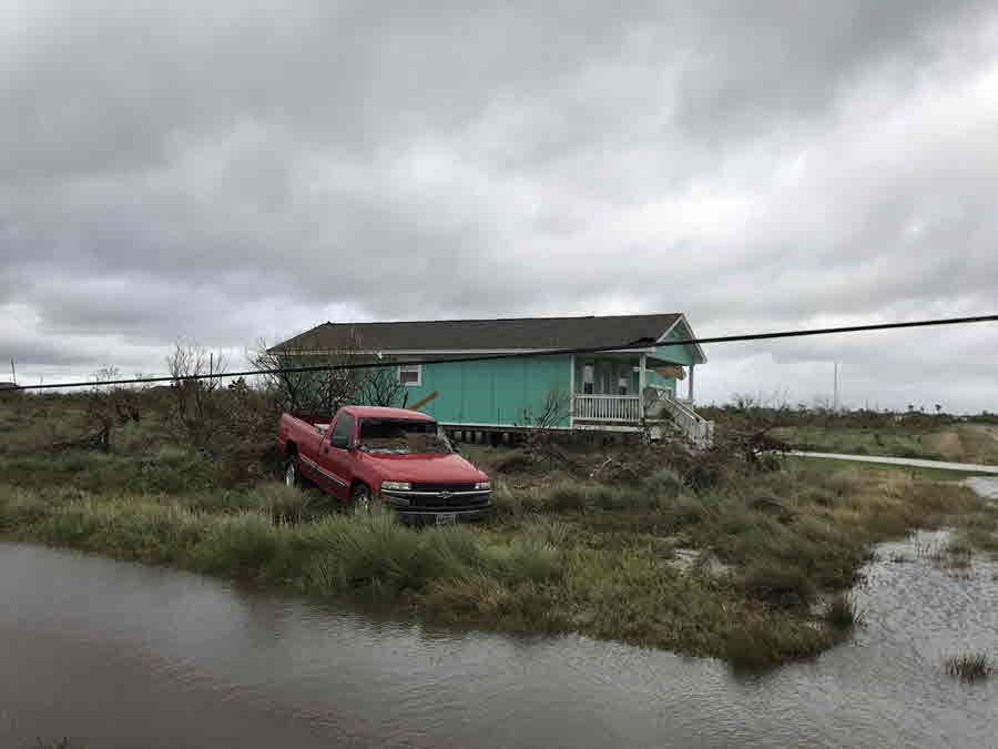
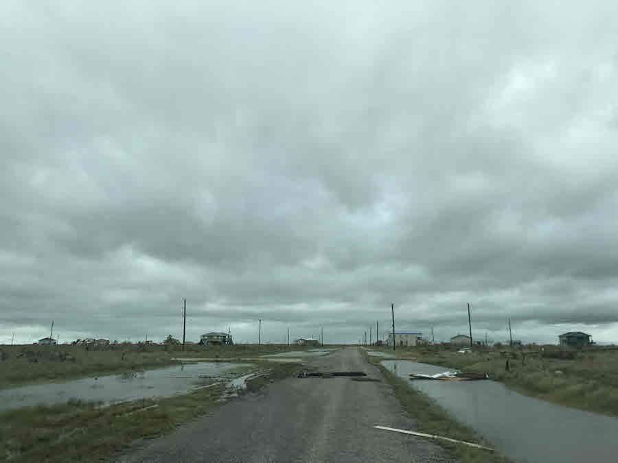
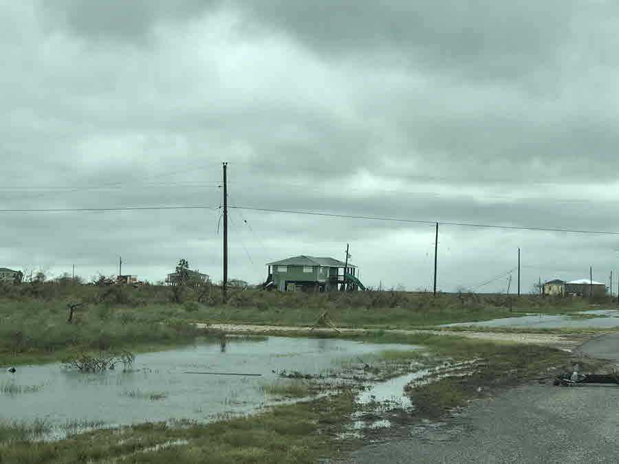
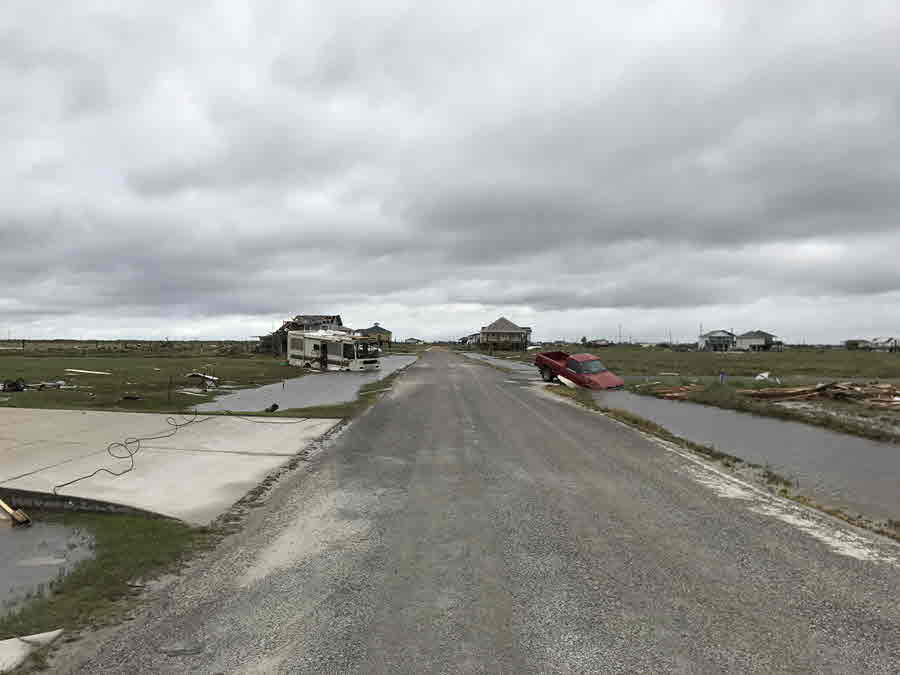
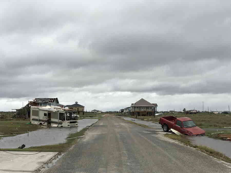
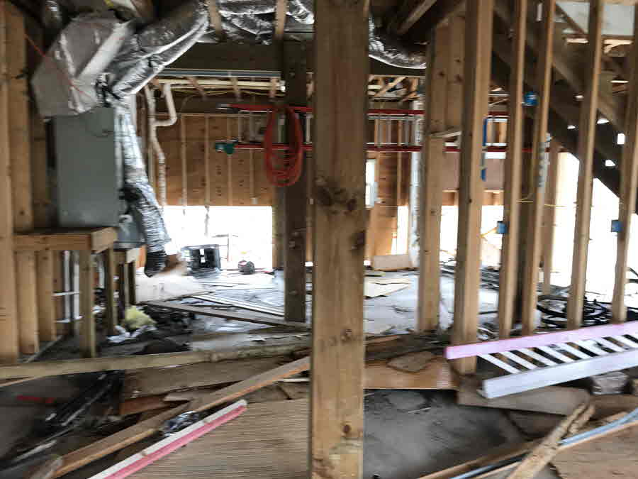
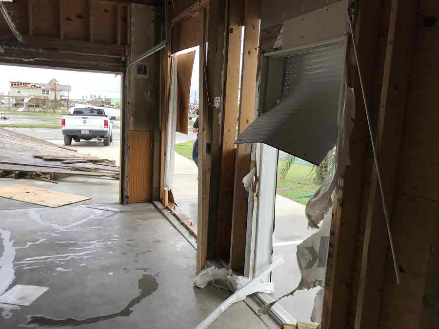
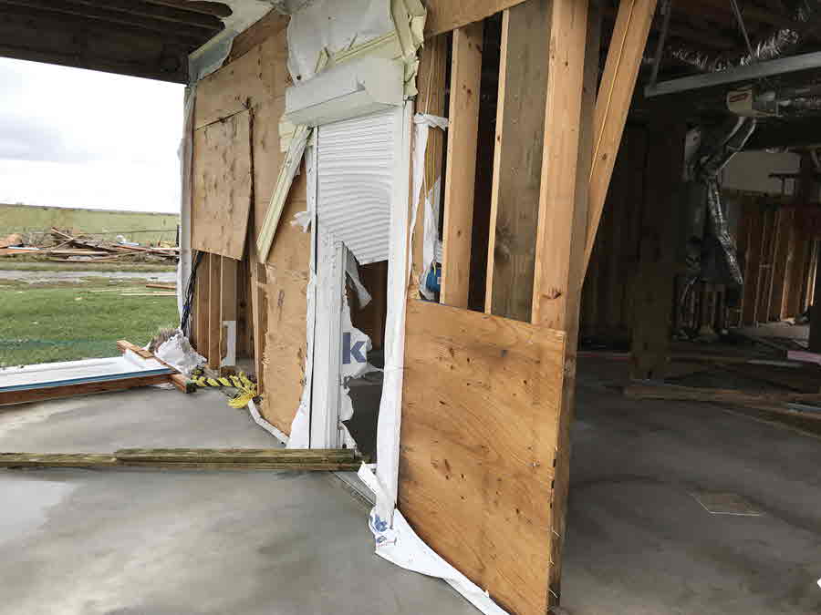
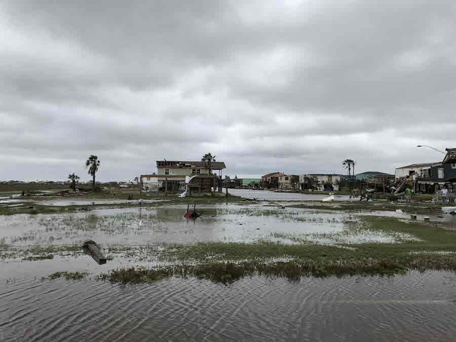
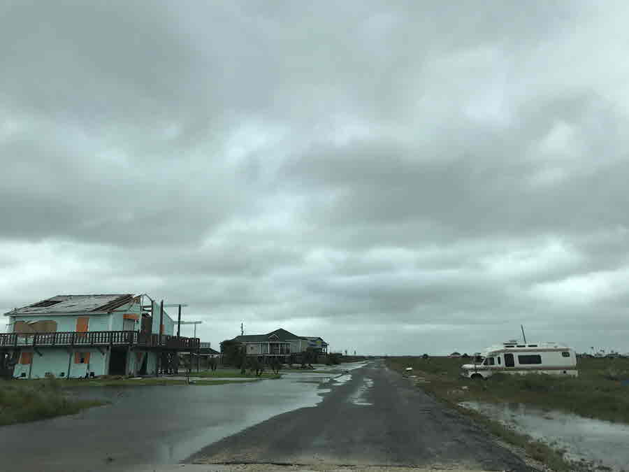
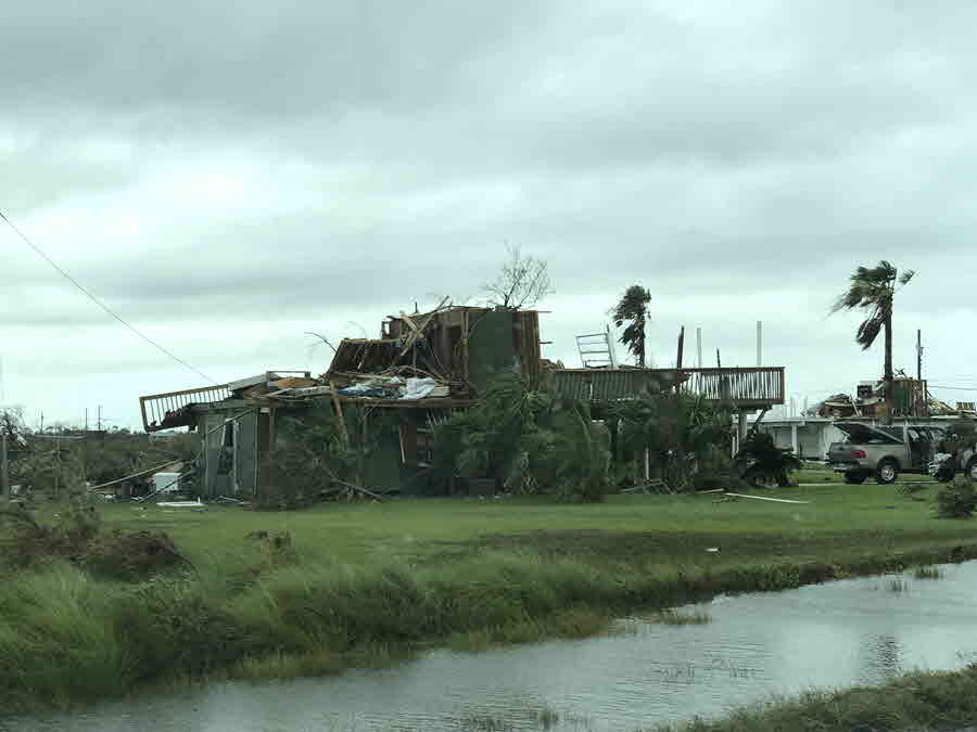
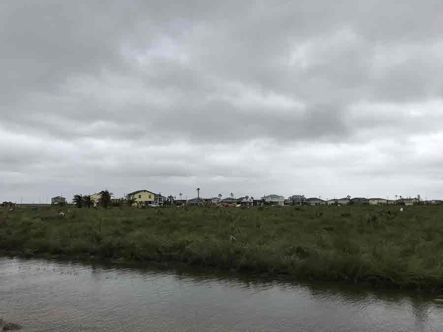
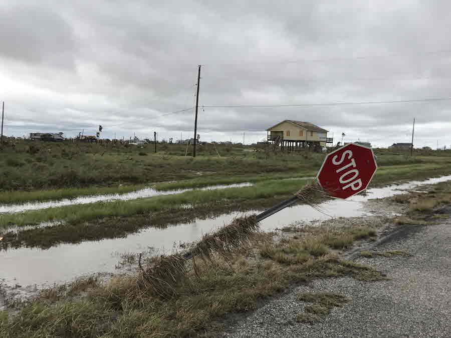
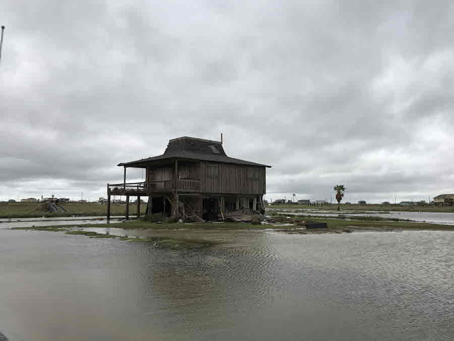
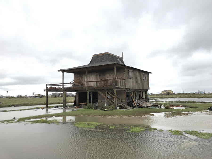
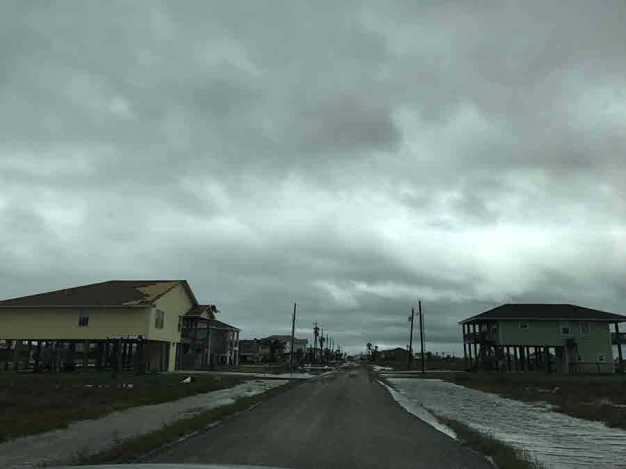
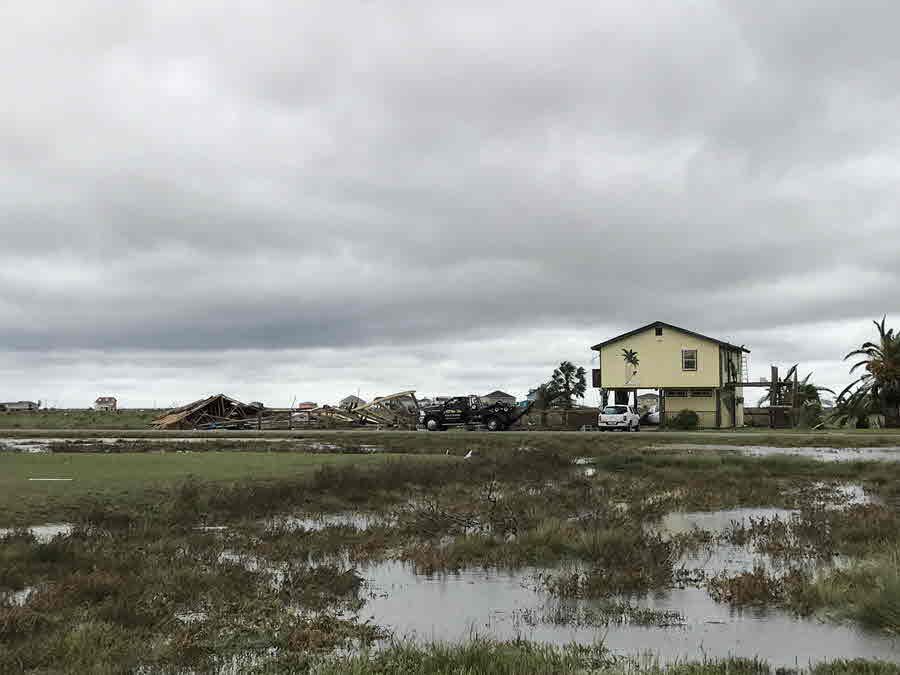
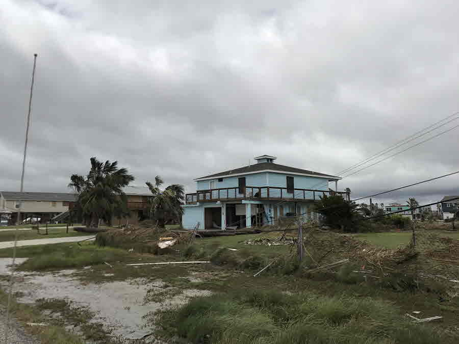
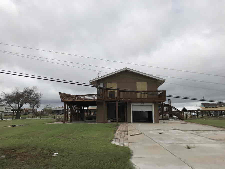
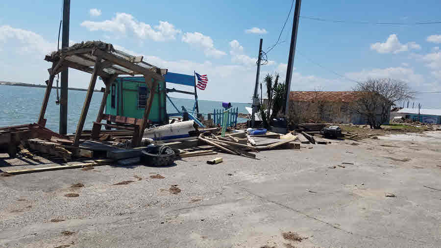
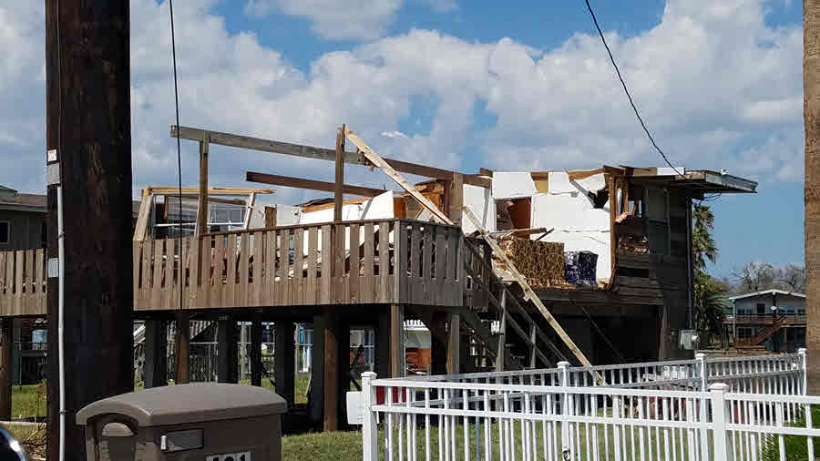
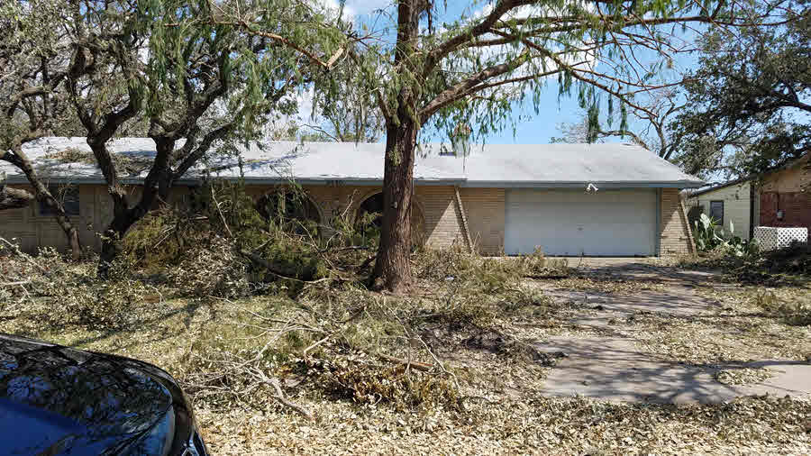
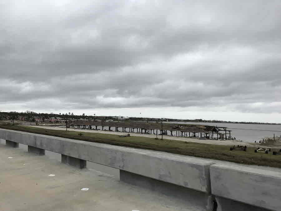
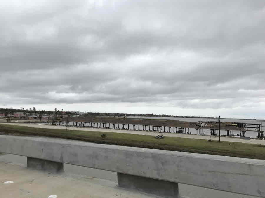
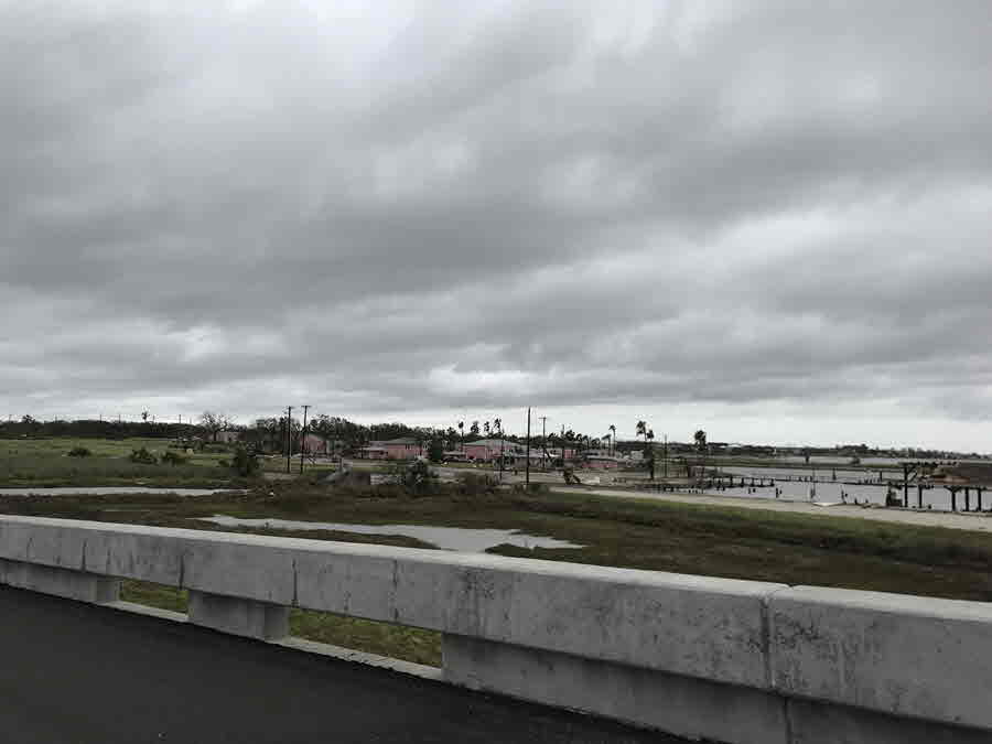
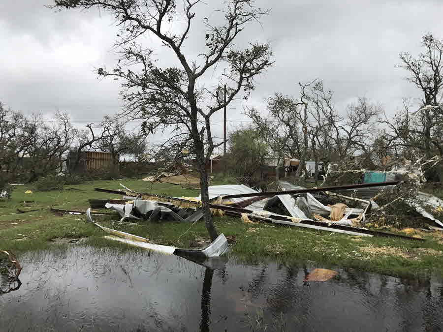
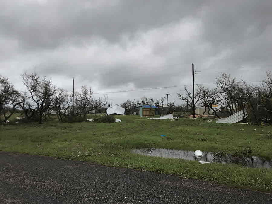
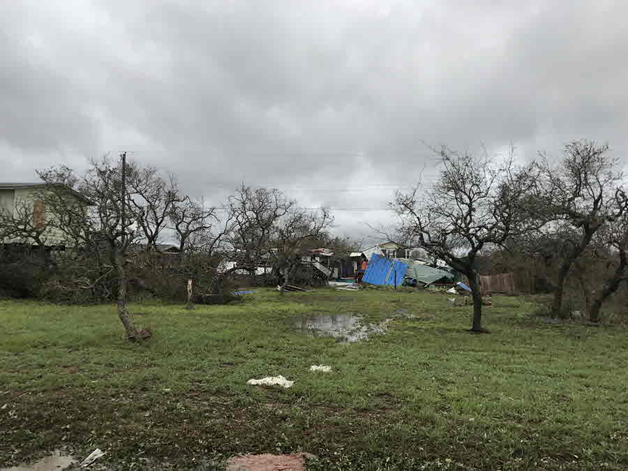
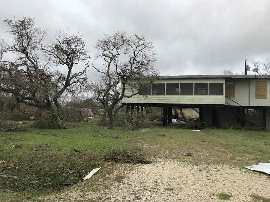
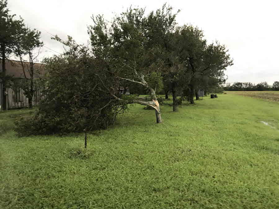
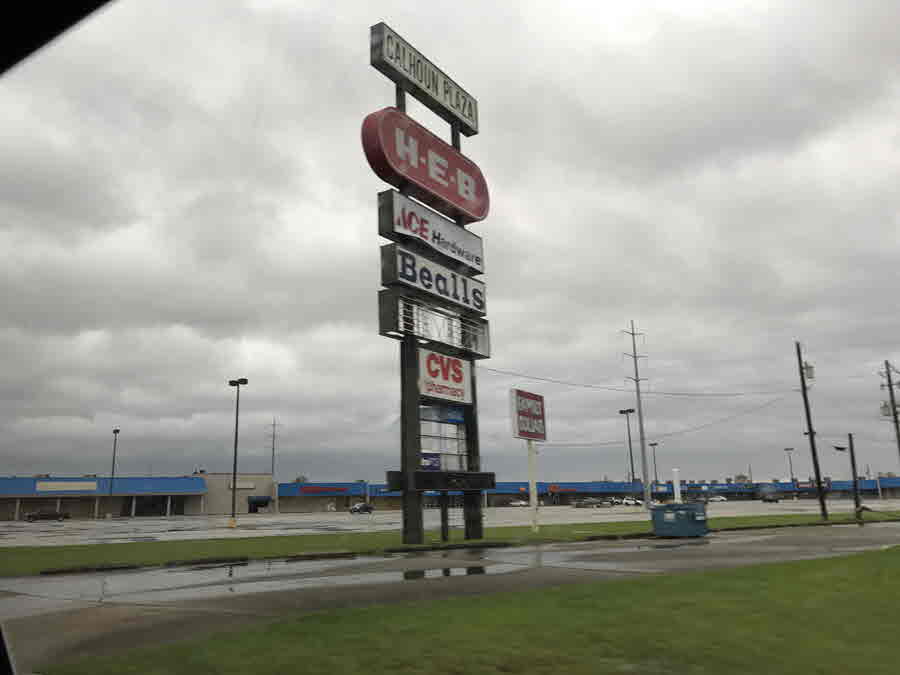
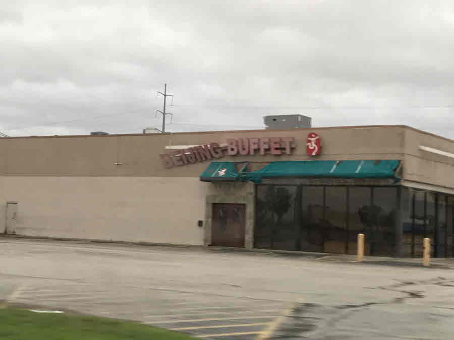
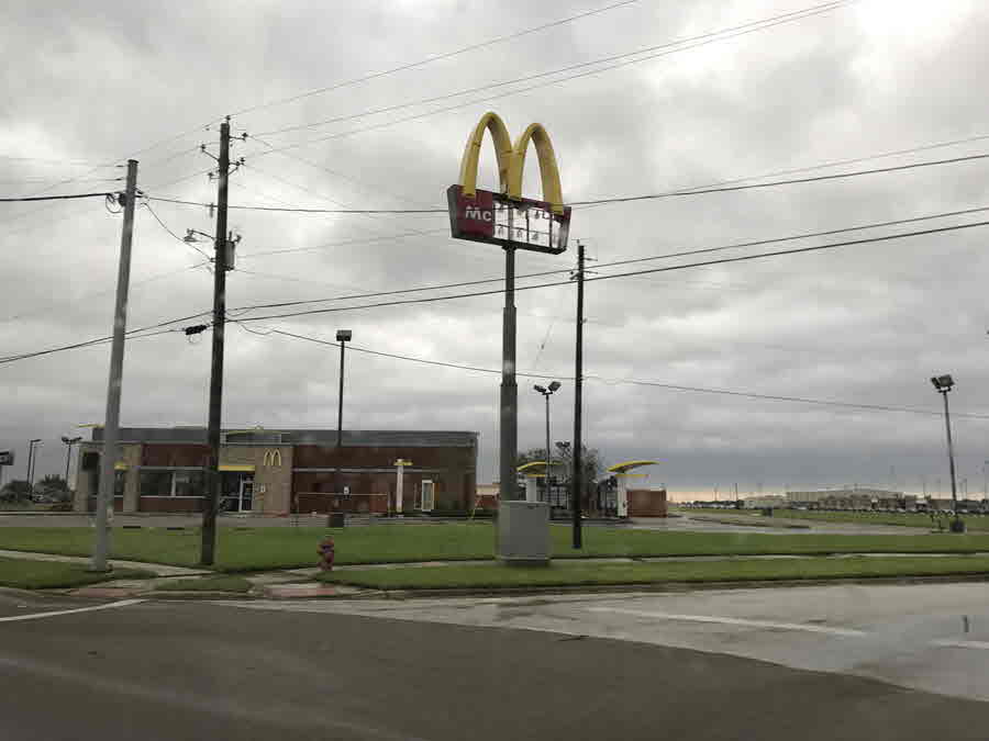
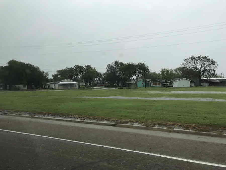
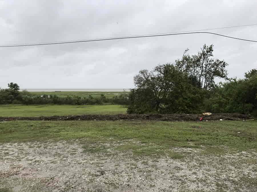
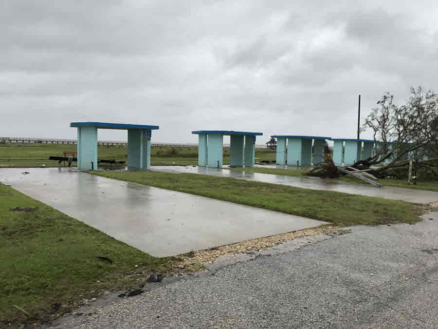
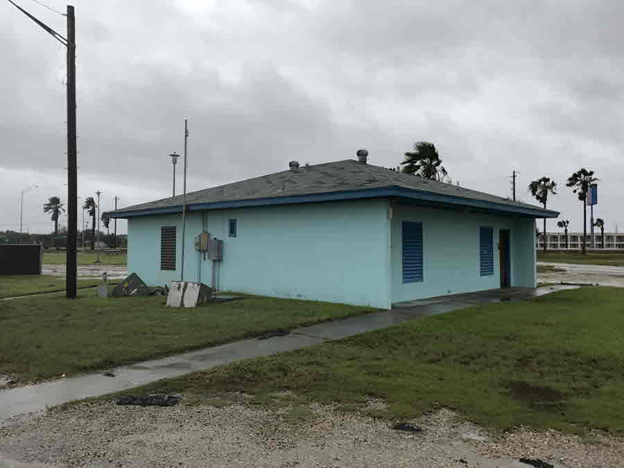
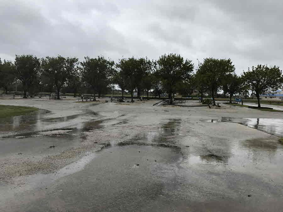
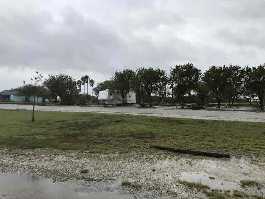
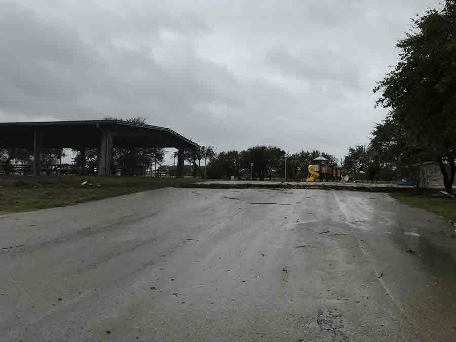
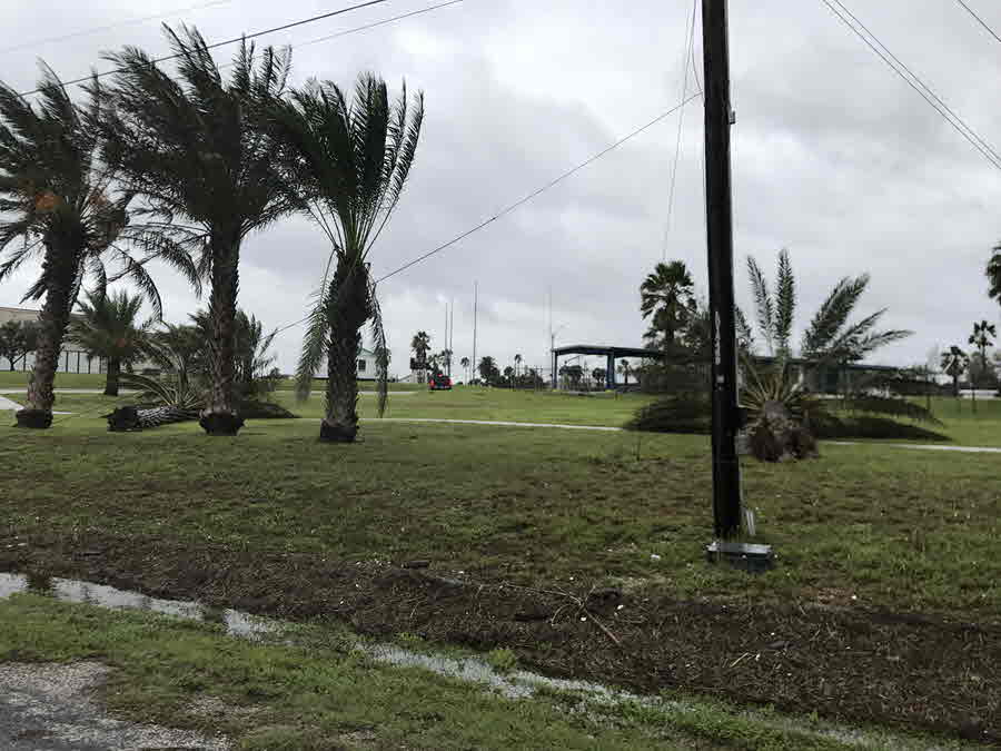
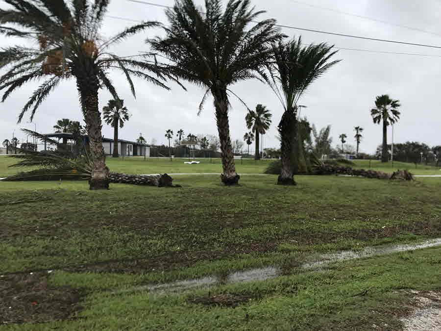
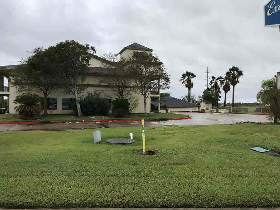
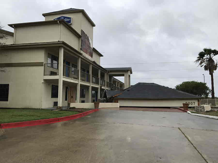
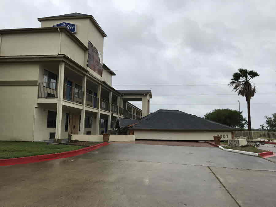
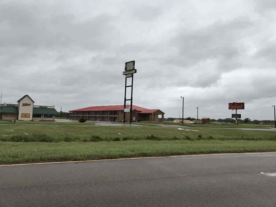
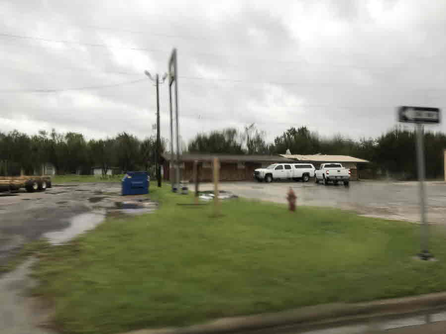
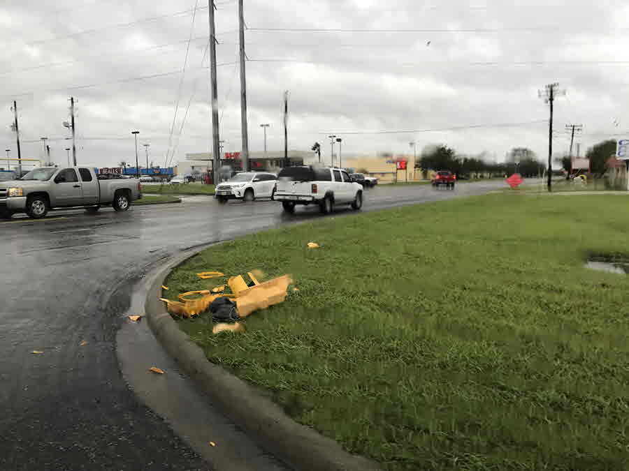
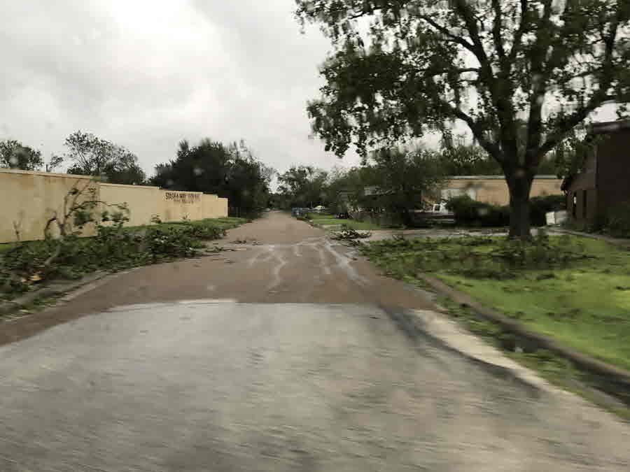
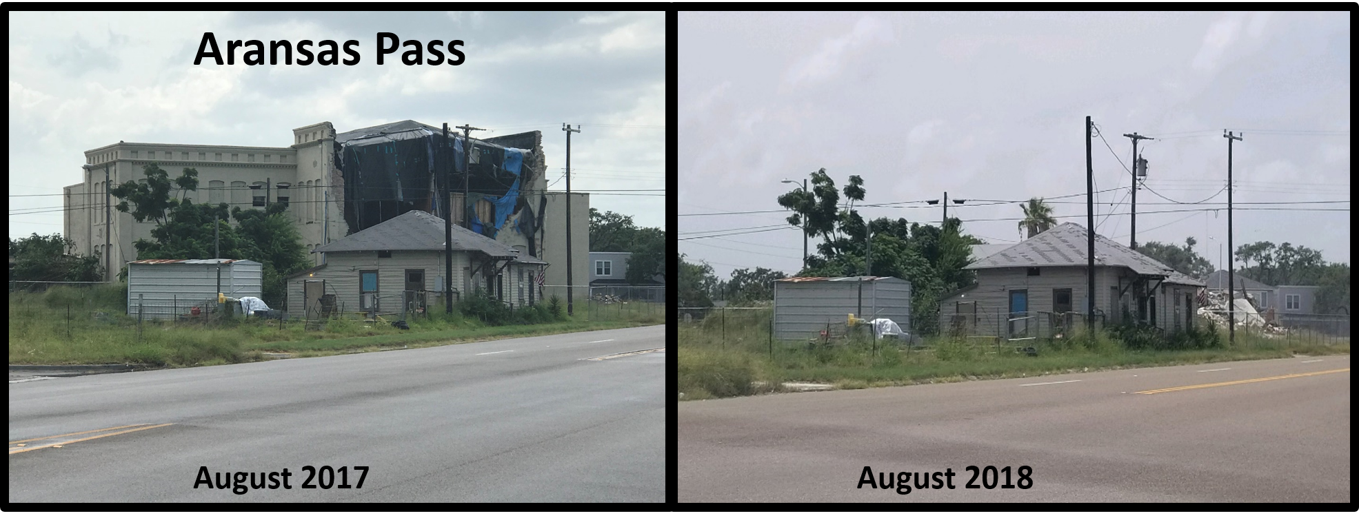
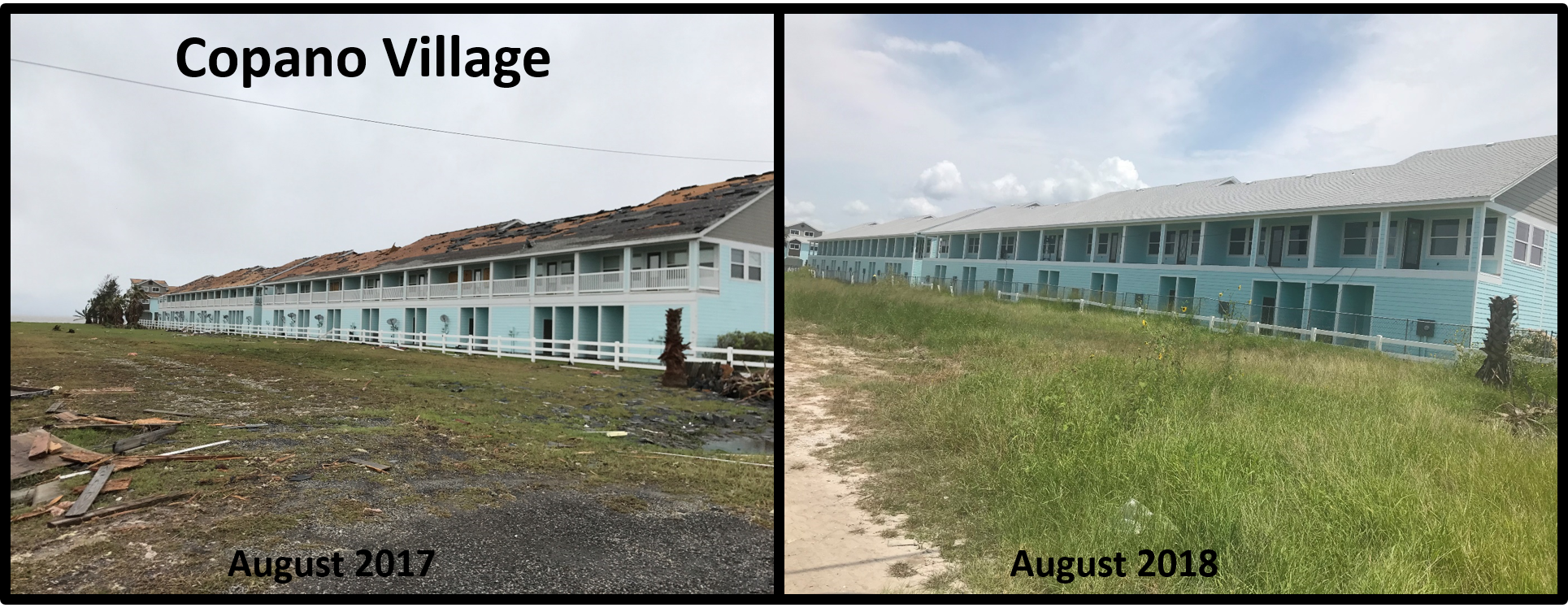
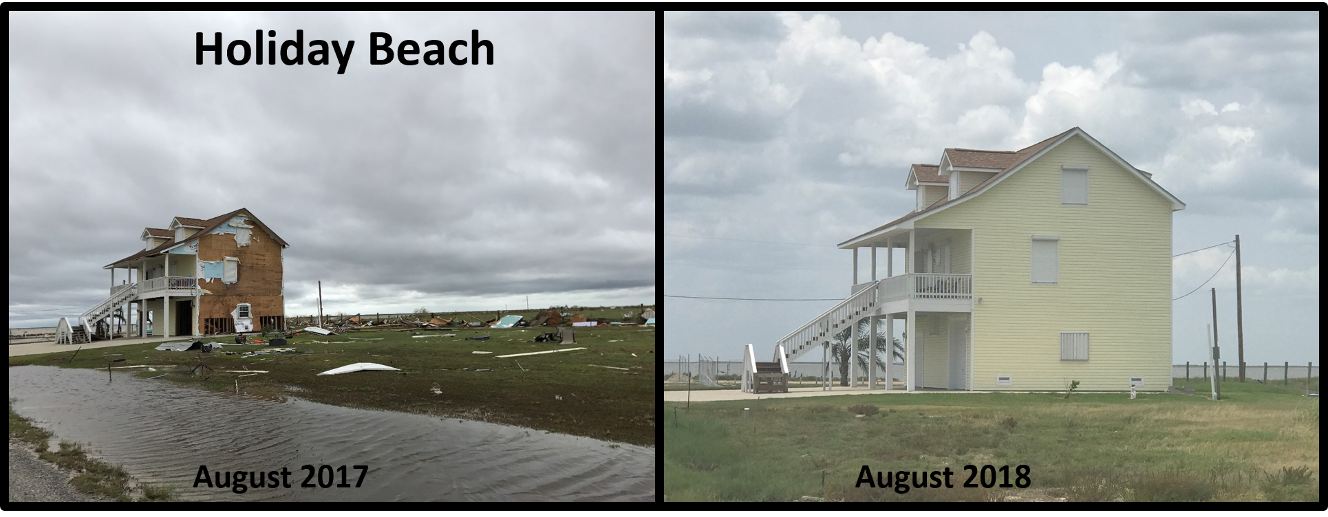
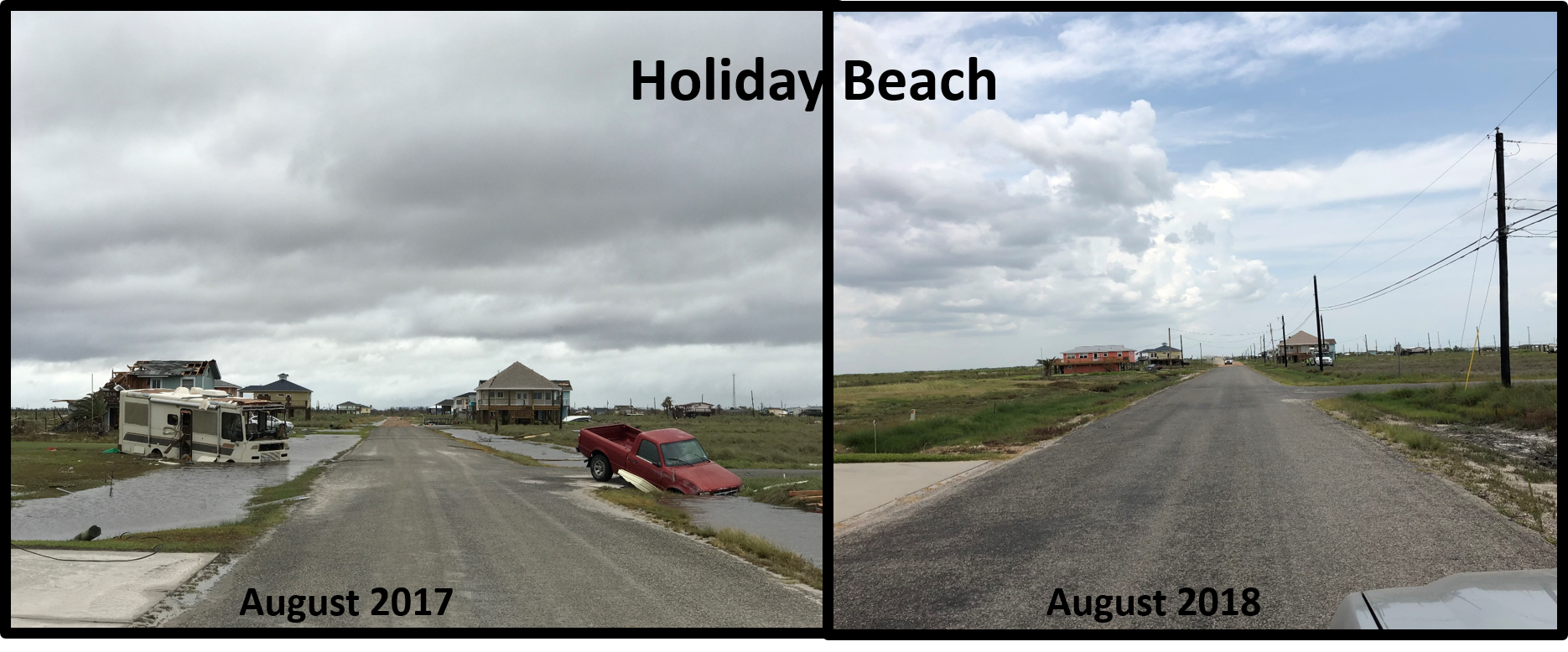
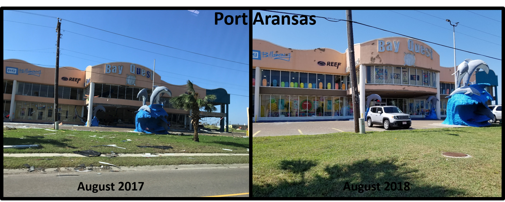
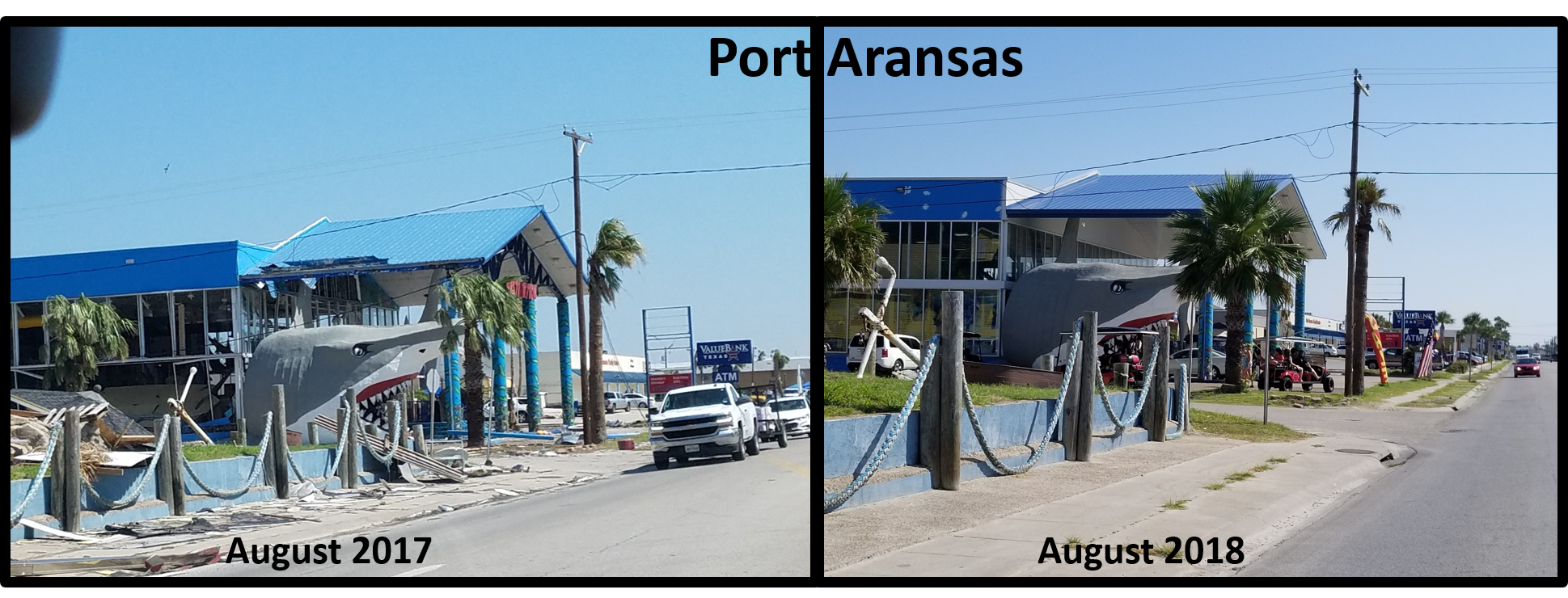
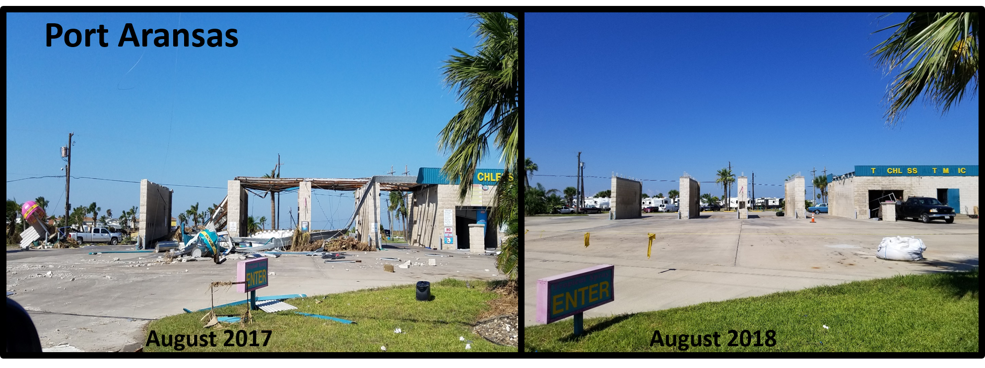
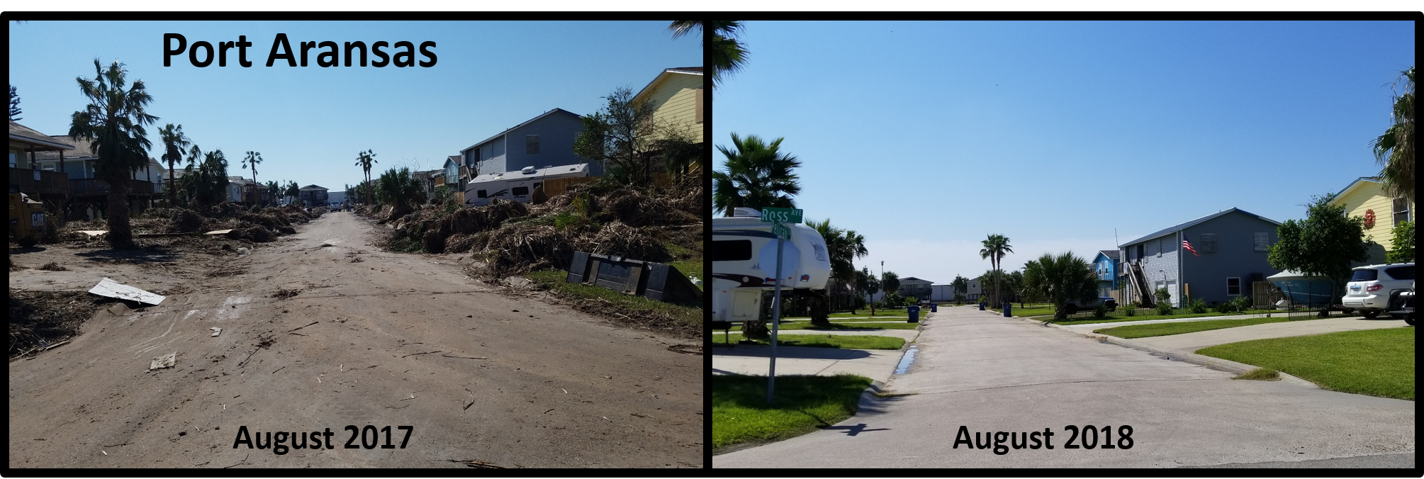
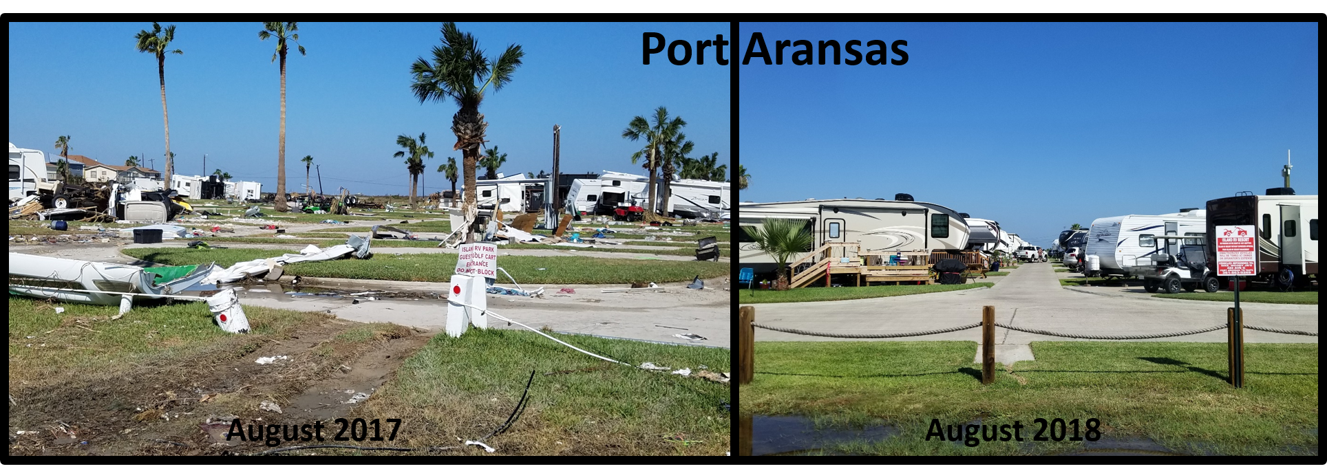
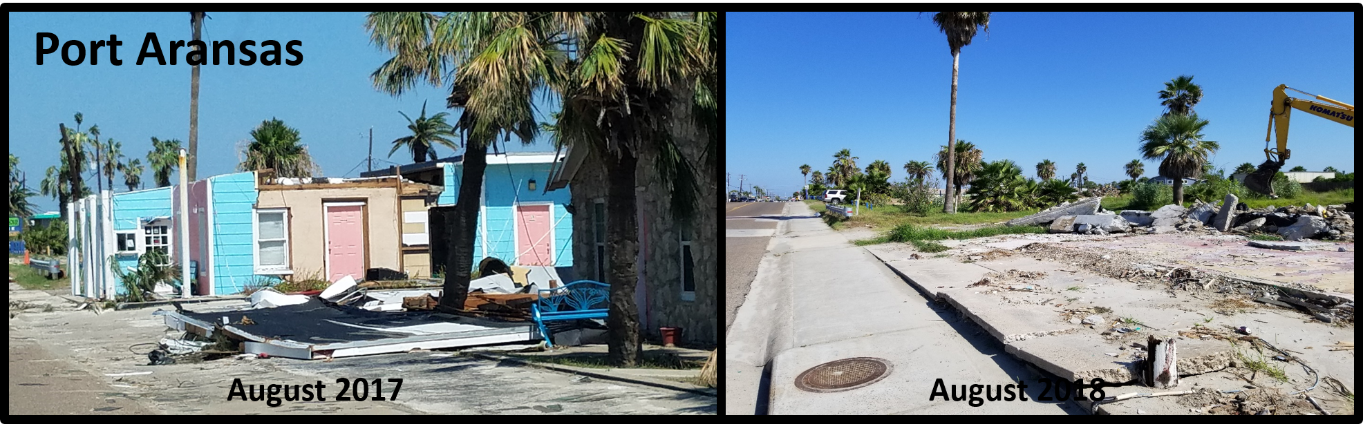
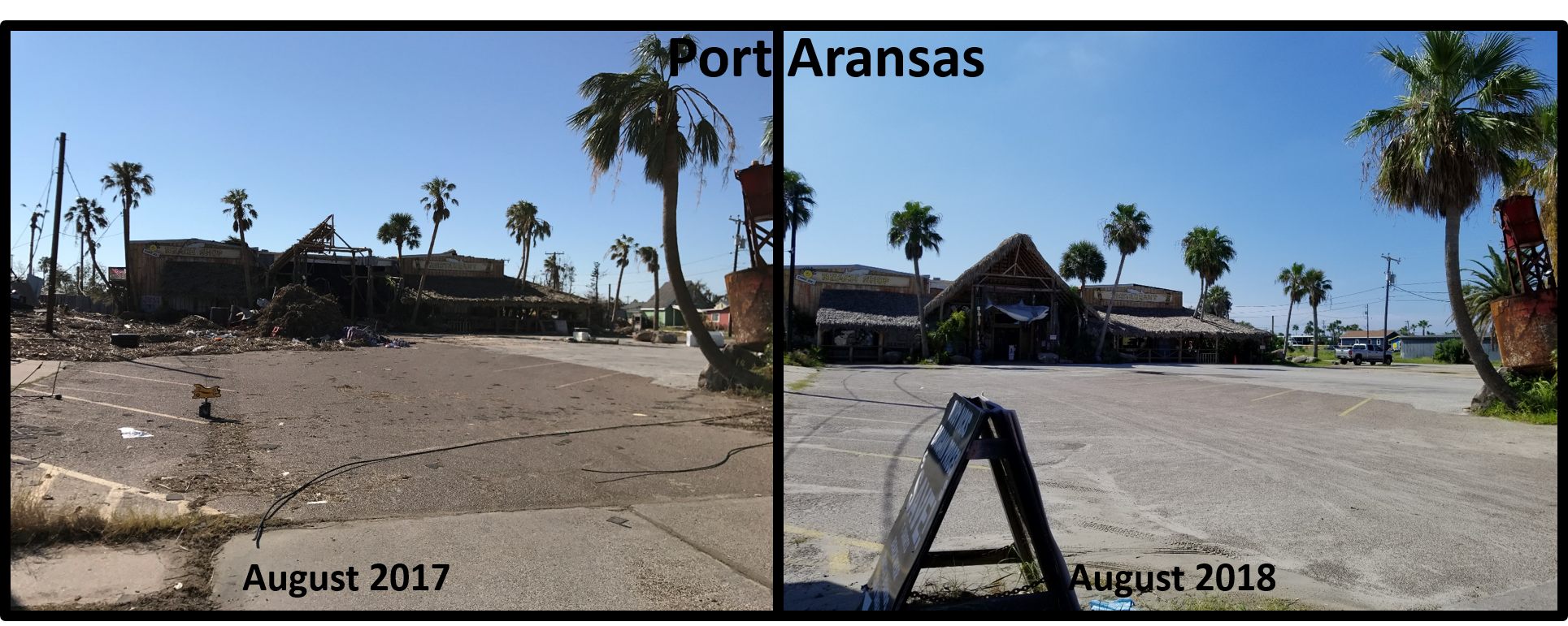
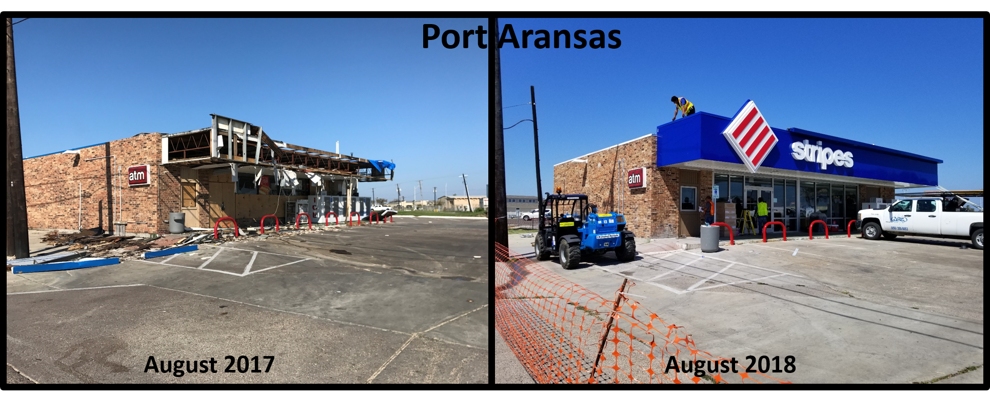
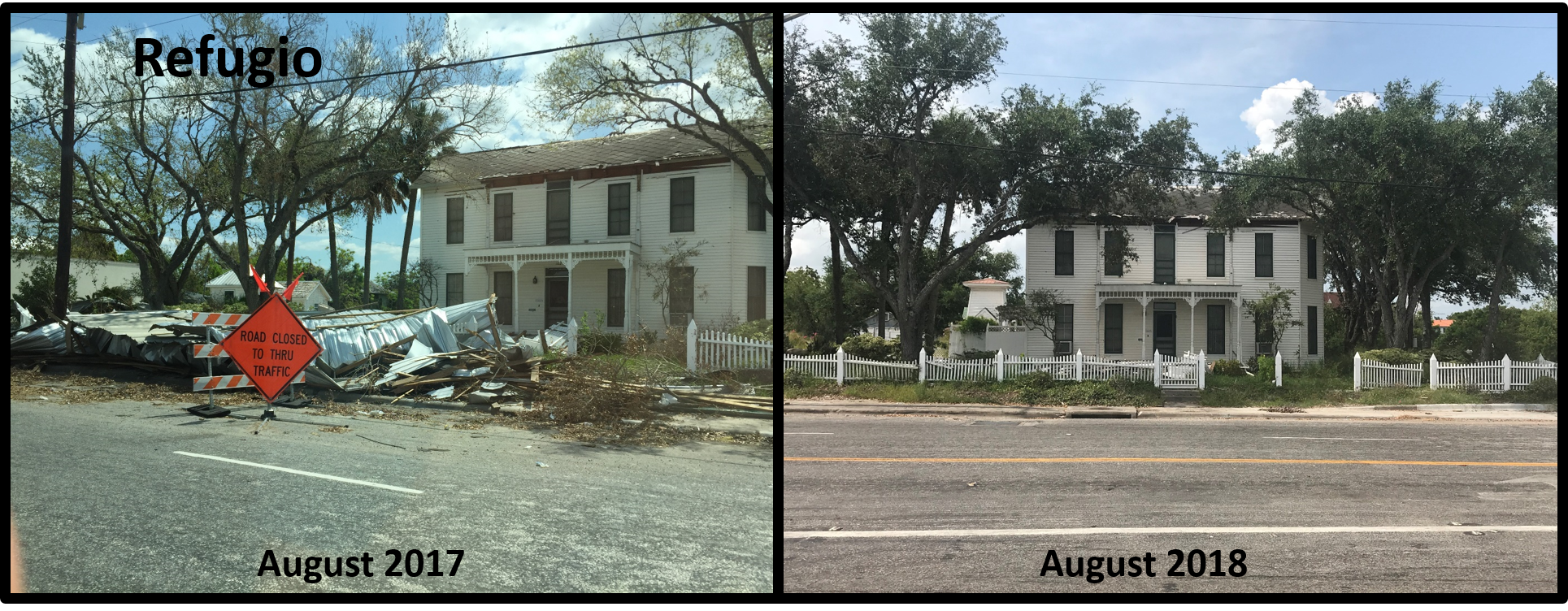
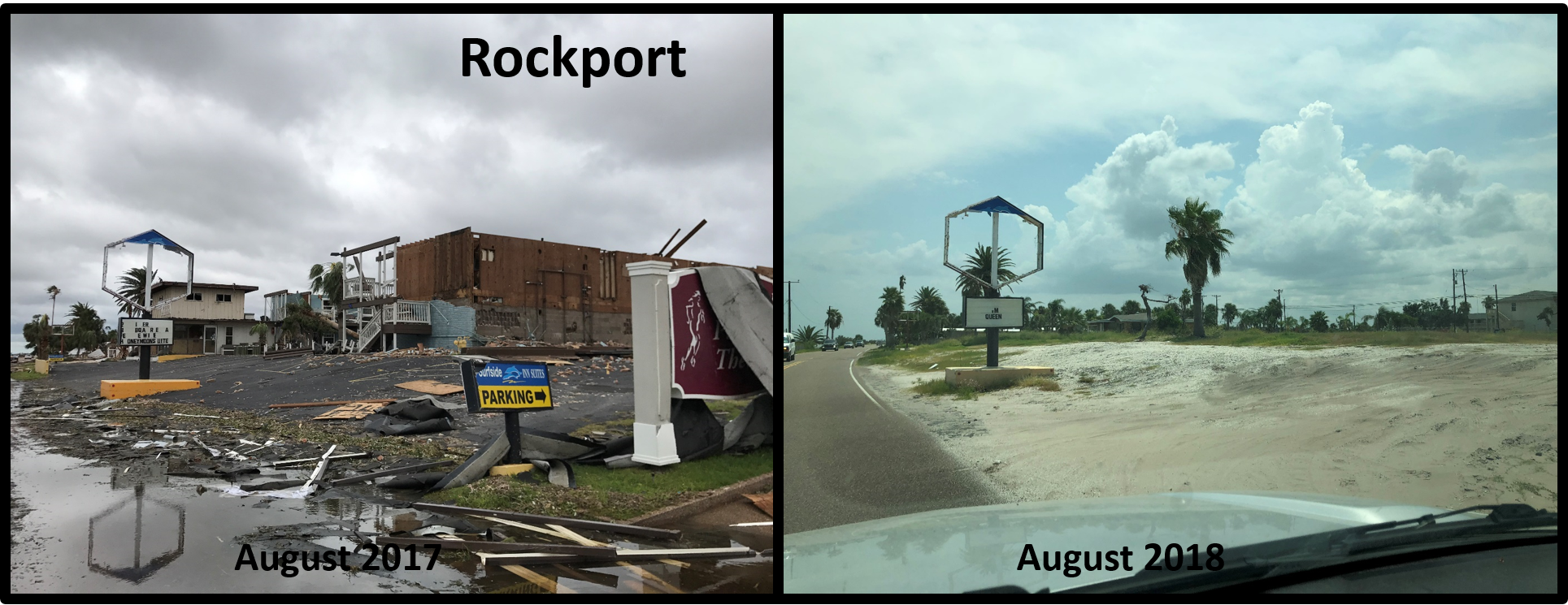
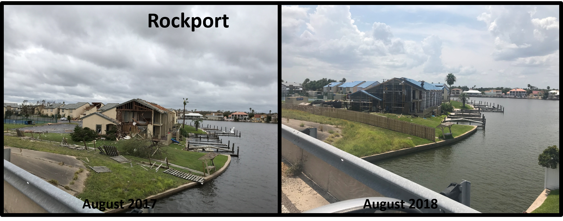
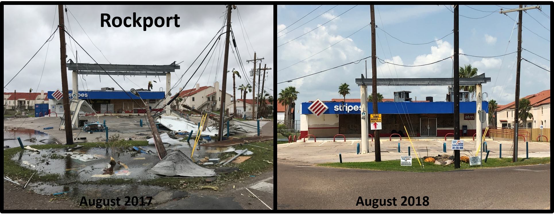
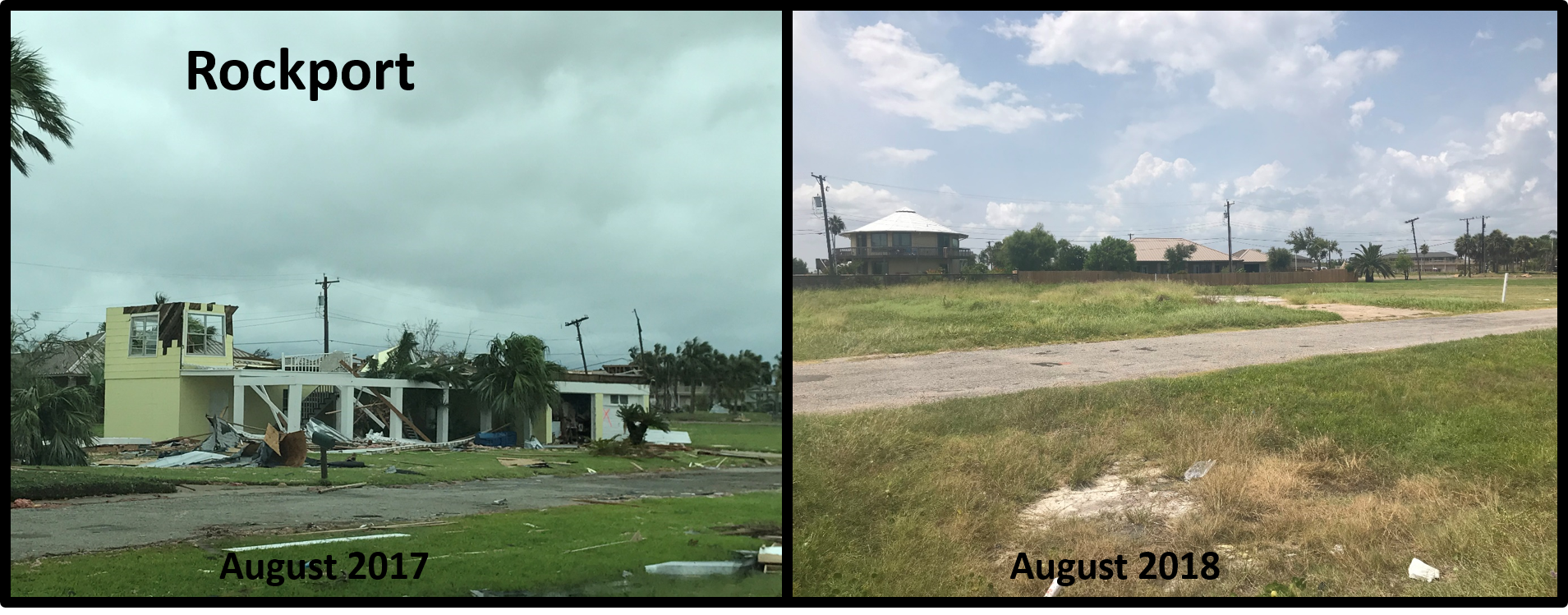
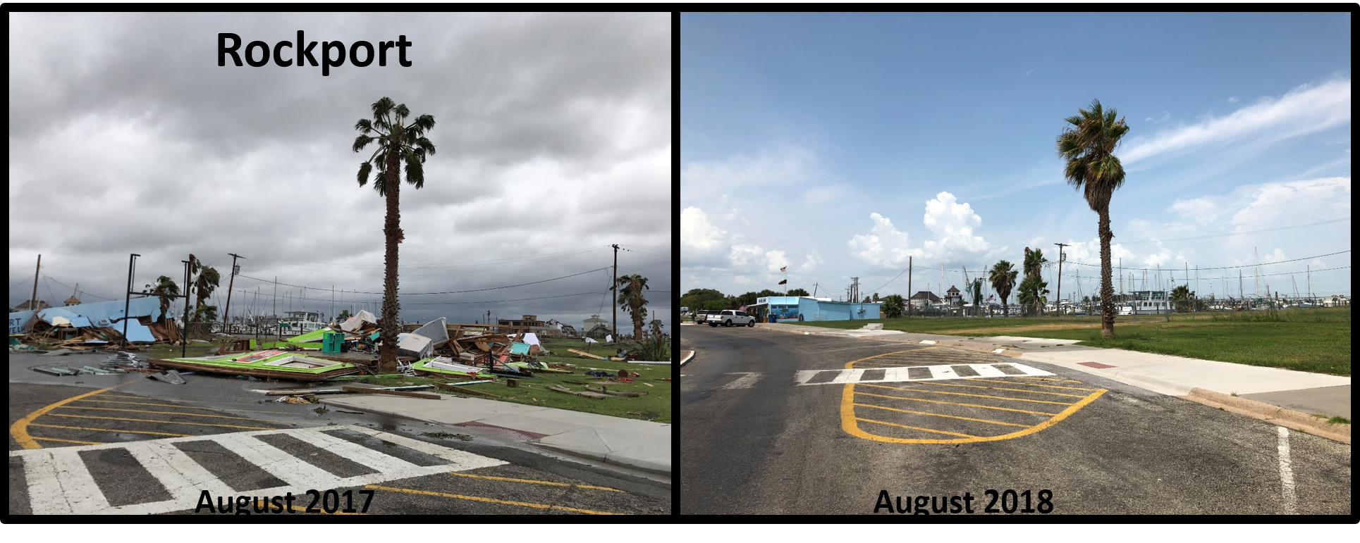
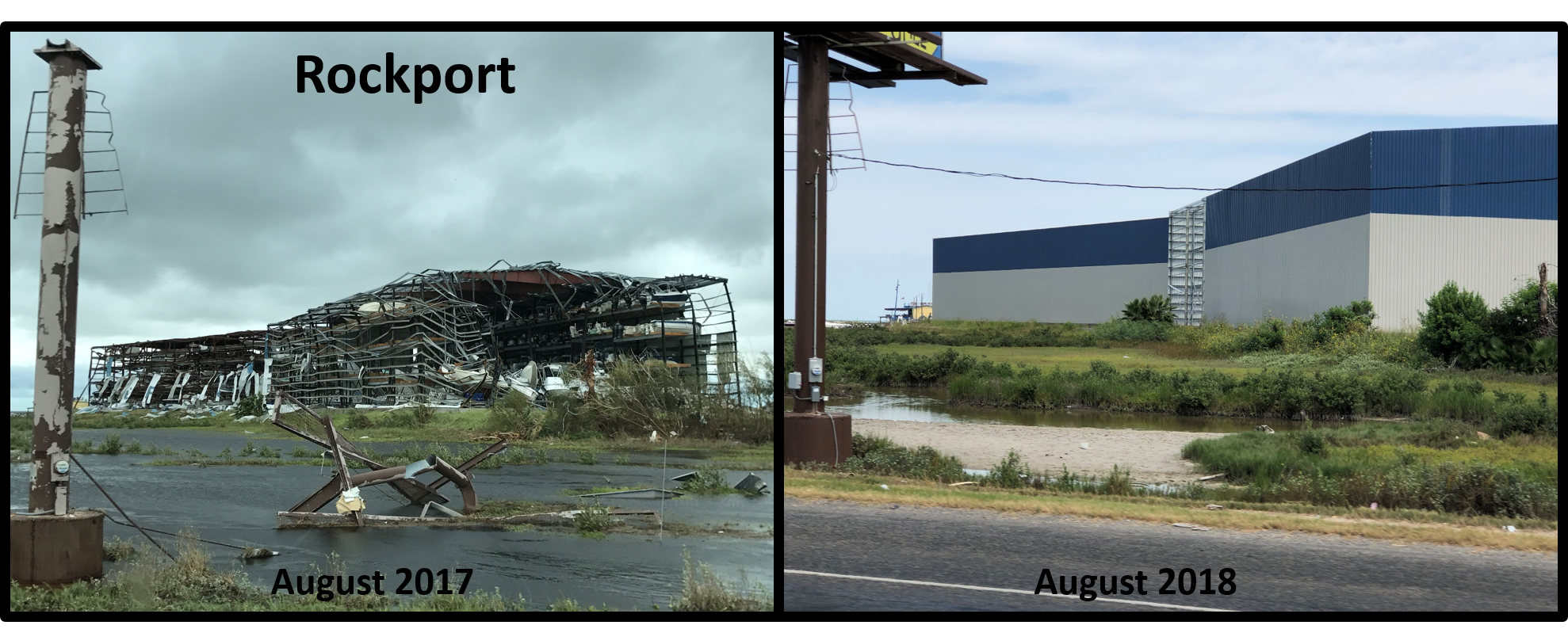
The communities of South Texas have made significant strides in recovering from Hurricane Harvey. The storm devastated many communities throughout the Coastal Bend and into the Victoria area. Below are photos taken days after the storm hit, and comparison photos taken approximately 1 year later, in August 2018. As can be seen, the recovery process is ongoing, but progress is being made. Recovery will continue for months - and possibly years - to come, and many families are still suffering today.
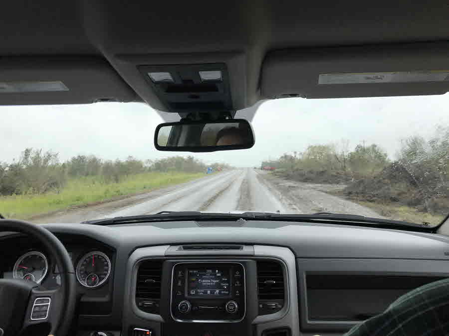
Residents across the Coastal Bend came together with the help of volunteers from across the state immediately after the storm ravaged the coastline. Countless crews from across the country arrived to help restore power, clear debris and aid in recovery efforts. Many schools and churches held donation drives across the area and residents were overwhelmed by the support and generosity. In addition to donating household items and food, South Texans went out in droves to the heavily damaged areas to assist in debris removal. They provided much needed help to those who lost most, if not all, of their homes and possessions.
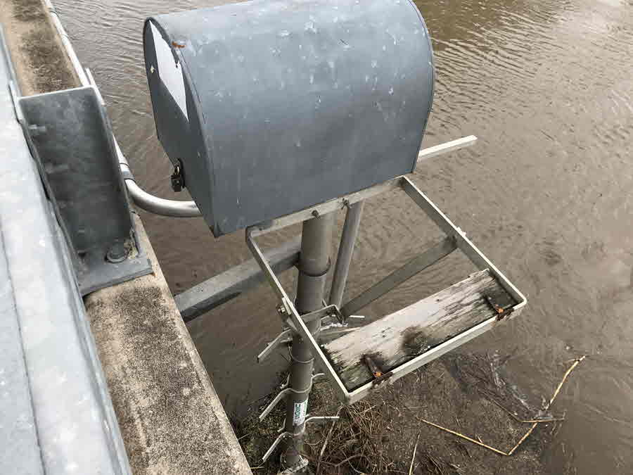
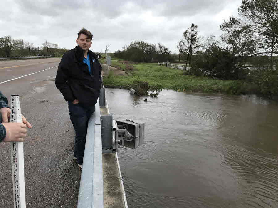
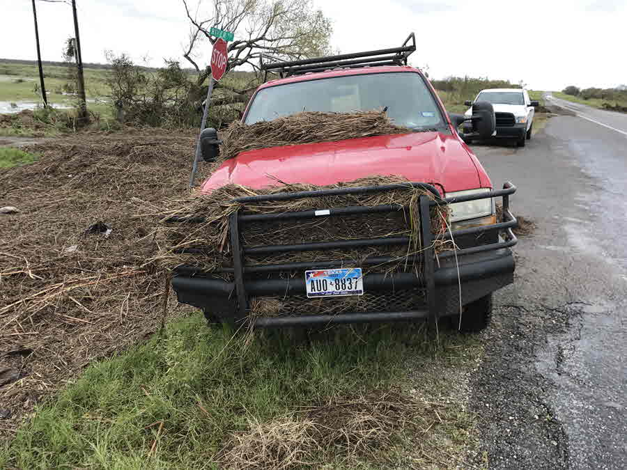
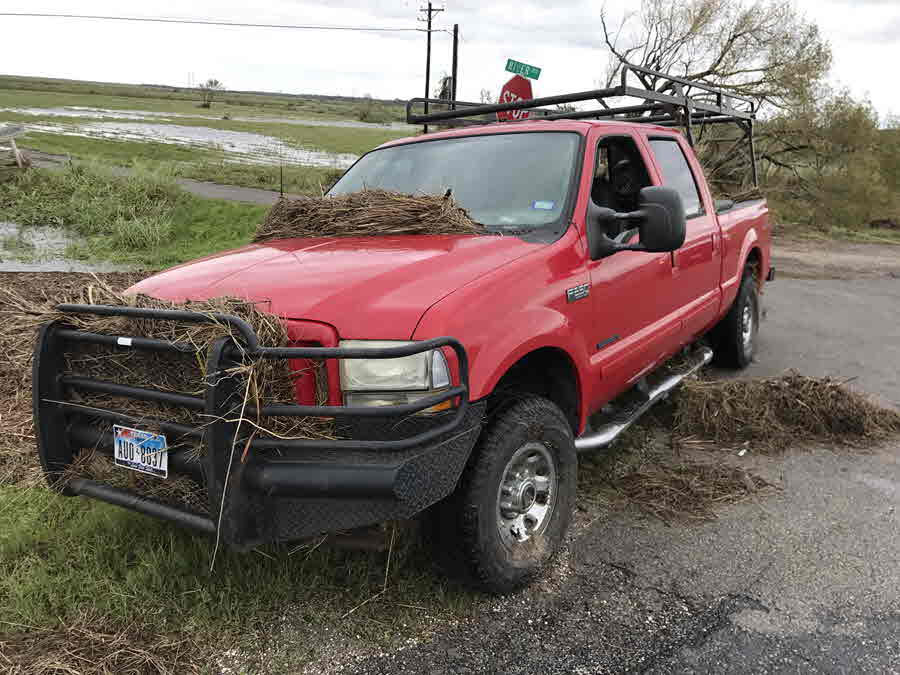
The massive rebuilding effort has not been easy. At times, severe weather across the region hindered the recovery effort in several locations. On March 28th, thunderstorms developed and tracked towards the coast, resulting in strong winds and several tornadoes. Homes that had been rebuilt and were nearing completion were heavily damaged yet again. The rebuilding effort was once again delayed when the Coastal Bend received 10-20 inches of rain during a 4 day period from June 18th through the 21st. Even after the setbacks, our communities are determined to regain a sense of normalcy and become stronger than ever.
Before and After Photos

 Follow us on YouTube