Google Maps is a popular tool that has existed for many decades, allowing us to view live satellite images of the world. It enables us to learn about or explore our local community. It also helps us navigate to different locations via detailed travel directions. You'll never worry about getting lost again when you pair Google Maps and GPS with one of the best Android phones. This guide discusses the various ways to view satellite imagery of Earth from your smartphone or desktop computer.
How are satellite images created?
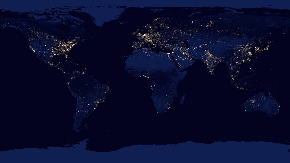
A satellite image is taken from hundreds of miles above our heads and can help track weather conditions or view the world around us. But, Earth is too large to capture all the details required for a single high-resolution image. So it's necessary to take hundreds of thousands of smaller photos, which can vary by date, time of day, and source material. Simply put, a satellite view of a map, for example, does not consist of a single image. Instead, these images are stitched together in a process called photogrammetry to create a seamless user experience.
Google Maps and Google Earth are the most well-known examples many of us turn to when we want to view satellite images online. It's common for satellites in space to take high-resolution photos, but that's not to say it's the only method to capture these images. In the case of Google Maps and Google Earth, they also tap into planes that fly over land while taking even higher-quality ground images. These aerial photos are used to create detailed maps and other unique features, such as 3D trees and buildings.
At the same time, Google only develops some images they use to create the Google Maps and Google Earth experience. It mentions that this data is a team effort consisting of various entities, including state agencies, geological survey organizations, and other commercial imagery providers. Google's combined effort with these third-party contributions makes Google Maps and Google Earth possible on such a large scale. It also states that these images are often taken at different times of day under various weather and lighting conditions. As such, this explains why you may notice some differences in certain situations.
Satellite image details and update frequency
Unlike photos from a smartphone camera, typically defined by megapixels (MP), satellite images are measured in centimeters (cm) or meters (m). Because Earth is so large, each pixel must be represented in larger chunks of land coverage since megapixels are limited by scope. Say you have a service that offers 30 cm spatial resolution satellite images. This means every pixel covers a 30 cm by 30 cm square of land. And the lower the cm count of a satellite image, the higher the resolution you get, giving you an even cleaner result.
Depending on the type of satellite image service, some only offer lower-resolution images using meters instead of centimeters. Since meters are much larger than centimeters, you can expect these images to be less detailed, especially regarding buildings or landmarks. To get the best possible satellite image experience, look for a service that uses centimeters for its spatial resolution. Many free services offer satellite image quality in meters, while the premium paid services provide higher resolution options in centimeters. We cover a variety of choices a little later on.
Public satellite image services may be limited to a maximum spatial resolution of 26 cm to 30 cm, which is plenty for personal use. Commercial services go beyond that, with many offering 15 cm and up for the highest resolution sensors. The update frequency for these satellite images can vary depending on their original source. Public and commercial services update their imagery database once every few days, but it differs from company to company. Visit their website and look for an FAQ section to see how frequently they update their satellite images.
Using higher-resolution satellite images
Since centimeters provide the best quality and details for satellite imagery, why don't we use the highest resolution for every situation possible? One technicality holds us back. Equipping and deploying each satellite with robust high-resolution sensors is expensive. Aside from that, the higher the resolution, the overall file size of the images increases. Maintaining and updating large satellite image files would be a monumental task, but it wouldn't be impossible. As this technology advances, we will likely see even higher-resolution images from public and commercial satellite image services.
Is it possible to view real-time satellite video?
You'll find online webcams that show a worldwide real-time view. Those cameras are static. They're grounded and bound to a single location. They allow us to watch various locations across any part of the world from the comfort of our homes at any time of the day or night. However, this concept doesn't work with satellites since they don't specialize in livestreaming videos. Webcams are specifically designed to stream video, but a satellite's primary purpose is to capture high-definition images. Without mounting an external camera, satellites don't possess the necessary features to livestream video.
To complicate the situation, we would likely need thousands of active low-orbit satellites working together to produce anything usable to the consumer. The high cost of deployment, additional equipment weight, and significant network bandwidth required to keep everything online 24 hours a day are demanding roadblocks. Although SpaceX is working on deploying thousands of satellites for its Starlink internet service, it lacks the necessary external camera system. SpaceX has no interest in creating a network of livestreaming video satellites for now, but time will tell as technology advances.
Weather events and resource management
Some of us might enjoy browsing satellite maps to check out the world around us, but there's more to it. By leveraging satellite data and high-wattage radar systems, we can track and display real-time weather statistics on an interactive map with different layers. This technology allows us to better prepare for natural disasters like hurricanes or the recent cold snaps seen across parts of the U.S. Regardless of whether you tune into your local TV news station or use your favorite smartphone app, the weather is one of the best uses for satellite technology.
As hurricanes have continued to ramp up due to various climate changes, how we track them also improves with time. The National Oceanic and Atmospheric Administration (NOAA) is a dedicated government agency that provides daily weather forecasts and near real-time information on weather events. If you live in an area prone to hurricanes, you've heard your local TV news metrologist give updates from the NOAA's National Hurricane Center (NHC) as their official source. These technologies are used to save lives and inform us before a storm approaches land, often over a week in advance.
To keep track of other severe weather events, such as earthquakes, landslides, and wildfires, the U.S. Geological Survey (USGS) allows us to view real-time satellite imagery of current conditions. In partnership with NASA, there's a program known as Landsat Missions, special Earth Observation satellites. They are responsible for collecting constant high-quality land surface images of Earth to track and better understand global resource management. This information allows land managers and local leaders to make more informed, helpful environment-related decisions. As of 2021, Landsat 9 continues to provide us with datasets that have proven very useful today.
Free sources for raw satellite images
All the free options below offer different spatial resolutions for satellite or aerial imagery, depending on its use case.
Sentinel-2
According to the official website, the European Space Agency (ESA) operates missions under Sentinel-2, which consists of two polar-orbiting satellites. They track the Earth's surface for changes, including climate change and land monitoring. You can locate the satellite data via their Copernicus Open Access Hub. The highest spatial resolution they offer goes up to 10 meters. Downloading the raw data offline or from the cloud via their official website is also available.
Landsat 8 and 9
As mentioned earlier, USGS and NASA created a partnership for the unique Landsat missions. Landsat 9 is the newest, but it also offers raw data you can view from the older Landsat 8. Located on the official Landsat Data Access website, you can download this information offline or use cloud-based services. They offer a spatial image resolution of up to 15 meters, but 30 meters is the most common for each use case.
MODIS
MODIS is short for Moderate Resolution Imaging Spectroradiometer and is owned and operated by NASA. It offers a detailed view of weather events worldwide, including climate change and cloud cover. The highest spatial resolution is 250 meters, more than enough to track these weather events. You can download the raw data from their official website using the Level-1 and Atmosphere Archive & Distribution System.
OpenAerialMap
An open source collection of aerial imagery, OpenAerialMap allows anyone to upload and contribute to the database as a professional. Once you interact with the OpenAerialMap viewer, you can find a source file that interests you. From there, you can download its raw data instantly. Since this is a community-led effort, the spatial resolution varies, but it can sometimes go up to 1 cm. New sources are constantly added to the database for you to check out.
NAIP
The National Agriculture Imagery Program (NAIP) is headed by the United States Department of Agriculture (USDA) under the Farm Service Agency (FSA). The NAIP uses aerial imagery to offer insights during peak agriculture season, helping federal farm programs and general education about land changes. They provide a 1-meter spatial resolution for satellite images but may also use centimeters for other use cases. You can visit the official Geospatial Data Gateway to download the raw data.
Paid sources for raw satellite images
All the paid options below offer at least a 1-meter spatial resolution for satellite or aerial imagery.
Maxar Imagery Mosaics
The most comprehensive commercial satellite imagery provider, Maxar Imagery Mosaics, offers high-resolution, virtually seamless images, as the official website states. It creates imagery basemaps with unrivaled accuracy to provide the best experience possible. Used to monitor borders, plan future expansion for land development, or track land changes across the globe, Maxar is perfect for anyone looking for robust satellite image tools. You can learn how to download the raw data offline through their official Imagery Download website.
Airbus OneAtlas
Airbus OneAtlas is another massive commercial-based satellite imagery provider offering high-resolution basemaps to view and download. From 3D textured models and radar tasking to viewing multi-resolution images via the Living Library archive, Airbus OneAtlas has everything you need. You can even request a specific day to communicate with the satellites to create a custom dataset tailored to your needs. You can learn how to download the raw data from the official OneAtlas Data Download Service website.
Hexagon Geospatial
Hexagon Geospatial provides high-resolution aerial images taken by aircraft during the best weather conditions. This allows it to get the cleanest and highest quality data possible for aerial satellite imagery. Since aircraft are closer to the ground than satellites, you can expect highly detailed images with even greater accuracy. It also takes 45-degree shots to reveal more structural and building details. You can learn how to download the data and software from their official Customer License Portal.
Vexcel Imaging
With Vexcel Imaging, you can access high-resolution satellite imagery that can be used to track natural disaster responses, different building or land attributes, and smart city planning with 3D modeling. It's also possible to accurately measure a roof's surface area to get a repair estimate from anywhere in the world. Everything is cloud-based and powered by UltraCam technology, allowing for easy future expansion of the Vexcel service. Check out the Vexcel Data Program to access more specific data. The official website says it's "the world's largest aerial imagery and geospatial data program."
EagleView
EagleView is an aerial imagery provider offering high-resolution satellite images for various use cases. It can be used for construction purposes or building planning, big government design decisions, and can help insurance companies make property claim estimates from anywhere globally. On top of that, you can get accurate roofing measurements via satellite images for easy solar panel installation on any property. More features are available than the few mentioned, making EagleView a one-stop shop for all your aerial imagery needs. You can get started by visiting their official Place an Order website.
Nearmap Orthographics
Another big player in the aerial image provider game, Nearmap Orthographics, provides much higher-quality images than traditional satellite images. As it put its, businesses and government officials can "conduct virtual site visits" using Nearmap 3D city models without leaving the office. Since Nearmap is a cloud-based platform, it integrates everything you need via a web browsing experience. You also have the option to bring the data into another imaging or CAD platform as you see fit for offline use. To get started with Nearmap Orthographics, you can get a quote today.
Satellite map services for personal use
The above sections covered some great examples of free and paid services for accessing raw data and commercial uses. But now it's time to highlight some public map services that the average consumer can use for personal purposes.​​​​​​
Google Maps

Google Maps combines satellite imagery with other features to create one of the best mapping experiences in the business. You can zoom in on highly detailed satellite maps for navigating the world and use the Explore feature to find new places to visit. Street View offers an up-close experience and an aerial view option to get a better lay of the land. Live View is also helpful, which overlays an interactive map with walking directions on your smartphone using augmented reality. There's something for everyone here, so it's easy to recommend Google Maps.
Google Earth

Google Earth offers many of the same features as Google Maps but with one key difference: The emphasis is on the globe instead of maps. Google Maps is mainly designed to help you navigate and explore your local community, while Google Earth shows you a view of the entire world. Google Earth allows you to select a dataset of information and go back in time to check out historical satellite images. And with the Google Earth View feature, you can explore a compilation of unique, strange, and striking landscapes captured via satellite images.
You can also download the Google Earth Pro standalone version for desktop computers, which offers more advanced options than its web counterpart. We recommend using Google Earth Pro to get the most out of your experience regarding historical datasets and timelapse features. However, it might require a slight learning curve before you get comfortable using it.
Zoom Earth

Google Maps and Google Earth help us navigate and explore the world. However, Zoom Earth has a different focus: the weather aspect of satellite imagery. This allows you to view near real-time live radar and HD maps of weather events across the globe whenever you want. You can track information about a specific location, including precipitation, wind, humidity, temperature, atmospheric pressure, active fires, and tropical systems. You can also customize the experience the way you want, with multiple options to tweak the animations, map overlays, and varying units of measure.
NASA Worldview

Headed up by the organization we know and trust to handle all things space-related, NASA Worldview allows us to explore near real-time satellite imagery of Earth. With thousands of high-resolution map layers that are updated daily in most cases, this gives us a highly detailed view of what our planet looks like. You can track real-time weather events and disasters such as wildfires, air quality, smoke plumes, dust storms, and flood monitoring, to name a few. For historical reasons, you can go back in time and view datasets from previous events for comparison.
Earth Explorer

We talked a bit about USGS earlier and their partnership with NASA to bring real-time satellite imagery of current weather conditions. Earth Explorer is part of this effort. It's a geographic information system (GIS) that takes various datasets and lets us see them on a global interactive satellite map. Some of the datasets you can view include aerial satellite imagery, declassified data, Landsat, radar, and vegetation monitoring (known as Sentinel). You can also input the latitude and longitude of a location to pinpoint precisely what you're looking for, which is handy for research purposes.
Bing Maps

A worthy Microsoft alternative to Google Maps, Bing Maps offers similar features and functionality with some key differences. For starters, you get directions for navigating and a traffic map layer. Plus, you can discover restaurants or other locations using the Local Guide feature. Regarding satellite imagery, you get the usual extra map layers you might expect, including aerial and street views. While Bing Maps and Google Maps are similar, Google's offering often provides a more extensive database of high-quality satellite images. And since Google leverages its powerful search engine, it often edges out Bing Maps for search-related features.
Mapbox Satellite Live

Mapbox offers a blank satellite image canvas where you can tap into the Mapbox Satellite layer vector with Mapbox Streets. You can then choose light or dark maps, street views, and even outdoors. There are plenty of options to make a custom map that fits your needs. However, you must sign up for a Mapbox account to use the building tools to create your mapping experience. You can start using the free tier, but it has a pay-as-you-go option, allowing you to purchase only what you need.
HERE WeGo Satellite

Often seen as a solid alternative to Google Maps, HERE WeGo offers a variety of features, from GPS-based navigation or real-time traffic updates to offline maps and adding your own shortcuts manually. You can even create extra stops via waypoints during an already-in-progress trip, and it readjusts and guides you along the way. HERE WeGo gives you the complete mapping and satellite experience on your smartphone for Android and iOS. There's even a version of HERE WeGo for Android Auto if you prefer to use it in your vehicle rather than on your mobile device.
Livestream what Earth looks like from space
Typical satellites are not equipped with external cameras to allow for livestreaming video. In the unique case of NASA, the International Space Station (ISS) has a high-resolution camera attached to it. It can stream a high-quality live video of what Earth looks like from space whenever you want to tune in. Although not a regular satellite, the ISS video feed offers a rare glimpse at something that wasn't entirely possible until recently. You can participate in this experiment and easily share the live feed with others on social media.
Using live satellite views has many advantages
There are various ways to view live high-resolution satellite images, with Google Maps and Google Earth being two of the more popular choices. The advancements and underlying technology we use in satellite imagery have forever changed how we view the world. Without leaving the house, we can travel to and explore new destinations with a high level of detail at a moment's notice. At the same time, we have the power to check the daily weather map in a location with decent accuracy. We can even apply this concept to natural disasters like hurricanes to help save lives.
Google Maps offers many useful features to its users, almost to the point where you might have missed some without realizing it. Check out our 10 simple Google Maps tips and tricks to take your experience to the next level.