
By Connor Swift, PCTA Trail Crew Technical Advisor
The 2013 Mountain Fire closed nearly 25 miles of the Pacific Crest Trail through the San Jacinto Mountains as it approaches the town of Idyllwild in Southern California.
The fire burned hot and intensely, creating hazards in some places such as dangerous snags, unstable trail and sliding hillsides. Subsequent rain and snowmelt took their own toll. In many places, the trail, or rock walls supporting it, were destroyed.
Over the past few years, the Pacific Crest Trail Association, the U.S. Forest Service and the American Conservation Experience (ACE) teamed up to address the overwhelming challenges of repairing the damage and making the trail safe and passable. To accomplish this feat, the recovery project was divided into three phases. Phase 1 started at the PCT junction with the Cedar Spring Trail and ended at the Fobes Trail; Phase 2 went from Fobes Trail north to the Spitler Peak Trail; and Phase 3 encompassed the northernmost 8 or 9 miles of the area damaged by the fire.
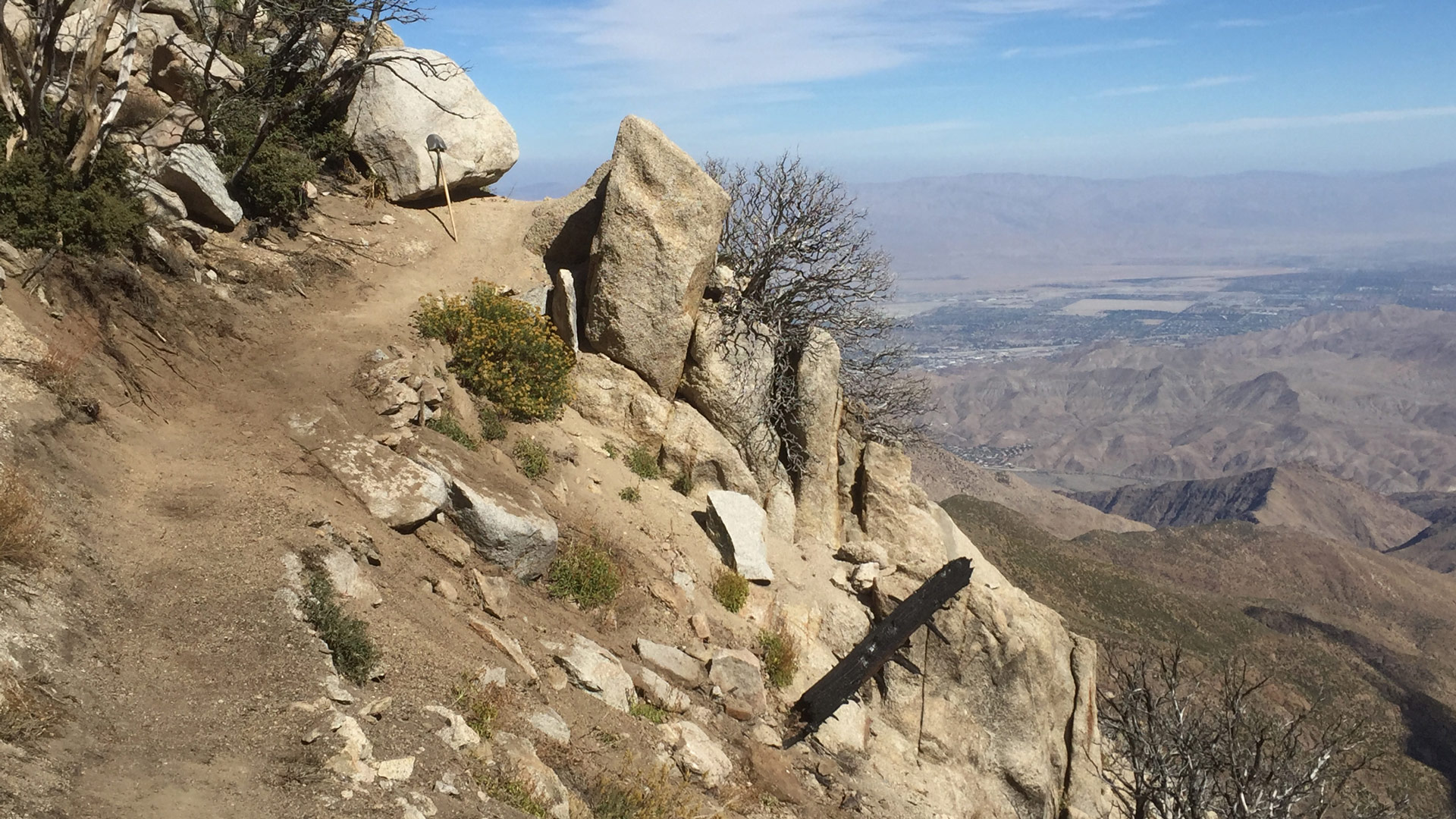
The amazing views throughout this particular section of the PCT.
By focusing our efforts on one phase until it was up to standard and ready to be opened, we knew we could make noticeable and practical progress on the huge job of repairing the trail and getting it ready for public use. In 2016, the Forest Service was able to open Phase 1, the southernmost phase of the project after many hours and much hard work. This allowed trail users to get on and off the PCT at the Fobes Trail junction, roughly 15 miles North of State Route 74.
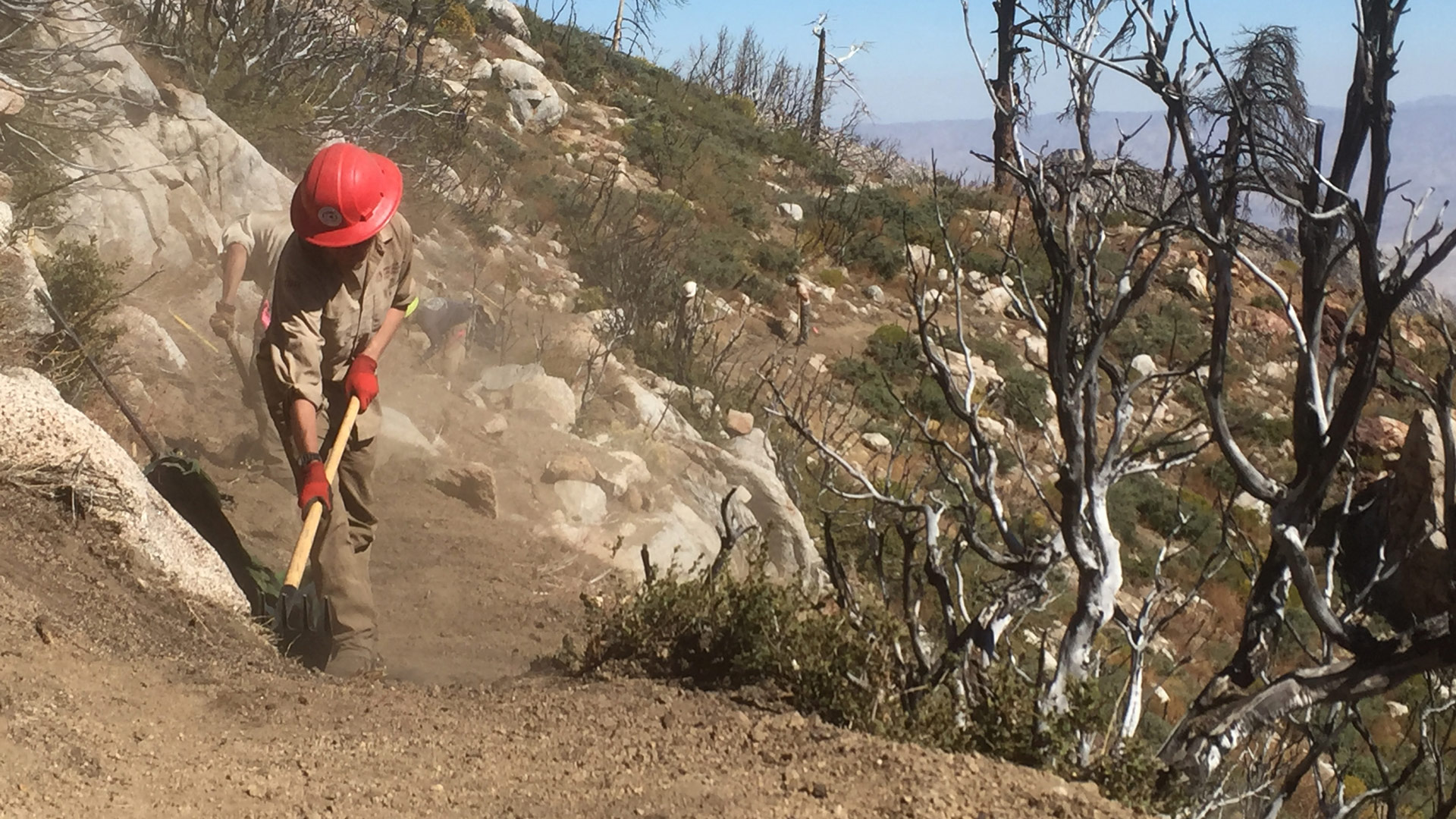
ACE corp crews really pushing hard to complete a section of damaged trail.
After a great 2017 season of trail repairs and reconstruction, I’m excited to announce that two more miles of the PCT are open! This leg—Phase 2 of the project—follows the ridgeline from the Fobes Trail north to the Spitler Peak Trail. It’s an amazing part of the PCT, offering panoramic views both east and west. The Spitler Peak Trail is also a more convenient access point for PCT thru-hikers, allowing a more direct alternate route that limits the amount the amount of time that hikers will be on highways.
A set of rock-checks constructed to accommodate the equestrian users on the Spitler Peak Trail.
It required months of effort to rebuild this 2-mile section of the PCT. And the Spitler Peak Trail underwent major reconstruction as well. This trail runs more than 4 miles and had its own unique issues and challenges. Much of the Spitler Peak Trail was wiped out or was in need of extensive tread retention. That meant that progress was slow. Patience is a virtue…but also makes for good trails!
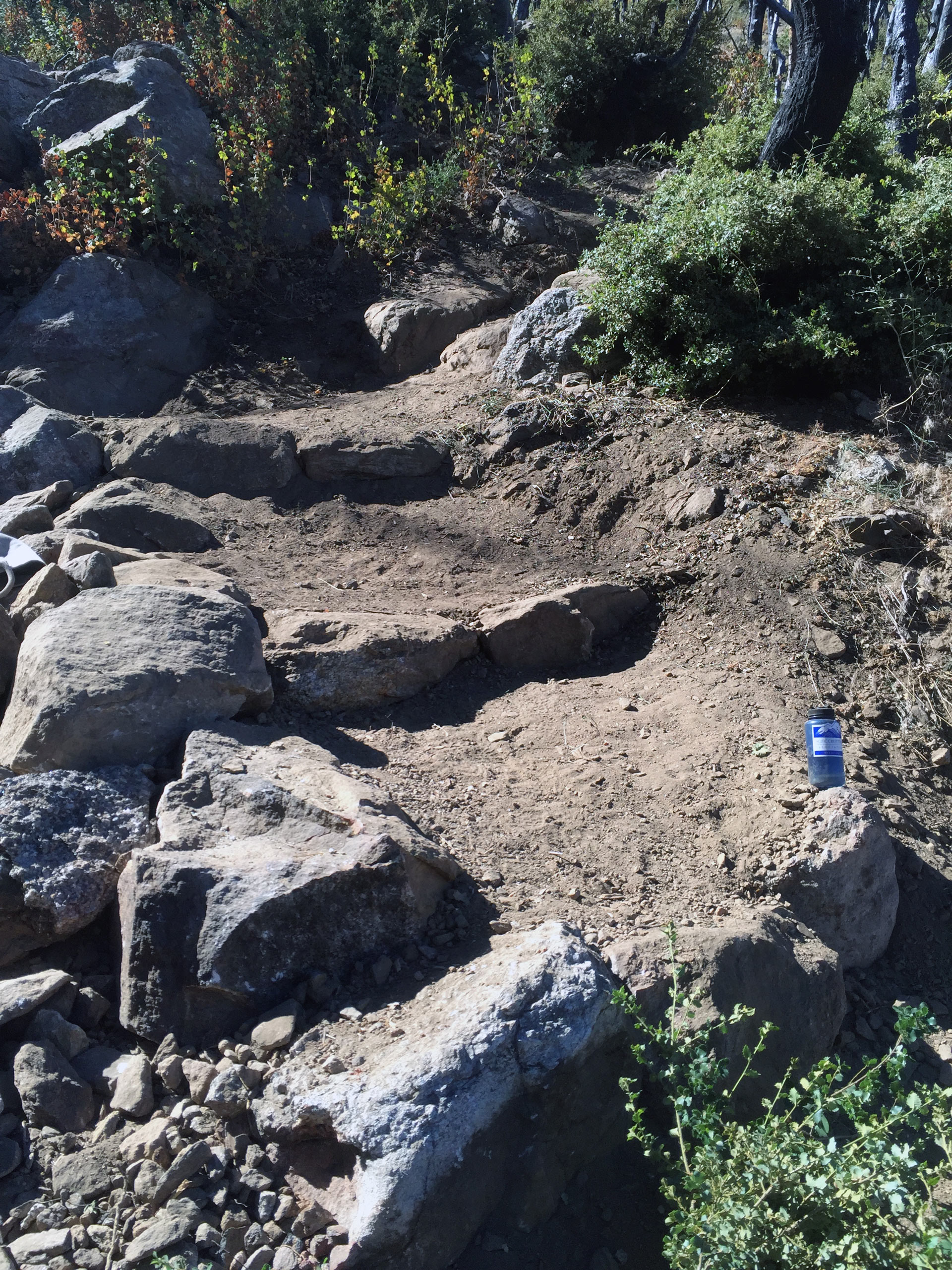
Previously absent, the trail needed to be reconstructed and cut into the hillside.
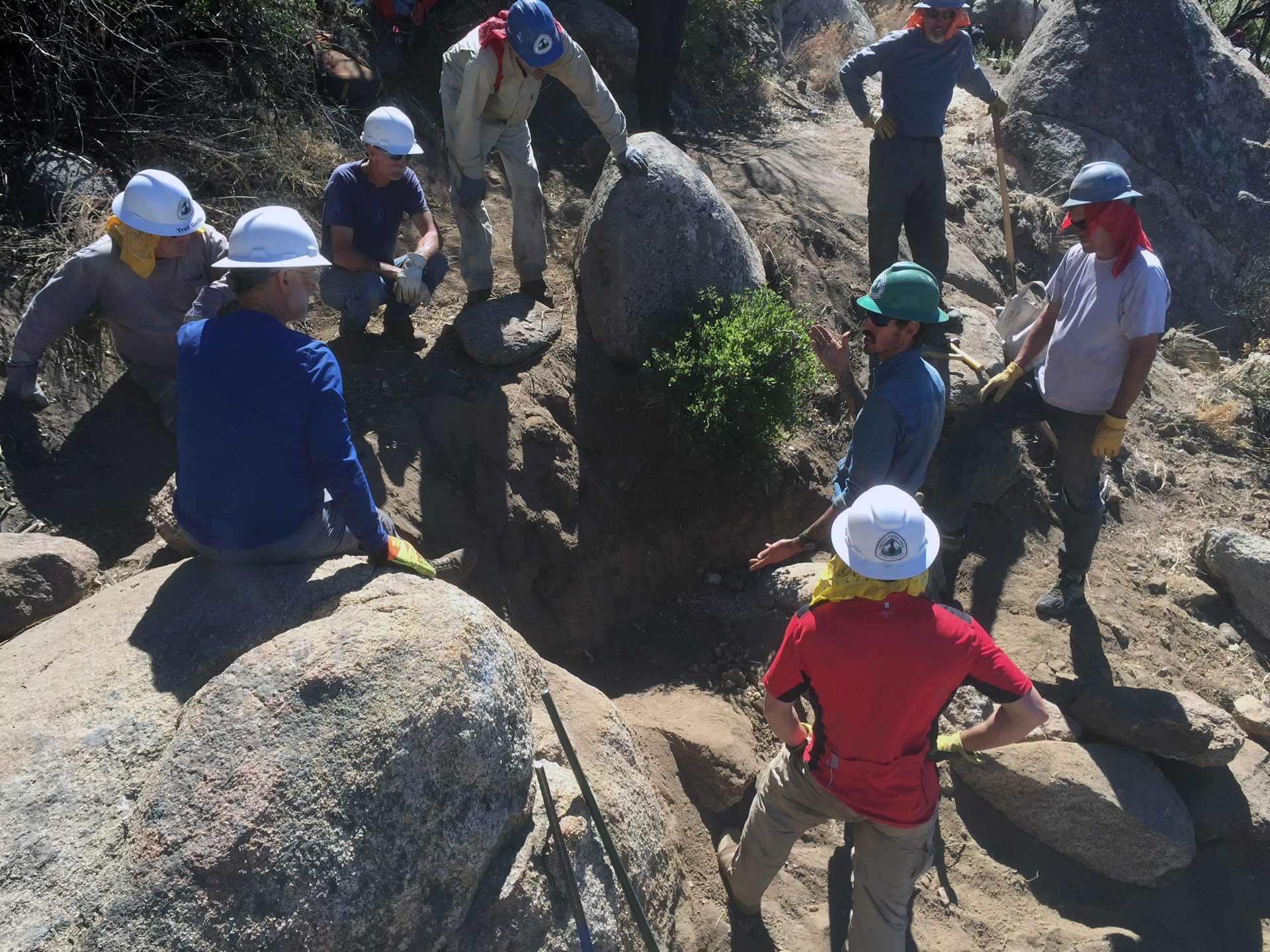
Volunteers learning how to construct rock retaining walls using dry-masonry techniques.
This project provided many opportunities to teach volunteers the skills to do intricate rock work. We set up a Rock Retaining Wall Course on the Spitler Peak Trail for local volunteers. Not only were we able to repair a portion of the damaged trail, but many volunteers attended courses that might not have been available otherwise. And the skills they learned will better serve the trail in this area for years to come.
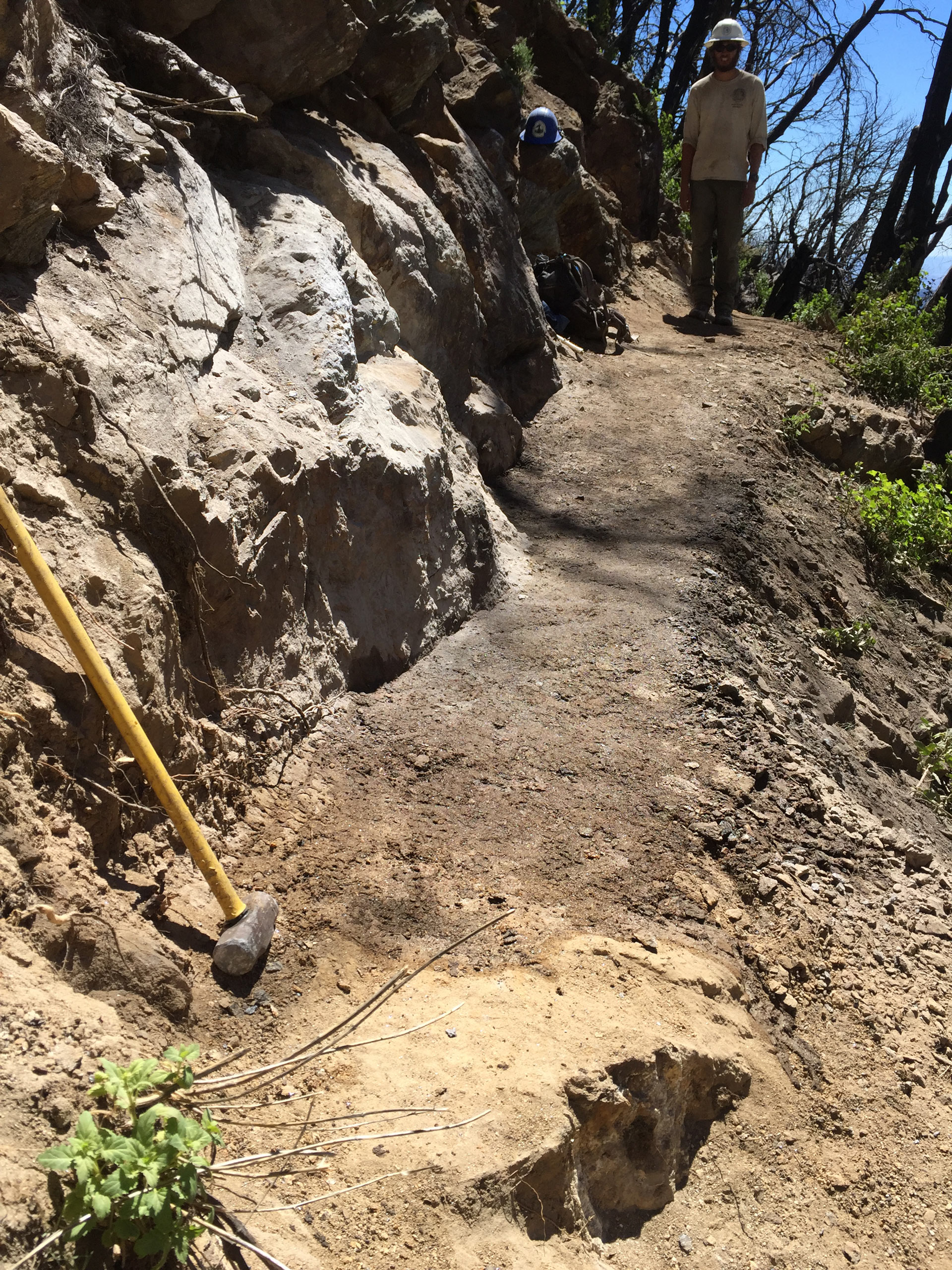
Completing repairs on the Spitler Peak Trail also provides crucial access for packers bringing gear to backcountry trail crews. We’ll be using this access as our work in the area continues. One of the greatest challenges of reconstructing the PCT here is the logistics. Available drinking water is scarce. These long, dry stretches and the topography create challenges for getting crews to the locations that need to be rebuilt. Camping options are limited and it’s not realistic or possible to hike in and out every day and still accomplish the necessary work. One way we mitigate this is by packing the trail crews in to the backcountry with stock. Michael Lewis, an avid PCTA volunteer and packer, has done almost all of the pack-ins for the trail crews. Without Michael and his fellow packers and their mules, none of the trail repairs would have been possible within the Mountain Fire burn area.
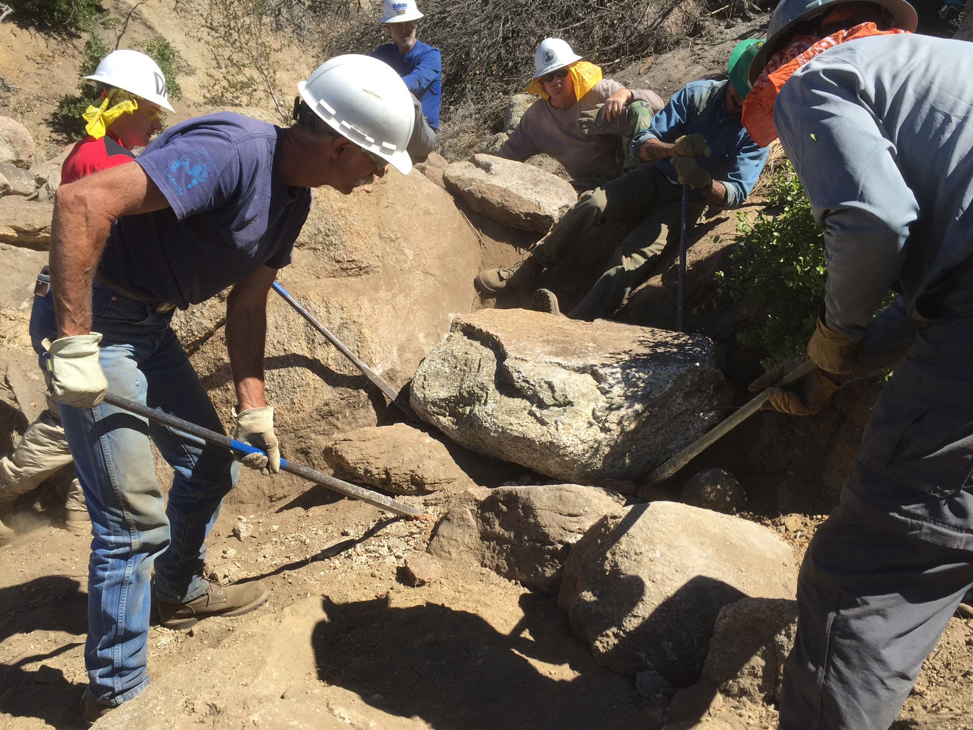
Volunteers maneuvering a large rock to set within the retaining wall.
Reopening the access to and from the PCT at the Spitler Peak Trail is a tremendous achievement for the Forest Service, PCTA and the hiking and equestrian communities.
On to Phase 3! Unfortunately, 8 to 9 miles of the PCT—from the Spitler PeakTrail/PCT Junction north to Tahquitz Creek—remain closed. The fire burned most intensely in this area of steep hillsides covered with heavy vegetation. Plants, their roots and the soils burned. Retaining walls were destroyed immediately or fell from the side of the mountain. In some areas trail tread was burned to a fine, black ash and in others it disappeared because of sliding earth. An abundance of poodle-dog bush has grown since the fire.
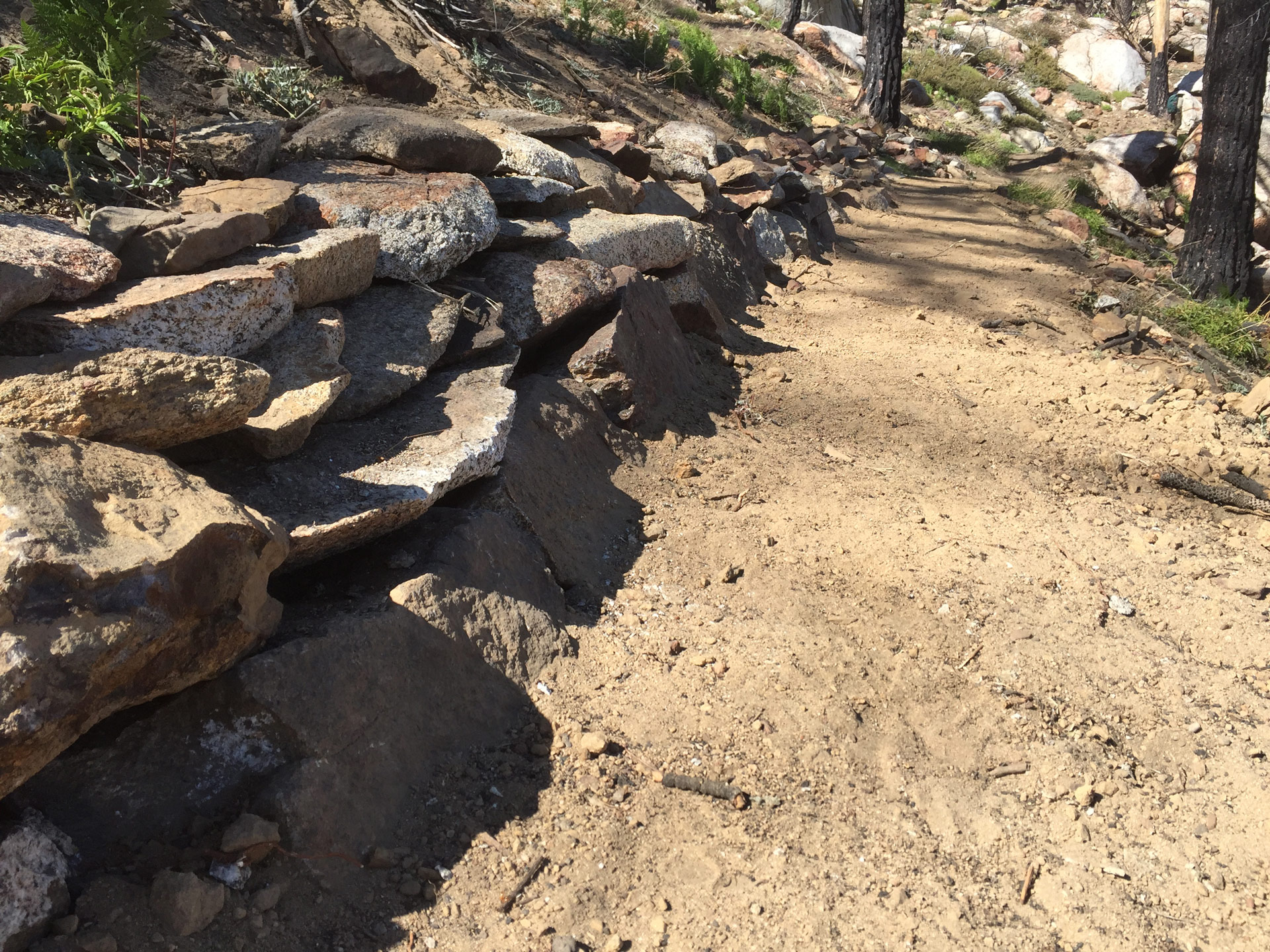
Armor on the backslope of the trail to prevent further sloughing and erosion of the trail.
The PCTA, the Forest Service and ACE corps crews are working hard to address the repairs throughout this section of trail. But it will take time and a significant effort. Until we can rebuild the trail in this area, we ask that you refrain from accessing the PCT in the area where U.S. Forest Service Fire Closure Order remains in effect.

ACE crew members finishing up a retaining wall installed on the Spitler Peak Trail.
Get involved in this recovery project by volunteering on a trail crew or donating to the PCTA’s effort.