A taste of tropical air pushing into Ontario to end the weekend will provide an early taste of summer for much of the region.
The arrival of warmth and humidity may fuel several opportunities for thunderstorms overnight Saturday and again during the day Sunday.
Warmth will linger into the beginning of the workweek, but with dramatic temperature changes as the cooler lakes flex their influence over the shorelines.
PHOTOS: Highway camera captures stunning tornado on the horizon
Saturday night storm risk for some
Our late-weekend warmth arrived in far southwestern Ontario on Saturday as temperatures climbed to 26.3°C in both Windsor and Sarnia, with enough humidity to push feels-like values above 30.
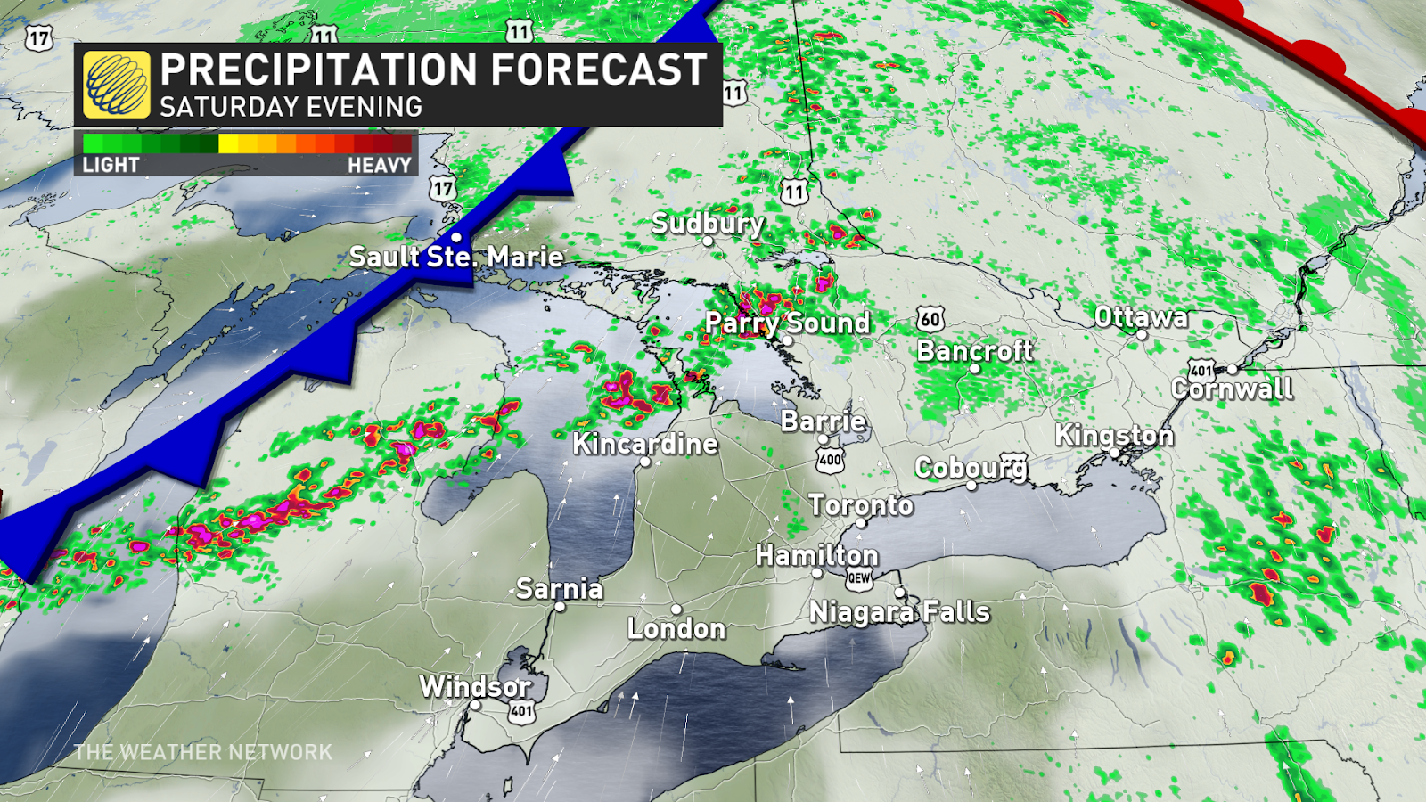
More warmth is on the way for Sunday, but we have to get through a storm risk Saturday night as a cold front plows into northeastern Ontario.
If the cold front speeds up a touch, a few of the storms could turn severe with a risk for heavy rainfall, strong wind gusts, and possibly even some large hail. Some of the storms may develop rotation. This may be the case around Sudbury, Parry Sound, Manitoulin Island, and the Bruce Peninsula.
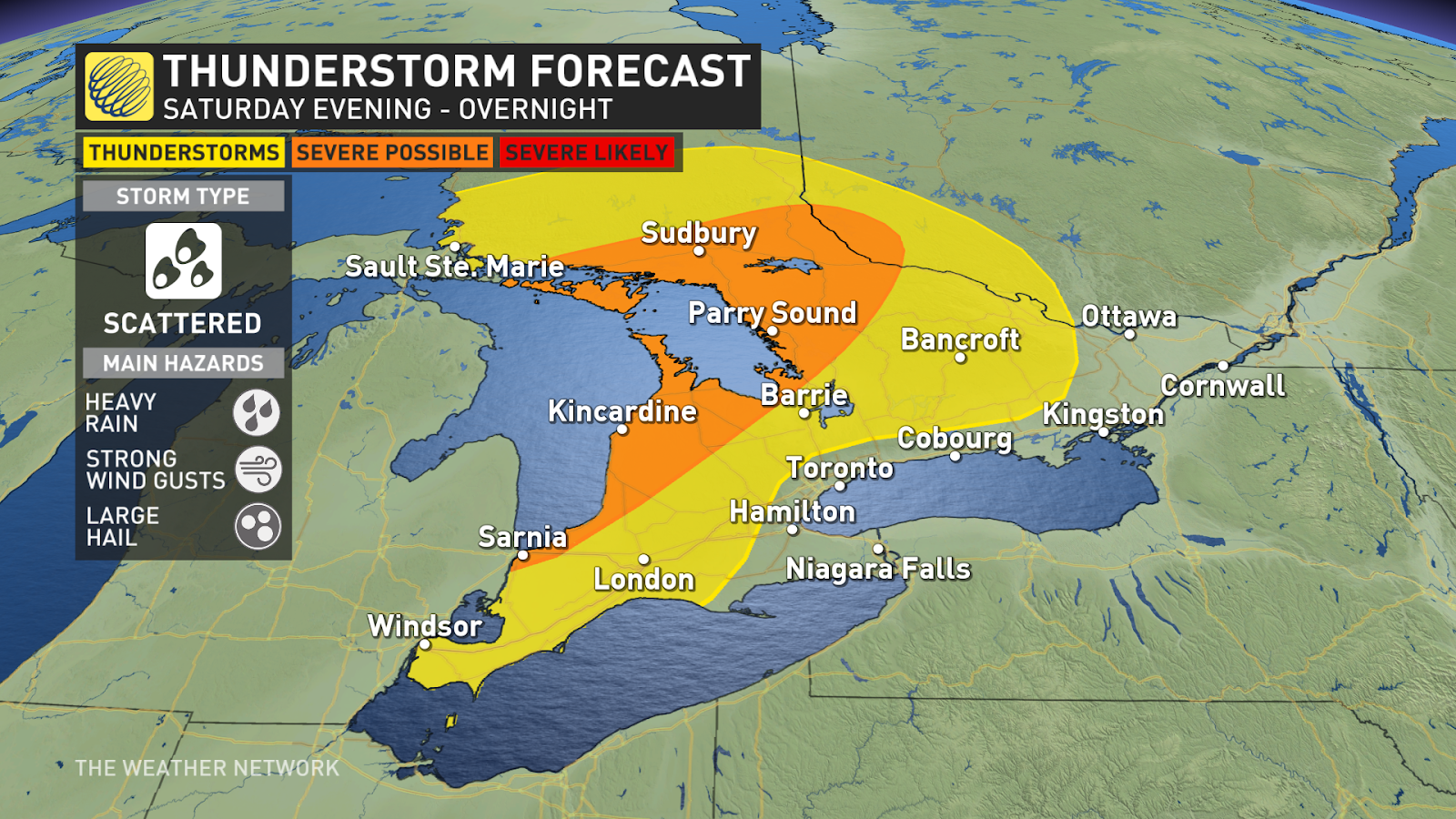
Uncertainty exists around the nocturnal storm threat, though, but it’s wise to keep it in mind as you wind down for the evening.
Early-summer tease arrives Sunday
The warmest day of the year is likely for much of southern Ontario on Sunday as warm, humid winds spread into the region. Enough instability could build that we may have to contend with more thunderstorms during the second half of the day.
Before this weekend, the warmest readings we’ve seen so far this year include:
- 26.1°C in Windsor on April 14
- 23.8°C in Hamilton on April 9
- 20.6°C in Toronto on March 13
- 19.9°C in London on April 14
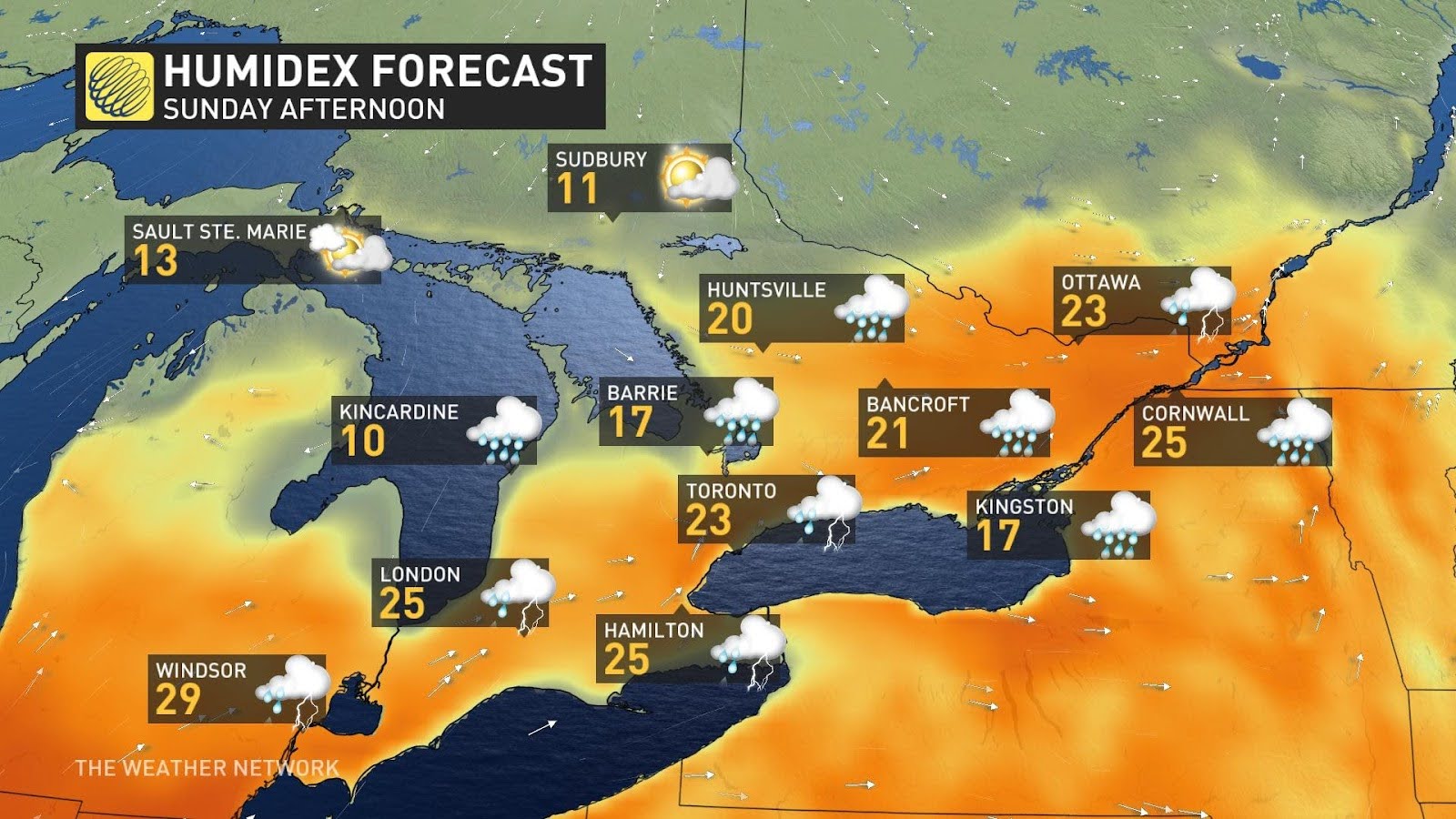
Daytime highs on Sunday will soar into the mid-20s for many communities, with humidex values possibly cracking 30 around Windsor.
Given the warmth in the forecast, Toronto and London are on track to beat 2024’s high-mercury mark by Sunday, while Hamilton might fall short by just a hair.
We’ll see a renewed risk for showers and thunderstorms over southern Ontario during the day Sunday as this warm and unstable air builds in.
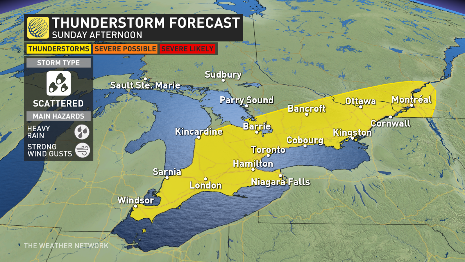
This includes much of the Highway 401 corridor from Windsor to Kingston, including Toronto, as well as north toward Bancroft and Barrie. Look out for heavy rain and gusty winds in any of the feistier storms that bubble up on Sunday.
Warmth sticks around into early next week
Another rainy system tracking into northern and central Ontario on Monday will keep the unseasonably warm air parked over the southern half of the province to start the week. However, there’s uncertainty in just how warm things will get on Monday. We could see big temperature variations over short distances with clouds and lake breezes.
MUST SEE: Bizarre alien ‘spiders’ spotted in ‘Inca City’ formation on Mars
We’ll see additional showers and possibly a risk for rumbles of thunder as that disturbance passes the region to the west.
Temperatures will likely start to moderate back toward seasonal as we head into the second half of the upcoming week. Warm-weather lovers may not have to wait long for above-seasonal conditions to return, as more unseasonable warmth could arrive in time for the beginning of May.
Header image courtesy of Solomon Hoasjoe.
Stay with The Weather Network for all the latest on your forecast across Ontario.