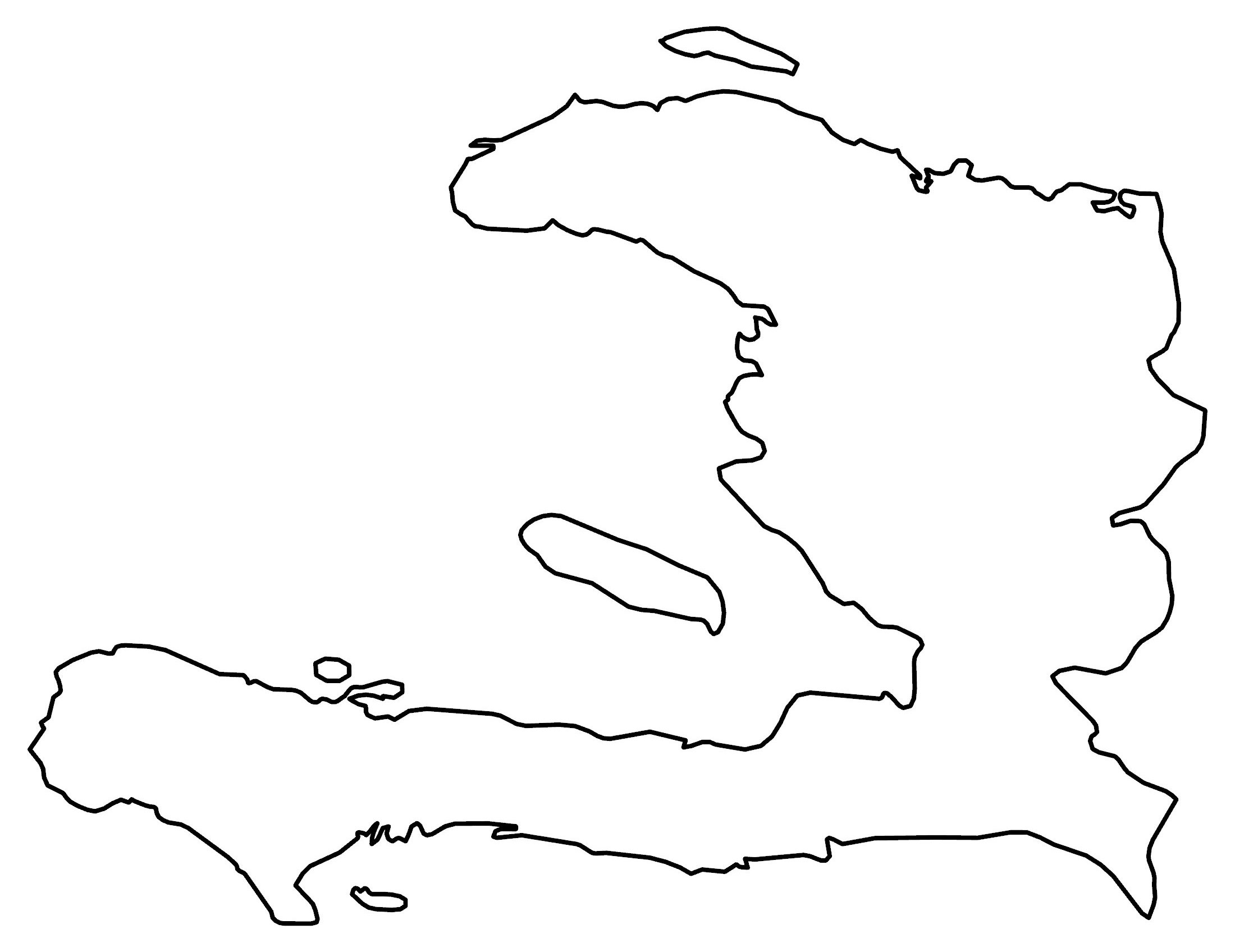
Map of Haiti
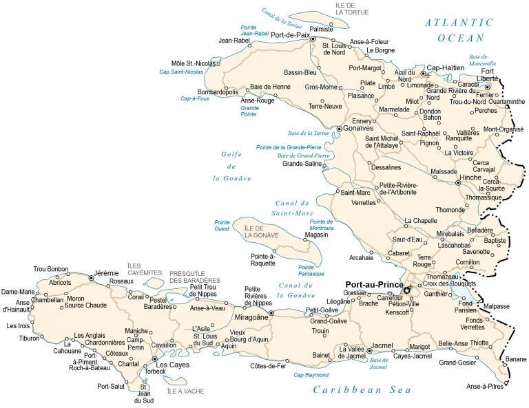
This map of Haiti contains major cities, towns, highways, and satellite imagery. An elevation map displays the rugged topography of Haiti and its various mountain chains.
Haiti map collection
You are free to use our Haiti map for educational and commercial uses. Attribution is required. How to attribute?
About the map
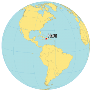
Haiti is an island located in the Caribbean within the Greater Antilles archipelago. It’s part of Hispaniola Island, next to the Dominican Republic to the east. Also, it’s close to Cuba to the west and is just 100 kilometers (60 mi) away. Whereas the Bahamas are to the northwest, Jamaica to the west, as well as Colombia and Venezuela are to the south.
Altogether, the country occupies an area of 27,750 square kilometers (10,714 sq mi) which is the third-largest in the Caribbean. In comparison to the Dominican Republic to the east, Haiti makes up about one-third of the landmass. The population is 11.26 million people. This makes it the most populous in the Caribbean. Port-au-Prince is the capital and largest city with about 1 million people.
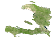
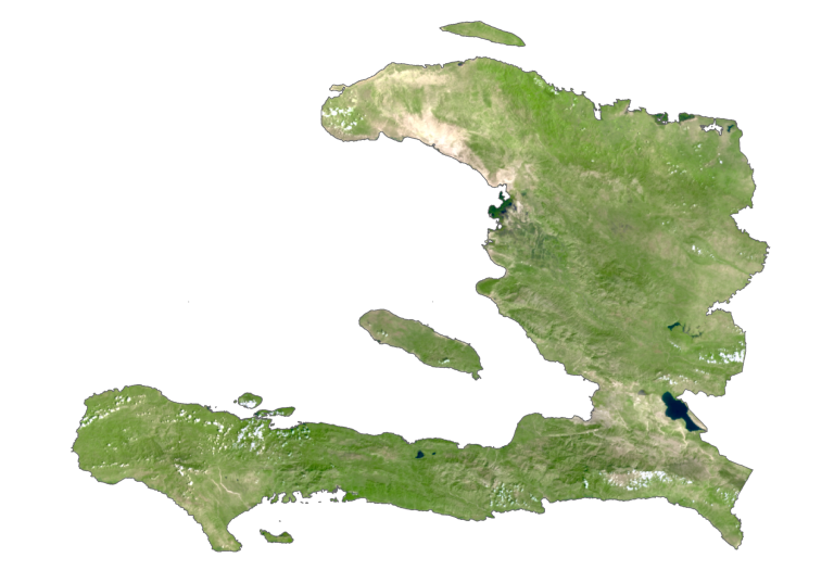
SATELLITE IMAGERY
Haiti Satellite Map
While forests cover 4% of Haiti, over 50% of the land is set aside for crops. The major agricultural products of Haiti are bananas, rice, and maize. Soil degradation is a major environmental issue in Haiti because of centuries of deforestation and over-reliance on agriculture.
With an average temperature of 26°C, the climate is primarily tropical with other areas semi-arid and subtropical. Its summers are especially wet and warm. Haiti is close to the Caribbean Plate and is subject to a large number of earthquakes, including the catastrophic 7.0 magnitude earthquake in 2010.
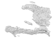
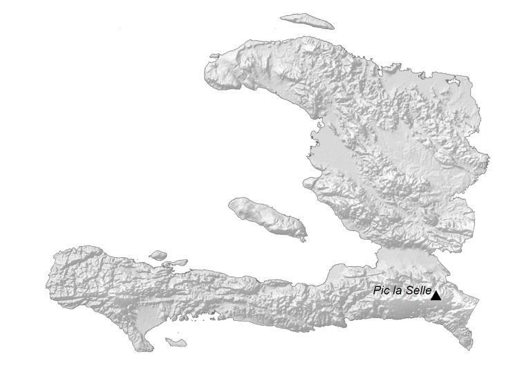
PHYSICAL MAP
Haiti Elevation Map
Haiti has the most rugged terrain with more mountains and hills than any other country in the Caribbean. It’s mostly mountains mixed with small coastal plains and river valleys. The interior of Haiti consists of two plains between two mountain ranges – Massif du Nord and Noires Mountains.
Between these two mountains is Haiti’s most important agricultural train, the Arbonite Plains. Its southernmost region contains the Massif de la Hotte with Haiti’s second-highest mountain, Macaya Peak. But La Selle Mountain (Pic la Selle) is Haiti’s highest peak at 2,680 m (8,790 ft) above sea level.
Capital City
Port-au-Prince
Major cities and towns
Cap-Haïtien
Carrefour
Cité Soleil
Croix-des-Bouquets
Delmas
Gonaïves
Gros-Morne
Jacmel
Léogâne
Les Cayes
Petite-Rivière-de-l’Artibonite
Port-de-Paix
Saint-Marc
Cities, towns and villages
Anse-à-Foleur
Anse-à-Pitres
Anse Chambellan
Anse Rouge
Arcahaie
Bainet
Bassin-Bleu
Belladère
Bombardopolis
Borgne
Cayes-Jacmel
Cerca-la-Source
Cerca-la-Victoire
Chantal
Cavaillon
Chardonnières
Corail
Côtes-de-Fer
Dame-Marie
Dondon
Ennery
Ferrier
Fond Parisien
Fort-Liberté
Fonds-Verrettes
Fonds-des-Nègres
Fort-Liberté
Gressier
Grand-Goâve
Grand-Gosier
Grande Rivière du Nord
Grande Saline
Hinche
Jérémie
La Vallée de Jacmel
Lascahobas
Limbé
Marmelade
Môle-Saint-Nicolas
Mirebalais
Mirebalais
Môle-Saint-Nicolas
Mont-Organisé
Montrouis
Moron
Petit-Goâve
Petite-Rivière-de-Nippes
Pignon
Pilate
Plaisance
Port-Margot
Port-Salut
Port-à-Piment
Quartier-Morin
Ranquitte
Roseaux
Saint-Louis-du-Nord
Saint-Michel-de-l’Attalaye
Saint-Raphaël
Saut-d’Eau
Savenette
Thiotte
Thomonde
Thomassique
Trou-Bonbon
Trou-du-Nord
Verrettes
Vieux-Bourg-d’Aquin
Canals, rivers and water features
Canal de la Tortue
Canal de Saint-Marc
Caribbean Sea
Golfe de la Gonâve
Gros Morne River
Petite Rivière de Nippes
Pointe de la Grande-Pierre
Pointe de Montrouis
Pointe de Raquette
Pointe Fantasque
Pointe Quest
Trouin River
Islands
Gonave Island
Île à Vache
Tortuga Island
Grande Cayemite
Caribbean


