Google runs one of the most impressive 3D mapping tools available. It's a reliable go-to for planet zooming, location finding, and basic geo-analysis. But, unlike Google Maps, Google doesn't market it to general users much, so you may not have heard of it. Let's talk about Google Earth Pro, the advanced, publicly available software that lets even casual users play with GIS data or go on a swooping tour of the world.
What is Google Earth Pro?
Google Earth Pro is a software provided by Google that ties extensive satellite data together into one system, where you can visualize the Earth and study its various geographic aspects. It evolved from a software called Keyhole, which launched in the late 1990s and was acquired by Google in the mid-2000s. Think of it like an advanced version of Google Maps that's more focused on science than directions, sometimes called a "geobrowser."
While it isn't a true, professional-grade GIS (Geographic Information System), it's used by students and scientists around the world while being basic enough for casual users to pick up. In addition to its high-res images of the planet, Google Earth Pro allows you to search for specific coordinates and download geospatial data files in the KML (Keyhole Markup Language) format for future use.
How do I get Google Earth Pro?
You have two options. You can visit the web-based version to use it in your browser, which frees up space on your computer but works best with speedy internet. Or you can visit Google's Earth Versions web page and download it for one of the latest Android phones or your desktop computer, which may be a more stable experience.
How do people use Google Earth Pro?
This software is one of the most user-friendly ways to take a detailed look at the planet and has a variety of search, placemark, and pathing options.
Broadcasters used early versions of the software to view Baghdad during the Iraq war. Today, it is frequently used by university students studying GIS, environmental sciences, engineering, and other fields. On the commercial side, it may be used to put together tours or overviews of an area.
Additionally, artists may use it for inspiration, while graphic designers can grab the data for mimicking real-world locations or landmarks. Hikers may also pull the data to study routes, and casual users might dip in to experience the planet's beauty or satisfy their curiosity.
There's also a version of Google Earth called Google Earth Engine, which focuses more on the GIS aspect than Earth Pro. This software is used by scientists and professionals for various analyses.
What sort of GIS data is available on Google Earth Pro?
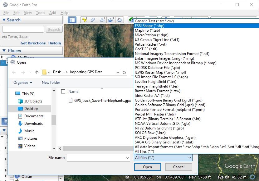
Google Earth Pro pulls data from NOAA, NASA, the U.S. Navy, the Copernicus program, and more. So, you can access an impressive amount of data, especially when using the desktop app. You can use built-in overlays to display specific features like parks, bodies of water, traffic patterns, and a variety of others. However, Google Earth Pro's real power comes from importing other GIS information like KML files for more specific projects. For example, a property agent might use Google Earth to view parcels of land.
While Earth Pro isn't technically a full GIS, it's relatively easy to use, and features like these provide valuable geographical tools to any user.
Is the Pro version different from Google Earth?
Google Earth is a simplified, less feature-heavy version of the software that's meant for the casual user. Google Earth Pro has additional import and export features and more sophisticated GIS data filtering options. Pro also has the feature, within limits, to go back in time using historical data.
Does Google Earth Pro cost money?
Years ago, this impressive 3D mapping software cost several hundred dollars. But Google has since made Google Earth Pro available for free via a web browser or as a download. There are no costs associated with its use.
This seems complicated. How do I get started using Google Earth Pro?
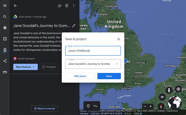
You'll find plenty of tutorials online to get you started. One of the best is Google Earth Outreach, which is a Google-based tutorial and geo-advocacy project. Outreach offers a variety of guides on how to do specific tasks, which include:
- Create a customized map or a "story" that travels through locations on Earth.
- Create a narrated tour.
- Create overlays for examining data points.
- Generate a KML using Google Sheets.
- Import additional GIS data from other sources.
The planet awaits
You're ready to use Google Earth Pro. Just make sure you have enough storage space to download and enough bandwidth to use the browser version comfortably. If you're interested in other mapping software, you may want to look at our guide to the best navigation and map apps for Android.


