Bogside
The Bogside is a neighbourhood outside the city walls of Derry, Northern Ireland. The large gable-wall murals by the Bogside Artists, Free Derry Corner and the Gasyard Féile are popular tourist attractions.Photo: Ardfern, CC BY-SA 3.0.
Photo: Ardfern, CC BY-SA 3.0.
Notable Places in the Area
Celtic Park
Stadium
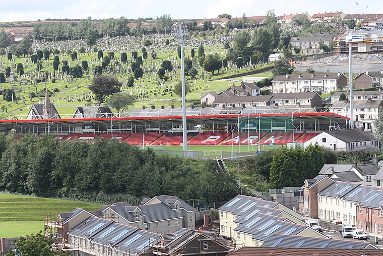
Photo: Ardfern, CC BY-SA 3.0.
Celtic Park is a GAA stadium in Derry, Northern Ireland.
St Eugene's Cathedral
Church

Photo: Romeparis, CC BY-SA 3.0.
St Eugene's Cathedral is the Roman Catholic cathedral located in Derry, Northern Ireland.
St Columb's Cathedral
Church
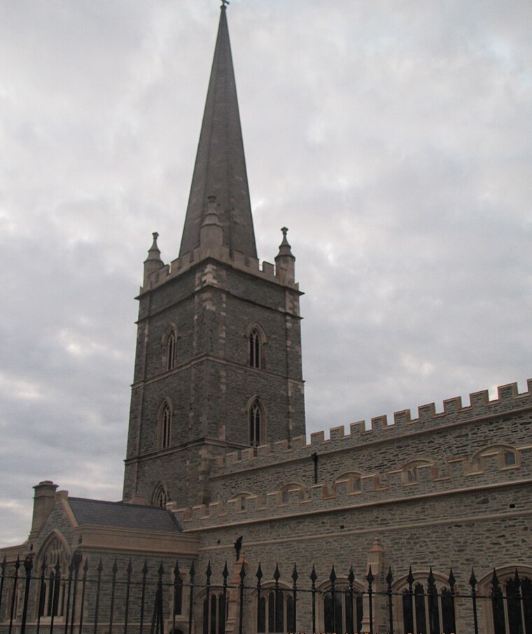
Photo: Romeparis, CC BY-SA 3.0.
St Columb's Cathedral in the walled city of Derry, Northern Ireland, is the cathedral church and episcopal see of the Church of Ireland's Diocese of Derry and Raphoe.
Localities in the Area
Derry
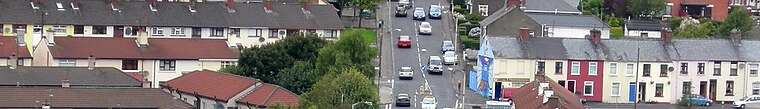
Photo: AlasdairW, CC BY-SA 3.0.
Derry or Londonderry is the second city of Northern Ireland, with a population of 85,000 in 2021.
Altnagelvin
Suburb

Photo: Kay Atherton, CC BY-SA 2.0.
Altnagelvin is a townland in County Londonderry, Northern Ireland. Altnagelvin is situated 1½ miles southeast of Bogside.
Newbuildings
Village

Photo: Stevieboyni82, CC BY-SA 3.0.
Newbuildings or New Buildings is a large village in County Londonderry, Northern Ireland. Newbuildings is situated 3 miles southwest of Bogside.
Bogside
- Type: Suburb
- Description: neighbourhood outside the city walls of Derry, County Londonderry, Northern Ireland
- Categories: human settlement and locality
- Location: Derry City and Strabane, Northern Ireland, United Kingdom, Britain and Ireland, Europe
- View on OpenStreetMap
Latitude
54.99643° or 54° 59' 47" northLongitude
-7.32993° or 7° 19' 48" westElevation
13 feet (4 metres)Open Location Code
9C6JXMWC+H2OpenStreetMap ID
node 4030821612OpenStreetMap Feature
place=suburbGeoNames ID
11836784Wikidata ID
Q890677Bogside Satellite Map
© OpenStreetMap, Mapbox and Maxar
Also Known As
- Basque: Bogside
- Catalan: Bogside
- Chinese: 博格賽德
- Czech: Bogside
- Dutch: Bogside
- English: The Bogside
- French: Bogside
- German: Bogside
- Irish: Taobh an Bhogaigh
- Irish: Taobh an Phortaigh
- Italian: Bogside
- Japanese: ボグサイド
- Polish: Bogside
- Russian: Богсайд
- Slovak: Bogside
- Spanish: Bogside
- Swedish: Bogside
- Welsh: Bogside
Other Places Named Bogside
Localities in the Area
- BrandywellSuburb
- RosemountSuburb
- CregganSuburb
- WatersideSuburb
- ClooneySuburb
Landmarks in the Area
- Bull ParkGrassland
- Museum of free derryMuseum
- Bloody Sunday Monument
- City BathsSports venue
- Double BastionScenic viewpoint
Popular Destinations in Northern Ireland
Discover Belfast, Derry, Giant's Causeway and Armagh.
Escape to a Random Place
Discover other destinations in the world.
About Mapcarta. Thanks to Mapbox for providing amazing maps. Data © OpenStreetMap contributors and available under the Open Database License. Text is available under the CC BY-SA 4.0 license, excluding photos, directions and the map. Description text is based on the Wikipdia page Bogside. Photo: Ardfern, CC BY-SA 3.0.