
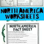
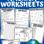
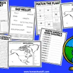
7 North America Worksheets (Free Geography Printables)
North America worksheets offer an engaging way to dive into the continent’s wonders.
Designed for both classroom and homeschool settings, these resources make learning about North America’s geography, culture, and languages both educational and fun.
Activities range from map labeling and detailed fact sheets to flag matching and lessons on greeting in 10 different languages.
All are aimed at familiarizing students with key locations and enhancing memory skills.
Additionally, word search and scramble games enrich vocabulary, making these free printable geography worksheets a comprehensive tool for exploring the diverse beauty of North America.
**There may be affiliate links in this post. You can read my full disclosure at the bottom of the page.**
Fun facts about North America for kids
Fun and interesting facts about North America that kids might enjoy:
- The world’s largest indoor water park, Kalahari Resort, is located in Sandusky, Ohio, USA.
- The shortest river in the world, the D River, is located in Lincoln City, Oregon, USA. It’s only 121 feet (37 meters) long!
- The largest snowflake ever recorded fell in Fort Keogh, Montana, USA, in 1887. It was 15 inches (38 centimeters) wide and 8 inches (20 centimeters) thick.
- The world’s largest volcano, Mauna Loa, is located in Hawaii, USA. It stands over 13,000 feet (3,962 meters) tall and covers an area of over 2,035 square miles (5,271 square kilometers).
- The highest tides in the world occur in the Bay of Fundy, located between Nova Scotia and New Brunswick, Canada. The tides can rise up to 50 feet (15 meters)!
- The world’s smallest desert, the Carcross Desert, is located in Yukon, Canada. It’s only 640 acres (260 hectares) in size.
- The Great Barrier Reef, located off the coast of Australia, is the world’s largest coral reef system. However, the second-largest coral reef system is actually located in North America, off the coast of Belize in Central America.
- The world’s first commercial oil well was drilled in Titusville, Pennsylvania, USA, in 1859.
- The tallest mountain in North America, Mount Denali, is so high that it creates its own weather patterns, including its own clouds and storms.
- The largest city in North America by population is Mexico City, with over 21 million people living in its metropolitan area.


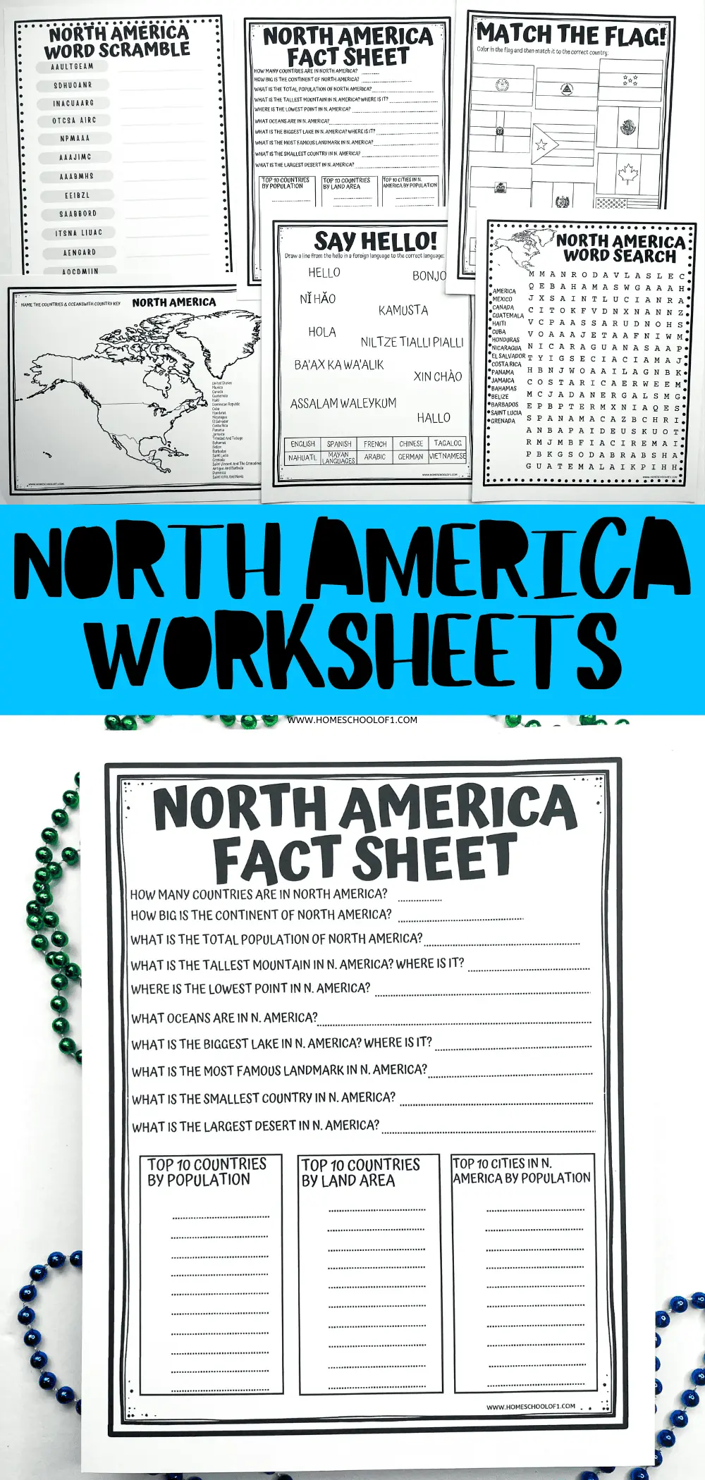
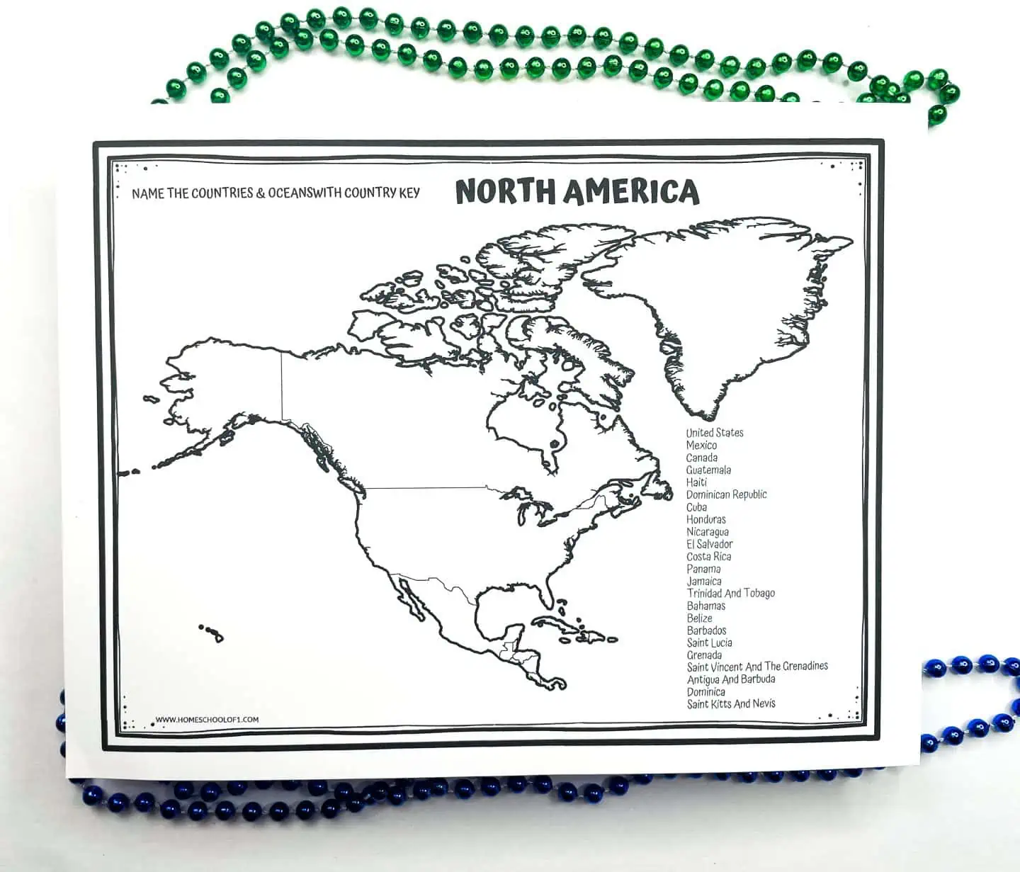
North America map worksheet
There are 23 different countries in North America.
There are 2 different maps of the continent of North America. One with the countries on the side to make it a little easier, and one with no country names.
The students can either color in the different countries or add the names to the correct country.
I also recommend these North American maps. The 100 infographic maps featured in this unique atlas reveal a wealth of new discoveries that will make you feel like North America is the most fascinating place on earth. Regardless of how well you thought you knew it before.
Add mapology world map game to this unit study.
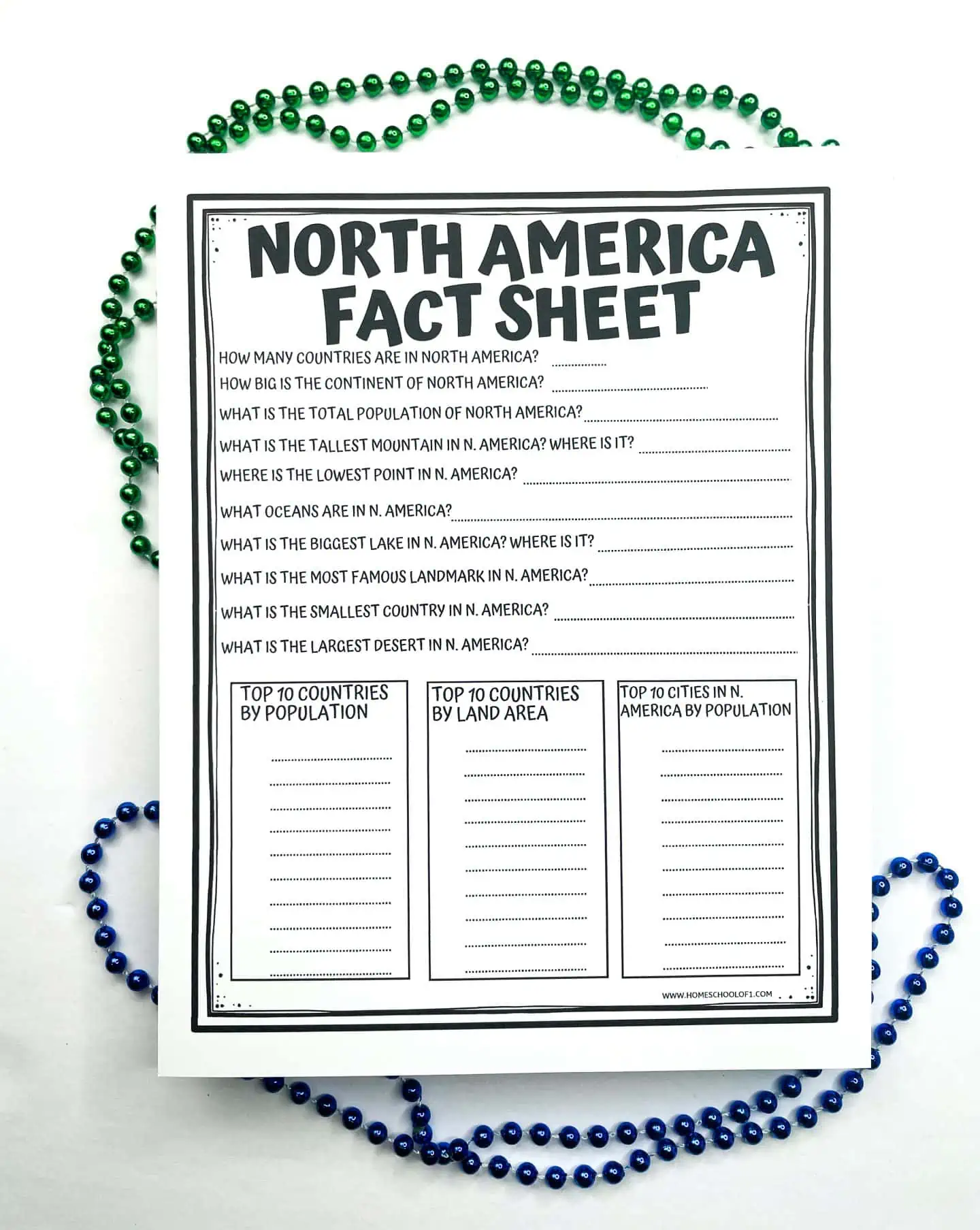
North America fact sheet
There are 10 questions about the continent of North America. Plus the top 10 countries by population, by land area, and the top 10 cities by population in North America.
- How many countries are in North America? 23
- How big is the continent of North America? 9.54 million square miles.
- What is the total population of North America? 579 million people.
- What is the tallest mountain in North America? Where is it? Mount Denali, Alaska
- What is the lowest point in North America? Where is it? Death Valley, California
- What oceans are in North America? Pacific, Atlantic, and Arctic Oceans.
- What is the biggest river in North America? Where is it? Mississippi River, USA.
- What is the most famous landmark in North America? Statue of Liberty (see our free Statue of Liberty worksheets)
- What is the smallest country in North America? Saint Kitts and Nevis.
- What is the largest desert in North America? Chihuahuan Desert, Mexico.
Top 10 countries by population in North America
- United States
- Mexico
- Canada
- Guatemala
- Haiti
- Dominican Republic
- Cuba
- Honduras
- Nicaragua
- El Salvador
Top 10 countries in North America by land area
- Canada
- United States
- Mexico
- Nicaragua
- Honduras
- Cuba
- Guatemala
- Panama
- Costa Rica
- Belize
Top 10 cities in North America by population
- Mexico City, Mexico
- New York City, USA
- Los Angeles, USA
- Chicago, USA
- Washington DC, USA
- Boston, USA
- San Francisco, USA
- Toronto, Canada
- Philadelphia, USA
- Dallas, USA
For even more fun learning about the world, I highly recommend the World card game.
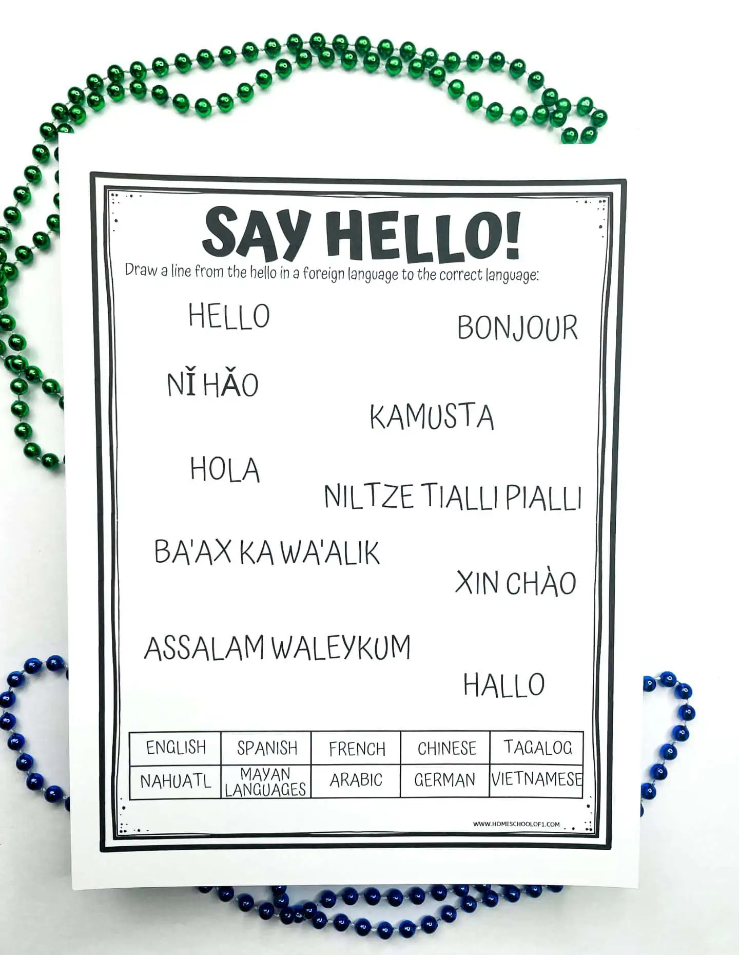
Say hello in North America’s most spoken languages
English and Spanish are the two most widely spoken languages in North America. English is the dominant language in the United States and Canada (approx 334 million speakers). And Spanish is widely spoken in Mexico, Central America, and parts of the Caribbean (approx. 200 million speakers).
But there are other languages you will hear when visiting North America.
French is spoken in Canada and Haiti (approximately 18 million speakers)
Chinese is spoken in the USA, Canada, and Mexico (approximately 5 million speakers.)
Tagalog, which is a language spoken widely in the Philippines, has about 2 million speakers in North America, making it the fifth most-spoken language on the continent.
Nahuatl an indigenous language spoken in Mexico has about 2 million speakers.
Vietnamese is spoken by about 1.5 million people in North America.
Mayan languages are another indigenous language spoken in Mexico with about 1.5 million speakers.
Next up is German with about 1.3 million speakers in North America.
Approximately 1.3 million people speak Arabic
There are 10 ways to say hello in 10 different languages, and the children need to label the correct greeting with the correct language.
Hello in North American languages:
- Hello – English
- Ni hao – Chinese
- Bonjour – French
- Xin Chao – Vietnamese
- Hola – Spanish
- Kamusta – Tagalog
- Hallo – German
- Ba’ax ka wa’alik – Mayan
- Assalam Waleykum – Arabic
- Niltze Tialli Pialli – Nahuatl
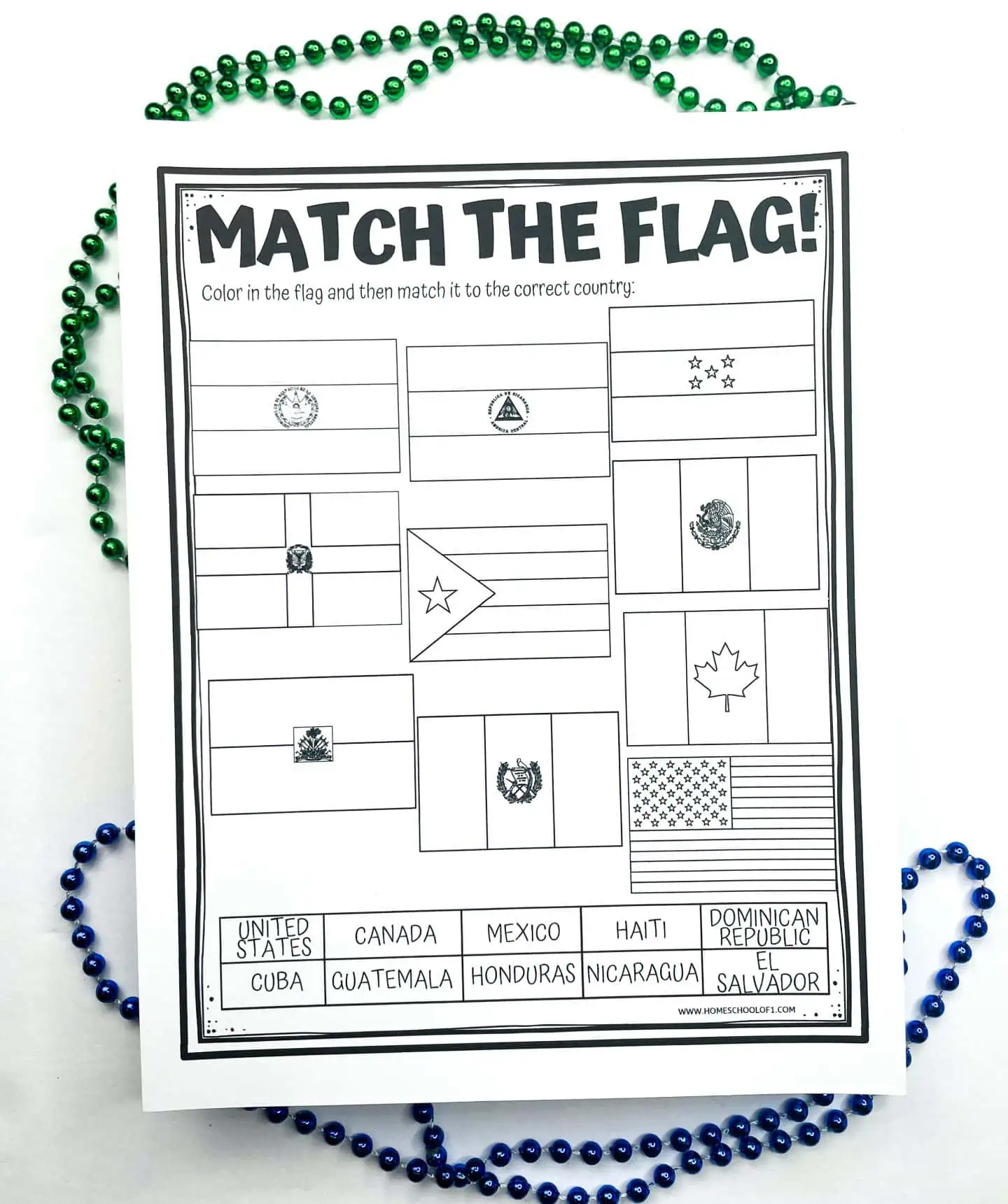
Match the North American flag worksheet
This match the flag worksheet is a lot of fun. The children need to research what colors to color in the maps of 10 North American countries.
When they have colored them in correctly, they need to add a line to the correct country.
The country flags included are:
- United States
- Canada
- Haiti
- Dominican Republic
- Mexico
- Guatemala
- El Salvador
- Honduras
- Cuba
- Nicaragua
You will also enjoy the 100 pics card game. Can you identify the countries from the flag?
North America word search
The North American countries and cities can be found, horizontally, vertically, diagonally, frontwards, or backward! Just to make it that much more difficult.
I have also added the word search answers, as some of the words are a little tricky to find!
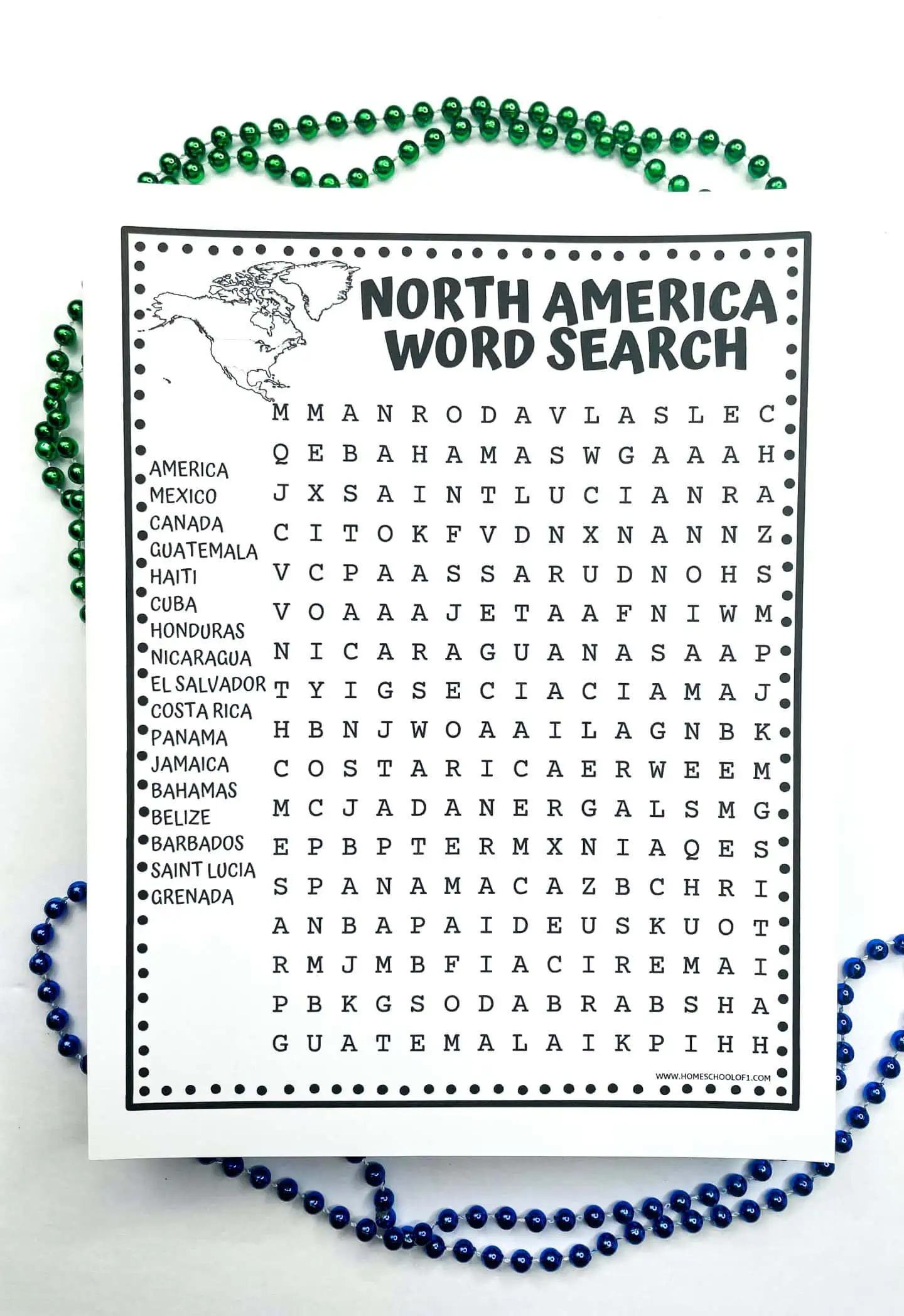
Tip: I recommend either using a highlighter pen or circling around the letters. Do not cross the letters out if you have found a word, as it may be used in another word!
The 17 North America countries to find are:
- America
- Mexico
- Canada
- Guatemala
- Haiti
- Cuba
- Honduras
- Nicaragua
- El Salvador
- Costa Rica
- Panama
- Jamaica
- Bahamas
- Belize
- Barbados
- Saint Lucia
- Grenada
Free word search printables are an excellent school activity for when the kids just need a break. They are educational, but more importantly, they are fun.
North America word scramble
There are no clues in our free word scramble, other than the 12 countries are all in the continent of North America.
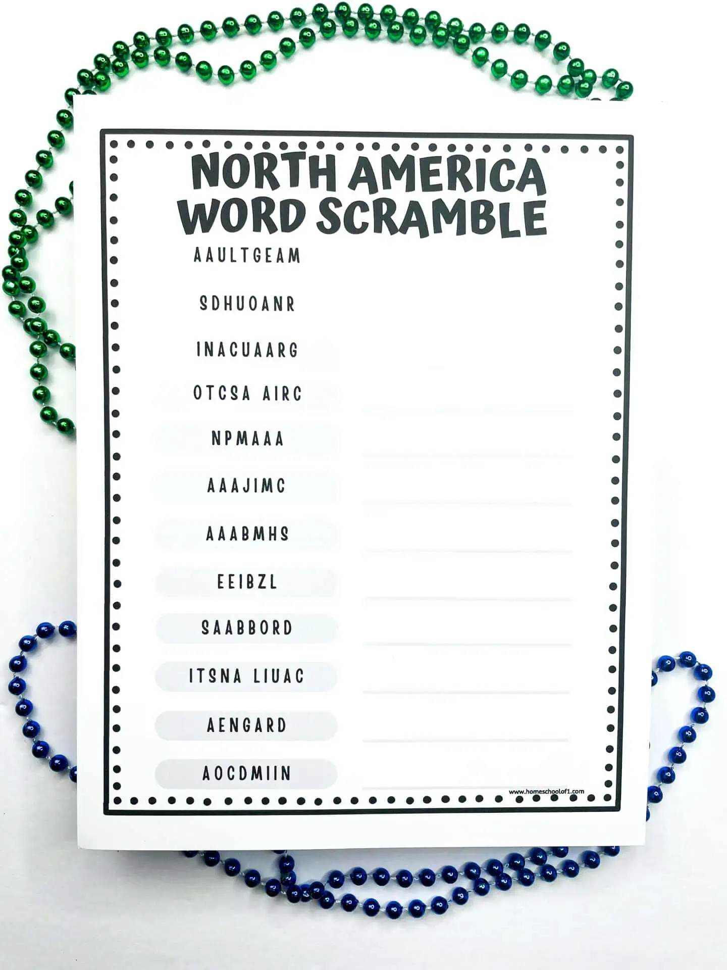
The 12 North American countries to find are: (I have included an answer sheet with the download.)
- Guatemala
- Honduras
- Nicaragua
- Costa Rica
- Panama
- Jamaica
- Bahamas
- Belize
- Barbados
- Saint Lucia
- Grenada
- Dominica
This free word scramble printable is great either for the classroom, the library, or homeschooling.
WANT ALL OF THE CONTINENTS WORKSHEETS NOW?
Books about North America for kids
These are the best geography books for kids:
- National Geographic Bird Guide of North America
- Native people of North America for kids
- Native American stories for kids
- US Road Trip Atlas
- National Geographic Kids Encyclopedia of American Indian History and Culture
Other free North American geography printables
These free North American geography printables offer a range of educational resources for students to explore the geography, culture, and history of North America, particularly the United States.
- American landmarks worksheets: These worksheets introduce students to some of the most famous landmarks in the United States, such as the Grand Canyon, Mount Rushmore, and the Golden Gate Bridge. They provide information about these landmarks and often include fun activities.
- State facts worksheet: Explore interesting facts about different states in the United States with this activity sheet. Students can learn about state capitals, geography, and historical tidbits.
- 50 States coloring pages printable: These coloring pages feature various symbols, cities, and capitals from across the United States. They provide a creative way for students to engage with and learn about their country.
- Statue of Liberty worksheets: Delve into the history and significance of the Statue of Liberty, an iconic symbol of freedom and democracy. These coloring pages include information about its construction, symbolism, and more.
- Continent worksheets: Broaden your understanding of North America by using continent worksheets. They cover topics like geography, countries, and important landmarks within the continent.
You will also enjoy our seven wonders of the world worksheets.
Tips for downloading the free files
Below you will see a large sign-up box where you need to add your name and email address, and press I NEED THIS NOW!
Within minutes you will be sent the free PDF directly to your email address, so you can print it out and start using it immediately.
Sometimes emails get a little wonky, so if you can’t see it, please check your spam folder where I am sure it is hiding.
Download the free printable North American worksheets
This continent of North America worksheet is free to print but is for personal or classroom use only.
Make sure you choose the correct paper size and click on the shrink to fit button. All of our free printables for kids work better when printed on cardstock (this is the one we use and love.)
Last Updated on 11 April 2024 by Clare