 Flushing is a neighborhood in the north-central part of the New York City borough of Queens, in the United States. While much of the neighborhood is residential, Downtown Flushing, centered on the northern end of Main Street, is a large commercial and retail area and is the fourth largest central business district in New York City.
Flushing’s diversity is reflected by the numerous ethnic groups that reside there, including people of Asian, Hispanic, Middle Eastern, European, and African American ancestry. It is part of the Fifth Congressional District, which encompasses the entire northeastern shore of Queens County, and extends into neighboring Nassau County. Flushing is served by five railroad stations on the Long Island Rail Road Port Washington Branch, as well as the New York City Subway’s IRT Flushing Line (7 <7> trains), which has its terminus at Main Street. The intersection of Main Street and Roosevelt Avenue is the third busiest intersection in New York City, behind Times and Herald Squares.
Flushing is part of Queens Community Board 7 and is bounded by Flushing Meadows–Corona Park to the west, Utopia Parkway to the east, the Long island Expressway to the south, and Willets Point Boulevard to the north.
ZIP codes beginning with 113 are administered from a sectional center at Flushing Post Office. The 113-prefixed area extends west into Jackson Heights, south into Elmhurst, Glendale, and Forest Hills, and east into Little Neck.
HISTORY
Dutch colony
In 1645, Flushing was established by Dutch settlers on the eastern bank of Flushing Creek under charter of the Dutch West India Company and was part of the New Netherland colony. The settlement was named after the city of Vlissingen, in the southwestern Netherlands, the main port of the company; Flushing is an anglicization of the Dutch name that was then in use.
In its early days, Flushing was inhabited by English colonists, among them a farmer named John Bowne. John Bowne defied a prohibition imposed by New Amsterdam Director-General Peter Stuyvesant on harboring Quakers by allowing Quaker meetings in his home. The Flushing Remonstrance, signed in Flushing on December 27, 1657, protested religious persecution and eventually led to the decision by the Dutch West India Company to allow Quakers and others to worship freely. As such, Flushing is claimed to be a birthplace of religious freedom in the new world.
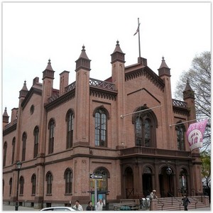
Landmarks remaining from the Dutch period in Flushing include the John Bowne House on Bowne Street and the Old Quaker Meeting House on Northern Boulevard.
English colonial history
In 1664, the English took control of New Amsterdam, ending Dutch control of the colony, and renamed it the Province of New York. When Queens County was established in 1683, the “Town of Flushing” was one of the original five towns which comprised the county. Many historical references to Flushing are to this town, bounded from Newtown on the west by Flushing Creek (now Flushing River), from Jamaica on the south by the watershed, and from Hempstead on the east by what later became the Nassau County line. The town was dissolved in 1898 when Queens became a borough of New York City, and the term “Flushing” today usually refers to a much smaller area, for example the former Village of Flushing.
Flushing was the site of the first commercial tree nurseries in North America, the most prominent being the Prince, Bloodgood, and Parsons nurseries. Much of the northern section of Kissena Park, former site of the Parsons nursery, still contains a wide variety of exotic trees. The naming of streets intersecting Kissena Boulevard on its way toward Kissena Park celebrates this fact (Ash Avenue, Beech, Cherry …Poplar, Quince, Rose). Flushing also supplied trees to the Greensward project, now known as Central Park in Manhattan.
During the American Revolution, Flushing, along with most settlements in present-day Queens County, favored the British and quartered British troops. Following the Battle of Long Island, Nathan Hale, an officer in the Continental Army, was apprehended near Flushing Bay while on what was probably an intelligence gathering mission and was later hanged.
The 1785 Kingsland Homestead, originally the residence of a wealthy Quaker merchant, now serves as the home of the Queens Historical Society. The 1790 United States census recorded that 5,393 people lived in what is present-day Queens County.
Nineteenth century
During the 19th century, as New York City continued to grow in population and economic vitality, so did Flushing. Its proximity to Manhattan was critical in its transformation into a fashionable residential area. In 1813, the Village of Flushing was incorporated within the Town of Flushing.By the mid-1860s, Queens County had 30,429 residents. Flushing’s growth continued with two new villages incorporating: College Point in 1867, and Whitestone in 1868. In 1898, although opposed to the proposal, the Town of Flushing (along with two other towns of Queens County) was consolidated into the City of New York to form the new Borough of Queens. All towns, villages, and cities within the new borough were dissolved. Local farmland continued to be subdivided and developed transforming Flushing into a densely populated neighborhood of New York City.