

Close your eyes and daydream of a summer road trip through the Pacific Northwest. Do you see the vibrant green forests, massive waterfalls, cascading mountains, and of course, the plethora of wildlife?
Now add some whales, rainbow rivers, and all the manners of Canada… The place you’re imagining is Vancouver Island, and this guide has everything you need to know to help you plan the ultimate Vancouver Island road trip itinerary!
For quick reference, this Vancouver Island road trip guide has been broken down into different regions based on driving routes. I have also included all my favorite photography locations in each region.
⛵️ General tips for visiting Vancouver Island
Vancouver Island is one of the best road trips in Canada and home to one of the best national parks in Canada. Everyone should have Vancouver Island on their Canada bucket list!
However, there are a few things that are worth noting before your trip…
If you are visiting from the US, your cell phone is unlikely to work once you cross the border. Even if it does, it is unlikely to work in most places outside the cities.
I recommend you download offline maps prior to visiting, and keep your notes offline in some way. I missed the secret waterfall at Sombrio Beach because I couldn’t access my notes and was kicking myself!
The weather tends to be moderate, and rain is common. If you are planning to road trip in a camper van, make sure you bring some quick-drying layers!
Beer can only be purchased in liquor stores, and craft beer lovers will rejoice at the variety of local British Columbia beers they will discover.
Amenities can be limited outside of the towns and cities. I will try to indicate in each region where amenities may be available.
Freedom camping out of your van is not exactly allowed, but it also isn’t really a monitored problem outside of the Tofino area. Be smart with where you park and, as always, leave no trace.
🚗 Getting to Vancouver Island

Whether arriving by ferry from Port Angeles in Washington or flying direct, visitors traveling from the US will begin their Vancouver Island getaway in the city of Victoria.
Those coming from Canada by ferry will most likely begin near Vancouver, British Columbia, and may find themselves in either Nanaimo or Victoria.
If you have the time then you should spend a couple of days in Vancouver prior to arriving on Vancouver Island!
The other option is to begin your Vancouver Island road trip in the remote Northern region, though services will be more limited.
The more popular ferry from Vancouver to Victoria or Nanaimo runs approximately every two hours. However, it will fill up days or even weeks prior during the peak summer season.
If you are planning a two-week getaway, or even shorter than that, it is imperative you book your ticket ahead of time or risk being stranded on the mainland.
📆 Best time to visit Vancouver Island
There is no absolute best time to visit Vancouver Island, as every season presents unique opportunities. The casual tourist may prefer the clear skies and warmer summer climate.
However, those visiting with photography in mind may prefer the spring wildflowers and waterfalls, or the colors of fall, or even the snow-capped mountains in the winter. Below are the pros and cons of each season.
Summer on Vancouver Island: June-August
Summer is certainly the most popular time to visit, and for good reason! The predictably gloomy Pacific Northwest (PNW) clouds tend to let up during the summer months, with average temperatures creeping up to 70°f (21°c).
If one were to open their eyes and find themselves on the white sand beaches of Tofino, they just might think they had woken up in Southern California!
- Pros: Best weather, whale watching peak season, no road closures.
- Cons: Large crowds, dry waterfalls, inflated pricing and limited availability on camping & accommodation.

Spring on Vancouver Island: April-May
While my visit was in July, I often found myself wishing I had been here a few months prior!
As a major focus of my visit was in photographing Vancouver Island, I could only imagine how much more special some of the waterfalls and vibrant colors would have been following the spring rain and snowmelt.
I have always been fascinated by waterfalls that spill onto beaches, combining two distinct landscapes into one amazing place, but most were dried up or nearly so by the time I visited.
- Pros: Roaring waterfalls, wildflowers, newborn wildlife, small crowds, warming temperatures.
- Cons: Lots of rain and unpredictable weather.
Winter on Vancouver Island: November-March
To most people’s dismay (but no one’s surprise), the winter season is the longest and moodiest on the north side of the border.
Fortunately, temperatures remain mostly tolerable even in the winter, rarely dipping below freezing except for at higher elevations.
It is the easiest time to go on a camper van-style road trip as you will be able to freedom camp almost anywhere!
- Pros: Discount pricing, smallest crowds, & snow-capped mountains make for gorgeous images.
- Cons: Predictably grey, rainy climate, with very days day of sunshine. Also expect drier waterfalls, less wildlife activity, and some road closures.
Fall on Vancouver Island: September-October
Last, we have those shoulder months that tend to be a favorite for photographers.
The autumn months provide a unique look at the climate and landscape as the hills and gardens explode in yellows, reds, and oranges. The crowds have thinned and if you’re lucky, the weather has yet to turn.
- Pros: Stunning autumn colours, thinning crowds, the potential for blue skies.
- Cons: Cooling temperatures and more unpredictable weather, dry waterfalls.
🏕️ Where to stay on Vancouver Island
Each region will have plenty of available lodging and accommodation. However, you may find more limited options in the remote northern region and Gulf Islands. You should have no problem finding a place to stay for most budgets outside of these two areas.
If you are planning on camping, either with a tent or in your vehicle, you should have no problem finding places to stay with plenty of availability outside of the summer months.
Most provincial parks have government-run campsites for $20 (Canadian) per night and include showers. These are reduced to $13 in the winter months (November-April).
In my two-week road trip, I never once had any issues sleeping in my van and finding camping, with one exception:
If you are planning on camping in Tofino, you had better come prepared!
Tofino boasts arguably the best beaches in all of Canada. Accordingly, people from all over travel here in swarms during the summer months. Camping is extremely limited, and even day-trip parking at some of the beaches can be a nightmare.
As with everything else during summer, ensure you make arrangements ahead of time if your Vancouver Island road trip includes this popular destination. You’ll also find some of the best glamping sites in BC on the island too!
Use the map below for a list of all campsites, both free and paid, on the island. If you’d prefer a more solid roof over your head then check here for current availability and pricing on hotels.
🌲 Planning your ultimate Vancouver Island road trip itinerary
The most important decision you’ll need to make when planning your road trip is how and where you will travel. To give you an idea of how much time you may need, I visited the island for 10 days and was still unable to get to the Northern Vancouver Island region.
This is largely due to the fact that some of the coastal roads dead-end or become unpaved, rather than connecting in a ring around the island. As a result, you will find yourself forced to make multiple return trips as opposed to traveling through.
I recommend at least a week to really see anything outside of the cities. However, a shorter visit may be sufficient if your interests can limit you to day trips from Victoria.
Hopefully, the photos and maps within this travel guide will help you decide which regions interest you and allow you to create an efficient route.
As for the “how,” campervans are always my favorite method of travel as they provide accommodation and liberation of schedule.
If hotels or BnBs are more your thing, make sure to arrange a rental car at least as the island will be mostly inaccessible by public transport.

🚙 Vancouver Island road trip guide by region
While other sources may do so differently, for the purpose of this road trip guide I have personally divided Vancouver Island into regions based on road access.
You will, therefore, find what I’ve categorized as regions to be different from those seen on other maps online. I find this to be an easier way to think of the island when planning a road trip itinerary.
These are the regions if you’d like to skip ahead to them:
- Greater Victoria & Swartz Bay
- Marine Circle Route
- Pacific Rim National Park Reserve
- South Vancouver Island
- Central Vancouver Island
- East Coast
- Strathcona Provincial Park
To plan your road trip, I hope you will find these regional distinctions more useful! I have provided some Google Maps with driving directions and points of interest to visualize your possible road trip routes. This should also help you pick and choose what you will have time for.
While most people only go as far as Tofino, it is possible to drive further north to Strathcona and Port Hardy.
The map above shows an ultimate Vancouver Island road trip route, covering the majority of the island’s accessible roads and regions. This driving route takes 14h 43m one-way and covers 1035km (643 miles).
To travel only as far as Tofino from Victoria following the route above would take 7h 33m and covers 475km (295 miles).
Vancouver Island road trip itinerary: Greater Victoria & Swartz Bay
Map of Greater Victoria with driving directions.
Victoria is undoubtedly the starting point for the majority of us who visit Vancouver Island. There are plenty of things to do and see in Victoria without ever leaving this little region.
During the summer months, there is some amazing whale watching. Whales can be spotted right off the shores of this entire bay, including multiple families of resident orcas. The Butchart Gardens is a beautiful facility that really comes to life during spring and fall.
Being the hub of the island, you can expect everything in Victoria you would expect in most major cities; a buzzing nightlife, great food, high-end hotels, and any other amenities you may want.
Personally, I spend as little time in the cities as I can. Therefore, I quickly made my way to Goldstream Provincial Park. I highly recommend this as your first stop, with time slotted for Vancouver Island’s very own (and much smaller) Niagara Falls, and/or Goldstream Falls if possible!
There is also a very nice government campground nearby with hot showers and plenty of space.
From Goldstream, you will have to decide which direction to go. This will largely depend on your interests and available time, as well as whether or not you plan on visiting the remote northern region or taking any day trips to the Gulf Islands or Discovery Islands.
Vancouver Island road trip itinerary: Marine Circle Route
Driving route for the “Marine Circle Route” from Victoria to Duncan via the Juan de Fuca coast.
There are a few beach access points and hiking trails out of East Sooke Regional Park. However, I wasn’t overly impressed nor did I end up taking any photos in this part of the island.
I, therefore, haven’t included this area on the map. Instead, I would advise you to continue along the coast to Port Renfrew via Juan de Fuca Provincial Park, which is where most of the stops I have highlighted were.
There are plenty of campgrounds available in this region, which you can register for on location. Please consider that Sooke will be your last chance to pick up groceries or supplies until you arrive at Port Renfrew, which will be very limited.
The Juan de Fuca Provincial Park begins about 35 km to the north of Sooke at China Beach and stretches up to Botanical Beach near Port Renfrew. The main draw to this park is the Juan de Fuca Marine Trail.
This 47km multi-day hike takes you through a stunning but rugged wilderness along the coast. There are four trailheads; Botanical Beach, Parkinson Creek, Sombrio Beach and China Beach.
Fortunately, if you’re not up for multi-day hikes, the driving route from Sooke to Port Renfrew follows the coast with plenty of beach access and there are shorter hikes you can take along the way. It is worth checking on the BC Parks website to ensure all the trails are open.
Below are what I consider to be the highlights along this route. Each of these are pinned on the map above to give you an exact location.
Sheringham Point Lighthouse

A great spot to take in sunrise or sunset with minimal hiking. Unfortunately, some of the best photography compositions for both have been closed off as private homes have gone up in the area.
Sandcut Beach

A short hike down to the stony beach had me wondering what was so special about this place. However, when you arrive at the beach, turn left and walk a few minutes.
During spring and early summer days, you will discover this small waterfall ending its journey and a nearby rope swing.
Mystic Beach

Mystic Beach was my personal favorite spot on this stretch of the coast. This beach is part of the Juan de Fuca Provincial Park.
It requires a 45-minute walk and the trail can be a bit confusing, especially as it gets dark. Be very mindful of trail indicators, especially if you want to be here for sunset.
With that said, I think any landscape photographer would agree that this is probably the prettiest spot for sunset. The waterfall that plummets directly onto the golden sand shore is most impressive during spring.
However, there was just enough of a trickle left to make for some good photos in July.
Sombrio Beach / Sombrio Point

Again, I arrived at the sand and rock filled beach and wondered why I’d put Sombrio Point on my map. I began walking to the left.
After about 30 minutes, I accidentally stumbled onto a massive, albeit distant, waterfall that cut through the forest and spilled directly into the emerald green waters of the Pacific Ocean! The funny thing is, this is NOT why Sombrio Beach was even on my map.
In addition to the waterfall above, there is a secret waterfall that I had missed. As you are walking down the beach, look for a gorge that cuts in off the beach.
Follow this a short distance to reveal a tall, slender waterfall hidden amongst the mossy gorge.
Port Renfrew
The small town at the end of the road is a very pretty, charming place to spend an afternoon. There are a few trees that many tourists visit while here.
However, personally, they didn’t interest me enough to seek them out. If you are into the arbor scene, you will want to add “Big Lonely Doug” and “Canada’s Gnarliest Tree” to your list.
The one I did stop for, however, was on our way out of the Pacific Rim region and back towards the east coast. This one is called “The Tree on the Lake”. It is a beautiful little Doug Fir defying all odds and growing from an old tree stump on Fairy Lake.

From Port Renfrew, you will either have to backtrack toward Victoria or drive the Pacific Marine Circle toward Lake Cowichan. I elected to do the Marine Circle Route which ends in the city of Duncan, north of Victoria.
This could be done as a 2-3 day road trip from Victoria for those very short on time. However, if your time is limited, you may be better off exploring Swartz Bay or visiting the San Juan Islands.
By doing the Marine Circle Route, you will miss the small stretch of coast between Victoria and Duncan, but I think it’s worth the saved time and miles. In addition, I absolutely loved Lake Cowichan!
After being without much in the way of services for my first few days along the Juan de Fuca stretch, I was happy to roll into the charming city limits of Lake Cowichan and find a small but colorful little town there.
⭐️ Pro Tip: For a secret but awesome view of the sunset over the lake, look for Sunset Drive off of Meades Creek Rd.
Pacific Rim National Park Reserve
The Pacific Rim National Park Reserve is divided into three areas; West Coast Trail, Broken Group Islands and Long Beach.
Pacific Rim National Park Reserve: West Coast Trail
The West Coast Trail is a popular multi-day hike, covering 75km (45 miles) between Bamfield and Port Renfrew.
While it is possible to drive to Bamfield and Pachena Bay from Port Renfrew, this drive is via gravel logging roads and does not have access to the coast until Pachena. For this reason, I chose to leave out this portion of Vancouver Island.
If you do wish to hike the West Coast Trail then it’s worth noting that the trail is only open from May 1 to September 30 and you do have to book a permit. For more information visit the Parks Canada website.
Pacific Rim National Park Reserve: Broken Islands
The Broken Islands are a collection of over 100 uninhabited islands. They are only accessible by water from Port Alberni, Ucluelet or Torquart Bay.
While it is possible (and a popular activity) to camp on the islands, they have no running water, food or electricity. With this in mind, you would have to be very well prepared to undertake such a trip or book through a tour company.
Pacific Rim National Park Reserve: Long Beach
This part of the Pacific Rim is located between Ucluelet and Tofino. This unit is much easier to explore as it doesn’t require multi-day hikes to reach the sights.
I really loved this part of the coastline and cover it in greater detail below in my Central Vancouver Island.
Vancouver Island road trip itinerary: South Vancouver Island
Whether you’ve decided to travel north from Victoria or east from Lake Cowichan and the Pacific Rim, you will end up at the city of Duncan.
From here, you will either continue north on Hwy 1A to Nanaimo, the second biggest city on the island, or arrange to visit the Gulf Islands.
I actually loved the city of Nanaimo, which was a lot smaller and more manageable than Victoria. If you are staying the night here, the Colliery Dam has a gorgeous park with an array of walking trails and even a hidden waterfall!

The easiest way to find that waterfall is to literally ask anyone you see in the Colliery Dam Park; it is very tricky to explain in writing, but I was pointed in the right direction by everyone we stopped to ask. Canadians are too friendly not to chat with anyway!
Make sure you stock up on supplies here, as there will not be any big cities for some distance!
⭐️ Pro Tip: In the summer months, the student dorms at Vancouver Island University are vacant and available for overnight bookings. I loved my night there and the price was unbeatable!
Ammonite Falls

Not far from Nanaimo is this beautiful waterfall that was, unfortunately, a bit drier than I was hoping to discover. The hike took about 45 minutes each way, but it was a gorgeous adventure through the woods!
Colliery Dam Park

As mentioned, a beautiful place to spend an evening in Nanaimo, complete with a secret waterfall and a beautiful park for sunset.
Vancouver Island road trip itinerary: Central Vancouver Island
The unfortunate thing about venturing across the central region is that you will have to backtrack a lot of miles from Tofino. Unfortunately, there is no way around this as there is only one road in and back.
Still, the route from Port Alberni to Uculuelet and along the coast to Tofino is one of the most scenic drives in the world and is simply too beautiful to miss. The coastal route between Ucluelet and Tofino takes in the Long Beach unit of the Pacific Rim National Park Reserve and has many stunning stops.
What’s more, Tofino is probably the prettiest destination and most fun city in all of Vancouver Island. The only way I would justify removing this region from your Vancouver Island itinerary is if time is short and you prefer the mountains to the ocean.
Mount Arrowsmith
Known more for its skiing, Mount Arrowsmith can also be a beautiful area to explore and photograph in the spring while the peaks are still snow-capped.
Cathedral Grove – MacMillan Provincial Park

For anyone visiting from parts of the world that don’t have massive deciduous forests, this unbelievably popular walking park is for you!
During the summer months, expect parking issues and crowds, but also expect to be whisked away to an enchanted forest of Douglas Fir and Red Cedar.
Port Alberni
This will be your first real town and opportunity for supplies since leaving Nanaimo, and even this will be rather limited. It is also near here where the drive starts to really become spectacular.
If you wished to visit the Broken Islands, this would also be where you would arrange that journey!
Hole in the Wall

A “secret” spot that is known by some but missed by most, you will access the trail near the Coombs Country Candy Store just as you get to Port Alberni.
Chances are, quite a few cars will be parked near the trail entrance, which is not well-signed. I was able to use Google Maps to find it easily enough and would recommend doing the same.
Wally Creek Pullout

A spectacular stretch of cascading water and distant mountain, this pullout is the perfect place to stretch out and take in a visual feast!
Ancient Cedars Loop Trail

If you want to see some large, old cedars, it’s worth the stop!
If you have seen enough of these by now, I wouldn’t make this trail a priority as you will come across plenty of cedars during your Vancouver Island road trips!
Ucluelet

At the point when I arrived in Ucluelet, it was my favorite part of Vancouver Island. The coastline here is savage and beautiful, and there are simply too many hikes to go through.
When you arrive in town, pop into the visitor center or any local restaurant and grab a map and trail guide of the Wild Pacific Trail. Those who have indefinite time tables can spend from days up to a week navigating it in its entirety, but most of us will pick select stretches.
Personally, I did about three trails but only remember the name of the one that impressed me most; the Amphitrite Point Lighthouse!

From the parking lot, pick a direction and just start walking! I loved the lookouts along the stretch to the right of the lighthouse, especially for sunset, but found some beautiful views for sunrise going to the left as well.
The best part, though, was watching a pod of orcas swim right past me less than 50 meters away!
Plan to spend at least one night in Ucluelet if time allows. I slept in the car right at the Amphitrite Lighthouse parking lot as there were no signs prohibiting it anywhere and drop toilets nearby.
Wickaninnish Beach

As you drive north to Tofino, you will start to near the famously pristine beaches of Vancouver BC. The first one you will pass is Wickaninnish Beach, which is also the quietest.
You will find as you journey north that each beach gets more popular and busy as you near Tofino.
You must pay to park here, but if you want a beach day, this might be the best option!
Combers Beach
This one requires a bit of walking, which means you will only be sharing it with the surfers and a few picky locals!
Long Beach

Now you are starting to get into the thick of it! Expect large crowds during the summer months, but don’t fret; this is a massive stretch of perfect white sand with plenty of space for everyone!
Cox Bay/Chesterman Beach

In my opinion, Chesterman and Cox Bay are the best beaches in all of Tofino, but they are also the busiest.
The unique shape where the two come together at Frank Island is incredible and provides the most interesting compositions for photography. It also happens to be the softest sand in all of Canada!
Tofino

The heart and soul of the Pacific Rim is Tofino! There are so many things to do in Tofino and this city has become perhaps too popular for its own good or capacity, at least during the summer.
While the beaches make it a coveted surf and vacation destination, what amazed me most was the Clayoquot Sounds that the city is nestled into.
To truly appreciate these remarkable works of nature, you have to get airborne! I don’t often recommend tours of any kind, but if finances allow, you should definitely consider doing a flight with any of the local companies.
In addition to the beautiful scenery, the town of Tofino itself is teeming with energy. It is home to Tofino Brewing, which has some amazing craft beers, local distilleries, and no shortage of yummy eats. You will want at least one night to enjoy everything this place has to offer, probably two.
That said, camping can be difficult, and freedom camping is heavily prohibited. There are a couple of campsites nearby and plenty of hotels available, so be sure to make a reservation ahead of time; especially between June/July/August.
Maquinna Marine Provincial Park/Hot Springs Cove
If you fancy a trip to the skies to appreciate the sounds but want a bit more adventure, Tofino Air offers a package delivering you by a 4-seater prop plane to a remote island hot spring. The experience is everything you hope it will be!

Vancouver Island road trip itinerary: East Coast
Alright, technically we’ve already driven along the east coast via Hwy 1, but until this stretch, there hasn’t been a ton of really remarkable points worth stopping for. If waterfalls are your thing, however, this final stretch of road will be right up your alley!
Little Qualicum Falls


The name implied it would be little, but the Qualicum Falls are anything but! The drive is a slight detour of about 15 minutes, but it is well worth it. There is a loop trail that takes you through multiple waterfalls ranging from very large to small, but the setting they reside in is simply stunning.
Browns River Falls
Located just outside of Courtenay, this small but beautiful waterfall is certainly worth the stop!
Elk Falls Provincial Park and Suspension Bridge


Just north of the town of Campbell River is a massive waterfall that had almost slipped under my radar! Elk Falls is one of three different waterfalls in the provincial park, but is really the only one that is absolutely worth visiting in my opinion!
This monstrous waterfall can be seen and photographed from a variety of angles, including a long and somewhat scary (but perfectly safe) suspension bridge.
Don’t bother doing the loop to Deer Falls, but you may consider walking the trail in that direction, which eventually opens up and allows you direct access to Elk Falls… there’s no fence, so just don’t get too close to the edge!
There is also a very nice campground here for those looking to stop for the night.
Vancouver Island road trip itinerary: Strathcona Provincial Park

Of course, I saved my favorite place for last! From Campbell River, the Strathcona Park entrance is only a 40-minute scenic drive away and I cannot recommend this place enough.
If you are a mountain lover like myself, this place is heaven. The drive is spectacular, following lakes and rivers and streams throughout, surrounded on all sides by cascading mountain ranges.
There are a lot of campgrounds in the park, including one on an island, but they were all full in the summer. Luckily, there is a rest area on Gold River Hwy on the way to Lady Falls where you can car camp without issue. This is definitely worth noting if you are living the van life during your road trip.
I took 2 full days, one night, to explore the waterfalls and shorter trails. Honestly, I could have easily spent a week here! Stop in at the headquarters or at the visitor center in Campbell River to get a trail map of the area; it will come in handy!
Butte Lake Boat ramp

A great place for sunset, surprisingly, with gorgeous views to the west (and everywhere else, really).
Lupine Falls

A short hike to a beautiful waterfall tucked away into the Strathcona Provincial Park wilderness.
Karst Falls

Smaller than Lupine Falls, but somehow more beautiful. I loved the way Karst Falls was sort of tucked away in the forest; arriving here felt like being transported to a magical forest!
Finding the trail can be slightly tricky, but you will want to park in the Karst Day Use Area and cross the road. You should find a trail and map there.
Lower Myra Falls

This is the crowd favorite for waterfalls on all of Vancouver Island, though its remote location keeps the numbers down even in the summer. You will first see the falls from across the river before crossing a bridge and driving up to the trailhead.
The hike is very reasonable and once there, the photography opportunities are endless. Follow the water all the way down to where it meets the river and keep that camera ready at all times!

Lady Falls

After reaching Lower Myra Falls, I drove back toward the entrance stopping for sunset at the Butte Lake Boat Ramp before crossing the bridge to continue exploring the park via Gold River Highway.
There is a rest stop about 15 minutes from here where you can sleep overnight in your camper or journey onward to Lady Falls.
Lady Falls was a large, gorgeous waterfall in a lush green setting. It likely would have ranked much higher on my list except the viewpoint is directly in the path of a nonstop spray that makes it impossible to photograph without drenching the camera and lens.
As this viewing platform is the only decent, unobstructed view available, you are also limited with compositions. Still, it’s a beautiful waterfall and well worth the stop.
Elk River

Lady Falls was our last real stop of interest, but I highly recommend continuing along the river drive as the mountain views and water color become incredible at different points. But don’t take my word for it, pictures say a thousand words!
🇨🇦 Other areas you may want to include on your Vancouver Island road trip itinerary
Northern Vancouver Island
From Strathcona, those with the time and desire would head back to Highway 19, continuing to Port Mcneill and Port Hardy almost three hours north of Campbell River.
Unfortunately, I was out of time at this point and the only place I had on my radar that looked uniquely special for photography was the Little Huson Caves.
However, Telegraph Cove is also supposed to be a lovely, picturesque village and a good place for whale watching during the summer. If you decide to journey this far north, I’d love to hear where you went and what you thought of it!
Gulf Islands
To visit the Gulf Islands, you would want to arrange your boat or plane from Duncan. This was outside of my time and financial budget, but is undoubtedly an impressive piece of landscape, especially from the air!
🙏🏽 Thank you for reading my Vancouver Island road trip itinerary!
The two of us work very hard to create these free travel guides to help you plan your dream vacation. If you think we’ve done a good job and would like to say thanks, please consider clicking the donate button below 🙂
I hope this guide will serve you well on your ultimate road trip to Vancouver Island! The Pacific Northwest deserves every bit of fame and prestige it receives in regards to its beauty.
Think I’ve missed something? Please let me know in the comments below.
If you are journeying south toward Washington and Port Angeles from here you may be interested in checking out our photography guide to Olympic National Park, providing insight into the best places to photograph in the country’s most biodiverse national park!
📍 Enjoyed This Vancouver Island Road Trip Itinerary? PIN IT!?


Stunning photos! Wish I could get in my car and go now!!
Thank you so much Kara!
I love how you wrote insider tips for travelers! The Pros vs Cons are great. Happy Travels!
I’m really glad you found them useful 🙂
Wow!!! This is an amazing guide!! I have yet to visit Canada but it looks like there is just so much natural beauty there!!
Thank you for your kind words. I hope you get to visit there soon 🙂
What an incredibly comprehensive post! Such a lovely part of Canada!
Wow, I have to say this is such a comprehensive guide to Vancouver Island. I was only able to visit Victoria and there’s so much more I have so see. I love road tripping through places that have great hikes so this is a perfect companion guide to help me navigate my routes. Thanks for the tips on the different seasons too, I love fall colours, so I’ll risk the dry waterfalls for that.
Sounds like you have a great excuse to go back to Victoria then!! The fall colours certainly would be beautiful 🙂
Very thorough it was everything that you’d need to know for a roadtrip.The waterfalls are amazing. The more I read about Canada the more I want to visit. We are thinking about stopping over before heading to Asia. My concern is that Canada is so expensive.
It certainly is a beautiful country, although definitely not as cheap as parts of Asia!
Amazing guide! So many amazing places on Vancouver island I’ve nust skimmed the surface. Cannot wait to go back
At least you have a good excuse to go back! 🙂
I lived in Victoria for several years, and I am so sad I never got the chance to really explore much of the rest of the island. It really is such a beautiful place. This looks like the ideal road trip everyone should do!
I feel like that’s so often the case when you’re living somewhere. It’s always easier as a tourist to explore more.
So many great information and the photos are stunning! I would love to visit right now! Vancouver area is indeed on my wishlist and I would love to go there soon! Thanks for sharing!
Thank you Pia! I hope you do get to go 🙂
Thank you so much Sophie, currently on a solo road trip around the island and relied on your guide heavily! Wonderful photos, great insider tips and accurate information.
That’s so great to hear Shannon. Have a wonderful trip and let me know if you think there’s anything missing in the guide 🙂
Wow! Great guide! I’m a local from Sooke and am super impressed with this guide! The Island truly is one of the best places on earth! Thanks so sharing!
When we can get that level of endorsement from a local, that really says a lot!! Thank you so much for the kind words Lora 🙂 So glad you found this useful and you are truly lucky to call this amazing island home!
Thank you so much for this guide!!
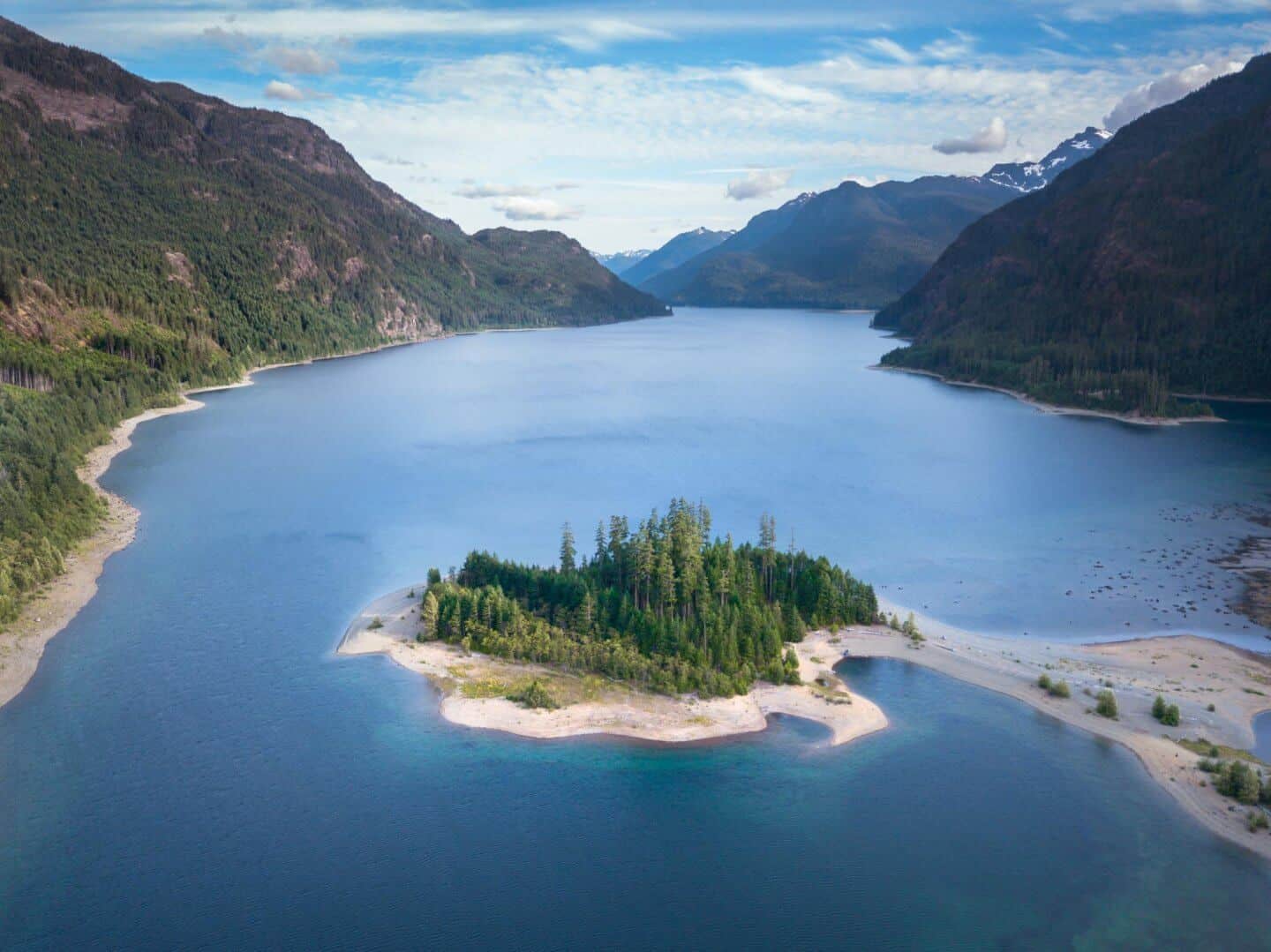
Can you please tell me the name of the place on your cover/title page?
Oh my gosh Angela we are so sorry for the late response! That is Ucluelet; it is one of the most beautiful places on the island!
Great post!! Hoping to get to the island next month & will definitely be referencing your post!!?
Thank you so much! We’re glad you found it useful and hope you have an amazing trip, it’s such a beautiful place 🙂
Your explanation of the sight seeings near Vancouver is so detailed with beautiful photos. Thanks a lot.
The world has incredible beauty which makes us visit new places for sure.
Thank you so much for your kind comment Alex. It’s great to hear you found our Vancouver road trip itinerary useful 🙂 The world truly is beautiful, you’re right about that!
Very Detailed trip Summary, You wont believe I have actually booked tickets to Victoria to Explore the Island after reading your travel Itenary
Thank you so
Oh how amazing! We are glad you found it useful and hope you have an amazing visit!
Helllo
I visited again following your Itenary
Thank you. This is amazingly well done
Nice, now we are ready for our trip in Vancouver island
Thank you for your kind words Alex. I hope you have the best time in Vancouver Island!
– Adam