Bodega Bay
Bodega Bay is a shallow, rocky inlet of the Pacific Ocean on the coast of northern California in the United States. It is approximately 5 mi across and is located approximately 40 mi northwest of San Francisco and 20 mi west of Santa Rosa.Photo: Pixistik1687, Public domain.
Localities in the Area

Valley Ford
Hamlet
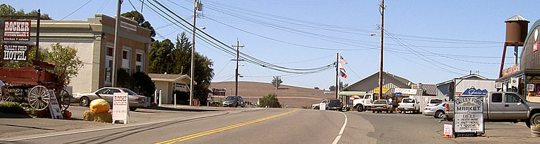
Photo: Stepheng3, Public domain.
Valley Ford is an unincorporated community and census-designated place in western Sonoma County, California, United States. Valley Ford is situated 5 miles northeast of Bodega Bay.
Fallon
Hamlet
 Fallon, California is an unincorporated community in Marin County, California. Fallon is situated 5 miles east of Bodega Bay.
Bodega Bay
- Type: Bay
- Description: inlet in California
- Categories: inlet, archaeological site, historic district and body of water
- Location: Marin County, California, United States, North America
- View on OpenStreetMap
Latitude
38.27353° or 38° 16' 25" northLongitude
-123.00611° or 123° 0' 22" westElevation
-16 feet (-5 metres)Open Location Code
84CR7XFV+CHGeoNames ID
5329734Wikidata ID
Q2088977Bodega Bay Satellite Map
© OpenStreetMap, Mapbox and Maxar
Also Known As
- Cebuano: Bodega Bay (luuk)
- Cebuano: Bodega Bay
- Chinese: 博德加灣
- Dutch: Bodega Bay
- Hebrew: בודגה ביי
- Italian: Bodega Bay
- Russian: Бодега
- Spanish: Bahia Bodega
- Spanish: Bahia de Bodega
- Spanish: Bahía Bodega
- Spanish: Bahía de Bodega
- Hafen Bodega
- Port Bodega
- Port Romanzov
- Port Rumyantsev
- Puerto De La Bodega
Other Places Named Bodega Bay
Localities in the Area
- Dillon BeachHamlet, 2½ miles southeast
- Bodega IslandArea, 3½ miles northwest
- Vincent LandingHamlet, 5 miles southeast
- BodegaVillage, 5 miles north
- Bodega DunesArea, 5 miles northwest
Landmarks in the Area
- Estero de San AntonioStream
- Shorttail GulchValley, 2 miles north
- Tomales PointPoint, 2½ miles south
- Tomales BluffCliff, 2½ miles south
- Pinnacle RockIsland, 2½ miles north
Popular Destinations in Marin County
Discover Tiburon, San Rafael, Sausalito and Novato.
Escape to a Random Place
Discover other bays in the world.
About Mapcarta. Thanks to Mapbox for providing amazing maps. Text is available under the CC BY-SA 4.0 license, excluding photos, directions and the map. Description text is based on the Wikipdia page Bodega Bay. Photo: Pixistik1687, Public domain.