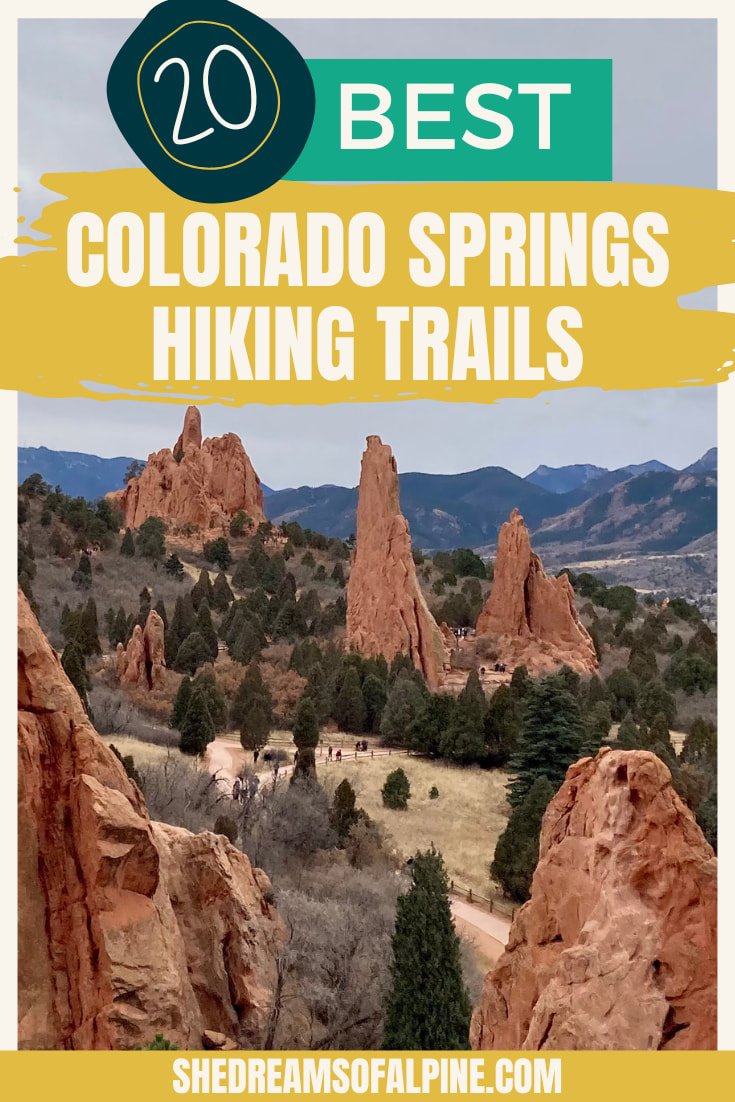
The 20 Best Colorado Springs Hiking Trails (For All Levels)

When Michael & I decided to settle down in one spot for a while and give up van life, we chose to make Colorado Springs our home. And one of my absolute favorite things about living here is the amazing Colorado Springs hiking!
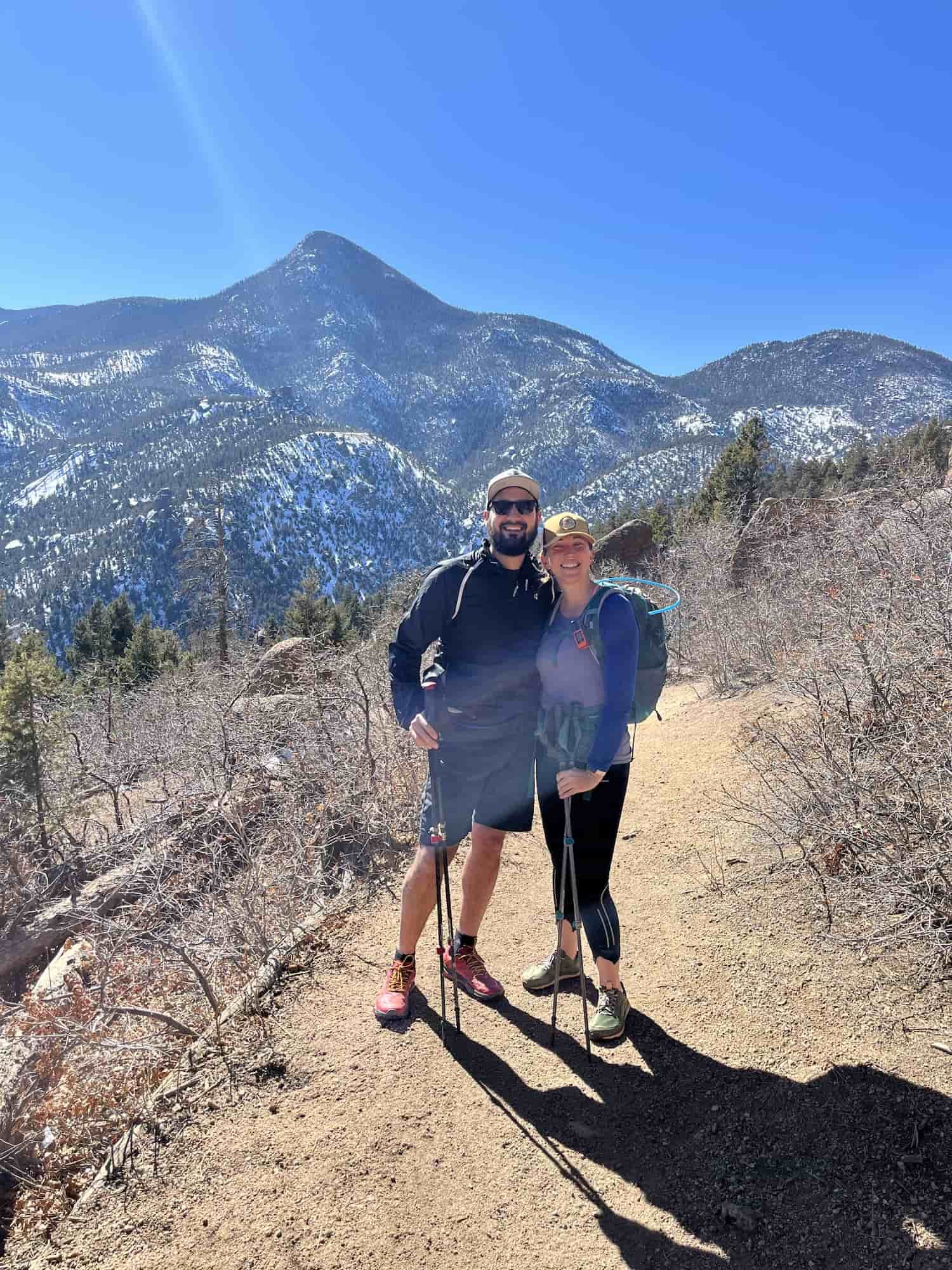
There are trails right outside our front door, and I truly can’t get enough of it! From the iconic sandstone formations of Garden of the Gods to the leg & lung-busting workout of the Manitou Incline to the many spectacular waterfall trails, Colorado Springs hiking offers something for everyone.
ABOUT THIS GUIDE TO COLORADO SPRINGS HIKING
There are so many awesome Colorado Springs hiking trails, so I’ve split this guide up to help you find the best hikes in Colorado Springs for you. Hiking difficulty is always subjective, but here is how I’ve generally categorized Colorado Springs trails:
Best Easy Colorado Springs Hiking Trails - If a trail is less than 4 miles OR under 500 feet of total elevation gain, the hike is rated as “easy.”
Best Moderate Colorado Springs Hiking Trails - If the trail is within the 4-13 mile range OR between 500-2,000 feet of total elevation gain, the hike is rated as “moderate.”
Best Difficult Colorado Springs Hiking Trails - If a trail is over 13 miles long OR over 2,000 feet of total elevation gain, the hike is rated as “difficult.”
I have done a lot of these trails during my short time so far in Colorado Springs (including several trips up the Manitou Incline!) and some of the others are high on my to-hike list!
BEST EASY COLORADO SPRINGS HIKING TRAILS
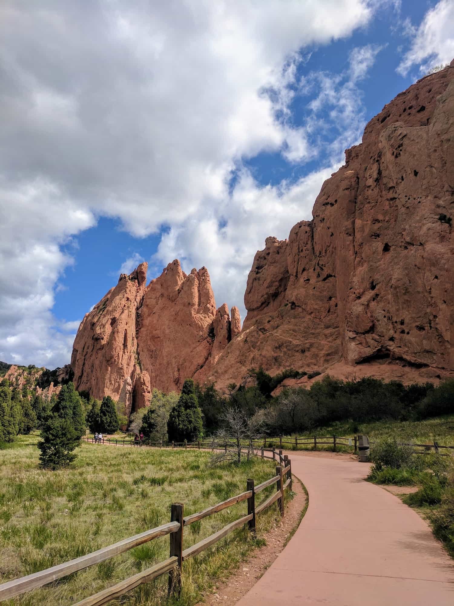
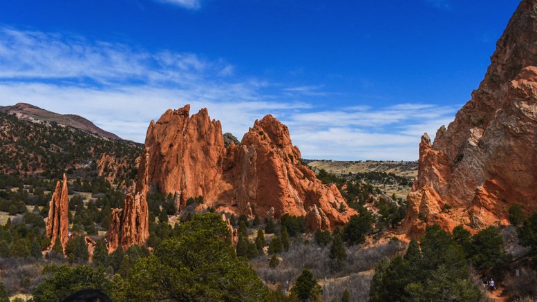
1 - GARDEN OF THE GODS TRAILS
Garden of the Gods Hiking Quick Facts:
Type of Trail: Choose your own adventure!
Total Mileage: 0.5-3.5 miles round trip
Total Elevation Gain: Minimal to 300 feet
Difficulty: Easy
Permit Required: No
For hiking in Colorado Springs, Garden of the Gods tops the list! The signature red rock formations in the park are probably what come to mind first when you think of Colorado Springs hiking. And as a bonus, entrance to the park is always free!
You can choose your own adventure on the Garden of the Gods trails, most of which are easy and many of which are paved. Loop through through the center of the park to see the sandstone spires, like Montezuma’s Tower, up close.
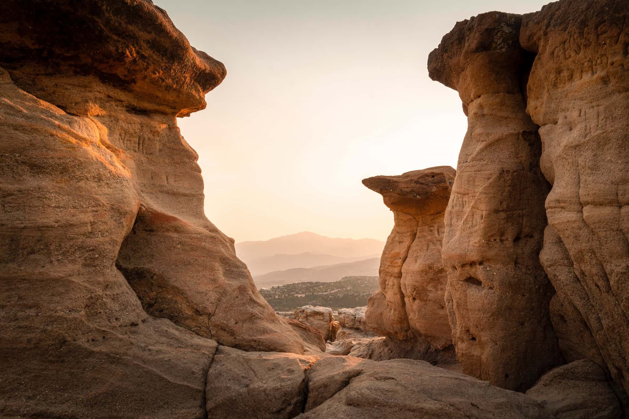
2 - RED ROCK CANYON OPEN SPACE TRAILS
Red Rock Canyon Open Space Hiking Quick Facts:
Type of Trail: Whatever you want!
Total Mileage: 1-3.3 miles round trip
Total Elevation Gain: Minimal to 350 feet
Difficulty: Easy
Permit Required: No
Just across the road from Garden of the Gods, you can explore more trails through the sandstone at Red Rock Canyon Open Space. There are several easy loops to choose from, including the Hogback, which offers a great perspective of the park with Pikes Peak in the distance.
3 - BUFFALO CANYON TRAIL
Buffalo Canyon Hike Quick Facts:
Type of Trail: Out & back
Total Mileage: 0.5 miles round trip
Total Elevation Gain: 118 feet
Difficulty: Easy
Permit Required: No
North Cheyenne Cañon is a beautiful area full of hikes near Colorado Springs, and the Buffalo Canyon Trail is a perfect easy introduction hike to the area. This short trail takes you to the base of Cascade Falls for a lovely view. And there are plenty of other trails in the area if you want to add on and make your hike longer.

4 - HELEN HUNT AND SILVER CASCADE FALLS
Helen Hunt and Silver Cascade Falls Hike Quick Facts:
Type of Trail: Out & back
Total Mileage: 0.6 miles round trip
Total Elevation Gain: 298 feet
Difficulty: Easy
Permit Required: No
Another great little trail in North Cheyenne Cañon is Helen Hunt and Silver Cascade Falls. This is a super easy hike that’s short but steep. It starts at a waterfall – Helen Hunt Falls – and finishes at a waterfall – Silver Cascade Falls – before you head back. The falls are beautiful when they’re running, but they will dry up to a trickle during part of the year.
5 - SANTA FE REGIONAL TRAIL
Santa Fe Regional Trail Hike Quick Facts:
Type of Trail: Point-to-point
Total Mileage: 16.9 miles
Total Elevation Gain: 1,213 feet
Difficulty: Easy
Permit Required: No
If you look at the trail stats here, you might wonder why this trail is categorized as easy! But that’s because the Santa Fe Regional Trail is a well-built point-to-point trail, which means you can just turn around whenever you’ve had enough hiking, so most people only hike a small section of it.
There are several trailheads and access points for the Santa Fe Trail, so you can choose to do as much or as little of the trail as you like. The Santa Fe Trail is also a great connector trail to lots of other hikes around Colorado Springs.
GRAB MY [FREE] OUTDOOR BACKPACKER STARTER KIT:
I created the Ultimate Outdoor Backpacker Starter Kit for you (and it's FREE)! This starter kit is filled with 14 pages of my best hiking and backpacking tips to help you learn what it takes to become a safe, confident, and self-sufficient outdoor backpacker!
BEST MODERATE COLORADO SPRINGS HIKING TRAILS
6 - PULPIT ROCK PARK LOOP
Pulpit Rock Park Loop Hike Quick Facts:
Type of Trail: Loop
Total Mileage: 4.2 miles round trip
Total Elevation Gain: 557 feet
Difficulty: Moderate
Permit Required: No
A popular trail in Austin Bluffs Open Space, the Pulpit Rock Park Loop is one of the lovely moderate Colorado Springs trails. You’ll meander your way along the perimeter of the park before making your way up to the ridgeline of Pulpit Rock. From here, you can take in the scenic views of the Rocky Mountains before heading back down the loop.

7 - MOUNT MUSCOCO
Mount Muscoco Hike Quick Facts:
Type of Trail: Out & back
Total Mileage: 4 miles round trip
Total Elevation Gain: 1,292 feet
Difficulty: Moderate
Permit Required: No
Mount Muscoco makes for a great way to snag a summit on a moderate trail. Located in Cheyenne Cañon, this trail does get rocky near the top but stays Class 1, though it is steep so be prepared for a workout. I would recommend trekking poles for this one, due to the steepness.
It’s totally worth the effort to get to the 8,020 foot summit of Mount Muscoco where you’ll find panoramic views of nearby mountains, waterfalls, and old mining ruins. If you want to bag a second summit, you can also hike up to the top of Mount Cutler (7,218 feet) on the way to Mount Muscoco, since they are off the same trail.
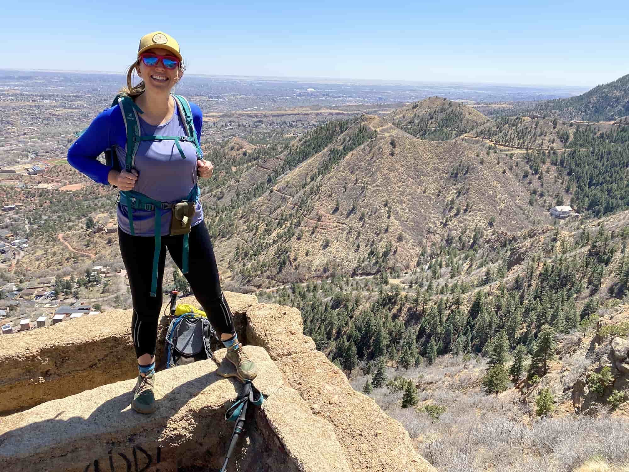
8 - RED MOUNTAIN
Red Mountain Hike Quick Facts:
Type of Trail: Out & back
Total Mileage: 2.5 miles
Total Elevation Gain: 944 feet
Difficulty: Moderate
Permit Required: No
For an easier alternative to the famous Manitou Incline, but with equally awesome views from the top, check out Red Mountain. It’s about the same distance to the top as The Incline, but it has switchbacks instead of going straight up. The trail is also less crowded, and you can even use the same free parking and shuttle as The Incline to get to the trailhead.
And the views are spectacular, featuring Pikes Peak, the Manitou Incline, Garden of the Gods, as well as the city of Colorado Springs. This really should be at the top of your list of best hikes near Colorado Springs!

9 - SEVEN BRIDGES TRAIL
Seven Bridges Trail Hike Quick Facts:
Type of Trail: Out & back
Total Mileage: 5.7 miles
Total Elevation Gain: 1,597 feet
Difficulty: Moderate
Permit Required: No
Another one of the beautiful hikes near Colorado Springs in North Cheyenne Cañon, the Seven Bridges Trail is a shady hike along a stream, so it’s especially nice during the hot summer months. You’ll cross seven bridges along the trail (hence the name), and can splash in the creek to cool off when it’s hot out.

10 - LOUD’S CABIN
Loud’s Cabin Hike Quick Facts:
Type of Trail: Out & back
Total Mileage: 6.2 miles
Total Elevation Gain: 1,778 feet
Difficulty: Moderate
Permit Required: No
The hike to Loud’s Cabin follows the Seven Bridges Trail for the first part of the hike. That section of the trail is pretty crowded, but you’ll find a little more solitude once you get past the popular Seven Bridges part. (Be sure to get to the parking lot early on weekends, since it can fill up quickly though.)
There is a short section of this trail (about half a mile) that is very narrow loose gravel on steep terrain. I went slowly through it and was okay, but it definitely wasn’t my favorite part. Keep that in mind before hiking this trail if that doesn’t sound like something you’d be comfortable with.
The trail gets better after that though, and you’ll walk through a really cool aspen grove at one point. At the end you’ll reach the ruins of Loud Cabin, which are pretty neat! Then you can turn around and head back or connect this with a bunch of other nearby trails if you want more mileage.

11 - ST. MARY’S FALLS
St. Mary’s Fall Hike Quick Facts:
Type of Trail: Out & back
Total Mileage: 5.9 miles
Total Elevation Gain: 1,394 feet
Difficulty: Moderate
Permit Required: No
St. Mary’s Falls is another one of the best hikes near Colorado Springs that culminates in a waterfall. The trailhead for St. Mary’s Falls is at the same parking lot as the Seven Bridges hike, and the shady trail runs along a stream for most of the hike. The trail is lovely the whole way, especially when wildflowers are in bloom, and watching the 300-foot waterfall makes the elevation gain – it’s uphill the whole way to the falls – worth it.
12 - COLUMBINE TRAIL
Columbine Trail Hike Quick Facts:
Type of Trail: Out & back
Total Mileage: 7.6 miles
Total Elevation Gain: 1,607 feet
Difficulty: Moderate
Permit Required: No
The Columbine Trail is a wonderful way to check out Cheyenne Cañon, and it actually has three trailheads so you can make the hike shorter or longer to fit your needs. The trail follows the creek through Cheyenne Cañon with lovely views of the granite canyon walls along the way to Helen Hunt Falls.
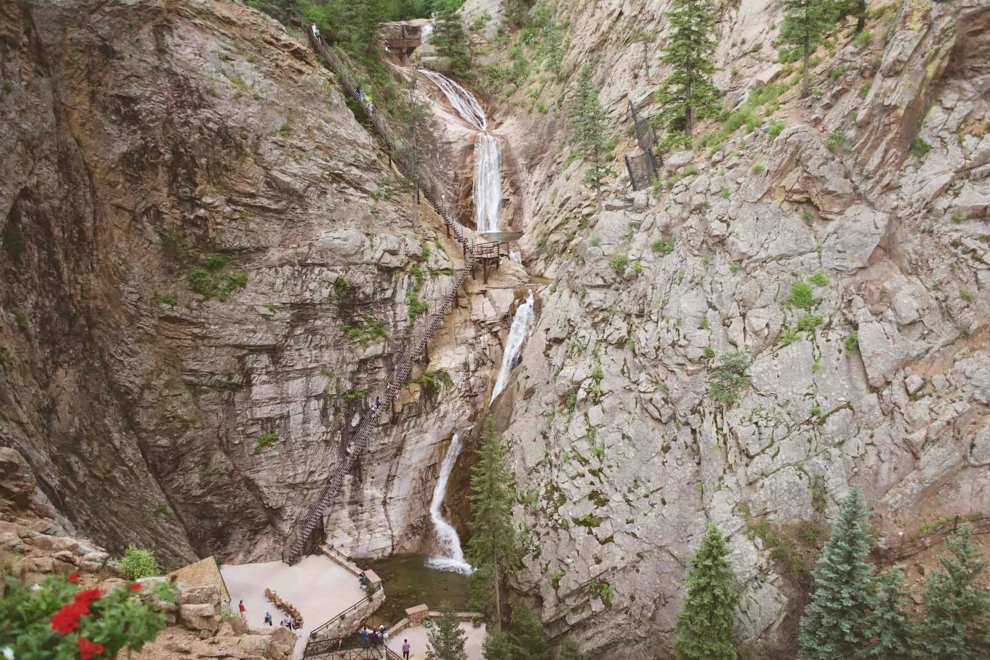
13 - SEVEN FALLS
Seven Falls Hike Quick Facts:
Type of Trail: Out & back
Total Mileage: 3 miles
Total Elevation Gain: 770 feet
Difficulty: Moderate
Permit Required: $17 ticket required for entry
Set in a stunning 1,250-foot wall box canyon, the hike to Seven Falls is a special experience. You’ll hike up 224 steps to reach the actual trail that then takes you to the top of the 181-foot waterfall for incredible views.
Since the trail is located on the grounds of The Broadmoor resort, hiking Seven Falls requires purchasing a ticket and taking a shuttle bus to the trailhead. Seven Falls is not open every day, so be sure to check The Broadmoor website to find out the operating hours.

14 - MOUNT ROSA
Mount Rosa Hike Quick Facts:
Type of Trail: Out & back
Total Mileage: 6.9 miles
Total Elevation Gain: 1,729 feet
Difficulty: Moderate
Permit Required: No
There are a couple of ways to get to the summit of Mount Rosa, but starting from the Frosty Park trailhead is the more moderate route (although the drive to the trailhead requires 4WD). You can reach the summit of Mount Rosa as an extension of the trail to St. Mary’s Falls as well, but this is a much more challenging hike.
The moderate route up Mount Rosa is a wonderful way to summit a cool peak and take in the amazing views from the top. As a fun piece of history, Mount Rosa was named after Rose Kingsley, an Englishwoman who came to Colorado Springs and was known as an avid hiker.
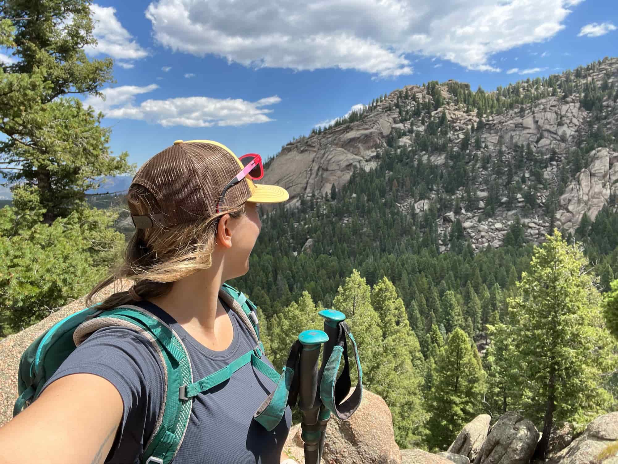
15 - LITTLE SCRAGGY PEAK LOOP
Little Scraggy Peak Loop Hike Quick Facts:
Type of Trail: Loop
Total Mileage: 13 miles
Total Elevation Gain: 1,601 feet
Difficulty: Moderate
Permit Required: $7 day use fee at trailhead
This trail is about an hour drive from Colorado Springs in the Buffalo Creek Recreation Area, which is known for its awesome mountain biking trails – and I would love to come back and mountain bike it someday! Be aware that this means you can expect a lot of mountain bikers sharing the trail, so pay attention while hiking and know the trail etiquette about who has the right of way.
Little Scraggy Peak loop is an excellent long hike that shares a segment with the Colorado Trail. As you hike along the base of Little Scraggy Mountain, you’ll encounter some fun-looking boulders, and you’ll follow the trail through some forested areas. When you come out of the woods, you’ll get some great views of Pikes Peak in the distance.
You can do the loop either direction, but I recommend hiking Little Scraggy Peak loop clockwise, because it’s somewhat less steep that way.
16 - UTE PASS TRAIL
Ute Pass Trail Hike Quick Facts:
Type of Trail: Out & back
Total Mileage: 7.5 miles
Total Elevation Gain: 1,750 feet
Difficulty: Moderate
Permit Required: No
Although the Ute Pass Trail shares a trailhead with the Manitou Incline, it takes you along an original Native American trail for a totally different hike. The Ute people, the oldest residents of Colorado, established this trail as a connection between the plains and the mountains.
As you hike the Ute Pass Trail, you’ll encounter interpretive panels featuring Ute history, as well as sweeping views of the area.
BEST DIFFICULT COLORADO SPRINGS HIKING TRAILS
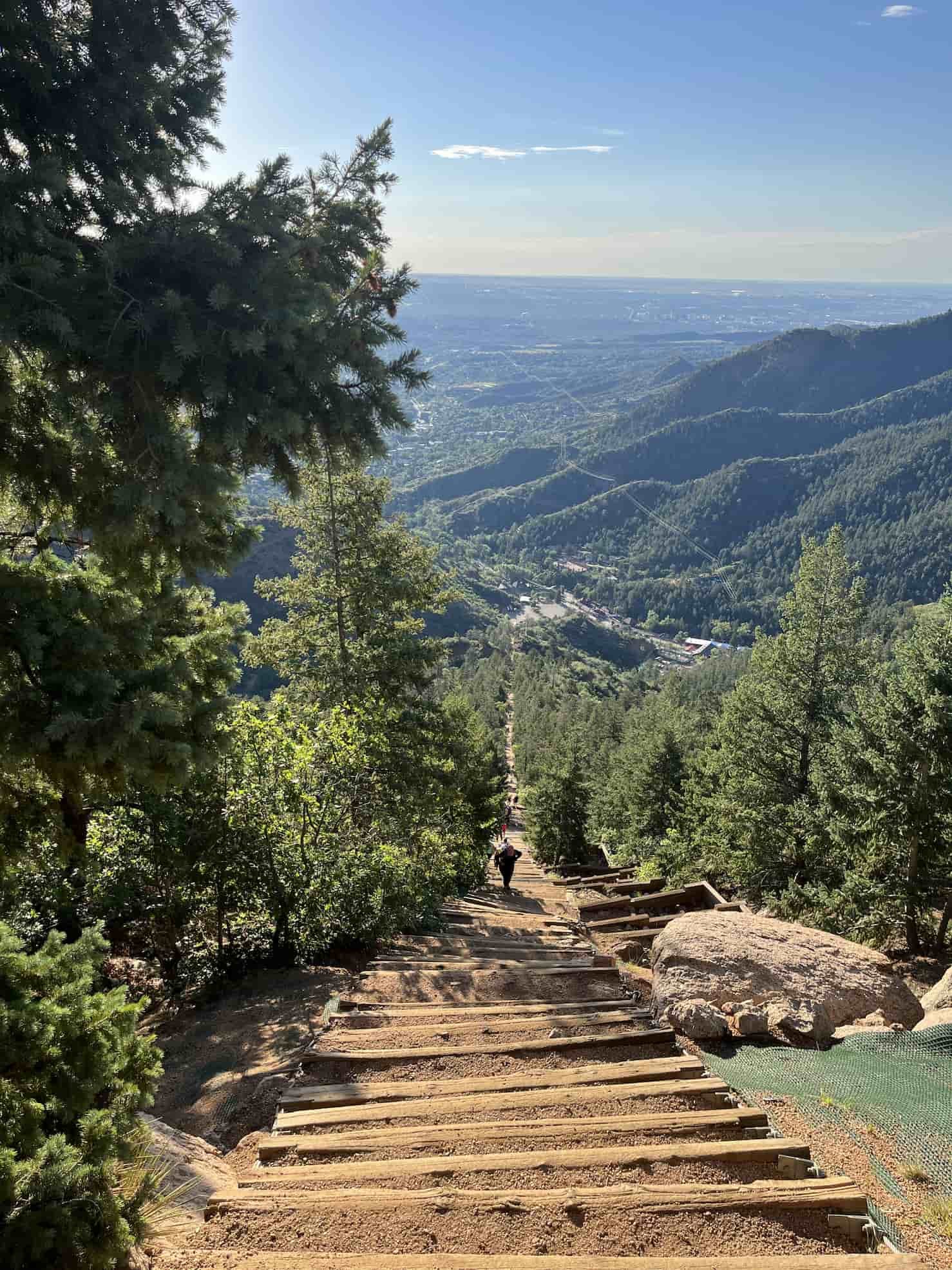
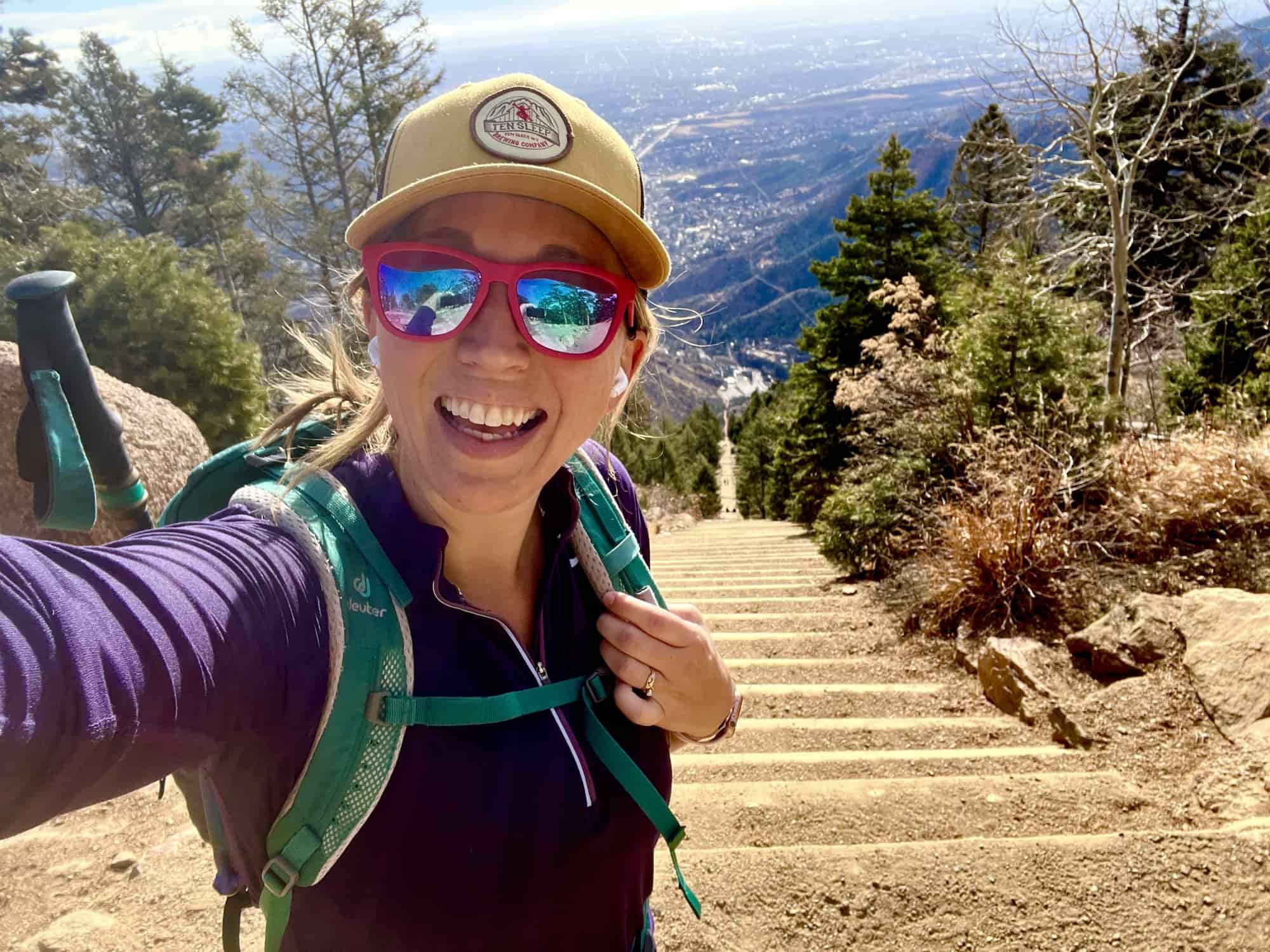
17 - MANITOU INCLINE
Manitou Incline Hike Quick Facts:
Type of Trail: Loop
Total Mileage: .9 miles up The Incline (+ 3 miles back down the Barr Trail)
Total Elevation Gain: 2,020 feet
Difficulty: Difficult
Permit Required: Yes, free reservations are required
The Manitou Incline (or just “The Incline” to locals), is 2,020 feet of elevation gain basically straight up in just under a mile. A total of 2,744 steps take you to the top, before you head back down via the 3-mile long Barr Trail (to keep the hiking traffic going one-way up the incline).
If this sounds like a serious workout, believe me, it is! Both your legs and lungs will definitely feel it on the Manitou Incline hike. But it’s a great way to test your fitness, especially if you’re training for a Colorado 14er or another big hike.
You must make a free online reservation to hike The Incline, and spots are timed and limited. Find out more details about the Manitou Incline, parking, and reservations here.

18 - PIKES PEAK
Pikes Peak Hike Quick Facts:
Type of Trail: Out & Back
Total Mileage: 26 miles round trip
Total Elevation Gain: 7,434 feet
Difficulty: Difficult
Permit Required: No
Pikes Peak is the mountain that stands out in the backdrop of Colorado Springs, and you can summit this 14er (14,115 feet) a couple of different ways.
The most common way to do the Pikes Peak hike is via the Barr Trail, which is 13 miles to the summit. From there, you can take a shuttle or the Cog Railway back down if you don’t want to hike another 13 miles – or you could make this into a two-day backpacking trip and spend the night at Barr Camp (reservations required).
Another route up Pikes Peak is via the Crags Trail. This is the shorter option to the summit, at 13.6 miles round trip (so about half as long), with less elevation gain.
19 - ROCKY MOUNTAIN PEAK
Rocky Mountain Peak Hike Quick Facts:
Type of Trail: Loop
Total Mileage: 9 miles round trip
Total Elevation Gain: 2,650 feet
Difficulty: Difficult
Permit Required: No
Often overshadowed by nearby Pikes Peak, Rocky Mountain Peak is an awesome hidden gem among Colorado Springs hiking trails. This trail actually shares the same start on the Barr Trail as Pikes Peak for a few miles before it splits off and heads off toward the Fremont Experimental Forest. When you reach the summit, you will have unparalleled views of the entire Pikes Peak mountain range and the town of Colorado Springs.
20 - MOUNT GARFIELD PEAK
Mount Garfield Hike Quick Facts:
Type of Trail: Out & back
Total Mileage: 9.7 miles round trip
Total Elevation Gain: 3,480 feet
Difficulty: Difficult
Permit Required: No
If you’re an experienced hiker looking for a challenge on multiple levels, the hike up Mount Garfield is the epic adventure you seek. Bring your GPS and trekking poles on this hike because much of it is on a very faint to non-existent trail – marked only by cairns – that gets super steep and loose as you near the summit. But if you make it to the top, you’ll be rewarded with some truly incredible vistas that might just make you forget the struggle.
COLORADO SPRINGS HIKING PACKING LIST
Here are some of the essential items to bring on any Colorado Springs hiking trail. This is definitely not a comprehensive list, so also be sure to consider the terrain and check the weather where you’ll be hiking and pack appropriately for the conditions.
Note: The list below contains affiliate links.
Again, remember this is NOT your full day hiking packing list (just some of the super important items to remember), so check out my day hiking checklist for my full gear recommendations.
DOWNLOAD OUR HIKING PACKING CHECKLIST:
So that you can hit the trails with peace of mind knowing that you didn’t leave anything essential behind!
Hope this guide has you ready to hit the trails in Colorado Springs! Which Colorado Springs hiking trail is at the top of your list? Let us know in the comments!
More Trail Guides for the Western US:
If you’re looking for more trails in Colorado and other western states, check out these blog posts:
Also be sure to check out these essential hiking resources!
7 Tips to Hiking and Summiting Your First Fourteener Mountain
Permit Deadlines and Reservations for Popular California Hiking Trails
Cheers,
Allison - She Dreams of Alpine


15 Incredible Joshua Tree Hikes to Explore the Desert | Entering Joshua Tree National Park is like landing on another planet – the landscape of rock formations and gnarled Joshua trees is simply otherworldly. To fully explore this crazy cool desert landscape, you’ll want to try one of these 15 amazing Joshua Tree hikes in the park. | shedreamsofalpine.com