City of Battle Creek
Battle Creek is a city in Calhoun County, West Central Michigan, with a population of 51,000. It is well known for its breakfast cereal industry and the Battle Creek Sanitarium which was a high-end health spa started by W.K.Notable Places in the Area
W. K. Kellogg Airport
Aerodrome
W. K. Kellogg Airport is a city-owned, public-use, joint civil-military airport located three nautical miles west of the central business district of Battle Creek, a city in Calhoun County, Michigan, United States.
Battle Creek Transportation Center
Railway station
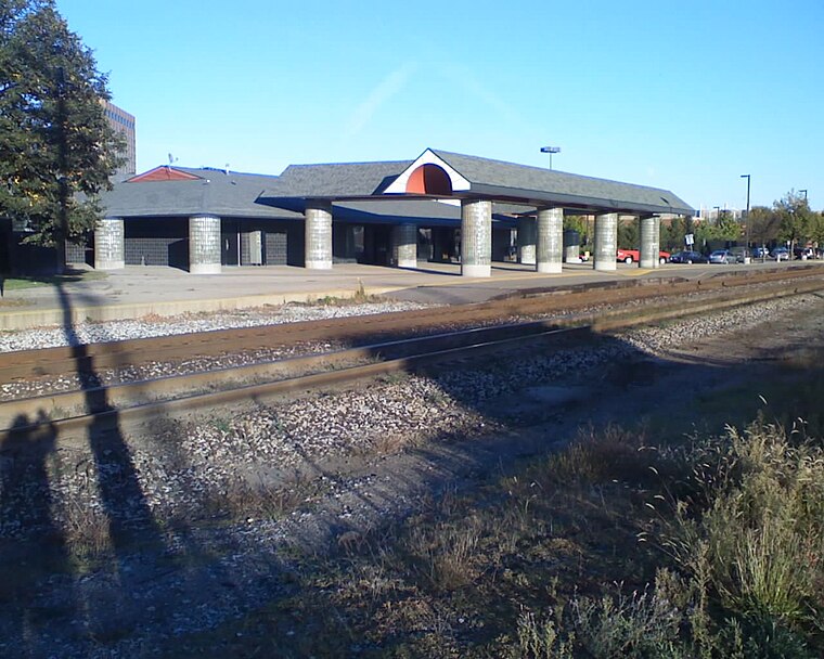
Photo: Dp67, Public domain.
Battle Creek Transportation Center is an intermodal station in Battle Creek, Michigan, used by Amtrak, Indian Trails and Greyhound Lines. Battle Creek Transportation Center is situated 2½ miles northeast of City of Battle Creek.
Battle Creek Regional History Museum
Museum
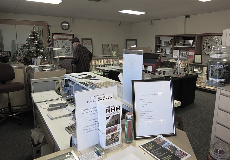
Photo: Gpwitteveen, CC BY-SA 3.0.
Battle Creek Regional History Museum is situated 2½ miles northeast of City of Battle Creek.
City of Battle Creek
- Type: Locality with 52,300 residents
- Location: Michigan, Midwest, United States, North America
- View on OpenStreetMap
Latitude
42.2985° or 42° 17' 55" northLongitude
-85.2296° or 85° 13' 47" westPopulation
52,300Elevation
928 feet (283 metres)Open Location Code
86JP7QXC+95GeoNames ID
4985159City of Battle Creek Satellite Map
© OpenStreetMap, Mapbox and Maxar
Other Places Named City of Battle Creek
In the Area
City of Battle Creek is situated close to the hamlets Springfield Place and Lakeview.
Localities
- SpringfieldVillage
- Thunderbird Mobile VillageLocality, 2½ miles north
- Old Mill GardensHamlet, 2½ miles southeast
- Sunrise HeightsHamlet, 3 miles east
- Orchard ParkHamlet, 3½ miles northeast
- UrbandaleHamlet, 4 miles north
Landmarks
- Memorial Park CemeteryCemetery
- Youngs CemeteryCemetery
- Sunset GardensCemetery
- Clark IslandIslet
- Goguac LakeLake
- Vince IslandIsland
Popular Destinations in Michigan
Escape to a Random Place
About Mapcarta. Thanks to Mapbox for providing amazing maps. Text is available under the CC BY-SA 4.0 license, excluding photos, directions and the map. Description text is based on the Wikivoyage page City of Battle Creek. Photo: Traveler100, CC BY-SA 4.0.