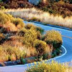
The Angeles Crest Highway is a scenic drive in California in the Los Angeles Area. This is one of the most beautiful roads in California. In fact, it is a unique opportunity to have an alpine road in direct proximity of L.A. area.
Where is the Angeles Crest Highway?
The road is located on the northeast side of Los Angeles in California. It starts in La Cañada and ends near Wrightwood.
The Angeles Crest Highway is a popular destination among car enthusiasts, bikers, and road cyclists for its scenery, and the possibility to view alpine landscapes near Los Angeles. Taking a drive on this highway offers a chance to escape the city and enjoy clean air, mountains, and thrilling curves.
You can locate the road on the map below:
Enlarge the map
Facts about the Angeles Crest Highway
Road description:
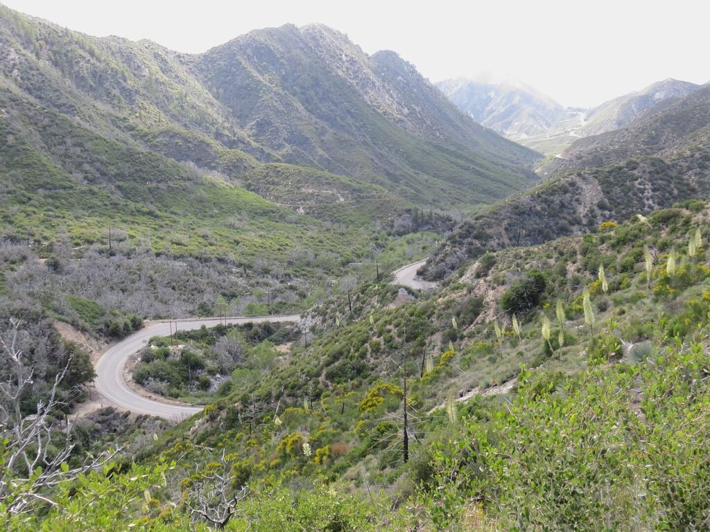
This is a two lanes road that passes through the San Gabriel Mountains and the Angeles National Forest. The entire Angeles Crest Highway, with the exception of a very small section in La Cañada, is a part of California State Route 2.
The itinerary is 105 kilometers (66 miles) long. As already said, the road crosses the San Gabriel Mountains and is one of the highest roads in California at some point it is 2100 meters (7000 ft) above the sea level. The highest point of this mountain is the Dawson Saddle peak (2410 meters, 7900 ft).
The drive from La Cañada to Wrightwood on the Angeles Crest Highway typically takes between 1.5 to 2 hours.
The road is in excellent condition as a large part was reconstructed after closure in the 2000s. In fact, the asphalt is really good and the bikers can enjoy the ride and don’t think about potholes.
In the high season or on weekends there can be a lot of people on that road, so better choose a weekday or come there earlier in the morning!
The speed limitation is 45 mph (70 km/h) to 55 mph (90 km/h), depending on the portion of the road.
Be aware that there is no gas station for 55 miles (90 kilometers) between La Cañada and Wrightwood. Consider refueling before starting your road trip!
History
The original purpose of the Angeles Crest Highway was to act as a fire access road. Construction started in 1929 but was put on hold when World War II broke out.
Work began again in 1946 after the war was over, and it was finished a decade later, in 1956. Prisoners who were made to work on the project were employed to build the highway.
There was an idea by local authorities to upgrade the road into a freeway in the 1950s. However, the idea was abandoned because of the difficult terrain.
How to get to the Angeles Crest Highway?
Usually, people come from Los Angeles. In this case, you will have to drive in the north east direction to La Cañada town. The route is a part of the California State route number 2, so you can take the Glendale freeway (part of state route 2) and go straight to the Angeles Crest Highway.
If you are coming from the other side (from Las Vegas or from the Cajon Pass) and are going in direction of the pacific coast, you will have to get to Wrightwood town where the state route 2 crosses the state road 138.
You visualize how to get there on this map of the drive:
Things to do nearby
There are several activities to practice or places to see while driving the Angeles Crest Highway.
Of course, there are viewpoints where you can admire the splendid landscapes. But there also other things to do, here are some of the favorite one:
- The Mount Wilson Observatory, located on Mount Wilson in the San Gabriel Mountains. Situated at 1742 meters (5715 ft) above the sea level it was build here in 1904.
- There are many trails for hiking in the area. Indeed, you can easily find some on specialized hiking websites.
- You can visit the Cooper Canyon Falls, a 12 meters (40 ft) waterfall.
- In winter you can ski in the Mount Waterman or Mountain High ski resorts.
In order to park on the road, at a picnic area, viewpoints or other sites, you may need a Forest Service “Adventure Pass”. It costs 5$ for the day or 30$ annually. You can have more info on the official website of the Forest Service here.
A preview of the drive:
If you are planning your road trip to California, here is a video of the complete drive. You are obviously not obliged to see all the 2 hours, but it will give a great idea of the beauty of this road. Here is the 4K video from Youtube:
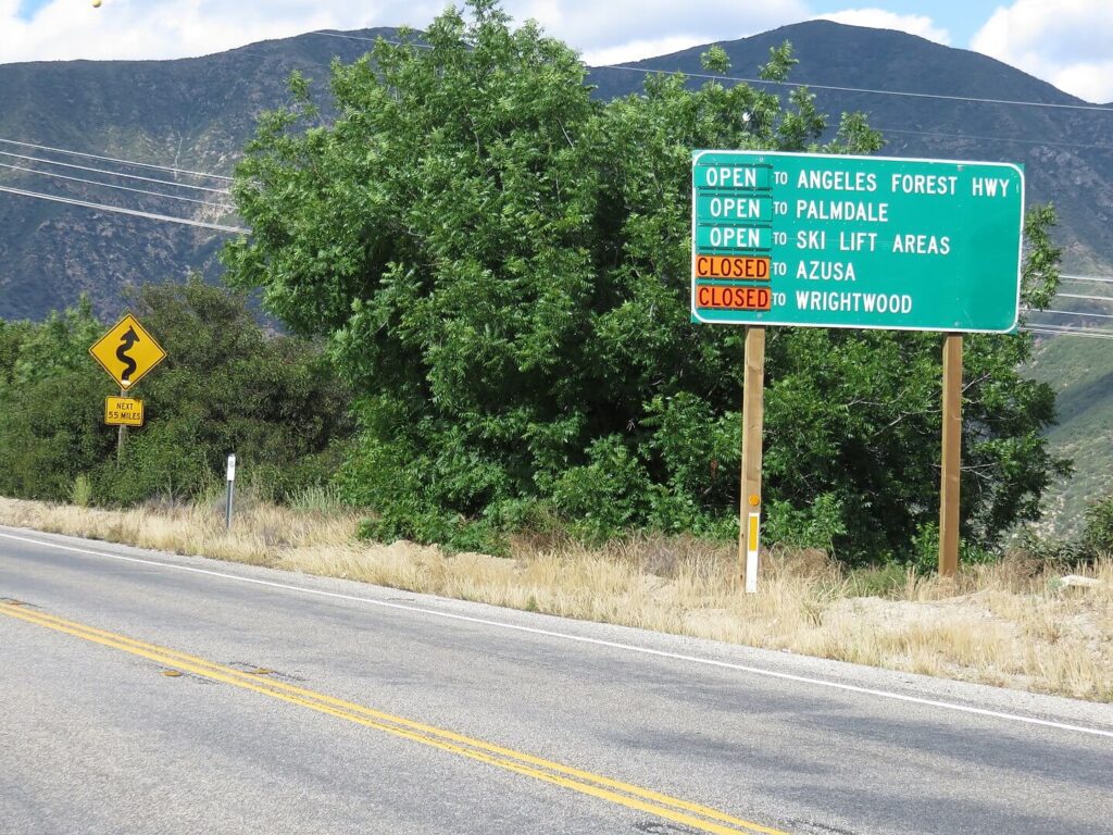
Is Angeles Crest Highway open?
How to know if Angeles Crest hwy is open today ?
The Californian State Road number 2 is normally always open. However, the road can close occasionally because of forest fire or other weather conditions issues, especially in winter. You can have some information about the road status on the official website of the Californian government, or also at the department of the public road of the LA county website. Also, a road sign will show you if the road is open:
Be aware that the mobile phone reception can be very poor in some areas, because of the mountains and the fact it’s quite inhabited in the area of the road.
Angeles Crest Highway closure :
The road was closed for a long period twice in the last 20 years. Once in 2005 because of strong winter storms. In 2006 a stronger storm caused much more damage and the road had to be partially reconstructed. The State was concerned about rebuilding the road to support the Wrightwood town business (as it depends on a big part of tourism from State Road 2). The budget allowed was 4 million dollars. But it ended with a 4 and a half years closure and more than 10 million dollars expenses. The road was reopened in May 2009.
The same year, in 2009, the road had to close again. Indeed, there was a big fire that caused many damages to some parts of the road. In addition, a rock slide added to the problems. The road was closed until June 2011.
We can draw a positive point from these problems: as we already say, the Angeles Crest Highway is today in excellent condition!
If you are in the Los Angeles area, or you are planning to get there and wonder what road you should drive in the surrounding area, the Angeles Crest Highway definitely worth it! Moreover, you can add to this itinerary the Cajon Pass drive and then go back to LA or continue into Big Bear Lake direction. That way you will have your day trip ready!
Pictures sources: Antony-22 – Own work, CC BY-SA 4.0, https://commons.wikimedia.org/w/index.php?curid=79249952
Discover other roads around in the United States: click here or see our road map!