The US is such a huge and diverse country, with 50 states that span from coast to coast, and from the chilly north to the sunny south.
Each state has its own mix of beautiful scenery, fascinating history, and unique traditions that make it a great place to visit or call home.
No matter whether you’re visiting or residing in one of these amazing 50 states, there’s always a novel and thrilling adventure waiting for you.
But what are these 50 states even called to begin with?
Let’s keep it simple for today and let us just have a look at what the names of these states are and discuss a few basic facts about these.
Note: You will find FREE downloads (All US States in alphabetical order, US States with capitals, US States on the map & more) towards the end of this post! Enjoy.
We will kick this off with a list of all 50 US states in alphabetical order.
US States List in Alphabetical order
- Alabama
- Alaska
- Arizona
- Arkansas
- California
- Colorado
- Connecticut
- Delaware
- Florida
- Georgia
- Hawaii
- Idaho
- Illinois
- Indiana
- Iowa
- Kansas
- Kentucky
- Louisiana
- Maine
- Maryland
- Massachusetts
- Michigan
- Minnesota
- Mississippi
- Missouri
- Montana
- Nebraska
- Nevada
- New Hampshire
- New Jersey
- New Mexico
- New York
- North Carolina
- North Dakota
- Ohio
- Oklahoma
- Oregon
- Pennsylvania
- Rhode Island
- South Carolina
- South Dakota
- Tennessee
- Texas
- Utah
- Vermont
- Virginia
- Washington
- West Virginia
- Wisconsin
- Wyoming
All 50 US States List with Abbreviations
- Alabama – AL
- Alaska – AK
- Arizona – AZ
- Arkansas – AR
- California – CA
- Colorado – CO
- Connecticut – CT
- Delaware – DE
- Florida – FL
- Georgia – GA
- Hawaii – HI
- Idaho – ID
- Illinois – IL
- Indiana – IN
- Iowa – IA
- Kansas – KS
- Kentucky – KY
- Louisiana – LA
- Maine – ME
- Maryland – MD
- Massachusetts – MA
- Michigan – MI
- Minnesota – MN
- Mississippi – MS
- Missouri – MO
- Montana – MT
- Nebraska – NE
- Nevada – NV
- New Hampshire – NH
- New Jersey – NJ
- New Mexico – NM
- New York – NY
- North Carolina – NC
- North Dakota – ND
- Ohio – OH
- Oklahoma – OK
- Oregon – OR
- Pennsylvania – PA
- Rhode Island – RI
- South Carolina – SC
- South Dakota – SD
- Tennessee – TN
- Texas – TX
- Utah – UT
- Vermont – VT
- Virginia – VA
- Washington – WA
- West Virginia – WV
- Wisconsin – WI
- Wyoming – WY
50 US States List – Largest to Smallest
If you have have been wondering what US state is the biggest and what US state is the smallest, you will find this info in the list below.
All 50 US states List Largest to Smallest in Terms of Population
- California
- Texas
- Florida
- New York
- Pennsylvania
- Illinois
- Ohio
- Georgia
- North Carolina
- Michigan
- New Jersey
- Virginia
- Washington
- Arizona
- Massachusetts
- Tennessee
- Indiana
- Missouri
- Maryland
- Wisconsin
- Colorado
- Minnesota
- South Carolina
- Alabama
- Louisiana
- Kentucky
- Oregon
- Oklahoma
- Connecticut
- Utah
- Iowa
- Arkansas
- Mississippi
- Kansas
- Nevada
- New Mexico
- Nebraska
- West Virginia
- Idaho
- Hawaii
- New Hampshire
- Maine
- Rhode Island
- Montana
- Delaware
- South Dakota
- North Dakota
- Alaska
- Vermont
- Wyoming
US States List Largest to Smalls in terms of Land Area
- Alaska
- Texas
- California
- Montana
- New Mexico
- Arizona
- Nevada
- Colorado
- Oregon
- Wyoming
- Michigan
- Minnesota
- Utah
- Idaho
- Kansas
- Nebraska
- South Dakota
- Washington
- North Dakota
- Oklahoma
- Missouri
- Florida
- Wisconsin
- Georgia
- Illinois
- Iowa
- New York
- North Carolina
- Arkansas
- Alabama
- Louisiana
- Mississippi
- Pennsylvania
- Ohio
- Virginia
- Tennessee
- Kentucky
- Indiana
- Maine
- South Carolina
- West Virginia
- Maryland
- Hawaii
- Massachusetts
- Vermont
- New Hampshire
- New Jersey
- Connecticut
- Delaware
- Rhode Island
50 US States List with Capitals
- Alabama – Montgomery
- Alaska – Juneau
- Arizona – Phoenix
- Arkansas – Little Rock
- California – Sacramento
- Colorado – Denver
- Connecticut – Hartford
- Delaware – Dover
- Florida – Tallahassee
- Georgia – Atlanta
- Hawaii – Honolulu
- Idaho – Boise
- Illinois – Springfield
- Indiana – Indianapolis
- Iowa – Des Moines
- Kansas – Topeka
- Kentucky – Frankfort
- Louisiana – Baton Rouge
- Maine – Augusta
- Maryland – Annapolis
- Massachusetts – Boston
- Michigan – Lansing
- Minnesota – Saint Paul
- Mississippi – Jackson
- Missouri – Jefferson City
- Montana – Helena
- Nebraska – Lincoln
- Nevada – Carson City
- New Hampshire – Concord
- New Jersey – Trenton
- New Mexico – Santa Fe
- New York – Albany
- North Carolina – Raleigh
- North Dakota – Bismarck
- Ohio – Columbus
- Oklahoma – Oklahoma City
- Oregon – Salem
- Pennsylvania – Harrisburg
- Rhode Island – Providence
- South Carolina – Columbia
- South Dakota – Pierre
- Tennessee – Nashville
- Texas – Austin
- Utah – Salt Lake City
- Vermont – Montpelier
- Virginia – Richmond
- Washington – Olympia
- West Virginia – Charleston
- Wisconsin – Madison
- Wyoming – Cheyenne
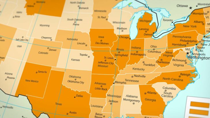
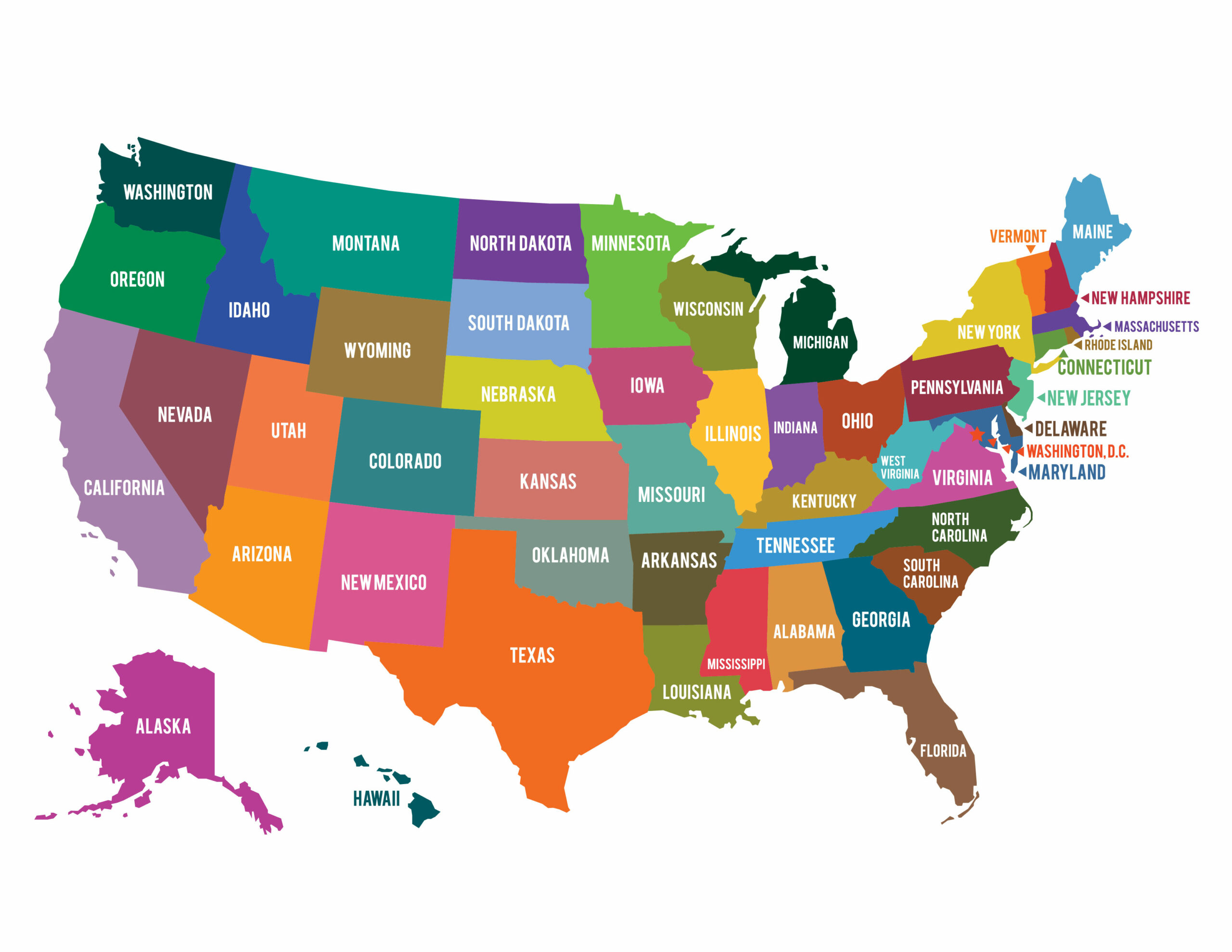
The 50 US States on the Map
If you have a look at a map of North America, you’ll see that the United States is comprised of 50 states that come together to create a beautiful, diverse tapestry.
Each US state has its own individual identity and contributes to the country’s unique character.
In the east, the Atlantic coast is lined with states like Maine, Florida, and the Carolinas (North Carolina and South Carolina), each with their distinct coastlines and history.
The Midwest is characterized by the Great Lakes region, with states such as Michigan, Ohio, and Wisconsin, and the agricultural heartland, featuring states like Iowa (IA), Nebraska (NE), and Kansas (KS).
To the south, bordering Mexico, states like Texas and Arizona showcase a blend of cultural influences and vast desert landscapes.
As we move towards the West, the majestic Rocky Mountains span across states like Colorado, Wyoming, and Montana, offering breathtaking views and outdoor adventures.
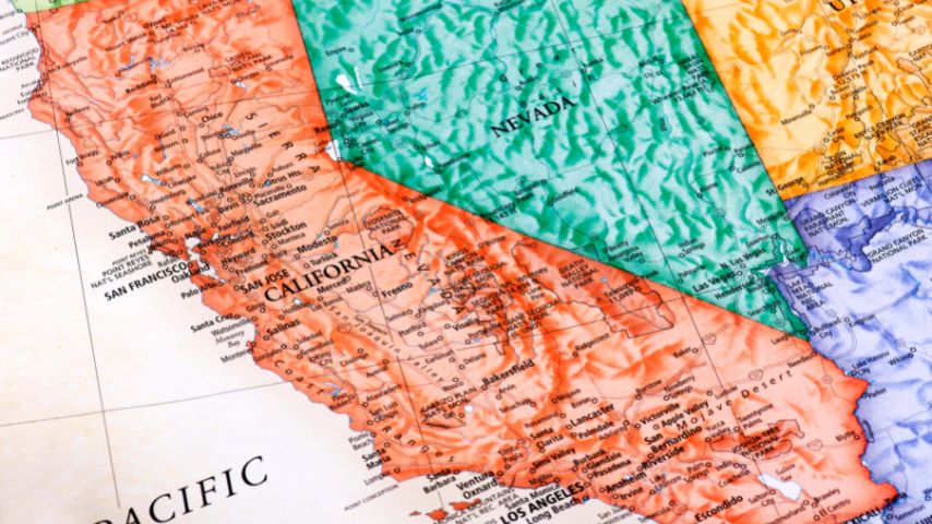
The Pacific Coast, with states like California, Oregon, and Washington, features a diverse mix of vibrant cities, rugged coastlines, and lush forests.
In addition to the contiguous 48 states, the US map also includes the non-contiguous states of Alaska and Hawaii.
If you are wondering what a contiguous state is, then here’s a definition for you: A contiguous state refers to states that are adjacent to one another and share a common border, forming an unbroken geographical connection.
As Alaska and Hawaii don’t share a common border and are not adjacent to the other states of the US, these are called non-contiguous states. (At this point, you might also want to look into what a “Tri-state area” is).
Alaska, located in the northwest extremity of the continent, is the largest state by land area and is known for its stunning wilderness and remote landscapes.
Hawaii, on the other hand, an archipelago in the Pacific Ocean, is famous for its tropical climate, volcanic landscapes, and rich Polynesian culture.
Together, the 50 states on the US map create a rich geographical tapestry that reflects the country’s diverse environments, regional cultures, and historical narratives.
List with 52 US States — Wait a second…
If you are looking for a list with 52 US States, then you are, unfortunately, misinformed.
As a matter of fact, the US only counts 50 states.
However, there are a couple of reasons why some people think that the US indeed counts 52 states instead of 50. Let’s have a quick look at these misconceptions and let’s clear things up.
People count Puerto Rico and Washington, D.C as US States
One common reason for the confusion whether the US counts 50 or 52 states is that people might be including Puerto Rico and Washington, D.C., in the count.
Puerto Rico is a US territory, not a state, and although its residents are US citizens, it does not have the same representation in Congress as the 50 states.
Then, as far as Washington D.C. goes, while it is the capital of the United States, it is NOT part of any state. It is a separate federal district, which is why it is called the District of Columbia.
People misinterpret the US flag
We all know the US flag. And we all know that there are stars on it. In fact, the US flag features 50 stars, representing the 50 states of the United States.
However, as there are so many of it, some people may miscount the stars or assume that the 13 stripes also represent states, leading to confusion about the actual number of states in the US.
People count other US territories as US States that simply are not
The US has other territories besides Puerto Rico, such as Guam, the US Virgin Islands, and American Samoa, which some people may mistakenly count as US states.
With all that said, when people search for a list with 52 states, they falsely count Puerto Rico and Washington D.C. as additional states of the US. Which is simply not the case.
Download a List with all the 50 States in the US (Word & PDF)
If you would like to download the list with all 50 US states, we are more than happy to provide this list for you:
- All 50 US States in Microsoft Word format (use in MS Word or Google Docs) in Alphabetical Order
- All 50 US States in Alphabetical Order as a PDF Download
- 50 US States List Largest to Smallest in Terms of Land Area (Word)
- 50 US States List Largest to Smallest in Terms of Land Area (PDF)
- 50 US States List Largest to Smallest in Terms of Population (Word)
- 50 US States List Largest to Smallest in Terms of Population (PDF)
50 States List in Excel Format (Excel or Google Sheets)
If you would like to have the list with all 50 US states in Excel format, here you go:
Download the US Map with all 50 States
Download the US Map featuring all the 50 states for quick reference and educational purposes (private use!)
Download a List with the 50 States and Capital for each State
US States Quiz
Download our little quiz and put your knowledge of the US states to test! Good luck!
Frequently asked questions about the 50 US States
Which US state is the largest?
In terms of land area, Alaska is the largest US state.
Which US state is the smallest?
In terms of land area, Rhode Island is the smallest state in the United States. In terms of population, Wyoming is the smallest US state.
Which is the most populous state in the US?
California is the most populous state in the US with about 39 million people.
Which US state is the oldest?
If the question refers to the oldest state in terms of joining the United States, then the answer would be Delaware. Delaware was the first state to ratify the US Constitution on December 7, 1787, making it the first state to join the Union.
Which US state is known as the “Last Frontier” and has the largest land area?
Alaska is known as the “Last Frontier” and has the largest land area.
Which state has the longest coastline, stretching over 3,300 miles?
Alaska has the longest coastline with over 3,300 miles.
What US state is known as the “Land of 10,000 Lakes”?
The US state Minnesota is known as the Land of 10,000 lakes. However, Minnesota has even more lakes than that. In fact, the amount of lakes in Minnesota is pretty close to 12,000.
Which state is home to the oldest national park in the United States, Yellowstone National Park?
Wyoming is home to Yellowstone National Park.
Are there 52 states in the US?
There are only 50 US states. Chances are that you are counting Puerto Rico and Washington D.C as US states. However, Puerto Rico is simply a US territory but not a US State and Washington D.C, while being the capital of the US, is not part of any state.


Hey fellow Linguaholics! It’s me, Marcel. I am the proud owner of linguaholic.com. Languages have always been my passion and I have studied Linguistics, Computational Linguistics and Sinology at the University of Zurich. It is my utmost pleasure to share with all of you guys what I know about languages and linguistics in general.