

Midwest Weather ForecastMidwest Weather Forecast

Midwest is 1478 m above sea level and located at 43.41° N 106.28° W. Midwest has a population of 410. Local time in Midwest is MDT.
Midwest Weather Today(1–3 days)Light rain (total 6mm), mostly falling on Thu afternoon. Very mild (max 18°C on Sun morning, min 5°C on Thu night). Wind will be generally light. | Midwest Weather (4–7 days)Light rain (total 7mm), mostly falling on Tue night. Warm (max 23°C on Mon afternoon, min 7°C on Tue night). Mainly fresh winds. | 10 Day Midwest Weather(7–10 days)Light rain (total 8mm), mostly falling on Wed night. Very mild (max 14°C on Wed afternoon, min 1°C on Thu night). Wind will be generally light. | Midwest Weather Next Week(10–12 days)Heavy rain (total 21mm), heaviest during Mon night. Warm (max 23°C on Sun afternoon, min 2°C on Mon night). Winds increasing (light winds from the SSE on Sat night, fresh winds from the NW by Sun afternoon). | |||||||||||||||||||||||||||||||||
Thu 09 | Friday 10 | Saturday 11 | Sunday 12 | Monday 13 | Tuesday 14 | Wednesday 15 | Thursday 16 | Friday 17 | Saturday 18 | Sunday 19 | Monday 20 | Tue 21 | ||||||||||||||||||||||||
PM | Night | AM | PM | Night | AM | PM | Night | AM | PM | Night | AM | PM | Night | AM | PM | Night | AM | PM | Night | AM | PM | Night | AM | PM | Night | AM | PM | Night | AM | PM | Night | AM | PM | Night | AM | |
 |  | |  |  |  | | | |  | | | | | |  | |  | | | | | | | |  | | | | | |  | | |  | | |
Wind km/h | ||||||||||||||||||||||||||||||||||||
light rain | rain shwrs | light rain | rain shwrs | clear | clear | clear | clear | clear | some clouds | clear | clear | clear | rain shwrs | rain shwrs | risk tstorm | light rain | cloudy | cloudy | light rain | light rain | light rain | light rain | light rain | light rain | some clouds | clear | clear | clear | clear | clear | risk tstorm | rain shwrs | light rain | heavy rain | light rain | |
Rain mm | 4.7 | 1.4 | 0.1 | 0.3 | - | - | - | - | - | - | - | - | - | 0.9 | 0.6 | 1.5 | 4.1 | - | - | 5 | 0.5 | 1.1 | 0.6 | 0.6 | 0.3 | - | - | - | - | - | - | 0.9 | 0.2 | 0.2 | 17 | 2.9 |
High | 7 | 6 | 9 | 12 | 10 | 15 | 18 | 15 | 18 | 20 | 15 | 20 | 23 | 18 | 16 | 14 | 10 | 11 | 14 | 11 | 7 | 8 | 4 | 4 | 7 | 4 | 11 | 15 | 12 | 21 | 23 | 14 | 13 | 11 | 5 | 3 |
Low | 6 | 5 | 7 | 11 | 8 | 11 | 17 | 12 | 15 | 19 | 13 | 17 | 23 | 11 | 14 | 14 | 7 | 8 | 13 | 3 | 5 | 7 | 1 | 2 | 7 | 2 | 6 | 14 | 10 | 16 | 22 | 10 | 11 | 8 | 2 | 3 |
Feels°C | 2 | 4 | 6 | 9 | 7 | 11 | 14 | 12 | 13 | 15 | 13 | 15 | 17 | 14 | 11 | 10 | 5 | 6 | 8 | 6 | -1 | 1 | 0 | -2 | 0 | -1 | 6 | 10 | 8 | 14 | 16 | 10 | 10 | 6 | -1 | -1 |
Humid Humid % | 80 | 91 | 79 | 64 | 63 | 54 | 30 | 37 | 41 | 28 | 51 | 45 | 19 | 54 | 55 | 61 | 84 | 63 | 37 | 96 | 66 | 48 | 92 | 82 | 51 | 67 | 58 | 24 | 35 | 29 | 23 | 88 | 83 | 82 | 100 | 100 |
UV | - | - | - | - | - | - | - | - | - | - | - | - | - | - | - | - | - | - | - | - | - | - | - | - | - | - | - | - | - | - | - | - | - | - | - | - |
| - | - | 5:46 | - | - | 5:45 | - | - | 5:43 | - | - | 5:43 | - | - | 5:41 | - | - | 5:41 | - | - | 5:39 | - | - | 5:39 | - | - | 5:37 | - | - | 5:37 | - | - | 5:35 | - | - | 5:35 | |
| 8:15 | - | - | 8:16 | - | - | 8:17 | - | - | 8:19 | - | - | 8:20 | - | - | 8:21 | - | - | 8:22 | - | - | 8:22 | - | - | 8:23 | - | - | 8:24 | - | - | 8:25 | - | - | 8:27 | - | - | |

Live weather stations near Midwest
| Weather Station | Temp. | Weather | Wind | Gusts | Cloud / Visibility |
|---|---|---|---|---|---|
|
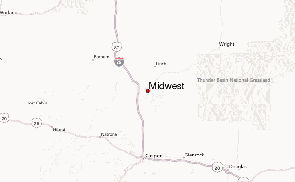
Midwest Location map
Weather forecast for places near Midwest:
| Place Name | 1–3 Day Summary | 4–6 Day Summary | 7–9 Day Summary | 10–12 Day Summary |
|---|---|---|---|---|
|
Gillette
72 km |
Some drizzle, heaviest during Thu afternoon. | Moderate rain (total 12mm), heaviest on Mon night. | Light rain (total 6mm), mostly falling on Wed night. | Light rain (total 2.4mm) at first, then becoming colder with a dusting of snow on Tue morning. |
|
Laramie
149 km |
Light rain (total 3.6mm), mostly falling on Thu afternoon. | Heavy rain (total 20mm), heaviest during Tue night. Later becoming colder with a dusting of snow on Wed morning. | A dusting of snow turning to light rain (total 2.2mm) on Thu afternoon. | Moderate rain (total 13mm), heaviest on Mon night. |
|
Cheyenne
174 km |
Light rain (total 2.6mm), mostly falling on Thu afternoon. | Heavy rain (total 21mm), heaviest during Tue night. | Light rain (total 5mm) at first, then becoming colder with a dusting of snow on Thu morning. | Moderate rain (total 17mm) heaviest on Mon night, then becoming colder with a dusting of snow on Tue morning. |
|
Fort Collins
207 km |
Light rain (total 2.3mm), mostly falling on Fri morning. | Heavy rain (total 36mm), heaviest during Tue night. | Moderate rain (total 15mm), heaviest on Fri afternoon. | Light rain (total 4.9mm), mostly falling on Tue afternoon. |
|
Rapid City
160 km |
Some drizzle, heaviest during Thu afternoon. | Moderate rain (total 11mm), heaviest on Tue afternoon. | Moderate rain (total 11mm), heaviest on Wed night. | Light rain (total 5mm), mostly falling on Sun night. |

