
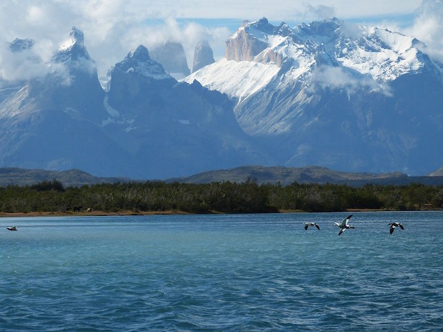
Grey Lake in Chile’s Patagonia
Continental Chile extends from ∼17°S to ∼56°S latitude and is comprised of 5 major bioclimatic zones, with an additional 25 climatic sub-types.
Subtropical Easter Island and the polar climate zone of the Chilean Antarctica (Territorio Antártico) give Chile even more unique climate zones and biodiversity.
“Seasons in the Southern Hemisphere are opposite of those in the Northern Hemisphere. Austral summer extends from December to February and austral winter from May to July ”
The climatology or average long term meteorological conditions are the result of complex interactions of countless factors, such as astronomical location, surface features, altitude, wind speed, mountain ranges, ocean currents, proximity to oceans or mountains, volcanic activity, the reflection of sunlight from clouds, and latitude.
These factors just barely scratch the surface when trying to understand the complex relationship of climate and topography or whole climate systems. This post reviews the climate of and specific climate regions of Chile, so let’s get started!
Chile is one of the most geographical and climatically diverse places on the planet because it's so long.
Continental Chile passes through 39 degrees of southern latitude, which has an immense effect on the wind and precipitation, due to the high pressures produced by the anticyclone of the South Pacific, which is located at between 25 ° S to 40 ° S latitude.
The anticyclone influences the distribution of rainfall from Norte Chico to Zona Sur.
Chile is the longest country in the world at ∼2750 miles from north to south. This span is equal to 1/10 the perimeter of Earth or the distance between Ketchikan, Alaska to the southern tip of Baja California.
“Climate is what we expect. Weather is what we get.”
Chile and comparison with the United States of America
Chile is bordered on the west by the Pacific Ocean, to the east by the Andes mountains range with the central depression and coastal range in-between.

Map source
Chile has 3 principal lands formations that run the length of the country (generally speaking):
Andes mountain range: This imposing mountain range runs the length of Chile. The tallest peaks of over 20,000 feet (6000 m) extend from Santiago to Puerto Montt, which is from the Central Zone to the northern edge of Zona Austral. The Andes are called Cordillera de los Andes or Los Andes in Spanish
The central depression or central longitudinal valley is dotted with over 100 volcanoes, numerous glaciers, and flat areas that are home to massive pastures for cattle, horses, and sheep. The central depression starts just north of Santiago and ends after being submerged into the sea near Puerto Montt, at the start of Zona Austral. This narrow valley has a maximum width of only 50 miles (80 km).
Chilean Coastal Range is a mountain range that runs parallel to the Andes mountain range but follows the Pacific coast. The highest peaks are near Santiago, at over 10,200 feet or 3110 meters and ends at the Chile Triple Junction.
“The Andes Mountain Range is the world’s longest mountain system, measuring some 5500 mi (8900 km) from north to south. ”

Santiago, Chile and the Andes
is chile hot?
Generally speaking, the answer is NO. The vast majority of Chile has four distinct seasons with pronounced seasonal differences.
Summer runs from December to March with Pichilemu being Chile’s top-spot for surfing.
Winter is June to October and the country is home to over 20 ski resorts.
The majority of Chile is located in a climatic type known as temperate or one of the subtypes of temperate.
What is a temperate climate?
A climate that isn’t as hot as subtropical but is warmer than polar climates. Summer temperatures range from the 50s to mid-70s degrees Fahrenheit in most parts of Chile, which is a fairly temperate or moderate climate.
Chile is home to 5/6 climate groups, so parts of Chile are extremely hot. Based upon the percentage of Chilean land area though, Chile has a pleasantly mild climate.
Chile has one of the most unique topographical profiles of any country due to the great diversity of land formations in such a long and narrow band. Chile’s average width is 110 miles or 177 km.
As you move south in South America, the continent narrows. This narrowing of width amplifies the effect of ocean currents on the surrounding lands and as a result, the Argentina coast is 10 degrees Fahrenheit warmer than the Chilean side even at the same latitude and elevation.
Chile has one of the most unique topographical profiles of any country due to the High Andean summits sloping down into the central valley then rising again to the peaks of the coastal range before plunging into the waters of the Pacific Ocean.
This all occurs within a width of 40 to 221 miles.

Pichilemu, Chile (top surfing spot)
Norte Grande (Great North)

Five geographical zones of Chile
Chile is generally broken down into 5 distinct geographical areas or zones since each area has a unique climate.
The coastal area of northern Chile (17°S–27°S) is one of the driest regions on the planet and is home to the Atacama Desert, which is the driest non-polar desert, and the oldest desert on Planet Earth.
The Atacama stretches nearly 700 miles in distance with temperatures hovering close to 90° F during the day and dropping down near the freezing point at night.
In the northern section of the Norte Grande region, there are four main climatic subtypes.
The coastal cloud desert climate that runs the length of the coast within this region
Inland desert climate located in the Pampa del Tamaruga, which is a plateau over 3280 feet (1000 m) high and is extremely dry (zero rainfall on average), due to absence of oceanic influences
Marginal high desert (>6500 feet) climate and this is characterized by seasonal summer rains with an annual average temperature of 50 °F / 10° Celsius.
High steppe climate in the Andean mountain range of over 10,000 feet
“The Atacama is so dry because it’s in a ‘double rain shadow’ – the Chilean Coastal Range to the West and the Andes to the East prevent just about all moisture from reaching this part of the world.”

The Atacama Desert, the driest non-polar desert in the world in northern Chile.
Average Temp of the largest city in each of the 5 geographical zones of Chile
The Mild Coastal Deserts
The coastal deserts are surprisingly mild in temperature and dry year-round, due to the moderating influence from the cold-water Humboldt Current. The coastal deserts are not overly hot:
They average 77°F (25°C) in the hottest summer month of January (seasons reversed)
64°F (18°C) degrees in the winter month of July, with similar temperatures for both nighttime and daytime.
This Norte Grande zone is a 75% arid climate, which is due primarily from the expansive Atacama Desert. The remaining 25% of this zone is polar-climate due to the 10,000+ feet of elevation of the Andes.
San Pedro de Atacama & The Center of The Desert
The town of San Pedro de Atacama is commonly considered to be in the center of the Atacama desert.
This town sits at an average of 8000 feet (2400 m) above sea level and is both dry with a mild temp. Daytime temperatures are a comfortable 70s to 80s year-round.

The town of San Pedro de Atacama in the Atacama Desert, Chile, South America

Atacama Desert, Chile
The Interesting Atacama Desert
The Atacama Desert only receives rainfall between two and four times a century, and there are parts where rainfall has never been recorded. This is the driest place on earth, excluding the Antarctic dry valleys. Despite its aridity, the coastal Atacama hosts an impressive variety of plant life. A dense fog known as the camanchaca is formed when cold air from the Humboldt Current hits warm inland desert air. This fog is harvested by flora called lomas, which are isolated islands of vegetation that can contain a wide variety of species, from cactuses to ferns.
norte chico (Little North)
La Serena located in the Norte Chico zone of Chile.
The Little North & The Transition Zone
27 °S to 32 °S latitude and is a semi-arid region. This relatively small macro-region is really more of a transition zone from the dry deserts of northern Chile to the Chilean Mediterranean region of the Central Zone.
The far north is barren desert and as you move toward the southern boundary the landscape becomes increasingly scrubby and filled with cacti. The far southern section receives spring rains, and the ground bursts with flowers during September and October.
Daytime temperatures hover in the low 70s and drop down into the 30s at night.
If one were to generalize the entire northern two zones of Chile, they would be described as very low in humidity, lack of precipitation, and free of cloud cover.
The Central Valley is in yellow
Image Source: Wikimedia Commons
Zona Central / central valley
The Central Valley 32° S - 38 ° S latitude includes the capital city of Santiago and the famed seaside city of Valparaiso.
This Central Zone houses over 80 percent of the population, with nearly half of Chileans living in the capital.
This zone is one of five Mediterranean climate microregions on the planet and is the agricultural zone of Chile, including the main wine-growing regions. This Central Valley is known for warm dry summers and short humid winters.
Rain averages from 8 inches up to 28 inches in this region with the majority of rain falling in the winter months.
Santiago Metropolitan Region
The main climatic characteristics of the Santiago region correspond to the Mediterranean type-climate, with a long dry season and a short rainy winter. Rainfall decreases from the coast to the central depression and increases again in the Andes Mountains.
Certain districts of Santiago are arid in climate, with greater temperature fluctuations, which is due to the presence of the Chilean Coastal Range.
This Chilean Coastal Range, acts as a screen, by blocking the maritime climatic conditions.

Santiago, Chile - the capital city
Average annual temperature is 57° F / 14° C
Warmest month is January with average temperature of 72° F / 22° C
The coldest month is July averaging 45°F / 7°C
Average annual rainfall is 14 inches / 350 mm
Elevation of Santiago: 1870 feet / 570 meters
Valparaiso Region
The port city of Valparaíso is 62 mi ( 100 km) from Santiago and is also part of the mild Mediterranean climate zone of the Central Valley. The Valpo Region has more climatic variations compared to the capital city, due primarily to the presence of the Humboldt Current, which is responsible for the low temperatures near the Pacific coast.
Average annual temperature is 57°F / 14°C
The warmest month is January with an average temp of 68 ° F / 20 ° C
July is the coldest month with an average of 52 ° F / 11 ° C
Average annual rainfall is 18 inches / 450 mm
Elevation of Valparaíso: 33 feet / 10 meters
Interesting Fact & Mediterranean Regions
The five Mediterranean climate regions of the world occupy less than 5% of the Earth’s surface, yet contain almost 20% of the world’s total vascular plant species.
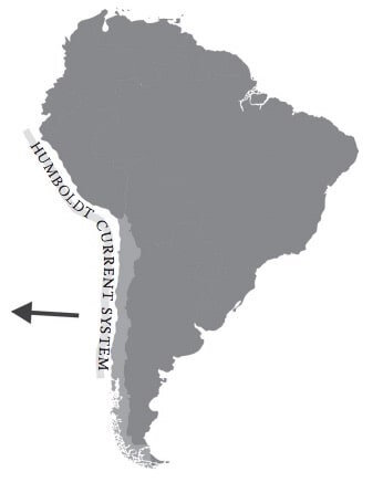
Humboldt Current or Peru Current
The Humboldt Current System (HCS) extends along the west coast of South America from southern Chile (~45°S) up to near the equator - or close to the Ecuadorian-Colombian border.
This current brings the cold water of Antarctica to the coast of Chile and Peru. The HCS is partly responsible for the temperate climate in northern Chile and the extreme rains of southerly Chile.
The Humboldt Current = Cold Water
Water temperature in this current averages 60° F / 16°C which is relatively cold, especially considering the waters surrounding the northern boundaries average 75 °F / 24°C.
The Peruvian Current & All The Fishes
The waters off the west coast of South America produce more fish per unit area than any other region in the world ocean with approximately 1/5 of the world's commercial fish harvest coming from this area. The waters of the HCS, or the Peruvian Current, are the result of the upwelling of cold, deepwater nutrients brought to the surface from a current that splits off from the Antarctic Circumpolar Current near Cape Horn.
During El Nino-Southern Oscillation (ENSO) periods the Humboldt Current diminishes in strength while the warm water counter-current of El Niño moves southward, warming the waters within the current, which causes much devastation amongst the cold-water marine life and massive flooding on the lands. The El Niño effect is so powerful, most fishing operations take the season off.
“El Niño and La Niña are the warm and cool phases of a recurring climate pattern across the tropical Pacific—the El Niño-Southern Oscillation, or “ENSO” for short”
Why is it called the Humboldt Current?
German naturalist Alexander von Humboldt reported the measurements of the cold current in his 1846 book Cosmos, so the Humboldt Current was named in his honor.
Zona Sur / South Zone

Chilean Lake and Volcano District
This zone is characterized by dozens of glacier-fed lakes, numerous volcanoes, including 4 currently-active, and many forests, such as the Valdivian Temperate Rainforest.
This area is known as the Chilean Lake District of northern Patagonia. The main climatic difference between Zona Sur and Zona Central is Zona Sur’s lack of dry season.
This region receives rain year-round but receives significantly less rainfall during the summer months of December to March.

Villarrica in Zona Sur in Chile
Zona Sur = Temperate-Rainy Climate
The climate of Zona Sur is temperate-rainy, with an even distribution of rainfall. However, this region has numerous variations with significant differences in precipitation due to the coastal mountain range.
The Pacific coast receives abundant rainfall and decreases significantly east of the coastal mountains. The Valdivian Coastal Range’s highest point is located near Valdivia, with the city receiving close to 100 inches (2540 mm) of rain per year. As one moves further inland the precipitation lessens in the central valley and increases again towards the Andean foothills with parts of the Andes receiving over 120 inches (3000 mm ) annually.
This zone is 97% temperate or temperate-subtype.
The far northern section of this zone is a transitional zone between the Mediterranean type climate of the Central Zone and the temperate climate of the South Zone. This transition zone of the north is primary due to the high coastal range acting as a barrier against oceanic influences and cyclonic disturbances that frequent the surrounding area.
For example, the city of Concepcion, even though it’s less than 200 miles from Valdivia, receives 60 percent less rain, which is do to the barrier effect from the Nahuelbuta coastal range.
This area is widely considered as one of the prettiest places on the PLANET, and most unique:
Over a dozen major glacier-fed lakes
Several active volcanoes
Several dozens hot springs
Two massive mountain ranges
Temperate forest with trees over 3,500 years old
The Pacific Ocean
These natural gems are all present in under a two-hour car ride.
What is the average temperature of this zone?
The temperature varies from about 40°F to 75°F during the year. Temperatures rarely exceed 85°F or fall below freezing.
What are the warmest months? January and February with an average high-temperature of 73°F (23°C)
What are the coldest months? June and July with an average high of 48°F (9°C)
What is the driest month? January with only a few days of rain on average.
Zona Austral (Southernmost Zone)
This southernmost zone is more popularly known as ‘La Patagonia’ or just ‘Patagonia.’ This zone is incredibly long stretching nearly 1000 miles, which is longer than the entire state of California and twice as long as Florida.
The southernmost part of the region is incredibly narrow, and surrounded by the Pacific and Atlantic Oceans, which create rather unique climatic systems in the southern section of the Southern Cone.
Far South of Chile’s Patagonia
“It’s interesting to note that only around five percent of the Chilean Patagonia is classified as arid or arid-subtype, while the Argentinian Patagonia is nearly 90% arid, semi-arid, or sub-humid drylands.”
Zona Austral is a geographic region that can be further subdivided into several different climatic zones, most notably:
Polar Climate (52%)
Temperate Climate (44%)
Generally speaking in this zone, rain decreases from west to east with temperatures increasing in the same direction, until reaching the cold alpine climates of the Andes, with year-round temperatures below 32°F / 0° Celsius.
Approximately 5% of Patagonia is a semi-arid cold steppe climate, due to areas of shelter from the slopes of the Patagonian Andes near the Argentinian border.
Fun fact: Puerto Williams, the southernmost city in the world, and is a temperate sub-polar oceanic climate. This little portside “city” receives around 5 hours of sunshine during the heart of the winter.
Punta Arenas is the largest city (population ≈ 125,000) in this region and is located near the tip of South America on the Strait of Magellan. So what are the temperatures like for this southerly city located at 53°S latitude?
The average yearly temp is 43°F (6 °C)
January is the warmest month with an average of 52°F (11 °C)
July is the coldest month with an average temperature of 35°F (2 °C)

Perito Moreno Glacier near Argentina/Chile border in the Argentina Patagonia
Growing glacier
Perito Moreno Glacier located in Los Glaciares National Park near the Argentina/Chile border in La Patagonia is 1 of 3 glaciers in the world that is actually growing. Scientists aren’t sure why this particular 19-mile by 3-mile glacier is stable, while most of the world’s glaciers are melting or retreating.
What is el nino and la nina?
El Niño is a complex climate pattern that includes a warming phase and cooling phase of surface waters off the coast of South America. “The ENSO cycle is a scientific term that describes the fluctuations in temperature between the ocean and atmosphere in the east-central Equatorial Pacific”
El Niño is the warming phase and means The Little Boy, or Christ Child in Spanish
La Niña is the cooling phase and means The Little Girl in Spanish
Both phases are part of the larger phenomenon called the El Nino-Southern Oscillation (ENSO)
El Nino and La Nina refer to the ocean part of ENSO
The Southern Oscillation is referring to atmospheric changes
climate classification
I’m using the Köppen-Trewartha climate classification system (KTC), which uses 6 main climate groups and each category has several additional climatic sub-types. According to KTC, Chile has 5 of the 6 major climate types and an additional 25 subtypes.
So what are the climate types?

I have outlined the main groups and the primary subtypes.
Tropical humid climates
Defined as ‘killing frost absent’
All months must be warmer than 64°F / 18°C
Two major subtypes: Tropical wet and dry
Subtropical climates
Must be 8 to 12 months with temperatures over 50°F / 10°C
The temperature of the coolest month must be lower than 64°F / 18°C
Two main subtypes
Subtropical dry-summer climate, which is more commonly called the Mediterranean type climate
Subtropical humid climate
Temperate climates
4 to 7 months must have a monthly air temperature of over 50°F / 10°C
Two main subtypes: Oceanic & continental
Boreal climates
One to 3 months with a monthly mean air temperature of over 50°F / 10°C
Two subtypes: Oceanic and continental
Boreal climates are NOT found in Chile and are the only main climate category that is missing from the country.
Polar climates
All months must have a monthly mean air temperature of below 50°F / 10°C
Two primary subtypes
Tundra - Warmest month’s air temperature is above freezing (32°F / 0°C)
Icecap - Air temperature never gets above 32°F / 0°C
Dry climates also called arid or desert
Excess of evaporation over precipitation
Two main subtypes
Semi-arid
Steppe climate

Jesse is the Director of Pedal Chile and lives in Chile’s Patagonia (most of the year). Jesse has a Master of Science in Health and Human Performance and enjoys riding single-track down the active volcano near Pucón. I’m also an avid reader of mostly nonfiction and enjoy reading academic papers.


Sources for “Climate of Chile”
BANNISTER, J.R., VIDAL, O.J., TENEB, E. and SANDOVAL, V. (2020). Latitudinal patterns and regionalization of plant diversity along a 4270-km gradient in continental Chile. Austral Ecology, [online] 37(4), pp.500–509.
Belda, M., Holtanová, E., Halenka, T. and Kalvová, J. (2014). Climate classification revisited: from Köppen to Trewartha. Climate Research, [online] 59(1), pp.1–13.
Cereceda, P., Larrain, H., Osses, P., Farías, M. and Egaña, I. (2008). The climate of the coast and fog zone in the Tarapacá Region, Atacama Desert, Chile. Atmospheric Research, 87(3–4), pp.301–311. Link
Chester, S.R. (2008). Wildlife guide to chile. A & C Black Publishers Ltd.
Dahl, N. Highest, lowest, wettest, driest: South American extremes (sa expeditions .com)
Montecino, V. and Lange, C.B. (2009). The Humboldt Current System: Ecosystem components and processes, fisheries, and sediment studies. Progress in Oceanography, [online] 83(1–4), pp.65–79.
Veblen, T.T., Young, K.R. and Orme, A.R. (2007). The physical geography of South America. Oxford ; New York: Oxford University Press. link
Yáñez, E., Barbieri, M.., Silva, C., Nieto, K. and Espı́ndola, F. (2001). Climate variability and pelagic fisheries in northern Chile. Progress in Oceanography, [online] 49(1–4), pp.581–596. Available here
Data for temperatures of Chile was sourced from climate-data.org website.