Unten ist eine Momentaufnahme der Seite angezeigt, wie sie am 21.05.2024 angezeigt wurde (das letzte Datum, an dem unser Crawler sie besucht hat). Es handelt sich um die Version der Seite, die für das Ranking Ihrer Suchergebnisse verwendet wurde. Die Seite hat sich möglicherweise seit der letzten Zwischenspeicherung geändert. Damit Sie sehen können, was sich geändert hat (ohne die Markierungen), navigieren Sie zur aktuellen Seite.
Bing ist nicht für den Inhalt dieser Seite verantwortlich.
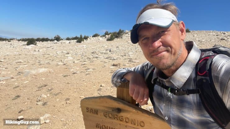
San Gorgonio Hike on the Vivian Creek Trail - HikingGuy.com
Easily the most popular San Gorgonio hike route, the Vivian Creek Trail is an iconic adventure up to the highest point in SoCal, at 11,503 feet. Vivian Creek is popular because it's the shortest and most accessible route, but it's also the steepest, so expect a good workout on your way to the summit. It's a beautiful hike through pines, cedars, and streams and then up to the barren moon-like landscape above the tree line. From the summit, you'll enjoy sweeping views from Nevada to the Channel Islands. Many people hike it in a day, but you can also make it an overnight backpacking trip. In this guide, I'll give you everything you need to know for either option.
In this Guide:
Video and Turn-by-Turn Directions for the San Gorgonio Hike
Parking and Permit Information for the Vivian Creek Trail
Maps, Elevation Profile, and Things to Know Before Going
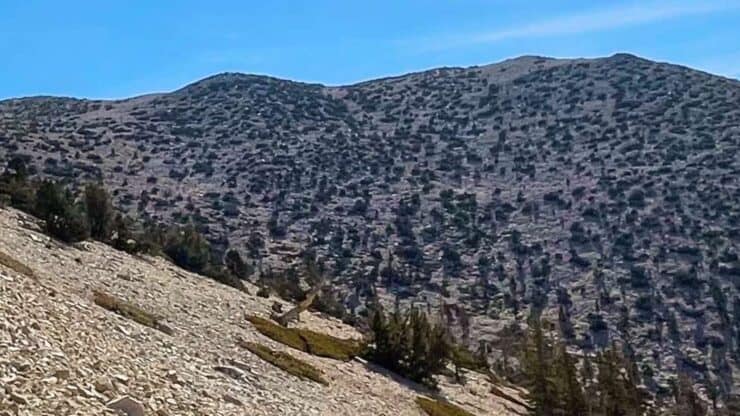
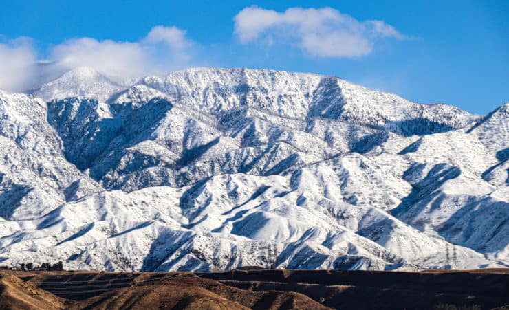
San Gorgonio is part of the Sand to Snow National Monument. Guess which part of the monument is the snow part? Yea, being the highest point in SoCal, this hike is often covered in snow during the winter months. If that's the case, give this hike a skip unless you've done the trail before and have winter hiking and mountaineering experience. You can read some tips on checking for snow on the trail here. Photo Boscco
Assuming the weather is on your side, you will need a permit to day hike or overnight to San Gorgonio. The good news is that it's easier than ever to get. Go to the San Gorgonio Wilderness Association's permit page and fill out the online form. There is a quota system in place to limit human impact on the wilderness. Once you get your permit, save it (offline) to your phone or print it and take it with you.
Permit Availablity
Can't get a permit for your date? Try OutdoorStatus.com and get a text message as soon as a cancelled permit opens up!.
Backpacking San Gorgonio
Even though the hike clocks in at 18 miles or so, many people hike San Gorgonio in a day. But you can also do it as an overnight backpacking trip. You just need to pick a date and your campsite(s).
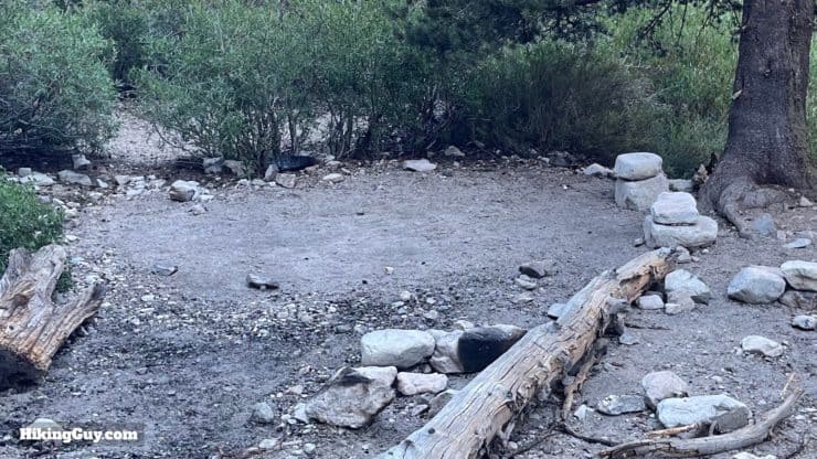
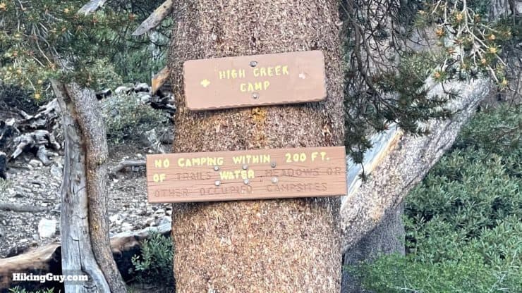
The online permit system lets you pick the camp area that you'd like to stay at.Here's a typical (larger) tent site at High Creek Camp. There are no facilities, it's just a cleared area. Make sure you get a free California campfire permit if you are going to use a stove.
All the campsites, aside from the summit, are close to water sources, most of which stop flowing at some point in the summer. If you want to check on the status of water, I'd look at the San Gorgonio Wilderness Association's (SGWA) forum pages.
Your permit only allows you to camp in the designated campsites within the San Gorgonio Wilderness, although you will see some dispersed tent sites along the route. I've marked them on the map and GPX file for reference, but don't consider them an option unless there's an emergency. Before the Lake Fire, an Explorer pass allowed you to camp at these sites, but not anymore. If this changes, please let me know.
Here's an example of an unofficial dispersed site (on the left).
Also note that camping on the summit can be very windy. Most of the summit tent sites have stone walls around them to help block the wind. There's also an official "summit campsite" to the southwest of the summit that's flat, sandy, and reasonably protected from the wind. I've marked both areas on the map and in the GPX file.
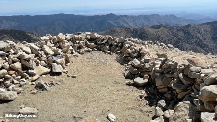
This is a campsite with stone wall enclosure at the summit.And here's the official "summit campsite" which is less popular but more camping-friendly.
Training for San Gorgonio
If you're not used to doing this type of distance and climbing, I recommend building up your hiking fitness before you tackle this hike. A good progression is:
And if you bag San Gorgonio, it's probably time for you to bag Mt Whitney next.
Where is the Start of the Hike?
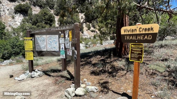
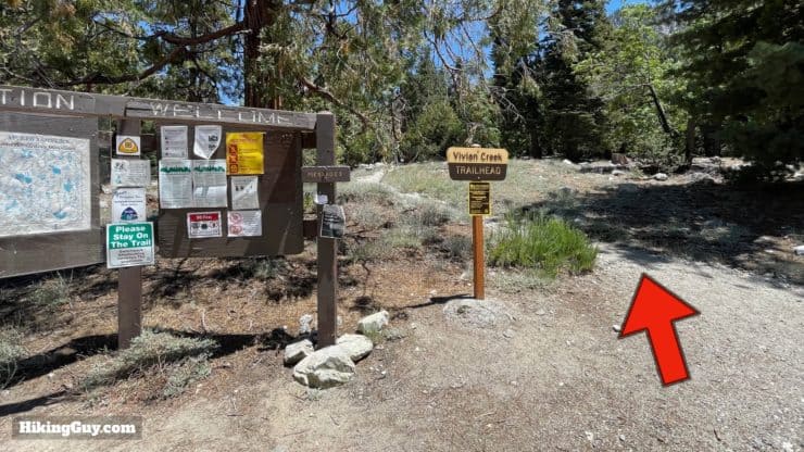
This route up to San Gorgonio Mountain starts at the Vivian Creek Trailhead, just past the Falls Picnic area in Forest Falls, CA. Use this trailhead address: 41900 Falls Rd Forest Falls, CA 92339.
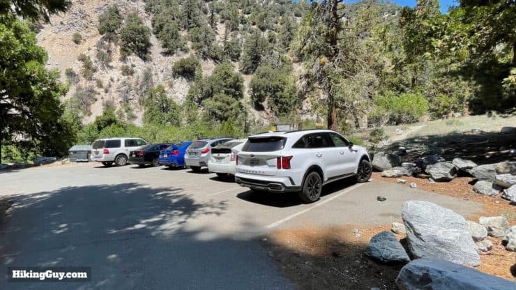
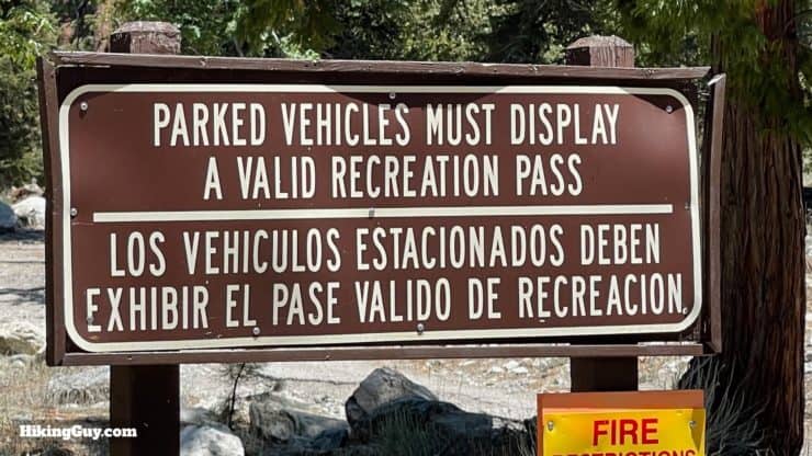
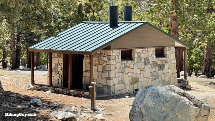
There's a small parking lot right by the trailhead, and more spaces farther back toward the picnic area.You need a parking pass for the trailhead. I use the affordable National Parks Pass, which gets me in every park, monument, and national forest. You can also use a (Southern California only) Adventure Pass, or buy a $5 day permit from the ranger’s office.There's a toilet at the trailhead, just behind the parking area.If you have to park farther away, note that the hike starts at the far eastern part of the parking area at this trailhead, not the nearby Big Falls Trailhead.
Gear For the Hike
This is a serious hike and you need to be well prepared with layers, water (3L), and food. The summit is in an alpine zone and is exposed. Check the summit weather and be prepared for changing conditions, including potentially spending the night if something goes wrong. Trekking poles help on the way down, especially on the section just before Mill Creek.
Gear That I Love Right Now
Nothing is sponsored or promoted, just the actual gear that I use.
Garmin InReach Mini 2If you are out of cellphone range the Mini 2 will reliably allow you to hit SOS via satellite. You can also send non-emergency texts to just say that you're late, let friends and family follow along, and check the weather. You can see my review here.
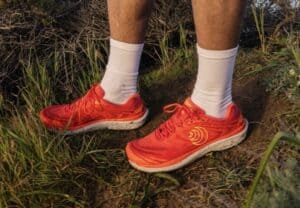
Topo Pursuit 2The wide toe box means no blisters, an aggressive tread is great on the trail, it dries very quickly, and it has lots of cushion for long days. It combines everything I love about every other shoe into one.
Garmin Epix ProThese watches are pricey, but I use them 24/7 for sleep tracking, workouts, heart rate, and tracking my hike. It has preloaded hiking maps that help me navigate the trails and is a backup to my smartphone navigation. The Epix Pro has a great battery life, a screen similar to an Apple Watch Ultra, and works in harsh conditions when just using the buttons. See my review here.
Osprey Hikelite 26This updated version of the Hikelite 26 offers incredible value for the money. It's got a wide trampoline back, so your back doesn't get sweaty. It's under 2lbs, has deep side pockets, and is a great balance of what you need without what you don't.
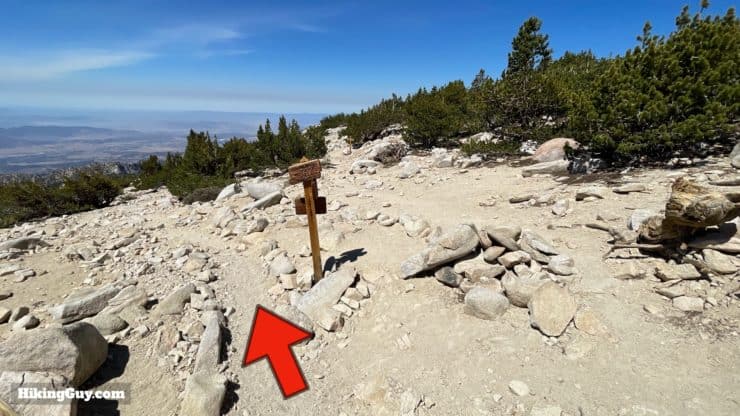
Overall the trail is well-marked, the junctions are signed, and the route is easy to follow. This is a popular hike and you can usually expect to see other hikers along the way.
The first mile and half are very steep, then there's a long middle section of gradual uphill. With about 2 miles to go you have another steep section, and then it's gradual to the summit.
Landmarks on the Hike
Landmark
Distance
Elevation
Trailhead
0
6080
Mill Creek Crossing
0.5
6200
San Gorgonio Wilderness Boundary
1.5
7050
Vivian Creek Camp
1.7
7100
Halfway Camp
3
8100
High Creek Camp
5.3
9200
Ridge Viewpoint
6.8
10000
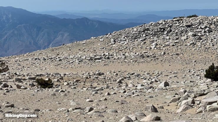
Tree Line
8
10700
Peak Divide Trail
8.5
11250
Summit
9
11503
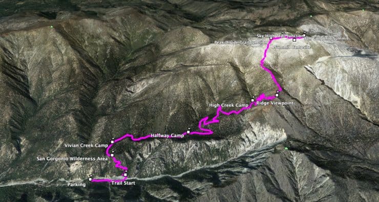
3D Map
From this 3D map you can see the steep sections. The first section up from Mill Creek is steep, then a long gradual middle section, and then a steeper section past High Creek Camp and the summit.
Hike Brief
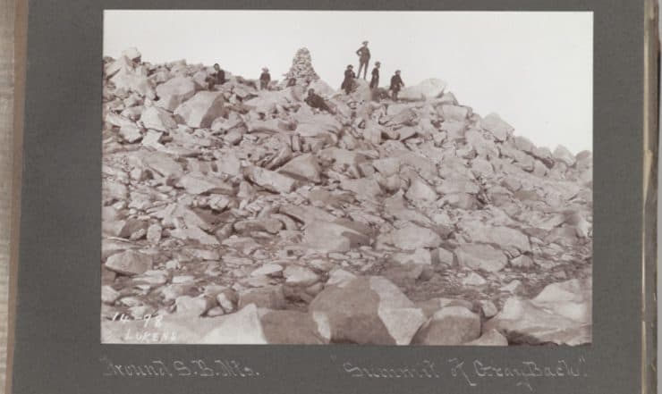
The first recorded ascent by gringos on San Gorgonio Mountain was in 1872. Shortly after that, it became popular with other outdoor enthusiasts, including Theodore Lukens, pictured here in 1898, who you might know from his namesake, Mount Lukens. The original footpath, called the Government Trail, followed today's Vivian Creek Trail. Photo California State Library
San Gorgonio has a mixed reputation among native peoples. The Serrano and Luiseño include it as part of their origin story, the Morongo believe it was the original home of the demon Tahquitz, and the Cahuilla just refer to it as a big pile of rocks.
Early settlers called it "gray back," as was common for treeless mountains like this, and today it's sometimes referred to as "old gray back."
But the name San Gorgonio dates to the 1850s when this area was part of a Mexican Land Grant. There's some dispute as to the origin, with some thinking it's tied to Saint Gorgonius of Nicomedia (celebrated in St. Gorgonio's Feast Day), and other sources citing Saint Gregory the Great (who converted Anglo-Saxon pagans to Christianity). Either way, it shows up on USGS maps in 1899 as San Gorgonio Mountain.
The longest recorded line of sight in the lower-48 United States is from Mt Whitney to the summit of San Gorgonio Mountain, 190 miles away. Today, on a clear day, you can see from San Clemente Island out in the Pacific Ocean to Mt Charleston, 163 miles away in Nevada (by Las Vegas).
The mountain's height and position above the San Gorgonio Pass (connecting LA to Palm Springs) have made the summit the scene of several tragic plane crashes, claiming the lives of Frank Sinatra's mother and Dean Martin's son (in a separate crash).
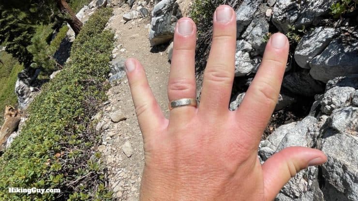
You can sometimes feel the (negative) effects of altitude sickness on this hike. Read my section on dealing with in on my guide to Mt Whitney. Swollen fingers are a (benign) sign of acute mountain sickness (AMS), but if you are experiencing more severe effects like nausea and headache, it's best to stop, descend, and rest.
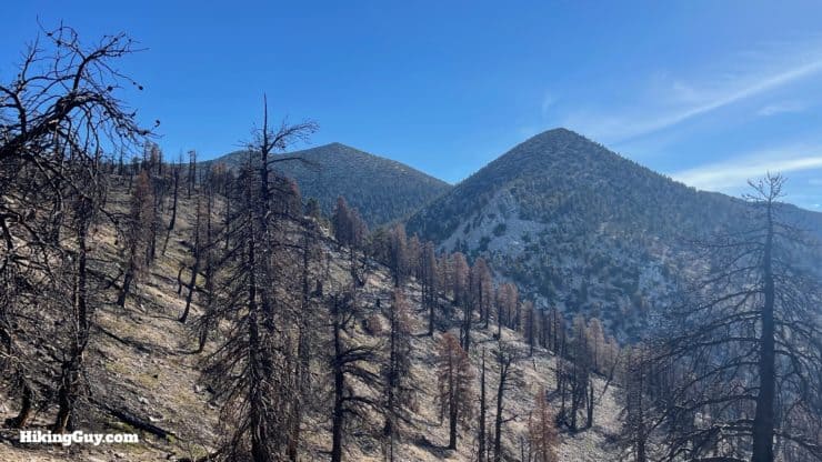
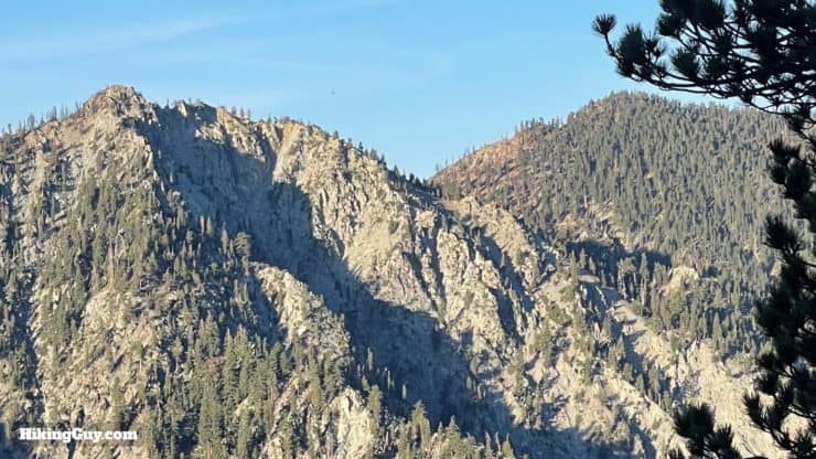
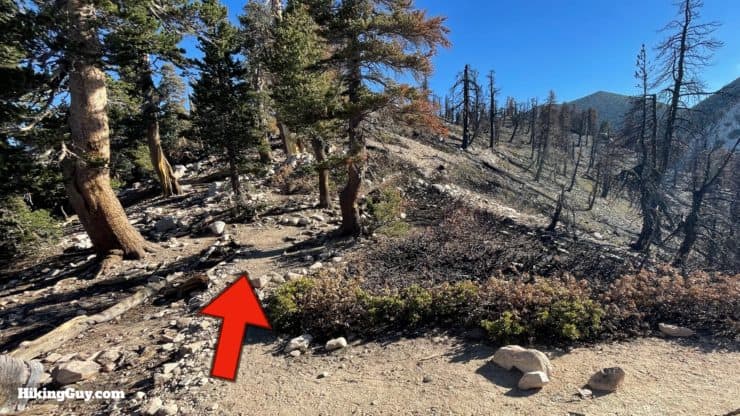
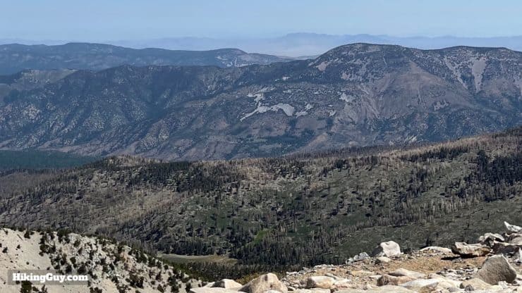
The 2020 Apple Fire skirts this route to the summit. The fire, which burned over 33,000 acres, was started by a malfunctioning diesel vehicle's exhaust system. The plume of smoke it sent up was so massive that it generated its own wind systems. Once you reach the ridge above High Creek Camp, you'll be able to see the aftermath of the Apple Fire.
San Gorgonio on Vivian Creek Hike Directions
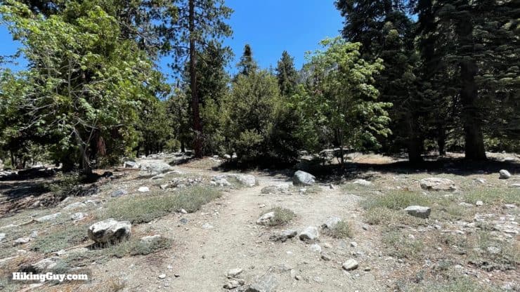
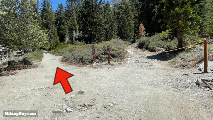
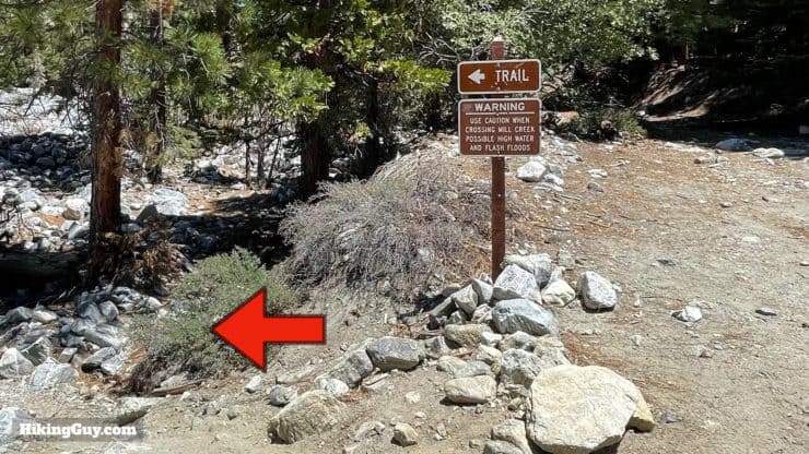
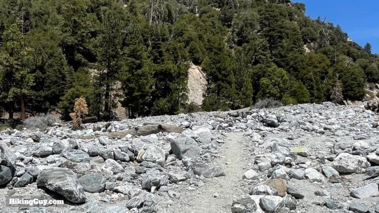
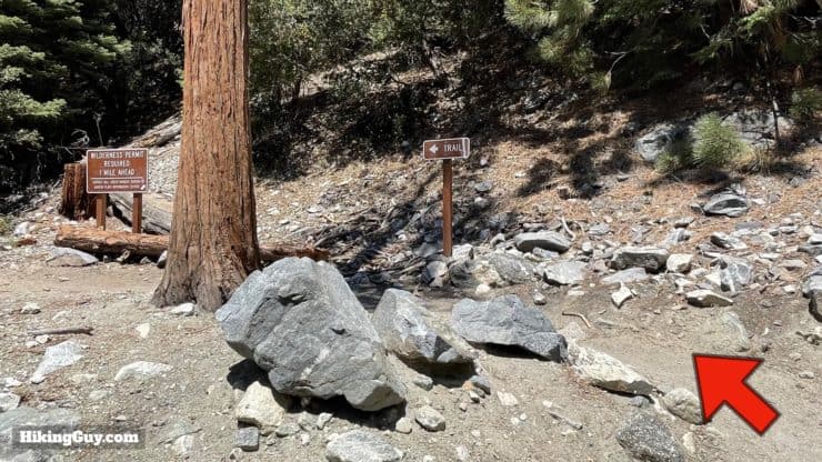
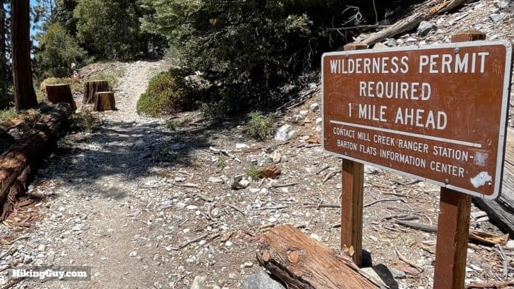
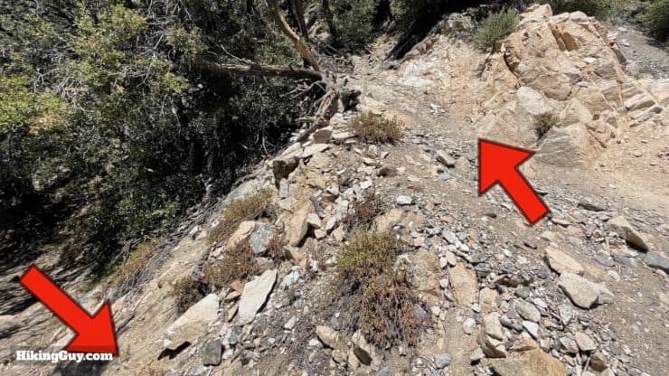
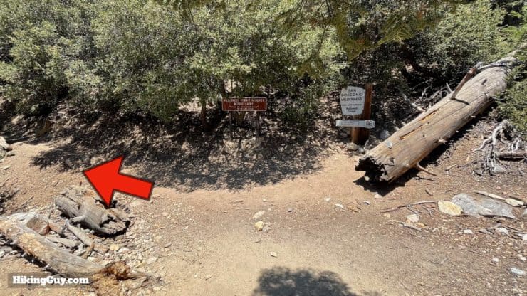
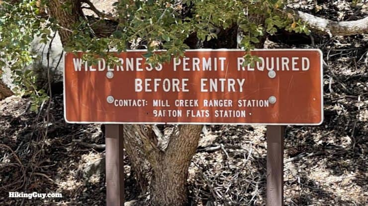
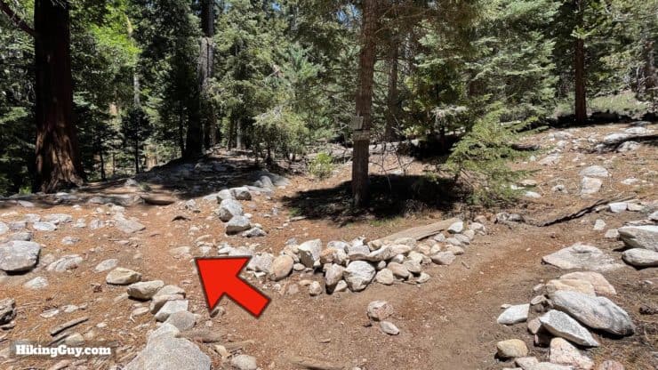
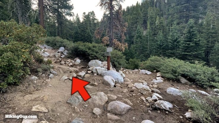
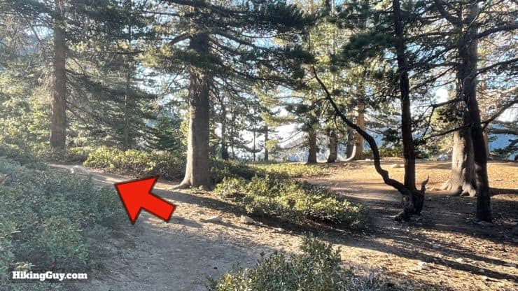
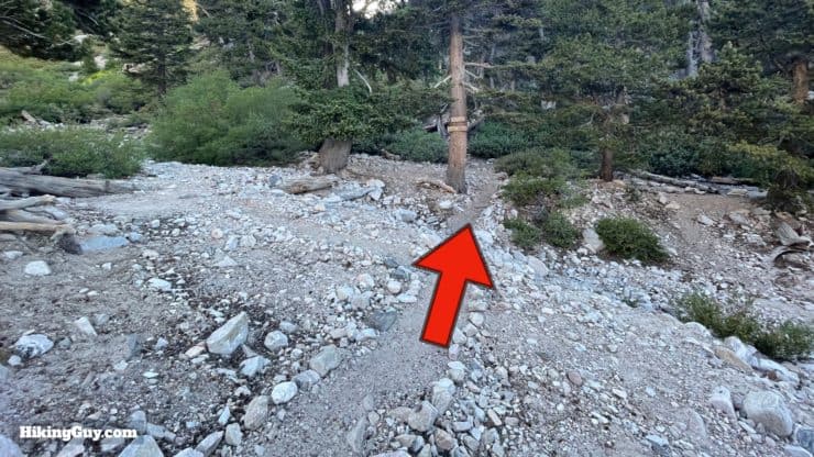
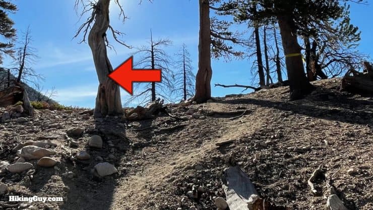
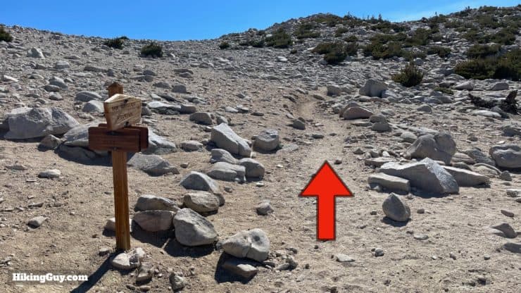
Take the small path just past the trail board and continue on the (dirt) Falls Road.Go straight up the rocky Falls Road.Avoid any driveways or private property on either side and keep hiking up the main road.This is the important sign to look for. When you see the sign on the left of the road, make the left turn and hike across Mill Creek.Follow the trail across the (dry) Mill Creek. The other side of the trail continues just a few feet upstream. During heavy rains Mill Creek will flood and it is not passable to cross. Look for the continuation of the trail on the other side of Mill Creek.There's also a sign letting you know that you need a permit once you reach the San Gorgonio Wilderness Area boundary. Start the tough climb from here.The climb is very steep and is up a series of switchbacks.As you approach the top you'll have nice views across Mlll Creek.And after about a mile of climbing you'll reach the boundary of the San Gorgonio Wilderness. The first big climb is done and the trail levels out, following along Vivian Creek.You need a permit to do any hiking or backpacking past this spot.
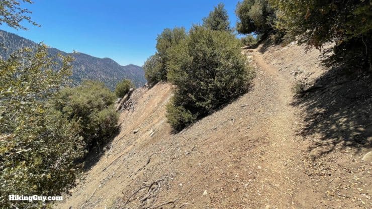
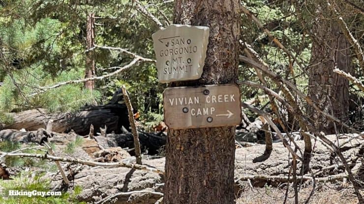
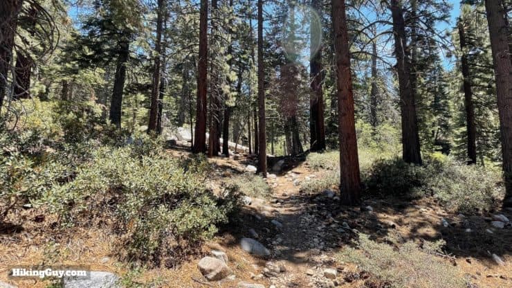
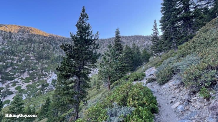
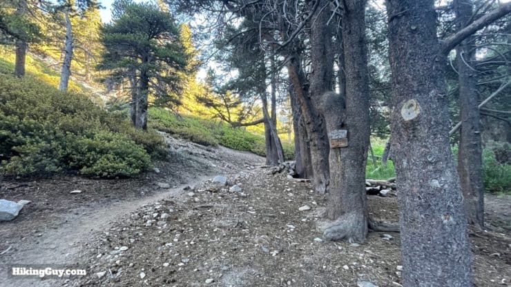
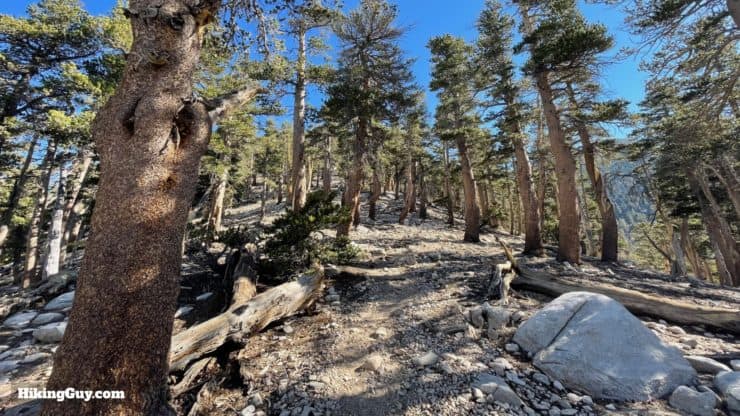
At around 1.7 miles you'll see the turnoff for Vivian Creek Camp. Keep left to head towards the summit.Here's a closeup of the sign at that last junction.Shortly after the junction you'll cross Vivian Creek.The next few miles are mellow and gradually uphill, passing through the canyon along Vivian Creek, which has some huge cedars.If you look at the elevation profile here, it's uphill, but on the ground it feels more level. Enjoy it while you have it.Around 3 miles in, bear left at the junction for Halfway Camp, which is roughly halfway to High Creek Camp, not the summit.Now the gradient gets a little steeper and you start climbing up broad switchbacks.As you climb you'll start to get glimpses down to Mill Creek where you started earlier.And you'll also see directly across to the peaks across Mill Creek, including Wanat Peak (left) and Little San Gorgonio Peak (right). Wanat Peak was just named in 2014 after lobbying by Paul Melzer, who works for the Wildlands Conservancy in Oak Glen. Wanat is a Serrano word for mountain lions.
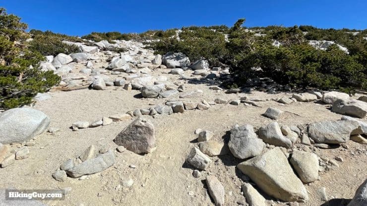
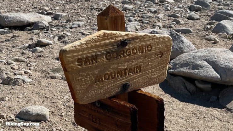
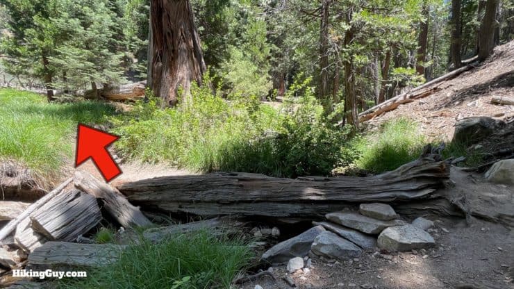
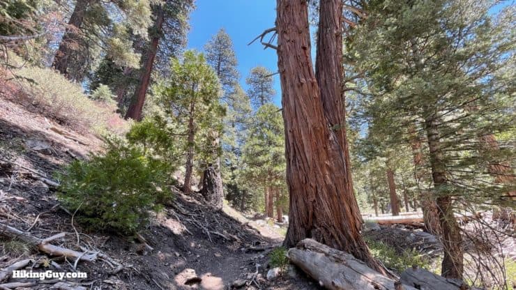
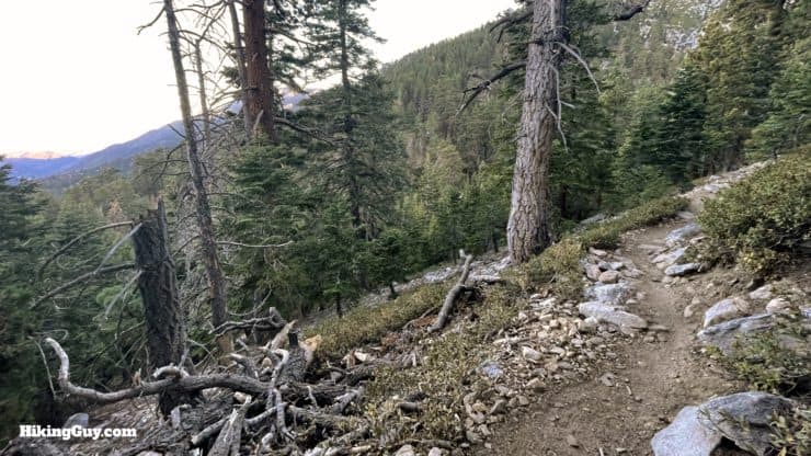
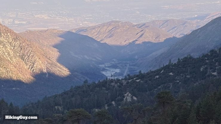
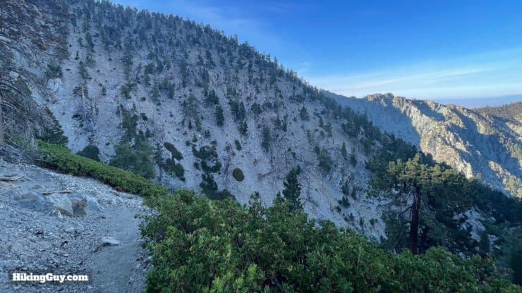
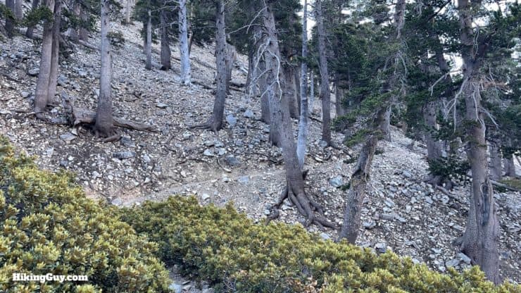
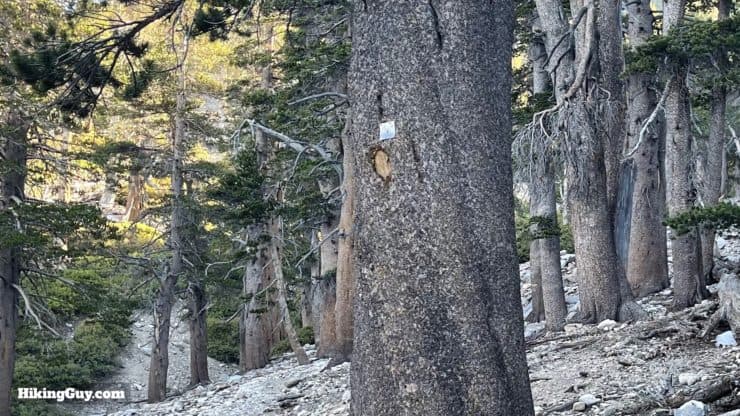
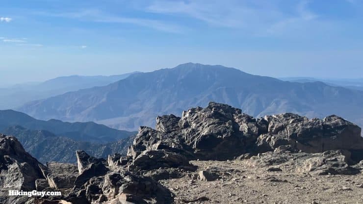
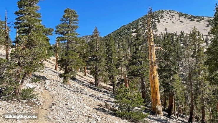
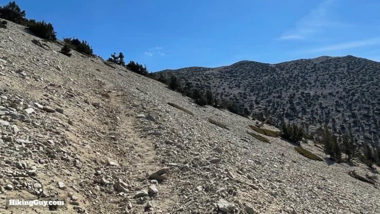
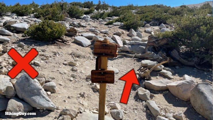
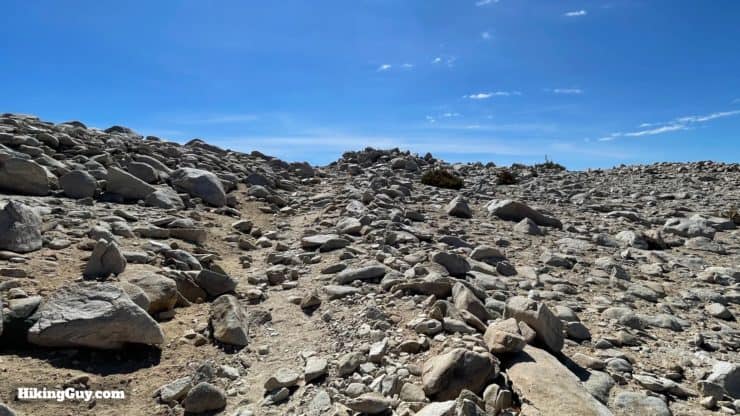
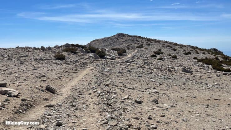
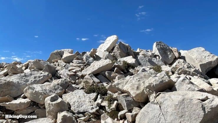
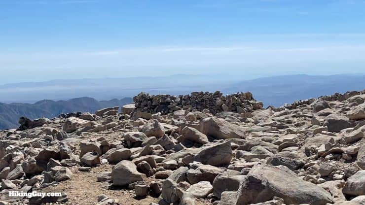
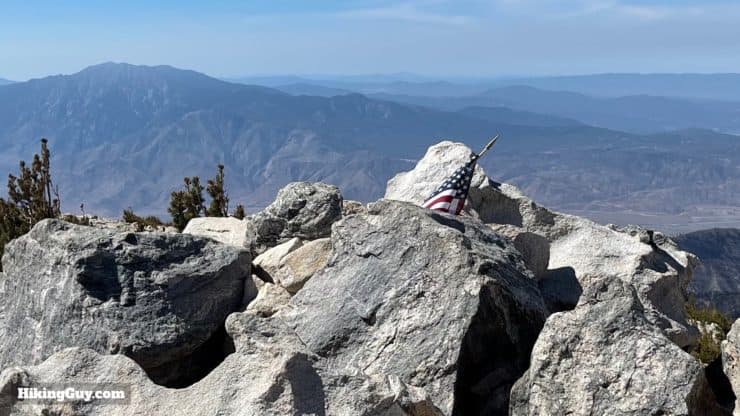
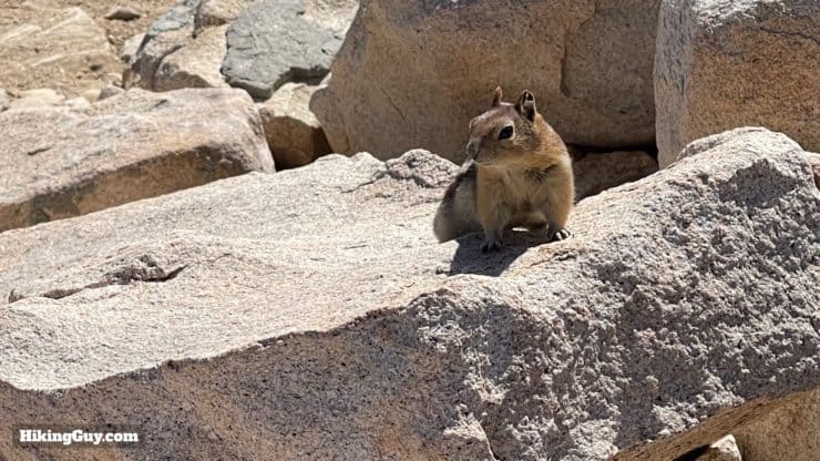
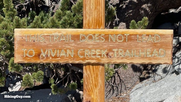
At some points you'll hike away from the view, with the impressive slopes of Dobbs Peak in front of you.Soon the trail winds around toward High Creek. There's a nice viewpoint at the bend to the right.Follow the trail around to the left, above High Creek, which you can often hear roaring below.As you approach High Creek Camp, you'll see some signs asking you not to camp in sensitive habitat areas.And then at around 5.3 miles you'll reach High Creek and the campsite, which has tent sites dispersed around the area.If you're camping here, look for dispersed and cleared campsites along the stream. This is often your last chance for water as well.Start hiking up about a dozen long, sweeping switchbacks.You'll notice the notches and nailed markers in the trees. These are older trail markers but are still useful when there's snow on the route.At the top of the switchbacks, the trail continues to the left. On the right is a nice viewpoint.Here's the viewpoint at the top of the ridge, with Mount San Jacinto prominent. This is a good place to fuel up before the last push to the summit.As you hike up from the ridgeline you'll see the line where the Apple Fire's advance stopped (right).Now you have a steep climb with short switchbacks up the ridge.And then the climb ends and the trial levels out.And soon you'll leave the tree line behind and hike up the rocky slope.At about 8.5 miles you'll reach the San Bernardino Peak Divide Trail. Go straight toward the summit.And shortly after that you'll see the Sky High Trail branch off to the right. Go straight.You'll crest a ridge that's a false summit.And then see the real summit ahead.Here you are at the summit! Climb the rocks up to your left to hit the peak.You'll notice the stone shelters for camping around the summit area.There's a trail register.And today just a flag at the peak. Usually there's a sign or two, but sometimes people take them home.There's a lot of visitors to the summit, and the rodents aren't shy about going for a Clif Bar, so watch your pack.In addition to the peaks we saw earlier, you'll also be able to see the peaks to the north in the Big Bear area, including Sugarloaf Mountain, the highest point across the valley.From the summit, just turn around and head back the way you came!Be careful at the San Bernardino Peak Divide Trail, it's easy to go straight, which won't be a good thing if you want to go back.Luckily there's a sign on that trial as an extra warning.
Need More Info?
Have a question about the guide or want to see what other people are saying/asking? View the Youtube comments for this video. Leave a comment and I will do my best to respond.
When planning, always check the park website and social media to make sure the trails are open. Similarly, check the weather and road conditions.


 Using the Apple Watch for Hiking
 Garmin Fenix 7 & Epix Review For Hikers
 How To Read a Topographic Map
 Garmin GPSMAP 67i Review
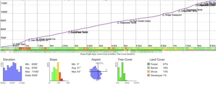

 Hike Mt Baldy on the Bear Canyon Trail
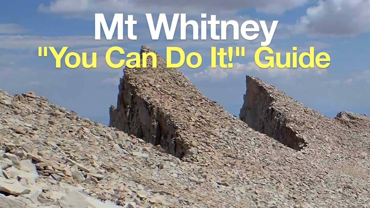 Mt Whitney Hike
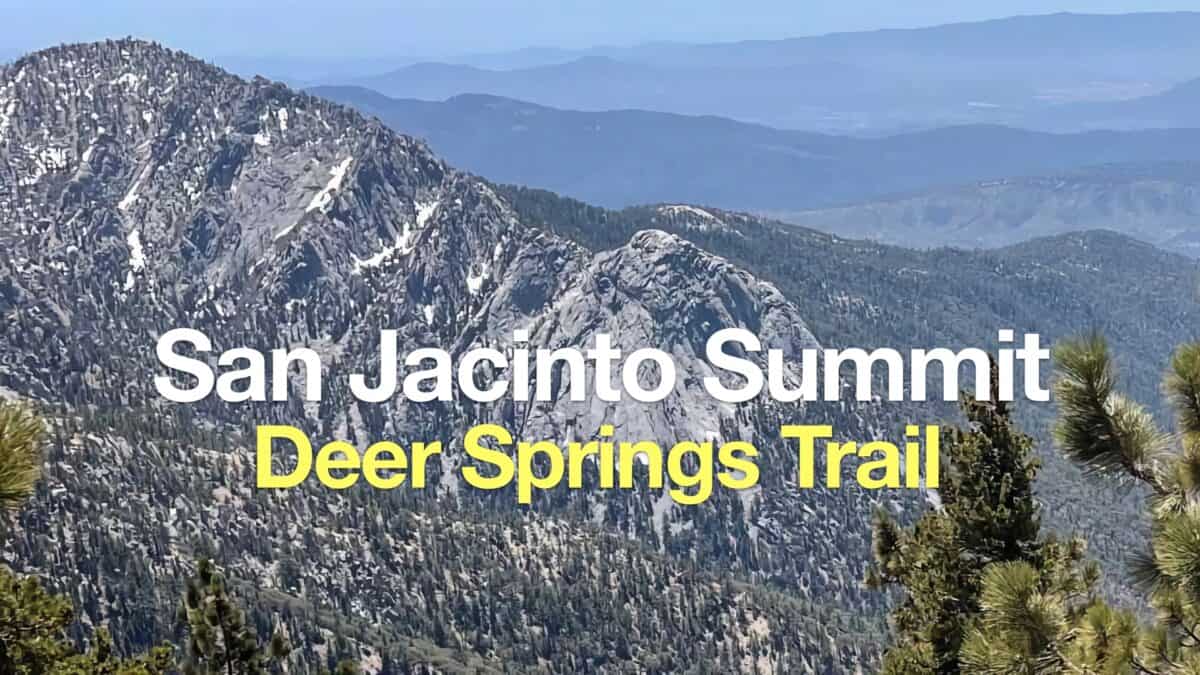 Hike Mt San Jacinto Peak on the Deer Springs Trail
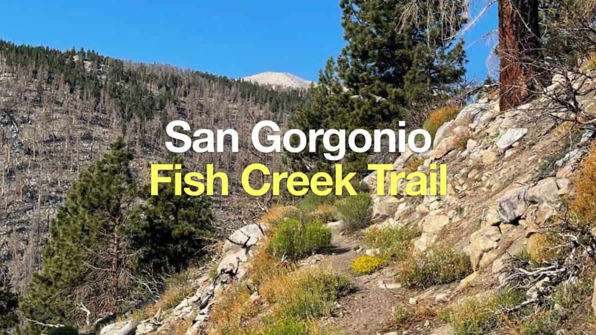 Fish Creek Trail to San Gorgonio Mountain
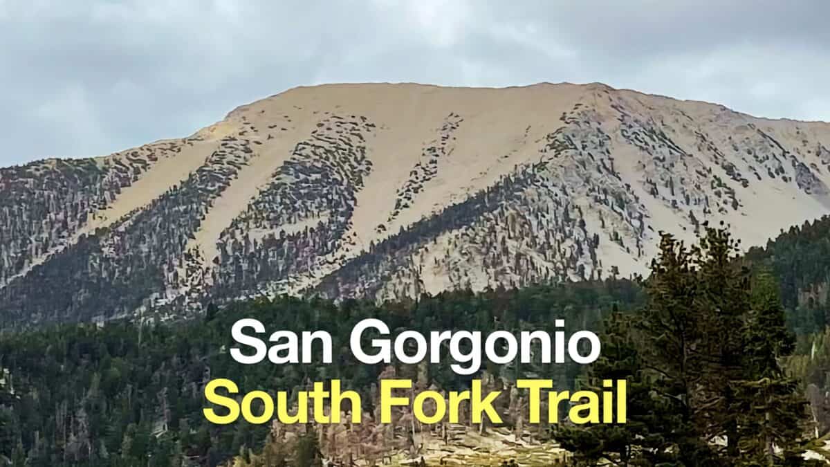 South Fork Trail to San Gorgonio Mountain
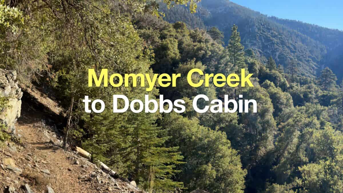 Momyer Creek Trail to Dobbs Cabin
 Los Angeles Hikes
 Backpacking Trips
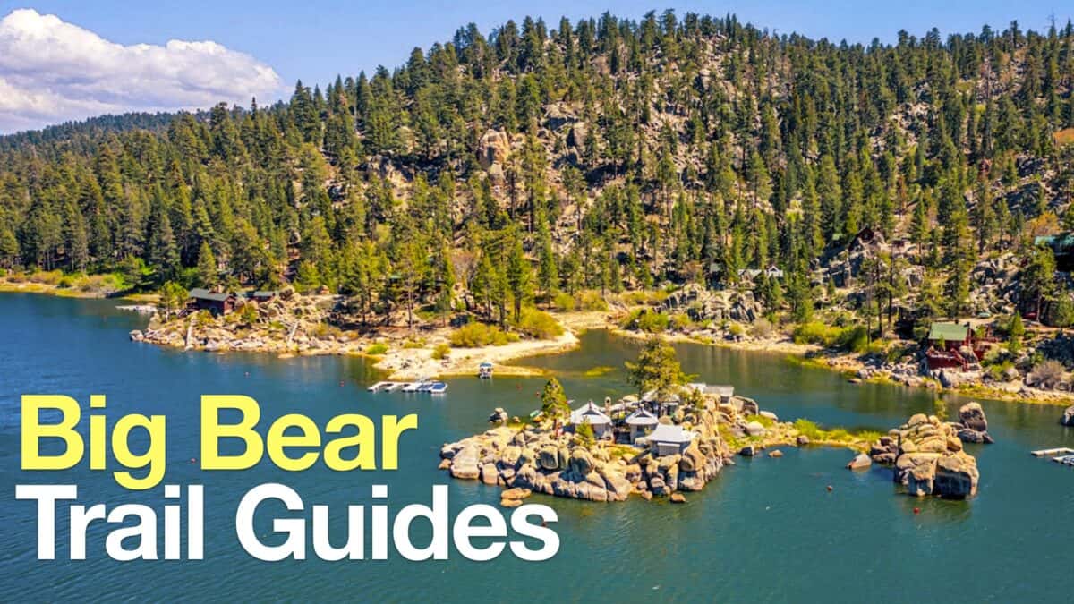 Big Bear Hikes
 LA Mountain Hikes
 San Bernardino National Forest Hiking Trails
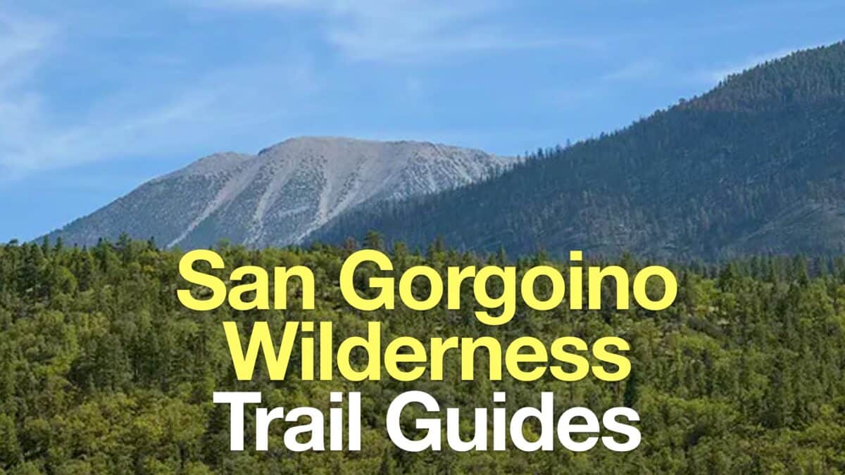 San Gorgonio Wilderness Hikes
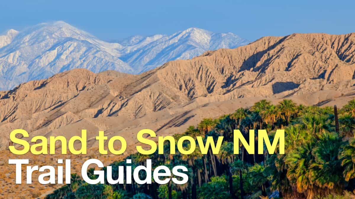 Sand to Snow National Monument Hikes
 Sierra Club 100 Peaks
 Best Hiking Gear 2024
 Hiking Boots or Shoes: Do I Really Need Hiking Boots?
 When to Hit SOS on inReach