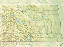
Fargo, North Dakota
Fargo, North Dakota | |
|---|---|
Downtown Fargo Plains Art Museum Fargo Civic Center Veterans Memorial Bridge Fargo Air Museum Cathedral of St. Mary | |
| Coordinates: 46°52′24″N 96°49′38″W / 46.87333°N 96.82722°W | |
| Country | United States |
| State | North Dakota |
| County | Cass |
| Founded | 1871 |
| Named for | William Fargo |
| Area | |
| • City | 50.77 sq mi (131.49 km2) |
| Elevation | 906 ft (276 m) |
| Population | |
| • City | 125,990 |
| • Rank | US: 216th ND: 1st |
| • Density | 2,481.68/sq mi (958.19/km2) |
| • Urban | 216,214 (US: 178th)[2] |
| • Urban density | 2,781.6/sq mi (1,074.0/km2) |
| • Metro | 258,663 (US: 190th) |
| • Demonym | Fargoan |
| Time zone | UTC-6 (Central) |
| ZIP Codes | 58102–58109, 58121–58122, 58124–58126 |
| Area code | 701 |
| FIPS code | 38-25700 |
| GNIS feature ID | 1036030[3] |
| Website | fargond.gov |
Fargo is the largest city in the American state of North Dakota. It is in the eastern part of the state, near the Minnesota border. The city was founded in 1871, and it has a population of 125,990 as of the 2020 census.[4] Fargo lies at the intersection of two major highways, Interstate 29 and Interstate 94.

References[change | change source]
- ↑ "ArcGIS REST Services Directory". United States Census Bureau. Retrieved September 20, 2022.
- ↑ "List of 2020 Census Urban Areas". census.gov. United States Census Bureau. Retrieved January 7, 2023.
- ↑ 3.0 3.1 U.S. Geological Survey Geographic Names Information System: Fargo, North Dakota
- ↑ 4.0 4.1 "Profile of General Population and Housing Characteristics: 2020 Demographic Profile Data (DP-1): Fargo city, North Dakota". United States Census Bureau. Retrieved February 18, 2024.


