


Severe Thunderstorms Move into the Midwest and Ohio Valley; High Winds in the High Plains
An Enhanced Risk (Level 3 of 5) for scattered severe thunderstorms has been outlooked across the Ohio Valley today. Tornadoes, hail, and damaging winds possible. Farther west on the back side of the storm system driving the severe thunderstorms, strong winds and critical fire weather will affect the High Plains and parts of the Rockies through midweek, along with heavy snow in the high Rockies. Read More >
LOADING...
Click a location below for detailed forecast.
Last Map Update: Tue, May. 7, 2024 at 6:28:21 pm MDT
High Wind Warning
Rain Outlook
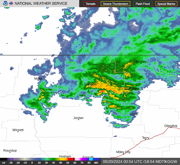
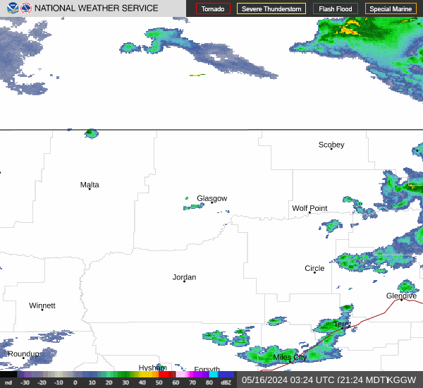
NE Montana Radar

A High Wind Warning is in effect through this evening. High west winds will persist through this evening. There is a high probability (60-90%) for wind gusts of 60 mph or more and/or sustained @ 40 mph. Watch for crosswinds on N/S highways including US 191.

Periods of rain will continue through Wednesday night, with heaviest additional rainfall amounts likely through today. This rainfall will increase travel impacts on unpaved roads, flooding in low lying areas,
and elevate stream flows along smaller streams and creeks. Quick rises remain possible a portion of the Milk River into the weekend.
|
Text Product Selector (Selected product opens in current window)
|
|
 Glasgow Radar
 Satellite
 Current observations
 Webcams
 Forecast discussion
 Montana weather
 Fire weather
 Recreation forecasts
.png) Transportation forecast
Transportation forecast.png) Weather Prediction Center
Weather Prediction Center Storm Prediction Center
 Aviation weather
.png) Skywarn
Skywarn GHWO
GHWO Follow us on YouTube