Tag Archives: Bedlam Walls

From Wrest Point to New Norfolk on the Derwent River

‘Have you got a red hat?’ friend An asked me. Recently she became Princess Pollyanna, an esteemed member of Hobart’s Scarlatt O’Hatters (http://www.hobartredhats.com/), and urged me to join particular excursions that have a connection with my walking project.  The delicious carrot being wriggled before my eyes was a ferry trip from Hobart to New Norfolk on the Derwent River.  I paid my membership fee to Queen Poppi and then found a common red beach hat (although others were wearing all manner of superb creations on their heads – are these the modern day ‘mad hatters’, I wondered). I donned a range of purple clothes and, as the newly appointed Lady Walkabout, jumped on the tiny water taxi ferry with 20 colourful new friends to be.

20150304_093216

The wind was strong and some swell across the River kept us bobbing.  However, the ride was comfortable and no one needed to bark at the fish over the side.  Sprays of salt water marked the windows and there were few opportunities to move outside into the clear moist air.  But the day was beautiful, the wind chopped waves dramatic and the panoramic scenery majestic.

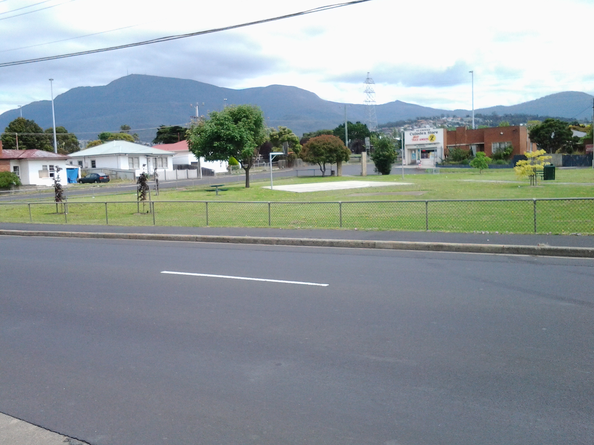
What a thrill the journey was. After we left the jetty at Wrest Point Casino in Sandy Bay, a southern suburb of Hobart, we motored with commentary from our driver.  He pointed out environmental and historical features. This was a wonderful reminder of research and findings I made while walking the edges of the Derwent between the mouth of the River and Bridgewater Bridge, and I learned a few new details.

20150304_093514

The surprise sighting of a white sea eagle perched in a high tree against the cliffs in Shag Bay (an inlet between the Bedlam Walls – refer to my Stage 6 report) inspired the driver to stop and allow us outside to get a privileged view of this large bird.

20150304_095143

One of the great treats of the day was motoring underneath the very low Bridgewater Bridge (reminded me of travelling on some flat top boats in Paris where you feel sure the boat will become wedged against the bridge metal) and passing through without a bump or grind.

During our trip, at one stage hundreds of coots flew up from the water, we were accompanied for part of the journey by a small flock of sleek long necked swans, and in a small inlet a large family of pelicans were flying around.  Our eyes focused on all these birds.

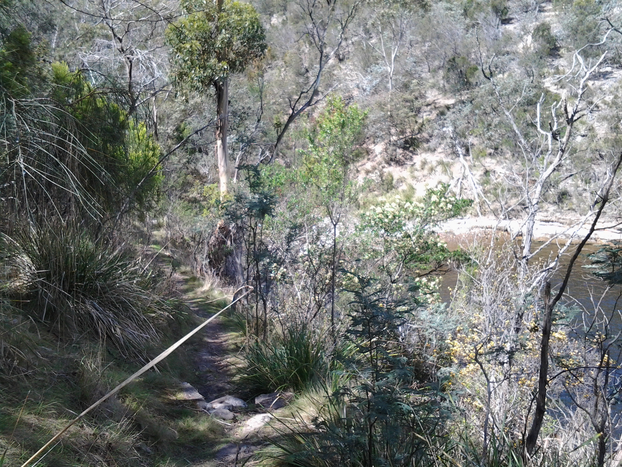
As we continued on the Derwent River against landscape which I am yet to see on foot, it was clear my earlier belief that marshlands will prevent me from walking directly next to the River for most of the way from the Bridgewater Bridge to New Norfolk, is correct.  Occasionally it will be possible to walk on paths and grass, but mostly I will be tramping the hard road verges.  I was not aware the remains of a historic Lime Kiln sits beside the water, and it was good to see that I should be able to walk pass this on my way northwards.

As a result of this one-day excursion and from many car trips up and back to New Norfolk, I have a good understanding of the route. However, I realise that at foot level the world looks completely different and I look forward to finding out more in the near future.

understanding of the route. However, I realise that at foot level the world looks completely different and I look forward to finding out more in the near future.

Lutana

Having made the decision not to visit the industries that hug the edge of the Derwent River during my Stage 10 walk, I turned right and walked down hill along Derwent Park Road on the footpath passing the Veolia recycling plant, turned left at Cox Ave then right at Furneaux Avenue. This route gave me the opportunity to surprise a friend by dropping in unexpectedly.  Two hours later after wonderful cups of tea I ventured out again.

There are many suburban routes over the Lutana hill and I chose to walk up O’Grady Avenue (which made me think of one of Australia’s elite cyclists Stuart O’Grady who was a major player in Le Tour de France and other international races, but has now retired) turned right into Bowen Ave, left into Michael St, left at Lennox, and right at Ledwell St.

This route presented superb views to the north and the south.  Views of the suburb of Moonah to the north and north west included:

20150109_123334  20150109_123338  20150109_123611

To the south and east, the views included Bedlam Walls and East Risdon State Reserve on the other side of the Derwent River.  This gave me a perspective I never had when walking on that side of the River in an earlier stage.

20150109_123854  20150109_123912  20150109_124333

There came a point where I could see the Tasman Bridge in the distance (staggering now to see it was so far away and yet I walked under the Bridge and continued onto Hobart later that day).

Towards Tasman Bridge

Landmarks further south include large white fuel tanks. These were clearly visible from a number of vantage points as I walked over Lutana.

20150109_124401  20150109_130014

I continued downhill on the southern side, until I crossed Ashbolt Crescent at 12.45pm. I was surprised to find a golf course designed to flow on either side of Reece St, a normal suburban street that I walked down to reach Risdon Road.

20150109_124651

The visual highlight of this part of the walk was the graphic nature of tyre marks on the streets from hoons doing wheelies and other mark making with their vehicles.  I liked looking at the result and have made this image my computer screen background for the moment.

20150109_124407

Once down onto Risdon Road I turned right and followed it parallel to New Town Bay in a westerly direction towards New Town Creek. About 1pm I was passing the Waterfront Lodge, motel accommodation which I did not know existed.

.Waterfront Lodge on Newtown rivulet

Five minutes later the Apex Park was on my right and on the other side stood the Culloden Hot Take Away Store with the glorious backdrop of Mount Wellington.

20150109_130559

When I stood and looked south, I could see a few tombstones of the huge Cornelian Bay cemetery between the trees on the distant small hill. In this photo, a smidgin of New Town Bay appears in the left of the photo through the vegetation.

Cornelian Bay cemetary from Lutana

At 1.07 I reached the junction of Risdon Road with the Queens Walk,where a bridge crossed New Town Creek.

Yesterday I completed Stage 10 of my sequential walk along the Derwent River

The goal for Stage 10 was to start at my last stopping point, MONA in the middle of Berriedale on the western shore of the Derwent River, and continue to Lutana the last suburb of the City of Glenorchy before the City of Hobart starts. But I went further.  Much further.  Almost much further than my feet could take me.  I walked to Hobart.

Over future posts I will write up the stories of the walk, what I saw and what I experienced, but for now it’s enough to say that I am continuing with this massive project to walk both sides of the Derwent between the mouth and Bridgewater, and then onwards to Lake St Clair. Once I get walking it is always so addictive.  Even when my feet feel crippled, I say to myself … ‘go just a little bit further. What else will I be able to see with fresh eyes?’

The day was gloomy with a cloudy sky, and Mount Wellington had veils of clouds covering at least part of its prominence most of the day. But it didn’t rain and so was perfect for walking.  However, the weather ensured the photographs were without sunshine.

Yesterday I covered 12 kilometres of the length of the Derwent River on the western shore (making 22 kms in total on the western shore), and walked approximately 19 kilometres (making a total of 130 kms to date) to achieve that distance. This distance also takes in the streets and paths on which I walked that led to dead ends so that I needed to retrace my footsteps.

Of the many highlights of the walk, I saw the building that once started life as Rosetta Cottage, and powerful Clydesdale horses with their large hairy feet.

20150109_162649

I surprised a friend still in pyjamas when I went visiting for the first time in my walks. The hot cups of tea were most welcome.

I am always excited when I walk the striped edged boardwalks of GASP (Glenorchy Arts and Sculpture Park) or pass the boatsheds of Cornelian Bay and it was no different yesterday.  See the photos below for a taste of the colour.

20150109_084404  20150109_145335

I very much enjoyed looking at the eastern shore where I had walked during past stages and seeing the landscape from a different perspective.  I felt it made the Greater Hobart Area seem undeveloped in a way which is quite amazing for a capital city. For example, Bedlam Walls on the eastern shore from the western shore of the Derwent River, in the photo below.

20150109_123940

From comments I have received, I know my walks are inspiring others to think about what they might do. Even if you choose not to walk, perhaps you can set yourself other challenges.

My next walk will start at Hunter St at Sullivans Cove on the wharf in Hobart and probably extend to Kingston.  But before then I need to record the details of yesterday’s walk.

Leaving home last Friday towards the start of Stage 7 of my walk along the Derwent

From my house early morning, I could see a mirror sheen across the Derwent River. This promised a great day for walking and so I was eager to get going.  Unfortunately the bus service to the area I was starting from departs only every couple of hours. Eventually I caught the Metro bus 694 when it passed through the Eastlands Shopping Centre bus mall at 9.13am.

The bus passed through upper Lindisfarne as it headed along the East Derwent Highway. When I looked left across the Derwent River, my view of the top of the mountain was cut off by a thick resting white cloud. The roads were calm. People were at work and kids at school. When we passed Geilston Bay I could the water was serenely flat. By this point, I was the only passenger on the bus and felt luxuriously chauffeured.  We detoured for a scenic view through the upper Geilston Bay residential area, then back to the highway.  As we travelled onwards, I noted the start of the trail to Bedlam Walls which I had walked previously, then the electricity pylons and fire trails marking the East Risdon State Reserve. The Willows Tavern loomed on the left and on the right hand side of the highway I glimpsed the starkness of the barb wired fencing of the state Prison.

At the roundabout (where I wanted to go left) the bus turned right to travel through the suburb of Risdon Vale.  Lots of small weatherboard houses and lawns with a few bushes rather than complex luscious gardens. ‘Donut’ burnout tyre marks on the intersections of roads. Rooves needing paint.  Neat and tidy. Streets prettily named after plants: Spinifex, Sycamore, Lindon (although Lindon Park had no Lindon trees), Poplar, Heather, Banksia, Kerria, Hawthorn, Marlock, Gardenia, Lantana and Holly.

Side view of the mountain: I marvelled at the speed with which clouds were being pushed across the top of the mountain southwards.

At 9.39 I was off the bus just before the junction of Saundersons Road, Risdon with the East Derwent Highway.  This is on the southern side of Risdon Cove. Around the corner of the road in the photo below, I could look over the railing in the direction of the Derwent River.

20141031_093816

I walked to that distant railing and realised that walking on the road would be very dangerous with traffic speeding on the narrow lanes.  I legged it over the railing and walked on the River side. The photo below is one of my first views.  Note the pair of black swans.

20141031_094126  20141031_094118

No longer did I have Mount Wellington as my standard backdrop across the water. In the photos above, the elevated section on the other side of the Derwent River (above the Bowen Bridge) is the Mount Faulkner Conservation Area.

Geological history and the Bedlam Walls area

For readers interested in the rock foundations of the Bedlam Walls Point the information from http://www.mrt.tas.gov.au/mrtdoc/dominfo/download/TR12_116_118/TR12_116_118.pdf may be of help.

“The area examined is rectangular and measures about 700 yards from SW to NE and about 600 yards from NW to SE. It is on an elevated promontory projecting into the Derwent estuary, bounded on the N by Shag Bay, on the W by the Derwent River and on the S by Geilston Bay.

The rocks present are fine light grey sandstone and siltstone of the Malbina Formation of Permian age. The sandstone forms hard, compact massive beds from one foot to six feet in thickness which alternate with siltstone beds generally less than two feet in thickness. The siltstone weathers more readily and so is readily distinguished in outcrop, but it is not markedly softer than the sandstone.

The rocks dip at low angles up to 6° to the W, that is, towards the Derwent. They possess vertical joints usually from nine inches to four feet apart although locally they may be as little as one inch or as far as six feet apart. Scattered isolated pebbles up to eight inches in diameter are present in the Formation Cliffs and on the W side of the area they plunge into the Derwent River. Along the foreshore in the NW corner are three shallow sea caves about 30 feet along any diameter. Their floors are now about twenty feet above sea level. There has been some collapse. No evidence of groundwater was seen either on the promontory or along the shoreline. The soil cover is a shallow silty grey loam overlaying thin stony clay. This forms a podsolic profile up to  eighteen inches and usually less than one foot in thickness.

Comments: In view of the rock types present, the low angle of dip and the well-drained nature at the rocks, the general stability of the area is not in doubt. Locally, the presence of the caves has been mentioned but they are superficial features caused by marine erosion, and do not extend underground for any distance. Except on the steepest slopes, the rocks are adequate to support normal industrial structures. Excavation will be assisted by the jointed and bedded nature of the rocks. Where there are large joint spacings, explosives will be required but in the closely jointed areas heavy earth moving equipment will be sufficient. Blocks up to six feet in diameter could be quarried from the massive sandstone. Groundwater supplies are not likely, and in any case would be limited in quantity to, at the most, 1,000 gallons per hour from a bore hole, and in quality by the proximity of sea water.”

The photo below was taken off the rocks at Bedlam Walls Point.

20141015_101248

Bedlam and its Walls on the Derwent River. What are they all about?

You may be aware that the Hospital of St Mary of Bethlehem in London served from the 1377 as a lunatic asylum and is used today for people with mental illness. The word bedlam, used to describe a place of uproar and confusion, derives from the behaviour of the inmates of this institution and others like it in the early centuries.

I cannot find how or when the Bedlam Walls or the Bedlam Walls Point along the Derwent River were named.  Perhaps the quarrying and fertiliser production in a comparatively isolated location amounted to sheer madness? Does anyone know?

Along the northern side of Shag Bay and onwards along the Derwent River

I used the mini bridge to cross the tiny creek feeding into Shag Bay and began immediately to take the walking track uphill on the northern side.  From here on I was not particularly confident about the clarity of tracks or, in fact, whether there would be tracks. I was pleased to discover that many tracks existed and as I long as I kept the Derwent River on my left, I couldn’t get lost – even if I did not know at what part of the suburb of Risdon I would arrive (‘all roads lead to Rome’ even if entry is by a different gate).

On the way up the first hill I had stopped for a view and a swig of water. During that time I surprised a dog that came around the corner behind me with her mistress. They both stopped in their tracks.  She told me that in all the dozens of times she has walked this track, she has never seen anyone on it.  Peace and solitude. Yet only a dozen or so kilometres from the heart of a city.  A capital city.

The photo below through a wooded landscape extends a view southwards to the Derwent River with the MONA ferry coming my way.  At this point, I was as high as the uppermost part of the Tasman Bridge located closer to the mouth of the River.

20141015_111529

Around me eucalyptus gum nut shells lay on the ground exuding a clean fresh perfume (think of May Gibbs’ hats on the gumnut babies Snugglepot and Cuddlepie – Tales of Snugglepot and Cuddlepie: their adventures wonderful was first published in 1918.).  Not long afterwards, the track passed through a copse of self-seeding wattle trees: I know some varieties are considered to be weeds in certain parts of Australia and I suspect this collection of specimens may be ‘weeds’.  The problem is that it grows quickly and blocks out the opportunity for other trees to survive. Monocultures are death to the natural landscape.

At the top and moving along parallel to the Derwent River, I was on top of the Bedlam Walls.  Various unofficial tracks disappeared over the cliff but I stayed on the main path. My reasoning was that I had an infrequent bus service to connect with at Risdon Cove and I was not sure how long it would take to reach there.  The downside was that I missed experiencing the actual walls and their walkways and caves. I would have liked to have seen the following (https://www.flickr.com/photos/bleeter/7266025800/), but I must return for a closer inspection.

7266025800_c8d48839e8_b

Along the top I was afforded detailed views of the western shore and especially of the smelting works, Nystar as shown below.

20141015_112338

It is now obvious to me that when I walk south along the western shore of the Derwent I will not be able to be close to the river edge when I pass this massive Nystar industry covering many acres of land. I reached a major electricity pylon around 11.20am and watched its wires swing across the river to the power hungry industry (these wires are just visible in the photo above). Looking southwards and across the River from the top of Bedlam Walls, I could see Mount Wellington overshadowing Cornelian Bay and the Newtown suburb of Hobart.

20141015_112331

My track moved inland and parallel to the electricity pylons. After 5 minutes the track split and I turned left. It came to an end with a rough worker’s seating area in view of the Bowen Bridge crossing the Derwent River further north.  The cliff seemed to drop away and I judged that a slippery slide down might not be a good idea with no one else around if something should go wrong.  Later in the day when I was much further north, I was able to look back to the pylon and see I really should have braved it down the hill and kept closer to the water. But then again it might be safer to walk south and climb that hill rather than slip down it heading northwards. By 11.35am I had walked back to the divide with the original clear but rough 4WD track and chose the other arm along the pylons.

Reaching Shag Bay as I walked along the Derwent River

From Bedlam Walls Point, tracks meandered northward and before long a large quarry was visible on the other side of Shag Bay. At its base I could see the rusting remnants of machinery parts.

20141015_103753

Descending to Shag Bay at this point seemed perilous so I turned right and found tracks moving inland parallel to the Bay.  Fresh wallaby poo beside the track: black olive sized and shaped, glistening in the sun. I did not see the wallaby which undoubtedly would be looking elsewhere for a midday shady rest spot. Large grey-brown fantailed birds darted amongst the trees.

I was back on the main track at 10.45am and a couple of minutes later reached a sign marking the start of the East Risdon State Reserve (dogs prohibited, even on leads). The deep dark brown green water of Shag Bay rested liked a solid plane behind the sign. Very seductive.  Once at the water’s edge I was surprised how clear the water was except for the natural colouring and tannins from native plants.

20141015_104855

I stepped carefully down the rocky crumbling path to the Bay.

20141015_104912

The quality of light was extraordinary. Rain during the night had cleared the air and the colours of the landscape were clear. I reached the bottom next to the water’s edge of Shag Bay after a further five minutes, and breathed in my surrounds, feeling very joyful to have such easy access to this beautiful environment.

Temporarily I was startled by the spectacle of a massive White Bellied Sea Eagle flying up and down Shag Bay. I stood spellbound unable to move to click a photograph.  Have a look at the photo on http://www.parks.tas.gov.au/?base=5115 and see the large fish in the eagle’s talons. It wasn’t long before a large (but much smaller than the eagle) black bird came and swooped at the eagle to drive it away.  It’s not an easy life for these birds; they have no rest.

As I continued along the foot of the Bay, I came across an old rusting boiler up on the rocks, a massive lump of concrete, and other rusting metal in the water and around about.

20141015_105602     20141015_105701

A couple of minutes before 11am I reached the boiler used as part of a blood and bone factory in the late 19th and early 20th centuries, shown in the photos above, then a few minutes later I reached the curve of the Bay and could see a second old boiler partly obscured by the bush.  Apparently the Tasmanian Fertiliser Company was operating here for many years until a massive boiler explosion caused death and destruction resulting in the business folding. You can read the records of the inquest at http://trove.nla.gov.au/ndp/del/article/10403147.

20141015_110028

Looking down the Bay, past two fishermen in their outboard motored runabout, I soaked in the view of the western shore of the Derwent River with Mount Wellington rising above it. Hardly any air movement and the temperature was cool enough to make standing in the sun a comfortable delight.

Prior to the walk I did uncover information (http://www.parks.tas.gov.au/indeX.aspX?base=1799) that Shag Bay was used for the demolition of boats such as the HMS Nelson in 1926. The photo below is from the collection of the State Library of Tasmania.

abandonedHMS Nelson Shag Bay

I saw no evidence of boat demolition during my walk around Shag Bay, however on a second visit if I investigate the quarry maybe I will find materials of interest.

The Clarence City Council (http://www.ccc.tas.gov.au/page.aspx?u=1487) suggests the 3km round trip from

Geilston Bay to Shag Bay will take 45 minutes (although another website suggests an hour and a half for the return trip). I took considerably longer by following unofficial tracks and taking time to observe the land around me as I walked. Apart from the two fishermen on the Bay there was not a soul around. I cannot recommend this walk too strongly. Everything about the walk and the location is attractive so I hope people living in Hobart will take themselves out to Geilston Bay and make their own discoveries.  The website at http://highteawithhominids.squarespace.com/ancient-humans/2011/8/19/bedlam-walls-a-walk-in-tasmania.html provides additional details which may help locate some of the historical sites that I missed.

Also on the Clarence City Council website, the claims are made that the track is well signposted. This is not true.  I saw three signs only: Geilston Creek track from the bus stop, Bedlam Walls sign including a map to Shag Bay at the start of the track, and the East Risdon State Reserve billboard close to Shag Bay. Considering the myriad of unofficial tracks that will attract the attention of many walkers, if you wander aimlessly, you will need to remember to keep the river on your left as you walk north to Shag Bay and on your right when you return to Geilston Bay.  I do not recall seeing any signs at Shag Bay so I missed the aboriginal midden and quarry.

The Shag Bay and Bedlam Walls area covers much loved and used aboriginal land of the Moomairremener people

Various websites have indicated that the tract of land between Geilston Bay and Risdon Cove contains a great deal of evidence of land and river use by the original land owners.

Previously I acknowledged the traditional owners of the land along the Derwent River that I have been walking across. This land, before European settlement, belonged to the Moomairremener people however the early international settlers failed to understand that the local inhabitants had established government practices and legal systems, and worked with the land and sea to ensure an ongoing food supply. Unfortunately the characteristics which made the indigenous people civilised were different to those characteristics which made the settlers civilised. Because of their major cultural differences, both groups of people couldn’t grasp the positive values of each other. Each failed to learn from the other so that neither came to an understanding that the difference between them did not make one group better or worse.  As the new settlers encroached on aboriginal land and hunting grounds without understanding the value and significance of what they were doing and attacked aboriginal people, inevitably the Moomairremener people attacked in return.

Bedlam Walls Point’s aboriginal cave, middens and quarry were the main features of aboriginal occupation that I expected to access during my walk. Regrettably I did not find the cave or the middens but I did see, at a distance, the quarry.  Another walk is needed to take more time to access these additional sites.

All the above are in easy walking distance of the site (Risdon Cove) at which, according to one story, an Aboriginal band hunting kangaroos was mistaken by whites for attackers and massacred (http://fieldnotestasmania.blogspot.com.au/2009/11/bedlam-walls-walk.html). According to http://www.australianhistorymysteries.info/pdfs/StudiesAHM-1.pdf “On 3 May 1804 there was a violent clash between a group of British settlers and a large party of Aboriginal people at Risdon Cove, near Hobart in Tasmania (then known as Van Diemen’s Land). Different writers and historians have given varying accounts of what happened then.”  In my view, neither option expressed on this website does any credit to the early settlers.

I cannot help thinking about the ongoing contemporary parallels where governments provoke fear by urging our populations to be vigilant against others who dress or look different. I cannot see this is a helpful way to learn to understand the benefits that different people can bring to all our lives.

From Geilston Bay to Risdon on Stage 6 of my walk along the Derwent River yesterday

Yesterday’s walk was a sensationally wonderful experience. Over a few posts I will colour in the rich fabric of the day, much of it in clean fresh smelling bushland (such as that at Tommy’s Bight in the photo below).

20141015_133405

To start with, I caught Metro bus 694 destined for Risdon Vale and Glenorchy (scheduled from the Hobart city bus mall at 9.03) on the eastern shore and travelled to bus stop 14 on the East Derwent Highway at Geilston Bay. Thankfully the Clarence City Council has erected a sign marking the start of the walk.

20141015_093747

From the bus stop, I walked along the edge of Geilston Bay then northwards around Bedlam Walls Point to Shag Bay and onwards to the top of the Bedlam Walls, where I was rewarded with panoramas across the Derwent River. My northwards walk continued into and across the East Risdon State Reserve before descending into the suburb of Risdon. I turned south and walked on the edge of the Derwent River to Porters Bay where I took my lunch break before continuing south to Tommy’s Bight.

Eventually I retraced my steps back to Risdon and continued along the water’s edge to the junction of Saunderson’s Road with the East Derwent Highway. The return bus stop for a 694 bus, which arrived at 2.35pm (with not another one due for two hours), was on the Highway across from Risdon and adjacent to the land and water marking the Risdon Cove area.

I was away from home for approximately 6 and ¼ hours, and walked a total of around 12 kms winding over many tracks and retracing parts of my walk.

Previously I had walked 23 kms of the length of the Derwent River.  Yesterday I added 3 kms which brings the new tally to 26 kms.