
Xingshan County
Xingshan County
兴山县 Hingshan | |
|---|---|
.jpg) Near Wujiaping (between Gaoqiao and Nanyang) | |
 Xingshan is the northernmost division on this map of Yichang | |
 Yichang in Hubei | |
| Coordinates (Xingshan government): 31°20′53″N 110°44′49″E / 31.348°N 110.747°E | |
| Country | People's Republic of China |
| Province | Hubei |
| Prefecture-level city | Yichang |
| Area | |
| • Total | 2,316 km2 (894 sq mi) |
| Population | |
| • Total | 182,600 |
| • Density | 79/km2 (200/sq mi) |
| Time zone | UTC+8 (China Standard) |
| Website | Xingshan County People's Government (in Chinese) Xingshan County People's Government (English Version) |
Xingshan County (simplified Chinese: 兴山县; traditional Chinese: 興山縣; pinyin: Xīngshān Xiàn) is a county of western Hubei, People's Republic of China. It is under the administration of Yichang Prefecture-level City.
Geography[edit]
The county occupies the mountainous north-western corner of Yichang prefecture ("prefecture-level city"), bordering on Badong County in the west and Shennongjia in the north. The highest mountains within the county are Mount Wanchao (2,253 metres (7,392 ft) elevation) and Mount Wanfu (1,819 metres (5,968 ft)).
The county seat is in Gaofu town; this is the location that is simply marked as "Xingshan" on less detailed maps.
Although the county is away from the Yangtze River itself, and most of its land is at high elevations, the construction of the Three Gorges Dam resulted in the flooding of the valley of the Yangtze's tributary Xiang Xi (香溪, "Fragrant Stream"), where many of the county's residents lived. Accordingly, some 20,000 residents had to be relocated from the flooded areas.[3] It is officially part of the Three Gorges Reservoir Region.
Climate[edit]
| Climate data for Xingshan (1991–2020 normals, extremes 1981–2010) | |||||||||||||
|---|---|---|---|---|---|---|---|---|---|---|---|---|---|
| Month | Jan | Feb | Mar | Apr | May | Jun | Jul | Aug | Sep | Oct | Nov | Dec | Year |
| Record high °C (°F) | 21.0 (69.8) |
27.9 (82.2) |
35.5 (95.9) |
37.5 (99.5) |
40.3 (104.5) |
41.2 (106.2) |
42.2 (108.0) |
42.1 (107.8) |
43.1 (109.6) |
34.7 (94.5) |
28.0 (82.4) |
21.6 (70.9) |
43.1 (109.6) |
| Mean daily maximum °C (°F) | 10.6 (51.1) |
13.6 (56.5) |
18.7 (65.7) |
24.6 (76.3) |
28.0 (82.4) |
31.4 (88.5) |
34.1 (93.4) |
34.0 (93.2) |
29.2 (84.6) |
23.3 (73.9) |
18.0 (64.4) |
12.3 (54.1) |
23.2 (73.7) |
| Daily mean °C (°F) | 5.6 (42.1) |
8.1 (46.6) |
12.4 (54.3) |
17.7 (63.9) |
21.4 (70.5) |
25.0 (77.0) |
27.5 (81.5) |
27.1 (80.8) |
23.1 (73.6) |
17.6 (63.7) |
12.3 (54.1) |
7.3 (45.1) |
17.1 (62.8) |
| Mean daily minimum °C (°F) | 2.2 (36.0) |
4.3 (39.7) |
7.8 (46.0) |
12.6 (54.7) |
16.7 (62.1) |
20.5 (68.9) |
23.2 (73.8) |
22.6 (72.7) |
19.0 (66.2) |
13.9 (57.0) |
8.7 (47.7) |
3.8 (38.8) |
12.9 (55.3) |
| Record low °C (°F) | −4.9 (23.2) |
−3.7 (25.3) |
−1.5 (29.3) |
1.8 (35.2) |
9.0 (48.2) |
12.7 (54.9) |
16.6 (61.9) |
15.8 (60.4) |
11.9 (53.4) |
3.0 (37.4) |
−0.6 (30.9) |
−6.9 (19.6) |
−6.9 (19.6) |
| Average precipitation mm (inches) | 14.9 (0.59) |
24.8 (0.98) |
43.5 (1.71) |
85.1 (3.35) |
117.9 (4.64) |
145.2 (5.72) |
150.5 (5.93) |
151.5 (5.96) |
96.4 (3.80) |
84.8 (3.34) |
39.4 (1.55) |
14.0 (0.55) |
968 (38.12) |
| Average precipitation days (≥ 0.1 mm) | 6.5 | 7.2 | 10.2 | 12.0 | 14.1 | 12.9 | 13.1 | 13.0 | 11.5 | 10.8 | 8.8 | 6.2 | 126.3 |
| Average snowy days | 2.4 | 1.6 | 0.7 | 0 | 0 | 0 | 0 | 0 | 0 | 0 | 0.1 | 0.6 | 5.4 |
| Average relative humidity (%) | 70 | 68 | 66 | 69 | 72 | 74 | 75 | 73 | 74 | 77 | 77 | 73 | 72 |
| Mean monthly sunshine hours | 84.4 | 87.7 | 121.1 | 143.0 | 143.5 | 149.6 | 178.8 | 188.8 | 132.7 | 118.5 | 106.6 | 94.5 | 1,549.2 |
| Percent possible sunshine | 26 | 28 | 32 | 37 | 34 | 35 | 42 | 46 | 36 | 34 | 34 | 30 | 35 |
| Source: China Meteorological Administration[4][5] | |||||||||||||
Administrative division[edit]
The county is administratively divided into 8 township-level divisions: 6 towns and 2 townships.[1][6][7]
Six towns:
Two townships:
Gallery[edit]
-
 Baishahe Village, Nanyang Town
 -
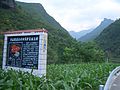 In Liangtai River valley, near Gaoqiao Township
 -
 Houzibao Hydroelectric Power Station
 -
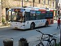 Regular bus service operates between the county seat (Gufu) and other major towns


Notes[edit]
- ^ a b 兴山县历史沿革 [Xingshan County Historical Development] (in Simplified Chinese). XZQH.org. 14 July 2014. Retrieved 5 November 2018.
1996年,兴山县面积2316平方千米,{...}2010年第六次人口普查,兴山县常住总人口170630人,其中:古夫镇42425人,昭君镇22809人,峡口镇24582人,南阳镇11195人,黄粮镇21864人,水月寺镇22187人,高桥乡14568人,榛子乡11000人。
- ^ 兴山概况 [Xingshan County Summary] (in Simplified Chinese). Xingshan County People's Government. Archived May 22, 2009, at the Wayback Machine
- ^ Emigration Archived November 21, 2008, at the Wayback Machine (from the county's official site)
- ^ 中国气象数据网 – WeatherBk Data (in Simplified Chinese). China Meteorological Administration. Retrieved 11 June 2023.
- ^ 中国气象数据网 (in Simplified Chinese). China Meteorological Administration. Retrieved 28 May 2023.
- ^ 2017年统计用区划代码和城乡划分代码:兴山县 [2017 Statistical Area Numbers and Rural-Urban Area Numbers: Xingshan County]. National Bureau of Statistics of the People's Republic of China. 2017. Retrieved 5 November 2018.
统计用区划代码 名称 420526101000 古夫镇 420526102000 昭君镇 420526103000 峡口镇 420526104000 南阳镇 420526105000 黄粮镇 420526106000 水月寺镇 420526201000 高桥乡 420526202000 榛子乡
- ^ 部门列表 [Department Listing] (in Simplified Chinese). Xingshan County People's Government. Retrieved 5 November 2018.
兴山高桥乡 兴山黄粮镇 兴山县国土局 兴山县教育局 兴山水月寺镇 兴山峡口镇 兴山古夫镇 兴山县林业局 兴山榛子 乡
External links[edit]
- Xingshan County People's Government (in Chinese)
- Xingshan County People's Government - English version
- Study on the impact of hydroelectric power at the Xiangxi River, ScienceDirect. Retrieved on June 1, 2013.

| International | |
|---|---|
| National | |