 創作內容
創作內容
4 GP
作者:艾洛│2011-03-12 15:01:56│巴幣:0│人氣:2409

 【攝影】日本大地震
作者:艾洛│2011-03-12 15:01:56│巴幣:0│人氣:2409
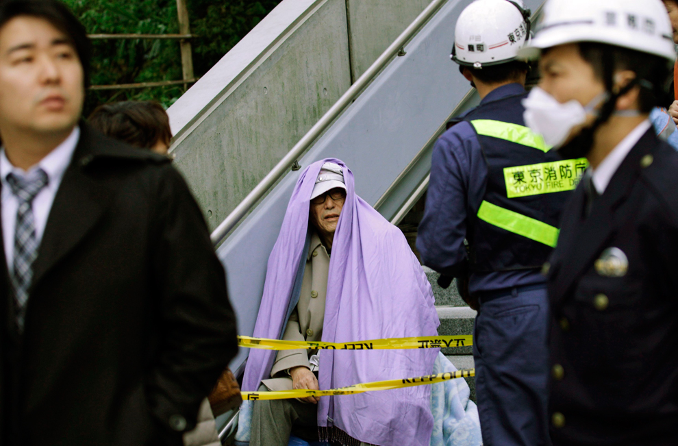
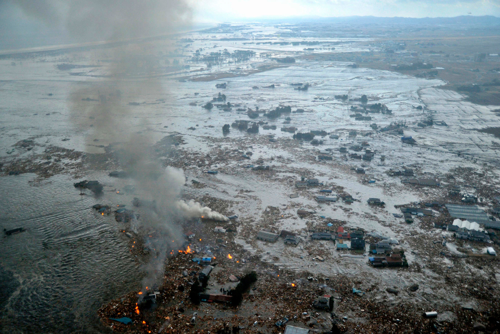
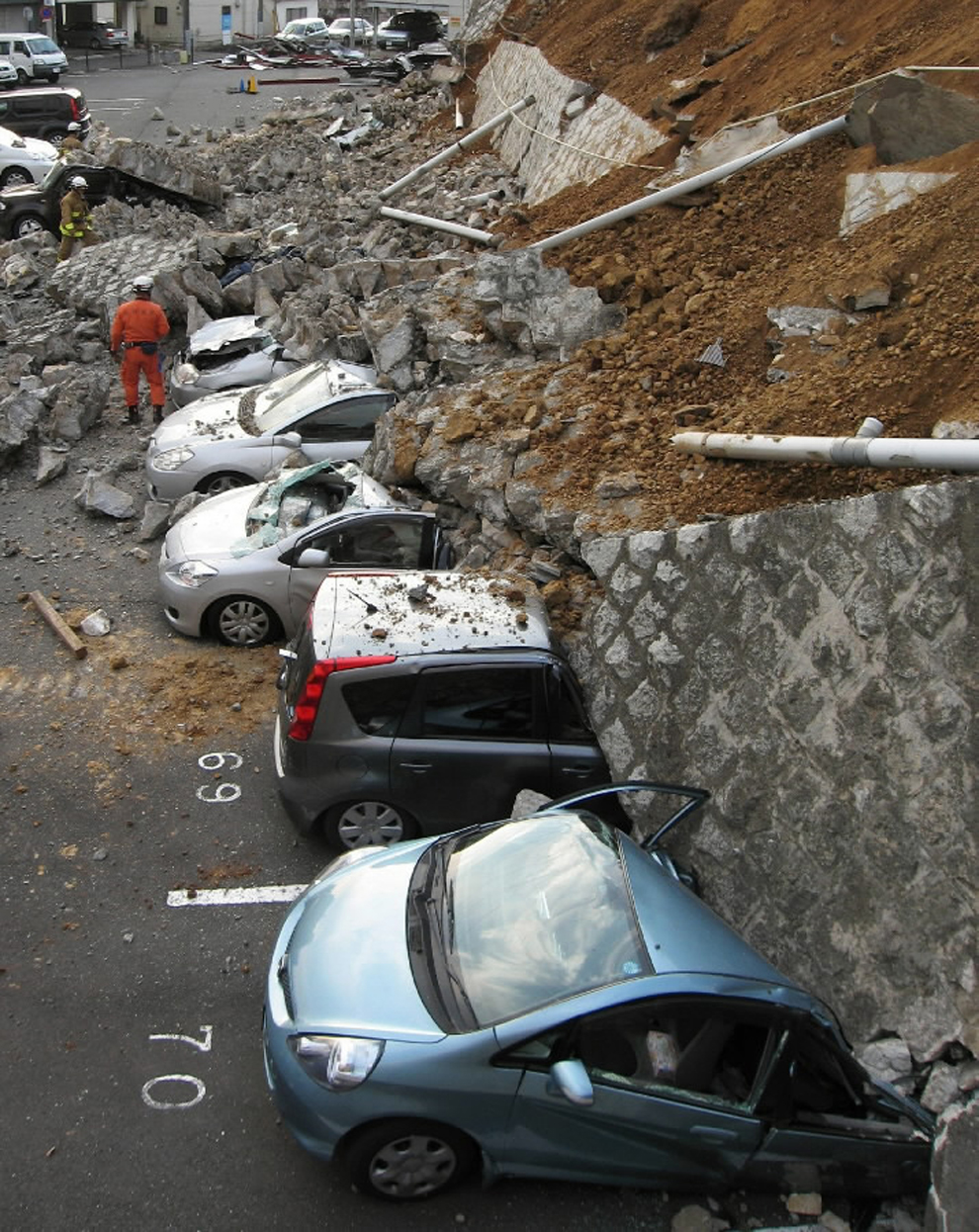
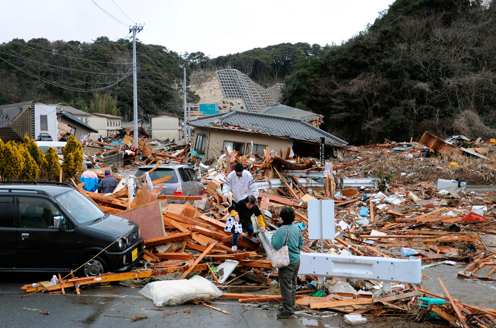
日本大地震
在今天台灣時間的下午,規模8.9級的地震襲擊了日本東部海岸。
這次地震還創下了世界史上歷史規模第八大的地震記錄
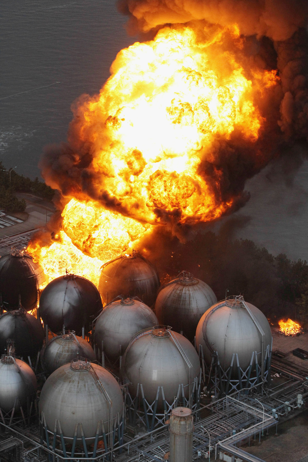
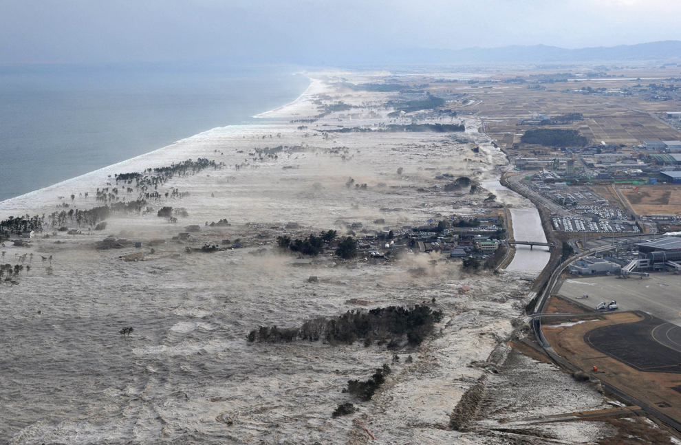
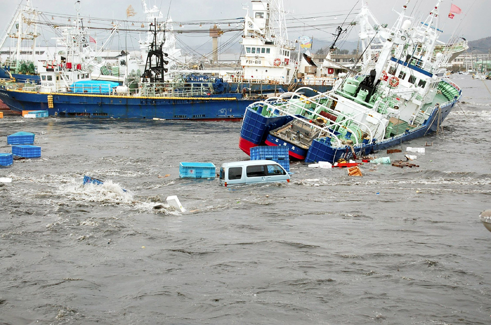
引發了23英尺的海嘯,重創日本的海岸,造成了數百人(目前保守估計)的死亡,橫掃了汽車,家庭,建築物和船隻。
以下一些國外的媒體,抵達日本所拍下的照片...
![]()
![]()
![]()
![]()
![]()
![]()
![]()
![]()
![]()
![]()
![]()
![]()
![]()
![]()
![]()
![]()
![]()
![]()
![]()
![]()
![]()
![]()
![]()
![]()
![]()
![]()
![]()
![]()
![]()
![]()
![]()
![]()
![]()
![]()
![]()
![]()
![]()
![]()
![]()
![]()
![]()
![]()
![]()
![]()
![]()
![]()
YAHOO日本地震賑災捐款
天佑日本.....。
在今天台灣時間的下午,規模8.9級的地震襲擊了日本東部海岸。
這次地震還創下了世界史上歷史規模第八大的地震記錄
引發了23英尺的海嘯,重創日本的海岸,造成了數百人(目前保守估計)的死亡,橫掃了汽車,家庭,建築物和船隻。
以下一些國外的媒體,抵達日本所拍下的照片...
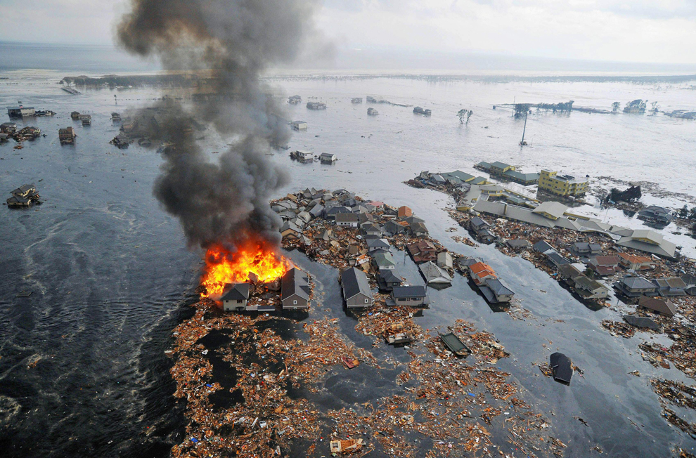
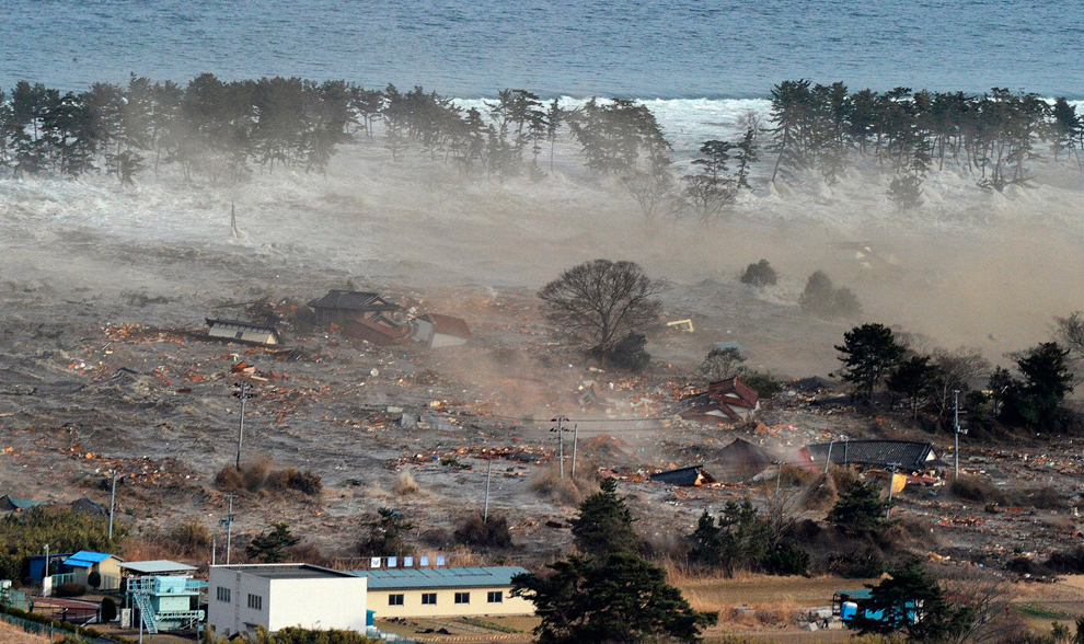
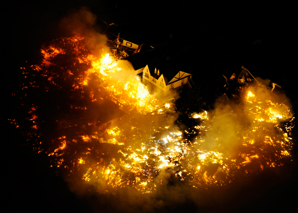
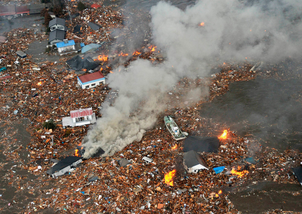
Houses swallowed by tsunami waves burn in Natori, Miyagi Prefecture (state) after Japan was struck by a strong earthquake off its northeastern coast Friday, March 11. (Kyodo News/Associated Press)

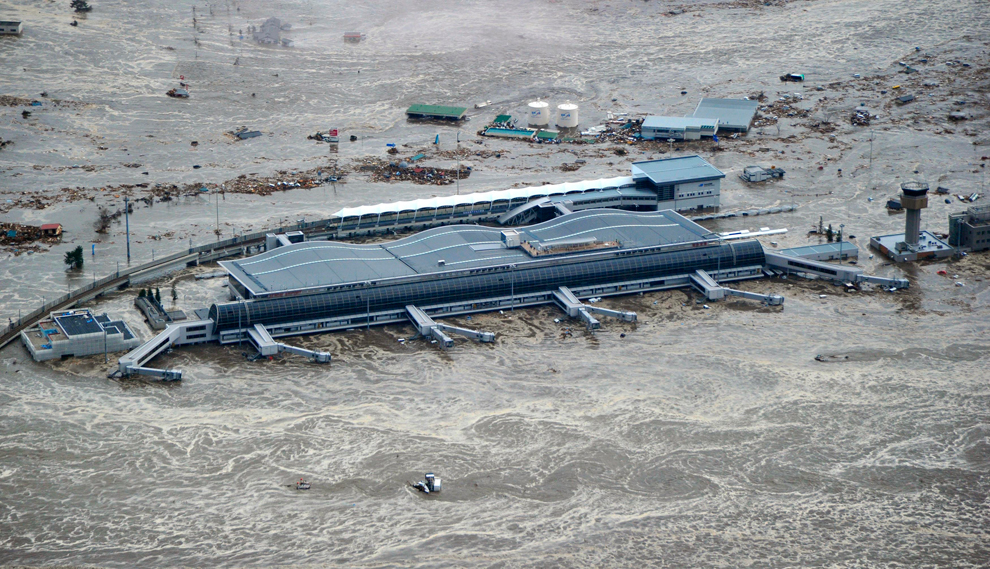
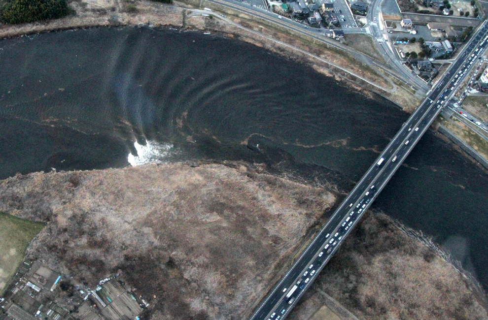
A tsumani triggered by a powerful earthquake makes its way to sweep part of Sendai airport in northern Japan on Friday March 11, 2011. The magnitude 8.9 earthquake slammed Japan's eastern coast Friday, unleashing a 13-foot (4-meter) tsunami that swept boats, cars, buildings and tons of debris miles inland. (Kyodo News/Associated Press) #
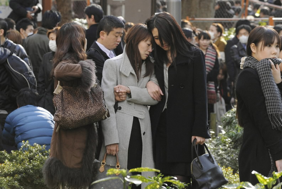
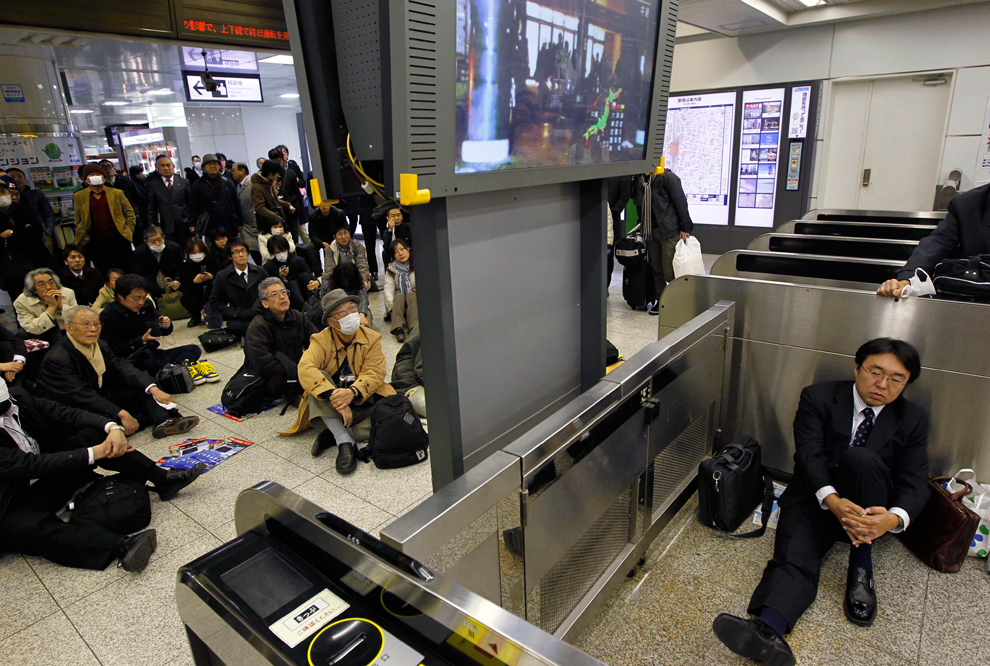
Evacuees stand around Shinjuku Central Park in Tokyo Japan March 11, 2011. A massive 8.9 magnitude quake hit northeast Japan on Friday, causing many injuries, fires and a ten-metre (33-ft) tsunami along parts of the country's coastline. A tsunami warning has been issued for the entire Pacific basin except for the mainland United States and Canada following a huge earthquake that hit Japan on Friday, the Pacific (Reuters) #
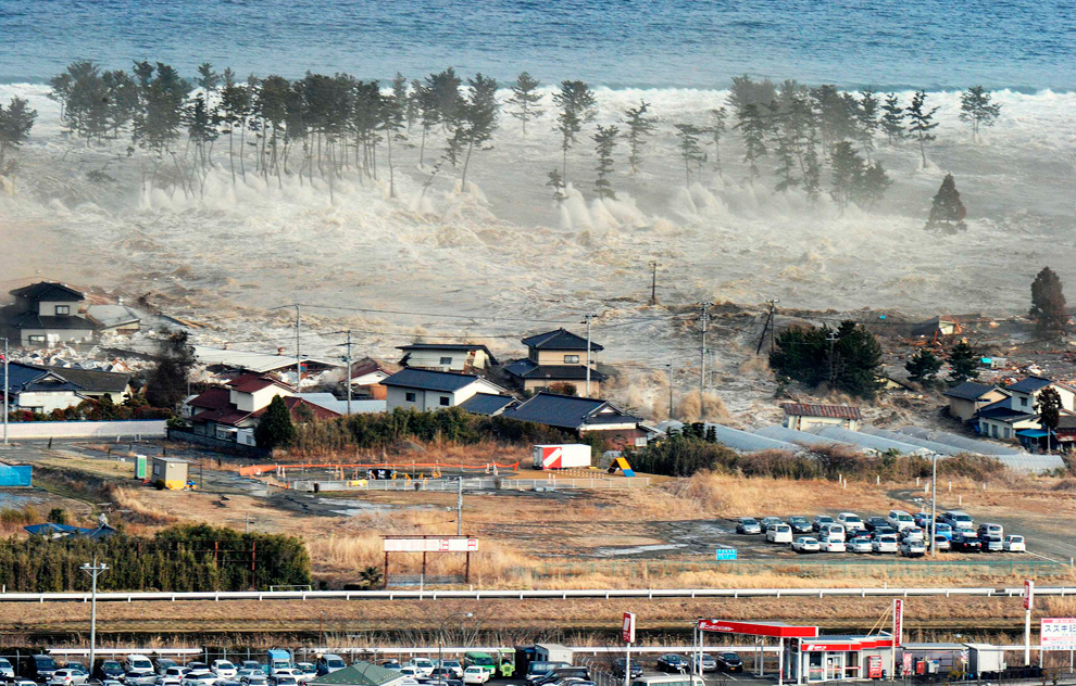
Houses are swept by a tsunami in Natori City in northeastern Japan March 11, 2011. A massive 8.9 magnitude quake hit northeast Japan on Friday, causing many injuries, fires and a ten-metre (33-ft) tsunami along parts of the country's coastline. There were several strong aftershocks and a warning of a 10-metre tsunami following the quake, which also caused buildings to shake violently in the capital Tokyo. (Reuters) #


Seismologists pose for the media as they display a seismographic graph showing the magnitude of the earthquake in Japan, on a monitor at the British Geological Survey office in Edinburgh, Scotland March 11, 2011. The biggest earthquake on record to hit Japan struck the northeast coast on Friday, triggering a 10-metre tsunami that swept away everything in its path, including houses, ships, cars and farm buildings. (David Moir/Reuters) #
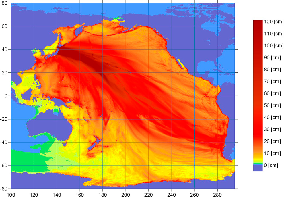
An energy map provided by the National Oceanic and Atmospheric Administration (NOAA) shows the intensity of the tsunami caused by the magnitude 8.9 earthquake which struck Japan on March 11, 2011. A tsunami warning has been issued for the entire Pacific basin except mainland United States and Canada following a huge earthquake that hit Japan on Friday, the U.S. Pacific Tsunami Warning Center said. The warning includes Hawaii and extends from Mexico down to South American countries on the Pacific, the center said. (NOAA/Tsunami Warning Center/)#
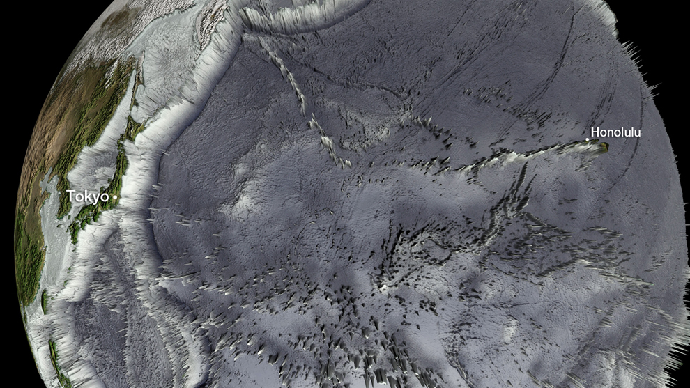
This National Oceanic and Atmospheric Administration (NOAA) Global bathymetry map image released on March 11, 2011 shows features of the ocean floor depth (or bathymetry) from a NOAA ETOPO-1 dataset. The image shows the entire Western Pacific basin. Notice how abruptly the Japanese islands rise out of the ocean. Other coastal Asian areas have much more gradual slopes. The islands and mountain ranges throughout the ocean, visible in this imagery, also affect the tsunami travel time and speed. In the open ocean, tsunamis can travel at speeds up to 500 mph (800 kph). This momentum is what creates such a destructive force as the wave moves inland. Tsunami waves rolled thousands of miles across the Pacific Ocean after a massive earthquake off Japan and washed ashore in Hawaii early March 11, 2011, but the tourist hotspot appeared to escape major damage. As sirens blared and Hawaiian authorities rapidly evacuated low-lying areas, the Pacific Tsunami Warning Center reported wave changes at Waianae Harbor at around 3:24 a.m. (NOAA/handout)#
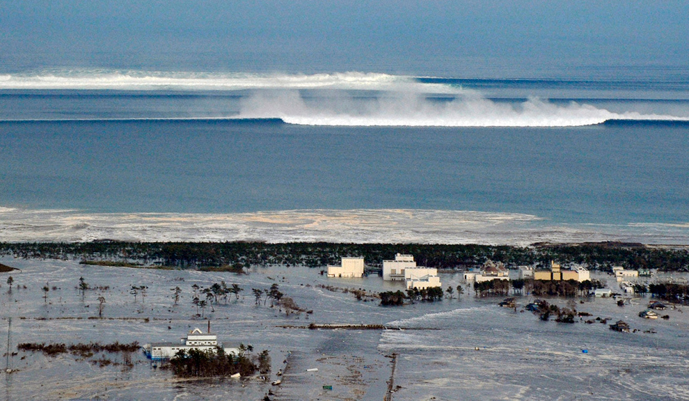
An oncoming tsunami strikes the coast in Natori City, Miyagi Prefecture, northeastern Japan March 11, 2011. The biggest earthquake to hit Japan in 140 years struck the northeast coast on Friday, triggering a 10-metre tsunami that swept away everything in its path, including houses, cars and farm buildings on fire. (Reuters) #


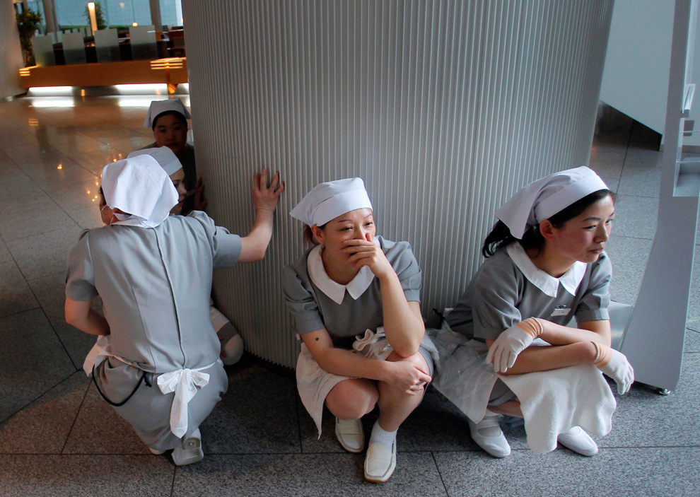
Japan's Prime Minister Naoto Kan (center) reacts he he feels an earthquake as he attends a committee meeting in the upper house of parliament in Tokyo March 11. A massive 8.8 magnitude quake hit the northeast coast of Japan on Friday, shaking buildings in the capital Tokyo, causing "many injuries", at least one fire and triggering a four-metre (13-ft) tsunami, NHK television and witnesses reported. (Toro Hanai/Reuters) #

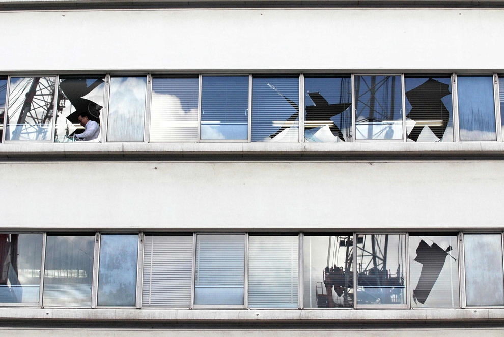
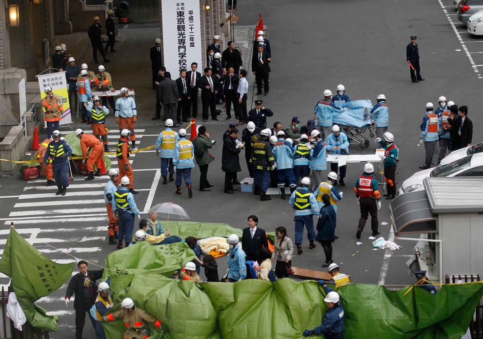
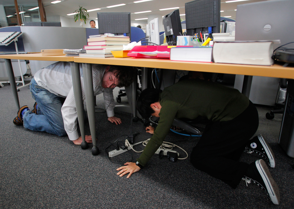
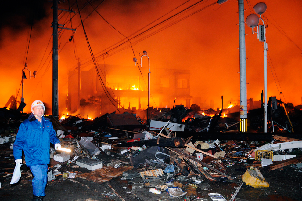
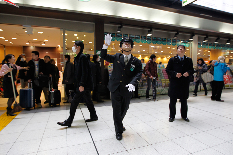
Rescue workers hurry to a building following reports of injuries in Tokyo's financial district after an earthquake hit off the coast of northern Japan. There were several strong aftershocks and a warning of a 10-metre tsunami following the quake, which also caused buildings to shake violently in the capital Tokyo. (Kim Kyung-Hoon/Reuters) #
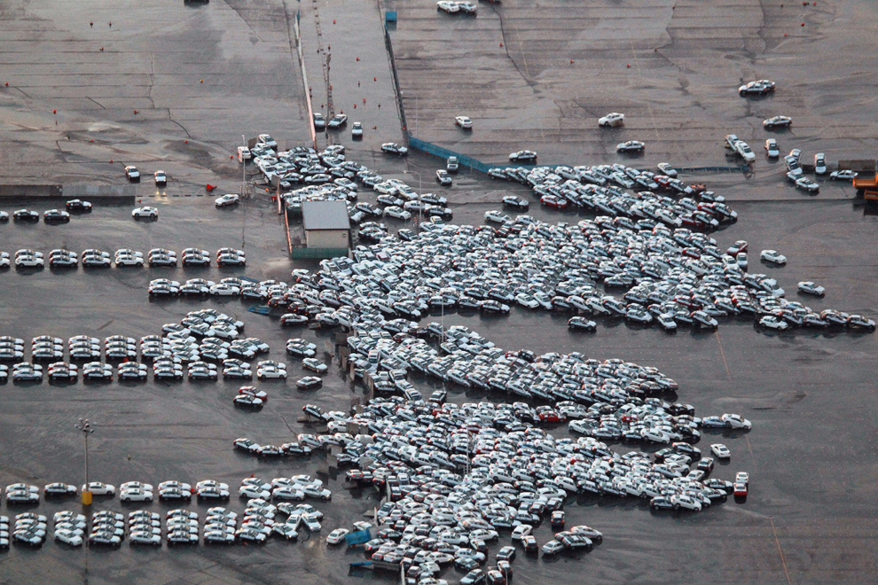
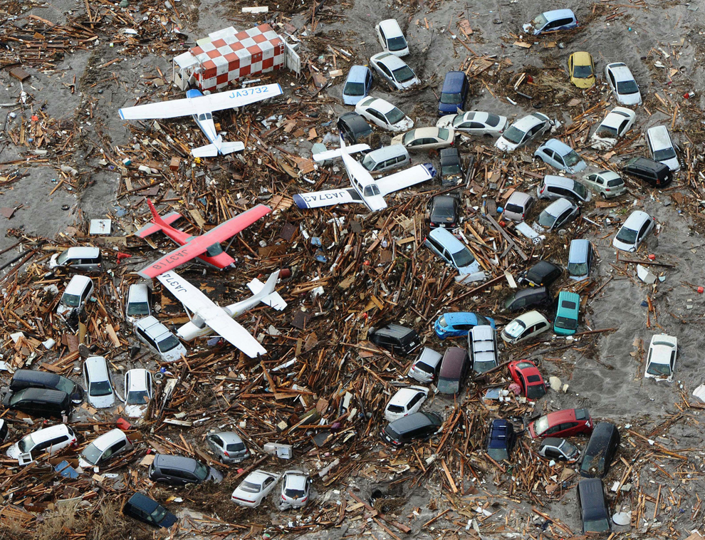
An aerial shot shows vehicles ready for shipping being carried by a tsunami tidal wave at Hitachinaka city in Ibaraki prefecture on March 11, 2011. A massive 8.8-magnitude earthquake shook Japan, unleashing a powerful tsunami that sent ships crashing into the shore and carried cars through the streets of coastal towns. (AFP/Getty Images) #

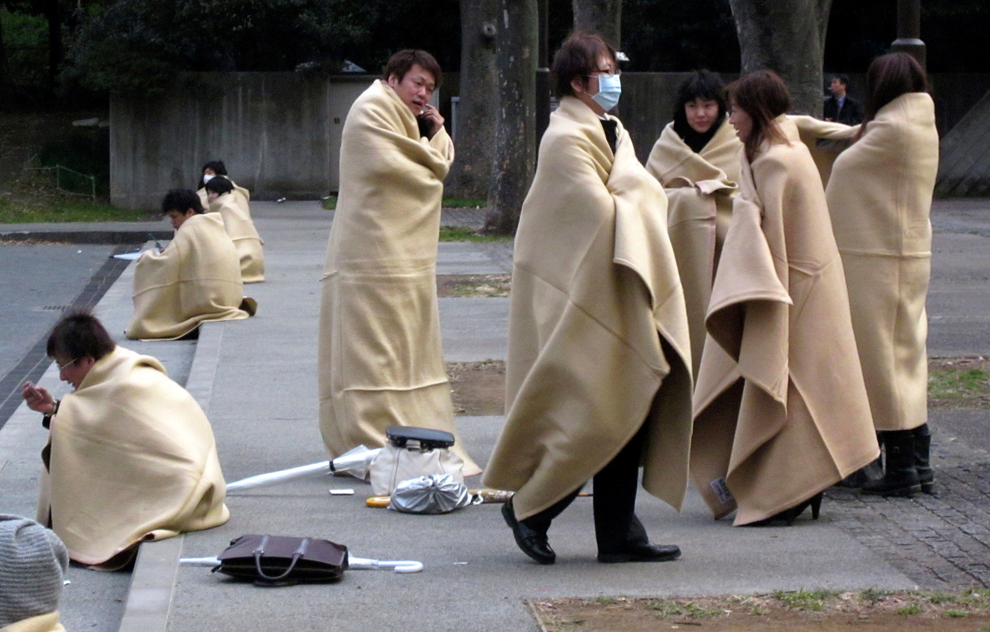
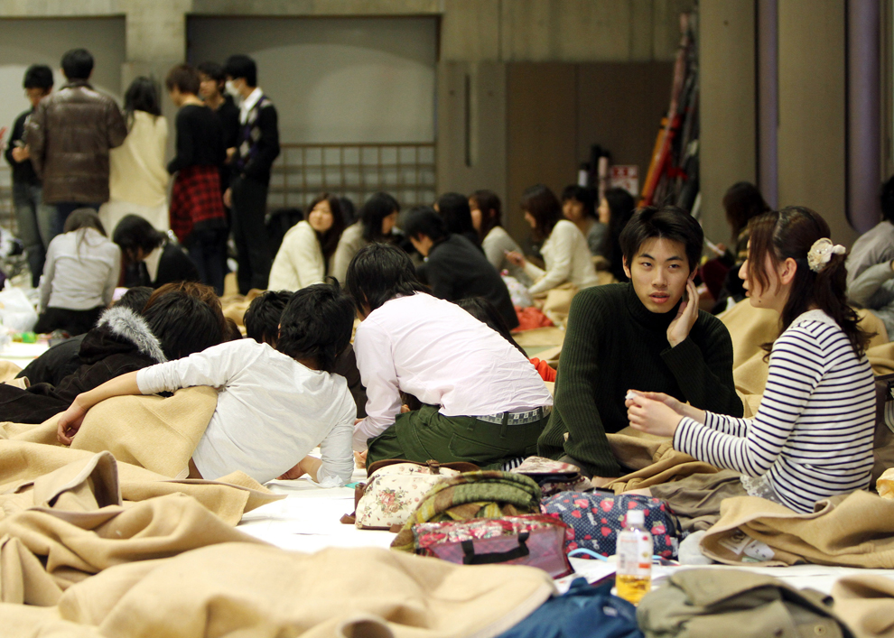
Evacuees wait in an evacuation area following an earthquake in Tokyo, Japan, on Friday, March 11, 2011. Japan was struck by its strongest earthquake on record, an 8.9-magnitude temblor that shook buildings across Tokyo and unleashed a seven-meter-high tsunami that killed hundreds as it engulfed towns on the northern coast. (Haruyoshi Yamaguchi/Bloomberg) #

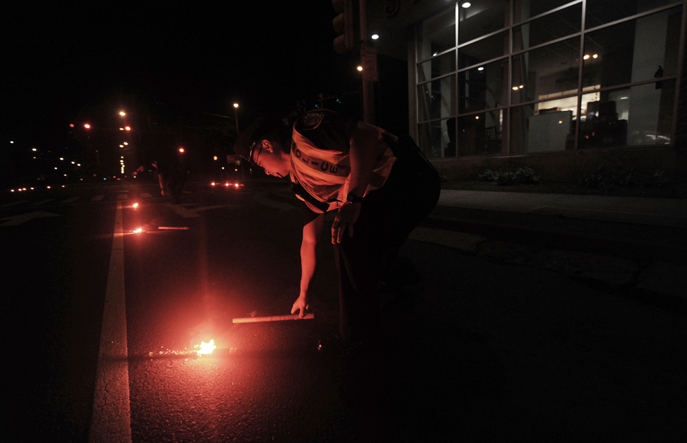
Police place roadside flares along the highway on March 11 in Honolulu, Hawaii. An earthquake measuring 8.9 on the Richter scale has hit the northeast coast of Japan causing tsunami alerts throughout the Pacific Ocean. Thousands along the coast are evacuating their homes in Hawaii as the state prepares for tsunami waves. (Lucy Pemoni/Getty Images) #
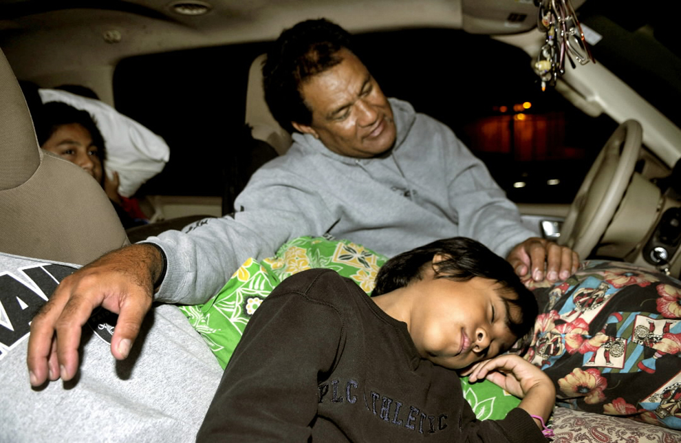
Puipui Faletoi, of Moiliili, Oahu, background center, rests in his vehicle with his sons Daniel, left, and Fletcher Faletoi in the parking lot of Manoa District Park in Oahu, Hawaii. The site is a volunteer staging area which could turn into a Red Cross shelter if a tsunami arrives. The Faletoi family plan to take shelter here. (Rebecca Breyer/Associated Press)#

This National Oceanic and Atmospheric Administration (NOAA) image released on March 11, 2011 shows model runs from the Center for Tsunami Research at the NOAA Pacific Marine Environmental Laboratory showing the expected wave heights of the tsunami as it travels across the Pacific basin. The largest wave heights are expected near the earthquake epicenter off Japan. The wave will decrease in height as it travels across the deep Pacific but grow taller as it nears coastal areas. In general, as the energy of the wave decreases with distance, the near shore heights will also decrease (e.g., coastal Hawaii will not expect heights of that encountered in coastal Japan). Tsunami waves rolled thousands of miles across the Pacific Ocean after a massive earthquake off Japan and washed ashore in Hawaii early March 11. (NOAA) #
YAHOO日本地震賑災捐款
天佑日本.....。
引用網址:https://home.gamer.com.tw/TrackBack.php?sn=1254596
All rights reserved. 版權所有,保留一切權利
All rights reserved. 版權所有,保留一切權利


 生活日記 (15)