Bradfield
Bradfield is a village and former civil parish, now in the parish of Swafield, in the North Norfolk district, in the county of Norfolk, England. The village is 7.6 miles south south east of Cromer, 18.1 miles north north east of Norwich and 135 miles north east of London.Notable Places in the Area


Localities in the Area
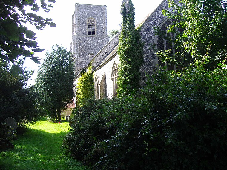
Trunch
Village
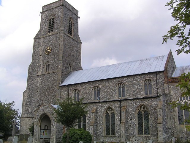
Photo: Helen Hanley, CC BY-SA 2.0.
Trunch is a village and parish in Norfolk, England, situated three miles north of North Walsham and two miles from the coast at Mundesley.
Southrepps
Village

Photo: Stavros1, Public domain.
Southrepps is a village and a civil parish in the English county of Norfolk. Southrepps is situated 1½ miles northwest of Bradfield.
North Walsham
North Walsham is a market town and civil parish in Norfolk, England, within the North Norfolk district.Bradfield
- Type: Village
- Description: village in Norfolk, England, UK
- Category: locality
- Location: Swafield, North Norfolk, Norfolk, East of England, England, United Kingdom, Britain and Ireland, Europe
- View on OpenStreetMap
Latitude
52.85197° or 52° 51' 7" northLongitude
1.36883° or 1° 22' 8" eastElevation
115 feet (35 metres)Open Location Code
9F43V929+QGOpenStreetMap ID
node 29829127OpenStreetMap Feature
place=villageGeoNames ID
12266674Wikidata ID
Q4954515Bradfield Satellite Map
© OpenStreetMap, Mapbox and Maxar
Also Known As
- Dutch: Bradfield, Norfolk
- English: Bradfield, Norfolk
- French: Bradfield
- Irish: Bradfield
- Polish: Bradfield (Norfolk)
- Polish: Bradfield
- Swedish: Bradfield, Norfolk
- Swedish: Bradfield
- Welsh: Bradfield, Norfolk
- Welsh: Bradfield
Other Places Named Bradfield
Localities in the Area
- AntinghamVillage
- Lower SouthreppsLocality
- LyngateLocality
- SwafieldHamlet
- Upper SouthreppsLocality, 2 miles northwest
Landmarks in the Area
- Bradfield Hall FarmMotorhome stopover
- The Old RectoryMotorhome stopover
- The WarrenEvergreen forest
- Southrepps Common - Open Access LandNature reserve
- Southrepps Social ClubClub
Popular Destinations in Norfolk
Discover Norwich, Great Yarmouth, King's Lynn and Norfolk Broads.
Escape to a Random Place
Discover other destinations in the world.
About Mapcarta. Thanks to Mapbox for providing amazing maps. Data © OpenStreetMap contributors and available under the Open Database License. Text is available under the CC BY-SA 4.0 license, excluding photos, directions and the map. Description text is based on the Wikipdia page Bradfield. Photo: Wikimedia, CC BY 3.0.