Hethel
Hethel is a small village in the civil parish of Bracon Ash, in the South Norfolk district, in Norfolk, England, approximately five miles southeast of the market town of Wymondham, and approximately ten miles south of the city of Norwich.Notable Places in the Area

Localities in the Area
Wreningham
Village

Photo: John Salmon, CC BY-SA 2.0.
Wreningham is a village and civil parish in the English county of Norfolk.
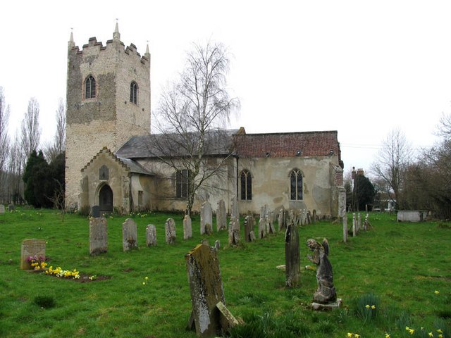
Ashwellthorpe and Fundenhall
Village
Ashwellthorpe and Fundenhall is a civil parish in the English county of Norfolk, situated some 6 km south-east of Wymondham and 20 km south-west of Norwich. Ashwellthorpe and Fundenhall is situated 2 miles southwest of Hethel.
Hapton
Village

Photo: Evelyn Simak, CC BY-SA 2.0.
Hapton is a village and former civil parish, now in the parish of Tharston and Hapton, in the South Norfolk district, in the county of Norfolk, England, located about nine miles south of Norwich. Hapton is situated 2½ miles south of Hethel.
Hethel
- Type: Village
- Description: village in South Norfolk, England, United Kingdom
- Category: locality
- Location: Bracon Ash, South Norfolk District, Norfolk, East of England, England, United Kingdom, Britain and Ireland, Europe
- View on OpenStreetMap
Latitude
52.55605° or 52° 33' 22" northLongitude
1.18353° or 1° 11' 1" eastElevation
148 feet (45 metres)Open Location Code
9F43H54M+CCOpenStreetMap ID
node 283572757OpenStreetMap Feature
place=villageGeoNames ID
12253626Wikidata ID
Q750149Hethel Satellite Map
© OpenStreetMap, Mapbox and Maxar
Also Known As
Other Places Named Hethel
Localities in the Area
- Penny's GreenLocality
- SherwoodLocality
- Rush PieceLocality
- WoodcloseLocality
- Fulcher'sLocality
Landmarks in the Area
- 389th Bomb Group Memorial ExhibitionMemorial
- Lotus Test TrackMotorsport racing track
- Countryside Stewardship AccessGrassland
- Fir Grove AirstripAirstrip
- Long's WoodDeciduous forest
Popular Destinations in Norfolk
Discover Norwich, Great Yarmouth, King's Lynn and Norfolk Broads.
Escape to a Random Place
Discover other destinations in the world.
About Mapcarta. Thanks to Mapbox for providing amazing maps. Data © OpenStreetMap contributors and available under the Open Database License. Text is available under the CC BY-SA 4.0 license, excluding photos, directions and the map. Description text is based on the Wikipdia page Hethel. Photo: matthewhartley369, CC BY-SA 2.0.