


Latest quakes in or near California in the past 24 hours on Thursday, March 14, 2024 - list, stats and map
Overview
| Latest quake today See all | Mag. 0.9 earthquake 2.1 mi northwest of Lake Elsinore, California, USA - |
| Strongest today | Mag. 2.7 Washoe County, Oregon, USA - |
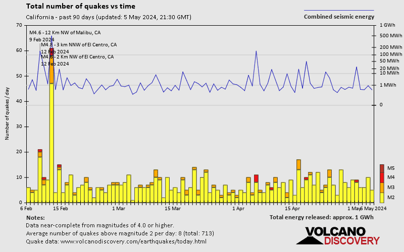
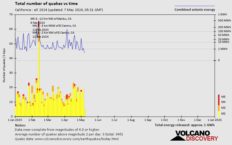
- 6 quakes above magnitude 2
- 110 quakes below magnitude 2 that people normally don't feel.
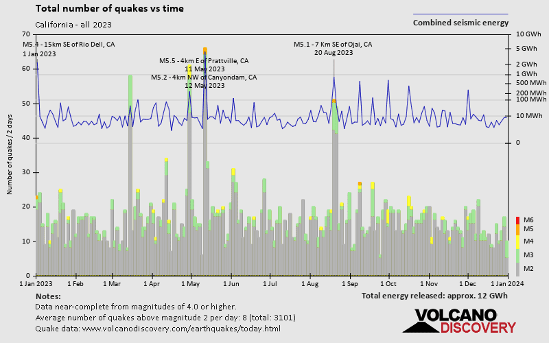
Number of quakes per year
Date and Time | Mag Depth | Nearest Volcano | Location | Details | Map |
| Mar 14, 02:52 am (Los Angeles) Mar 14, 09:52 GMT | 0.9 14 km | Info | |||
| Mar 14, 02:39 am (Los Angeles) Mar 14, 09:39 GMT | 1.4 9 km | Info | |||
| Mar 14, 02:08 am (Los Angeles) Mar 14, 09:08 GMT | 1.3 10.1 km | Info | |||
| Mar 14, 02:08 am (Los Angeles) Mar 14, 09:08 GMT | 1.1 2.1 km | Info | |||
| Mar 14, 01:22 am (Los Angeles) Mar 14, 08:22 GMT | 0.6 9.8 km | Info | |||
| Mar 14, 12:48 am (Los Angeles) Mar 14, 07:48 GMT | 0.9 3.8 km | Info | |||
| Mar 14, 12:43 am (Los Angeles) Mar 14, 07:43 GMT | 0.3 0.7 km | Info | |||
| Mar 14, 12:40 am (Los Angeles) Mar 14, 07:40 GMT | 0.9 9.2 km | Info | |||
| Mar 14, 12:03 am (Los Angeles) Mar 14, 07:03 GMT | 0.8 1.5 km | Info | |||
| Mar 14, 12:03 am (Los Angeles) Mar 14, 07:03 GMT | 1.1 1.7 km | Info | |||
| Mar 14, 12:02 am (Los Angeles) Mar 14, 07:02 GMT | 0.7 1.9 km | Info |
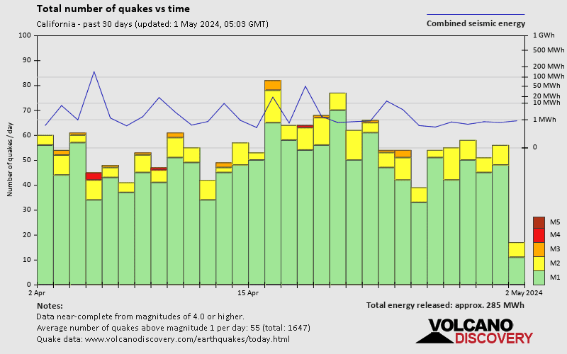
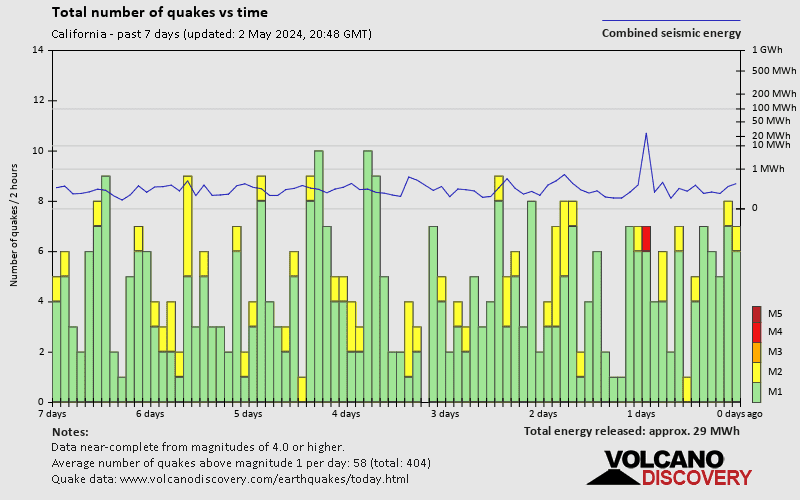
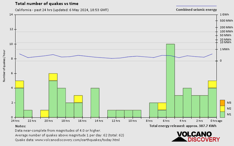
California Quake-O-Meter
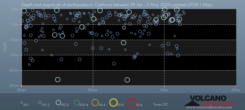
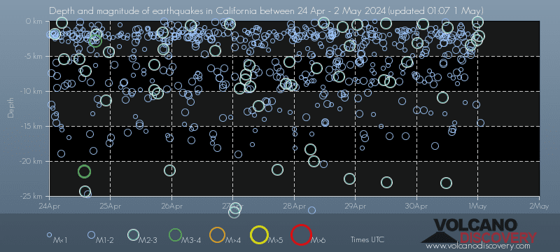
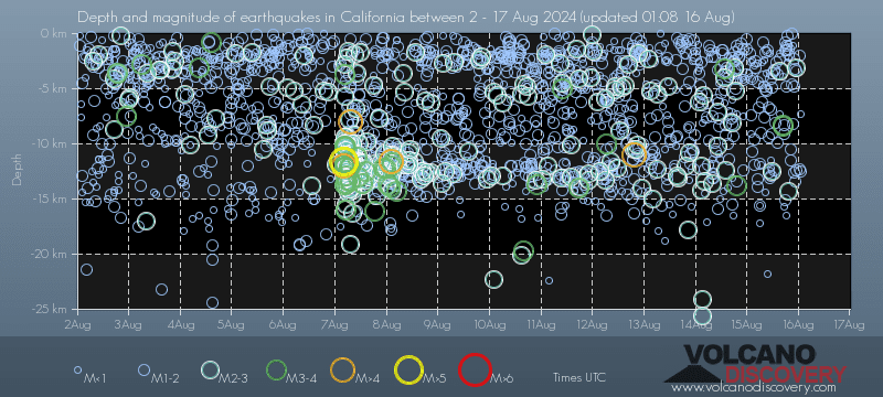
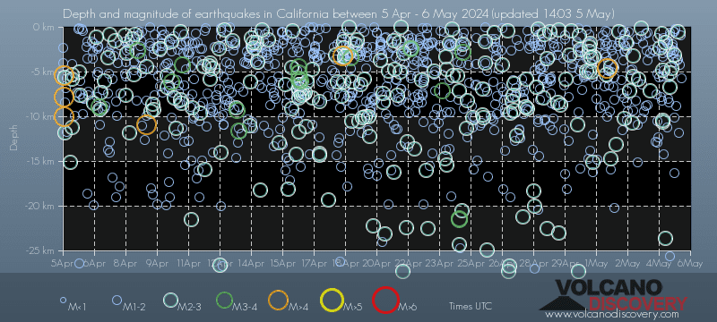
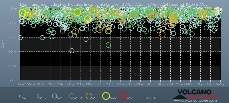
Quakes, magnitude and depth over time
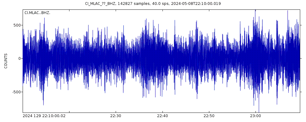
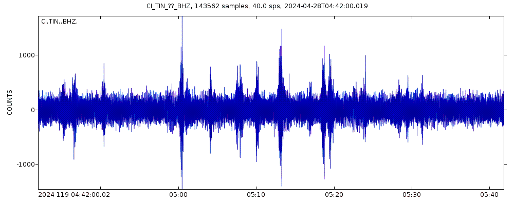
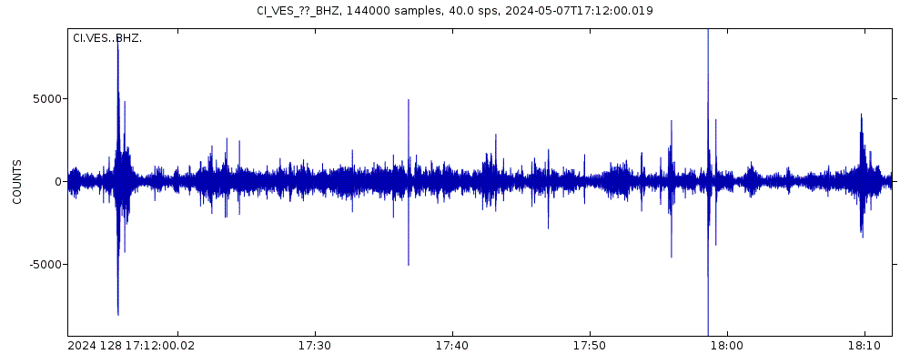
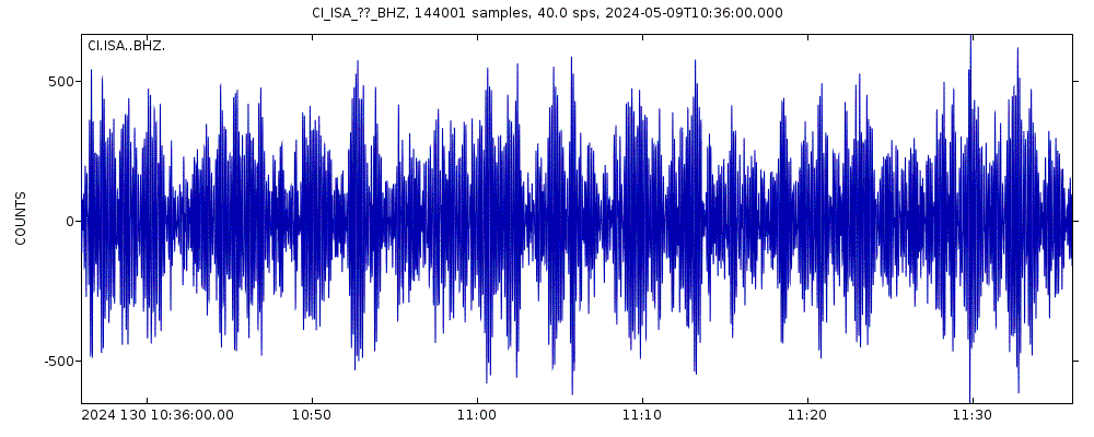
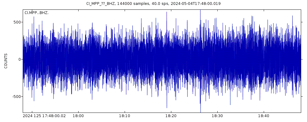
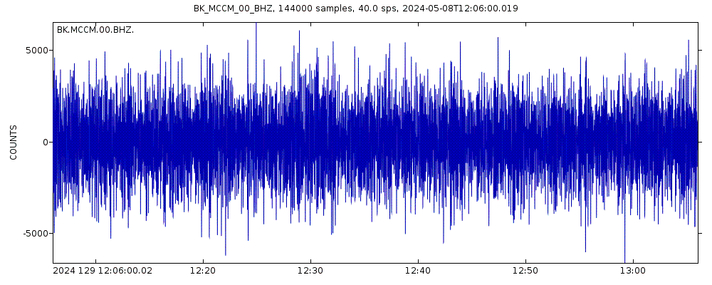
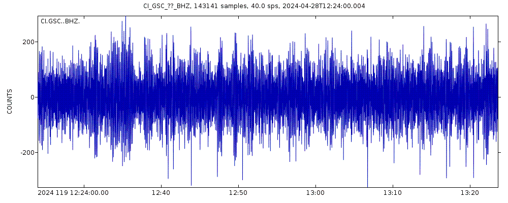
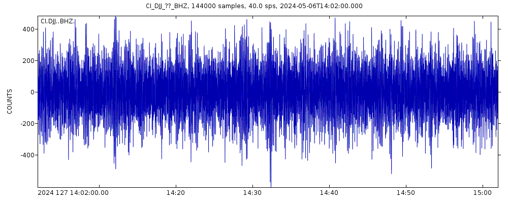
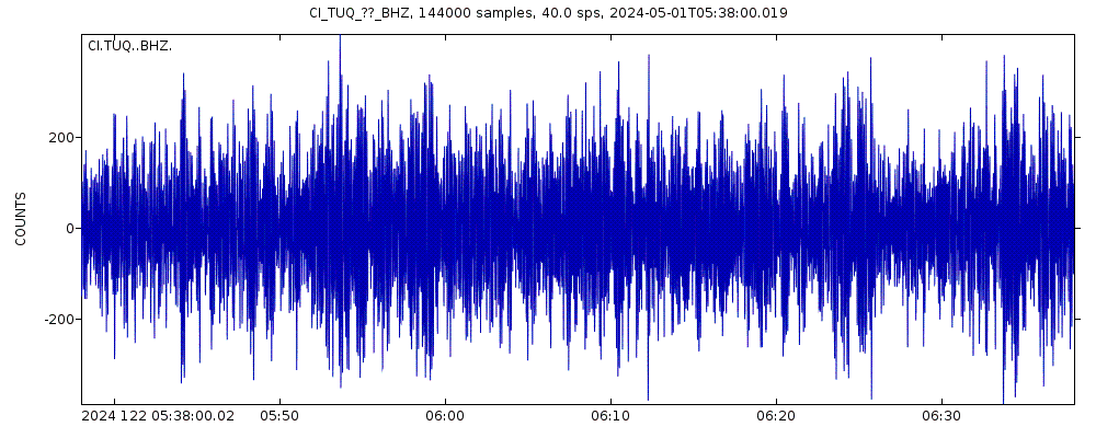
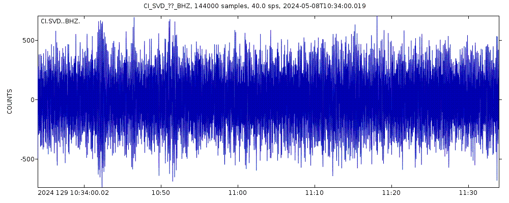
Latest seismic signals
Earthquake Catalog - Look up past earthquakes
| or | ||
Look up quakes! | ||
Earthquake statistics
Average number of earthquakes
- Mag. 7 or higher: 0.15 quakes per year (or 1 quake every 6.7 years)
- Mag. 6 or higher: 1.04 quakes per year
- Mag. 5 or higher: 5 quakes per year
- Mag. 4 or higher: 44 quakes per year (or 3.7 quakes per month)
- Mag. 3 or higher: 407 quakes per year (or 33.9 quakes per month)
- Mag. 2 or higher: 4,700 quakes per year (or 12.9 quakes per day)
- Mag. 1 or higher: 23,000 quakes per year (or 62 quakes per day)
Number of earthquakes over time
California Earthquake FAQ
+How frequent are earthquakes in or near California?
California has a high level of seismic activity. Based on data from the past 10 years and our earthquake archive back to 1900, there are about 42,000 quakes on average per year in or near California. California has had at least 19 quakes above magnitude 7 since 1900, which suggests that larger earthquakes of this size occur infrequently, probably on average approximately every 5 to 10 years.
+How many quakes occur in California every day?
California has about 10-15 quakes every day. Most of them are too small to be felt by humans, although there is usually one or two that are.
Typically there are 1-2 quakes of magnitudes greater than 3 every day. Quakes of magnitude 4+ occur about once every 5 days on average.
Magnitude 5+ events are about once every 2 months, and strong quakes from magnitude 6+ occur on average once every 4-5 months.
+Why does California have so many quakes?
California is located near the boundary between the Pacific and North American tectonic plates. In the area of California, it is called a transform boundary, because the movement of the two plates is mostly a side-wise sliding alongside each other. The Pacific Plate is moving northwest relative to the North American plate, at a rate of approx. 33-37 millimeters (1.3-1.5 in) per year on average.
This creates a complex system of very active fault systems, the most prominent being the San Andreas Fault, which runs for roughly 750 mi (1,200 km) through California. However, there are also many other faults including some found directly underneath the State's major cities including L.A. and San Francisco.
+When was the latest earthquake in or near California?
The last earthquake in or near California occurred 21 minutes ago and had a magnitude of 0.9:
A light magnitude 0.9 earthquake hit 3.4 km (2.1 mi) away from Lake Elsinore, California, ![]() United States, in the early morning of Thursday, Mar 14, 2024 at 2.52 am local time (America/Los Angeles GMT -7). The quake had a very shallow depth of 14.1 km (9 mi) and was too small to be felt by people.
United States, in the early morning of Thursday, Mar 14, 2024 at 2.52 am local time (America/Los Angeles GMT -7). The quake had a very shallow depth of 14.1 km (9 mi) and was too small to be felt by people.
+How many quakes were there in or near California in the past 24 hours?
In the past 24 hours, California has had 6 quakes of magnitude 2.0 or above. There were also 110 quakes below magnitude 2.0 which people don't normally feel.
+What was the strongest quake in or near California in the past 24 hours?
The strongest earthquake in or near California in the past 24 hours had a magnitude of 2.7 and occurred 13 hours ago:
A light magnitude 2.7 earthquake hit 70 km (44 mi) away from Lakeview, Oregon, ![]() United States, in the early afternoon of Wednesday, Mar 13, 2024 at 2.42 pm local time (America/Los Angeles GMT -7). The quake had a very shallow depth of 3.2 km (2 mi) and was not felt (or at least not reported so).
United States, in the early afternoon of Wednesday, Mar 13, 2024 at 2.42 pm local time (America/Los Angeles GMT -7). The quake had a very shallow depth of 3.2 km (2 mi) and was not felt (or at least not reported so).
Embed or share standalone map
You can use the standalone version of our interactive earthquake map or embed it on your website:Largest Quakes in or near California
Strongest in 10 years
The largest quake that occurred in or near California during the past 10 years was a magnitude 7.1 earthquake that hit California,Strongest since 1900
118 years ago, California,Below is a list and map of the largest quakes in or near California in recent years and since 1900.
Date and Time | Mag Depth | ###DIST_LABEL### | Location | Details | Map |
|---|---|---|---|---|---|
| Dec 20, 2022 10:34 GMT Dec 20, 2022 02:34 am (Los Angeles) | 6.4 18 km | 3 km (1.9 mi) to the NW | Info | ||
| Dec 20, 2021 20:10 GMT Dec 20, 2021 12:10 pm (GMT -8) | 6.2 15 km | 30 km (19 mi) to the NW | Info | ||
| Jul 8, 2021 22:49 GMT Jul 8, 2021 03:49 pm (Los Angeles) | 6.0 7.5 km | Info | |||
| Jun 24, 2020 17:40 GMT Jun 24, 2020 10:40 am (Los Angeles) | 5.8 4.7 km | Info | |||
| May 15, 2020 11:03 GMT May 15, 2020 04:03 am (Los Angeles) | 6.5 2.8 km | 58 km (36 mi) to the NE | Info | ||
| Jul 6, 2019 03:19 GMT Jul 5, 2019 08:19 pm (Los Angeles) | 7.1 8 km | Info | |||
| Jul 4, 2019 17:33 GMT Jul 4, 2019 10:33 am (Los Angeles) | 6.4 10.7 km | Info | |||
| Aug 24, 2014 10:20 GMT Aug 24, 2014 03:20 am (Los Angeles) | 6.0 11 km | Info | |||
| Aug 24, 2014 10:20 GMT Aug 24, 2014 03:20 am (Los Angeles) | 6.0 11 km | Info | |||
| Mar 10, 2014 05:18 GMT Mar 9, 2014 09:18 pm (GMT -8) | 6.8 17 km | 72 km (45 mi) to the NW | Info | ||
| Apr 4, 2010 22:40 GMT Apr 4, 2010 03:40 pm (Tijuana) | 7.2 10 km | 72 km (45 mi) to the SE | Info | ||
| Jun 15, 2005 02:50 GMT Jun 14, 2005 06:50 pm (GMT -8) | 7.2 16 km | 150 km (93 mi) to the NW | Info | ||
| Oct 16, 1999 09:46 GMT Oct 16, 1999 02:46 am (Los Angeles) | 7.1 14 km | Info | |||
| Jun 28, 1992 11:57 GMT Jun 28, 1992 04:57 am (Los Angeles) | 7.3 -0.1 km | Info | |||
| Apr 25, 1992 18:06 GMT Apr 25, 1992 11:06 am (Los Angeles) | 7.2 9.9 km | Info | |||
| Aug 17, 1991 22:17 GMT Aug 17, 1991 02:17 pm (GMT -8) | 7.0 1.3 km | 133 km (83 mi) to the NW | Info | ||
| Nov 8, 1980 10:27 GMT Nov 8, 1980 03:27 am (Los Angeles) | 7.2 19 km | 7 km (4.3 mi) to the NW | Info | ||
| Dec 16, 1954 11:07 GMT Dec 16, 1954 03:07 am (Los Angeles) | 7.3 15 km | 137 km (85 mi) to the NE | Info | ||
| Jul 21, 1952 11:52 GMT Jul 21, 1952 04:52 am (Los Angeles) | 7.5 6 km | Info | |||
| Jan 31, 1922 13:17 GMT Jan 31, 1922 05:17 am (GMT -8) | 7.3 15 km | 115 km (71 mi) to the NW | Info | ||
| Apr 18, 1906 13:12 GMT Apr 18, 1906 06:12 am (Los Angeles) | 7.9 12 km | 3 km (1.9 mi) to the W | Info |
Map of largest quakes in or near California
Earthquakes in or near California
Quakes in nearby regions
On this page:
Support us - Help us upgrade our services!
We truly love working to bring you the latest volcano and earthquake data from around the world. Maintaining our website and our free apps does require, however, considerable time and resources.We need financing to increase hard- and software capacity as well as support our editor team. We're aiming to achieve uninterrupted service wherever an earthquake or volcano eruption unfolds, and your donations can make it happen! Every donation will be highly appreciated. If you find the information useful and would like to support our team in integrating further features, write great content, and in upgrading our soft- and hardware, please make a donation (PayPal or Online credit card payment).
Planned features:
- Improved multilanguage support
- Tsunami alerts
- Faster responsiveness
- Design upgrade
- Detailed quake stats
- Additional seismic data sources


