File:Turkmenistan location map.svg
Jump to navigation
Jump to search

Size of this PNG preview of this SVG file: 800 × 568 pixels. Other resolutions: 320 × 227 pixels | 640 × 454 pixels | 1,024 × 727 pixels | 1,280 × 909 pixels | 2,560 × 1,817 pixels | 1,796 × 1,275 pixels.
Original file (SVG file, nominally 1,796 × 1,275 pixels, file size: 277 KB)
Captions
Captions
Add a one-line explanation of what this file represents
Summary[edit]
| Description |
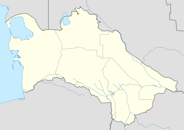
Deutsch: Positionskarte von Turkmenistan
Quadratische Plattkarte, N-S-Streckung 120 %. Geographische Begrenzung der Karte:
English: Location map of Turkmenistan
Equirectangular projection, N/S stretching 120 %. Geographic limits of the map:
|
| Date | |
| Source |
own work, using
|
| Author | NordNordWest |

|
This map has been made or improved in the German Kartenwerkstatt (Map Lab). You can propose maps to improve as well.
|
Licensing[edit]
I, the copyright holder of this work, hereby publish it under the following licenses:

|
Permission is granted to copy, distribute and/or modify this document under the terms of the GNU Free Documentation License, Version 1.2 or any later version published by the Free Software Foundation; with no Invariant Sections, no Front-Cover Texts, and no Back-Cover Texts. A copy of the license is included in the section entitled GNU Free Documentation License. |
This file is licensed under the Creative Commons Attribution-Share Alike 3.0 Unported license.
- You are free:
- to share – to copy, distribute and transmit the work
- to remix – to adapt the work
- Under the following conditions:
- attribution – You must give appropriate credit, provide a link to the license, and indicate if changes were made. You may do so in any reasonable manner, but not in any way that suggests the licensor endorses you or your use.
- share alike – If you remix, transform, or build upon the material, you must distribute your contributions under the same or compatible license as the original.
You may select the license of your choice.
File history
Click on a date/time to view the file as it appeared at that time.
| Date/Time | Thumbnail | Dimensions | User | Comment | |
|---|---|---|---|---|---|
| current | 17:29, 27 November 2009 | | 1,796 × 1,275 (277 KB) | NordNordWest (talk | contribs) | corr |
| 19:10, 24 October 2008 |  | 1,796 × 1,177 (277 KB) | NordNordWest (talk | contribs) | {{Information |Description= {{de|Positionskarte von Turkmenistan}} Quadratische Plattkarte, N-S-Streckung 120 %. Geographische Begrenzung der Karte: * N: 43.2° N * S: 34.9° N * W: 52.0° O * O: 67.2° O {{en|Location map of [[:en:Tu |
You cannot overwrite this file.
File usage on Commons
The following 8 pages use this file:
- User:NordNordWest/Gallery/Location maps
- File:Ahal Province in Turkmenistan.svg
- File:Ashgabat City in Turkmenistan.svg
- File:Balkan Province in Turkmenistan.svg
- File:Dasoguz Province in Turkmenistan.svg
- File:Lebap Province in Turkmenistan.svg
- File:Map of Turkmenian license plate codes.png
- File:Mary Province in Turkmenistan.svg
File usage on other wikis
The following other wikis use this file:
- Usage on an.wikipedia.org
- Usage on ar.wikipedia.org
- Usage on av.wikipedia.org
- Usage on az.wikipedia.org
- Aşqabad
- Mərv
- Arçman
- Türkmənbaşı
- Şablon:Yer xəritəsi Türkmənistan
- Xarəzm
- Türkmənabad
- Daşoğuz
- Türkmənbaşı Ruhu məscidi
- Köhnə Ürgənc
- Əbivərd
- Türkmənistan şəhərləri
- Marı
- Bayramalı
- Şadlıq
- Yolötən
- Sərhədabad (Türkmənistan)
- Balkanabad
- Qumdağ
- Bərəkət (Türkmənistan)
- Sərdar (Türkmənistan)
- Xəzər (Türkmənistan)
- Kerki
- Maqdanlı
- Seydi
- Qazocaq
- Sakar
- Qaraboğazgöl
- Türkmənbaşı körfəzi
- Şimali Çələkən körfəzi
- Türkmən körfəzi
- Cənubi Çələkən körfəzi
- Uzunada körfəzi
- Balxan körfəzi
- Baherden
- Qaraboğaz
- Türkmənbaşı sarayı
- Türkmənistandakı ümumdünya irsi obyektlərinin siyahısı
- Uzboy
- Aşqabad Beynəlxalq Hava Limanı
- Muncuqlutəpə yaşayış yeri (Türkmənistan)
- Anau
- Gökdepe
- Usage on ba.wikipedia.org
View more global usage of this file.