close
-
Layers w
- Map Content
- More Layers
- Pro
- Pro
- Pro
- Pro
- Pro
- Pro
- Pro
- Pro
-
Upgrade to

3D
Trail Conditions
- Unknown
- Snow Groomed
- Snow Packed
- Snow Covered
- Snow Cover Partial
- Freeze/thaw Cycle
- Icy
- Prevalent Mud
- Wet
- Variable
- Ideal
- Dry
- Very Dry
Trail Flow (Ridden Direction)
Trailforks scans users ridelogs to determine the most popular direction each trail is ridden. A good flowing trail network will have most trails flowing in a single direction according to their intension.
The colour categories are based on what percentage of riders are riding a trail in its intended direction.
The colour categories are based on what percentage of riders are riding a trail in its intended direction.
- > 96%
- > 90%
- > 80%
- > 70%
- > 50%
- < 50%
- bi-directional trail
- no data
Trail Last Ridden
Trailforks scans ridelogs to determine the last time a trail was ridden.
- < 2 days
- < 1 week
- < 2 weeks
- < 1 month
- < 6 months
- > 6 months
Trail Ridden Direction
The intended direction a trail should be ridden.
- Downhill Only
- Downhill Primary
- Both Directions
- Uphill Primary
- Uphill Only
- One Direction
Contribute Details
Colors indicate trail is missing specified detail.
- Description
- Photos
- Description & Photos
- Videos
Trail Popularity ?
Trailforks scans ridelogs to determine which trails are ridden the most in the last 9 months.
Trails are compared with nearby trails in the same city region with a possible 25 colour shades.
Think of this as a heatmap, more rides = more kinetic energy = warmer colors.
- most popular
- popular
- less popular
- not popular
ATV/ORV/OHV Filter
Max Vehicle Width
inches
US Cell Coverage
Legend

Radar Time
x
Activity Recordings
Trailforks users anonymized public ridelogs from the past 6 months.
- mountain biking recent
- mountain biking (>6 month)
- hiking (1 year)
- moto (1 year)
Activity Recordings
Trailforks users anonymized public skilogs from the past 12 months.
- Downhill Ski
- Backcountry Ski
- Nordic Ski
- Snowmobile
Winter Trails
Warning
A routing network for winter maps does not exist. Selecting trails using the winter trails layer has been disabled.
x
Missing Trails
Most Popular
Least Popular
Trails are colored based on popularity. The more popular a trail is, the more red. Less popular trails trend towards green.
Jump Magnitude Heatmap
Heatmap of where riders jump on trails. Zoom in to see individual jumps, click circles to view jump details.
Trails Deemphasized
Trails are shown in grey.
Only show trails with NO bikes.
Save the current map location and zoom level as your default home location whenever this page is loaded.
SavePopular Trail Networks
view all areas »
No description for Santa Clara County has been added yet!
Login or register to submit one.
Activities Click to view
- Mountain Bike
630 trails
- E-Bike
254 trails
- Hike
744 trails
- Trail Running
739 trails
Stats
- Avg Trail Rating
- Trails (view details)
- 780
- Trails Mountain Bike
- 630
- Trails E-Bike
- 254
- Trails Horse
- 105
- Trails Hike
- 744
- Trails Trail Running
- 739
- Trails Dirtbike/Moto
- 22
- Trails Observed Trials
- 1
- Trails ATV/ORV/OHV
- 1
- Trails Snowshoe
- 1
- Trails Downhill Ski
- 1
- Trails Backcountry Ski
- 1
- Trails Nordic Ski
- 2
- Total Distance
- 1,022 mile
- Total Descent
- 183,587 ft
- Total Vertical
- 4,138 ft
- Highest Trailhead
- 4,140 ft
- Reports
- 4,149
- Photos
- 1,134
- Ridden Counter
- 85,138
 Articles
Recommended Routes: Los Gatos, California - CyclingTips
Mar 30, 2021 from cyclingtips.com
There is no excerpt because this is a protected post.
Sub Regions
- Gilroy (2)
- Los Altos (16)
- Los Altos Hills (1)
- Los Gatos (26)
- Milpitas (4)
- Morgan Hill (135)
- Mountain View (11)
- Palo Alto (116)
- San Jose (232)
- Santa Clara (38)
- Saratoga (41)
- Stanford (1)
- Sunnyvale (6)
- Fremont Older (5)
Popular Santa Clara County Mountain Biking Trails
| status | title | difficulty | rating |
|---|---|---|---|
| John Nicholas Sanborn County Park | |||
| Lisa Killough Trail Calero County Park | |||
| Cottle Trail Calero County Park | |||
| John Nicholas Trail Sanborn County Park | |||
| Red Tail Connector Arastradero Preserve | |||
| Bay Area Ridge Trail Saratoga Gap Open Space Preserve | |||
| Saratoga Gap Trail Saratoga Gap Open Space Preserve | |||
| Rocky Ridge Santa Teresa County Park | |||
| Turtle Rock Saratoga Gap Open Space Preserve | |||
| Hickory Oaks Trail Saratoga Gap Open Space Preserve | |||
| Los Gatos Creek Trail (Gravel) Sierra Azul Open Space Preserve | |||
| Ridge 3 Monte Bello Open Space | |||
| Lower White Oak Monte Bello Open Space | |||
| Alpine Road Monte Bello Open Space | |||
| Redtail Loop Connector Arastradero Preserve |
Santa Clara County Mountain Bike Routes
| title | rating | distance |
|---|---|---|
| Calero Loop Calero County Park | 7 miles | |
| Calero Park Loop Calero County Park | 9 miles | |
| san vicente Calero County Park | 10 miles | |
| Arastradero Sampler Arastradero Preserve | 7 miles | |
| Los Gatos Turkey Day Ride St. Joseph's Hill Open Space Preserve | 13 miles | |
| Rocky Ridge Out and Back Santa Teresa County Park | 4 miles | |
| Henry Coe Pacheco Falls MTB Adventure Gilroy | 23 miles | |
| Rancho Canada to Calero and back Rancho Cañada del Oro | 18 miles | |
| Calero Longer Calero County Park | 15 miles | |
| Harvey Bear Loop Coyote Lake - Harvey Bear Ranch County Park | 13 miles |
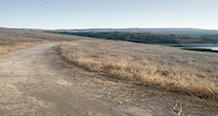
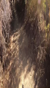
Photos of Santa Clara County Mountain Bike
trail: Kennedy
91 |
Mar 7, 2021 @ 10:30am
Mar 7, 2021
trail: Coyote Ridge
224 |
Apr 29, 2019 @ 9:12pm
Apr 29, 2019
trail: Stevens Canyon
494 |
Feb 26, 2019 @ 4:36pm
Feb 26, 2019
trail: Stevens Canyon
390 |
Jul 8, 2018 @ 9:50am
Jul 8, 2018
trail: Coyote Ridge
205 |
Oct 29, 2017 @ 10:13am
Oct 29, 2017
trail: Saratoga Gap Trail
196 |
Jul 3, 2017 @ 4:23pm
Jul 3, 2017
trail: PS Walk the Line
1,222 | | 1 comments
Aug 14, 2014 @ 7:29pm
Aug 14, 2014
trail: PS Walk the Line
161 |
Jul 27, 2014 @ 8:57pm
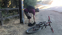
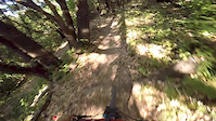
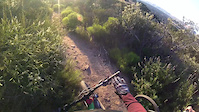
Jul 27, 2014Videos of Santa Clara County Mountain Bike
trail: Oak Cove
105 |
Sep 11, 2021
trail: Alamitos Creek
|
Nov 17, 2020

trail: Willow Ridge
0:41 |
102 |
Apr 22, 2020
trail: Alpine Road
1:04 |
569 |
Sep 21, 2018
trail: Table Mountain Fire Road
1:38 |
146 |
Jul 26, 2017
trail: Parking Lot
3:24 |
35 |
Nov 19, 2016
trail: Ridge
2:19 |
128 |
May 9, 2016
trail: Jackson
1:28 |
282 |
Mar 13, 2016
Current Trail Warnings
| status | trail | date | condition | user | info |
|---|---|---|---|---|---|
| Butano View Trail Palo Alto | May 12, 2024 @ 12:51am May 12, 2024 | Unknown | Lucilius | Bikes are not allowed on this trail | |
| Fir Knoll Trail Skyline Ridge Open Space Preserve | May 12, 2024 @ 12:51am May 12, 2024 | Unknown | Lucilius | No bikes allowed on this trail | |
| Horseshoe Loop Trail Palo Alto | May 12, 2024 @ 12:50am May 12, 2024 | Unknown | Lucilius | Bikes are not allowed on this trail |
Recent Trail Reports
Activity Feed
| username | action | type | title | date |
|---|---|---|---|---|
| Lmpicard | comment | trail | activity #52667200 | May 15, 2024 @ 9:49pm 1 day |
| Lmpicard | vote | trail | activity #52667183 | May 15, 2024 @ 9:48pm 1 day |
| Lmpicard | add | report | activity #52621172 | May 14, 2024 @ 9:18pm 2 days |
| uartglenn | add | report | activity #52612991 and 6 more | May 14, 2024 @ 5:59pm 2 days |
| 80085 | add | report | activity #52600393 and 2 more | May 14, 2024 @ 1:13pm 3 days |
Recent Comments
| username | type | title | comment | date |
|---|---|---|---|---|
| trail | Pretty flowy single track that was a nice spin... | May 15, 2024 @ 9:49pm 1 day | ||
| trail | Slightly overgrown. Full green. But not a real... | May 11, 2024 @ 6:40am May 11, 2024 | ||
| trail | Double track, not single. | Apr 20, 2024 @ 5:56pm Apr 20, 2024 | ||
| trail | lol | Mar 31, 2024 @ 11:38pm Mar 31, 2024 | ||
| trail | This trail is no longer a ST flow track. ... | Mar 21, 2024 @ 5:51pm Mar 21, 2024 |
Local Badges
-
Rocky Dropper349 awarded -
Hill Climber!0 awarded -

Climbing 10k Badge315 awarded -

Big Ride 30k11,146 awarded -
Big Ride 30k12,068 awarded -

Completionist1 awarded
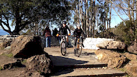
Bike & Skill Parks
| name | type | city | rating |
|---|---|---|---|
| Lake Cunningham Action Sports Park | skill park | San Jose | |
| Calabazas BMX Park | skill park | San Jose | |
| Metcalf Motorcycle County Park | skill park | San Jose | |
| MX-408 | skill park | San Jose |
Upcoming Local Events
Activity Type Stats
| activitytype | trails | distance | descent | descent distance | total vertical | rating | global rank | state rank | photos | reports | routes | ridelogs |
|---|---|---|---|---|---|---|---|---|---|---|---|---|
| Mountain Bike | 630 | 842 miles | 147,953 ft | 345 miles | 4,137 ft | 1,064 | 4,141 | 86 | 167,633 | |||
| E-Bike | 254 | 386 miles | 77,776 ft | 164 miles | 4,137 ft | 38 | 3,302 | 13 | 11,224 | |||
| Horse | 105 | 155 miles | 28,976 ft | 70 miles | 4,124 ft | 600 | 6 | 6 | ||||
| Hike | 744 | 1,005 mile | 179,836 ft | 418 miles | 4,137 ft | 32 | 4,141 | 9 | 7,283 | |||
| Trail Running | 739 | 1,000 mile | 179,432 ft | 417 miles | 4,137 ft | 4,141 | 11 | 5,194 | ||||
| Dirtbike/Moto | 20 | 9 miles | 1,778 ft | 4 miles | 1,309 ft | 558 | 57 | |||||
| Observed Trials | 1 | 200 ft | 3 ft | 98 ft | 3 ft | 12 | 49 | |||||
| ATV/ORV/OHV | 1 | 200 ft | 3 ft | 98 ft | 3 ft | 561 | 28 | |||||
| Snowshoe | 1 | 200 ft | 3 ft | 98 ft | 3 ft | 10 | 4 | |||||
| Downhill Ski | 1 | 200 ft | 3 ft | 98 ft | 3 ft | 10 | 6 | |||||
| Backcountry Ski | 1 | 200 ft | 3 ft | 98 ft | 3 ft | 10 | 4 | |||||
| Nordic Ski | 2 | 4,642 ft | 102 ft | 1,699 ft | 2,575 ft | 10 | 10 |
- By brenthillier
 NSMBA TRAILFORKS & contributors
 - Admins: CAMTB, ericfoltz, Redhawk, jpmcghee, sanfret, brianpetry, spokesmanmtb, SVMTB
- #7900 - 12,623 views
- santa clara county activity log | embed map of Santa Clara County mountain bike trails | santa clara county mountain biking points of interest polygons
Downloading of trail gps tracks in kml & gpx formats is enabled for Santa Clara County.
You must login to download files.