
Upper Township, New Jersey
Upper Township, New Jersey | |
|---|---|
 | |
 Seal | |
 Location of Upper Township in Cape May County highlighted in red (left). Inset map: Location of Cape May County in New Jersey highlighted in red (right). | |
 Census Bureau map of Upper Township, New Jersey | |
 Upper Township Location in Cape May County  Upper Township Location in New Jersey  Upper Township Location in the United States | |
| Coordinates: 39°15′29″N 74°43′37″W / 39.258112°N 74.726912°W[1][2] | |
| Country | |
| State | |
| County | |
| Formed | April 2, 1723 |
| Incorporated | February 21, 1798 |
| Government | |
| • Type | Township |
| • Body | Township Committee |
| • Mayor | John "Jay" Newman (R, term ends December 31, 2023)[3][4] |
| • Administrator | Gary Demarzo[5] |
| • Municipal clerk | Joanne R. Herron[6] |
| Area | |
| • Total | 68.68 sq mi (177.89 km2) |
| • Land | 62.03 sq mi (160.65 km2) |
| • Water | 6.66 sq mi (17.24 km2) 9.69% |
| • Rank | 17th of 565 in state 2nd of 16 in county[1] |
| Elevation | 30 ft (9 m) |
| Population | |
| • Total | 12,539 |
| • Estimate | 12,617 |
| • Rank | 205th of 565 in state 3rd of 16 in county[12] |
| • Density | 202.2/sq mi (78.1/km2) |
| • Rank | 502nd of 565 in state 15th of 16 in county[12] |
| Time zone | UTC−05:00 (Eastern (EST)) |
| • Summer (DST) | UTC−04:00 (Eastern (EDT)) |
| ZIP Codes | |
| Area code | 609[14] |
| FIPS code | 3400974810[1][15][16] |
| GNIS feature ID | 0882047[1][17] |
| Website | www |
Upper Township is a large township in Cape May County, in the U.S. state of New Jersey. The township, and all of Cape May County, is part of the South Jersey region of the state and of the Ocean City metropolitan statistical area, which is part of the Philadelphia-Wilmington-Camden, PA-NJ-DE-MD combined statistical area, also known as the Delaware Valley or Philadelphia metropolitan area.[18] As of the 2020 United States census, the township's population was 12,539,[9][10] an increase of 166 (+1.3%) from the 2010 census count of 12,373,[19][20] which in turn reflected an increase of 258 (+2.1%) from the 12,115 counted in the 2000 census.[21]
New Jersey Monthly magazine ranked Upper Township as its 2nd best place to live in its 2008 rankings of the "Best Places To Live" in New Jersey.[22]
Upper Township is home to the only yellow fire trucks in Cape May County, a tradition started in 1985 when the Seaville Fire Rescue Company was purchasing a new vehicle and thought that federal regulations would require the color.[23] Since being formed in 1964 and purchasing its first fire truck a year later, the Seaville company has served the area, responding to over 200 calls a year from its fire station is located on Route 50 across from Dino's Seaville Diner.[24]
History[edit]
Upper Township was formed as a precinct on April 2, 1723, and was incorporated as one of New Jersey's initial 104 townships by an act of the New Jersey Legislature on February 21, 1798. Portions of the township have been taken to form Dennis Township (March 1, 1827) and Ocean City borough (March 3, 1884),[25] and territorial changes were made involving Sea Isle City in March and April 1905.[26] The township's name came from its location when Cape May was split into three townships in 1723 at the same time that Lower Township and Middle Township were created.[27]
During 2008, Upper Township was considering consolidation with neighboring Corbin City. Corbin City already shares extensively with Upper Township for municipal service, but the question of consolidating municipalities across county borders presented an obstacle to a full merger.[28]
Geography[edit]
According to the United States Census Bureau, the township had a total area of 68.68 square miles (177.89 km2), including 62.03 square miles (160.65 km2) of land and 6.66 square miles (17.24 km2) of water (9.69%).[1][2]
Strathmere (2010 population of 158) is an unincorporated community and census-designated place (CDP) located within Upper Township.[29][30]
Other unincorporated communities, localities and place names located partially or completely within the township include Beesley's Point, Blackmans Island, Cedar Springs, Corsons Inlet, Formosa, Greenfield, Marmora, Marshallville, Middletown, Miramar, Palermo, Petersburg, Seaville, Steelmantown, Tuckahoe, West Ocean City and Whale Beach.[31] The township contains many different communities and enclaves that create a diverse area reaching from Great Egg Harbor to the Atlantic Ocean. Seaville is the largest community and Strathmere is the township's island containing a beach community.
The township borders the municipalities of Dennis Township, Ocean City, Sea Isle City and Woodbine in Cape May County; Corbin City, Egg Harbor Township, Estell Manor and Somers Point in Atlantic County; and Maurice River Township in Cumberland County.[32][33][34]
Demographics[edit]
| Census | Pop. | Note | %± |
|---|---|---|---|
| 1810 | 1,664 | — | |
| 1820 | 2,107 | 26.6% | |
| 1830 | 1,067 | * | −49.4% |
| 1840 | 1,217 | 14.1% | |
| 1850 | 1,341 | 10.2% | |
| 1860 | 1,552 | 15.7% | |
| 1870 | 1,483 | −4.4% | |
| 1880 | 1,702 | 14.8% | |
| 1890 | 1,381 | * | −18.9% |
| 1900 | 1,351 | −2.2% | |
| 1910 | 1,483 | 9.8% | |
| 1920 | 1,272 | −14.2% | |
| 1930 | 1,657 | 30.3% | |
| 1940 | 1,675 | 1.1% | |
| 1950 | 1,922 | 14.7% | |
| 1960 | 2,539 | 32.1% | |
| 1970 | 3,413 | 34.4% | |
| 1980 | 6,713 | 96.7% | |
| 1990 | 10,681 | 59.1% | |
| 2000 | 12,115 | 13.4% | |
| 2010 | 12,373 | 2.1% | |
| 2020 | 12,539 | 1.3% | |
| 2022 (est.) | 12,617 | [9][11] | 0.6% |
| Population sources:1810–2000[35] 1810–1920[36] 1840[37] 1850–1870[38] 1850[39] 1870[40] 1880–1890[41] 1890–1910[42] 1910–1930[43] 1940–2000[44] 2000[45][46] 2010[19][20] 2020[9][10] * = Lost territory in previous decade.[25] | |||
2010 census[edit]
The 2010 United States census counted 12,373 people, 4,566 households, and 3,461 families in the township. The population density was 199.1 per square mile (76.9/km2). There were 6,341 housing units at an average density of 102.0 per square mile (39.4/km2). The racial makeup was 96.61% (11,954) White, 0.58% (72) Black or African American, 0.13% (16) Native American, 0.74% (92) Asian, 0.01% (1) Pacific Islander, 0.72% (89) from other races, and 1.20% (149) from two or more races. Hispanic or Latino of any race were 2.36% (292) of the population.[19]
Of the 4,566 households, 32.6% had children under the age of 18; 62.2% were married couples living together; 9.7% had a female householder with no husband present and 24.2% were non-families. Of all households, 20.1% were made up of individuals and 9.4% had someone living alone who was 65 years of age or older. The average household size was 2.71 and the average family size was 3.14.[19]
23.8% of the population were under the age of 18, 7.7% from 18 to 24, 20.2% from 25 to 44, 34.0% from 45 to 64, and 14.3% who were 65 years of age or older. The median age was 43.6 years. For every 100 females, the population had 94.4 males. For every 100 females ages 18 and older there were 92.1 males.[19]
The Census Bureau's 2006-2010 American Community Survey showed that (in 2010 inflation-adjusted dollars) median household income was $81,250 (with a margin of error of +/− $8,629) and the median family income was $97,372 (+/− $6,832). Males had a median income of $63,597 (+/− $2,442) versus $46,250 (+/− $4,552) for females. The per capita income for the borough was $38,702 (+/− $2,243). About 2.5% of families and 4.0% of the population were below the poverty line, including 2.9% of those under age 18 and 6.6% of those age 65 or over.[47]
2000 census[edit]
As of the 2000 United States census[15] there were 12,115 people, 4,266 households, and 3,365 families residing in the township. The population density was 191.8 inhabitants per square mile (74.1/km2). There were 5,472 housing units at an average density of 86.6 per square mile (33.4/km2). The racial makeup of the township was 97.59% White, 0.69% African American, 0.12% Native American, 0.61% Asian, 0.06% Pacific Islander, 0.19% from other races, and 0.74% from two or more races. Hispanic or Latino of any race were 1.28% of the population.[45][46]
There were 4,266 households, out of which 39.5% had children under the age of 18 living with them, 67.7% were married couples living together, 8.5% had a female householder with no husband present, and 21.1% were non-families. 17.4% of all households were made up of individuals, and 8.3% had someone living alone who was 65 years of age or older. The average household size was 2.84 and the average family size was 3.23.[45][46]
In the township the population was spread out, with 28.6% under the age of 18, 6.0% from 18 to 24, 27.7% from 25 to 44, 25.5% from 45 to 64, and 12.2% who were 65 years of age or older. The median age was 38 years. For every 100 females, there were 93.0 males. For every 100 females age 18 and over, there were 89.4 males.[45][46]
The median income for a household in the township was $60,942, and the median income for a family was $68,824. Males had a median income of $46,528 versus $31,325 for females. The per capita income for the township was $27,498. About 2.4% of families and 3.5% of the population were below the poverty line, including 3.1% of those under age 18 and 3.8% of those age 65 or over.[45][46]
Parks and recreation[edit]
With its beaches in the Strathmere section, Upper Township is one of five municipalities in the state that offer free public access to oceanfront beaches monitored by lifeguards, joining Atlantic City, North Wildwood, Wildwood and Wildwood Crest.[48]
Government[edit]
Local government[edit]
Upper Township is governed under the Township form of New Jersey municipal government, one of 141 municipalities (of the 564) statewide that use this form, the second-most commonly used form of government in the state.[49] The Township Committee is comprised of five members, who are elected directly by the voters at-large in partisan elections to serve three-year terms of office on a staggered basis, with either one or two seats coming up for election each year as part of the November general election in a three-year cycle.[7][50] At an annual reorganization meeting, the Township Committee selects one of its members to serve as Mayor.
As of 2023[update], members of the Upper Township Committee are Mayor John C. "Jay" Newman (R, term on committee ends December 31, 2024; term as mayor ends 2023), Deputy Mayor Kimberly R. Hayes (R, term on committee ends 2024; term as deputy mayor ends 2023), Curtis T. Corson Jr. (R, 2023), Victor W. Nappen II (R, 2025) and Mark E. Pancoast (R, 2025).[3][51][52][53][54][55]
After Hobie Young resigned from office from a seat expiring in December 2022, Kim Hayes was appointed to fill the vacancy. In the November 2021 general election, Hayes ran for a full three-year term, while Mark Pancoast ran for the balance of Young's term of office, with both winning their election bids.[56][54]
Federal, state and county representation[edit]
Upper Township is located in the 2nd Congressional District[57] and is part of New Jersey's 1st state legislative district.[58][59][60]
For the 118th United States Congress, New Jersey's 2nd congressional district is represented by Jeff Van Drew (R, Dennis Township).[61] New Jersey is represented in the United States Senate by Democrats Cory Booker (Newark, term ends 2027)[62] and Bob Menendez (Englewood Cliffs, term ends 2025).[63][64]
For the 2024-2025 session, the 1st legislative district of the New Jersey Legislature is represented in the State Senate by Mike Testa (R, Vineland) and in the General Assembly by Antwan McClellan (R, Ocean City) and Erik K. Simonsen (R, Lower Township).[65]
Cape May County is governed by a five-person Board of County Commissioners whose members are elected at-large on a partisan basis to three-year terms of office on a staggered basis, with either one or two seats coming up for election each year; At an annual reorganization held each January, the commissioners select one member to serve as director and another to serve as vice-director.[66] As of 2024[update], Cape May County's Commissioners are:
Director Leonard C. Desiderio (R, Sea Isle City, 2024),[67] Robert Barr (R, Ocean City; 2025),[68] Will Morey (R, Wildwood Crest; 2026),[69] Melanie Collette (R. Middle Township; 2026),[70] and Vice-Director Andrew Bulakowski (R, Lower Township; 2025).[71][66][72]
The county's constitutional officers are: Clerk Rita Marie Rothberg (R, 2025, Ocean City),[73][74] Sheriff Robert Nolan (R, 2026, Lower Township)[75][76] and Surrogate E. Marie Hayes (R, 2028, Ocean City).[77][78][79][72]
Politics[edit]
As of March 2011, there were a total of 9,154 registered voters in Upper Township, of which 1,403 (15.3%) were registered as Democrats, 4,454 (48.7%) were registered as Republicans and 3,287 (35.9%) were registered as Unaffiliated. There were 10 voters registered as Libertarians or Greens.[80]
In the 2012 presidential election, Republican Mitt Romney received 58.2% of the vote (4,027 cast), ahead of Democrat Barack Obama with 40.5% (2,807 votes), and other candidates with 1.3% (89 votes), among the 6,998 ballots cast by the township's 9,487 registered voters (75 ballots were spoiled), for a turnout of 73.8%.[81][82] In the 2008 presidential election, Republican John McCain received 57.2% of the vote (4,165 cast), ahead of Democrat Barack Obama, who received 40.9% (2,980 votes), with 7,286 ballots cast among the township's 9,053 registered voters, for a turnout of 80.5%.[83] In the 2004 presidential election, Republican George W. Bush received 61.1% of the vote (4,391 ballots cast), outpolling Democrat John Kerry, who received around 37.6% (2,701 votes), with 7,192 ballots cast among the township's 8,988 registered voters, for a turnout percentage of 80.0.[84]
In the 2013 gubernatorial election, Republican Chris Christie received 70.2% of the vote (3,396 cast), ahead of Democrat Barbara Buono with 28.2% (1,364 votes), and other candidates with 1.6% (77 votes), among the 4,974 ballots cast by the township's 9,433 registered voters (137 ballots were spoiled), for a turnout of 52.7%.[85][86] In the 2009 gubernatorial election, Republican Chris Christie received 57.8% of the vote (2,865 ballots cast), ahead of both Democrat Jon Corzine with 33.4% (1,655 votes) and Independent Chris Daggett with 6.3% (312 votes), with 4,954 ballots cast among the township's 9,341 registered voters, yielding a 53.0% turnout.[87]
Education[edit]

The Upper Township School District serves students in pre-kindergarten through eighth grade.[88] As of the 2021–22 school year, the district, comprised of three schools, had an enrollment of 1,404 students and 122.0 classroom teachers (on an FTE basis), for a student–teacher ratio of 11.5:1.[89] Schools in the district (with 2021–22 enrollment data from the National Center for Education Statistics[90]) are Upper Township Primary School[91] with 497 students in grades PreK-2, Upper Township Elementary School[92] with 408 students in grades 3-5 and Upper Township Middle School[93] with 485 students in grades 6-8.[94][95][96] Students from Corbin City, a non-operating school district, attend the Upper Township schools as part of a sending/receiving relationship.[97]
Students in public school for ninth through twelfth grades from Upper Township attend Ocean City High School in Ocean City as part of a sending/receiving relationship with the Ocean City School District, along with students from Corbin City, Longport and Sea Isle City.[98] As of the 2021–22 school year, the high school had an enrollment of 1,231 students and 126.4 classroom teachers (on an FTE basis), for a student–teacher ratio of 9.7:1.[99] As of 2015[update] about 60% of students in Ocean City High School were from Upper Township.[100]
Countywide schools include Cape May County Technical High School (for technical school students)[101] and Cape May County Special Services School District (for special needs students) in Cape May Court House.[102]
The Roman Catholic Diocese of Camden operates Bishop McHugh Regional School, a Catholic K-8 school, in Dennis Township, which has a Cape May Courthouse postal address.[103] The Press of Atlantic City describes it as being in Ocean View,[104] though it lies outside of the Ocean View CDP.[105] It is the parish school of Marmora/Woodbine Catholic Church and three other churches.[106]
Cape May County Library operates the Upper Township Branch in Petersburg.[107]
Police Department[edit]
Upper Township does not maintain its own municipal police department. The township is served by the New Jersey State Police who respond from their barracks in neighboring Woodbine.[citation needed]
Transportation[edit]
_at_Exit_20_(U.S._Route_9,_New_Jersey_State_Route_50_NORTH,_Upper_Township)_in_Upper_Township,_Cape_May_County,_New_Jersey.jpg)
Roads and highways[edit]
As of May 2010[update], the township had a total of 140.23 miles (225.68 km) of roadways, of which 74.84 miles (120.44 km) were maintained by the municipality, 36.95 miles (59.47 km) by Cape May County and 19.37 miles (31.17 km) by the New Jersey Department of Transportation and 9.07 miles (14.60 km) by the New Jersey Turnpike Authority.[108]
The Garden State Parkway passes through and has two exits that provide access to Route 50 and U.S. Route 9 (since the Beesley's Point Bridge is closed). The Parkway connects Dennis Township on the south to Egg Harbor Township in the north.[109] at Interchange 20 for Seaville / Tuckahoe and Interchange 25 for Ocean City / Marmora via County Route 623.[110]
Other major roads that pass through include Route 49,[111] CR 548[112] and CR 557.[113][114]
Public transportation[edit]
NJ Transit offers the 313 and 315 (and the 316 offering seasonal service) inter-city bus routes that runs through the town three times a day and shuttle people between Cape May and Philadelphia, the 319 route between Cape May and the Port Authority Bus Terminal in Midtown Manhattan, and the 552 route between Cape May and Atlantic City.[115][116]
Points of interest[edit]
Notable people[edit]
People who were born in, residents of, or otherwise closely associated with Upper Township include:
- George Gandy (1851–1946), business executive and developer, best known for constructing the original Gandy Bridge, the first bridge to span the Tampa Bay in Florida.[117]
- Garet Garrett (1878–1954), journalist and author, noted for his opposition to the New Deal and U.S. involvement in World War II.[118]
- Carlton Godfrey (1865–1929), politician and businessman who served in the New Jersey General Assembly for five years and was Speaker of the House in 1915.[119]
- Ford Palmer (born 1990), professional middle-distance runner who specializes in the 1500 meters and the mile.[120]
- Bob Pellegrini (1934–2008), linebacker who played in the National Football League for the Philadelphia Eagles and the Washington Redskins.[121]
- Dummy Stephenson (1869–1924), outfielder in Major League Baseball who played for the Philadelphia Phillies in 1892.[122]
- Adam Williamson (born 1984), professional soccer midfielder who has played for the Ocean City Barons in the USL Premier Development League.[123]
References[edit]
- ^ a b c d e f 2019 Census Gazetteer Files: New Jersey Places, United States Census Bureau. Accessed July 1, 2020.
- ^ a b US Gazetteer files: 2010, 2000, and 1990, United States Census Bureau. Accessed September 4, 2014.
- ^ a b Meet your Committee, Township of Upper. Accessed August 23, 2023.
- ^ 2023 New Jersey Mayors Directory, New Jersey Department of Community Affairs, updated February 8, 2023. Accessed February 10, 2023. Note that, as of date accessed, Newman is listed as mayor of Upper Saddle River Borough.
- ^ Personnel, Township of Upper. Accessed February 28, 2023.
- ^ Clerk / Registrar, Township of Upper. Accessed February 28, 2023.
- ^ a b 2013 New Jersey Legislative District Data Book, Rutgers University Edward J. Bloustein School of Planning and Public Policy, March 2012, p. 8.
- ^ U.S. Geological Survey Geographic Names Information System: Township of Upper, Geographic Names Information System. Accessed March 14, 2013.
- ^ a b c d e QuickFacts Upper township, Cape May County, New Jersey, United States Census Bureau. Accessed January 4, 2023.
- ^ a b c Total Population: Census 2010 - Census 2020 New Jersey Municipalities, New Jersey Department of Labor and Workforce Development. Accessed December 1, 2022.
- ^ a b Annual Estimates of the Resident Population for Minor Civil Divisions in New Jersey: April 1, 2020 to July 1, 2022, United States Census Bureau, released May 2023. Accessed May 18, 2023.
- ^ a b Population Density by County and Municipality: New Jersey, 2020 and 2021, New Jersey Department of Labor and Workforce Development. Accessed March 1, 2023.
- ^ Look Up a ZIP Code for Woodbine, NJ, United States Postal Service. Accessed May 14, 2012.
- ^ May Area Code Lookup - NPA NXX for Marmora, NJ, Area-Codes.com. Accessed April 16, 2015.
- ^ a b U.S. Census website, United States Census Bureau. Accessed September 4, 2014.
- ^ Geographic Codes Lookup for New Jersey, Missouri Census Data Center. Accessed April 1, 2022.
- ^ US Board on Geographic Names, United States Geological Survey. Accessed September 4, 2014.
- ^ New Jersey: 2020 Core Based Statistical Areas and Counties, United States Census Bureau. Accessed December 22, 2022.
- ^ a b c d e DP-1 - Profile of General Population and Housing Characteristics: 2010 for Upper township, Cape May County, New Jersey Archived February 12, 2020, at archive.today, United States Census Bureau. Accessed May 14, 2012.
- ^ a b Profile of General Demographic Characteristics: 2010 for Upper township, Cape May County, New Jersey Archived April 30, 2012, at the Wayback Machine, New Jersey Department of Labor and Workforce Development. Accessed May 14, 2012.
- ^ Table 7. Population for the Counties and Municipalities in New Jersey: 1990, 2000 and 2010, New Jersey Department of Labor and Workforce Development, February 2011. Accessed May 1, 2023.
- ^ "Best Places To Live - The Complete Top Towns List 1-100" Archived 2008-02-28 at the Wayback Machine, New Jersey Monthly, February 21, 2008. Accessed February 24, 2008.
- ^ Leach, Ben. "Seaville firefighters stand out in yellow", The Press of Atlantic City, June 30, 2010. Accessed September 28, 2012. "For the past 35 years, residents living in Upper Township have been able to lay claim to the only yellow fire trucks in Cape May County."
- ^ History, Seaville Volunteer Fire & Rescue Company. Accessed September 28, 2012.
- ^ a b Snyder, John P. The Story of New Jersey's Civil Boundaries: 1606-1968, Bureau of Geology and Topography; Trenton, New Jersey; 1969. p. 116. Accessed May 14, 2012.
- ^ Honeyman, Abraham Van Doren. Index-analysis of the Statutes of New Jersey, 1896-1909: Together with References to All Acts, and Parts of Acts, in the 'General Statutes' and Pamphlet Laws Expressly Repealed: and the Statutory Crimes of New Jersey During the Same Period, p. 306. New Jersey Law Journal Publishing Company, 1910. Accessed October 18, 2015.
- ^ Stevens, Lewis Townsend. The History of Cape May County, New Jersey: From the Aboriginal Times to the Present Day, p. 92. L.T. Stevens, 1897. Accessed September 3, 2015. "The county of Cape May was divided into three townships, Upper, Middle and Lower, April 2, 1723, of which the official record says:"
- ^ Staff. "12 Months Later / Corbin City, Upper Township await word on merger study", The Press of Atlantic City, July 20, 2009. Accessed October 17, 2012. "In July 2008, Mayor Carol Foster went to Trenton to apply for a grant to study the possibility of eliminating her municipality.Corbin City and Upper Township officials had proposed a merger plan four months earlier, as state legislators slashed municipal aid and offered incentives for towns to conduct shared-services studies.... Corbin City, which is part of Atlantic County, already shares its library, schools, fire company, emergency medical services and municipal court with Upper Township, which is in Cape May County."
- ^ DP-1 - Profile of General Population and Housing Characteristics: 2010 for Strathmere CDP, New Jersey Archived February 12, 2020, at archive.today, United States Census Bureau. Accessed May 14, 2012.
- ^ New Jersey: 2010 - Population and Housing Unit Counts - 2010 Census of Population and Housing (CPH-2-32), United States Census Bureau, August 2012. Accessed October 17, 2012.
- ^ Locality Search, State of New Jersey. Accessed December 18, 2014.
- ^ Areas touching Upper Township, MapIt. Accessed March 13, 2020.
- ^ Cape May County, Coalition for a Healthy NJ. Accessed March 13, 2020.
- ^ New Jersey Municipal Boundaries, New Jersey Department of Transportation. Accessed November 15, 2019.
- ^ Barnett, Bob. Population Data for Cape May County Municipalities, 1810 - 2010, WestJersey.org. January 6, 2011. Accessed September 28, 2012.
- ^ Compendium of censuses 1726-1905: together with the tabulated returns of 1905, New Jersey Department of State, 1906. Accessed September 28, 2013.
- ^ Bowen, Francis. American Almanac and Repository of Useful Knowledge for the Year 1843, p. 232, David H. Williams, 1842. Accessed September 28, 2013.
- ^ Raum, John O. The History of New Jersey: From Its Earliest Settlement to the Present Time, Volume 1, p. 262, J. E. Potter and company, 1877. Accessed September 28, 2013. "Upper township was incorporated in 1798, and contained in 1850 1,341 inhabitants; in 1860, 1,552; and in 1870, 1,433." Population for 1870 of 1,433 conflicts with other sources.
- ^ Debow, James Dunwoody Brownson. The Seventh Census of the United States: 1850, p. 138. R. Armstrong, 1853. Accessed September 28, 2013.
- ^ Staff. A compendium of the ninth census, 1870, p. 259. United States Census Bureau, 1872. Accessed September 28, 2013.
- ^ Porter, Robert Percival. Preliminary Results as Contained in the Eleventh Census Bulletins: Volume III - 51 to 75, p. 97. United States Census Bureau, 1890. Accessed September 28, 2013.
- ^ Thirteenth Census of the United States, 1910: Population by Counties and Minor Civil Divisions, 1910, 1900, 1890, United States Census Bureau, p. 336. Accessed May 14, 2012.
- ^ Fifteenth Census of the United States : 1930 - Population Volume I, United States Census Bureau, p. 715. Accessed December 5, 2011.
- ^ Table 6: New Jersey Resident Population by Municipality: 1940 - 2000, Workforce New Jersey Public Information Network, August 2001. Accessed May 1, 2023.
- ^ a b c d e Census 2000 Profiles of Demographic / Social / Economic / Housing Characteristics for Upper township, Cape May County, New Jersey Archived October 23, 2003, at the Wayback Machine, United States Census Bureau. Accessed May 14, 2012.
- ^ a b c d e DP-1: Profile of General Demographic Characteristics: 2000 - Census 2000 Summary File 1 (SF 1) 100-Percent Data for Upper township, Cape May County, New Jersey Archived February 12, 2020, at archive.today, United States Census Bureau. Accessed September 28, 2012.
- ^ DP03: Selected Economic Characteristics from the 2006-2010 American Community Survey 5-Year Estimates for Upper township, Cape May County, New Jersey Archived February 12, 2020, at archive.today, United States Census Bureau. Accessed March 30, 2013.
- ^ Spoto, MaryAnn. "Surfers fighting to save dwindling free beaches", NJ Advance Media for NJ.com, May 20, 2015. Accessed October 30, 2015. "New Jersey has five free guarded ocean beaches – Atlantic City, Wildwood, North Wildwood, Wildwood Crest and the Strathmere section of Upper Township."
- ^ Inventory of Municipal Forms of Government in New Jersey, Rutgers University Center for Government Studies, July 1, 2011. Accessed June 1, 2023.
- ^ "Forms of Municipal Government in New Jersey", p. 7. Rutgers University Center for Government Studies. Accessed June 1, 2023.
- ^ 2023 Municipal Data Sheet, Township of Upper. Accessed August 23, 2023.
- ^ 2023 County & Municipal Elected Officials Cape May County, NJ -- July 2023, Cape May County, New Jersey, August 3, 2023. Accessed August 23, 2023.
- ^ Summary Results Report 2022 November Cape May General Election November 8th, 2022 Official Results, Cape May County, New Jersey, updated November 17, 2022. Accessed January 1, 2023.
- ^ a b 2021 General Election Successful Candidates, Cape May County, New Jersey, updated November 16, 2021. Accessed January 1, 2022.
- ^ 2020 General Election Successful Candidates, Cape May County, New Jersey, updated December 4, 2020. Accessed January 1, 2021.
- ^ Barlow, Bil. "Ocean City police sergeant to run for election to Township Committee", Ocean City Sentinel, March 17, 2021. Accessed July 26, 2022. "Mark Pancoast is running for Upper Township Committee this year, according to township Republican leader Larry Trulli. The sergeant with the Ocean City Police Department is the Republican organization’s pick to round out the three-person ticket. Pancoast has the party’s backing for the nomination for a one-year term open this year, which was formerly filled by Hobie Young. After Young’s high-profile resignation last year, committee appointed Kim Hayes to fill the seat until the next election."
- ^ Plan Components Report, New Jersey Redistricting Commission, December 23, 2011. Accessed February 1, 2020.
- ^ Municipalities Sorted by 2011-2020 Legislative District, New Jersey Department of State. Accessed February 1, 2020.
- ^ 2019 New Jersey Citizen's Guide to Government, New Jersey League of Women Voters. Accessed October 30, 2019.
- ^ Districts by Number for 2011-2020, New Jersey Legislature. Accessed January 6, 2013.
- ^ Directory of Representatives: New Jersey, United States House of Representatives. Accessed January 3, 2019.
- ^ U.S. Sen. Cory Booker cruises past Republican challenger Rik Mehta in New Jersey, PhillyVoice. Accessed April 30, 2021. "He now owns a home and lives in Newark's Central Ward community."
- ^ Biography of Bob Menendez, United States Senate, January 26, 2015. "Menendez, who started his political career in Union City, moved in September from Paramus to one of Harrison's new apartment buildings near the town's PATH station.."
- ^ Home, sweet home: Bob Menendez back in Hudson County. nj.com. Accessed April 30, 2021. "Booker, Cory A. - (D - NJ) Class II; Menendez, Robert - (D - NJ) Class I"
- ^ Legislative Roster for District 1, New Jersey Legislature. Accessed January 12, 2024.
- ^ a b Board of County Commissioners, Cape May County, New Jersey. Accessed April 28, 2022. "Cape May County Government is governed by a Board of County Commissioners. These individuals are elected at large by the citizens of Cape May County and hold spaced 3-year terms." Note that as of date accessed, Desiderio is listed with an incorrect term-end year of 2020.
- ^ Leonard C. Desiderio, Cape May County, New Jersey. Accessed April 28, 2022.
- ^ E. Marie Hayes, Cape May County, New Jersey. Accessed April 28, 2022.
- ^ Will Morey, Cape May County, New Jersey. Accessed April 28, 2022.
- ^ Jeffrey L. Pierson, Cape May County, New Jersey. Accessed April 28, 2022.
- ^ Andrew Bulakowski, Cape May County New Jersey. Accessed January 30, 2023.
- ^ a b 2021 County & Municipal Elected Officials Cape May County, NJ -- July 2021, Cape May County, New Jersey, September 13, 2021. Accessed April 28, 2022.
- ^ County Clerk, Cape May County, New Jersey. Accessed April 28, 2022.
- ^ Members List: Clerks, Constitutional Officers Association of New Jersey. Accessed April 28, 2022.
- ^ Sheriff's Page Page, Cape May County, New Jersey. Accessed April 28, 2022.
- ^ Members List: Sheriffs, Constitutional Officers Association of New Jersey. Accessed April 28, 2022.
- ^ Surrogate, Cape May County, New Jersey. Accessed April 28, 2022.
- ^ Members List: Surrogates, Constitutional Officers Association of New Jersey. Accessed April 28, 2022.
- ^ Constitutional Officers, Cape May County, New Jersey. Accessed April 28, 2022.
- ^ Voter Registration Summary - Cape May, New Jersey Department of State Division of Elections, March 23, 2011. Accessed October 16, 2012.
- ^ "Presidential General Election Results - November 6, 2012 - Cape May County" (PDF). New Jersey Department of Elections. March 15, 2013. Retrieved December 24, 2014.
- ^ "Number of Registered Voters and Ballots Cast - November 6, 2012 - General Election Results - Cape May County" (PDF). New Jersey Department of Elections. March 15, 2013. Retrieved December 24, 2014.
- ^ 2008 Presidential General Election Results: Cape May County, New Jersey Department of State Division of Elections, December 23, 2008. Accessed October 16, 2012.
- ^ 2004 Presidential Election: Cape May County, New Jersey Department of State Division of Elections, December 13, 2004. Accessed October 16, 2012.
- ^ "Governor - Cape May County" (PDF). New Jersey Department of Elections. January 29, 2014. Retrieved December 24, 2014.
- ^ "Number of Registered Voters and Ballots Cast - November 5, 2013 - General Election Results - Cape May County" (PDF). New Jersey Department of Elections. January 29, 2014. Retrieved December 24, 2014.
- ^ 2009 Governor: Cape May County Archived October 17, 2012, at the Wayback Machine, New Jersey Department of State Division of Elections, December 31, 2009. Accessed October 16, 2012.
- ^ Upper Township Board of Education District Policy 0110 - Identification, Upper Township School District. Accessed January 4, 2023. "Purpose: The Board of Education exists for the purpose of providing a thorough and efficient system of free public education in grades Pre-Kindergarten through eight in the Upper Township School District. Composition: The Upper Township School District is comprised of all the area within the municipal boundaries of Upper Township."
- ^ District information for Upper Township School District, National Center for Education Statistics. Accessed December 1, 2022.
- ^ School Data for the Upper Township School District, National Center for Education Statistics. Accessed December 1, 2022.
- ^ Upper Township Primary School, Upper Township School District. Accessed January 4, 2023.
- ^ Upper Township Elementary School, Upper Township School District. Accessed January 4, 2023.
- ^ Upper Township Middle School, Upper Township School District. Accessed January 4, 2023.
- ^ School Information, Upper Township School District. Accessed January 4, 2023.
- ^ School Performance Reports for the Upper Deerfield Township School District, New Jersey Department of Education. Accessed April 1, 2024.
- ^ New Jersey School Directory for the Upper Township School District, New Jersey Department of Education. Accessed February 1, 2024.
- ^ 13 Non-Operating School Districts Eliminated, New Jersey Department of Education press release dated July 1, 2009. Accessed March 31, 2011.
- ^ Ocean City High School 2016 Report Card Narrative, New Jersey Department of Education. Accessed August 6, 2017. "Ocean City High School is a comprehensive high school serving the communities of Ocean City, Upper Township, Sea Isle City, Corbin City and Longport, with an enrollment of over 1,250 students."
- ^ School data for Ocean City High School, National Center for Education Statistics. Accessed December 1, 2022.
- ^ "Upper Township school board members frustrated OCHS not accepting School Choice students", The Gazette of Upper Township, March 18, 2015. Accessed January 10, 2017. "Upper Township pays around $10 million in tuition for more than 600 students to attend Ocean City High School. Upper Township students make up around 60 percent of the student body, Palmieri said."
- ^ Frequently Asked Questions, Cape May County Technical High School. Accessed February 28, 2023. "Who can attend Cape May County Technical High School? All residents of Cape May County are eligible to attend Cape May County Technical High School. Our Adult and Continuing Education programs allow anyone to attend no matter where they may live. We have arrangements with Atlantic and Cumberland Counties for special circumstances that allow students to attend our Technical High School as well."
- ^ About Us, Cape May County Special Services School District. Accessed February 28, 2023.
- ^ "Zoning Map" (PDF). Dennis Township. Retrieved September 14, 2020. - Compare to the address: "2221 Rt. 9 North, Cape May Court House, NJ 08210"
- ^ Leach, Ben (September 10, 2010). "Bishop McHugh Regional Catholic School in Ocean View opens doors to kindergartners, pre-K students". Press of Atlantic City. Retrieved September 14, 2020.
Bishop McHugh Regional Catholic School in the Ocean View section of Dennis Township
- ^ "P.L. 94-171 COUNTY BLOCK MAP (2020 CENSUS): Cape May County, NJ" (PDF). U.S. Census Bureau. p. 19. Retrieved May 16, 2021.
- ^ "About". Bishop McHugh Regional School. Retrieved September 14, 2020.
- ^ Upper Township, Cape May County Library. Accessed February 28, 2023.
- ^ Cape May County Mileage by Municipality and Jurisdiction, New Jersey Department of Transportation, May 2010. Accessed July 18, 2014.
- ^ Garden State Parkway Straight Line Diagram, New Jersey Department of Transportation, updated August 2014. Accessed February 13, 2023.
- ^ Travel Resources: Interchanges, Service Areas & Commuter Lots, New Jersey Turnpike Authority. Accessed August 5, 2014.
- ^ Route 49 Straight Line Diagram, New Jersey Department of Transportation, updated May 2017. Accessed February 13, 2023.
- ^ County Route 548 Straight Line Diagram, New Jersey Department of Transportation, updated June 2012. Accessed February 13, 2023.
- ^ County Route 557 Straight Line Diagram, New Jersey Department of Transportation, updated June 2012. Accessed February 13, 2023.
- ^ Cape May County Highway Map, New Jersey Department of Transportation. Accessed February 13, 2023.
- ^ Cape May County Bus/Rail Connections, backed up by the Internet Archive as of May 22, 2009. Accessed August 4, 2011.
- ^ South Jersey Transit Guide Archived September 29, 2018, at the Wayback Machine, Cross County Connection, as of April 1, 2010. Accessed December 15, 2014.
- ^ Hartzell, Scott Taylor. ed. St. Petersburg: An Oral History, p. 68. Arcadia Publishing, 2002. ISBN 9780738514253. Accessed September 12, 2016. "George Sheppard Gandy was born in Tuckahoe, New Jersey, in 1851, the son of a shipmaster who owned numerous clipper sailing vessels."
- ^ Houdart, Michael. "Focus on History: Garet Garrett, the forgotten genius of Upper Township", The Gazette of Upper Township, December 17, 2015. Accessed September 12, 2016. "When Garrett came to Upper Township in 1924, he chose to live on the banks of the Tuckahoe River in Marshallville. He lived in a three-story brick colonial house, part of the Stille Homestead that was supposedly built by slaves."
- ^ Hall, John F. The Daily Union History of Atlantic City and County, New Jersey: Containing Sketches of the Past and Present of Atlantic City and County, p. 475. Daily Union Printing Company, 1900. Accessed September 12, 2016. "Carlton Godfrey, Esq. Our present City Solicitor was born at Beasley's Point, Cape May County, N. J., January 13, 1865."
- ^ McGarry, Michael. "Former Absegami High School runner Ford Palmer chases 4-minute mark in mile", The Press of Atlantic City, July 19, 2014. Accessed September 27, 2017. "Palmer's mother, Gina, lives in Galloway Township, while his father lives in Upper Township. He splits his time between both homes."
- ^ Staff. "1996 Hall of Fame Inductee Bob Pellegrini Dies", National Football Foundation, April 20, 2008. Accessed September 12, 2016. "Bob Pellegrini, a 1996 inductee into the College Hall of Fame and a unanimous All-America center at Maryland, died April 11 at his home in Marmora, N.J. He was 73."
- ^ McKenna, Brian. Dummy Stephenson, Society for American Baseball Research. Accessed August 12, 2016. "Reuben Crandol Stephenson was born on September 22, 1869, in Upper Township, a large town in Cape May County, New Jersey. During the first half of the nineteenth century the towns of Dennis and Ocean, now known as Ocean City, were separated from Upper because it was so vast. Stephenson is often cited as hailing from Petersburg, but that is merely a post office designation, not typically used as a biographical reference in baseball encyclopedias."
- ^ Adam Williamson - Fall 2005 Men's Soccer, Lehigh Mountain Hawks. Accessed June 9, 2016. "Hometown: Petersburg, N.J.; High School: Ocean City"
External links[edit]
- Upper Township website
- Upper Township School District
- School Performance Reports for the Upper Township School District, New Jersey Department of Education
- School Data for the Upper Township School District, National Center for Education Statistics
- The Upper Township Gazette Local community newspaper
Municipalities and communities of Cape May County, New Jersey, United States | ||
|---|---|---|
| Cities | 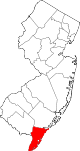 | |
| Boroughs | ||
| Townships | ||
| CDPs | ||
| Other communities | ||
Places adjacent to Upper Township, New Jersey | |
|---|---|