:format(webp)/cdn0.vox-cdn.com/uploads/chorus_asset/file/9372265/sanjuan_vir_2017271.png)
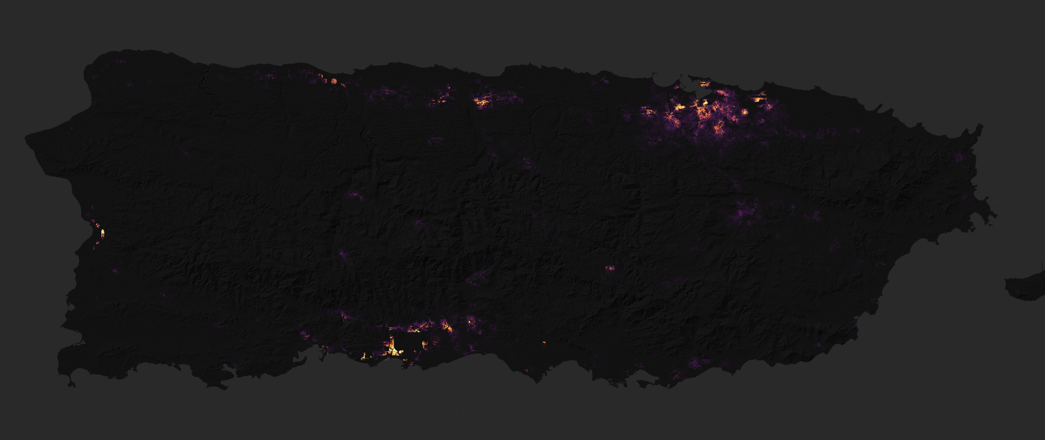
Puerto Rico’s extensive power loss in the wake of Hurricane Maria has been captured in newly released images from one of NASA’s Earth-orbiting satellites. The intense Category 4 storm left practically all of the 3.4 million US citizens in the country without access to electrical power, and many are still waiting for the lights to come back on. These new before and after nighttime photos show just how much of Puerto Rico’s biggest cities remained in the dark up to a week after Maria.
The photos were taken by NASA and NOAA’s Suomi-NPP satellite, a weather probe that monitors the long-term effects of climate change, natural disasters, air pollution, and more. Using the satellite’s infrared imaging instrument, NASA officials put together artificial light maps of Puerto Rico; one shows a typical night before Maria, and another composite image from September 27th and September 28th shows widespread outages on the island after the storm. The images were processed by NASA scientists to remove light from fires, the Moon, and other non-electric light, as well as any interference from clouds.

NASA hopes these images will be vital aids for first responders in Puerto Rico. Pinpointing where power has been out the longest on the island can help direct rescue efforts. “It is critical that we get this processing done quickly, so that we can provide the cleanest and most useful imagery to the National Guard, FEMA, and other first responders,” Miguel Román, who is leading the satellite mapping efforts at NASA’s Goddard Space Flight Center, said in a statement. The scientists are also trying to highlight the locations of streets and neighborhoods in their maps, using data from other satellites and OpenStreetMap, to make them more helpful for rescue teams.
Puerto Rico’s lack of power stems from the destruction of the country’s transmission lines, which carry electricity from power plants to distribution centers in the cities. More than 80 percent of these cables are out, and practically all of the power lines that carry electricity from distribution centers to local business and residences have been destroyed. Since Maria hit, most of Puerto Rico’s power has come from generators, though several hospitals and the country’s airport are back on the grid, according to a recent update from the Department of Energy.
:format(webp)/cdn.vox-cdn.com/uploads/chorus_asset/file/23935561/acastro_STK103__04.jpg)
:format(webp)/cdn.vox-cdn.com/uploads/chorus_asset/file/25288452/246992_AI_at_Work_REAL_COST_ECarter.png)
:format(webp)/cdn.vox-cdn.com/uploads/chorus_asset/file/25287681/1371856480.jpg)
:format(webp)/cdn.vox-cdn.com/uploads/chorus_asset/file/25287408/2003731596.jpg)