List of cities in the Dominican Republic
Last updated
Cities in the Dominican Republic , in accordance with the definition of urban population for purposes of the 2002 census, [1] are the urban centers and seats (cabeceras literally heads) of municipalities ( municipios singular municipio), the second level political and administrative subdivisions of the country, or of municipal districts (distritos municipales) within them.
Contents
Santo Domingo

Santo Domingo may refer to Santo Domingo de Guzmán, the sole municipality of the Distrito Nacional, or the metropolitan area of Santo Domingo spread over several municipalities, which as such is not an administrative or political entity. The 2002 census does not give data for metropolitan areas. Sources give different figures for the metropolitan areas population as of 2002 ranging from 1,887,586 [2] to 2,054,516 [3] or 1,840,000 (2000). [4] As the law about the creation of the Santo Domingo province, split from the Distrito Nacional in 2001, does refer to the cities of Santo Domingo de Guzmán, Santo Domingo Este, Santo Domingo Norte and Santo Domingo Oeste as former parts of the city of Santo Domingo for comparison the aggregated population of this cities is given as Santo Domingo (metropolitan) in the following table. [5] [6]
Cities with population figures
The following is a table of cities with more than 20,000 inhabitants in the Dominican Republic. Population figures are as of the 2010 census.


| City | Province | Population | Notes June 2006 |
|---|---|---|---|
| Santo Domingo de Guzmán | Distrito Nacional | 2,987,013 | |
| Santiago de los Caballeros | Santiago | 1,329,091 | three additional municipal districts |
| Santo Domingo Este | Santo Domingo | 624,704 | One additional municipal district |
| Santo Domingo Norte | Santo Domingo | 286,912 | |
| Santo Domingo Oeste | Santo Domingo | 701,847 | |
| San Felipe de Puerto Plata | Puerto Plata | 277,981 | One additional municipal district |
| Concepción de la Vega | La Vega | 220,279 | One additional municipal district |
| San Pedro de Macorís | San Pedro de Macorís | 193,713 | One new municipality created |
| La Romana | La Romana | 191,303 | One additional municipal district, also one new municipality created |
| Los Alcarrizos (D.M.) | Santo Domingo | 166,930 | Municipality with two municipal districts |
| San Francisco de Macoris | Duarte | 163,980 | |
| San Cristóbal | San Cristóbal | 137,422 | One additional municipal district |
| Salvaleón de Higüey | La Altagracia | 103,502 | |
| Santa Cruz de Barahona | Barahona | 74,958 | One additional municipal district |
| Bonao | Monseñor Nouel | 72,821 | Three additional municipal districts |
| San Juan de la Maguana | San Juan | 70,969 | Eight additional municipal districts |
| Baní | Peravia | 61,864 | Four additional municipal districts |
| Bajos de Haina | San Cristóbal | 61,400 | |
| Moca | Espaillat | 59,174 | Five additional municipal districts |
| Azua de Compostela | Azua | 56,453 | Eight additional municipal districts |
| Mao | Valverde | 47,828 | |
| Boca Chica | Santo Domingo | 46,385 | One additional municipal district |
| Punta Cana | La Altagracia | 43,982 | |
| Cotuí | Sánchez Ramírez | 42,115 | One additional municipal district |
| Esperanza | Valverde | 41,189 | One additional municipal district |
| Villa Altagracia | San Cristóbal | 36,791 | Three additional municipal districts |
| Hato Mayor del Rey | Hato Mayor | 34,006 | |
| Nagua | María Trinidad Sánchez | 32,035 | Two additional municipal districts |
| Villa Bisonó | Santiago | 29,723 | |
| Jarabacoa | La Vega | 27,370 | One additional municipal district |
| Constanza | La Vega | 27,090 | One additional municipal district |
| Consuelo | San Pedro de Macorís | 25,034 | |
| Pedro Brand (D.M.) | Santo Domingo | 22,695 | Municipality with two municipal districts |
| Santa Cruz del Seibo | El Seibo | 22,489 | One additional municipal district |
| Tamboril | Santiago | 21,939 | |
| Las Matas de Farfán | San Juan | 21,271 | One additional municipal district |
| San José de Ocoa | San José de Ocoa | 21,226 | Two additional municipal districts |
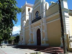
 Nizao
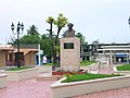
Nizao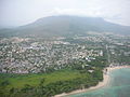 Puerto Plata
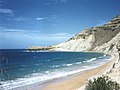 Coastline of Monte Cristi


Map
See also
Related Research Articles

The Dominican Republic is divided into thirty–one provincias, while the national capital, Santo Domingo, is contained within its own Distrito Nacional.

Baoruco, alternatively spelt Bahoruco, is a province of the Dominican Republic located in the southwest of the country, part of the Enriquillo Region, along with the provinces of Barahona, Independencia and Pedernales. Before 1952 it included what is now Independencia Province.

Barahona is a province of the Dominican Republic. The Barahona Coast is located on the southwestern part of the Dominican Republic approximately three hours drive from Santo Domingo the capital of the Dominican Republic. In 2019, volunteers from Amigos de las Americas visited to facilitate projects within the various municipalities of Barahona.

Dajabón is a northwestern province which currently comprises one of the 32 provinces of the Dominican Republic. It is divided into 5 municipalities and its capital city with the same name. It is bordered by the provinces of Monte Cristi to the north, Santiago Rodríguez to the south, Elías Piña to the south and the Nord-Est department of Haiti to the west.
Hato Mayor is a province of the Dominican Republic. The province was split from El Seibo in 1984.

La Vega is a province of the Dominican Republic. Until 1992 it included what is now Monseñor Nouel province.

María Trinidad Sánchez is a province of the Dominican Republic. It was split from Samaná Province in September 1959 as Julia Molina Province; in November 1961, it got its current name. The name commemorates a distinguished female soldier in the wars of independence. María Trinidad Sánchez was the first woman incarcerated and executed by Pedro Santana, a Dominican annexionist president.

Monseñor Nouel is a province in the central region of the Dominican Republic. It was split from La Vega province in 1982.

Monte Cristi is a province in the northwest of the Dominican Republic. The capital city is San Fernando de Monte Cristi. The spelling Montecristi is also seen. The Montecristi province is located in the Cibao frontier region, on the north coast of the country and borders the nation of Haiti. The land area of the Montecristi province is 1,924.35 km2. It is divided into six municipalities and four municipal districts.

San José de Ocoa is a province in the southern region of the Dominican Republic, and also the name of the province's capital city. It was split from Peravia on January 1, 2000. Published statistics and maps generally include this province in the old, larger, Peravia.

San Pedro de Macorís is a province of the Dominican Republic, also the name of its capital city. The city is fairly active due to its proximity to the national capital of Santo Domingo and also its role in the sugar industry. The province is informally known as San Pedro, SPM or Serie 23 for the first two numbers of their Dominican identification or Cedula.

Valverde is a province of the Dominican Republic. It was split from Santiago Province in 1959. It is in the northwestern part of the country. Its capital city is Santa Cruz de Mao.
Santo Domingo is a province of the Dominican Republic. It was split from the Distrito Nacional on October 16, 2001.
Bayaguana is a municipality (municipio) of the Monte Plata province in the Dominican Republic.

Santo Domingo Este is a municipality and the provincial capital of the Santo Domingo province in the Dominican Republic. It has one municipal district, San Luis.
Santo Domingo Norte is a municipality of the Santo Domingo Province in the Dominican Republic. There is one municipal district within the municipality: La Victoria.
Santo Domingo Oeste is a municipality of the Santo Domingo province in the Dominican Republic. It is part of the greater Santo Domingo metropolitan area, which is the de facto co-capital of the Dominican Republic as seat of the Constitutional Court and the Central Electoral Commission.
Greater Santo Domingo is a term commonly used referring to the metropolitan area of Santo Domingo in the Dominican Republic.
Jánico is a municipality (municipio) of the Santiago province in the Dominican Republic. Within the municipality there are two municipal districts : El Caimito and Juncalito.
References
- ↑ Oficina Nacional de Estadística. "Resultados Definitivos VIII Censo Poplación y Vivienda 2002 Resultados Generales Vol I" (in Spanish). Archived from the original (PDF) on 2007-07-09. Retrieved 2007-01-24.
- ↑ Thomas Brinkhoff - Citypopulation.de. "Dominican Republic - City Population" . Retrieved 2007-03-08.
- ↑ Stefan Helders - World Gazetteer. "Dominican Republic: largest cities and towns and statistics of their population". Archived from the original on November 10, 2006. Retrieved 2007-03-08.
- ↑ United Nations Population Division. "World Urbanization Prospects - The 2005 Revision Population Database". Archived from the original on 2007-03-10. Retrieved 2007-03-08.
- ↑ EL CONGRESO NACIONAL. "Ley No. 163-01 que crea la provincia de Santo Domingo, y modifica los Artículos 1 y 2 de la Ley No. 5220, sobre División Territorial de la República Dominicana" (in Spanish). Archived from the original on 2007-05-18. Retrieved 2007-03-08.
- ↑ {{cite web |url=http://www.one.gob.do/index.php?option=com_docman&task=doc_download&gid=294
External links
- (in Spanish) Oficina Nacional de Estadística, Statistics Portal of the Dominican Republic
- (in Spanish) Oficina Nacional de Estadística, Maps about the administrative division of the Dominican Republic, downloadable in PDF format
- (in Spanish) Federación Dominicana de Municipios - FEDOMU, Dominican federation of municipalities
- World Gazetteer - Cities in the Dominican Republic
- City Population - Dominican Republic

Text is available under the CC BY-SA 4.0 license; additional terms may apply.
Images, videos and audio are available under their respective licenses.