Plaza de la Concordia
Plaza de la Concordia is a park in Las Palmas, Gran Canaria. Plaza de la Concordia is situated nearby to the public building Junta de Distrito Centro and the post office Oficina de Correos.Notable Places in the Area
Plaza de la Feria
Park
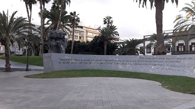
Photo: Beta15, CC BY-SA 4.0.
Plaza de la Feria is a park situated 130 metres northeast of Plaza de la Concordia.
Centro Insular de Deportes
Stadium

Photo: Tolagorn, CC BY-SA 4.0.
Centro Insular de Deportes is an indoor arena in Las Palmas, Spain. Centro Insular de Deportes is situated 410 metres east of Plaza de la Concordia.
Castillo de Mata
Castle

Photo: Beta15, CC BY-SA 4.0.
Castillo de Mata is a castle situated 630 metres south of Plaza de la Concordia.
Localities in the Area


Plaza de la Concordia
- Type: Park
- Category: recreation area
- Location: Las Palmas, Las Palmas, Gran Canaria, Canary Islands, Spain, Iberia, Europe
- View on OpenStreetMap
Latitude
28.1128° or 28° 6' 46" northLongitude
-15.42169° or 15° 25' 18" westOpen Location Code
7CW64H7H+48OpenStreetMap ID
way 437016249OpenStreetMap Feature
leisure=parkPlaza de la Concordia Satellite Map
© OpenStreetMap, Mapbox and Maxar
Other Places Named Plaza de la Concordia
In the Area
Plaza de la Concordia is situated close to ISM and the park Plazoleta de Perón.
Landmarks
- Plaza de la ConcordiaPark
- Cabildo de Gran Canaria, Espacio JovenCommunity center, 150 metres west
- TallerizatéCollege, 170 metres south
- Vera BSBGovernment office, 190 metres north
- Formación, Consultoría EmpresarialCollege, 190 metres southwest
- EmalsaGovernment office, 220 metres west
Other Places
- BolicheKiosk
- Abenacor DentalDental clinic
- SparSupermarket
- Di SenzoPhoto shop
- MPG Salón de Imagen PersonalBeauty salon
- UnidaTravel agency
Popular Destinations in Gran Canaria
Escape to a Random Place
Discover the parks Silverthorn Drive Park in Alberta, Canada and Crusader Cabin Recreation Site in British Columbia, Canada.
About Mapcarta. Thanks to Mapbox for providing amazing maps. Data © OpenStreetMap contributors and available under the Open Database License. Text is available under the CC BY-SA 4.0 license, excluding photos, directions and the map. Photo: Gino maccanti, CC BY 2.0.